| Report Type | Full |
| Peak(s) |
Torreys Peak - 14,272 feet Grays Peak - 14,275 feet Mt. Edwards - 13,860 feet McClellan Mountain - 13,594 feet |
| Date Posted | 06/13/2025 |
| Date Climbed | 06/12/2025 |
| Author | EmmaClaire5280 |
| Torreys, Grays, Edwards, and McClellan |
|---|
|
Date: June 12, 2025 We began hiking from the Grays and Torreys standard trailhead at 3:00 am. The lower portion of the trail was flooded in sections and covered in snow, particularly within the first half mile. There was running water across the trail in multiple spots and some shallow snowfields that were still hanging on from late spring. Waterproof shoes helped a lot here, and the conditions improved once we gained elevation. We made good time to the Kelso Ridge junction at around 12,200 ft, where we left the main trail and began ascending the ridge in the dark. Conditions on the lower section of Kelso Ridge were dry with stable footing. As we gained elevation, the sun began to rise, giving us enough light to navigate the trickier terrain without relying on headlamps.Kelso Ridge was in good condition overall for spring. We encountered several intermittent snow patches and two small cornices along the ridge, especially near the knife-edge and upper sections. The snow was firm and avoidable in all cases, so we never used microspikes or an ice axe. There was no need for traction, though we carried it just in case. Throughout the ridge, we spotted bighorn sheep and mountain goat track tracks stamped across multiple snowy sections, though we never saw the animals themselves. All major features on Kelso Ridge—including the notch, white rock, and the knife-edge—were dry and easily navigated. Staying on route required basic route-finding, but nothing exceeded Class 3. Exposure was moderate in sections, but manageable for those familiar with scrambling. We summited Torreys Peak (14,267 ft) at 5:45 am under clear skies. 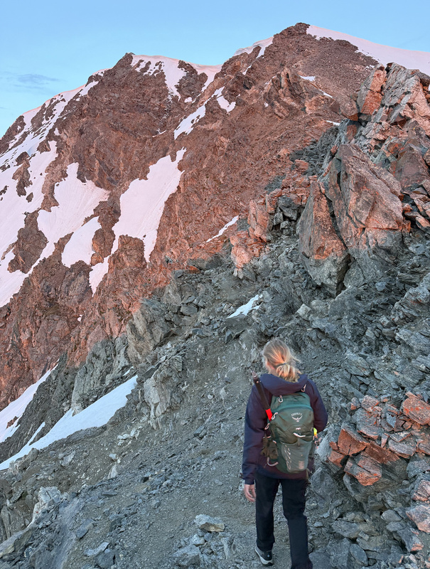
From Torreys, we continued directly down to the saddle and up to Grays Peak (14,270 ft) via the standard trail. There were a few small snow crossings along this stretch, mostly on the northeast side of the ridge, but they were short and had safe runouts. We reached the summit of Grays around 6:30 am and paused briefly for a snack. We then descended toward Mount Edwards, leaving the trail at the saddle and heading east. A faint climber’s trail leads partway along the ridge before fading. From there, we stayed ridge direct all the way to the summit. There were more snow patches along this section, but they were thin, melting, and easily bypassed. The ridge included some Class 2+ scrambling on talus and blocky terrain. There are two false summits before reaching the true summit of Mount Edwards (13,850 ft), which we reached approximately 45 minutes after summiting Grays. 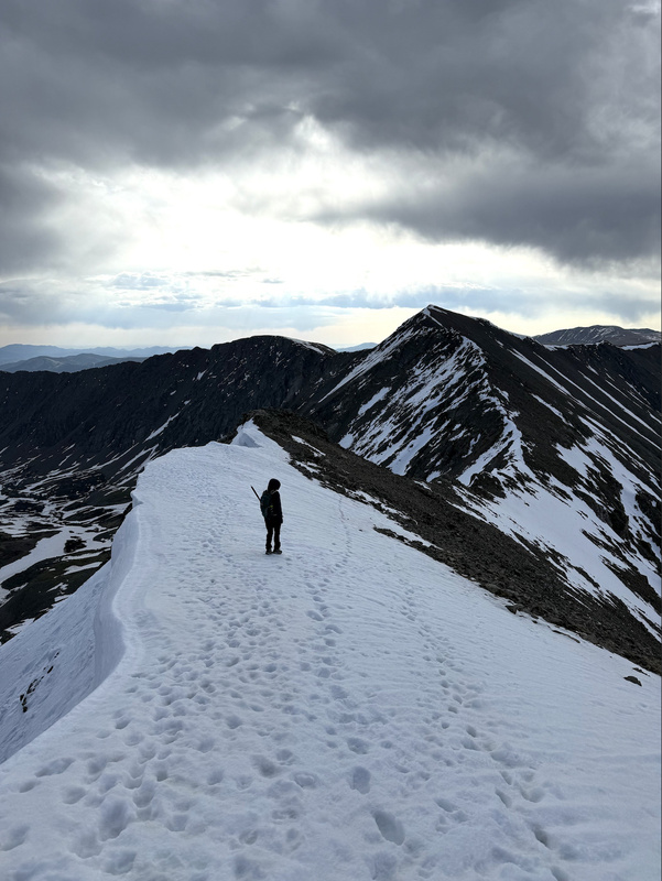
After another short break, we continued along the ridge to McClellan Mountain (13,587 ft), eventually intersecting the 4WD road near the summit. We located the gully descent just south of the road and began making our way down. The gully was steep and extremely loose, so we stayed on the right-hand side where we could use solid rock for better footing. About three-quarters of the way down, we came across a rolled-over vehicle, which looked like it had crashed recently. Near the bottom of the gully, we hit a small snowfield and were able to safely glissade the final section to the road. 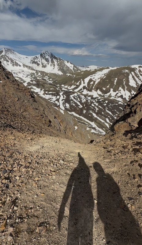

At the base of the gully, we explored the Flora Mine ruins for a few minutes before following the mining road about 0.25 miles back to the trailhead. Total time on trail was just under 6 hours. I wanted to write this report because I hadn’t seen many people mention linking all four peaks—Torreys, Grays, Edwards, and McClellan—in one go with a descent via the gully below McClellan. It made for a very efficient and rewarding loop with a little bit of everything: scrambling, snow travel, ridge hiking, and even some light route-finding. For anyone comfortable with moderate exposure and loose terrain, this is a great early summer alpine objective that avoids the crowds on the way down and adds a fun sense of exploration. Hope this helps and happy exploring! 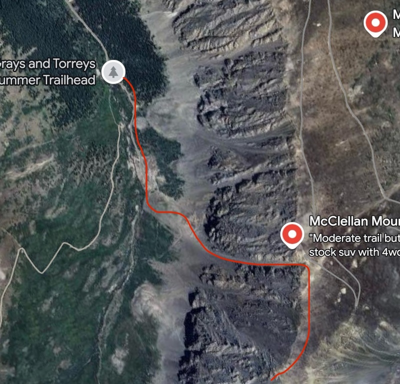
Thumbnails for uploaded photos (click to open slideshow):  Alpenglow and summit of Torreys via Kelsos Ridge")
 Cornice view with Mount Edwards in the background")
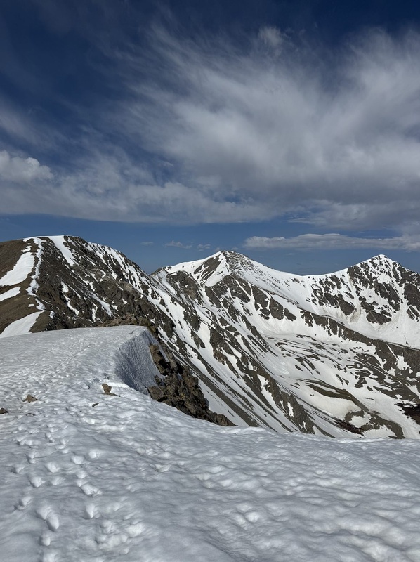
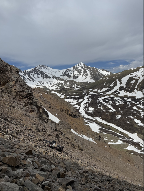
 A look back at the summits of Edwards, Greys, and Torreys")
 A look back on our route and the vehicle crash")
 The rolled off-roading vehicle found 3/4 of the way down the gully")
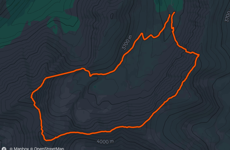
 Strava of the route that we took")
 Ariel view of the exact gully we took from the summit of McClellan")
 The gully we descended off of the summit of McClellan")
|
| Comments or Questions |
|---|
|
|
Caution: The information contained in this report may not be accurate and should not be the only resource used in preparation for your climb. Failure to have the necessary experience, physical conditioning, supplies or equipment can result in injury or death. 14ers.com and the author(s) of this report provide no warranties, either express or implied, that the information provided is accurate or reliable. By using the information provided, you agree to indemnify and hold harmless 14ers.com and the report author(s) with respect to any claims and demands against them, including any attorney fees and expenses. Please read the 14ers.com Safety and Disclaimer pages for more information.
Please respect private property: 14ers.com supports the rights of private landowners to determine how and by whom their land will be used. In Colorado, it is your responsibility to determine if land is private and to obtain the appropriate permission before entering the property.

