| Report Type | Full |
| Peak(s) |
"V 5" - 13,164 feet South Lookout Peak - 13,420 feet "V 2" - 13,319 feet US Grant Peak - 13,778 feet "V 4" - 13,541 feet |
| Date Posted | 06/09/2025 |
| Date Climbed | 06/08/2025 |
| Author | yaktoleft13 |
| Additional Members | handonbroward |
| Vs a Crowd |
|---|
|
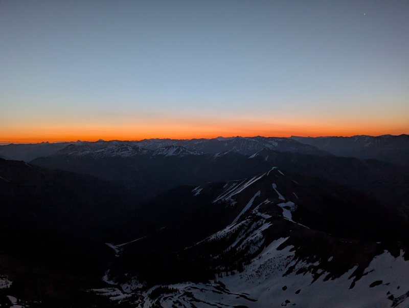
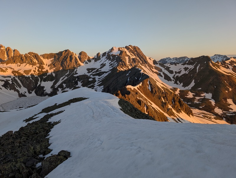
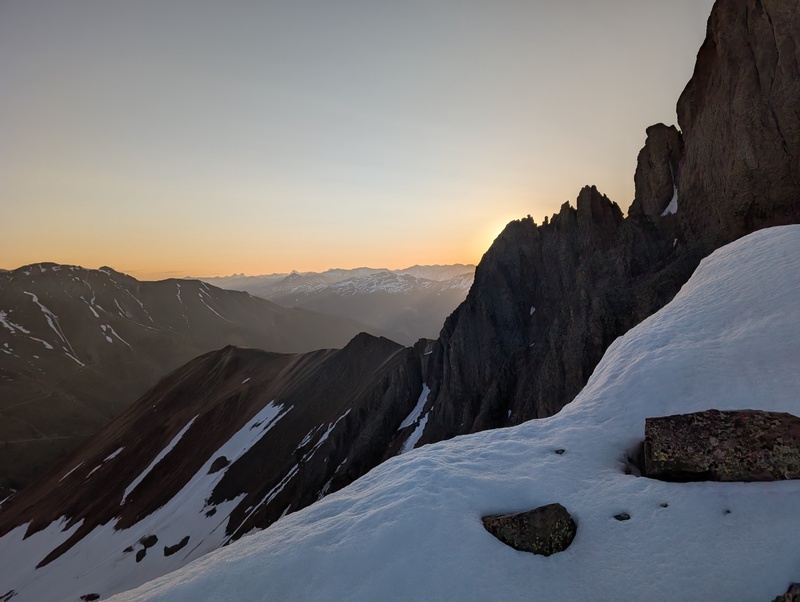
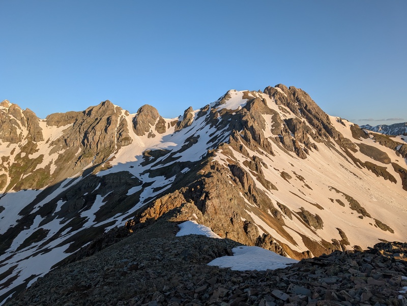
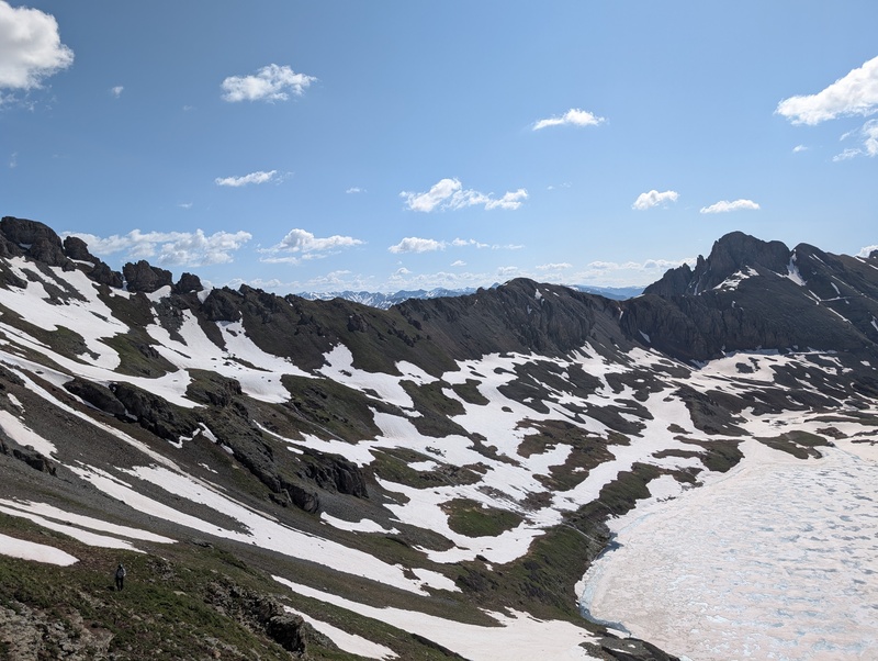
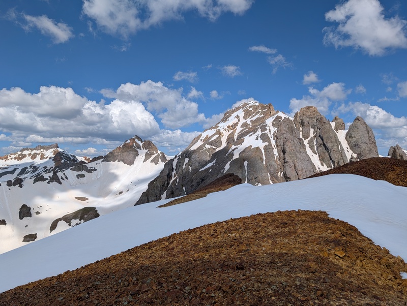
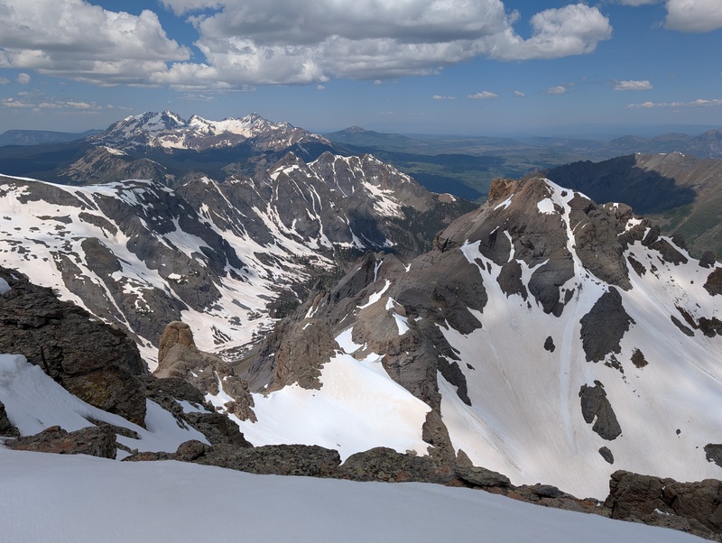
Trailhead: first switchback up road to Clear Lake Distance: ~11 miles (watch read a bit high all day) Gain: ~6k Difficulty: 5.easy Time: 13:15 I had been trying to get Brandon out for some climbing all spring, but training for a 50 miler and injuries kept him occupied and off the big peaks for the better part of the year. Now that the race was behind him and he was all healed up, I managed to convince him to drive 5 1/2 hours for what I promised was going to be an epic. At least I didn't undersell it! This spring I've been working my way down the western wall of Red Mountain pass, hitting these peaks when their chossy scree is blanketed under a layer of snow. This strategy has proven successful, and made some of the more profanity-inducing routes quite pleasant. Next up on the docket were the peaks above Clear Lake and Island Lake, holding some of the more challenging and thoughtful scrambling around, in large part due to the looseness. Cleaning out all five peaks in a single go was certainly going to be a large day, but it seemed within the realm of possibility, especially given how pedestrian the stats were on paper. As we soon found out, peaks aren't climbed on paper. Brandon met me at my house in Pine after a birthday REI run to fill a few gear gaps. We loaded up the 4Runner with more bags than a Kardashian on a Hamptons vacation and took off on the now-familiar drive down 285, over 50, and down 550, until we reached our parking spot up at the first switchback up Clear Lake Road. We crashed for a few hours and awoke annoyingly early for our 3 AM departure time. V5 was up first. We made good time up the dry road, following it until just after the switchback at about 11.7k. At that point, we turned right and began ascending the grassy southwest slope up toward V3. We angled in between a rib to our right and a snowfield to our left and found more dry ground until high up on the flanks of the mountain. As our hike turned toward a scramble, we elected to cross a short snowfield and take a direct line toward a saddle just to the east of the summit. After overcoming a bit of loose rock and a posthole to my unmentionables, we emerged high on the summit ridge and had a short jaunt to the summit. We topped out as first light appeared behind the peaks of Lake City, setting a magical scene for the start of the day! 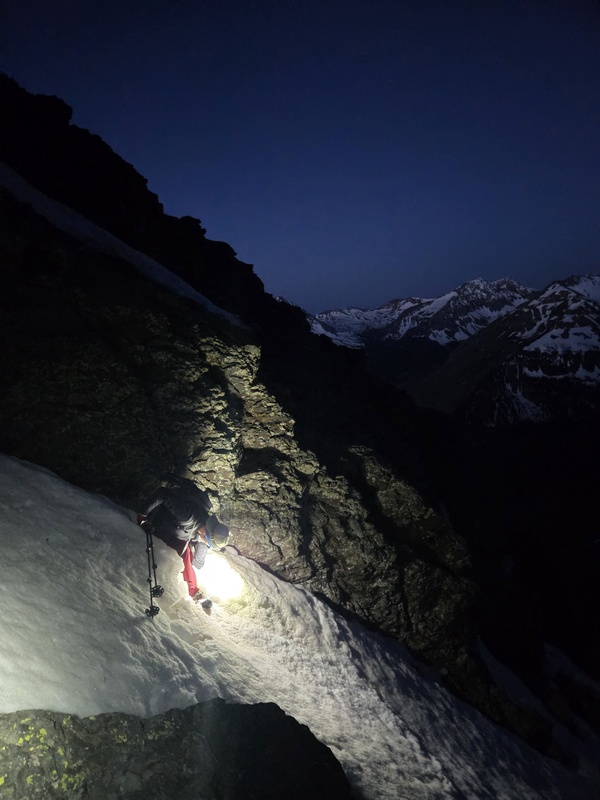
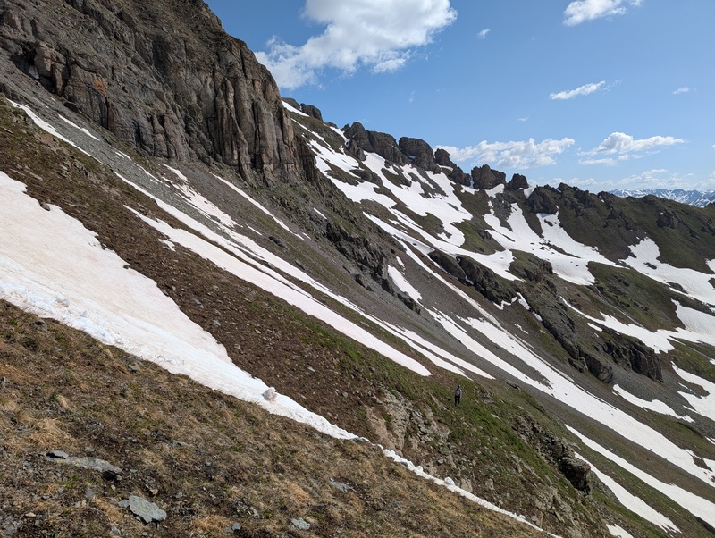
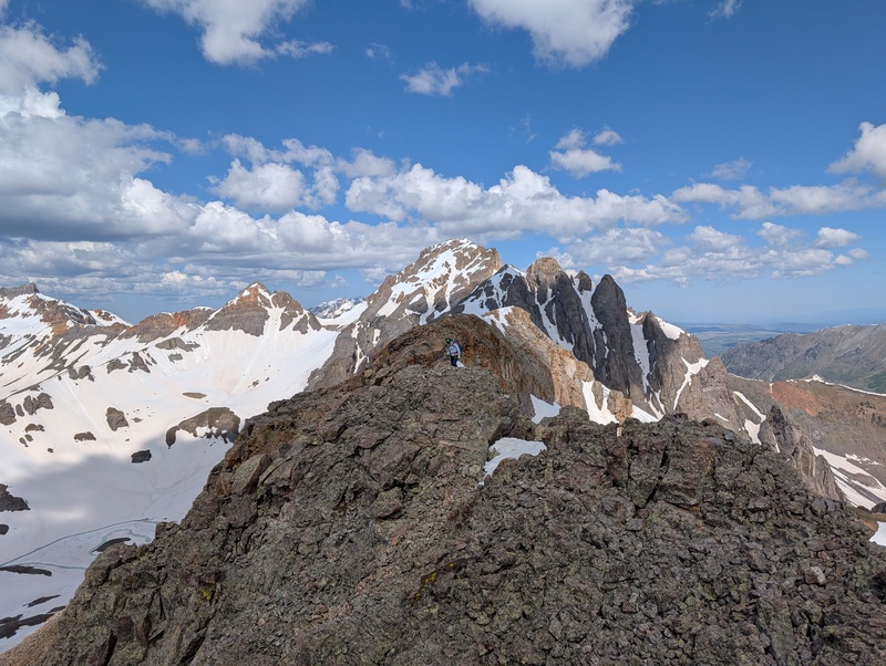
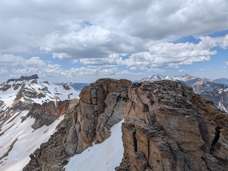
We backtracked our route down V5 and back across the snow crossing, as all sides but the one of V5 are massive cliffs. We ducked under a lingering snowfield below the cliffs on the southwest side and sidehilled on loose junk over to meet the ridge to South Lookout at a more reasonable place. The ridge over to South Lookout looked gnarly, with numerous spires and towers guarding the way, but the ridge climbed easier than it appeared and anything that didn't could easily be dodged. We traversed the ridge until the towers became a bit more serious and we journeyed out onto the south face and sidehilled under the difficulties. The rock was loose, but when was it not today? 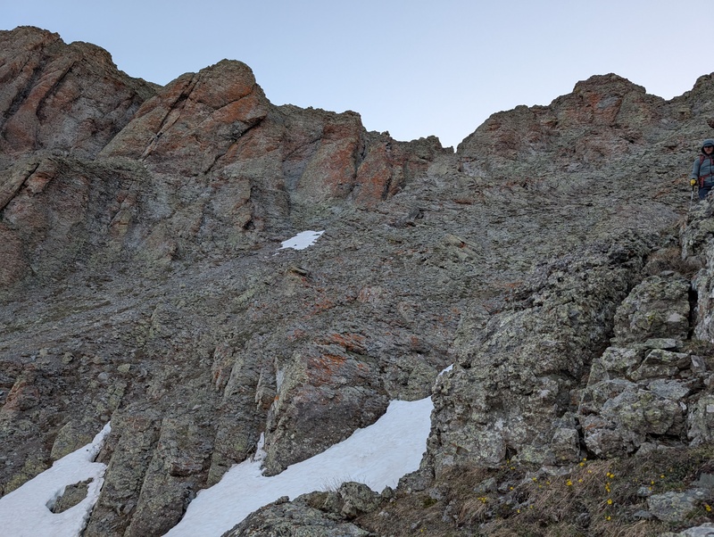
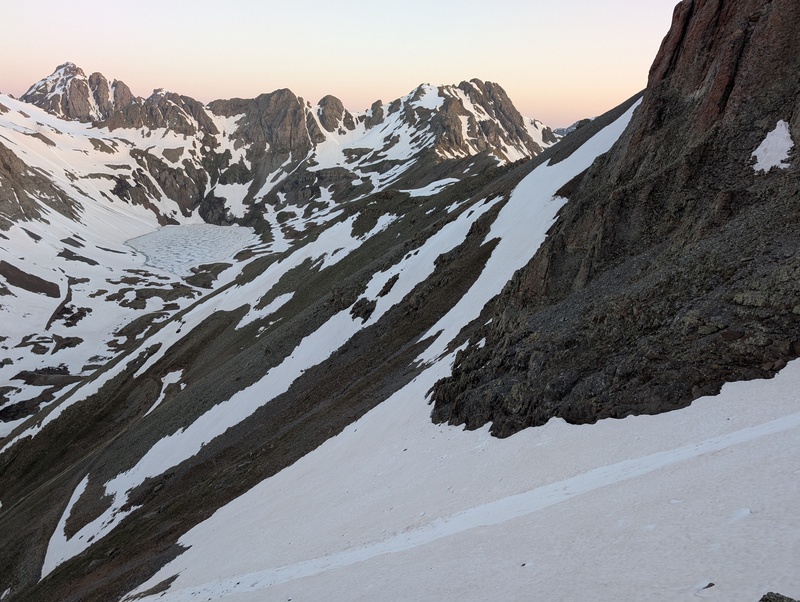
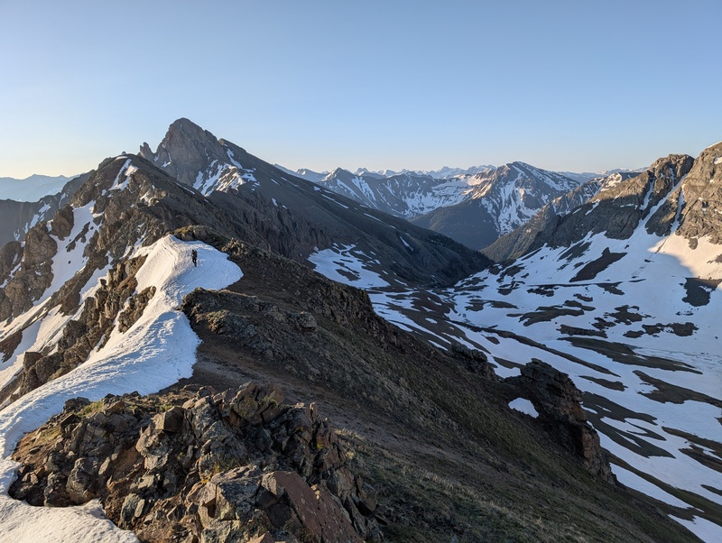
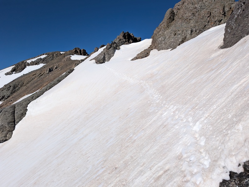
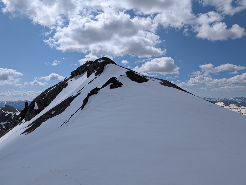
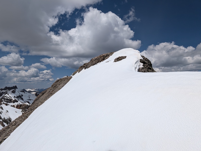
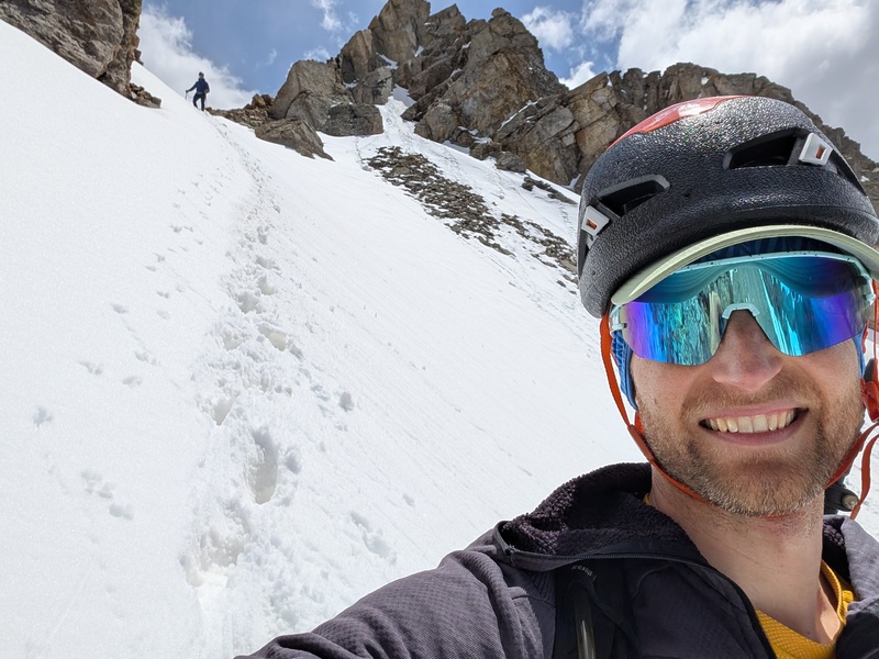
Once done sidehilling, we ascended grassy slopes and a short snowfield to reach the false summit guarding South Lookout's summit ridge. Now the fun begins. We followed the top of the ridge until a rocky outcropping allowed us easy access to the snowfield leading to the summit block. We cramponed up for this slope, as a slip would have been a thousand foot setback. The weak freeze from the night before and the hot early sun reared their ugly heads and we found hard snow that was rapidly warming with sugar below. Not the most fun to traverse. But we managed and popped off the pokey things for the summit scramble. 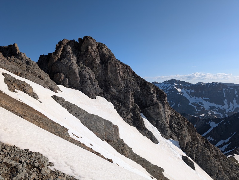
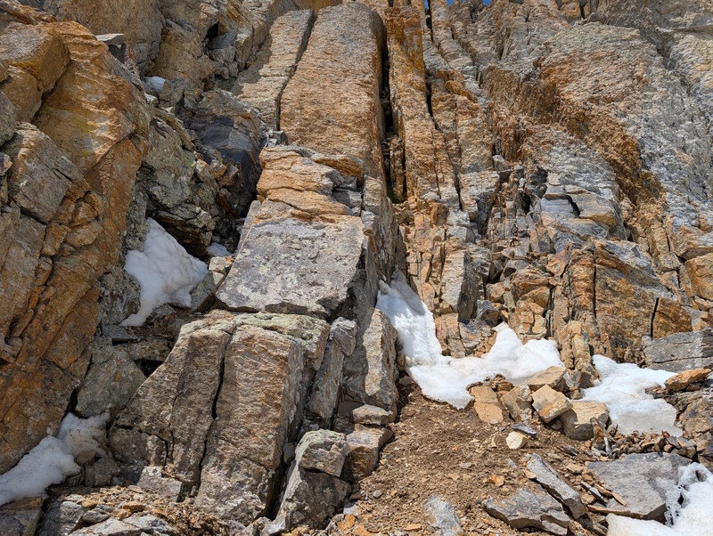
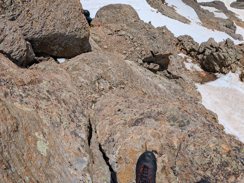
I could see where I wanted to go, which was a dark, broad gully one rib past where I was. The problem was, there wasn't a great way of getting there. The snow was uncooperative, and the rock on this section was disgusting. A lot of the rock wanted to fall off, and the ones that didn't were covered in ones that did. We tried a couple of options to get to where we wanted to be, but shy of putting on crampons to traverse down and around and back up again, we didn't find anything we liked. Finally, we went backed to where we first got back on rock after crossing the snowfield and looked up. There was a steep wall of semi-ugly rock, but it was better than some of the rock we'd seen in other places. And while improbable to climb straight up, it looked like there was a route that could follow a weakness to the left, then back up to the right to reach the next section of the mountain. I committed and found the initial section pretty simple 3rd/4th class, but then a drop down move to a ledge led to the crux: an awkward, loose, committing 5.easy move with a high left foot and not a lot else on crappy rock above exposure. I took my time and experimented with different angles for probably 30 seconds before committing, and when I did, everything held. I breathed a sigh of relief, looked up, and saw I was now in the gully I wanted to be in above the snow. I crossed the gully to the far right ridge and waited for Brandon. Unfortunately, he was stymied by the ledge and the committing move. He gave it a try for a couple of minutes, but never found an orientation that resulted in comfort, so he elected to wait while I summited. 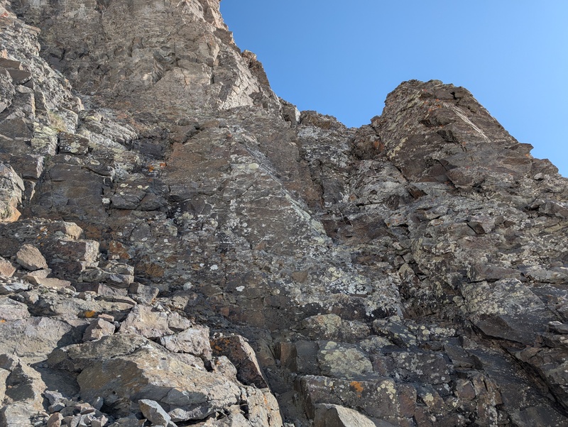
As a cruel twist, the rock above the initial climb improved greatly, and the summit block was downright fun. It consisted of slabs of good rock leading to an angling chimney/crack. It topped out at easy 4th, and I topped out moments later. One of the tougher 13ers in the state down, and summit number 2! From the top of the initial climb from the snow, the summit took less than 5 minutes. If I'd known where I was going initially, the summit is probably 10 minutes roundtrip from the snow. Once on the summit, I panicked for a couple of minutes that the northern summit was higher before confirming it wasn't via trip reports. Thank god, it doesn't look easy to get to! 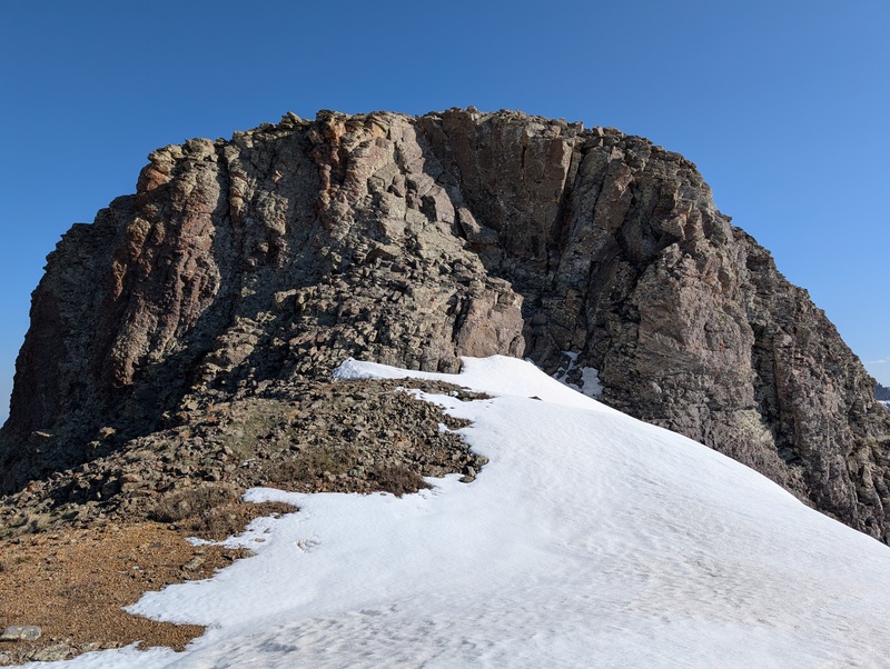
I whooped to let Brandon know I made it, snapped a couple of pictures, then backtracked. The climb down to the snow was easier on the way down. I retreated across the snow to Brandon before realizing I left my poles back on the other side of the crossing. Reluctantly, I put my crampons back on and sped there and back, poles included this time. 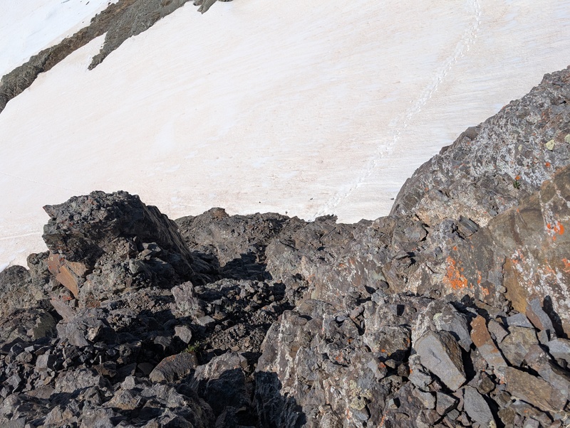
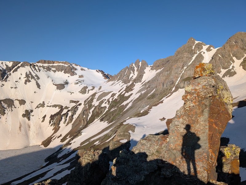
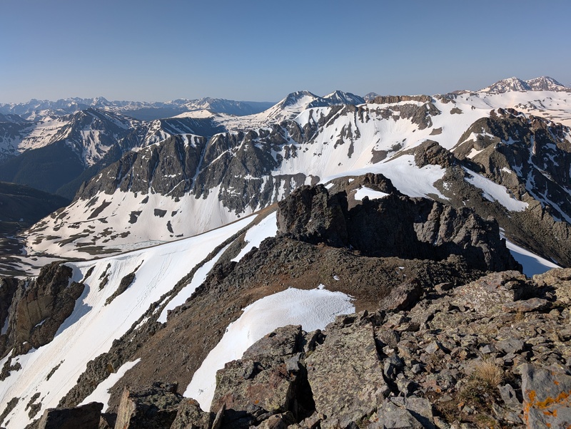
We headed back across the rounded false summit of South Lookout and down the south slopes, but this time once below a snowfield we sidehilled on loose junk again toward the snowfilled ramp that lead to the V2-US Grant saddle. The grassy section kept us from losing our minds too terribly, and we reached the snow quickly. We elected to put on snowshoes at this point, since we carried them this far (might as well use em!) and sidehilled toward the snowy slope. Have I mentioned that every sidehill was the same way? Angling down to the left on loose junk. Shame, I like a little variety with my sidehilling. We noticed that the far right edge of the snowy slope was dried out, and we figured that would be even easier than snowshoeing directly up, so we beelined for the Giesecke/V2 saddle and booted up loose, dry ground to reach the ridge. We turned left and crossed a couple of gentle snowfields to reach the talus that makes up V2's summit ridge. A cairn stood on the close end of the ridge, but the far side seemed higher. I worked my way down the ridge to the far point and looked back, only to realize that yes, the cairned spot was in fact the highest. We took a quick break, during which Brandon remarked of US Grant's east ridge: "how are we supposed to go up that?" Fair question... Another fair question was the weather. Fluffy white clouds had appeared early in the day, before 10 o'clock, but those friendly tufts were starting to turn a bit darker. Not what I was expecting given the forecast was sun with a 10% chance of storms afternoon! Nothing was heading directly at us yet, and nothing was actually dropping moisture yet...but we knew we'd need to keep an eye out. 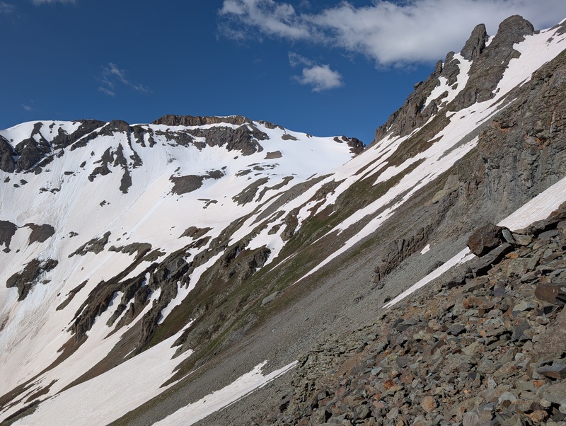
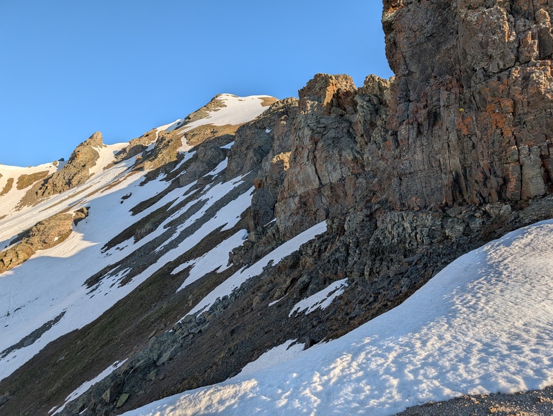
At this point in the day, the snow was starting to get pretty soft. Most snow steps were a guaranteed knee-deep drop, as the weak freeze from the night before froze the top three inches but left the rest soft as can be. That three inches was now melted. Armed with the confidence from that, we took off for US Grant. Once at the low point between V2 and US Grand, we began our climb up on (go figure) junky rock. Much of the rock was class 2 with occasional 3rd class moves. We knew at some point we'd have snow crossings, but we didn't know how many or how difficult they'd be. After ascending choss for a couple of hundred feet, we came to the first...and it wasn't bad! A couple of steps sunk in knee deep, but most were ankle deep and supportive. Even the knee deep ones had substance to them, so though they were a bit annoying, they were secure. Optimism renewed, we continued crawling up the east ridge, hoping for continued good luck in weather, snow, and rock. 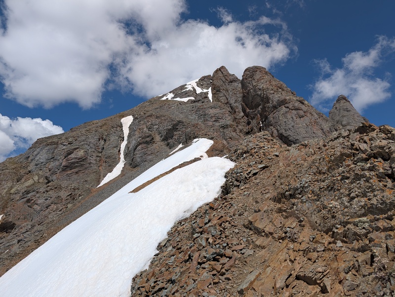
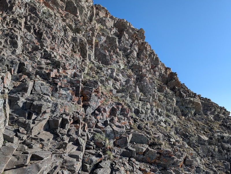
Eventually, we sidehilled around a loose point and came to a section that clearly upped the difficulty. On top of that, a look left showed the dark cloud that missed us was now raining on Rolling Mountain and semi-threatening clouds now started periodically drifting over US Grant and Ice Lakes basin. We were committed to the route at this point though, so on we went. We got to the snow and dispatched the right-leaning, then left-leaning cornice. This deposited us at the base of a cliff, where the only feasible way up was a loose class 3 ledge system and a short chimney. The ledge was 3 feet wide, exposed, and covered in loose rock, but fortunately this rock didn't pitch us down the mountain. The chimney was a blast and over all too soon. 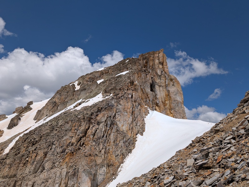
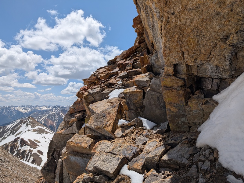
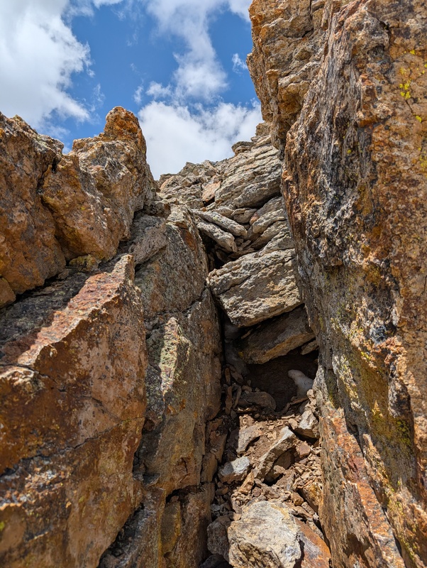
Above this section, we found more easy 3rd class scrambling on janky rock before reaching another snow crossing and cliff band. This cliff band didn't have a super obvious way out, but there was a small weakness on the opposite side that looked a bit easier than other areas. I crossed to it, worked a ledge around a corner, and found the only feasable way up was a stiff 4th class crack, about 6 feet high. Luckily, there was a good foot and hand on it and though committing, went easier than expected. At this point, we reached the snow-capped summit ridge. 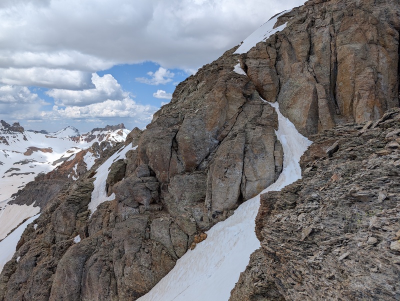
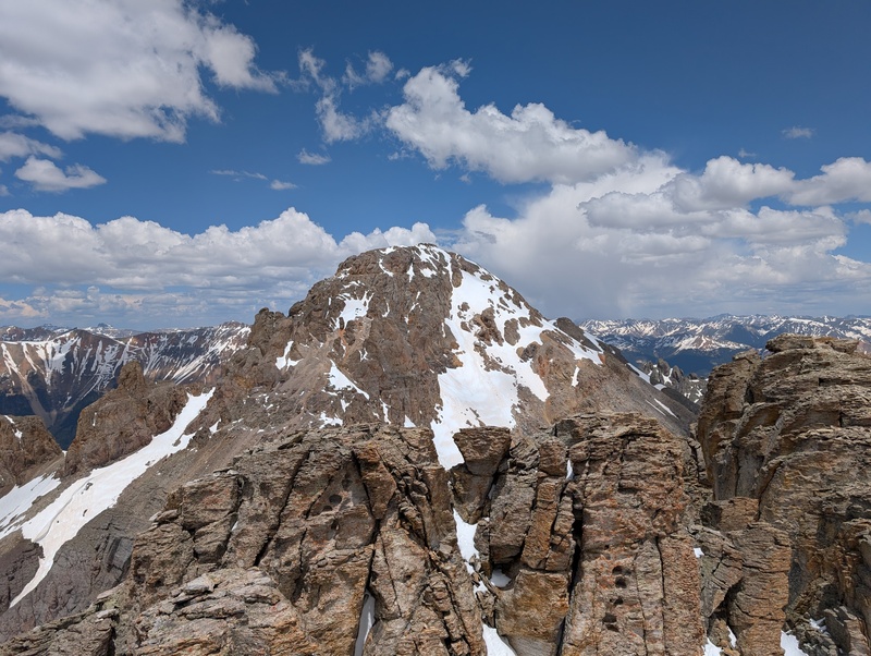
Not to give it up easy, US Grant forced us to do one more short scramble around the side of a rocky outcropping before finally yielding its summit. This one was a big one for both of us, but especially Brandon. Turning back on South Lookout didn't sit well with him, so to successfully reach US Grant's top while having to pull similarly difficult moves on loose rock was a catharsis of sorts. He said he needed to get warmed up and back into climbing shape; I'd say he was now warm. 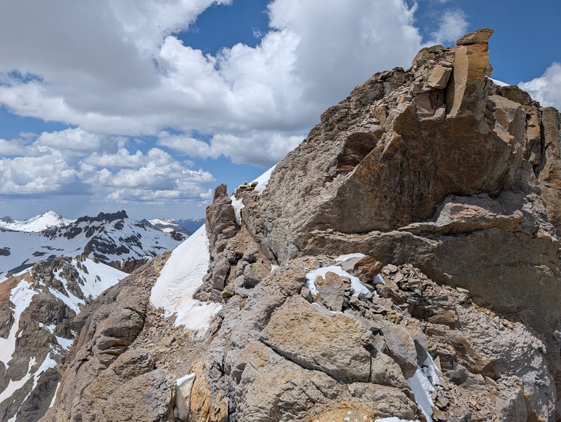
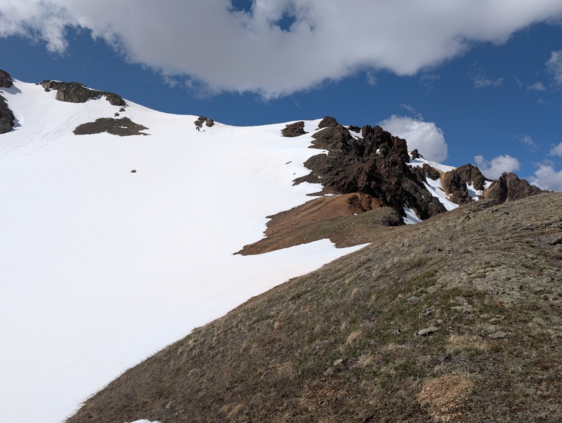
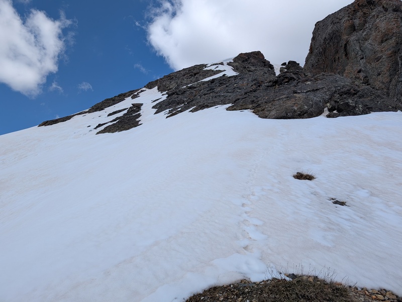
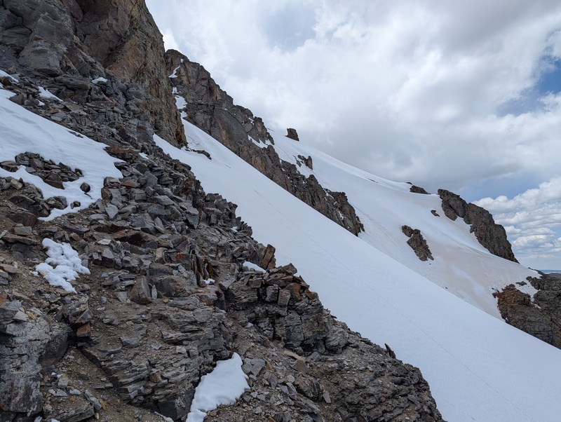
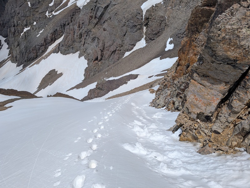
Getting off of US Grant didn't seem obvious to us. I know the standard summer route is somewhere along the west ridge, but the ridge that way looked improbably cliffy and uninviting. Instead, we both liked the look of descending the south face from just to the east of the summit on snow. Everything looked like it connected well and neither one of us liked the look of the west ridge. We put on crampons and started down, hoping that by some miracle the snow wouldn't suck us in to our waists every step... ...and it didn't! The snow was surprisingly supportive for it being after noon! We carefully worked our way down the face, but the care wasn't even needed. Most of the face was quite gentle, and anywhere that was out of view turned out to have snow connecting it to the next area. There was one choke down a narrow gully that might have reached 40 degrees, but it wasn't of concern. The snow was so good we elected to just sidehill over to the V4 saddle for our ascent of the last peak of the day, which I informed Brandon was the easiest of the day. None too soon too, as clouds continued coming and we could now see that some peaks of the Wemi were receiving a dusting. 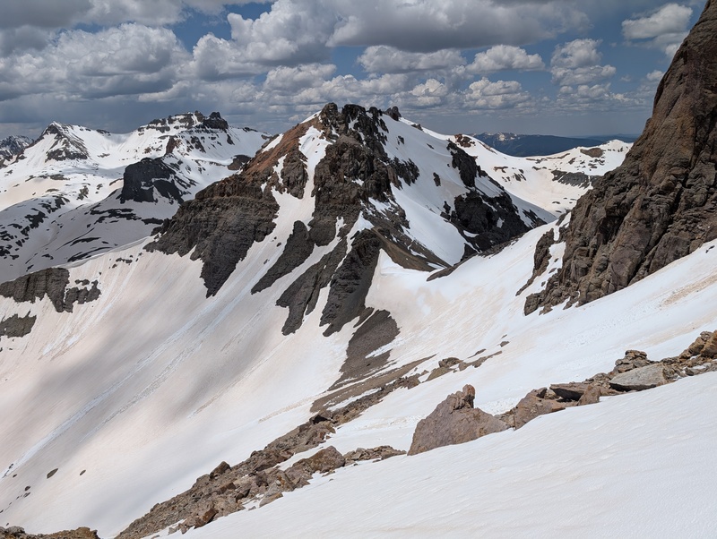
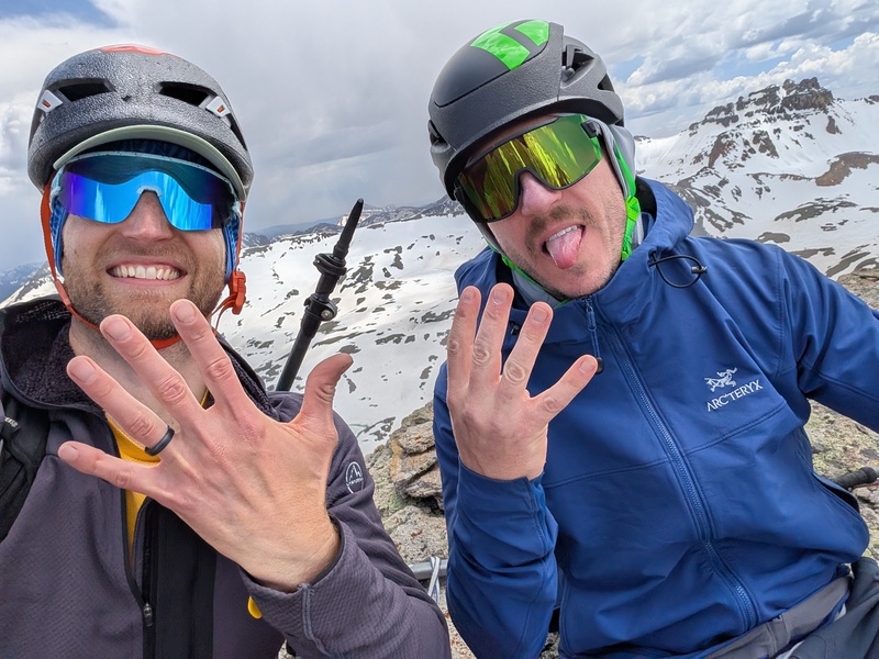
The problem is that in light of all the difficulties of the other peaks, I'd neglected to put any effort into researching V4. I thought we'd climb the ridge, traverse the east face and the gully, then scramble up to the top. That...did not work, like, at all. Out of all the rock I'd been on today, all of which was loose, that was the worst. I retreated to Brandon on the ridge, took a look at my gpx, and saw that everyone was ascending the north face. We scampered over there and found a beautiful snowfield leading up and out of sight. We strapped on crampons again and began up. And yet again, somehow, after 1 o'clock, the snow was amazing! We climbed the 200 feet of snow in no time and reached the saddle, where we stashed our crampons and climbed up. Quickly, we reached the summit block and scrambled to the top...only to look across and see a similarly high summit, that one with a cairn. Cliffs blocked easy passage between the two, so back down we went. Of course, we found another snowfield to traverse, and of course, we'd left our crampons 100 feet down. We elected to just send it in boots, given our experience with the snow thus far. And though mildly sketchy and postholey in places, we made it without incident and finally reached the summit of V4, our last! 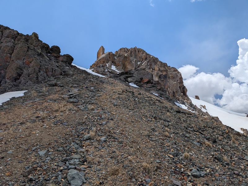
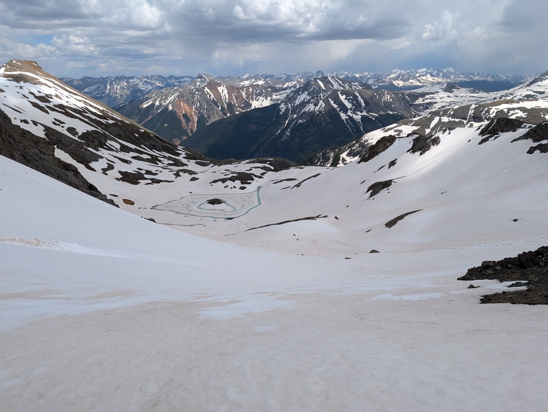
After basking in the day's effort, it was finally time to head down. We backtracked on the snow traverse to the saddle, down the snowfield, and through the scree to the saddle. From there, we were able to score a couple of large glissades, despite the softness of the snow. We got probably 600 or 700 feet of butt-sliding before having to rely on the feet again for downward travel. We put on snowshoes at the end of our sliding, traversed the right side of the lake, and worked our way toward the Island Lake trail, which was intermittently covered in snow. 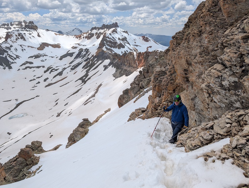
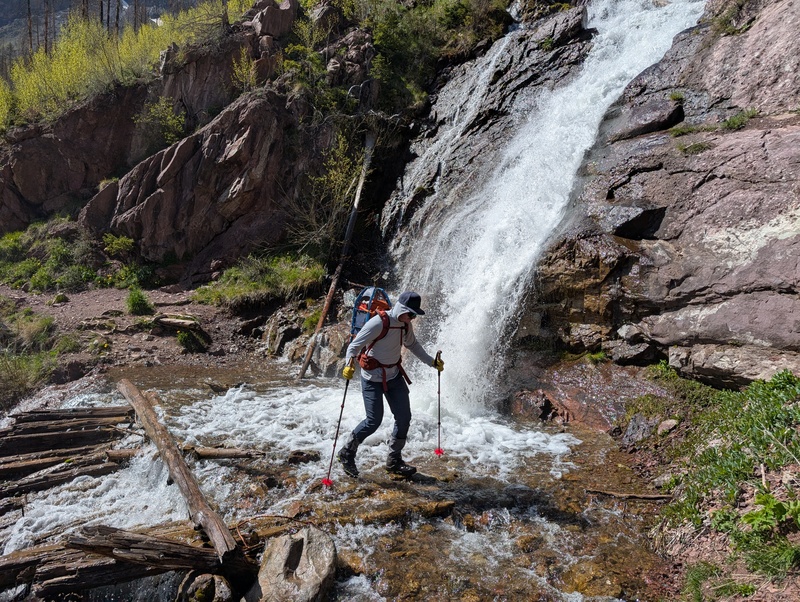
At this point, the combination of snow travel and glissading had absolutely frozen my gaiterless feet. Once out of the upper basin, we found a section of dry trail, where I warmed up the toes and Brandon filtered some water. I also unleashed the running tights shorts, much to the chagrin of everyone who has eyes. Once moving again, we navigated an area of willows that had been postholed out pretty thoroughly by lake hikers before reaching permanently dry trail around 11.5k. Our trail met up with the superhighway of the Ice Lakes basin trail, and we cruised down and managed to not miss the spur trail that led to our parking spot. Oh yeah, and had to cross a roaring waterfall to do it. 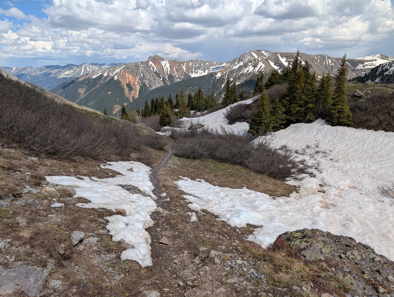
What a day! This 5 peak linkup, though not insane in mileage/vert, demanded everything we had. There is tough scrambling on loose rock, lots of snow travel, routefinding challenges, and constantly changing gear requirements, necessitating efficiency in tools and travel. I highly recommend this route to anyone seeking a mountaineering challenge beyond simply endurance. When I was trying to convince Brandon to come with me on this journey, I texted him "this is going to be one of those days in the mountains you never forget." And I think I was right. 
Thumbnails for uploaded photos (click to open slideshow): ")
")
")
")
")
")
")
")
")
")
")
")
")
")
")
")
")
")
")
")
")
")
")
")
")
")
")
")
")
")
")
")
")
")
")
")
")
")
")
")
")
")
")
")
")
")
")
")
")
")
|
| Comments or Questions | |||
|---|---|---|---|
|
Caution: The information contained in this report may not be accurate and should not be the only resource used in preparation for your climb. Failure to have the necessary experience, physical conditioning, supplies or equipment can result in injury or death. 14ers.com and the author(s) of this report provide no warranties, either express or implied, that the information provided is accurate or reliable. By using the information provided, you agree to indemnify and hold harmless 14ers.com and the report author(s) with respect to any claims and demands against them, including any attorney fees and expenses. Please read the 14ers.com Safety and Disclaimer pages for more information.
Please respect private property: 14ers.com supports the rights of private landowners to determine how and by whom their land will be used. In Colorado, it is your responsibility to determine if land is private and to obtain the appropriate permission before entering the property.

