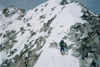
Hi everyone, posting this here because the Spider is a 12er in the Gore Range and cannot post a CR about it. Unfortunately, I didn't take any photos due to rushing the snow, so let me know if I should remove. But I thought it would be helpful to share some details, as this is now my second attempt and still didn't summit, but I got to the ridge.
I met a very low gate 10 miles below the Piney Lake trailhead a couple weeks ago. I ended up still attempting, but it took me over 3 hours each way to hike the mostly dry road, and it took up so much of my energy that I barely made it past the end of the 3 mile trail, and there was still just under 4 miles of bushwhacking to the base of the North Couloir. I ended up turning around at 12:45 PM only about 1 mile into the bushwhack.
I then contacted the White River NF, and learned the lower gate opens 6/1, 6.5 miles of the way to the TH, and the rest of the way 6/21. I made an effort to do it as soon as I could after 6/1, which was yesterday. The road is totally clear to the TH, and a ton of people were camping all along it. I brought my hybrid bike to bike the remaining 3.5 miles to the trailhead, and started biking at 5:30. That worked really well, especially on the way in, because there was so much downhill. The road was good dirt with rocks that were mostly avoidable. I did walk my bike both ways on the steep rocky hill up to campsite 5, but biked the rest of the way both ways, it took about :30 minutes on the way in and :50 on the way out. I started hiking from the trailhead at 6 AM. The trail is totally dry, as is the first mile or so of the bushwhack, which to be fair follows a faint trail, but I couldn't help but loose it a ton of times both ways, and it is covered by a lot of deadfall, as it does not get cleared. It reminds me of a much less steep version of the Ruby basin approach. Fortunately, this bushwhack is so low angle, that there are a lot of different options you can use to try to get around the deadfall. Snow started being intermittent a mile into the bushwhack, which was at around 10,1. It became consistent at around 10,5 for skinning, and I managed to ski it back to 10,4 on the way down. I almost gave up when I got to where the subsidiary creek shoots off south from the Piney River at just below 10,8. The rivers were not covered by snow at this point, and they were huge, fast flowing waterfalls. I didn't see how I would get through, until I happened to notice a narrow snow path just to the right of the offshoot creek. I followed that in skins, and was rewarded with access to the couloir Apron. The couloir was in great shape, and I skinned to the upper Apron at 11,1. It was noon by this point, the bushwhack had taken me 4.5 hours, and the trail hike 1.5. I kept going, as the snow was in good shape, it was helped by a little wind and cloud cover. I was only sinking ankle depth and it was very supportive below that. There were a few rocks around 11,5, but they were wide enough to be easily skied through at the reasonable angle of the couloir (probably high 30s). It was a bit unsupportive booting as you had to get within several feet of the close rocks. It is pretty rocky the last hundred feet to the ridge. After getting to the ridge, I saw that it was very rocky and was not the ski line. The ski line cuts off climbers right where the rocks start. It was a very steep entry point and the snow was very soft due to time of day, and it didn't look continuous, though there still looked like a lot of snow up there. It looked like with more supportive snow, it could probably go with a few rock step overs, some of them looked difficult with skis on, but I didn't have a perfect view of that face. I started skiing down around 2 PM, unfortunately I was rolling roller balls around basketball size, so I waited on every turn to let them pass. All loose wet sluffs, nothing accumulated. The bushwhack back was rough, because you have to stay in that elevation band between 10,4 where there is not enough snow to ski but above 10K where there is a lot of snow to posthole in, and I was postholing a lot. You have to go up and down a lot to get over some steep rocky sections on the W side of the Piney river. I got back to the established trail ~6:30, to the Piney Lake TH at 8, and to my Lost Lake TH at 9.
In conclusion, my ideas to try to make this more successful are as follows:
1) Wait until the upper TH gate opens at 6/21. The downsides of this are, I doubt the upper face will be in for skiing, which makes it not worth it. Already, I wouldn't have wanted to wait any later this season, but in a heavy snow year like 2023, I bet it might go on 6/21.
2. Start earlier in the day between 6/1 and 6/21. If I started any earlier, I would have had to bike the road in the dark, which would have made it difficult to avoid the bumpy rocks. This would probably work in a mountain bike with thicker tires.
3. Backpack in (either before 6/1 or before 6/21). This is probably the best way to get it in good conditions, but I was trying to avoid this. In retrospect, there would be good available water supply from the Piney River, it is a prime candidate for backpacking since the approach is a ton of difficult miles but hardly any elevation gain until you get to the couloir. If I backpacked before 6/21, the move would probably be to take the bus to Booth Falls TH, because there is a 3 hour parking limit there before 5/31. Or maybe a bike in of the whole 10 mile Piney Lake road with a mountain bike. Hiking the entire road is too hard on the feet.
Hopefully I didn't post too much beta on the deep gore range, so please call me out if I did and I will remove. Also, please let me know if you are aware of any ideas that I am missing to make it more successful. Otherwise, I think the best way to do this casually is in a heavy snow year after 6/21, just like Holy Cross.