| Report Type | Full |
| Peak(s) |
Mt. Bierstadt - 14,066 feet The Sawtooth - 13,780 feet |
| Date Posted | 06/06/2025 |
| Date Climbed | 07/05/2024 |
| Author | MaryinColorado |
| Additional Members | CrazyFlowerLady |
| Sawteeth and Two Descents |
|---|
|
Bierstadt - Sawtooth Traverse - The Sawtooth - Willows/Gully Extravaganza This trip report is a conglomeration of two different trips with two different partners and involving two different descents (one creative, one standard). First trip was 07/21/2023 with NoUsernameBeth (my name for her as she lacks a .com username) and 07/05/2024 with CrazyFlowerLady (Lisa). Beth: finished the 14ers in 2022. To the Stats! Trip #1 with Beth: 8.96 miles and 3,320' gain (red line) 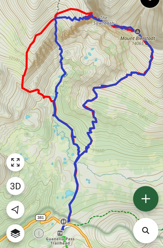
About the Trips Both started off the same, an early hour with beautiful soft sunrise. Getting to the summit of Bierstadt was as one would expect: not too difficult. This was my and Beth's third summit of Bierstadt together and is the only 14er we've done together. (We REALLY need to do a different 14er, Beth!) For Lisa, it was her first summit of this fine peak - and the Sawtooth traverse was to be her first class 3 and my first time agreeing to take someone on their first class 3. Lisa the CrazyFlowerLady? Yes, but also Lisa the GuineaPig. 
All three of us happen to have orange helmets. We are, collectively, the Orange Helmet Brigade. Other members include .com royalty such as sbenfield, blazintoes, d_baker, and HikesInGeologicTime. Don't worry, we'll hike with you even if your helmet is the wrong color. Probably. 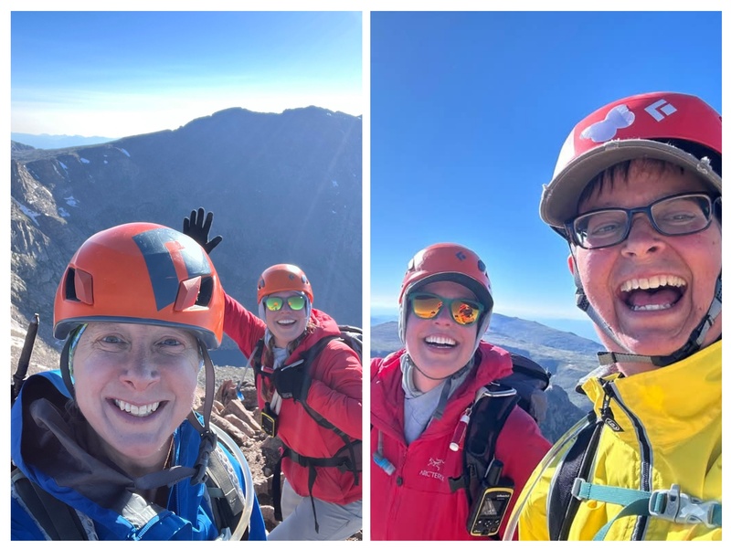
I admit, I'm not a big fan of the downclimb, but it is good practice for hopping around on boulders! 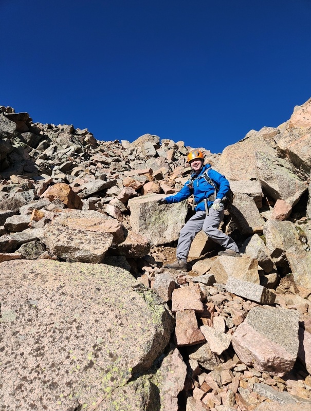
This boulder defied every law of physics. It had successfully toppled by the time Lisa and I came along a year later. 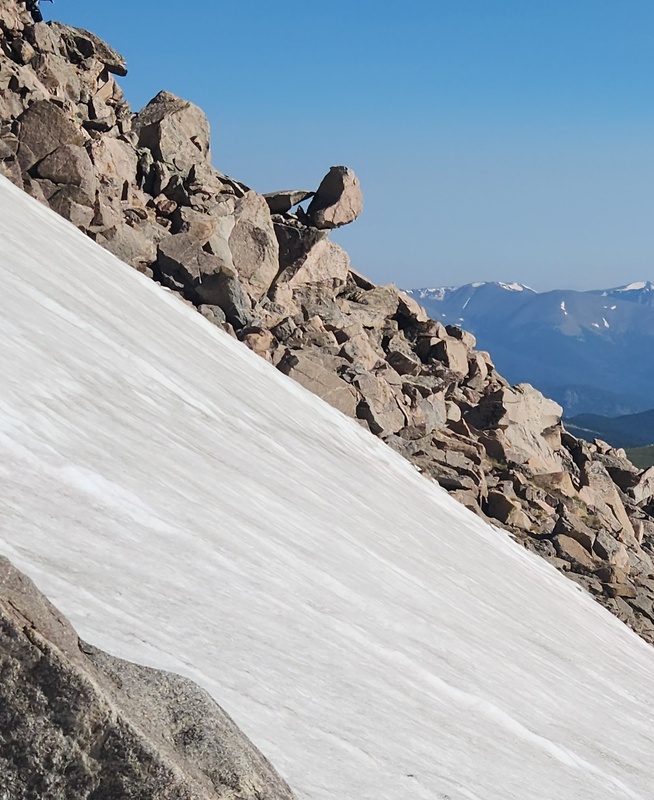
There is a snowfield (part of which is pictured above) that takes its sweet time to melt out, so that's something to consider depending how early in the season you're thinking of doing the route. Although, the bigger consideration, in my mind, is snow lingering on the final exposed section. I prefer to do the snow crossing pretty far down, but there's more than one way to skin the potato. I know some opt to cross higher up or to even potentially avoid it altogether by immediately hitting the ridge from the top. The snow crossing was fairly easy when Beth and I did it. With Lisa, different story; the snowfield was struggling to melt. I thought I found a great crossing spot, and it wasn't until it met up with the boulders on the other side that I realized there was a "mini crevasse" between end of snow and start of boulders. That created some unexpected tricky maneuvering which emulated class 4 moves and was a bit straining but not dangerous. Where to go from there? On neither trek did we travel closer to the actual ridge as indicated on the .com route but rather a little ways below it making a direct beeline for the base of the gendarme. I'm not sure if there's a trade-off, but it didn't create any problems and felt fairly benign. 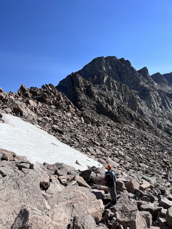
Both times, we opted for a direct up-and-over of the gendarme. 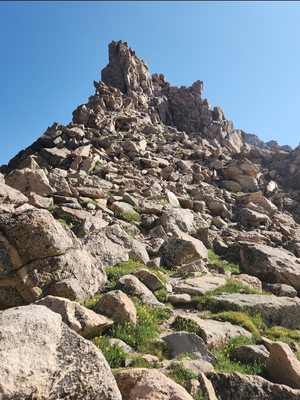
Candid shot by Beth. The suspenders and the Fruit by the Foot "pipe" really give this moment a classy feel, don't you think? 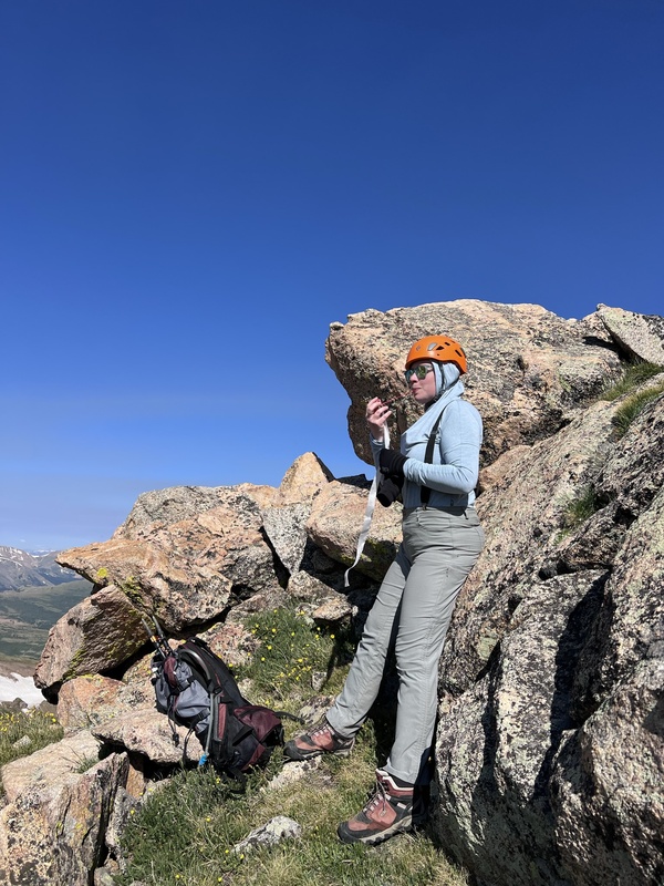
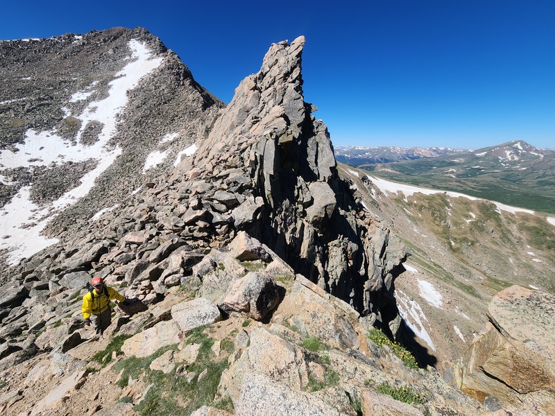
Beth, pro that she is, executed the class 3 moves smoothly, and I followed. There's a nice crack to utilize, though the first time around I felt waffly about a couple of my footholds. 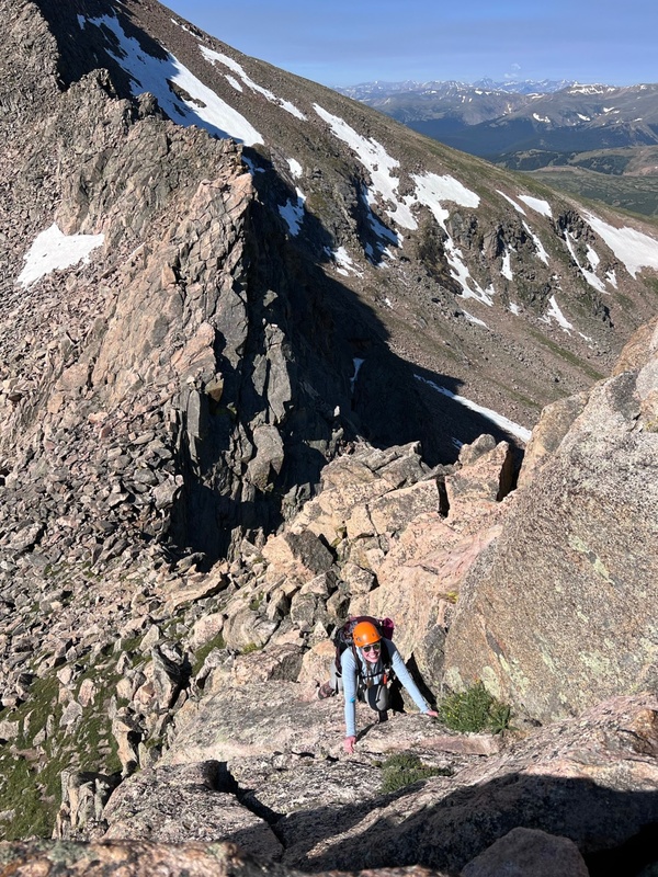
I coached Lisa through lines and moves. However, if I were to do it all over again I'd stay behind instead of demonstrating from the front. She is just enough shorter than me that I accidentally made one of the moves too difficult, and it would have probably been easier to get her out of that pickle if I were below. But, she took a little breather, focused, and made it on up! The next moves were in the tight but safe chimney. Once you're out of the chimney, things level out and are just your standard rocky fare. 
Lisa did great! Little bit of normal nerves but good at keeping composure. After she was through the chimney, she said, “I don't know if class 3 is for me,” and then a couple days later asked if we could do another one. Ahh, mountain amnesia is a beautiful thing! There's an obvious social trail to your next destination which is NOT up the next gendarme. Nope. You'll see an obvious notch before the “up” of the next gendarme, and this signals transitioning to the other side of the ridge. Even before you get to that notch, you gain a view of the "exit ramp" at the end of the Sawtooth. 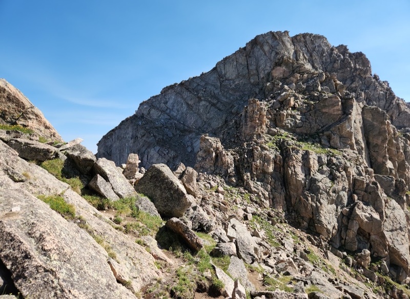
This other side of the ridge is also known as my least favorite part. When I did it with Beth, as soon as we came around the bend to the other side of the ridge, my mind was a flurry of “oh shit!”s. (Pardon my French.) My exposure tolerance has improved a lot over the years, but not enough, apparently. 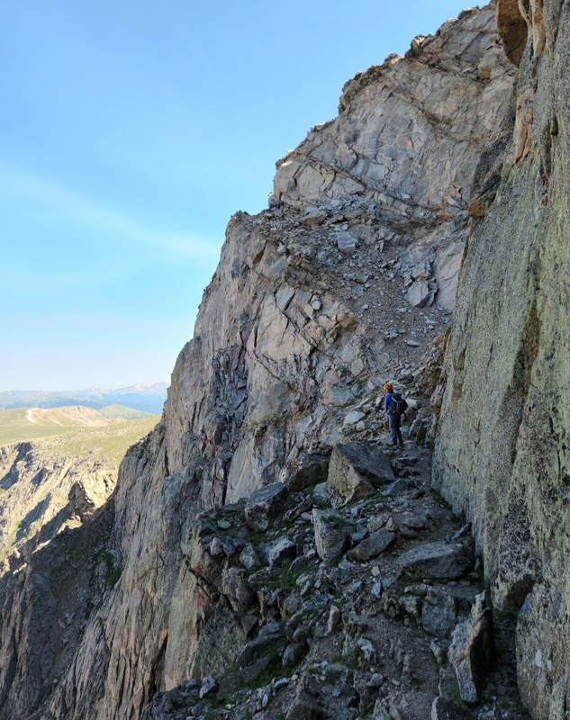
Beth was cool as a cucumber. I was a healthy blend of confident and nervous. We paused to assess if we wanted to skirt just below the rock slabs or go above them. From pictures, I thought for sure I wanted to traverse above them, but that would involve a bit more vertical on scree, and what seemed like a stable but tiny ledge. In person, it seemed more amiable to just scoot along the bottom of the slabs, so that's what we did. Here's a shot of us in that exact spot. (The hikers behind us took a handful of cool photos including this one.) 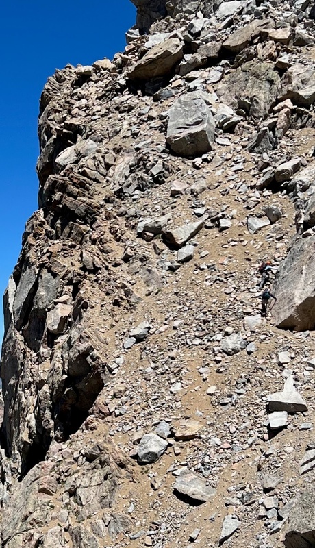
Admittedly, the whole final section is wider than it looks in pictures. Some angles in pictures even make it seem like this section should not be traversed, ever. So, I admit that, objectively speaking, it's not that bad. I just don't like it because of the loose stuff and the angle of the terrain. My brain kept thinking, “Cool, cool. Right over there is a 2,000 foot drop. COOL.” 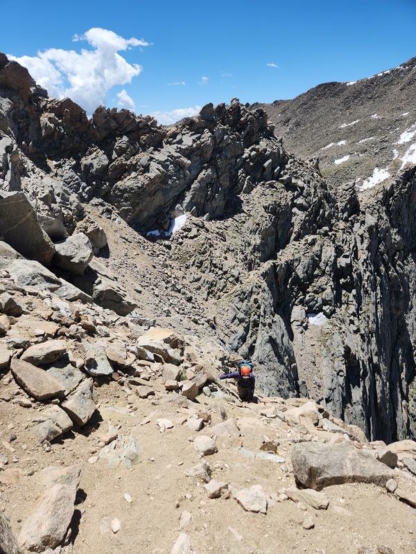
The aesthetic is hard to beat, but perspective sure is a fickle thing. It just doesn't look like it should be possible to traverse this side of the ridge. 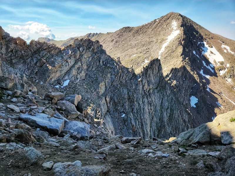
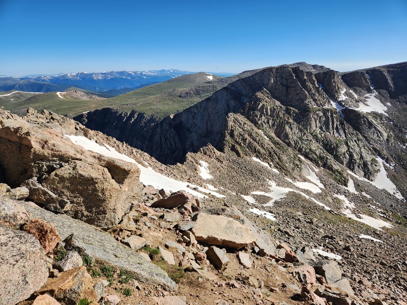
After Beth and I topped out and were no longer on the traverse, I thought, “THAT route is a one-and-done for me!” The lies we tell ourselves. That last stretch wasn't as bad for me when I went back with Lisa. Internally, I was much more calm. I still don't like it, but it's not terrible. As an aside, on that last stretch in 2024 a huge chunk of rock fell off the cliff face onto the route below. Based on pictures and videos provided by others on the 14ers.com Facebook page, it appears easily navigable. Time-wise, I'd say an average hiker needs to factor in 2.5 - 3 hours for getting across the Sawtooth traverse. Beth and I proceeded around the bend and up the rocks to the tippy-top of THE Sawtooth, the actual 13er itself. Obviously, we had to take hero shots! It's the perfect perch, and the views are spectacular. 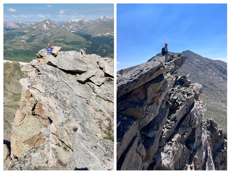
I was starting to feel a bit tired, apparently to the point that I said, “I can't believe we did ALL that work just for one little summit!” It appears I'd forgotten our day started with Bierstadt. Unsure of our weather window, Beth and I opted not to head over to Blue Sky. Would have been a cool add-on, but technically we didn't “need” a repeat of it, so we proceeded to engage my creative descent route. So About the Descents... Beth and I knew the standard is people take the gully down, but I thought I'd be clever and propose an alternate descent that would follow what I guess I would call the shoulder of Mount Spalding. Then, we'd pop into a drainage around 12,120’, follow the drainage out, and meet up with the "Gomer escape route" (i.e., the "standard willows" trail). Easy, right? And, surely, we're not the first people to try it. 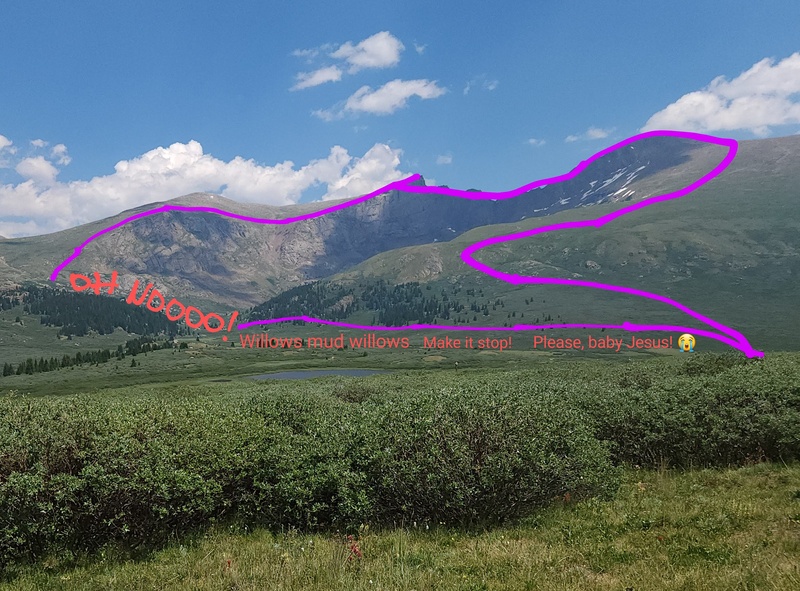
In fairness, after doing the gully descent a year later with Lisa, I'm not convinced either descent route is better than the other. The one thing I'll say about the route Beth and I took is that it is STUNNING until you get to the drainage. Beth said it was like hillsides out of The Sound of Music. We even hiked past a big herd of mountain goats! 
It was also cool looking back at Sawtooth and Bierstadt. It looks like at one point, surely, they were conjoined and simply one big peak. But then a giant came along and cracked them apart like a walnut. 
And beautiful alpine flowers for days! 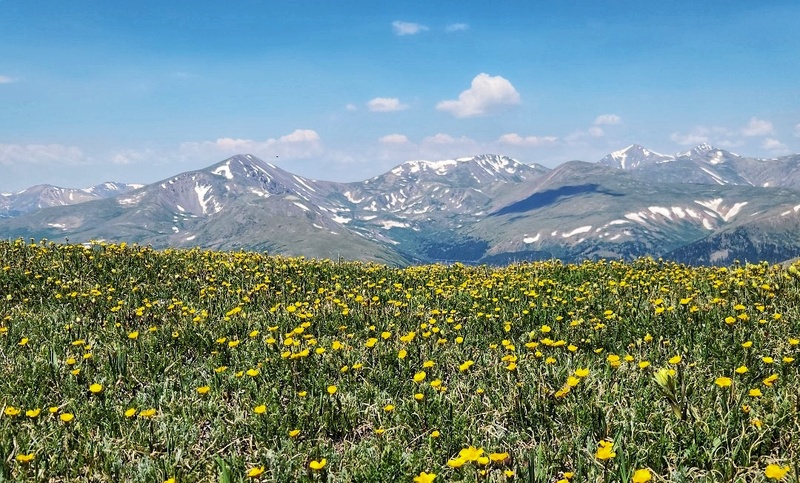
And even when we popped into the drainage, I was convinced this must be the best route idea I've ever had because it was such a lovely trek and so beautiful. Gully? What gully? Only suckers take the gully! We're heading for this beautiful, totally clear drainage: 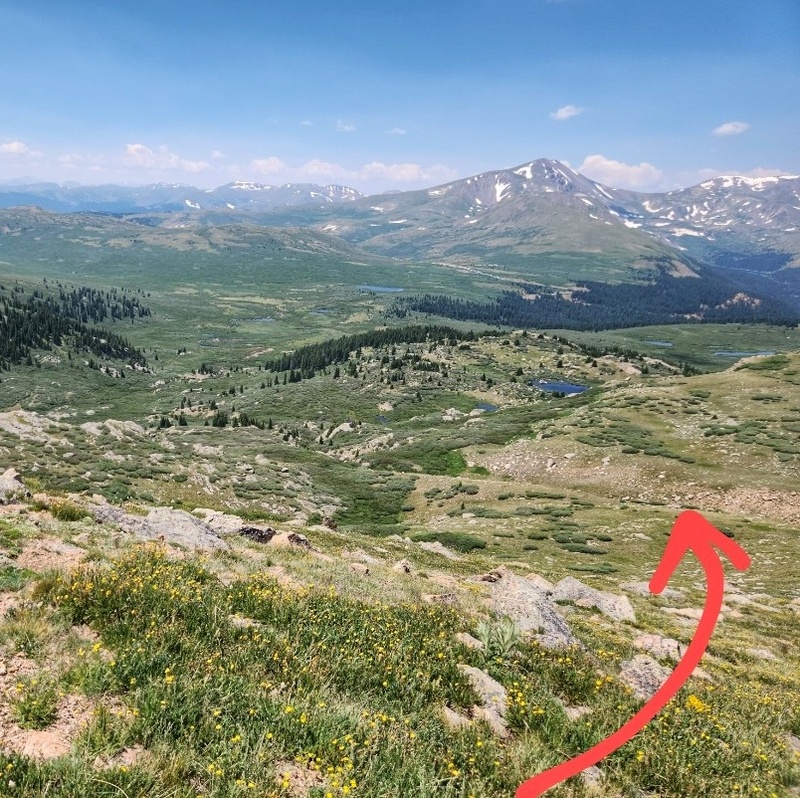
Did I say "totally clear"? What I meant was ... not even a little. It was at first, but then it got choked with willows. So instead of staying in the drainage, we hopped faint game trails outside the drainage - likely created by moose. But the tragedy is the willows were even worse than the normal willows along the Gomer escape path. These willows were a thousand feet tall, thick, strong, and relentless! The muscle strength required to push them aside and push through was obnoxious, and boy did some of those branches whip! Poor Beth, shorter than I, had it a bit worse than I did. And the whole time, of course, I'm thinking, “This is a surefire way to lose a hiking partner.” Not literally lose, more like “never hike with you again” lose. In Beth's uncensored words: "I don’t remember it being that bad but remember every so often thinking fuuuuuuckkk I hope we are heading in the right direction because I can’t see shit!" Accurate. There were times it was hard to see, and then we also found ourselves trying to avoid rock ledges that dropped a few feet. If you weren't paying attention, those could be a bad day. I was always pretty confident about our direction, I just wasn't always convinced we were actually making progress. When we finally emerged into an open area, I breathed a sigh of relief. Of course, it was short-lived because then it was time for Willows Part 2 as we met up with the Gomer escape route. And now, not only was it the joy of willows but it was the wallowing in willows. The mud was intense! Hiking poles were really helpful for MOSTLY avoiding the sudden knee-deep pockets of mud, but inevitably they got us a handful of times. 
As we merged back onto the Bierstadt trail, my heart soared, and Beth still liked me, for some reason. We rinsed off a little in the creek and trudged out the couple hundred feet of remaining uphill back to the parking lot where we sat and ate and decompressed. Now for the descent with Lisa... Lisa having traveled out from Iowa, I was starting to feel bad about having recommended this route as her first class 3 because, admittedly, it's a big day! The class 3 is just a small part of it. I like the route because it has a lot of terrain variety, but it's still arduous. So, we didn't add anything on after the traverse. We took a significant breather, and I shared my Fruit Gushers and Fruit by the Foots with three enthusiastic hikers that had been behind us. To the gully! I've been in the gully when there's snow, never when it's dry. I'm not sure why I looked down into it from the top and thought, "Oh, this is reasonably short. It'll be fine. It'll probably be easy. It has to be better than how Beth and I descended!" Famous last words. 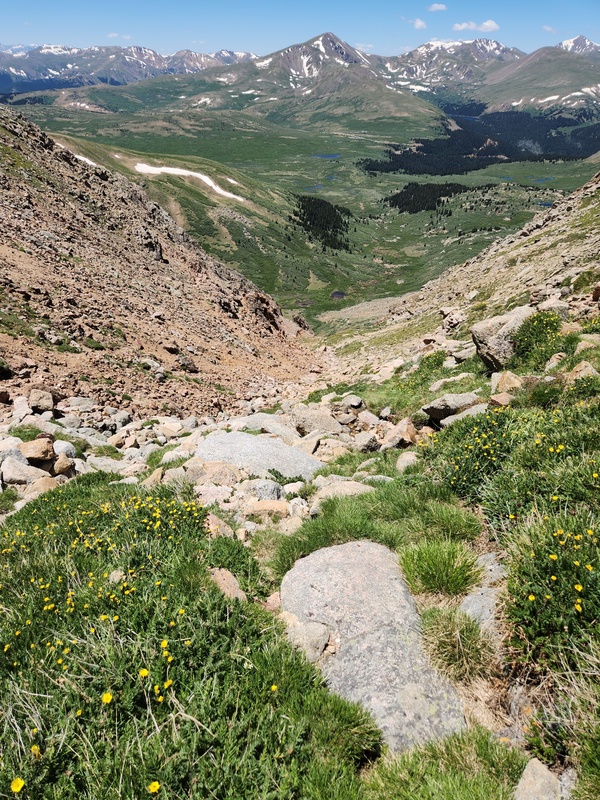
In Lisa's uncensored words: “The crappiest of all crappy gullies, the suckiest gully that sucked the very last ounce of hope and happiness out of your soul until all you want to do is sink into the welcoming muck of the willows.” I hike with honest people. But yeah, the gully is steep, loose, and never ends. Halfway down, suddenly the willowy descent with Beth didn't seem so bad! Lisa fell a couple times, and I came close a thousand different times. Gravity was after us like a pissed-off moose. 
When we were finally to the true bottom and level with our escape route, we were greeted by a family of marmots and a lot of beautiful bunches of columbines. That was a lovely, welcome contrast to what we just did. 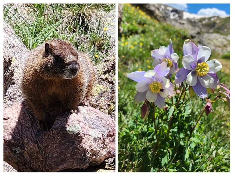
The day had gotten hot. Being in the gully was roasty, and tedious. Wonder of wonders, it actually felt pretty darn good once we got to the willows! We donned our gaiters and headed in. Ahhh, nice, cool mud. The mud was the same as before with Beth in terms of prevalence and difficulty. The path through the willows was pretty obvious. If I counted correctly, this was my 4th time through the willows (because I just can't help myself), so it'd be embarrassing if I somehow went the wrong way, anyway. 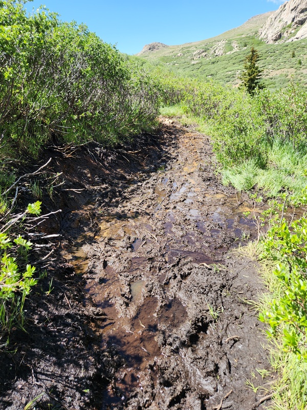
When we got back to the creek crossing, we just stood in it. Felt so good! Got a whole bunch of mud off the boots and gaiters and sloshed our way back to the parking lot. Per the usual, sat, ate, decompressed. If I recall, we polished off several tasty macarons gifted to us by CookieHiker. About Lisa: given my experience growth over the past few years, I really wanted to start paying it forward in the class 3/4 realm. Making the leap can be difficult to navigate, and Lisa's added challenge was being an out-of-stater. We'd struck up a friendship, and she seemed an ideal candidate for encouraging into class 3. Thank you, Lisa, for your trust and for giving me the opportunity to see if I could confidently lead and teach someone else. You did marvelous and are capable, level-headed, and rock a great attitude. I'm proud of you and can't wait for our next class 3 together! About Beth: she's such an amazing friend, and I appreciate her willingness to entertain crazy ideas and go into battle with me in the willows. Her sense of adventure is always a source of joy and motivation, and I'm so looking forward to many more years of shared adventures together - as well as volunteering together for CFI. Thank you, Beth, for being a treasured friend and hiking partner, but for the love of all that is good in this world, let's do a different 14er sometime! Which Descent is Better? I just can't. Six of one, half dozen of the other. They're even comparable statistically, so there's no major differentiating factor for me to hang my hat on. I probably hate the gully descent more than the willow descent. At least before all the willows, you have this glorious hillside experience that's easy trekking and super enjoyable. I think I'd like to sometime try to proceed through the drainage/willow descent slower and more thoughtfully to see if there's a cleaner way. I really think there must be since the moose travel through those groves all the time, so paying closer attention to game trails could be the golden ticket. Heck, maybe someone has even already figured that out. I sincerely doubt it's an original idea; I haven't scoped out TRs and GPX files to see for sure. Or, perhaps all of us who have tried it ultimately came to a collective conclusion that it's simply a bit crappy. Final Thoughts Sawtooth is a super great intro class 3, in my opinion. I'd say the potential drawback is the tedium of the full route, and it is a bigger day than some other good intro class 3s. But if you've got a good weather window, it's a great option. I do think the variety of terrain - including the bouldery downclimb and the exposure of the exit ramp from the Sawtooth - is an added bonus for being able to experience a few different things. You get a nice ascent of Bierstadt, tedious bouldery downclimb, class 3 section, big exposure, tedious gully, and rite-of-passage muddy willows. That's honestly a great mix of elements, and the whole area is beautiful. I don't see a lot of downsides here. Happy trekking! As with all things outdoors, please take nothing, and leave nothing. Thumbnails for uploaded photos (click to open slideshow): ")
")
")
")
")
")
")
")
")
")
")
")
")
")
")
")
")
")
")
")
")
")
")
")
")
")
")
")
|
| Comments or Questions | |||||||||
|---|---|---|---|---|---|---|---|---|---|
|
Caution: The information contained in this report may not be accurate and should not be the only resource used in preparation for your climb. Failure to have the necessary experience, physical conditioning, supplies or equipment can result in injury or death. 14ers.com and the author(s) of this report provide no warranties, either express or implied, that the information provided is accurate or reliable. By using the information provided, you agree to indemnify and hold harmless 14ers.com and the report author(s) with respect to any claims and demands against them, including any attorney fees and expenses. Please read the 14ers.com Safety and Disclaimer pages for more information.
Please respect private property: 14ers.com supports the rights of private landowners to determine how and by whom their land will be used. In Colorado, it is your responsibility to determine if land is private and to obtain the appropriate permission before entering the property.


