Download Agreement, Release, and Acknowledgement of Risk:
You (the person requesting this file download) fully understand mountain climbing ("Activity") involves risks and dangers of serious bodily injury, including permanent disability, paralysis, and death ("Risks") and you fully accept and assume all such risks and all responsibility for losses, costs, and damages you incur as a result of your participation in this Activity.
You acknowledge that information in the file you have chosen to download may not be accurate and may contain errors. You agree to assume all risks when using this information and agree to release and discharge 14ers.com, 14ers Inc. and the author(s) of such information (collectively, the "Released Parties").
You hereby discharge the Released Parties from all damages, actions, claims and liabilities of any nature, specifically including, but not limited to, damages, actions, claims and liabilities arising from or related to the negligence of the Released Parties. You further agree to indemnify, hold harmless and defend 14ers.com, 14ers Inc. and each of the other Released Parties from and against any loss, damage, liability and expense, including costs and attorney fees, incurred by 14ers.com, 14ers Inc. or any of the other Released Parties as a result of you using information provided on the 14ers.com or 14ers Inc. websites.
You have read this agreement, fully understand its terms and intend it to be a complete and unconditional release of all liability to the greatest extent allowed by law and agree that if any portion of this agreement is held to be invalid the balance, notwithstanding, shall continue in full force and effect.
By clicking "OK" you agree to these terms. If you DO NOT agree, click "Cancel"...
Ben has been gunning for his final ranked Sneffels Range peak, and I've been keen to explore the funky traverse into upper Oak Creek, so when he floated his plan to tackle this pig with spring snow cover I was sold. After food poisoning thwarted plans early in the month, the stars finally aligned again at the end of May. We met early in Ridgway and started hiking from the upper Oak Creek/Perimeter trailhead at 3:45 with the aim of having light for the traverse but also getting to the snow before it got too soft.
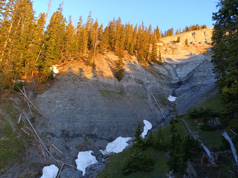
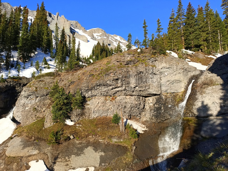
By 5:30 we had finished with the trail and started ascending west across the meadows high above Oak Creek. Soon we began to traverse the beautiful, steep-sided, Cimarron-esque volcanic ditches, of which there are three plus a handful of shallower ones, all blanketed with fresh ball-bearing pebbles. The first is the crux, with a social trail to bypass a steeper option on the higher contour. After descending 200' into the second ditch, we rounded a hill infested with deadfall, which we found on the return was slightly less tedious on game trails 100 feet upslope. A narrow trail cuts the steep wall on the far side of the third ditch, which we picked up and followed along the 11,100' contour southwest, across verdant meadows and another minor ditch to a neat little amphitheater hosting several waterfalls.
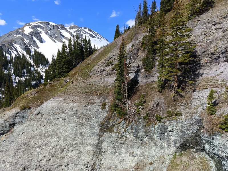
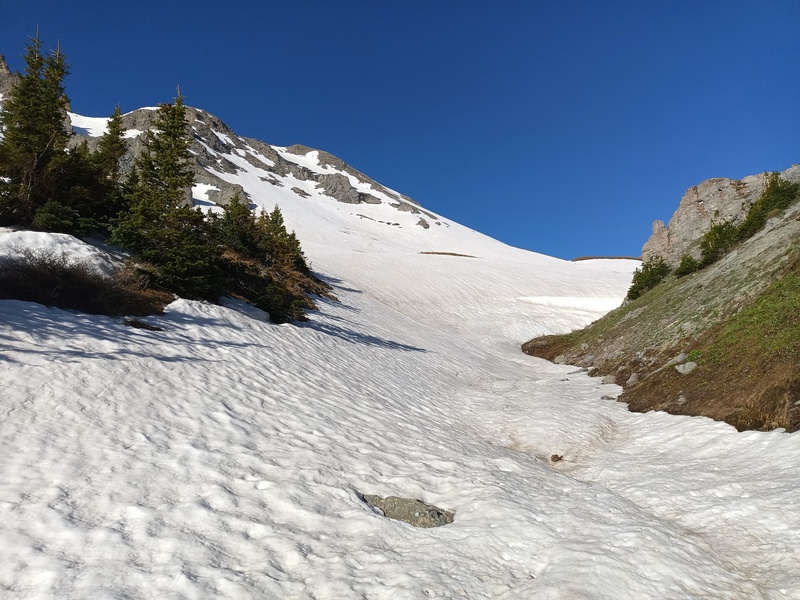
At 11,300' we contoured into Oak Creek and followed it up briefly until it was filled in by snow off the north slopes of Angel Knob. Shortly after 7:00 we switched to boots and crampons and walked up the mostly supportive lower north slopes to access a short, slanting couloir leading most directly to the peak. The snow on this route was thinning and had already softened considerably. Still, we reached the dry and crumbling summit ridge with no drama after a little over an hour on snow.
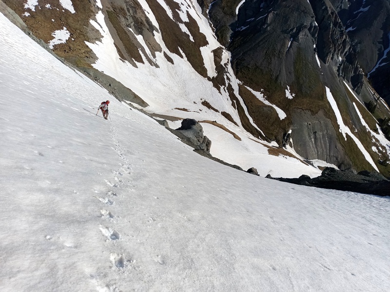
After soaking in the awesome position of this decomposing pile of choss among the giants of the eastern Sneffels Range, at Ben's suggestion we hiked a bit farther down the east ridge and descended the proper north couloir--steep at the very top and otherwise mellow--which, due to holding more snow and being partially shaded by a jagged spur to the east, had remained relatively firm through the sweltering morning. Glissades of mixed quality led back to the creek, where we retraced our steps out and down to the 80F unpleasantness of Ouray.
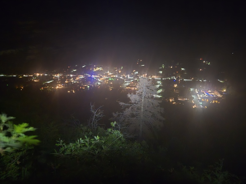
What Ouray looks like most of the time (Ben)
1st ditch high route
2nd ditch
Trail after 3rd ditch (on return)
Waterfalls
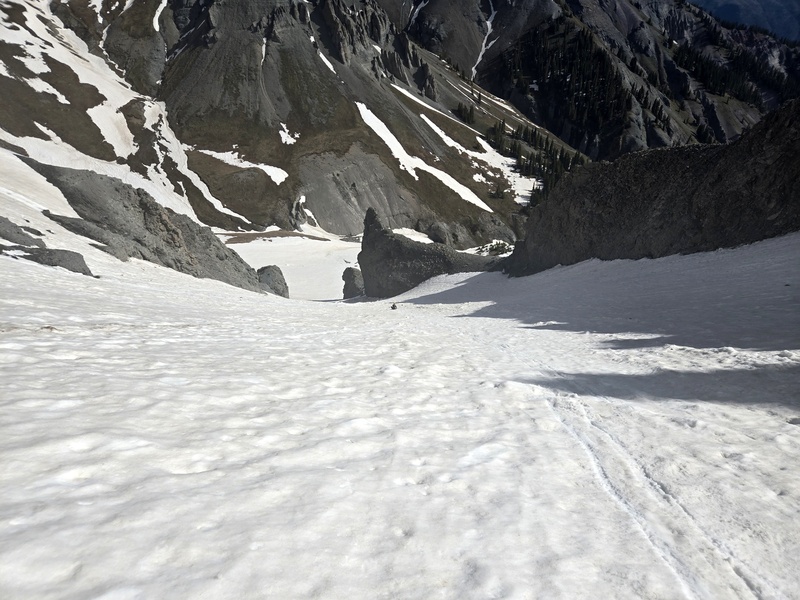
We went up the slanting couloir just below skyline
Up summit couloir
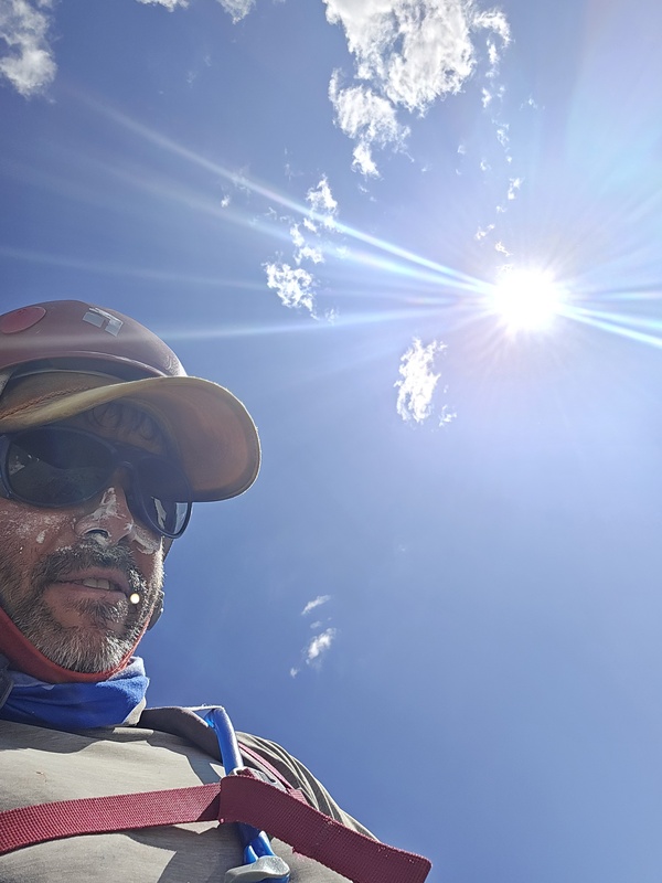
There's what my parents, friends, and colleagues think I'm doing. Then there's what I'm actually doing. (Ben)
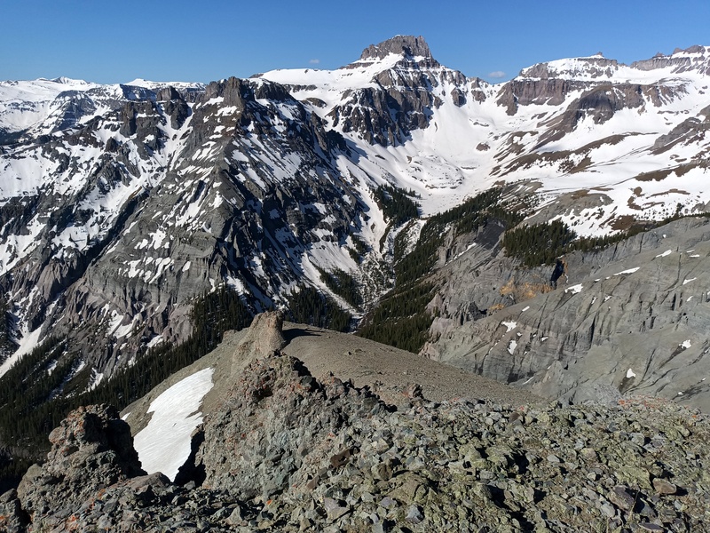
Le choss
Summit view to Weehawken and Potosi
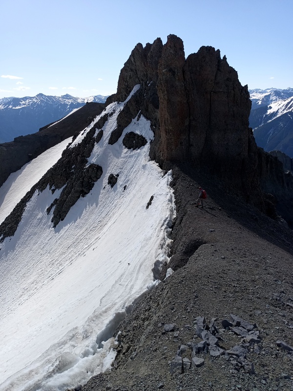
Top of N couloir
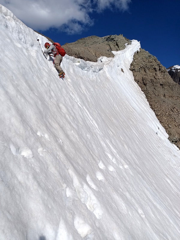
Ben getting in the N couloir
Down N couloir (Ben)
My GPS Tracks on Google Maps (made from a .GPX file upload):
That picture of me with sunscreen all over my face is horrible and hilarious. I approve of some comic relief. Another great climb and TR, thanks for coming along on my Sneffels Range finisher - those erosion gullies were scary and I needed the moral support.
Withering under relentless solar radiation, dripping sweat and sunscreen, eyes burning--it's the essence of snow climbing in a picture.
Turns out I have climbed only the 13er formerly known as "S 10" and not the ranked 12er (I think), and none of the lesser rankeds in the Sneffels Range.
I looked after our climb and there's not a whole lot of lower peaks. 12ers "Angel Knob," Stony Mountain, "S 10," "Reconnoiter Peak" (nearly a 13er) and high 11er Whipple Mountain are it. Contrast that to 26 13ers and lone 14er, Sneffels. The northern boundaries are obvious, and I'd consider Whipple Mountain and Black Bear Pass to be the southwestern and southeastern extents of the range, respectively. It's a remarkably high and compact range.
Looks like 2 11ers and a 10er? Those and S10 are the ones I haven't done. Someday the beetles will kill all trees on 12er summits. Then I'll do them.
Caution: The information contained in this report may not be accurate and should not be the only resource used in preparation for your climb. Failure to have the necessary experience, physical conditioning, supplies or equipment can result in injury or death. 14ers.com and the author(s) of this report provide no warranties, either express or implied, that the information provided is accurate or reliable. By using the information provided, you agree to indemnify and hold harmless 14ers.com and the report author(s) with respect to any claims and demands against them, including any attorney fees and expenses. Please read the 14ers.com Safety and Disclaimer pages for more information.
Please respect private property: 14ers.com supports the rights of private landowners to determine how and by whom their land will be used. In Colorado, it is your responsibility to determine if land is private and to obtain the appropriate permission before entering the property.
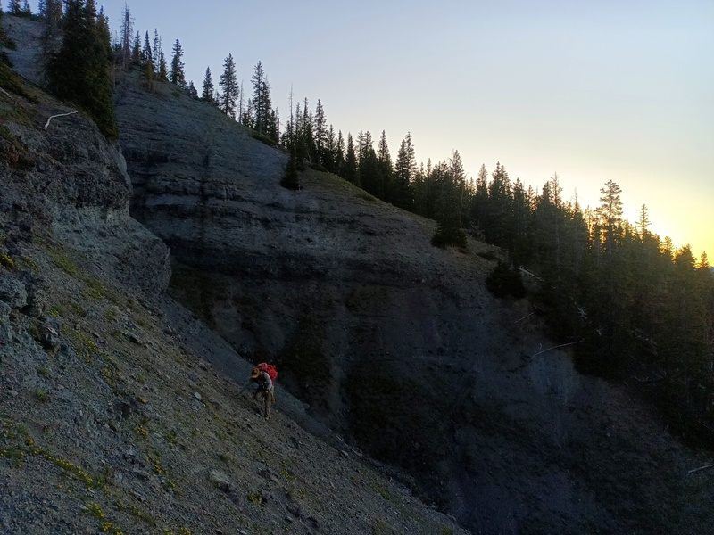

 1st ditch high route")
 2nd ditch")
 Waterfalls")
 We went up the slanting couloir just below skyline")
 Up summit couloir")
 Le choss")
 Summit view to Weehawken and Potosi")
 Top of N couloir")
 Ben getting in the N couloir")
 Trail after 3rd ditch (on return)")
 Ever wonder what snow climbing feels like? It feels like this. (Ben)")
 Down N couloir (Ben)")
 What Ouray looks like most of the time (Ben)")


