| Report Type | Full |
| Peak(s) |
Pico Ruivo, 1861 m, 6106' Montanha do Pico, 2351 m, 7713' Pico del Teide, 3715 m, 12188' |
| Date Posted | 06/08/2025 |
| Modified | 06/09/2025 |
| Date Climbed | 05/22/2025 |
| Author | dr_j |
| Acima das nuvens / Por encima de las nubes |
|---|
|
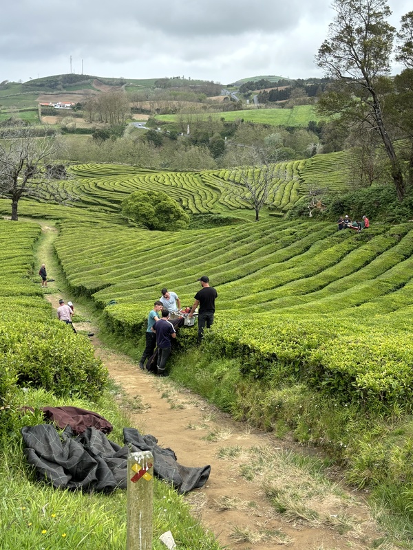
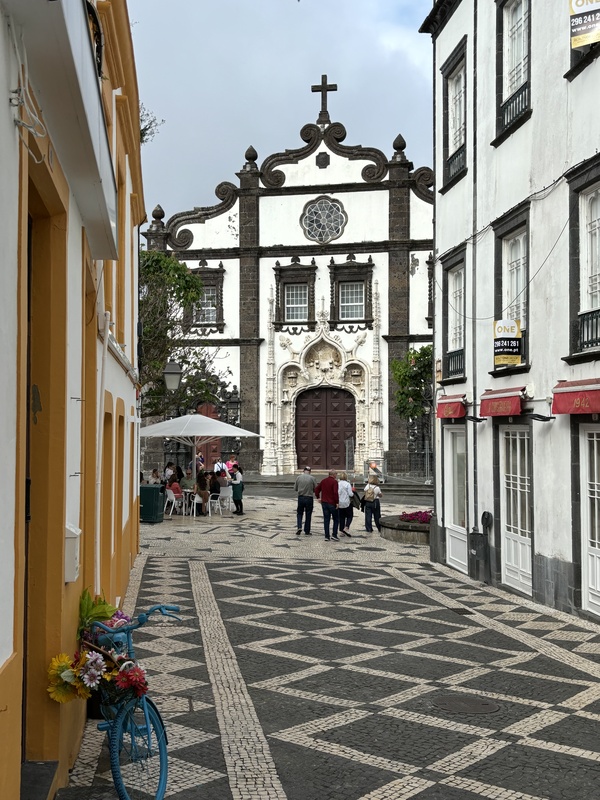
In my quest to see and do everything possible in my life, I took a solo trip to these magical islands in the Atlantic Ocean that also have some unusual and unique mountain peaks. In addition to getting a taste of the culture of these places, I hiked several peaks in the archipelagos of the Azores (Portugal), Madeira (Portugal), and the Canary Islands (Spain). The high points of Portugal and Spain are on these islands. These peaks are some of the highest in the north Atlantic, and the surrounding areas highly biodiverse owing to their isolation and prominence. None of the hikes are technical, but they do take some advance planning to master the logistics. If you are thinking of visiting these remarkable places, this TR and the links at the end will help you plan your trip. The variety of species and ecosystems present on these islands, and the pressures on this natural environment, emphasize the need for awareness and balancing out economic development, tourism, and preserving the environment. Azores These are volcanic islands, dotted with calderas, overgrown cinder cones, crater lakes, shield volcanoes, and stratovolcanoes. It looked magical in pictures, and it's indeed so experienced in person. I flew into the Azorean capital of Ponta Delgada on the island of São Miguel, the traditional jumping off point for trips to the Azores. Tourism has really ramped up in the Azores over the past decade, although it remains pretty quiet overall. São Miguel is located about 2400 miles from Boston and 800 miles from mainland Portugal, so it's a pretty isolated spot, even in today's hyperconnected world. The Azores were the origin of many Portuguese immigrants to the US, settling primarily in New England and the mid-Atlantic. The American whaling industry employed Azoreans in the mid-19th century. A more recent volcanic eruption on the neighboring island of Faial in 1957-58 displaced one-third of the island's population, spurring a second wave of immigration of Portuguese to the US. In fact, my first encounter with Portuguese food was on a trip to Provincetown on Cape Cod decades ago. I landed on a foggy evening after changing flights in Lisbon. Try not to fly into Lisbon if possible, since it's one of Europe's worst airports, and the passport and customs lines were backed up like a toilet. It took 90 minutes just the clear the immigration, with most of the North American flights landing in Lisbon late morning. The number of visitors to Portugal has climbed rapidly, and the airport has not been able to keep up, and it is not helped by a disorienting set of stairs, mazes, and long check-in and security lines. In other words, if another option is available, take it. São Miguel is the largest of the islands, and I spent a day exploring east of the capital, and a second day exploring west of the capital. The first day was marked by thick fog in the higher elevations with less than 100 feet of visibility, so I called it a day early. There was a brief period of visibility down low, so I toured one of Europe's only tea plantations, located on the north coast of São Miguel, about 30 miles from Ponta Delgada. 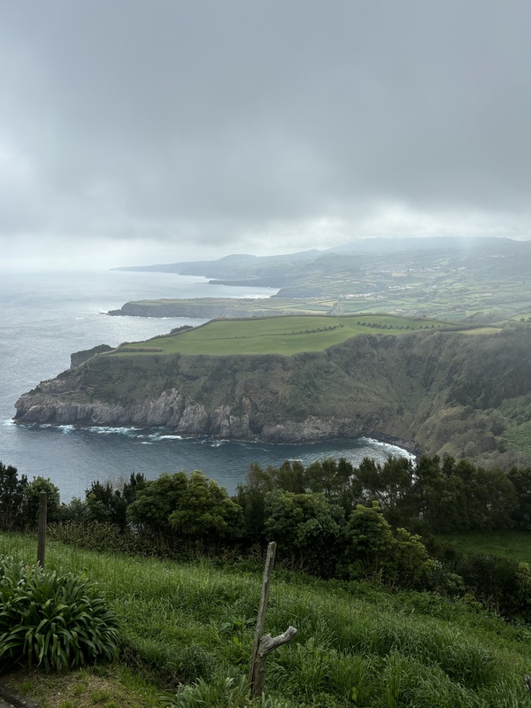
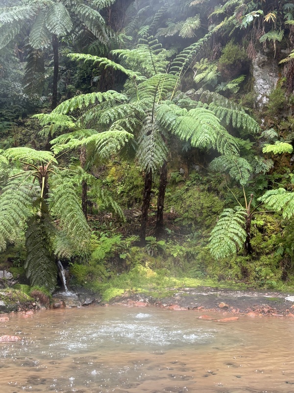
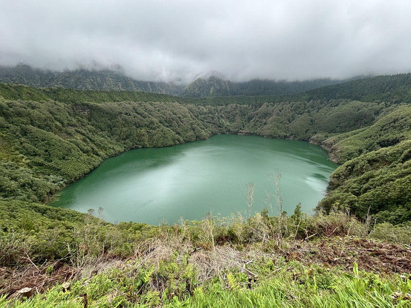
The second day promised to be a lot better weather-wise, so I headed west towards Sete Cidades (seven cities), a nifty geological feature of two different colored crater lakes inside a large caldera, and the views were pretty amazing once the fog lifted (and the crowds came). The hiking was mellow, as I opted for the ridgeline hike for a 4 mile out-and-back starting at the Miradouro da Vista do Rei, then slowly made my way back to the airport for my flight to Pico Island. 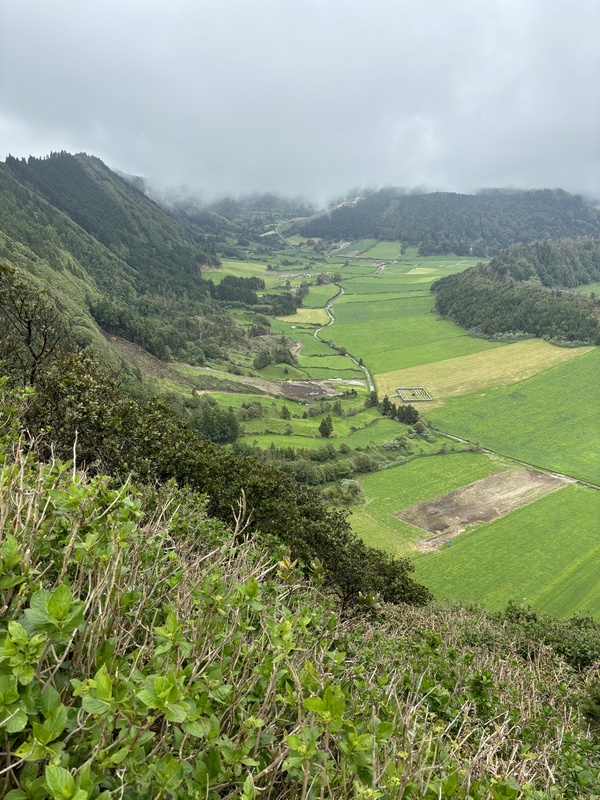
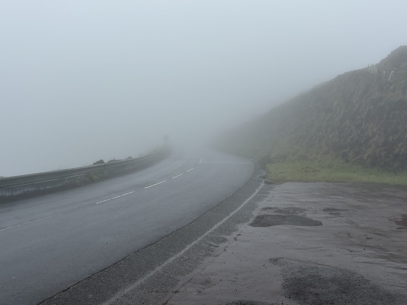
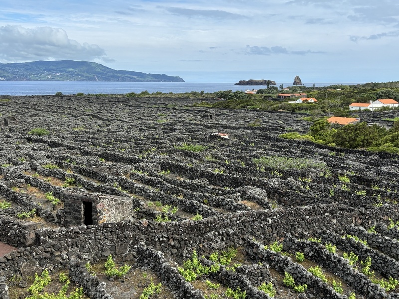
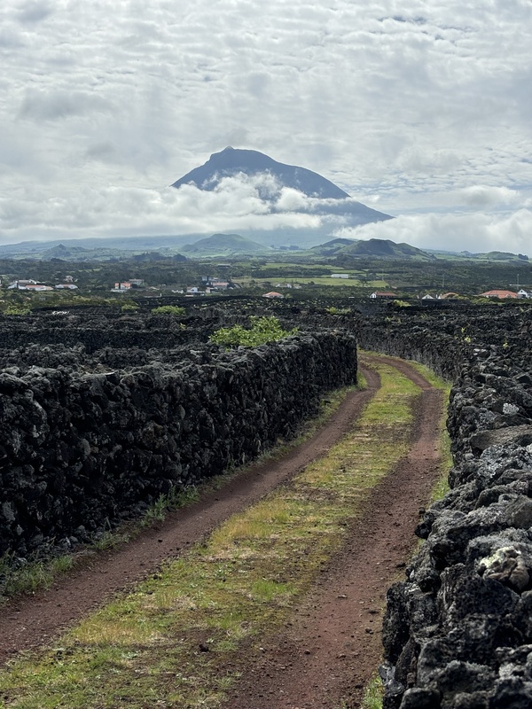
So with that prelude, I continued on to the island of Pico, on a very delayed flight that got me into my hotel in Madalena around midnight. Fortunately the start of the hike was only about 30 minutes away by car. I was up early the next morning, stuffing my hiking gear in the tiny rental car, and drove uphill on the road towards the mountain hut. The marine layer was dense, but was suppressed to around 900 meters, and after the road topped out, it was brilliantly sunny. It would be an excellent day for hiking. Montanha do Pico (7713', 2351 m), or Pico, as it's colloquially called, is the highest point in Portugal, located on the namesake island of Pico in the Azores, 1000 miles from mainland Portugal, and a scant 2400 miles east of Boston. At the foot of the volcano are a maze of remarkable vineyards built around circular and rectangular walls of lava rock. This industry has recently expanded, and the once-derelict historical vineyards have now been rejuvenated and recognized by wine enthusiasts, as well as UNESCO. More on that later in this report. The day started by checking in at the mountain house, where the staff will check your reservation, issue you a GPS wearable, and check that you have the right equipment with you, mostly the right hiking shoes. Permits are available on the website (see below for links), and seem to be fairly easy to obtain, and cost 25 Euro. The weather tends to be foggy, and it’s worth checking the usual websites of your preference to check the forecast. I booked about five days in advance, and happened to pick a good day. Don’t be alarmed if the lower elevations are socked in. If the weather is going to be foggy up high, routefinding will be an issue, and it might be good to hire a guide for the climb. 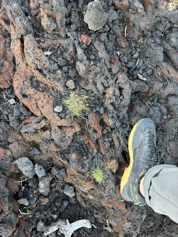
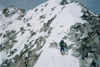
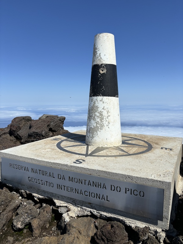
The hike is steep and tiring, in spite of the relatively low altitude. It still involves a decent 3700' of elevation gain, in 2.5 miles. The route is marked at irregular intervals with stakes, over 40 of them that keep you mostly on the right track. Given the terrain, plenty of social trails do exist, and you will need to look carefully for the next stake to keep your bearings. It's mostly walking on different types of lava rock, with a bit of vegetation down low, and then just a monotonous landscape of red and black rock. There are no water sources anywhere on the trail, bring plenty of fluids. The final part, after reaching the volcanic rim, is the most interesting, when you come face to face with one last mini cone, and scramble the last 200 feet to the true summit. I'd rate it as a Class 2/2+. Once up there, the view was pretty much just the marine layer far below. While the island of Faial was visible for just a bit in the early morning, it was now completely lost in the clouds. But still, any summit feels great, even if the views are not what you expected or wanted. After about 20 minutes up there, I started to make my way down. The descent was what I found to be worse, as the sun had baked the dark volcanic soil and it felt like a rotisserie. The lava rock is uneven and difficult to navigate, but after three hours of descending and getting pretty dehydrated in the process, I was finally back at the base station, where I turned in the GPS device and got a nifty paper certificate of completing the summit! Allow about 6-8 hours for the round trip, and hopefully the weather will cooperate. 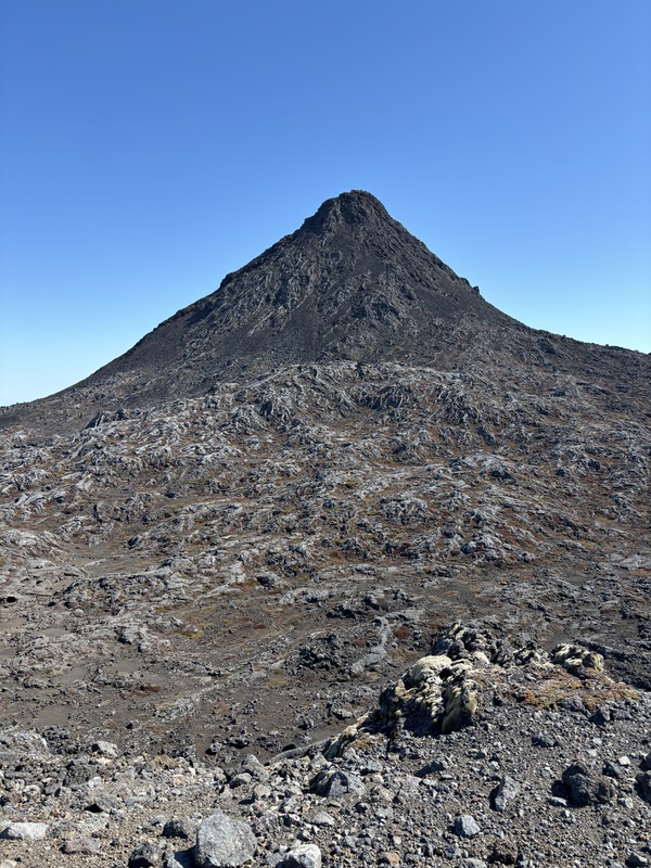
I spent the next day looking for views, but the heavy fog curtailed that. Finally, on my last day on Pico Island, the weather finally cleared up, and I spent the morning walking the route through the vineyards, and got to see the mountain from sea level. It's that shy. And of course, I stopped by a vineyard afterwards for wine tasting. Due to the proximity to the ocean, some of the roots of the grapes hit the sea level, imparting a salty flavor to some of the wine. The lava walls common to the area protected the vines from the winds but also focused the heat. It takes some serious ingenuity to tame a pretty inhospitable landscape into one producing world-class wines. Part of it was the transportation of soil centuries ago from nearby Faial Island to make Pico more arable. Another was the numerous freshwater wells, still a central feature of the settlements. Another was making boat transportation practical, through the many local harbors where goods and cargo could be easily distributed. The vineyards had fallen into disrepair until a few decades ago, having lost their worth when transportation routes started bypassing the Azores. Only recently did modern techniques of winemaking make its way to Pico, and now things are looking up for this very unique region. 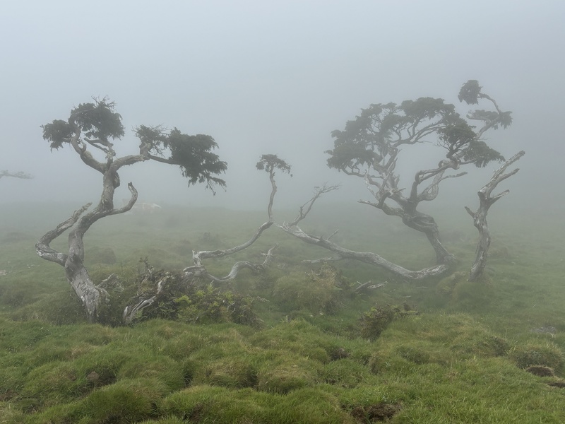
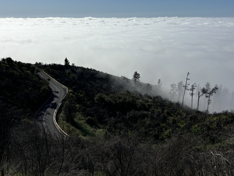
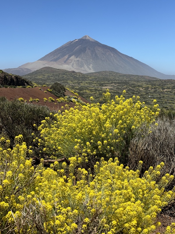
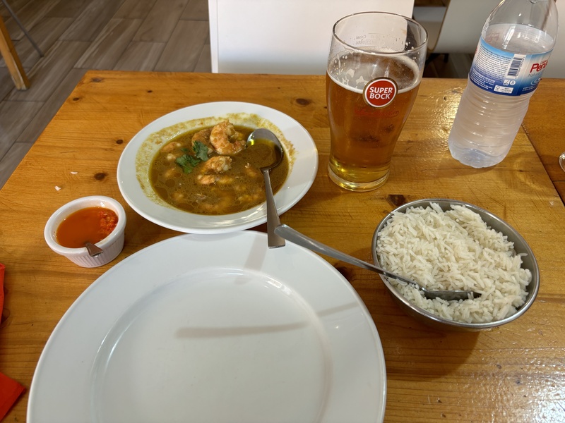
Leaving Pico, I headed to Tenerife, with an overnight in Lisbon. Although it's one of the smaller European capitals, the city is quite lively, and while it is said that European cities generally don't change, an influx of people over the past ten years has really pumped new life into this hilly city along the Tagus River. Something is refreshing about a place where it's still lively at midnight, and it's possible to get a full meal at that late hour. I've become too accustomed to my own town, where the restaurants close at 8 PM. And a few words about the food in Portugal. It's shedding its reputation as being heavy. Sure there are dishes with liberal use of cream, but for the most part it's simply prepared, heavy on the fish, lightly flavored with herbs and sea salt, and plenty of olive oil. Espresso is customary in the mornings, and there are versions of small bites, like fritters made from meat and cod, and various types of cured meats. It's uncomplicated and seemed generally healthy. I had plenty of cod, octopus, clams, with the occasional grilled steak, usually served with a boiled potato and a side salad, arranged on a single plate. Tenerife Tenerife is synonymous with beaches, which seems to be the purpose of most visits to the island. It is popular in the winter due to its favorable location just north of the Tropic of Cancer and eternally warm weather. While it's very close to the mainland Africa, just a few miles from Morocco, is fairly closely located to mainland Europe. Even though US-based air carriers have tried to get into the Tenerife market, it is still largely off the radar of travelers from North America. Also overlooked is the ecotourism potential of the island, which packs incredible vertical relief in its 785 square miles (half the size of Rhode Island, or just a bit bigger in area than Houston, TX), going from sea level to the summit of Pico del Teide (3715 m, 12188') in a matter of a few miles. The isolation of the Canary Islands, coupled with this incredible geography, gives a biodiversity unmatched in Europe, with lots of odd species and adaptations that are very interesting from a scientific perspective. The famous naturalist Alexander von Humboldt was particularly taken with the ecosystem in Tenerife, which he carefully documented back in 1799 while stopping there en route to South America. I flew into the airport in the south (TFS), rented a car, and spent the first day of my stay driving up to Teide via the southern route, then heading downhill to my lodging in the resort town of Puerto de la Cruz. My first impressions were poor, with a rather dull, industrial landscape on the southern side and a bland and rocky natural landscape. This changed after hitting the first forests around 1400 m elevation, which reminded me of the arid forests in southern California. Even the climate was similar, tinder dry, seemingly always on the verge of burning down. I stopped in Tenerife's highest town, Vilaflor, a historic town perched on the side of a ravine, had some lunch, then continued onwards and upwards. The scenery gave way to a barren volcanic landscape near the crest of the road, which topped out at just over 2100 meters before traversing into the caldera and a moonlike scene devoid of nearly all vegetation. 
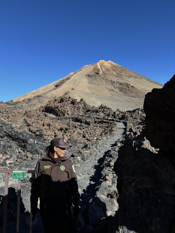
Pico del Teide rises out of a much larger caldera, estimated to be over 6000 m in elevation before collapsing. The volcanic activity remains evident today, with a strong smell of sulfur at the summit, and plenty of areas where steam is still being released. The lava flows are new, the youngest being a few hundred years old. A cable car leading close to the summit has been around since 1971, starting at 2330 m and topping out at 3555 m. For many years this easy access has led to damage to the alpine environment. These days, access to the peak is now restricted, with 300 people allowed to visit the peak per day on a permit system. It's much like the busier peaks in the US, e.g. Mt. Whitney, Half Dome, or Mt. St. Helens. To hike up the trail to the summit, which links the upper cable car station to the actual summit, you will need to reserve a permit well ahead of time. I checked two weeks ahead, and it was booked until July. Right now, as of the publication of this TR, it's booked every day of the summer. However, if you can’t find a summit permit for the day you want, then your best (and only) option is to book a guided tour with a company, which generally includes the summit permit, and the two-way cable car ride. Given that it was a last minute trip, this was the option I took, which involved a fairly easy hike of about 160 m of elevation gain, on a good trail. So much for the 3000 foot rule. There is a station just past the cable car terminus, staffed with personnel to check your permit- only then will you be admitted beyond the gate. As for the hike itself, it's a very well-maintained trail that ascends along one of the tongues of lava, then reaches a steaming crater with the usual odor of sulfur and hot steam vents, and tops out at a pointy summit rock. I suppose that I was fixated on getting to the summit, so I didn't exactly miss the guide's explanations about the geography during the ascent. Numerous companies run tours, I personally used Senda, with Sandra as a guide. The group size was seven, and all Spanish speakers (except me). I had to try several companies before finding one with availability during my stay. It turned out to be the day that I was flying out, so I took the tour, did the hike, and then drove the one and a half hours down to Tenerife North airport to catch my next flight. The limit of 300 persons per day on the summit still meant that everyone was stuffed into the 0.6 mile trail, and it was pretty busy. As of the end of 2024, if you wish to get up to the upper cable car station on foot, a permit is also required, but those are relatively easy to obtain. To summarize, in order to ascend to Teide's peak on foot from the road, two permits will be needed. 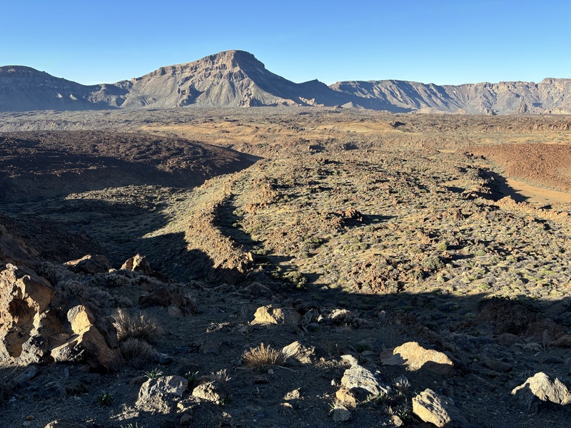
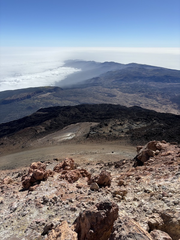
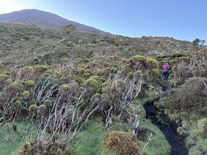
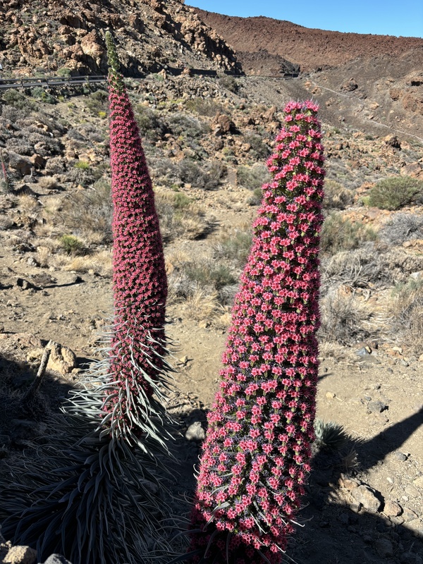
The summit was a bit underwhelming, especially given the lack of effort needed to get up there. But the real treat were the access routes, generally in the cardinal directions. I had the chance to drive three of them, approaching from the south, north, and east. By far, the eastern approach is the most scenic, as the road meanders above 2000 m for miles, with viewpoints that really evoke a sense of timelessness and quiet. Indeed, aside from heavy crowds at the cable car station and some parts of the protected zone, traffic is pretty light, and it's still possible to get some solitude. I also had a field day checking out the variety of plants and trees. There were the familiar flowers and shrubs and trees, but all warped into something uniquely Canarian. 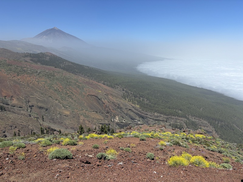
I also spent a day exploring the remote eastern part of the island, accessed by some really twisting, narrow highways, with white knuckle driving, and competing with buses and trucks that somehow manage to get around on these roads. One particularly cool drive went from the large city of Santa Cruz de Tenerife to the tiny historic settlement of Taganana, perched on a hillside just above the ocean. 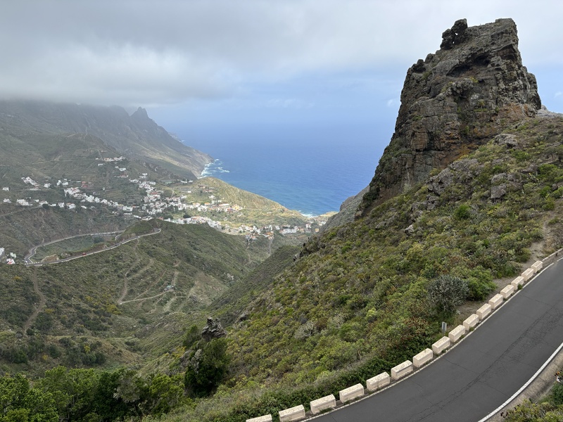
Another cultural highlight is the historic capital city of La Laguna, now dwarfed by nearby Santa Cruz de Tenerife. Unlike most of the places I visited on this trip, La Laguna is laid out on a strict grid system, and it is full of minimalist, sternly elegant architecture. 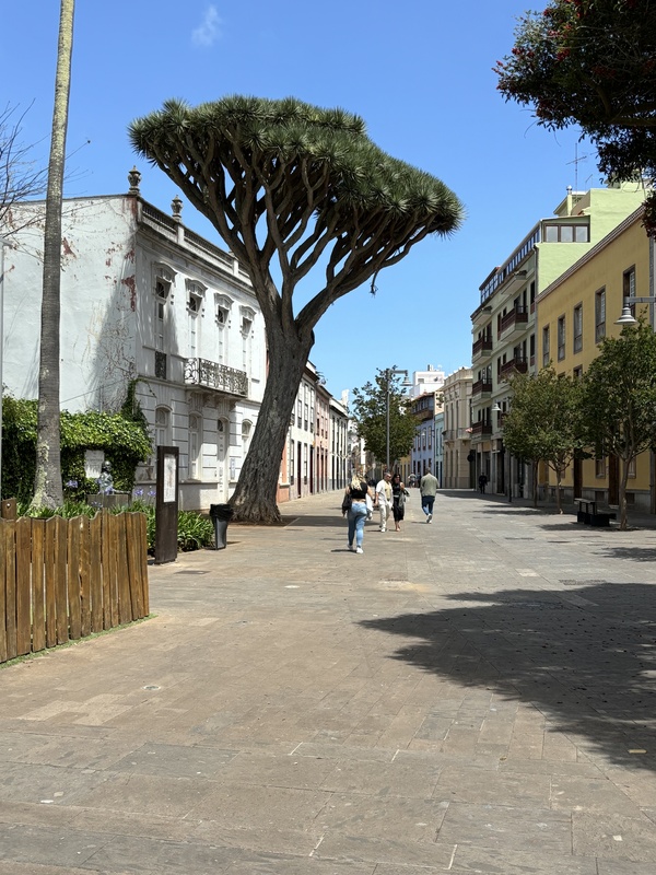
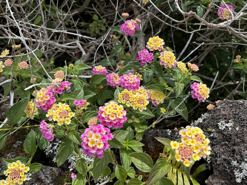
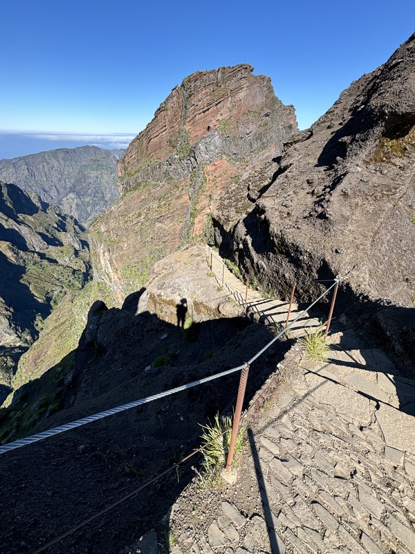
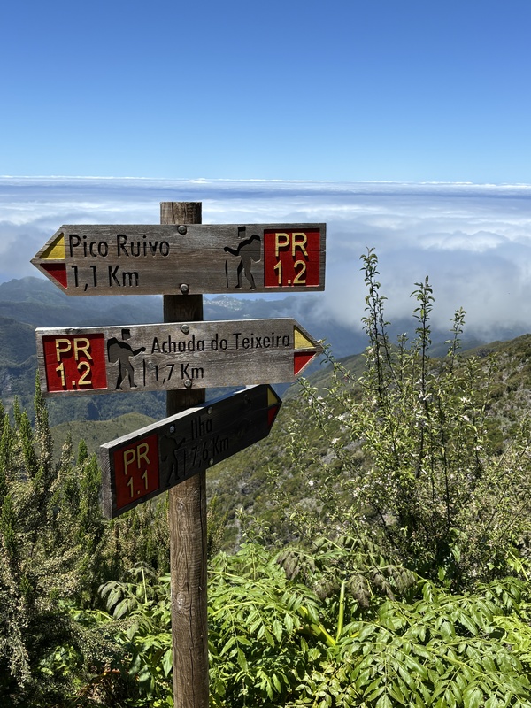
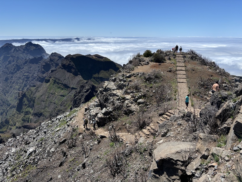
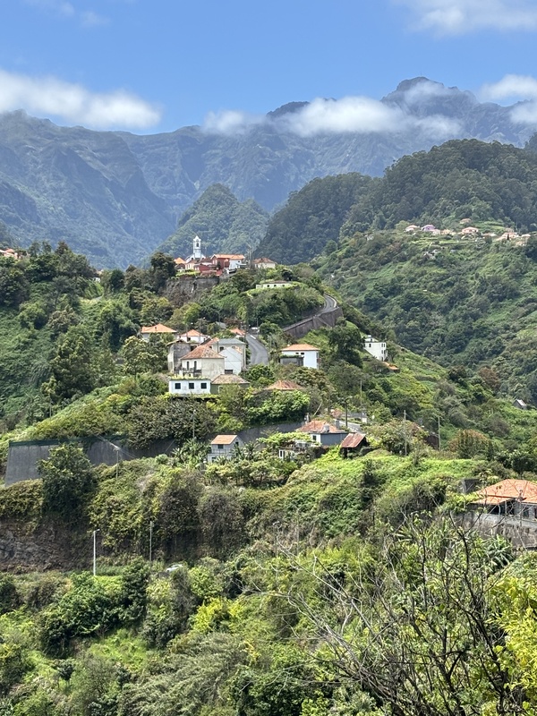
Distances are short on Tenerife, but the terrain is rugged, the roads can be slow, winding, and narrow. Use Google Maps, and even then, getting lost or missing a turnoff is just going to happen. Get a rental car, don’t drive a manual unless you’re really skilled, and keep track of the airports. There are two of them, TFN, and TFS. Most of the longer flights land at TFS, which was built in response to the often foggy weather at TFN. TFN, which is located over 2000 feet above sea level, is notorious for the deadliest commercial air disaster, the 1977 collision of two 747s on the runway, that cost 583 lives. Actually, that's how I first learned about the place, from reading accounts of the accident. Madeira My plane took off from TFN in a blanket of low clouds, actually. After safely arriving in Madeira 90 minutes later, I picked up my car and carefully negotiated my way into the capital Funchal's old town, cursing the parking situation, and being freaked out by the steepness of the streets. This is daily life in Madeira, which is built on very steep slopes, and despite being a small island, is very densely populated. A quarter million residents occupy just a small portion of island's area of 286 square miles (5x larger than Denver Airport). Large portions of the island remain inaccessible due to its rugged terrain. The road engineering in Madeira is remarkable, with narrow mountain roads connecting settlements built in impossible settings. There is also a faster option, through a series of tunnels built in the 2000s that greatly simplified travel. These tunnels link the regional capital Funchal with the airport and points east and north, while another system links Funchal with the more remote western two-thirds of the island. Off the main highways, driving in Madeira is an adventure. My very underpowered rental vehicle could only manage 20 km / h on some of the steeper grades. The most popular hikes cost a nominal sum, and should be paid for in advance. The ones I hiked were PR1 and PR1.2, which can be booked here. If you forget to make a booking, there are staff at the trailhead that can issue the tickets. They cost 3 Euro per hike, regardless of the distance. For PR1, there is pay parking about 1 km below the trailhead for 5 Euro a day, bring a credit card with a functioning chip. The most well-known hike is the 6-mile linkup between Pico do Areeiro (sometimes spelled Arieiro, 1818 m, 5961') and Pico Ruivo (1861 m, 6106'), the latter being the highest peak on the island, and the third highest on Portuguese soil. Due to a recent fire and erosion, it is not possible to do this hike in its entirety. Instead, I opted to hike the scenic section starting at the Pico de Areeiro mountain station to a viewpoint 1.2 km further. Beyond that the trail is closed. I then drove to the trailhead for Pico Ruivo (Achada do Teixeira), accessed from the village of Santana. From there I hiked to its peak, which was a 6 km round-trip. These are not trails like you see in the US, but are quasi-paved routes, with plenty of guardrails, and the parking lots resemble Bierstadt on a weekend day. There are also full-service restaurants at both trailheads. In other words, the hiker traffic is very heavy, and it's nowhere close to a wilderness experience. Still, I found that the hikers seem to be very well-decked out, many wearing pretty solid hiking boots, walking poles, and took these short hikes pretty seriously compared to their American counterparts. In my wisdom and hubris, I opted for bare feet and flip-flops for these hikes and probably didn't drink enough water. 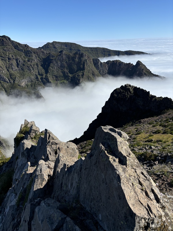
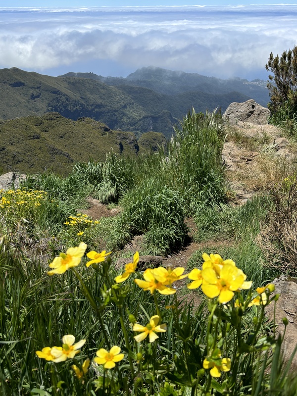
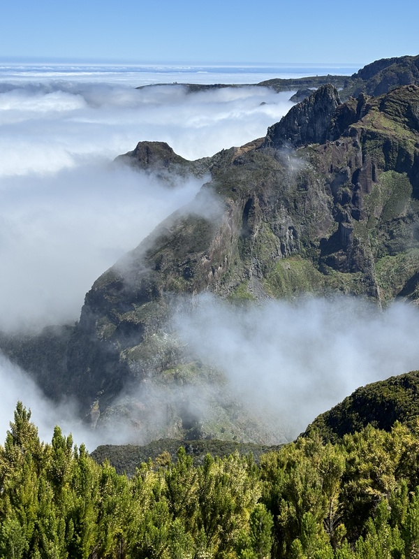
This is one crowded island, with lots of package tours coming in. I'd say that it is on the verge of being heavily damaged, and the inevitable restrictions are coming fairly soon. Despite this rather crowded, chaotic experience, the scenery really is magnificent. It's reminiscent of Kauai in its colors and lush peaks, and the vegetation is tropical. There was still a persistent marine layer, which added to the top of the world feeling. The food is traditional Portuguese, but with the incorporation of more tropical ingredients, such as passionfruit and bananas, into its dishes. The culture is heavily influenced by trade, with the famed Madeira wines bringing visitors and influences from around the world. The majority of the tourists were Europeans, with plenty of British and more recently, visitors from Eastern Europe. Prices are on the high side in Madeira, but still a bit below comparable prices in the States. I wrapped up my visit with a day in Lisbon, a very hilly city with expansive views overlooking the wide Tagus River. Some of you may recall that the city was devastated by the 1755 earthquake, tsunami, and resulting firestorm, so most of what exists today was built afterwards. It is not old by European standards, but has a very lived-in feel, with crumbling buildings hosting trendy restaurants, bars and densely packed housing, all with unique vistas. I compared it to San Francisco, and Lisbon even has its own long suspension bridge. The irregularity of the streets makes for nifty hidden squares and informal meeting places, and lots of stairways link the Baixa (lower town) and the Barrio Alto (upper town), which host terraces and outdoor cafes. The culinary scene is also rich, with reminders of the former reach of the Portuguese empire, especially in Africa. 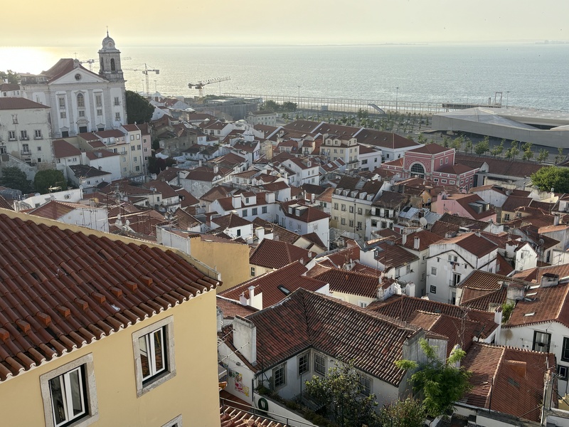
Useful websites and logistics Pico del Teide permits: Want to do it yourself? Go here. Click on "reservas" to see availability. Pico (Portugal) permits: Go here. Madeira hiking trails: PDF Madeira hiking trail payment system: Go here. Scroll to bottom of page for availability. Parking in Portugal: Generally spaces outlined in blue are pay parking areas, areas in white are free parking, areas in white with a letter (M for "moradores", or residents), or a sign, indicate reserved parking. Bring Euro coins. Transport: Public transportation exists, but is not that practical. The best way to get around is to rent a car. Your US drivers license should work, but the International Driving Permit is available at AAA offices. The driving demands full attention, traffic is heavy, roads are narrow, and steep, and there's little logic to the street "grid". Prepare to get lost, and have Google Maps and Google Translate handy. Driving in city centers is not recommended, if you do so, bring plenty of patience. Language(s): The tourist infrastructure is pretty good, English is the lingua franca even among other European tourists, but making the effort to speak Portuguese and Spanish is always appreciated. Interestingly, I found that the Spanish speakers used English to communicate with their Portuguese counterparts, as the languages sound significantly different enough to be difficult to understand. Other random stuff: The rental cars often do not have a "P" position, it's the combination of "N" and the hand brake. Septic systems are not too good, and while we're discussing restrooms, bring coins for public toilets. Getting around the Azores means flying SATA Azores Airlines, which is terrible. Don't expect to make it on time, and expect to pay for everything on board, including water. Thumbnails for uploaded photos (click to open slideshow): ")
")
")
")
")
")
")
")
")
")
")
")
")
")
")
")
")
")
")
")
")
")
")
")
")
")
")
")
")
")
")
")
")
")
")
")
|
| Comments or Questions | |||
|---|---|---|---|
|
Caution: The information contained in this report may not be accurate and should not be the only resource used in preparation for your climb. Failure to have the necessary experience, physical conditioning, supplies or equipment can result in injury or death. 14ers.com and the author(s) of this report provide no warranties, either express or implied, that the information provided is accurate or reliable. By using the information provided, you agree to indemnify and hold harmless 14ers.com and the report author(s) with respect to any claims and demands against them, including any attorney fees and expenses. Please read the 14ers.com Safety and Disclaimer pages for more information.
Please respect private property: 14ers.com supports the rights of private landowners to determine how and by whom their land will be used. In Colorado, it is your responsibility to determine if land is private and to obtain the appropriate permission before entering the property.