| Report Type | Full |
| Peak(s) |
Mt. Silverheels - 13,828 feet |
| Date Posted | 05/29/2025 |
| Date Climbed | 09/27/2024 |
| Author | MaryinColorado |
| Silver Heels and Autumn Gold |
|---|
|
Mt. Silverheels It was the finest autumn day. Some snow had fallen. The air was crisp and cool, but I was cozy in my jacket and thermals as I headed east across highway 9 from the Hoosier Pass parking lot. Into the woods, I went, following an old road. All was silent with the exception of the occasional chirp of a bird or chatter of a squirrel. Soon, I came upon a lone hunter. We exchanged a few pleasantries and well-wishes for a good day. He would be the only person I crossed paths with that day. 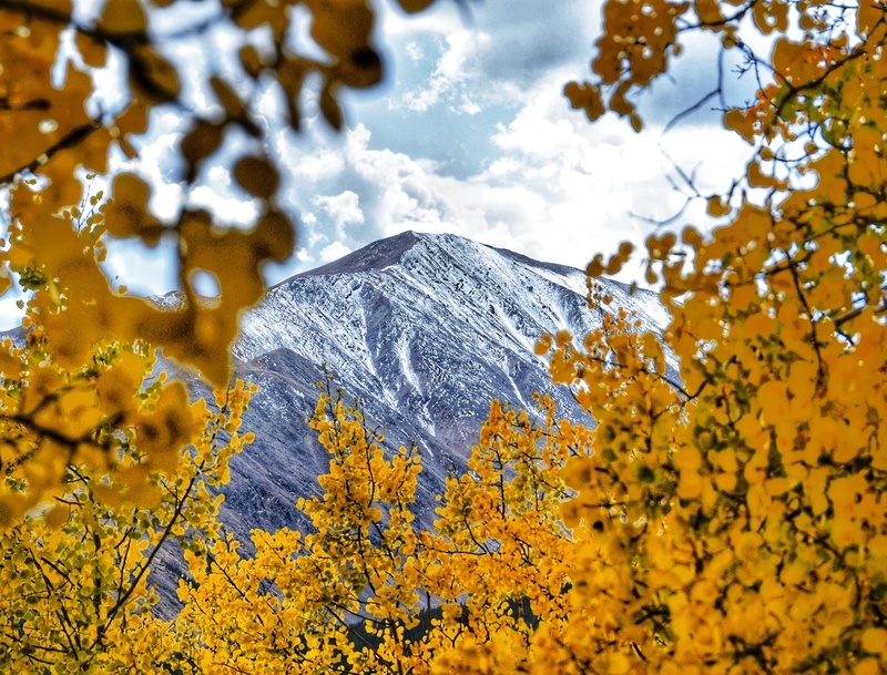
Though one of the key characteristics is how many times you go up and down along this route, the route overall is relatively straightforward and benign. Aesthetically, Silverheels has always caught my eye with its shape and prominence. It would prove to be a delightful solo day and truly rewarding in a variety of visual displays. About the Girl The year was 1861, and a young girl arrived to Alma by stagecoach. She was a talented dancer who became well-known at the local saloon and earned her nickname by way of the silver heels she wore. But the best part of her story is that, at risk to herself, she selflessly cared for many others when a smallpox epidemic spread through the community. She caught smallpox, herself, and disappeared. She was never seen again; however, eager to express their gratitude and to ensure she was memorialized in some fashion, miners began referring to the peak as Mount Silverheels in her honor. I bet she would have really liked that. 
To the Stats, We Go Total mileage: 9.87 miles The Hike Go eastward into the woods following an old road to tree line, and then continue eastward up a really wide slope. Your goal is the ridge, and it’s hard to go wrong getting there. 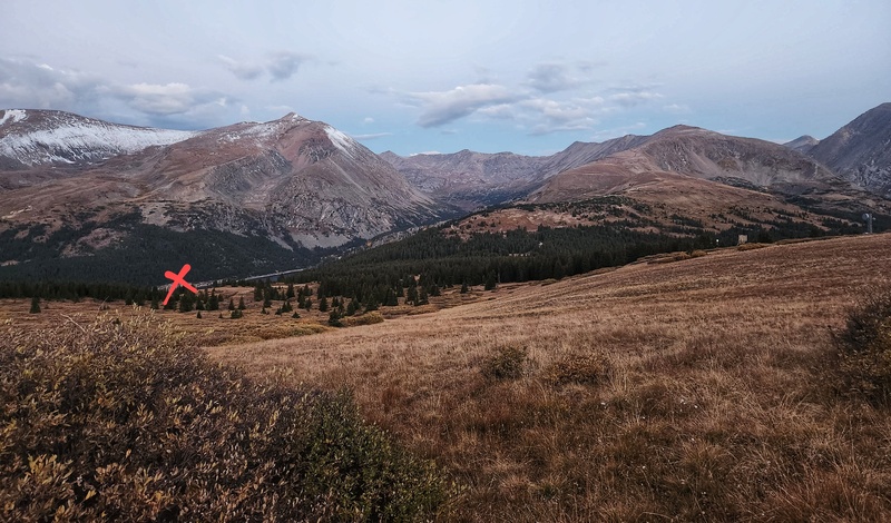
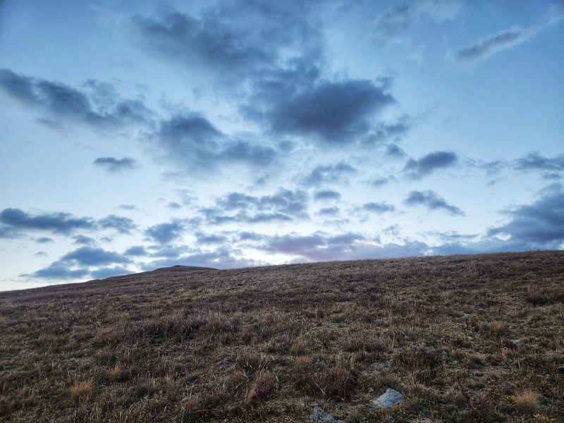
Be sure to look behind you once in a while so you can enjoy the views especially if you're starting before sunrise! (Mt. Lincoln serves as a great visual/directional aid, by the way.) I was happy to have brought my DSLR since today would yield many scenic moments of dusted peaks, gold aspens, and sunrise and shadows. 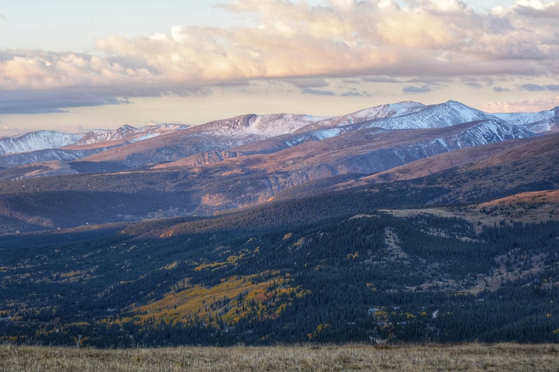
Once you get to the ridge, you’ll find a faint social trail. Follow it. You’ll ever-so-gradually curve to the left and attain the first bump. 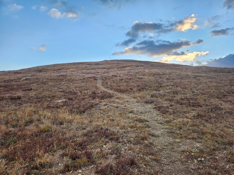
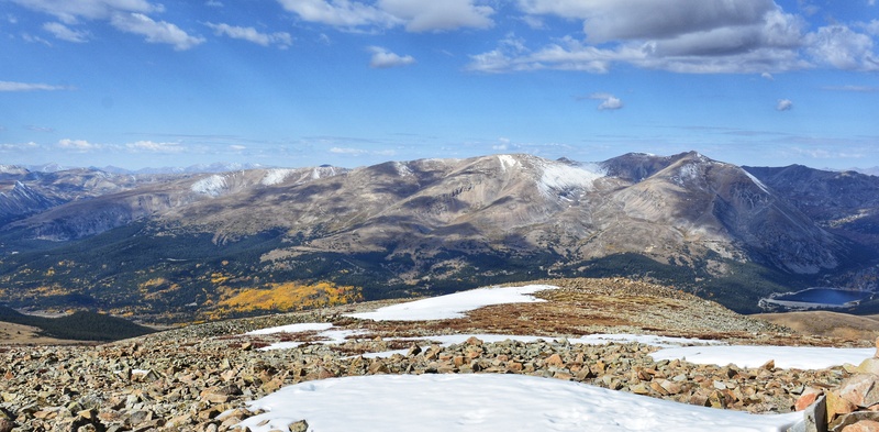
Across the way? Lincoln, North Star, Quandary; a fine collection of peaks and, for me, a fine way to watch the glow of the day take flight. Soon enough, sunlight would overcome the broad shadow cast by Hoosier Ridge. I continued my travel along the ridge looking back frequently so I wouldn’t miss any of the magical moments of changing light. 
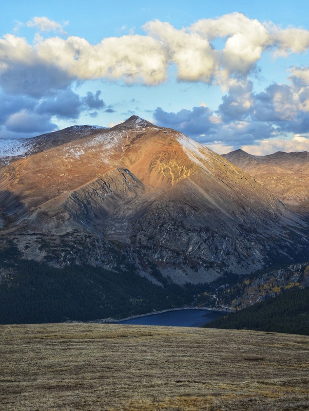
I came to a second bump. I also came into better views of Silverheels - and the remainder of the route. 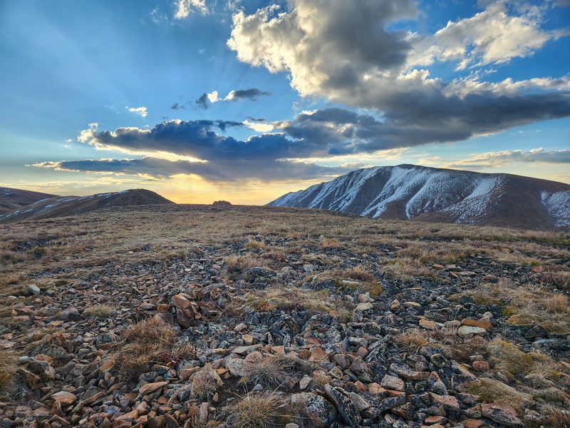
Your goal? Wait for the right time to swing right (south). X doesn’t really mark the spot, but a pretty obvious bump conjoined with a right-ward connecting “spur” does. Don’t swing right too early; the side-hilling will be tedious. Wait until you’re just about to the bump that connects with the spur. 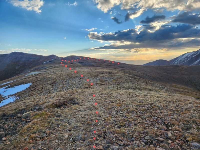
The faint social trail is your friend throughout even though it comes and goes sometimes. It helps you figure out that you can also go around a couple points instead of up and over. The power line towers below are a great visual clue, as well, since you need to descend to where they are. 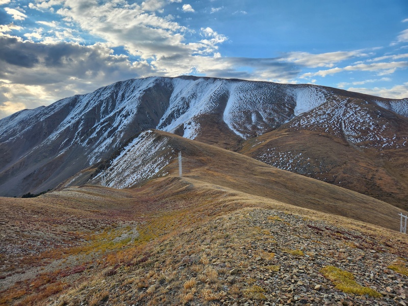
I was having a really nice time plodding along and taking in the sights, sounds, and colors. The day was already plenty magical, but then I heard high-pitched "shrieking". Elk bugling! It’s only the second time I’ve ever heard it. I couldn’t see any elk. I don’t think they were nearby, but the bugles echoed through the basin below as sunlight slowly lit up the aspens, and the sky grew more blue by the minute. I stopped for a couple minutes to be able to hear better. When I got to the steep slope, the snow covered up the social trail enough I couldn’t discern it from below, and unfortunately the snow didn't cover up the rocks enough to make for a bit easier passage. I tried to just go straight up, but the rocks shifted too much. "Tedious" is a good word, and "annoying" is another good word: place one foot forward, slide back two feet. That wasn't going to work, so I started zig-zagging. Of course, I paused a handful of times to take in the views, too, and to see if I could still hear elk. 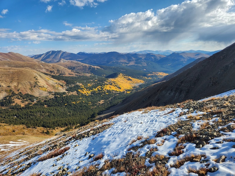
Past the steepest part of the slope, social trail became evident again and brought me to the ridge where I took a sharp left (east). 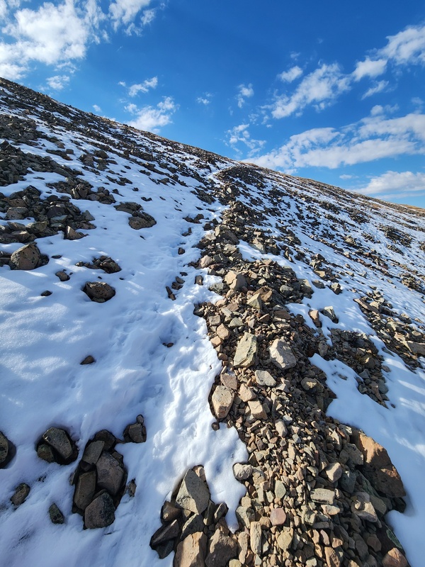
What you then see is not the summit, but it’s not too far beyond that! 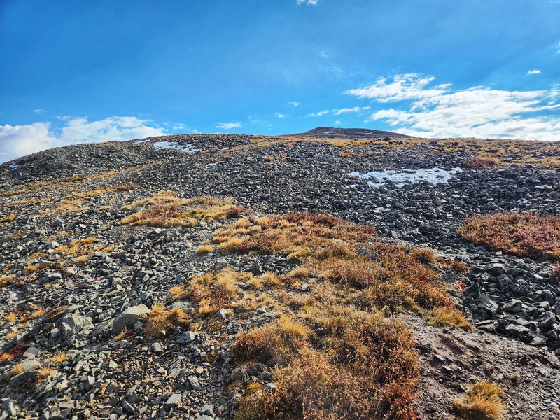
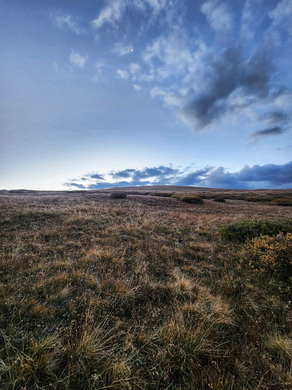
No social trail anymore, just obvious ridge, obvious direction. Keep going up, keep going east. Stay in the center. Or don’t. True summit comes into view once you can see past the last pile of rocks. 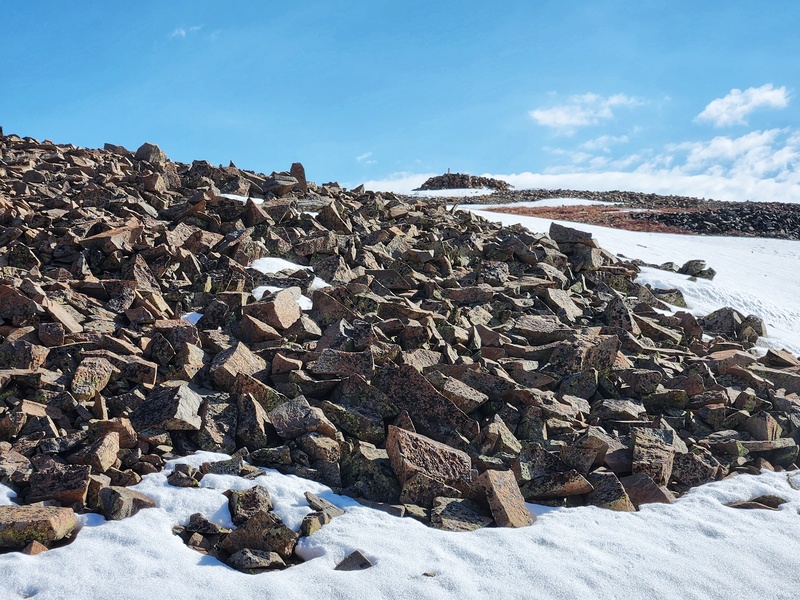
I had an amazing time up there and stayed quite a while soaking up the sun, listening for the elk, and watching big birds chase each other through the sky as part of a grand courtship ritual. It was a beautiful day, a perfect summit, perfect views. 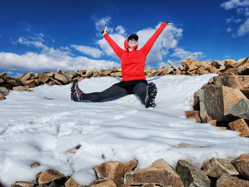
I really enjoyed looking around at other peaks I've done, too: the DeCaLiBron, Quandary, Hoosier Ridge, Bald, Boreas. But the peak I was on was one I'd wanted to be on for a while, and what a treat to have not only a spectacular day but the entire mountain all to myself. 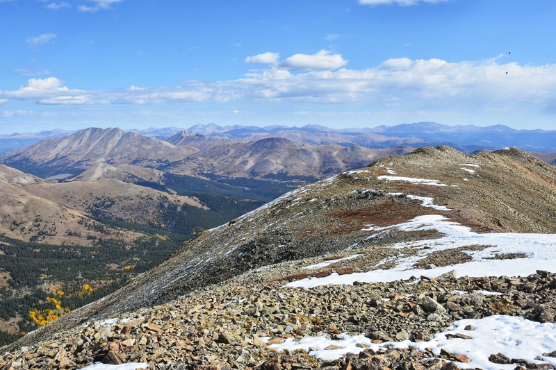
Heavy rain was in the forecast, and I figured I probably wouldn’t be as speedy on my return trek across the ups and downs as I was getting here, so I eventually faced the reality of having to leave the summit. 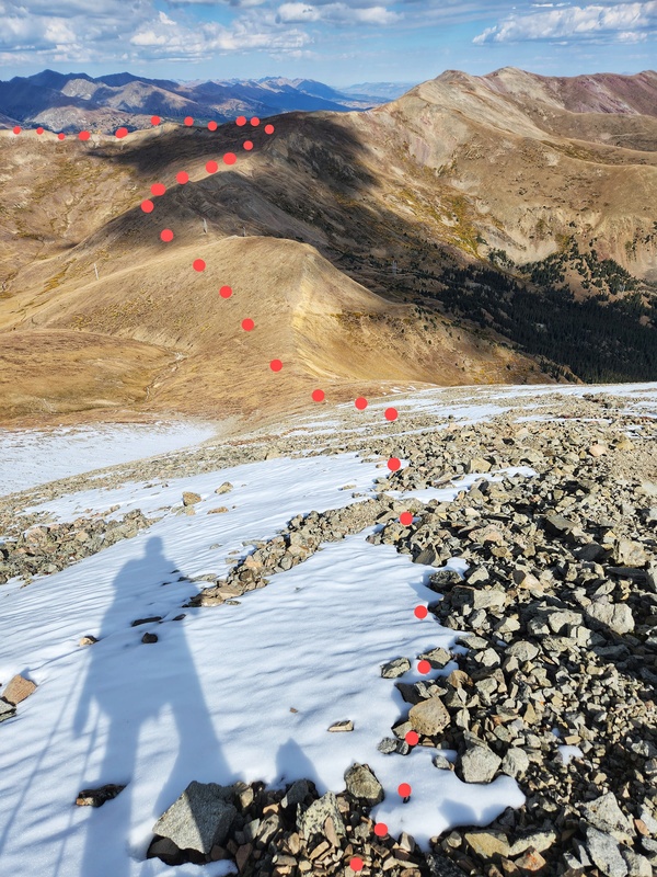
This time, I could more easily look down into the beautiful basin filled with aspens. I retraced my steps, and of course as sometimes happens, I got into the steepness of that slope, and the social trail throughout was much more obvious - which was helpful. 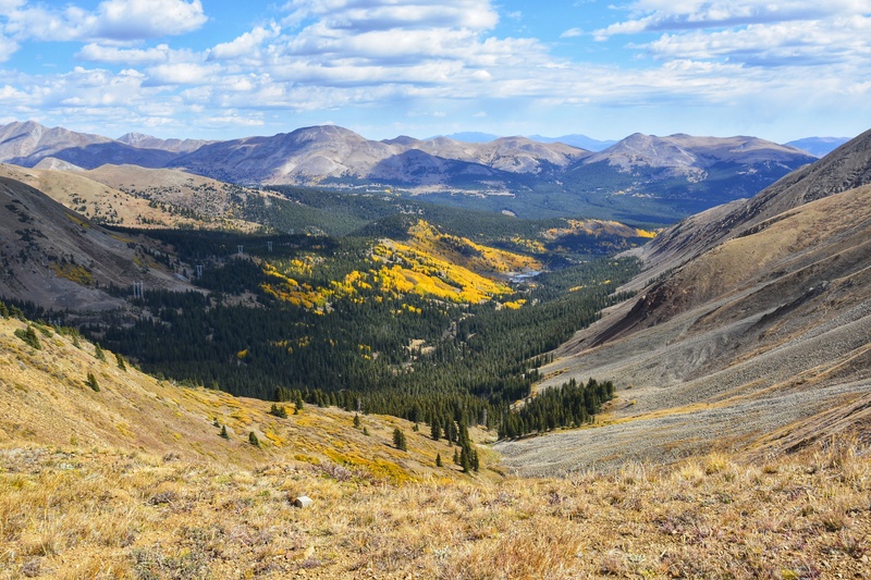
I made swift work of the initial descent and then slowed up a bit for the ups. I watched the rain clouds rolling in and thought, “This could get interesting.” I didn’t mind rain, but I might mind a torrential downpour if I wasn’t yet to the final downhill. Mind your slight turn off the end of the ridge. After the final bump, I got distracted looking around, enjoying, and just kept going. Oops. Eventually, it dawned on me I’d gone too far and that I needed to hop down onto the big slope again to go the correct direction back to my vehicle. 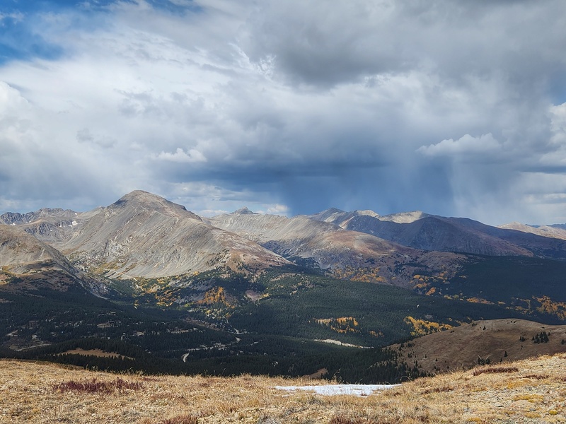
Sprinkles began just as I reached my vehicle. Perfect timing! Final Thoughts What a gem! Silverheels in autumn was amazing. The snow was an added bonus that I very much enjoyed. Good mileage, good gain, good views. And my sentimental heart likes that it’s a beautiful peak that belongs to a kind, beautiful girl whose spirit and legend lives on in these hills. As always, leave nothing, and take nothing. And be like young Miss Silverheels: be kind in the world, and remember to dance a little. For life is full of joy especially when you're out on the hills. 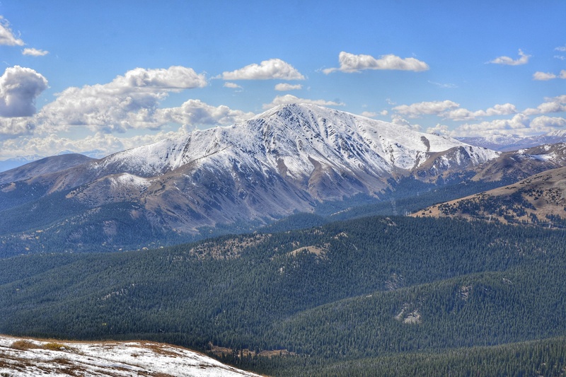
Thumbnails for uploaded photos (click to open slideshow): ")
")
")
")
")
")
")
")
")
")
")
")
")
")
")
")
")
")
")
")
")
")
")
|
| Comments or Questions | ||||||
|---|---|---|---|---|---|---|
|
Caution: The information contained in this report may not be accurate and should not be the only resource used in preparation for your climb. Failure to have the necessary experience, physical conditioning, supplies or equipment can result in injury or death. 14ers.com and the author(s) of this report provide no warranties, either express or implied, that the information provided is accurate or reliable. By using the information provided, you agree to indemnify and hold harmless 14ers.com and the report author(s) with respect to any claims and demands against them, including any attorney fees and expenses. Please read the 14ers.com Safety and Disclaimer pages for more information.
Please respect private property: 14ers.com supports the rights of private landowners to determine how and by whom their land will be used. In Colorado, it is your responsibility to determine if land is private and to obtain the appropriate permission before entering the property.


