Download Agreement, Release, and Acknowledgement of Risk:
You (the person requesting this file download) fully understand mountain climbing ("Activity") involves risks and dangers of serious bodily injury, including permanent disability, paralysis, and death ("Risks") and you fully accept and assume all such risks and all responsibility for losses, costs, and damages you incur as a result of your participation in this Activity.
You acknowledge that information in the file you have chosen to download may not be accurate and may contain errors. You agree to assume all risks when using this information and agree to release and discharge 14ers.com, 14ers Inc. and the author(s) of such information (collectively, the "Released Parties").
You hereby discharge the Released Parties from all damages, actions, claims and liabilities of any nature, specifically including, but not limited to, damages, actions, claims and liabilities arising from or related to the negligence of the Released Parties. You further agree to indemnify, hold harmless and defend 14ers.com, 14ers Inc. and each of the other Released Parties from and against any loss, damage, liability and expense, including costs and attorney fees, incurred by 14ers.com, 14ers Inc. or any of the other Released Parties as a result of you using information provided on the 14ers.com or 14ers Inc. websites.
You have read this agreement, fully understand its terms and intend it to be a complete and unconditional release of all liability to the greatest extent allowed by law and agree that if any portion of this agreement is held to be invalid the balance, notwithstanding, shall continue in full force and effect.
By clicking "OK" you agree to these terms. If you DO NOT agree, click "Cancel"...
The timing of this climb was ill-conceived, being a touch early in the season and also too late in the morning, despite our 4am departure from Montrose. Arriving at the end of the South Mineral road, we talked the resident moose down from kill mode ("here, murder my truck instead of us!") before heading up the disused trail along the upper south fork of Mineral Creek towards Rolling Mountain. It took only 40 minutes of creek-whacking and contouring beneath the slopes of the northeast ridge to reach the 1,900-foot north face already basking in full sun.
Originally I'd hoped to look at routes farther west, but I feared conditions would make them scary, and here was an obvious couloir system right in front of us. So up we went, enjoying firm snow through the first hundreds of feet of climbing through a gatekeeper cliff band.
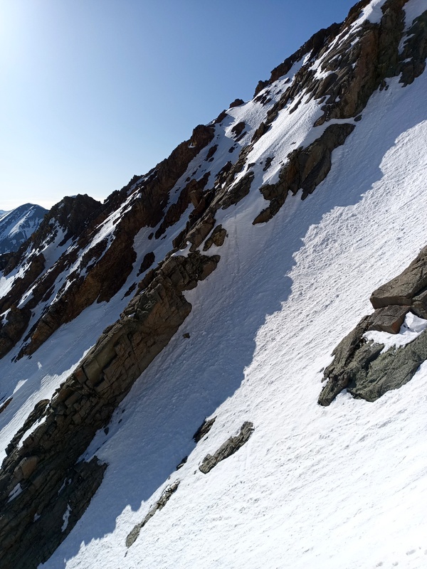
We launched into the 600-foot upper couloir, tracking a fairly recent booter (with signs they'd skied back down this route) up the steepening grade. Halfway in, I saw an explosion of snow at the top of the gully, followed by rocks. We dashed to a protected stance on the left wall to escape the fall line as three or four basketball-sized blocks rocketed past. We went to DEFCON 1 as we blasted up the remaining couloir, which opens to the broad face at 12,800'.
The remaining 900' of climbing is a grab-bag of gullies and spurs punctuated by rock outcrops and sloping choss tiers. Here at 7:30 we began to posthole laboriously in snow that might have been supportive an hour earlier. We diagonaled left into a poorly-defined gully, hoping for better consolidation in the trough, but instead found ourselves plowing up 50-degree intermittent waist-deep slush and hollow ice sheets for an excruciating spell before we could escape right to a shallow arete 500' below the ridge. Loosely tracking this feature, we wound our way up through outcrops to gain a pointy apex of the summit ridge.
We began our descent by the mellow southwest slope, then contoured east over a saddle into the drainage below the east ridge, which led smoothly to the valley floor. After modest postholing for a mile down the Rico-Silverton trail we reached the timber, where things went totally off the rails. Probably we should have swung around the tail of the northeast ridge to retrace our approach route, but we dropped into the creek and dialed the postholing, bushwhacking, and marsh wallowing up to 9--crystallizing for Dylan why he doesn't climb peaks with me--for the remaining 2/3 mile to the Rico-Silverton trailhead.
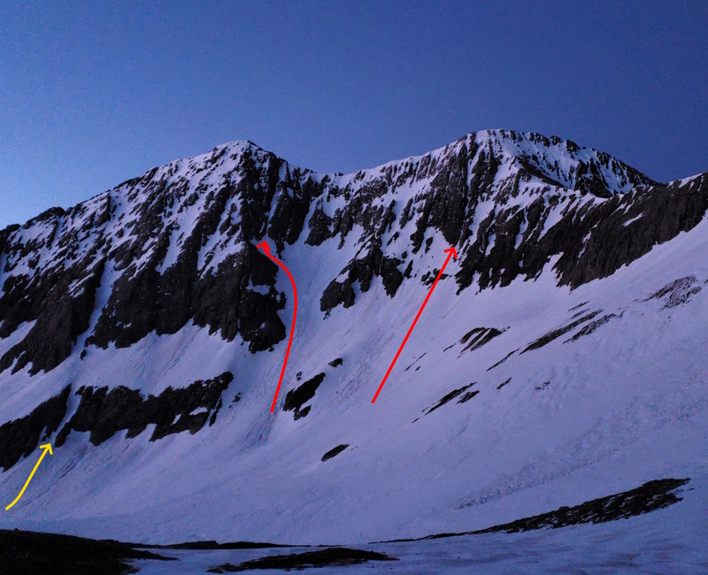
Route notes: The couloir is fun and moderate-to-steep (up to 45 deg.) for 1,000' to its end on the face. There are several options to finish the climb, but the average underlying slope is 45 deg. on the upper face. No bueno when soft. For that reason, and to further mitigate rockfall potential, I'd aim for 5:30 at the base. Solidly a mid-June or later climb.
Photo from late June '23 with routes of interest. Yellow = North Face
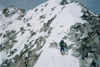
Starting up
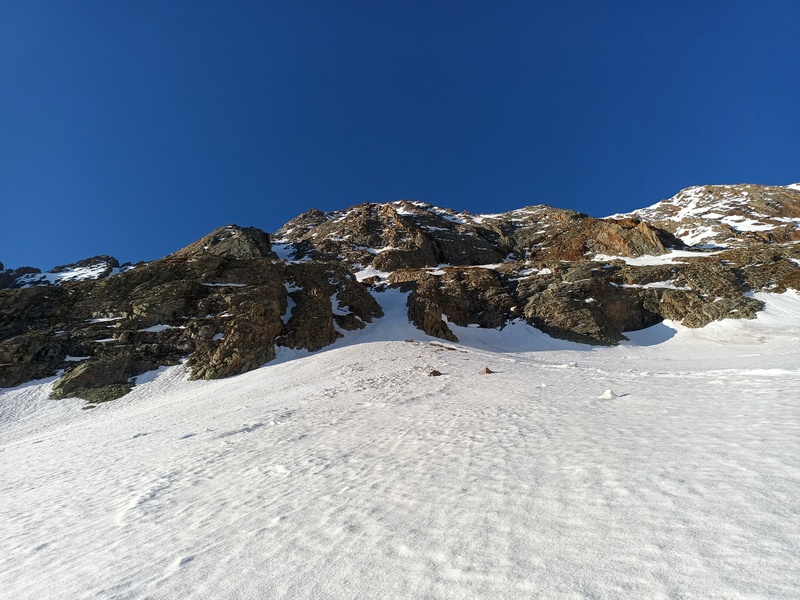
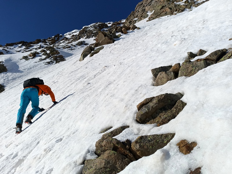
To upper couloir
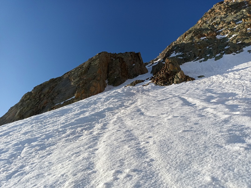
In upper couloir
On upper face
Above slush
Slush gully
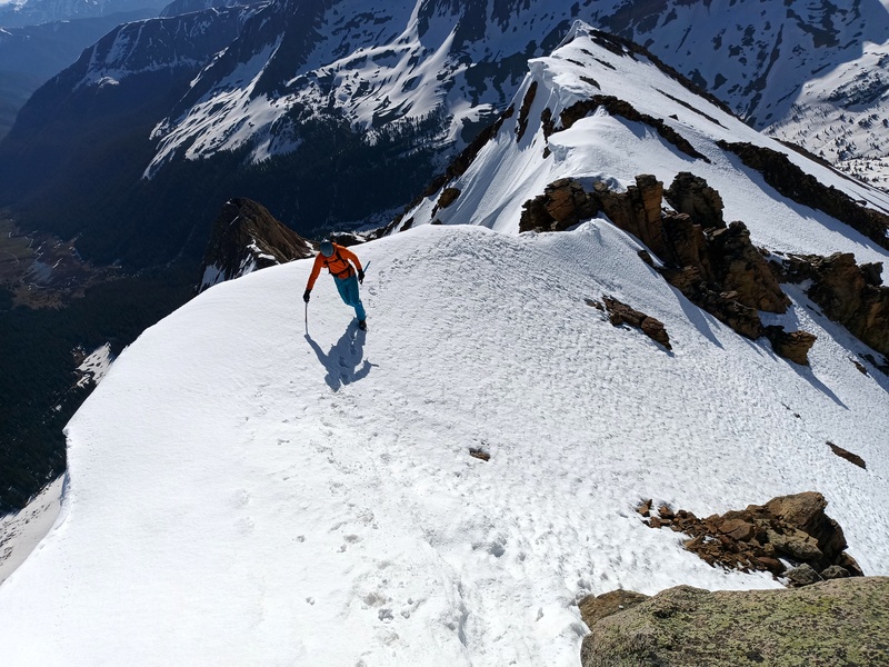
East ridge
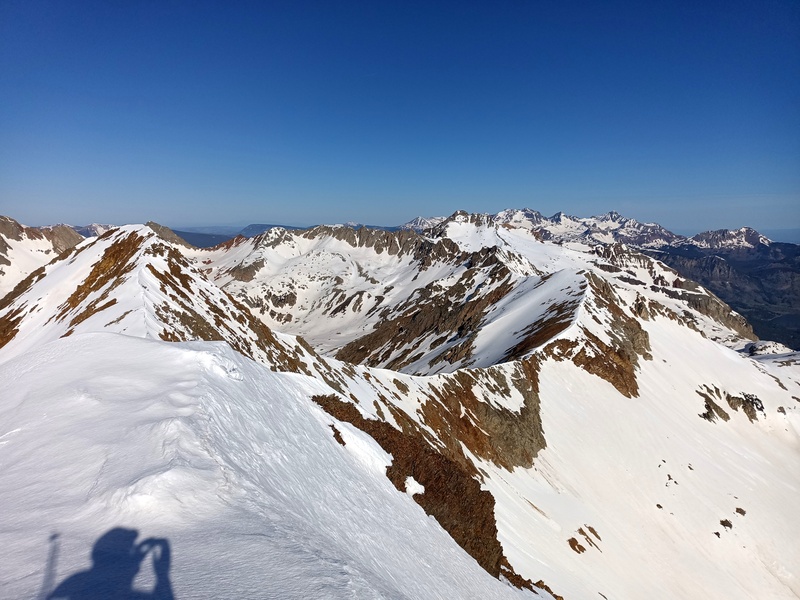
View west from summit
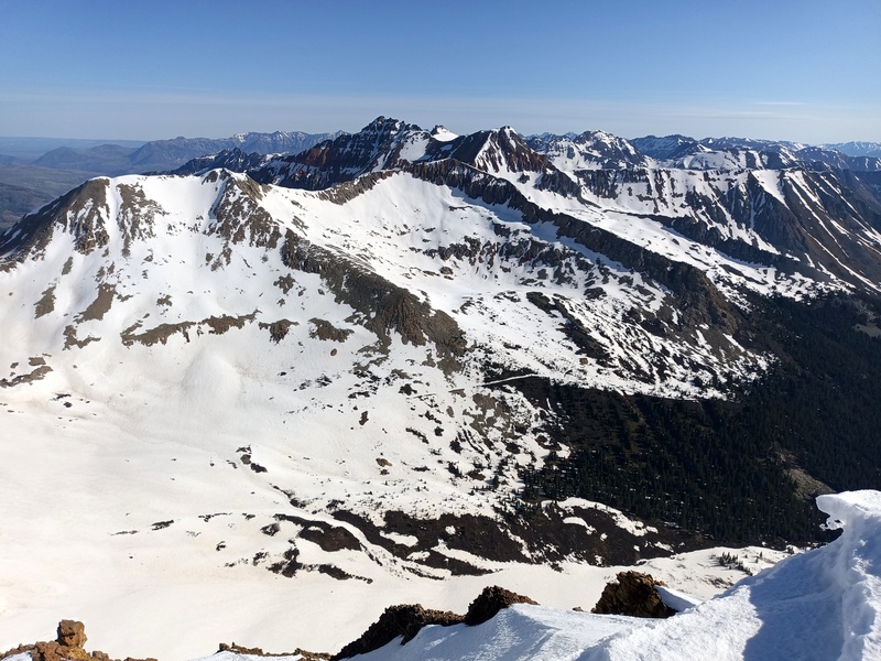
View north from summit
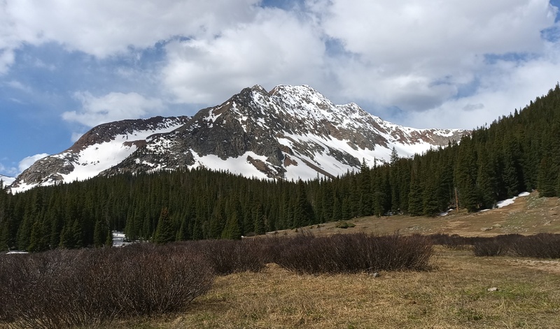
Parting shot
My GPS Tracks on Google Maps (made from a .GPX file upload):
Caution: The information contained in this report may not be accurate and should not be the only resource used in preparation for your climb. Failure to have the necessary experience, physical conditioning, supplies or equipment can result in injury or death. 14ers.com and the author(s) of this report provide no warranties, either express or implied, that the information provided is accurate or reliable. By using the information provided, you agree to indemnify and hold harmless 14ers.com and the report author(s) with respect to any claims and demands against them, including any attorney fees and expenses. Please read the 14ers.com Safety and Disclaimer pages for more information.
Please respect private property: 14ers.com supports the rights of private landowners to determine how and by whom their land will be used. In Colorado, it is your responsibility to determine if land is private and to obtain the appropriate permission before entering the property.
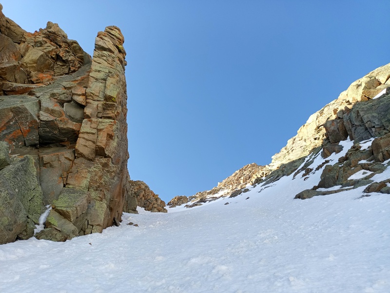

 Starting up")
 To upper couloir")
 In upper couloir")
 On upper face")
 Above slush")
 Slush gully")
 East ridge")
 View west from summit")
 View north from summit")
 Parting shot")
")