Download Agreement, Release, and Acknowledgement of Risk:
You (the person requesting this file download) fully understand mountain climbing ("Activity") involves risks and dangers of serious bodily injury, including permanent disability, paralysis, and death ("Risks") and you fully accept and assume all such risks and all responsibility for losses, costs, and damages you incur as a result of your participation in this Activity.
You acknowledge that information in the file you have chosen to download may not be accurate and may contain errors. You agree to assume all risks when using this information and agree to release and discharge 14ers.com, 14ers Inc. and the author(s) of such information (collectively, the "Released Parties").
You hereby discharge the Released Parties from all damages, actions, claims and liabilities of any nature, specifically including, but not limited to, damages, actions, claims and liabilities arising from or related to the negligence of the Released Parties. You further agree to indemnify, hold harmless and defend 14ers.com, 14ers Inc. and each of the other Released Parties from and against any loss, damage, liability and expense, including costs and attorney fees, incurred by 14ers.com, 14ers Inc. or any of the other Released Parties as a result of you using information provided on the 14ers.com or 14ers Inc. websites.
You have read this agreement, fully understand its terms and intend it to be a complete and unconditional release of all liability to the greatest extent allowed by law and agree that if any portion of this agreement is held to be invalid the balance, notwithstanding, shall continue in full force and effect.
By clicking "OK" you agree to these terms. If you DO NOT agree, click "Cancel"...
I found this route in the Colorado Mountain Club Snow Climbs guide book. After doing my research I thought this would be a great climb to end the snow climbing season.
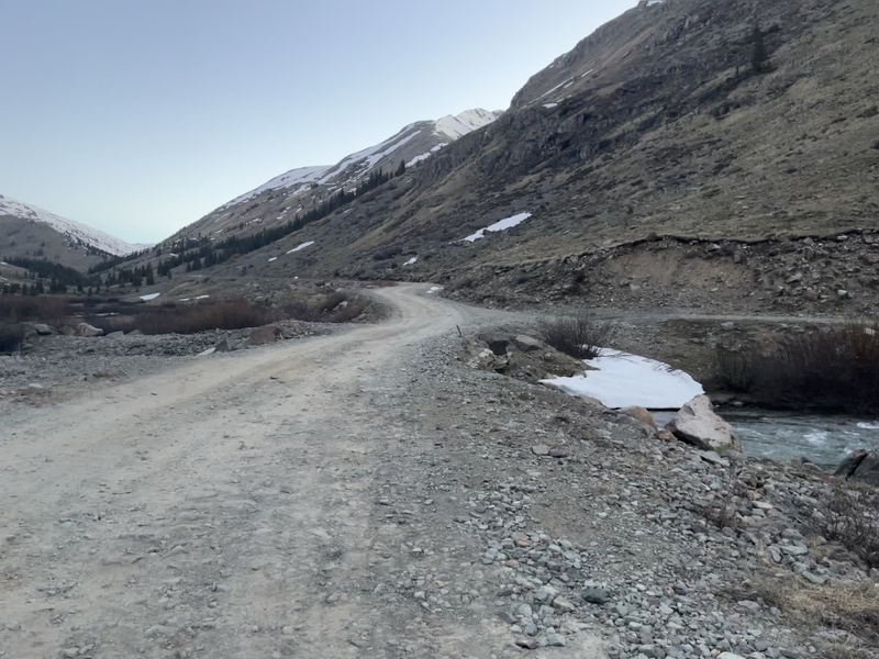
From Silverton drive up county road 2 about 11 miles until the road crosses to the east side of the Animas River. There is a place to park if you want to sleep in your car. If you plan on camping there are pull offs along the road before you get to the crossing.
The route up to Burns Gulch is just a jeep road that is immediately on your right after the main road crosses to the east side of the river.
Trailhead
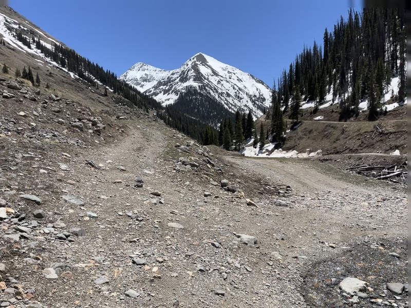
The jeep road was basically a stream in late spring. You very quickly come to a fork where you will go right.
Take the right
Follow the obvious road up into Burns Gulch. Niagara will be visible the whole time so there is no doubt as to where to go. Hike into the top of the basin and then choose your route up Niagara.
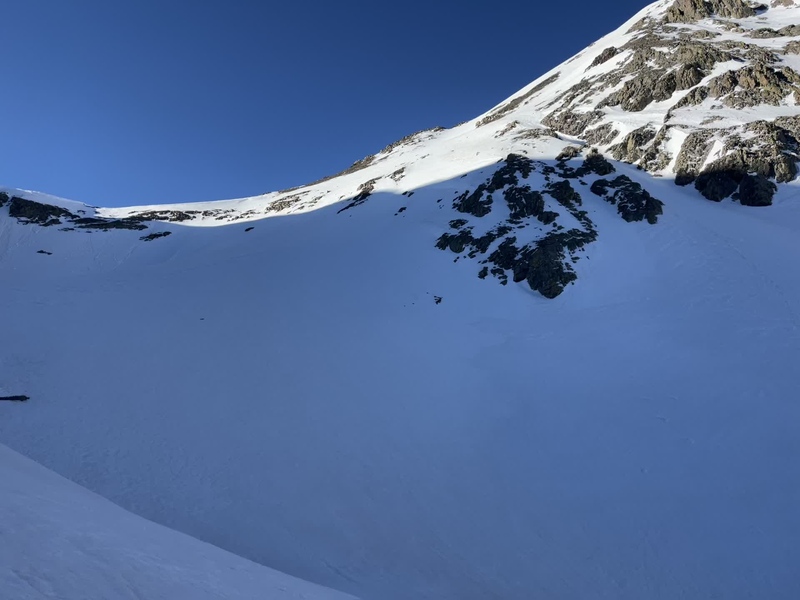
I went directly up the slope in the middle
You can start up the couloir on the right, go directly up the slope in the middle, or gain the saddle between Jones and Niagara which is the far left of the picture. Pick a line and go for the summit. The angle was between 35-50 degrees until you reach the summit.
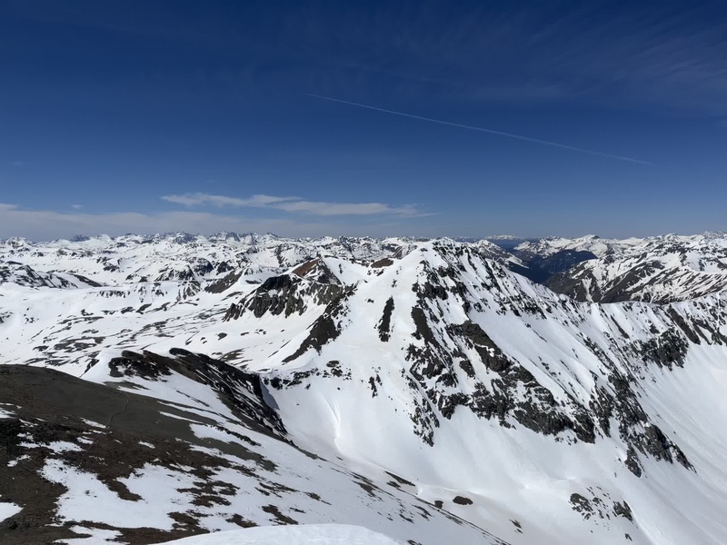
The heart of the San Juans
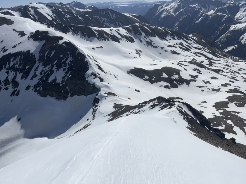
The panorama from the summit is as good as it gets. After a short break on top of Niagara I began the traverse over to Jones. The north ridge of Niagara presented an interesting climb down. The snow had been blown into a thin crest that was too narrow to walk on top of. Both sides of this snow crest were angled very steeply so I wound up facing the snow and downclimbing until I reached a good place to glissade a few hundred feet.
The climb down Niagara to get to the saddle
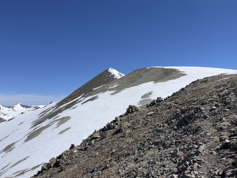
I traversed below the exposed rock to get to the saddle. From the saddle the summer route up Jones was almost completely melted out. If you were to climb this route in full snow coverage going directly on top of the ridge looked like the route you would want to take. I was more than happy to take advantage of the conditions and walk up the trail.
The final approach to Jones Peak.
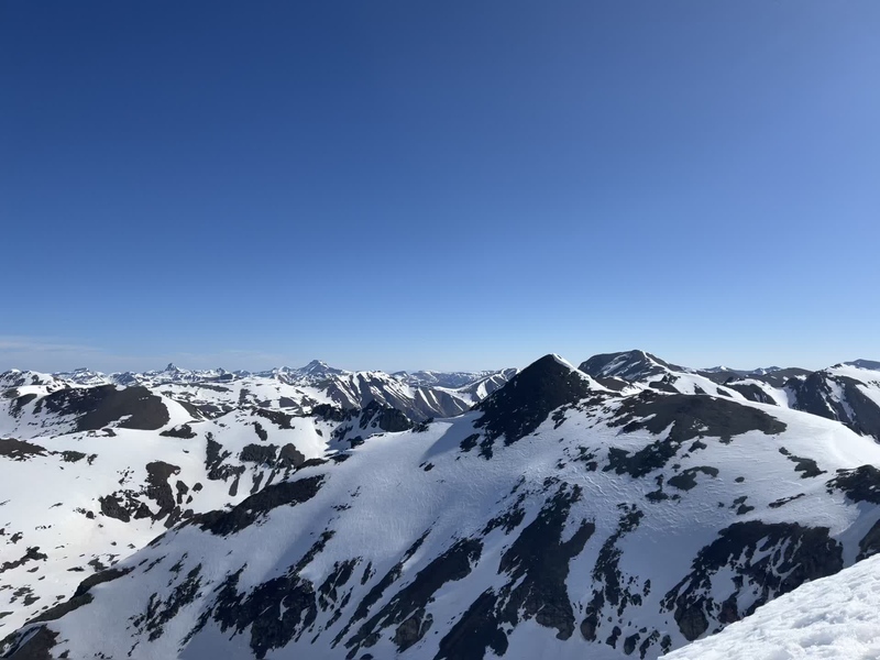
You have multiple options to descend into Burns Gulch from the summit of Jones. You get a good view of Jones coming up from Burns Gulch and from the summit of Niagara. Pick out a descent that looks safe and go for it.
Looking at Jones from Niagara. There are plenty of descent options to get down Jones.
The hike back to the trailhead is as easy as it gets. Other than some postholing in snow that had been warmed by the sun I had no issues. It was a perfect cherry on top of an awesome snow season.
Back at the trailhead.
Thumbnails for uploaded photos (click to open slideshow):
it's just getting started! Shaded northern aspects aren't even good yet. Keep at it!
Caution: The information contained in this report may not be accurate and should not be the only resource used in preparation for your climb. Failure to have the necessary experience, physical conditioning, supplies or equipment can result in injury or death. 14ers.com and the author(s) of this report provide no warranties, either express or implied, that the information provided is accurate or reliable. By using the information provided, you agree to indemnify and hold harmless 14ers.com and the report author(s) with respect to any claims and demands against them, including any attorney fees and expenses. Please read the 14ers.com Safety and Disclaimer pages for more information.
Please respect private property: 14ers.com supports the rights of private landowners to determine how and by whom their land will be used. In Colorado, it is your responsibility to determine if land is private and to obtain the appropriate permission before entering the property.

")
")
")
")
")
")
")
")
")


