Download Agreement, Release, and Acknowledgement of Risk:
You (the person requesting this file download) fully understand mountain climbing ("Activity") involves risks and dangers of serious bodily injury, including permanent disability, paralysis, and death ("Risks") and you fully accept and assume all such risks and all responsibility for losses, costs, and damages you incur as a result of your participation in this Activity.
You acknowledge that information in the file you have chosen to download may not be accurate and may contain errors. You agree to assume all risks when using this information and agree to release and discharge 14ers.com, 14ers Inc. and the author(s) of such information (collectively, the "Released Parties").
You hereby discharge the Released Parties from all damages, actions, claims and liabilities of any nature, specifically including, but not limited to, damages, actions, claims and liabilities arising from or related to the negligence of the Released Parties. You further agree to indemnify, hold harmless and defend 14ers.com, 14ers Inc. and each of the other Released Parties from and against any loss, damage, liability and expense, including costs and attorney fees, incurred by 14ers.com, 14ers Inc. or any of the other Released Parties as a result of you using information provided on the 14ers.com or 14ers Inc. websites.
You have read this agreement, fully understand its terms and intend it to be a complete and unconditional release of all liability to the greatest extent allowed by law and agree that if any portion of this agreement is held to be invalid the balance, notwithstanding, shall continue in full force and effect.
By clicking "OK" you agree to these terms. If you DO NOT agree, click "Cancel"...
Couloir mode continues with this obscure gem of a line I started looking at last season. The crux was committing to walk up the Camp Bird/Imogene roads, adding 5 miles and 1,200' gain to the round trip. Originally I was going to bike from the closure to lower Imogene but realized I'd probably be pushing my bike up most of the hills and lose time on the approach, so I decided to just walk it.
I left Montrose at 4, parked at 5, and was switching to boots and crampons at the bottom of the east slopes at 6:30. It turns out all those little evergreen saplings wash out in the glare of the snow from space, so my imagined romp up the snow-covered lower east slope was rather less rompy, but it still went pretty quick due to a barely-good-enough radiative freeze.
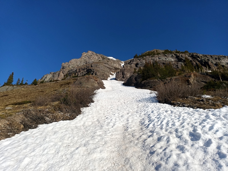
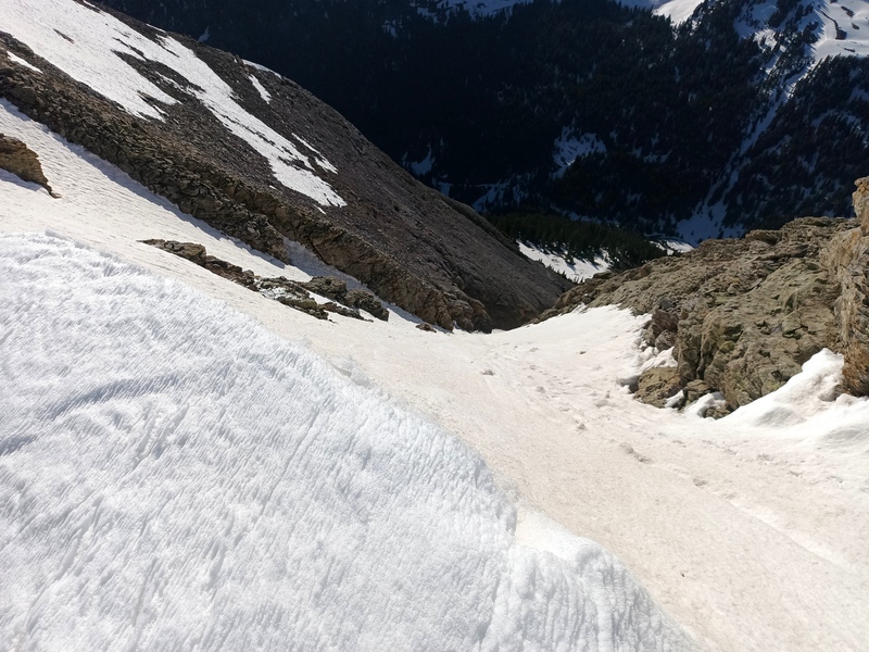
Just above the timber I contoured south and met the couloir, which I started up at 7. Conditions were nailed; perfectly bulletproof, featured snow with hardly a soft spot led upwards 1,200 feet to a shallow saddle in the east ridge, the apex of both the southeast and north couloirs. At 8 o'clock I turned a corner above the south wall of the couloir and was greeted by a steep headwall to gain the upper east ridge, upon which, due to its orientation, the accumulated snow formed a sharp crest rather than overhanging the north face. Still, I avoided the edge as I made my way to the summit.
I fled the panoramic views back down-ridge in order to descend the headwall, which was undergoing rapid enslushification, as soon as possible. It then dawned on me that the quickest descent was probably via the chill-looking north couloir rather than the furnace of the east ridge. This I did, cramponing down the shaded, punchy snow of the couloir to the sunny lower north face, which glissaded reasonably.
Much to my surprise I shortly encountered a skier traveling up the north bowl for the couloir. I then picked the wrong margin of the horrendous lower rock glacier and disaster-styled the remainder of the descent, alternating ball-bearing hardpan surfing and bottomless slush wallowing as I backtracked to my stashed shoes.
Route notes: The SE couloir is moderate (max 40 deg. or so). The upper E ridge headwall is steep and fairly exposed, but depending on snow levels there may be rock available to scramble instead. The N couloir is moderate and short, and lasts into July. The SE couloir should be good for another week or more, probably late May to mid June is the window most years.
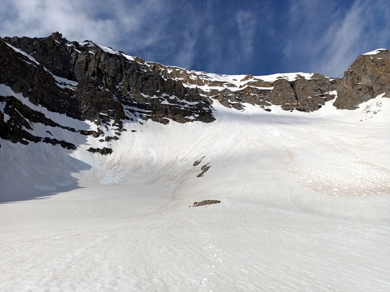
Starting up
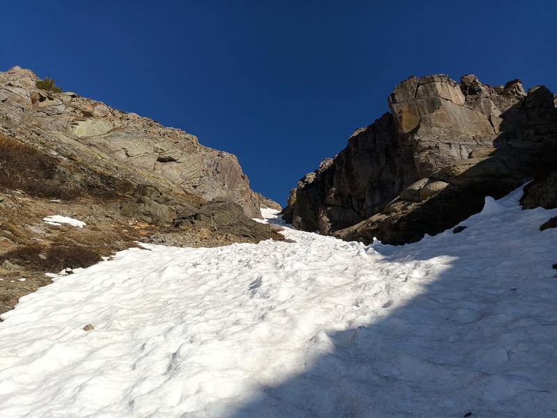
Halfway?
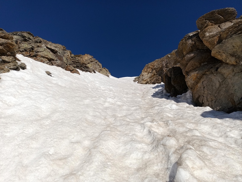
53/78ths
Progress
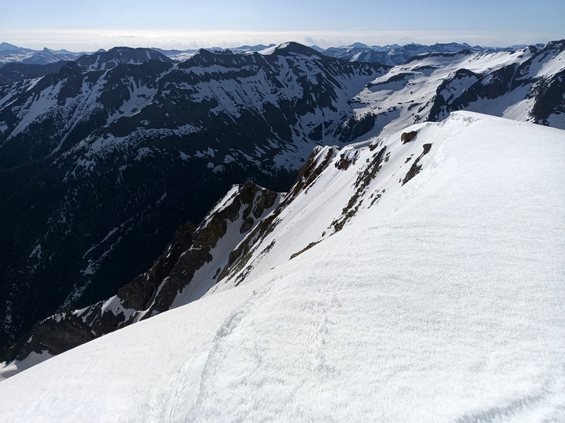
At the ridge, view down the N couloir
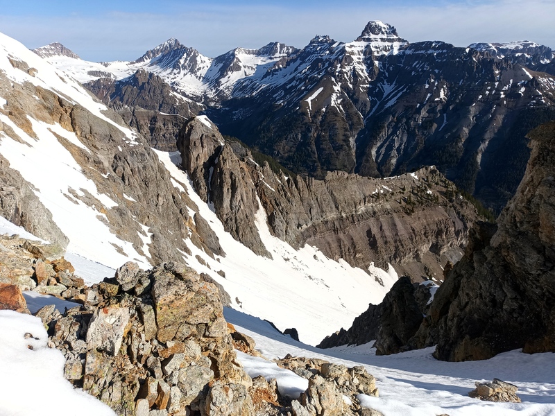
View down the SE couloir
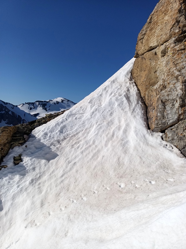
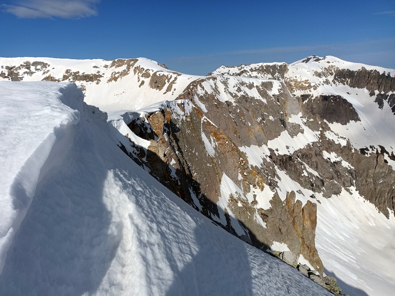
Passage to upper E ridge
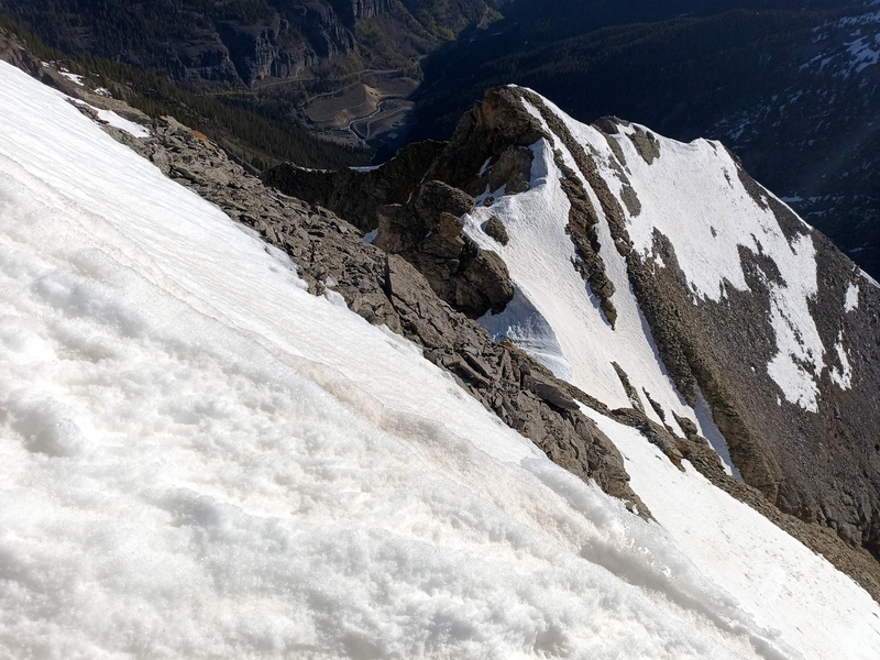
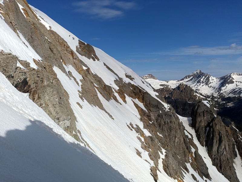
View down E ridge headwall
N side of E ridge, and N couloir (shaded), from summit
N side of W ridge, from summit
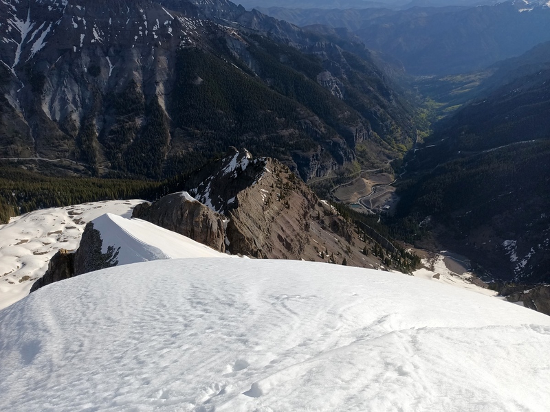
View to Camp Bird
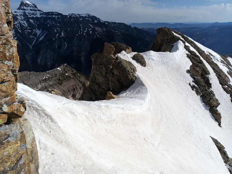
Return to crossover
Down N couloir
N face
Below N face
My GPS Tracks on Google Maps (made from a .GPX file upload):
Yeah that SE couloir is sweet! N is a good descent but I could see it going the opposite way, especially later when the N snow firms up and SE gets patchy. The approach slopes are about to melt out completely, which should help.
Caution: The information contained in this report may not be accurate and should not be the only resource used in preparation for your climb. Failure to have the necessary experience, physical conditioning, supplies or equipment can result in injury or death. 14ers.com and the author(s) of this report provide no warranties, either express or implied, that the information provided is accurate or reliable. By using the information provided, you agree to indemnify and hold harmless 14ers.com and the report author(s) with respect to any claims and demands against them, including any attorney fees and expenses. Please read the 14ers.com Safety and Disclaimer pages for more information.
Please respect private property: 14ers.com supports the rights of private landowners to determine how and by whom their land will be used. In Colorado, it is your responsibility to determine if land is private and to obtain the appropriate permission before entering the property.


 Starting up")
 Halfway?")
 53/78ths")
 Progress")
 At the ridge, view down the N couloir")
 View down the SE couloir")
 View down E ridge headwall")
 N side of E ridge, and N couloir (shaded),from summit")
 N side of W ridge, from summit")
 View to Camp Bird")
 Return to crossover")
 Down N couloir")
 N face")
 Below N face")
 Passage to upper E ridge")


