| Report Type | Full |
| Peak(s) |
Music Mountain - 13,365 feet |
| Date Posted | 05/25/2025 |
| Modified | 05/26/2025 |
| Date Climbed | 08/30/2024 |
| Author | MaryinColorado |
| Additional Members | d_baker, Jesus2021 |
| Music To My Ears |
|---|
|
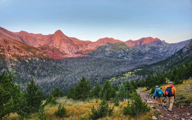
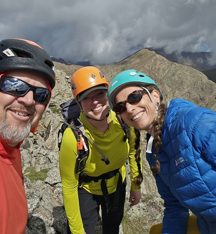
Music Mountain - 13,365' Sometimes, life humorously makes you work for that one peak. What took this one so long? To The Stats, We Go! Total mileage: 10.98 The Road Brainpower over GPS! At least as of this date, Google Maps only maps you to the Grape Creek Trailhead even if you ask it to take you to the Music Pass Trailhead. So, drive time is not what it appears. Also, you want the power and clearance of a 4x4 past the Grape Creek Trailhead. The Hike As an organist and pianist, obviously I was obligated to include this peak in my repertoire, but I was also excited about it having a great class 3 ridge. Win win! We were a fun crew, too: me, Lisa, and Darin. You start out working your way up to Music Pass. It's easy hiking on a nice trail, and views of Tijeras, Music, and Milwaukee are fantastic. 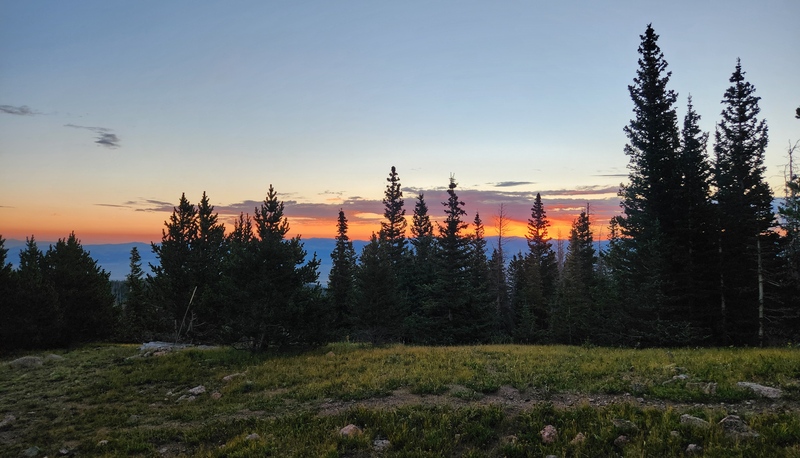
Your initial goal is to get all the way to Lower Sand Creek Lake. Don't turn left at the first junction you encounter. It has a nice sign that wants to lure you away from the trail, but that is not the way. Keep going; enjoy the views. You'll eventually come to a small creek crossing and start working your way uphill through a series of lovely switchbacks. 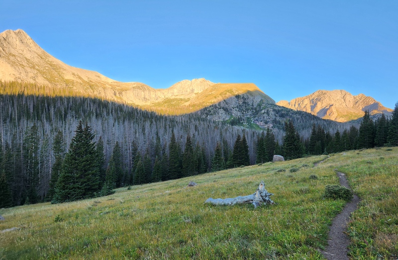
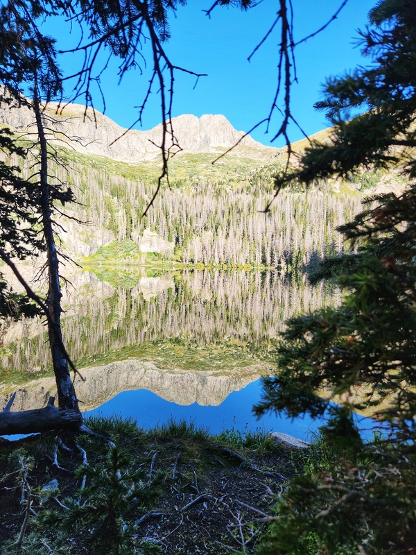
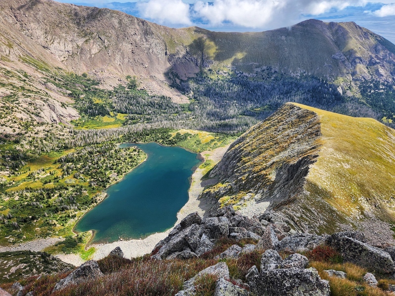
Before you know it, you are at Lower Sand Creek Lake. If you're lucky, you won't be greeted by hoards of mosquitoes and instead simply greeted with an amazing reflection of Tijeras's and Music's faces in the water. 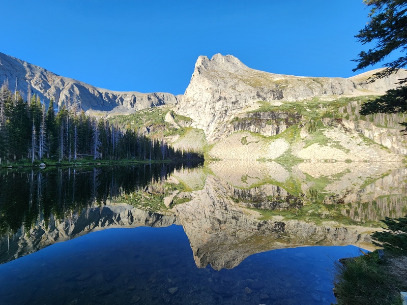
Here Comes the Sun... AND the Bushwhacking Follow the shoreline of the lake, but I highly recommend not leaving shoreline too soon because you'll have a LOT more bushwhacking than is absolutely necessary. We proceeded to the northwest side of the lake's shoreline and found faint evidence of a northerly departure up and into the forest. 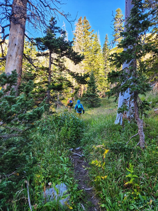
The current route on the .com says to angle into the drainage and follow it out of the trees. We didn't manage to do that successfully on ascent, but we did on descent. While our ascent path worked, too, the drainage seems the path of lesser resistance. 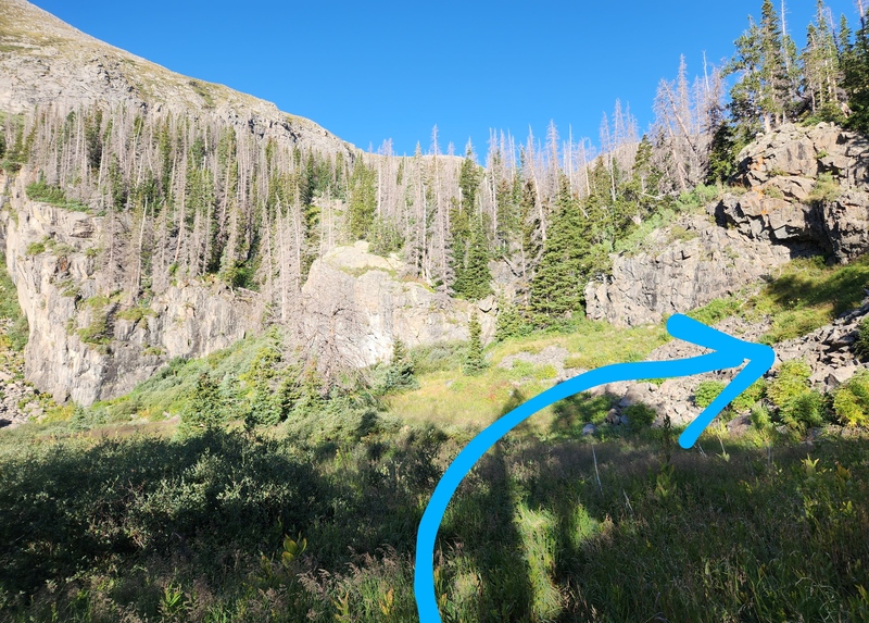
You can kind of see Music's ridge through the trees, and if you keep in mind that you want to start up the ridge from the right side of it, you can navigate your way up pretty succinctly. 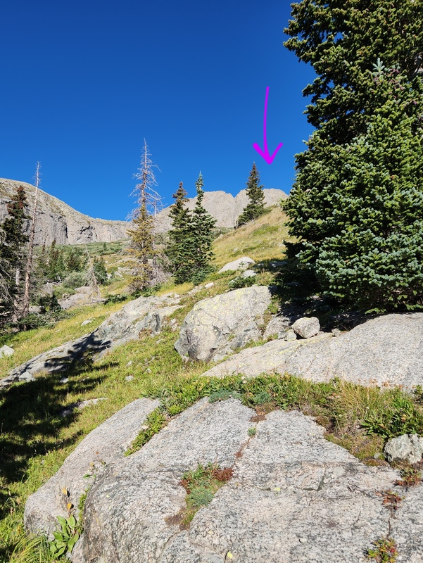
Whereas for some peaks I might have some better navigational indicators to offer, e.g., "stay to the left of this gully", or "turn right when you encounter the family of angry marmots", Darin and I kind of had an ongoing joke of, "You go up until the up doesn't go up anymore," because it is fairly straightforward since your biggest visual cues (ridge + notch) are consistently directly in front of your eyeballs. 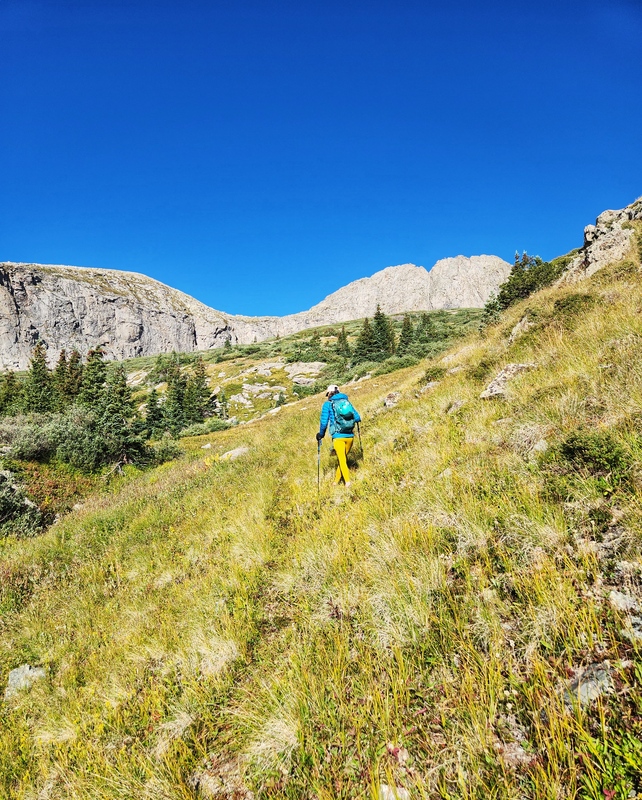
Genuinely, you're just trying to end up here, the entry point "notch" to starting up ridge proper: 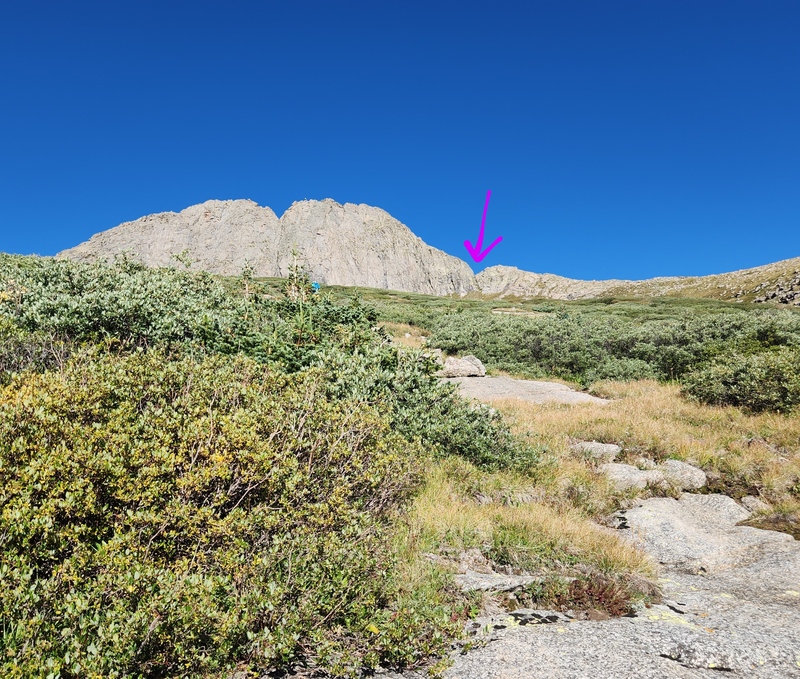
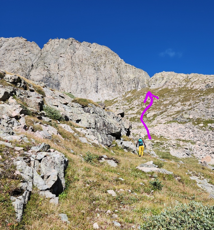
We made it to the notch and took a rest break. Beautiful day, beautiful weather, and the views are spectacular! Getting On the Ridge The notch doesn't give you a direct entry point onto ridge proper, but it's not difficult to get there. And that is your main goal: find a good line that takes you to the ridge proper fairly directly. We hopped up onto some slabby stuff and then just scrambled our way up to the ridge. The rock is great quality (but never foolproof). 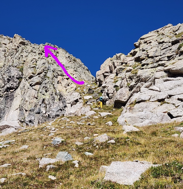

The ridge is decently steep, and there are some spots of loose-ish tundra and gravel between rocks, but for the most part it is a fun time scrambling and not difficult route-finding. 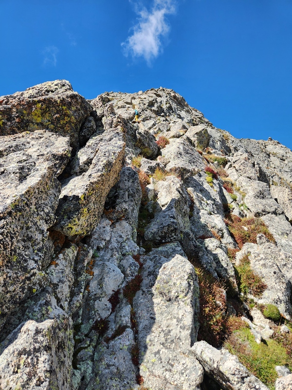
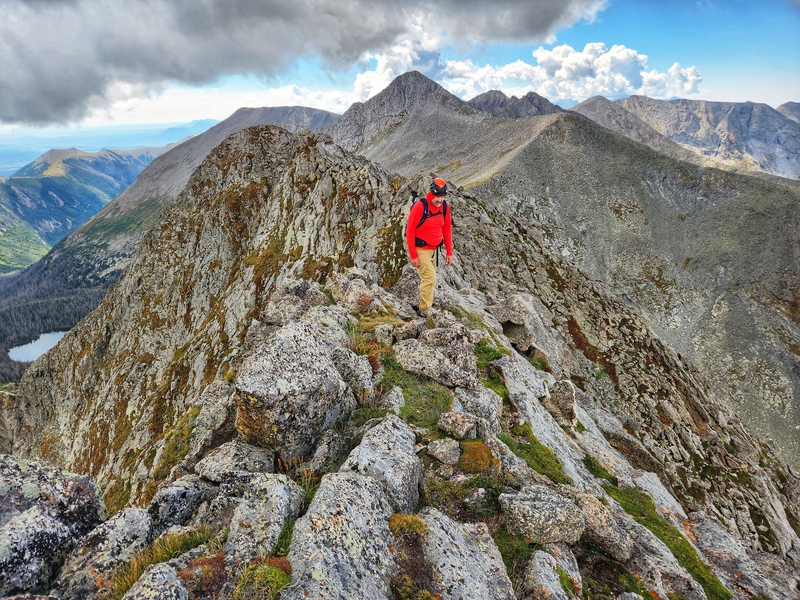
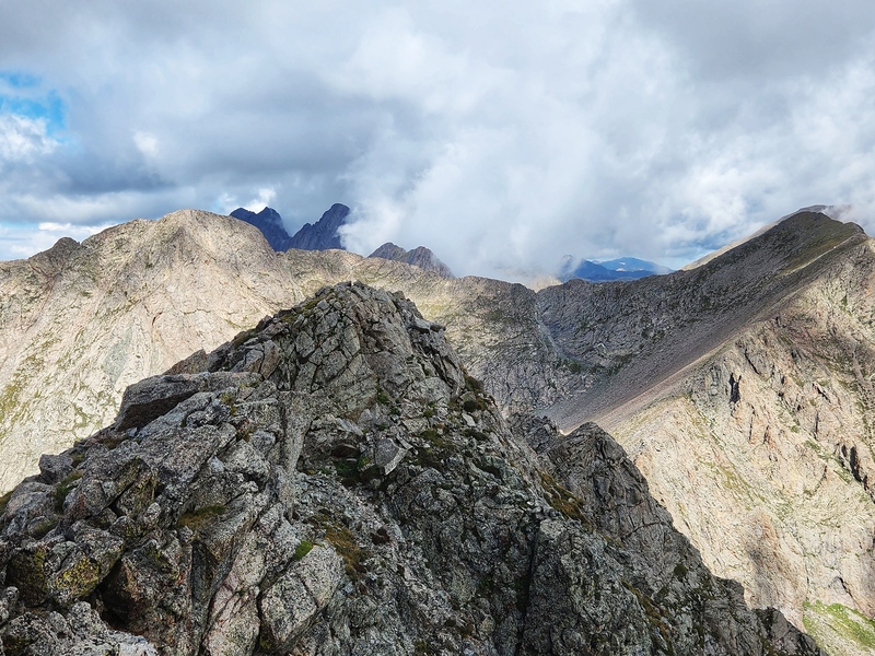
Things get a little more interesting when you finally top out on the ridge and summit comes into view. The ridge starts curving more northerly, is strictly rock, and you can choose one of many adventures to get from point A to point B. 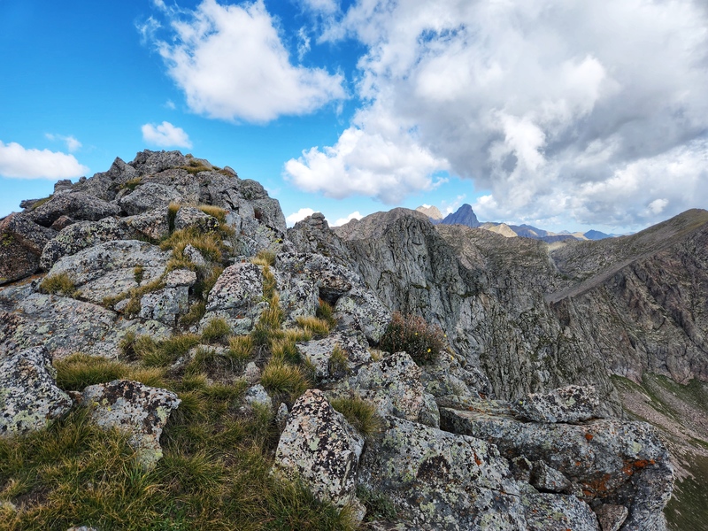
I would say, for me, navigating this next section in the photo below was kind of interesting mainly because, visually, it seemed like a bit of a no-win from an exposure perspective. But, it honestly wasn't that bad due to the quality of the rock, and it wasn't hard to pick good lines. 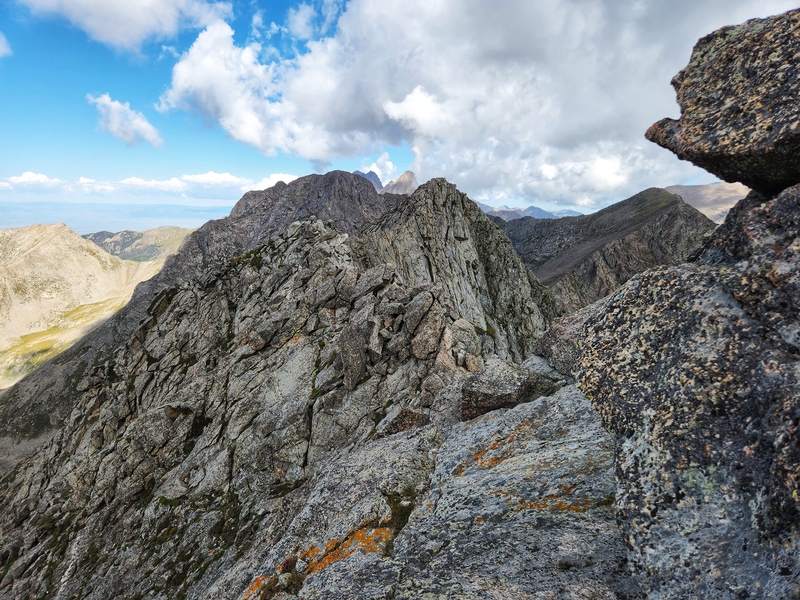
We went over to the farthest "hump" but then took our actual break and summit photos on the first hump (where Lisa is sitting in the pic below). 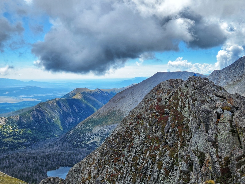
Did I bring a prop? DID I BRING A PROP? DID I?? Of course I did. But who among you can identify the classical music masterpiece whose sheet music I brought? Hmm... 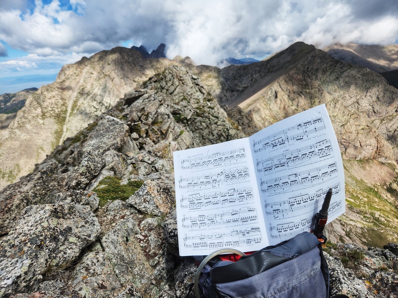
Descent I admit, this was a ridge I much preferred going up. Going down felt more tedious and difficult, and lengthy. But, slow, steady, and careful wins the race. Eventually you get back to the notch, and descent is pretty straightforward and swift from there. 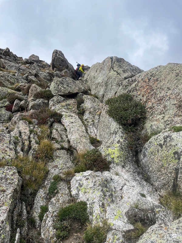
I think I started making our descent a tad more complicated than it needed to be, and Darin said, "Why don't we just take the drainage?" Yep. The drainage is great! 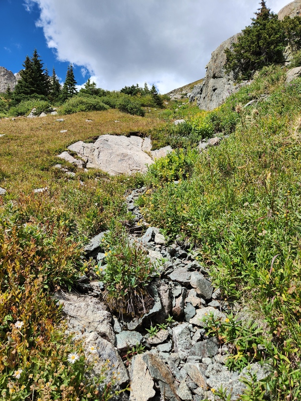
The trek out is pretty uneventful except you have it in your mind the whole time you still need to go uphill another few hundred feet. I grumbled about it a little bit internally, but I also told myself it was good mental practice for Crestone Peak the next day (having to re-ascend Broken Hand Pass). Final Thoughts Loved this peak! It's a variety show of some easy terrain, some bushwhacky goodness, some GREAT class 3 scrambling, and some absolutely incredible views within my favorite range. I'd definitely repeat it, though I'd probably try harder to find that drainage right out of the gate for ascent purposes just to decrease at least some of the bushwhacky goodness. If you climb it, I hope you enjoy it! And as with all things outdoors, enjoy it all - but leave nothing, and take nothing. 
Thumbnails for uploaded photos (click to open slideshow):  A beautiful sunrise greeted us when we reached the top of Music Pass.")
 Great views, and an easy trail to follow all the way to the lake.")
 Music Mtn is the hump in the middle that, from this angle, looks like nothing.")
 We lucked out with the lake being incredibly still creating amazing reflections! This is Tijeras.")
 This is Music.")
 We followed a slight path along shore heading northwest.")
 The path eventually petered out, and it was fairly obvious now was bushwhack time to the right of this")
")
 But look back once in a while and enjoy the sparkly views!")
")
 The arrow indicates the notch we need to reach.")
 Skirt to the right of some rocky terrain, just keep heading straight for the notch.")
 This roughly illustrates the slabs we hopped up to get to ridge proper.")
 Almost onto ridge proper, just a little more up.")
 Lisa kicking my butt on the steep ridge scramble!")
")
")
")
 Can you spot Lisa on the other side of that section?")
")
")
")
")
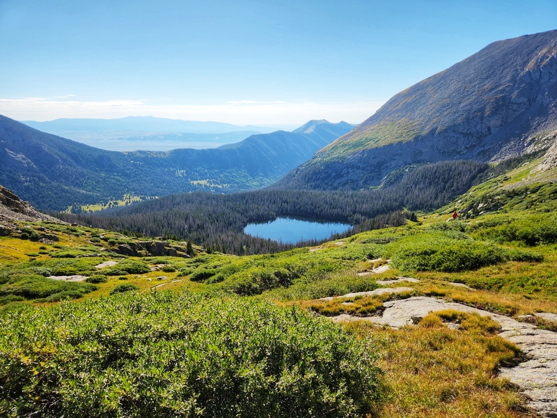
 Great view of Upper Sand Creek Lake")
 Things are getting moody over the Crestones")
 Lisa and I heading back")
 The drainage")
")
")
|
| Comments or Questions | |||||||||
|---|---|---|---|---|---|---|---|---|---|
|
Caution: The information contained in this report may not be accurate and should not be the only resource used in preparation for your climb. Failure to have the necessary experience, physical conditioning, supplies or equipment can result in injury or death. 14ers.com and the author(s) of this report provide no warranties, either express or implied, that the information provided is accurate or reliable. By using the information provided, you agree to indemnify and hold harmless 14ers.com and the report author(s) with respect to any claims and demands against them, including any attorney fees and expenses. Please read the 14ers.com Safety and Disclaimer pages for more information.
Please respect private property: 14ers.com supports the rights of private landowners to determine how and by whom their land will be used. In Colorado, it is your responsibility to determine if land is private and to obtain the appropriate permission before entering the property.


