Download Agreement, Release, and Acknowledgement of Risk:
You (the person requesting this file download) fully understand mountain climbing ("Activity") involves risks and dangers of serious bodily injury, including permanent disability, paralysis, and death ("Risks") and you fully accept and assume all such risks and all responsibility for losses, costs, and damages you incur as a result of your participation in this Activity.
You acknowledge that information in the file you have chosen to download may not be accurate and may contain errors. You agree to assume all risks when using this information and agree to release and discharge 14ers.com, 14ers Inc. and the author(s) of such information (collectively, the "Released Parties").
You hereby discharge the Released Parties from all damages, actions, claims and liabilities of any nature, specifically including, but not limited to, damages, actions, claims and liabilities arising from or related to the negligence of the Released Parties. You further agree to indemnify, hold harmless and defend 14ers.com, 14ers Inc. and each of the other Released Parties from and against any loss, damage, liability and expense, including costs and attorney fees, incurred by 14ers.com, 14ers Inc. or any of the other Released Parties as a result of you using information provided on the 14ers.com or 14ers Inc. websites.
You have read this agreement, fully understand its terms and intend it to be a complete and unconditional release of all liability to the greatest extent allowed by law and agree that if any portion of this agreement is held to be invalid the balance, notwithstanding, shall continue in full force and effect.
By clicking "OK" you agree to these terms. If you DO NOT agree, click "Cancel"...
I've been looking at this couloir on the east side of UN 12584 up South Mineral Creek near Silverton--whose benevolent north face has blessed us with so much quality ice climbing--for some time. Being a lower-elevation climb, it melts early, so I expected it to vanish even sooner this season. And since the stats are minimal, it seemed like a good first foray above 12K' since late fall.
The initial crux was waking up at 4am, which is late for a snow climb in Silverton. The next crux was crossing South Mineral Creek, which I didn't feel like wading barefoot at dawn o'clock with all the fresh ice on the rocks. So the adventure began with a splash and mildly soggy boots.
For the approach, I opted to hike up along Cataract Creek in hopes the ice climbing walkoff looker's left of the creek was somewhat consolidated. It wasn't.
Upon reaching the clearing above the waterfalls, snow quality improved. Continuing along the creek until there was a place to sneak around the willows guarding the apron of the couloir, I donned crampons and started up.
The lower couloir faces due east, so the snow was good for cramponing. But I was late (7am) for full sun on this aspect, and the surrounding crumbly red cliffs were shedding some. After 500' the couloir steepens, bends to the south and maintains a northeast aspect for the remaining 700' of climbing. Conditions were as expected for northerly snow in May, which had a more wintry feel and offered ankle-deep booting through a neat leaning narrows. Just below the top I encountered a fork, opting left up a dihedral ramp with some fun, scrappy, low-angle thin ice to climb.
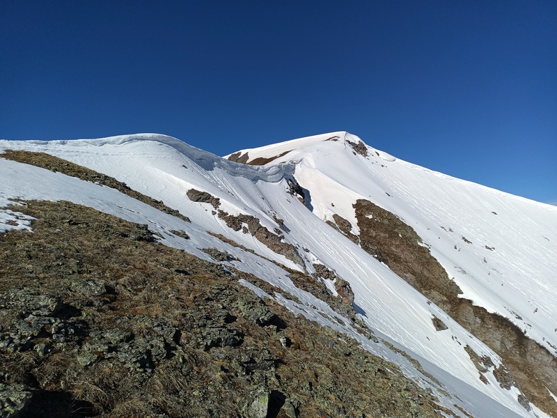
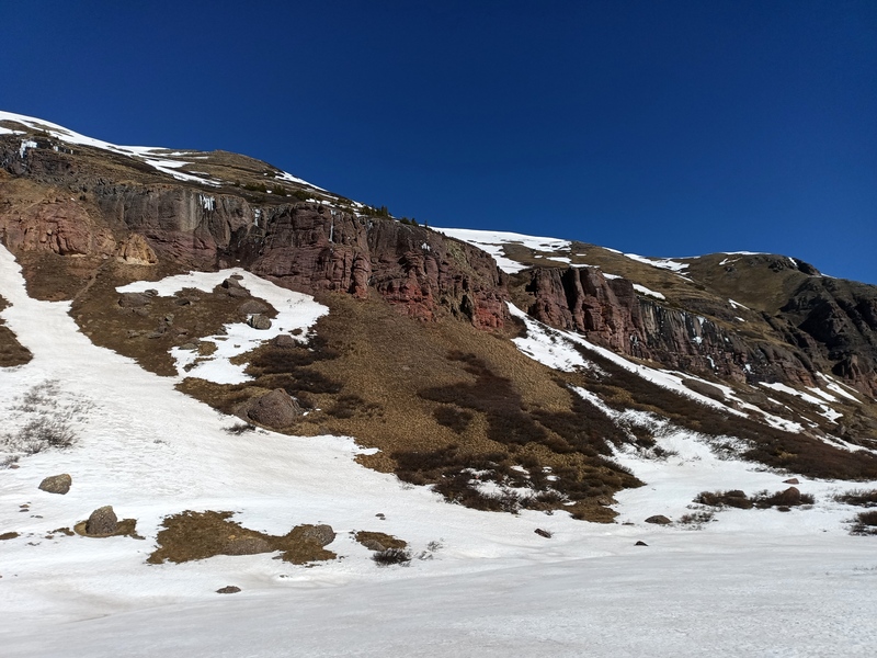
I continued along the northeast ridge to the summit, then walked down the south ridge a bit to an open snow bowl which glissaded nicely back down to the east. A cliff band rings upper Cataract Creek around 11800', but I located a steep tundra sneak just below the descent bowl.
Following the watercourse and my route back down Cataract, I enjoyed some gravity-assisted postholes and finally splashed back to the road.
Route notes: Max steepness is probably 40 deg. or less. Going left at the top makes it AI1/M1. Rockfall hazard is a consideration. Ideal season would be mid May through early June in a normal snow year. This would combine nicely with the ranked 12ers/13ers to the south, especially as a ski tour.
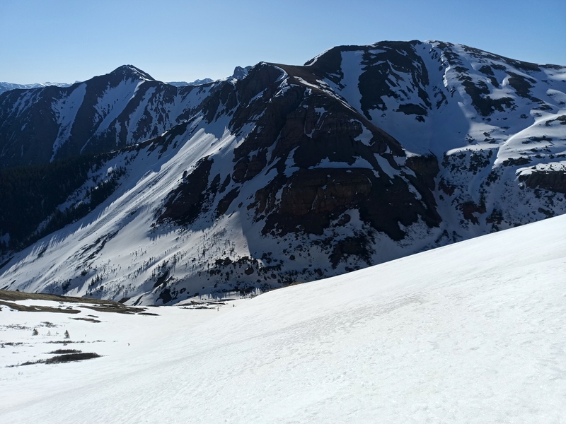
Upper Cataract
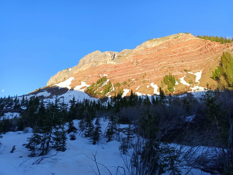
Willows blocking route. Upper couloir visible at top
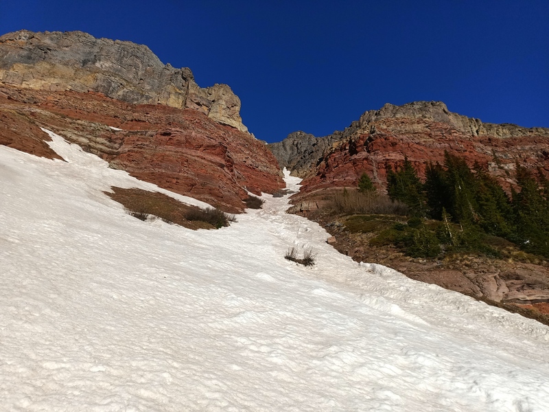
Lower couloir
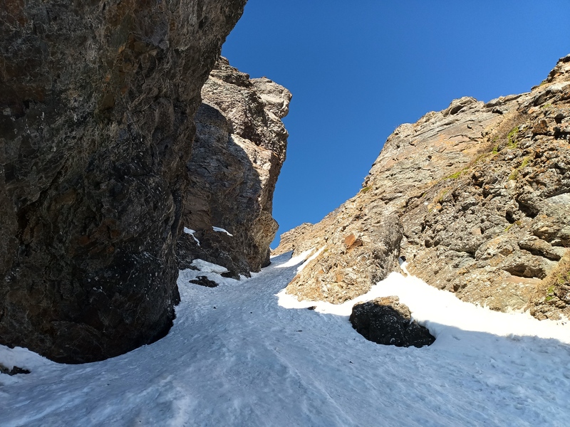
Bend to south
Leaning narrows
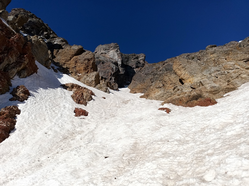
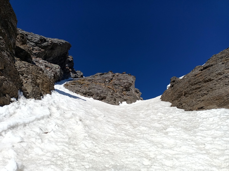
Options at top
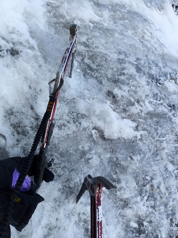
Legit sticks
Looking down
Ridge to summit
Glissade bowl
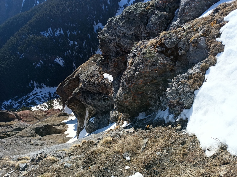
Cliff sneak near center
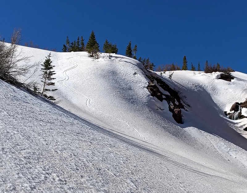
Some would call this a ski descent
Parting shot from Cataract
My GPS Tracks on Google Maps (made from a .GPX file upload):
Yep, Rebels! They're way overkill (especially both) for snow climbing but they can plunge, arrest, and handle vertical ice as needed.
I updated it to be more clear which peak/climb this is.
Trick question Amy, knee replacement either way.
Caution: The information contained in this report may not be accurate and should not be the only resource used in preparation for your climb. Failure to have the necessary experience, physical conditioning, supplies or equipment can result in injury or death. 14ers.com and the author(s) of this report provide no warranties, either express or implied, that the information provided is accurate or reliable. By using the information provided, you agree to indemnify and hold harmless 14ers.com and the report author(s) with respect to any claims and demands against them, including any attorney fees and expenses. Please read the 14ers.com Safety and Disclaimer pages for more information.
Please respect private property: 14ers.com supports the rights of private landowners to determine how and by whom their land will be used. In Colorado, it is your responsibility to determine if land is private and to obtain the appropriate permission before entering the property.
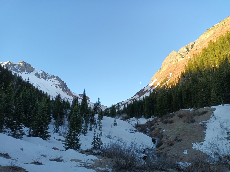
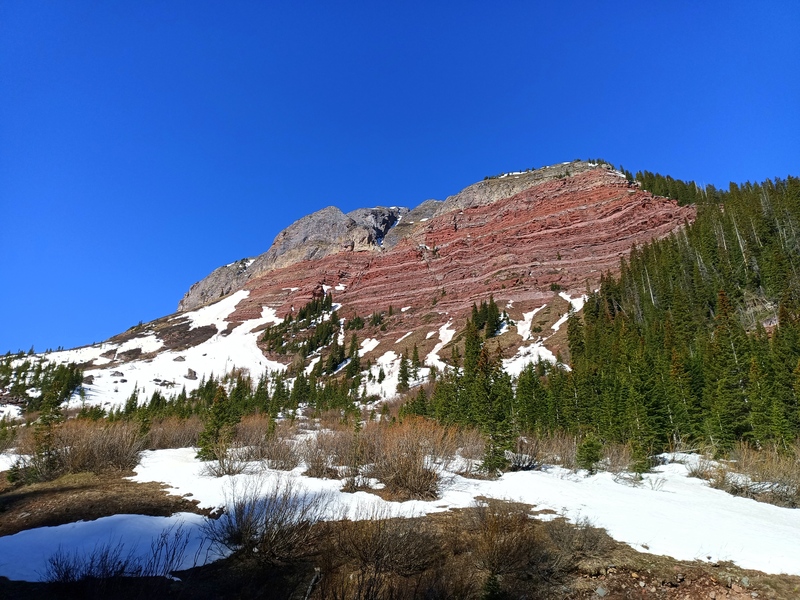
 Upper Cataract")
 Willows blocking route. Upper couloir visible at top")
 Lower couloir")
 Bend to south")
 Leaning narrows")
 Options at top")
 Legit sticks")
 Looking down")
 Ridge to summit")
 Glissade bowl")
 Cliff sneak near center")
 Some would call this a ski descent")
 Parting shot from Cataract")


