| Report Type | Full |
| Peak(s) |
Mt. Ouray - 13,979 feet Mt. Silverheels - 13,828 feet Clinton Peak - 13,866 feet Quandary Peak - 14,272 feet Horseshoe Mountain - 13,918 feet Culebra Peak - 14,053 feet Red Mountain - 13,911 feet |
| Date Posted | 04/22/2025 |
| Date Climbed | 03/24/2025 |
| Author | notidealbutfine |
| Quest to 100 - Part 1: Shredding that Sweet, Sweet Spring Gnar - #13 - #19 |
|---|
|
From My Blog: https://notidealbutfine.wordpress.com/2025/04/22/quest-to-100-shredding-that-sweet-sweet-spring-gnar-13-19/ 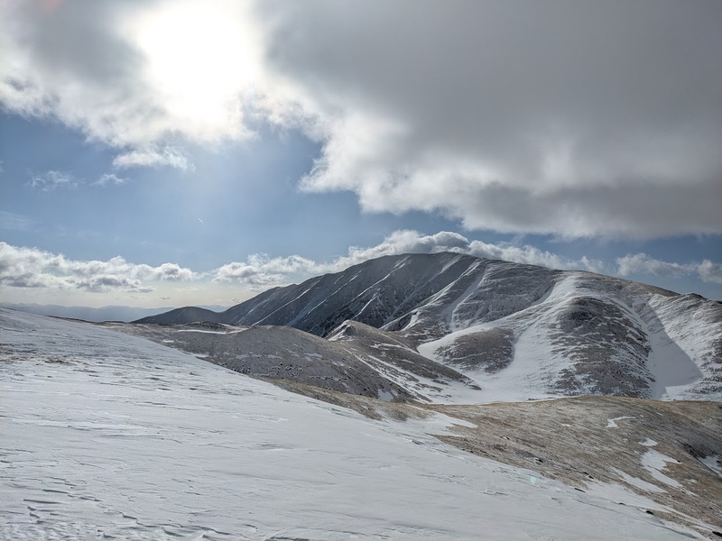
Enter 2025! As I walk into the next season of spring/summer mountaineering in Colorado, I’ve been hungry for setting myself a lofty goal to chew on that’d test my physical endurance and commitment to the mountains. I’ve always been interested in bagging peaks, but as of the past few years I’ve directed more of my efforts towards other outdoor sports such as ice climbing, backcountry skiing, and backpacking. As the spring of 2025 has come around, I’ve had a lot of excess energy in need of direction and noticed a bubbling up in my subconscious that’s nearly driven me to a state of madness: a compulsion to complete the Colorado Centennnials. Since a young age, I’d always thought the idea of the 14ers was intriguing, but it wasn’t until my first 14er summit when I was a freshman in high school that I truly tasted the fun, the suck and the glory that comes with hiking up mountains. I was 15, quite inexperienced, not particularly in shape, but stoked as all heck when I joined the outdoor club at my high school that was offering a trip to summit an easy 14er in the spring of 2006. My story on Grays Peak can generally be summed up something like this: not bringing enough food and water, wearing the wrong shoes, suffering my way up the switchbacks above tree line despite the enthusiastic positive encouragement from my peers and adult leaders, and summiting so late that we were booking our way down to avoid a late spring storm. Despite the challenges and rookie mistakes, I summited Grays that day, my first mountain peak ever bagged. Who knew it’d be another 14 years until I was standing atop the summit of another Colorado 14er? Since then, I’d focused more on rock and ice climbing more than mountaineering, practicing and sharpening my skills leading around the ice parks, Clear Creek, Eldorado, Black Canyon and the South Platte. As I was already climbing a lot of multi-pitch traditional rock climbing routes, moving into alpine climbing was a natural progression and in 2021 I climbed and led my first alpine route up a Colorado 14er: Challenger Point (well it was a ranked 14er at the time, give me a break). The route “Septem Virtutum Anima Mea” (a newer route, rated at 5.7+) truly revealed to me the love of combining these two beautiful sports: rock climbing and mountaineering. From here, needless to say, I’ve been chasing a lot more alpine climbing, especially in the Sangres, and directed most of my peak bagging towards hitting interesting technical lines over standard routes and hike ups. Since 2021, I’ve gotten to climb a good number of 5th class routes in the Sangres, some of my favorites being “The Prow” (5.8R) on Kit Carson and “North Pillar” (5.8R) on Crestone Peak. More recently, I’ve been exploring multi-peak ridge traverses and ski mountaineering and have fallen greatly in love with both as well. 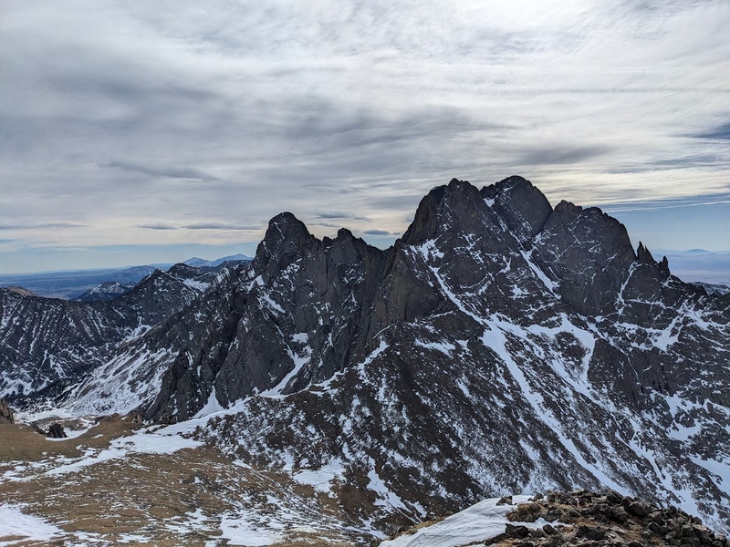
Flash forward to 2025, this subconscious bubbling has pushed me towards combing all these skills into a single larger project in which I can direct my energy and love for the mountains. The challenge? Climbing the rest of the 100 highest ranked peaks in Colorado, the Centennials, in under a year. For a semi weekend warrior, this would be a lofty goal that would require at least taking some time off work in the summer to bag some bigger linkups, especially in the San Juans. As of the beginning of 2025, I’d summited 12 of the 100 Centennials, which meant bagging 88 peaks in the course of about 7 or 8 months, with the small possibility of bagging a few more easy peaks in winter. My list of previously climbed Centennials includes:
To get the remaining 88 done in a year would mean combining all of these skills into a single cohesive project: spring ski mountaineering, 5th class ridge traverses, multi-day fastpacking, soloing, and camping and climbing leading up to and during calendar winter. The allure of this challenge is incredibly illuminating to me as it serves as a test not only of my accumulated skills in the mountains over the years, but also my devotion to not give up on a project that is so meaningful to me. Since pulling the trigger on the project on March 21, 2025, I’ve started acquiring more gear, building CalTopo maps, researching various routes, possible linkups and descents, and of course, skiing some peaks. The strategy for this spring was simple: ski as many peaks on my weekends that were in safe condition, didn’t require linkups, and were easily winter/spring accessible. Since I’d be saving most of the San Juans and Elks for ideal summer conditions, that meant focusing on the Front, Sawatch, Tenmile and Mosquito mountain ranges this early season (as I’ve climbed most of the Sangres already). Luckily for me, these are generally chill peaks that make for a good warmup to the season, chill skiing and are easily drivable in a day. And here we are! The spiritual voyage begins and I’m happy to have you along for the ride of my committing 2025 vision quest through the Rockies. Have fun and stay safe in the mountains! Here’s to 2025! My CalTopo Map: https://caltopo.com/m/KS1MKP5 3/24/25 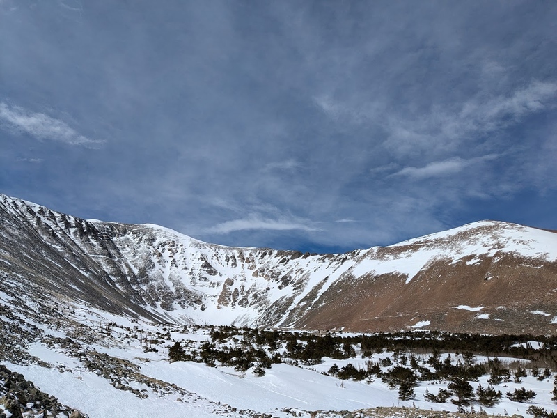
I’m out of practice! It’d been about 3 months since I last summited a peak (Obstruction Peak, December 24, 2024) so I made some rookie mistakes my first day of the season out on a mountain. Long story short, I ended up driving up Marshall Pass, back down to O’Haver Lake then back up Marshall Pass looking for the Grays Creek Trailhead. Eventually, I was out of the car and skiing by 7:20AM. The trail follows Grays Creek for a few miles to tree line where I ditched my skis and pack for running shoes and micro spikes as the east ridge was almost completely dry with the exception of a few small snow crossings near the top. I made it to the windy summit without too much problem, ran down the east ridge to my skis and slid out on crappy, warm mashed potato snow. Not the best descent, but not a bad first summit of the year! 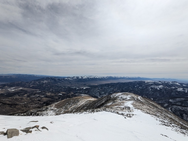
3/30/25 
March 30th was actually my second attempt on Silverheels this year. About a week prior, I had attempted the same route, but had to turn around after climbing the first 12er due to extreme wind chill. Even with all my gear on, I couldn’t feel my face, ears and hands. I chose to ski down and give it a try on another day that involved less suffering. My second attempt on Silverheels, however, has to be one of my best ski descents I’ve ever gotten the pleasure to take part in. Earlier in the week, I had minorly injured my back during a work accident trying to move a 2000 pound pallet of potatoes by myself. That being said, skiing Friday and Saturday were both out, but by Sunday I was feeling better, which lined up nicely with ideal wind and avalanche conditions. From Hoosier Pass, I skinned all the way to the top of the first 12er. From here, the suggested route advises staying on the ridge to access the north spur, but I opted to ski into the bowl towards Silverheels to approach the ridge just climber’s right of the north spur. The ridge was bare and was sandwiched between two nice looking couloirs and would make for an easy boot up. I hauled my skis to the top of the couloir, ran up to the summit in running shoes, and got back down to my pack pretty quickly. From here followed one of the most glorious ski descents I’ve experienced; dropping in on the ridge, beautiful corn snow turns, subsequently dropping into the couloir and riding the entire thing out pretty much exactly to my transition point below the up route. After transitioning, I skinned out of the bowl back to the 12er and had another beautiful quick descent through the trees all the way back to the highway. These are the kind of days you dream of! 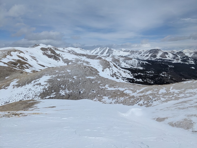
4/7/25 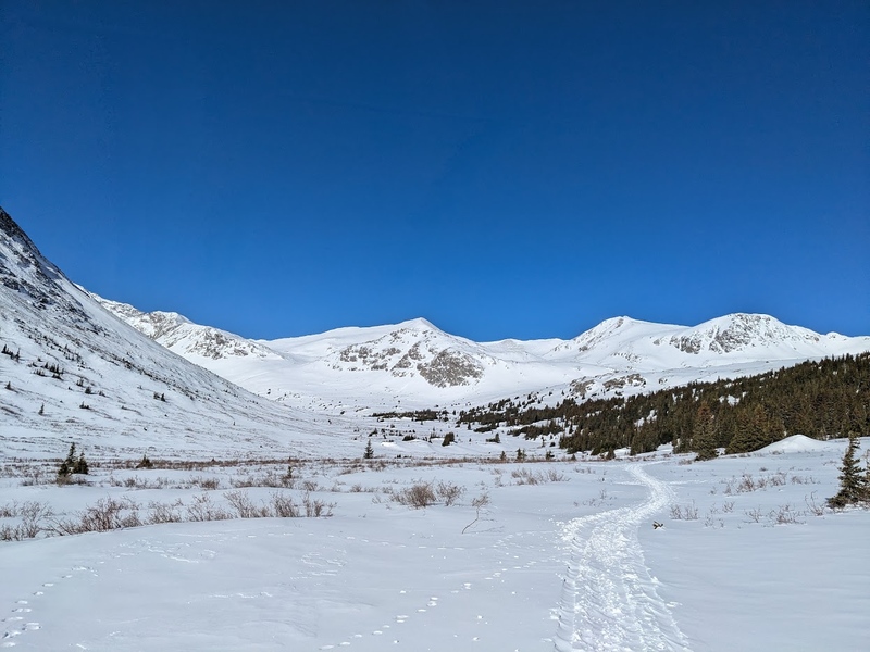
A big dump over the past three days had slopes loaded, but not particularly dangerous. In combination with low winds state-wide, I knew I had to take advantage of this Monday before my next work day. I opted for the south slopes on Clinton Peak because it seemed to have good conditions and safe snow for the day. I departed from Montgomery Reservoir at 7:30AM and pretty much got to use skins for the entire trail, with the exception of the quarter mile just below the summit. A nice snowmobile track went almost all the way to Wheeler Lake, making gliding and route finding especially easy. I summited just in time for good snow, and for the first time this season, had the pleasure and opportunity to ski directly off the summit. What followed was a fantastically smooth descent down the south slopes of Clinton Peak. While it was a little steeper than what I had anticipated getting into solo, things worked out and I was back down into the basin in minutes. The rest of the trail is generally rolling terrain making for a pretty unexciting, but quick exit to a fantastic ski. I’m always happy if I can ski all the way back to the car! 
4/10/25 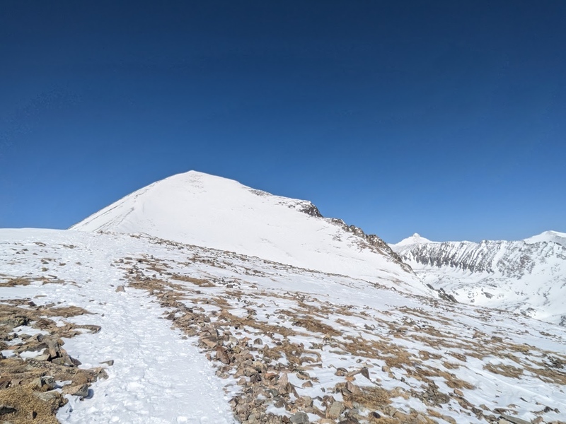
My regular Thursday truck route had been delayed due to construction on Wolf Creek Pass, so I decided to get out for a chill day due to low-winds and bluebird conditions. Quandary was an obvious pick for me: It was a popular peak on a weekday, I was trying to get on it before the parking reservation system went into place, and really preferred to ski this mountain as opposed to hike it. Unfortunately, I got a late start and didn’t begin until 7:50AM. I ended up just staying in my ski boots all day and never skinned up, as there was a very packed down trail from the high use this area sees. The climb up the east ridge is very aesthetic with incredible panoramic views the entire time. Surprisingly, I had the summit all to myself on this popular peak and, once again, had the wonderful opportunity to ski directly from the top. From the summit, I descended the upper northeast bowl and exited back onto the east ridge for a nice continuous ski ending about a quarter mile from the trailhead. Pretty crappy snow down low, but that was my fault for leaving so late. Another good day in my book though! 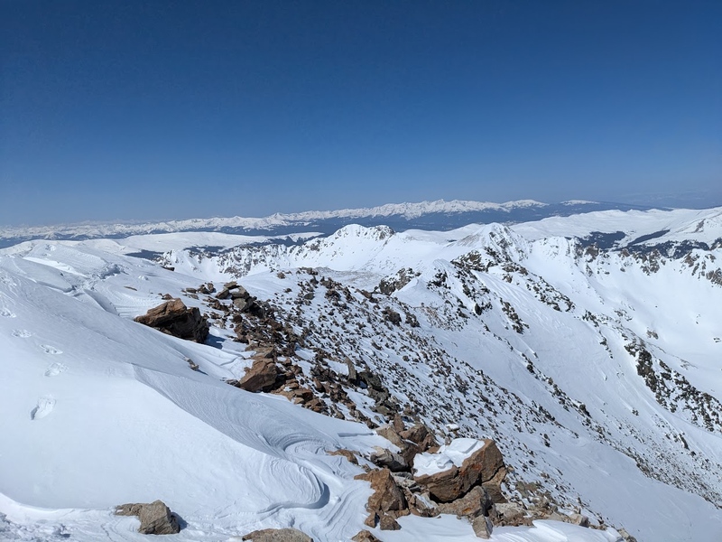
4/12/25 
There was a red flag warning in effect for most of the weekend, however there seemed to be a small window Saturday morning if I was able to start and end early as winds were picking up in the afternoon. Avalanche danger was moderate, mostly due to high temperatures later in the day. I accidently made the mistake of taking the wrong directions to the trailhead, almost ran out of gas and had to backtrack to Fairplay to fill up before making my way correctly to the winter trailhead. So much for starting early! Lots of folks climbing Sherman today, but only 2 other parties on Horseshoe. I skinned the road approach and majority of the climb up to the ridge saddle, taking a more direct approach than the summer road. From the saddle, I booted up in uncomfortably high winds to the summit and jetted down to my skis as quickly as possible. Another ski party had been climbing the Boudoir Couloir and were just getting to the top as I began descending. I opted to ski my up route, as it was a lot safer slope angle than the couloir for a solo. From the top of the saddle, I was able to ski continuously all the way back to the car. The snow was just right for the first mile but turned into total wet crap by the time I was below tree line. Another lesson to learn from I suppose. 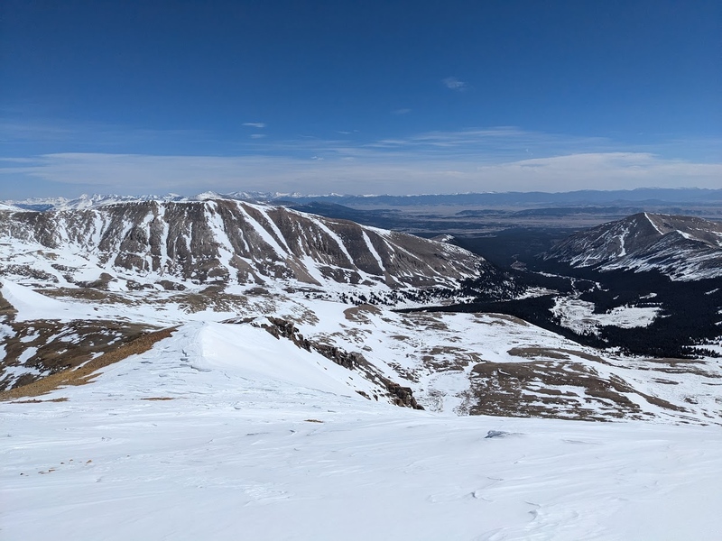
4/20/25 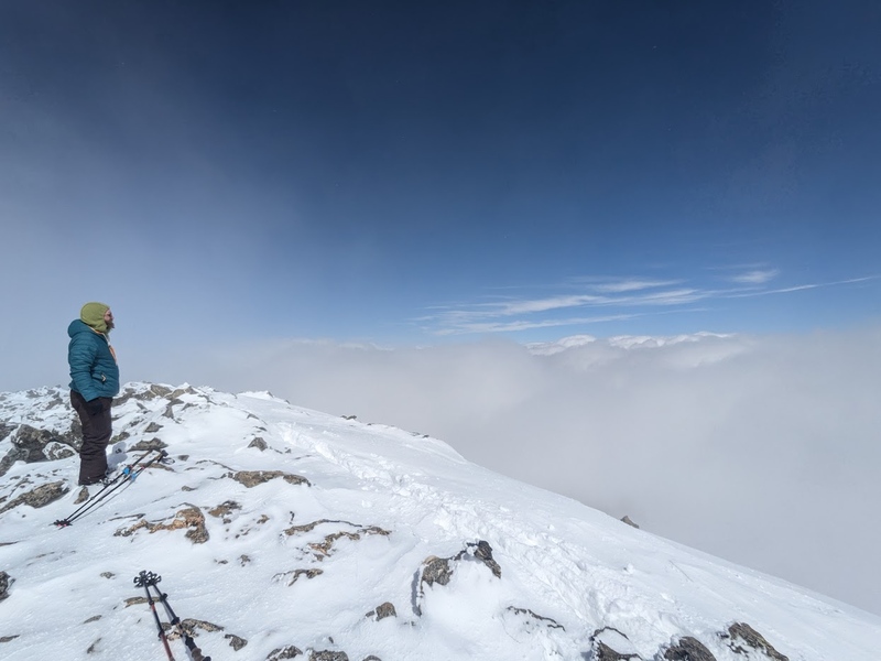
Lee and I had plans to ski something this weekend, but hadn’t decided on anything final yet. I brought up Culebra and thought it’d be the perfect time get on it because it was the day after a multiday storm cycle, permits were still readily available, and we were able to start from the Four Way Trailhead, effectively eliminating about 7 miles off the total round trip. This would make it extremely doable to bag both Culebra Peak and Red Mountain in a single day, eliminating the need to purchase a second permit, which was kind of out of the question for me. I awoke at 2:45AM, left my home an hour later and arrived at the Cielo Vista Ranch north gate around 5:45AM. After our IDs were checked at the gate, we were lead to the ranch headquarters for a brief orientation, then drove a few miles up to the Four Way trailhead. From here, we began hiking around 7:00AM and at about a mile in, we opted to skin up due to snow. The only problem was, I didn’t have my skins and had left them in the car: another rookie mistake on my part. I apologized to Lee and ran the mile down to the car in my ski boots, which for all intents and purposes, kind of sucked but was the price to pay for being so forgetful! Even more unfortunate, we ended up only skinning for about a mile before the base of the climb before switching back to boots. It honestly would have been faster for me to continue on than run back to the car, but sometimes a good two mile run is just what you need to start your day right apparently. We booted up the slopes to the cairn on the saddle and dropped our packs and skis here. It was pretty obvious we wouldn’t be skiing any further than this point. Once above 13,000 feet, we spent the rest of the day inside a swirling cloud that was parked atop the high peaks. Luckily route finding was easy, as all we needed to do was to stay on the ridgeline. We summited Culebra about four and a half hours after leaving the car and descended to the low point in the saddle just below Culebra and Red. Lee opted to stay behind and let me summit as his legs were starting to gas out from the high amount of elevation change on this ridge. I ran up and down Red quickly and we made a pretty speedy trip back to our packs. We opted to ski the big snow apron just below Punta Serpiente, which allowed us to ski back to the basin and down the road to about a mile and a half above the trailhead. Apparently it was a bluebird day below 13,000 feet! I’m grateful we were able to fit this one in before it started getting into busy season! 
So what’s next? Even though I’m looking forward to hiking conditions, longer days and the multi-mountain linkups that come with summer, as a skier, I’m still over here praying for snow like it’s my religion. After the most recent storm, we’ve effectively extended the (ideal) spring skiing season just a little bit longer, and I believe the juice is worth the squeeze. For the next upcoming weekends, I’m looking at tackling Fletcher Mountain in the Tenmile, getting started on some of the centennials in the Sawatch that aren’t included in Nolan’s 14 (more on that to come), as well as wrapping up a couple of peaks in the eastern San Juans (Stewart Peak and Phoenix Peak) and possibly Pikes Peak. Above all, good conditions and safety rule my plans and ultimately I must bow my head and ask permission to the primal gods of chaos, weather and snow for safe passage on that particular day. 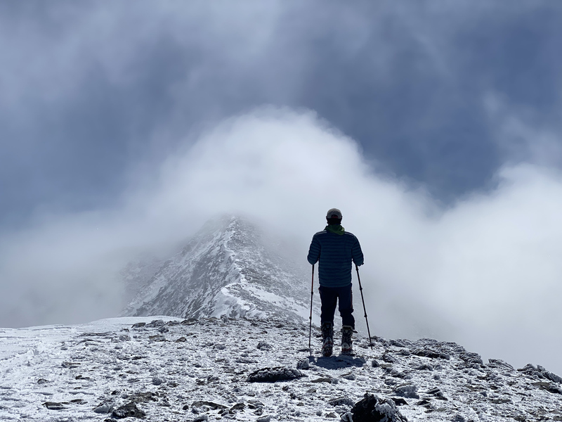
Until next time, have fun and stay safe out there! Thumbnails for uploaded photos (click to open slideshow):  Lee on Culebra")
 Crestone Needle and Crestone Peak from Obstruction Peak")
 Looking down Mt. Silverheels Descent")
 Red Mountain from Culebra Peak")
 Silverheels from the North")
 Silverheels Summit")
 Clinton Summit Views")
 Horseshoe Approach")
")
 Horseshoe Descent")
 Mt. Ouray")
")
 Mt. Ouray Descent")
 Quandary Summit")
 In the Clouds on Culebra")
|
| Comments or Questions |
|---|
|
|
Caution: The information contained in this report may not be accurate and should not be the only resource used in preparation for your climb. Failure to have the necessary experience, physical conditioning, supplies or equipment can result in injury or death. 14ers.com and the author(s) of this report provide no warranties, either express or implied, that the information provided is accurate or reliable. By using the information provided, you agree to indemnify and hold harmless 14ers.com and the report author(s) with respect to any claims and demands against them, including any attorney fees and expenses. Please read the 14ers.com Safety and Disclaimer pages for more information.
Please respect private property: 14ers.com supports the rights of private landowners to determine how and by whom their land will be used. In Colorado, it is your responsibility to determine if land is private and to obtain the appropriate permission before entering the property.


