| Report Type | Full |
| Peak(s) |
Unnamed 13552 - 13,552 feet Mt. Adams - 13,937 feet Unnamed 13159 - 13,159 feet |
| Date Posted | 02/05/2025 |
| Date Climbed | 02/03/2025 |
| Author | yaktoleft13 |
| Additional Members | Marsh |
| New Snow, New Flakes |
|---|
|
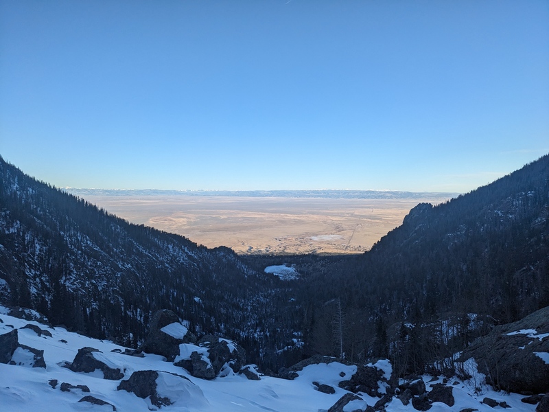
Trailhead: Willow Creek/S Crestone Route: 13,552 E ridge -> Adams W ridge -> 13,159 SE ridge Distance: 14.5 mi Vert: 6,250 ft Difficulty: easy 3rd (if you're me), 5.easy (if you're Marshall) Time: 11:15 This weekend, I had originally planned a trip out to LA to visit family and friends, particularly my 94 year old grandma. Unfortunately, the fires of the last few weeks forced my grandma and relatives to evacuate, and while her house survived (barely!), saddling them with hosting duties, including an increasingly uncontainable toddler, didn't seem like the best way for them to recover. We aborted the trip, instead choosing to spend a getaway weekend in BV, just bumming around doing nothing, which was relaxing and slightly fattening (can't quit the Roastery's baked goods). I had taken Monday off for the trip, and while I'd no longer be basking in sunshine, warm weather, and a pool, I could now try to sneak in a summit or two that day. Enter Marshall. I had first met him the week before on a successful summit of 13,038 with Kyra and Ryan, and it was clear right away he was capable and a great partner. He also made it clear that he is very free schedule-wise. I decided to put that to the test right away, and texted him Saturday to see if he was free Monday. He enthusiastically was! We Trying to find peaks that were on both of our radars was tricky, but we narrowed it down to a few options. After texting until Sunday evening, we ultimately settled on a linkup of 13,552, Adams, and 13,159: a combo on which I couldn't find any winter information (but was several hours less driving than the other options!), but seemed to be viable. The plan was audacious: head up either S Crestone Trail or Willow Creek Trail, run the ridge between the three peaks, then descend the other basin. There were some potentially dangerous avalanche conditions present, but they were primarily on north and east-facing slopes, and the proposed route required steep ascents on largely south-facing aspects. We decided to proceed. I met Marshall in BV, where he dropped his truck and hopped in. On the drive to BV, we weighed the pros and cons of which basin to ascend and which to descend. We ultimately decided that we'd rather trail-break going down than up, and we assumed Willow Lake would be more likely to have a trench than S Crestone. Plus, the steepest slopes with which we needed to contend were the south-facing slopes approaching the saddle between 552 and Adams, and if we went up those first, they wouldn't have time to roast in the sun and be a soppy mess. It was decided: up Willow Creek, hit 552, then Adams, then 159, then trench down S Crestone. We arrived at the Willow Creek Trailhead (which was mercifully open to the summer lot) at 5:45 and were hiking just before 6. The lengthy switchbacks up the slope to enter the Willow Creek drainage were snowcovered but very bootable, as it was packed down from hikers from the weekend. We crested the hill as light started to appear and found the trail on the north side of the valley to be largely dry, with occasional footprint-induced ice features and inch or two of snow. Travel went quickly in this area and we made good time as we approached the headwall. What was concerning, however, was the amount of shoeprints packing down the trail seemed to be dwindling, until just one set of prints forged the way for us in the increasing snow. The owner of said feet apparently deemed 10,300 as their destination and had turned around, which left us with no recent tracks from then on. 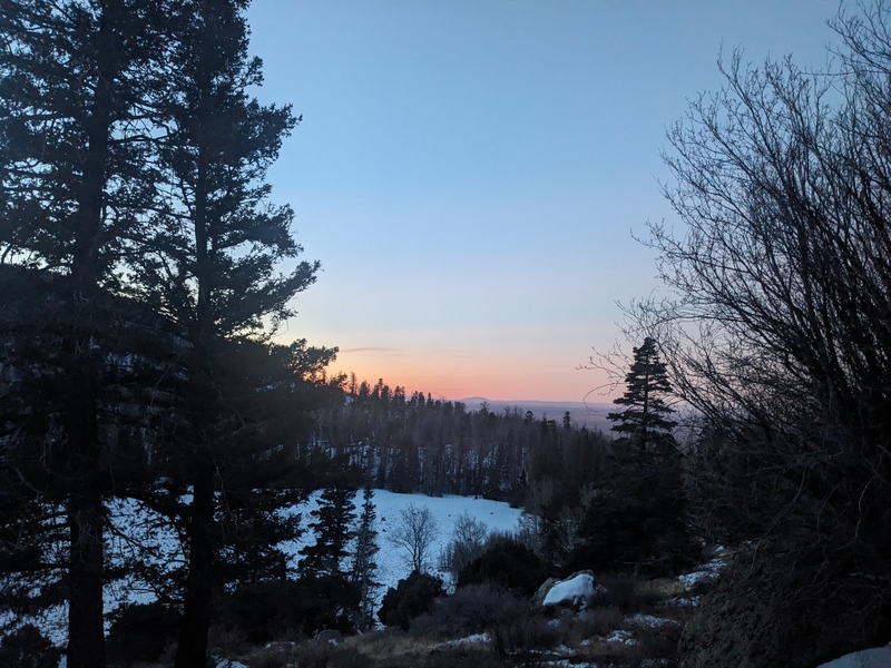
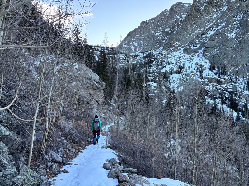
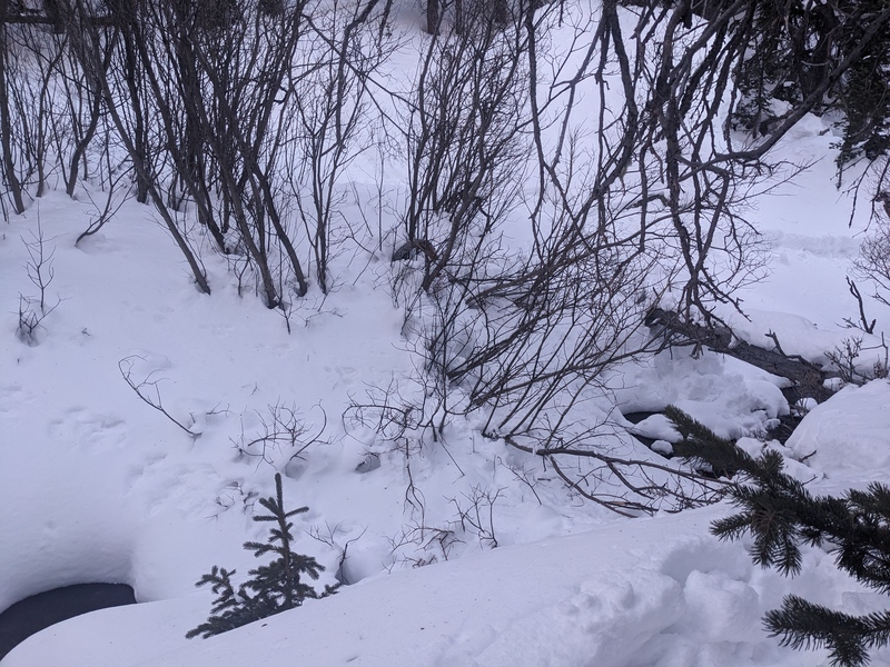
The snow still wasn't deep for the next few hundred vertical feet, sinking in just a few inches. When we arrived at the creek crossing that marks the entrance to the headwall, we found a solid logbridge across it and some animal tracks showing the way. Those animal tracks, plus the faintest evidence of an old trench, showed the way through the deepening snow. This probably would have been the right place to put on snowshoes, but we pushed on flotationless through the trees. Eventually, the animal tracks veered off into some rocks, and after crawling over a frictionless snow slab, we topped out on the headwall. 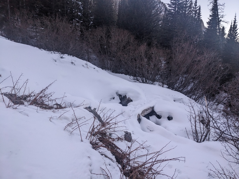

We paused for a drink on top of the headwall, and I took two steps and decided it was time to strap on the ol' snowshoes. We headed off into the valley, thankful for the flotation, and looked to find a place to cross the creek. The options weren't super great. I saw a snow bridge and took a step toward it, and a shooting crack whumpfed its way from my step, onto the bridge, and across the creek, causing a section of the snow to fall into the water. Not confidence inspiring. I went up the creek a bit further and found a log, but it was a thin log, maybe 4 inches in diameter, perhaps prohibitively small for crossing in snowshoes. At last, I found a snowbridge with willows growing across it, I stepped on the willows and bent them down, using their branches as extra flotation, and managed to cross the creek without falling in. I'm not exactly sure how Marshall got across, but I think it was on a mound of snow on a rock in the stream that held for him. Happy to be past that, we trenched forward through the snow, trying our best to follow the faint path that was trod months earlier. One rogue step meant sinking past the knee. We did a pretty good job of staying on it, and after what seemed like a long time (that section between the headwall and lake always appears much shorter than it really is), we reached the camping area for Willow Lake. 
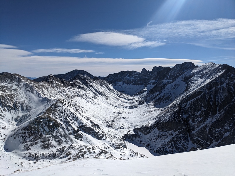
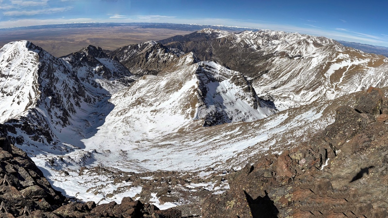
We headed a few hundred feet past the camping area and spied a good area to turn uphill and aim for the broad basin beneath Adams and 552. The snow here was starting to get a bit loose, as there wasn't a good freeze the prior night and everything we had to ascend was already getting pounded by the sun. A few minutes after leaving the standard trail for Kit Carson/Challenger, we popped above the trees, and a few minutes after that we crested the first hill, clomping our snowshoes on tundra and small rocks. We elected to keep clomping though, as we anticipated more snow in the basin. Climbing a couple more small hills gave us an enormous view of 552, Adams, and the route to the saddle. 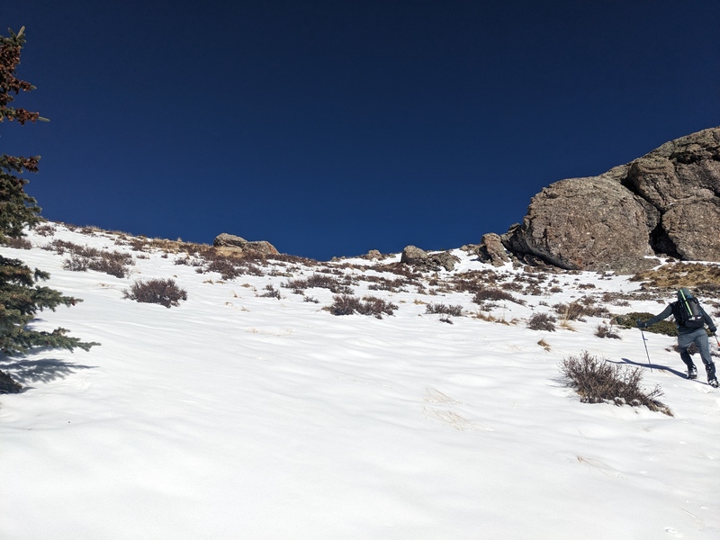
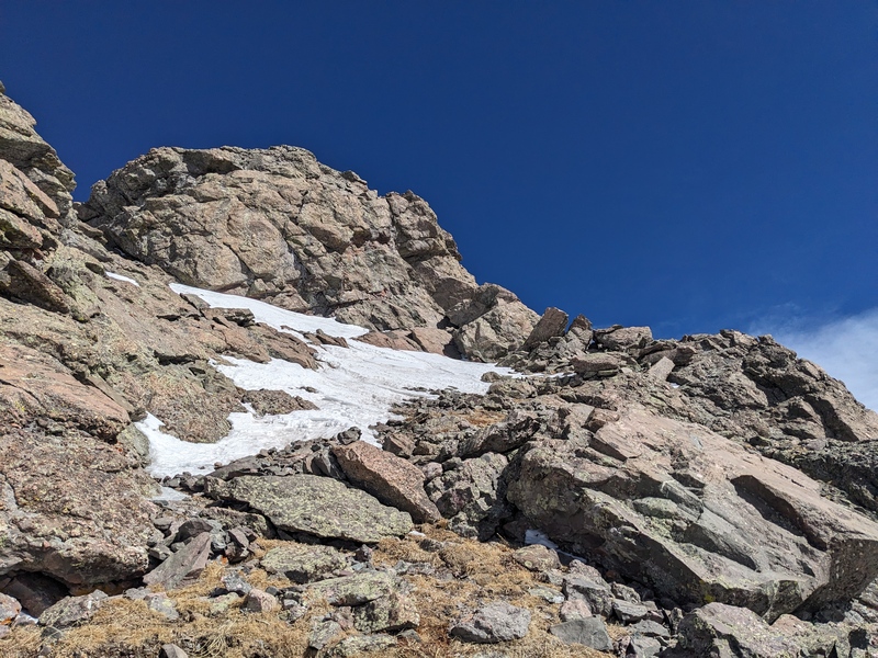
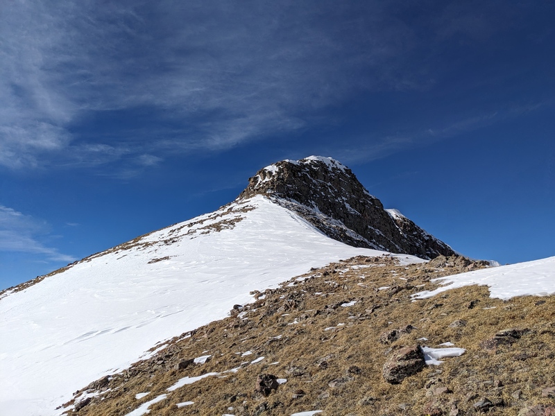
We paused for a moment upon entering the upper basin to discuss our options. We felt that most likely, the south-facing snow would be safe to climb on, but it was not my preferred option. It seemed as though a direct assault up 552's SE slopes could work, as there was a lot of exposed rock that could be linked together to reach the ridge up high. But Marshall, in his infinite wisdom, opined that the fastest way to the summit would be to gain the ridge as low as possible so we could stash snowshoes, thus saving a lot of speed-killing weight. He spied a series of rocky outcroppings that lined the left edge of the couloir to the saddle, then a dry patch next to one of the big cliffy rocks that we could exploit, which would allow us to hit the ridge very close to the saddle. We agreed on this plan, and it was flawless. There was only one very short snow section to cross (10 feet?) and this route took us directly to the ridge, only about 20 vertical above the low point. We took a break here to stash snowshoes, eat the first real food we'd had all day, and bask in the nearly windless morning. 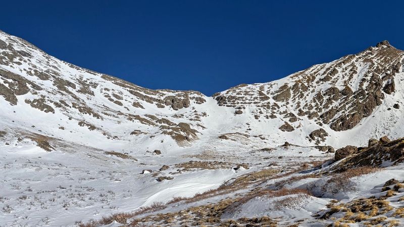
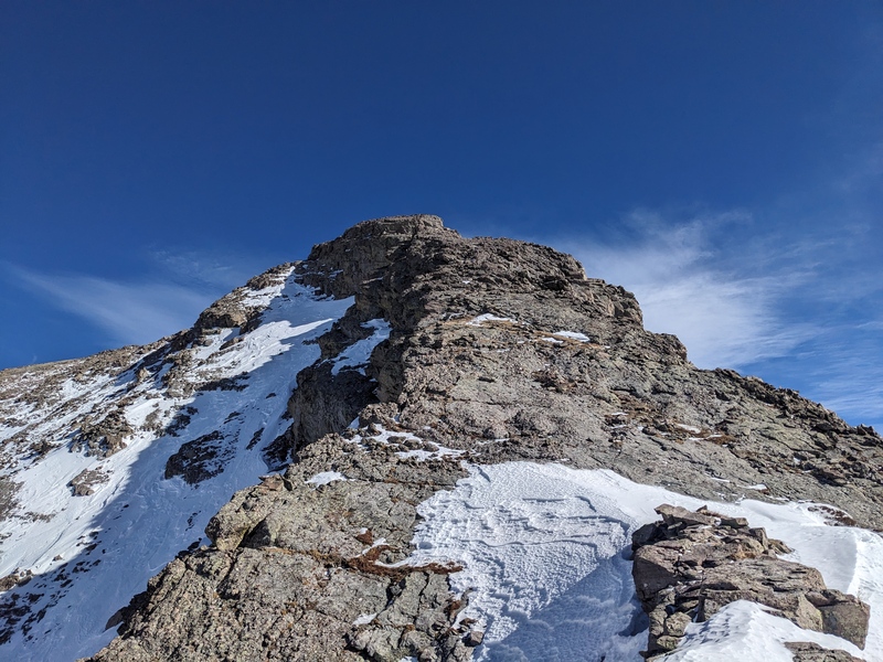
Once on the ridge, the route was straightforward. We donned microspikes. A couple of short drops on the flats led to mixed snow, tundra, and talus to the top. The steeper talus section was solid and went easily. The final pitch to the summit held a snowfield that looked like it might cause issues, but did not. We topped out on the summit, took a couple of pictures, and dropped a few feet back down the ridge, where the wind was nonexistent. Summit number 1! 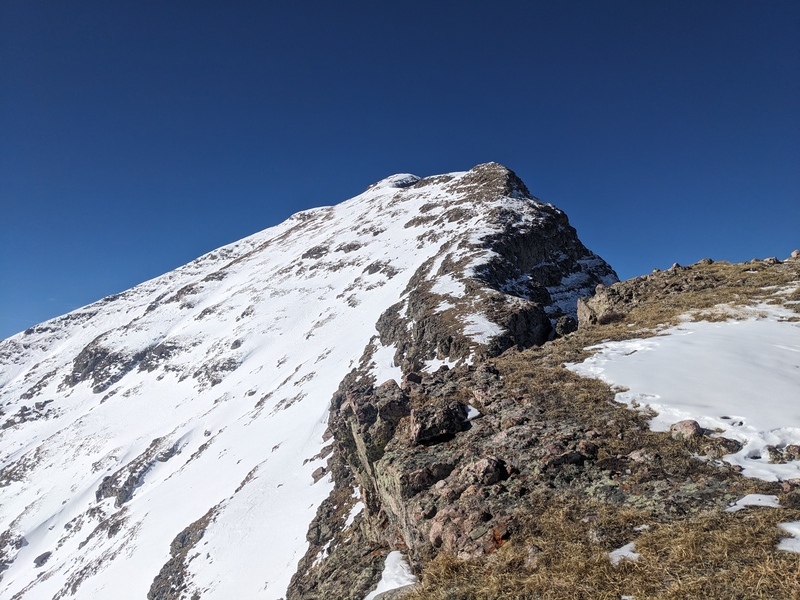


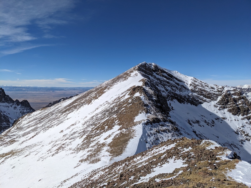
After getting a few more calories and liquids, it was time to move on. Reversing our route down the ridge, we arrived at our stashed snowshoes in 15 minutes. Next up was the 1,000 vert straight up the ridge of Adams. We knew this was the last big uphill of the day, as once we summited Adams, the only vert left to gain was around 400 to the top of 159. We loaded up the snowshoes and dropped down into the notch. A short, slabby snowfield in between some rocks dropped us onto the saddle, and a simple upclimb put us on Adams' ridge. 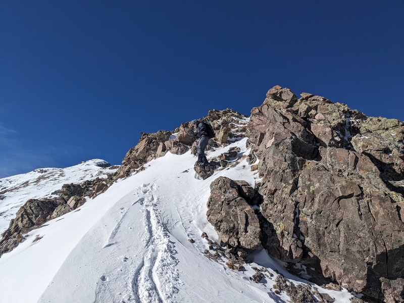
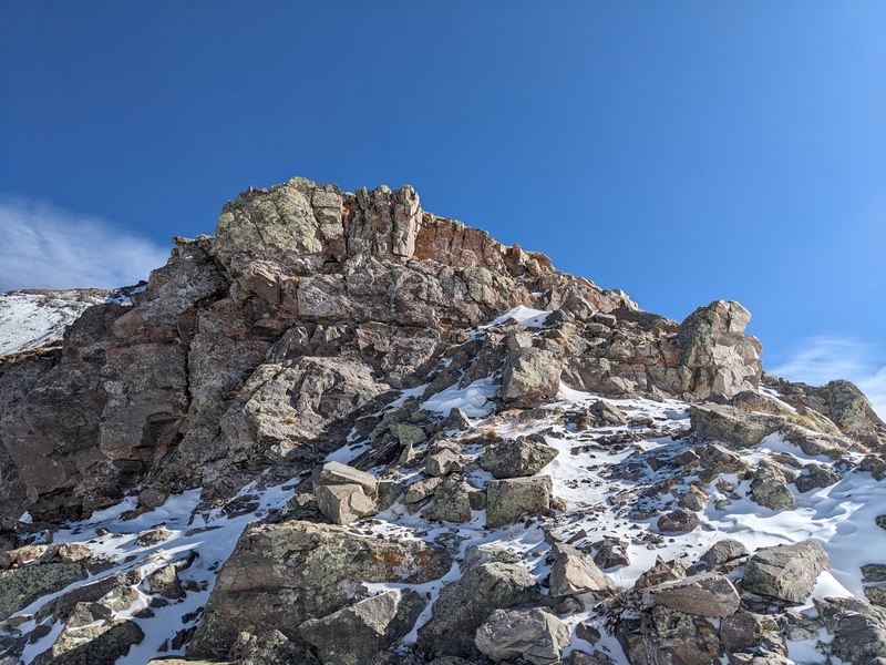
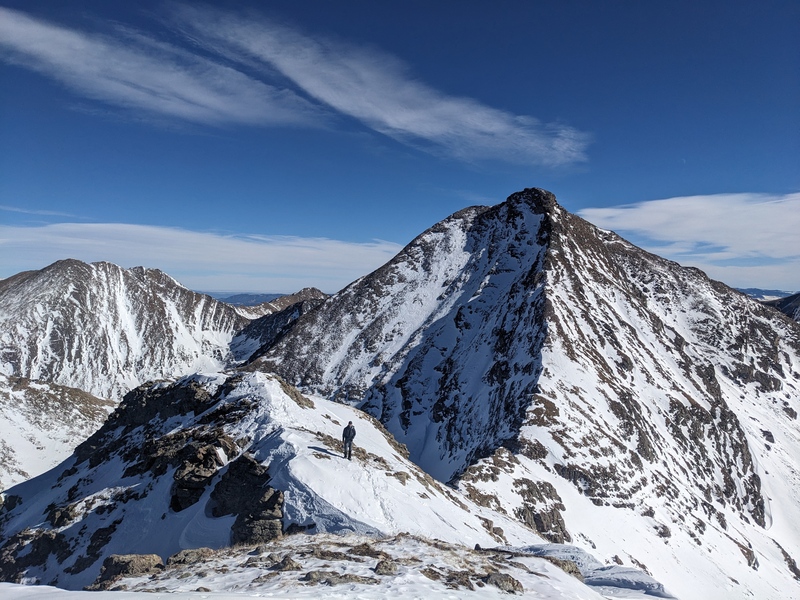
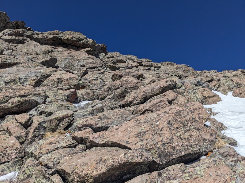
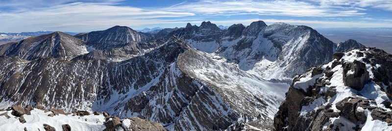
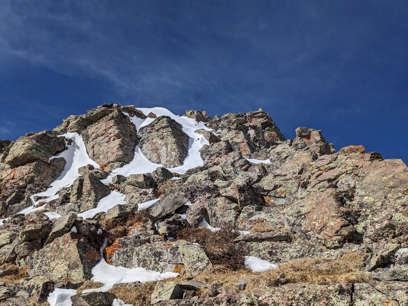
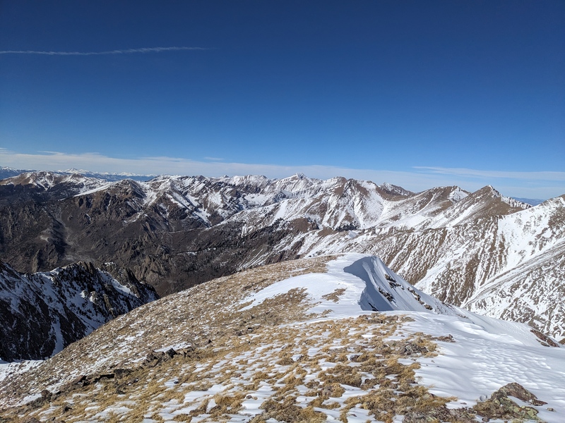
The climb up Adams felt like it took all day. In reality, it was only about 45 minutes, but with the snowshoe-laden packs, nearly 5k vert on our legs already, and the steepness of the ridge, every step seemed to take all of my energy. Marshall busted ahead, blazing a trail up the initially snow-covered ridge to reach the slabby conglomerate rock that makes up the meat of this ridge. It may have been easier to take our spikes off once we passed the major snowfield, but we didn't, choosing instead to skritch-scratch our way up the rock. At what felt like a natural time, we dropped off the ridge onto the south face below the summit block. We found a few cairns marking the path, and that led us around to the SE base of the summit block, which comprises the easiest way to reach the top. We scrambled up the 2+/easy 3rd rock and reached summit number 2 of the day! Adams has incredible views, particularly of the 14ers and high 13ers to the south. Winds were brutal up here, so I sheltered behind some large rocks as best I could and took a breather. 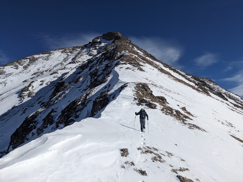
As the wind was really whipping on the summit of Adams, the time came to move. This was the only time of the entire hike that we really felt cold. We started picking our way down the N ridge of Adams, but quickly came to an abrupt halt. We were facing a 20ish foot 5th class chimney downclimb to drop below the cliffbands and reach the NE ridge toward 159. Marshall started the downclimb, but I, having just put on my mittens because my fingers were freezing, didn't particularly feel enthused by the prospects and sought to find another way down. I followed the edge of the cliffband down and down, periodically checking to see if there was a weakness I could exploit, but found none that I liked. I kept heading down and down, and before long I was 150+ vert down the face. Eventually, the cliffband melted back into the rock, and with some mild scrambling I was below it. However, this detour had put me squarely out on Adams' W face, and i had now had to face the prospect of crossing a number of steep snowfields to get back to the ridge. I started out onto the first one and woop! Tractionless snow slab. I quickly realized that mindlessly crossing straight toward the ridge wasn't a possibility. However, there were enough exposed rocks littered about that I felt confident I could link up a number of them and minimize the length of the snow crossings. This strategy worked, but I still had to cross a half-dozen windslabbed snow fields. I held my breath on each one, hoping the microspikes would give me enough grip, and while there were a couple of minor slips and slides in varying degrees of control, I managed to reach the ridge right as Marshall was descending to the same spot. He said his downclimb was better than it looked and there were holds everywhere he needed them. In hindsight, I'd rather have descended his way, but in the moment the cold fingers overruled the brain. 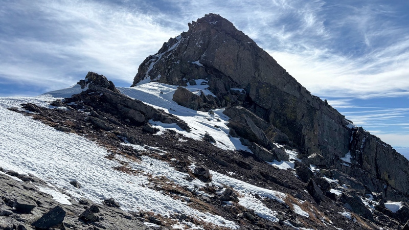
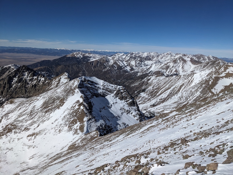


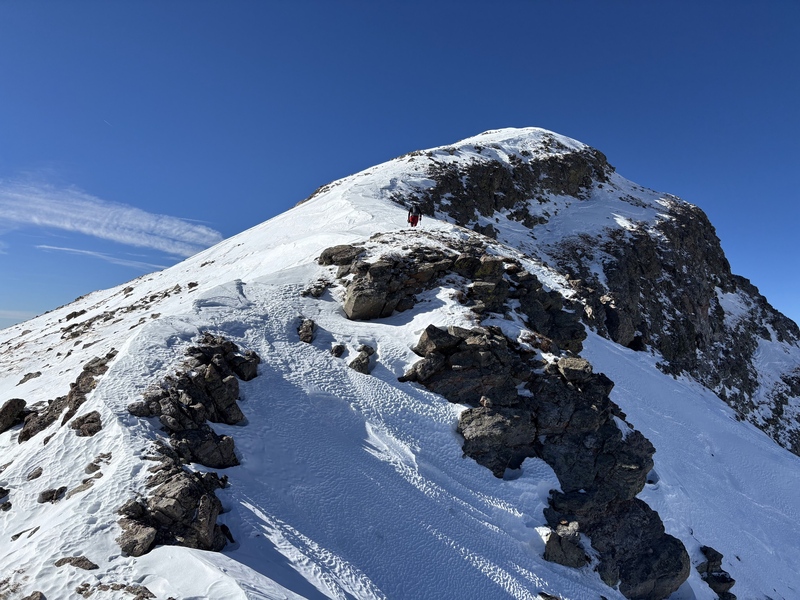
Once on the ridge, we rock-hopped talus and descended tundra down to the saddle. We knew that 159 would hopefully be a quick one, and our planned descent route was from this saddle down, so Marshall dropped his pack and proceeded unencumbered. I, for some reason, preferred to be cumbered, so I kept my pack on and began up the ridge. After a short ascent, the ridge held a rocky outcropping that offered some easy scrambling. Topping out led to a snowfield, then the final steep bump on the ridge. This was bypassable to the SE, which we did on the descent, but on the way up we hit it head on for 20 feet of 3rd class. Once above it, the summit came fast and we stood on top of summit 3! 
Thumbnails for uploaded photos (click to open slideshow): ")
")
")
")
")
")
")
")
")
")
")
")
")
")
")
")
")
")
")
")
")
")
")
")
")
")
")
")
")
")
")
")
")
")
")
")
")
")
")
")
")
")
|
| Comments or Questions |
|---|
|
|
Caution: The information contained in this report may not be accurate and should not be the only resource used in preparation for your climb. Failure to have the necessary experience, physical conditioning, supplies or equipment can result in injury or death. 14ers.com and the author(s) of this report provide no warranties, either express or implied, that the information provided is accurate or reliable. By using the information provided, you agree to indemnify and hold harmless 14ers.com and the report author(s) with respect to any claims and demands against them, including any attorney fees and expenses. Please read the 14ers.com Safety and Disclaimer pages for more information.
Please respect private property: 14ers.com supports the rights of private landowners to determine how and by whom their land will be used. In Colorado, it is your responsibility to determine if land is private and to obtain the appropriate permission before entering the property.

