| Report Type | Full |
| Peak(s) |
Hesperus Mountain - 13,238 feet Lavender Peak - 13,237 feet Babcock Peak - 13,161 feet Mt. Moss - 13,194 feet Centennial Peak - 13,068 feet Spiller Peak - 13,134 feet |
| Date Posted | 01/28/2025 |
| Modified | 09/19/2025 |
| Date Climbed | 09/01/2024 |
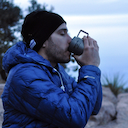
| Author | Ngrage1127 |
| Additional Members | jackvanlancker |
| The La Plata Enchilada - Full traverse of the La Plata Mountains |
|---|
|
Backstory - The first time I heard about this route was back in 2022 while visiting friends in Durango. I remember it feeling great to get away from the SLC heat. I had almost committed to going to school at Fort Lewis College the previous year, but I decided to move out to Salt Lake City instead. I love Utah, but it felt right to be back in SW Colorado. On that trip, I got to climb Arrow Peak/Wham Ridge, Lizard Head Peak, and see La Plata Canyon for the first time. My buddies Jack, Weston, and Cal told me about a big linkup they'd heard of around town, which they believed climbed all the highest peaks in the range. An epic crest that circumnavigated the horseshoe-shaped canyon. They called it the "La Plata Enchilada." Pretty sweet name... Jack and Calin were always hearing people spray about interesting stuff in the gear shop where they worked. Jack said it probably had similar stats to the LA Freeway or WURL... Damn! I found it especially intriguing that it truly started and ended in the same spot. From that moment on it was a seed in my mind! I remember driving back to a scorching SLC and missing my home state dearly. The La Plata Mountains are a subrange of the San Juans, decently isolated from other subranges like the San Miguels and Grenadiers. They are a stand-alone group. The West ridge of the range dominates the view all around the four corners. You can see Hesperus, Lavender, and Moss from the red rock deserts of Utah and Arizona on clear days. The east ridge of the horseshoe makes up Durango's skyline, which I look at from my campus every day. Silver and Lewis are the peaks that catch your eye on the East side, each in the high 12's. These two major ridgelines are connected via a series of flatter peaks and land bridges spanning off of Diorite peak, which close off the range.
La Plata Canyon - July 2022
Hesperus/Dibe Ntsaa - Spiller are the obvious twin-like summits in the distance. Seen from Mexican Hat, Utah. Many are visible though! Flash Forward to Summer 2024 - I have been living in Durango for over a year, going to school at Fort Lewis College. I spent the summer around Colorado's high country, finally getting the chance to do some dream ridges and peaks I'd been neglecting. As the summer was winding down, I was heading back to Durango after spending most of the summer closer to the Front Range. I didn't get the chance to give a shot at the LA Freeway (Longs - Arapahoe), which had been one of the main goals I'd been floating around. I was equally as excited to be back around the San Juan's and maybe see what the Enchilada was about. One of the first challenges was figuring out what the route was. I'd heard a lot of talk about it by now, so I wanted to figure out what to do as not to leave anything out. When I looked around the net I couldn't find any sort of writeup. Unfortunately, a couple of folks passed away in La Plata Canyon over the past few years. Many write-ups and news articles on these people mentioned "The La Plata Enchilada" as a grueling endurance route they might've been embarking on. It was a bit strange and seemed unvalidated, but alas, it was some of the only bits of info I could find that the route was referred to as the "enchilada." Finally, I came across a recently submitted track to the Fastest Known Time website. The route looked to flow nicely, as well as climb every major peak in the range. This was what I'd imagined, except there weren't any submissions for times. I figured that sometimes you have to go look for yourself! I got off school and called my buddy Jack Van Lancker, as he knew a decent bit about the range. Instead of giving me any beta, he insisted on coming along. It sounded like a plan, as Jack and I have done plenty of bigger days together. Whether it's the San Juans, Utah desert, or Black Canyon, I knew he'd be solid. I told him to come pick me up tomorrow at 2:00 am!
The first track/idea of the route I found. FKT website. Created and submitted by Brent Herring.
Supplies and Style We opted for an Unsupported push. Knowing that the last-second plan wouldn't allow us to coordinate anyone to come to meet us, or make any stashes ahead of time. This is our preferred style anyway! Above was all the food I carried for the ~ 34 Mile 18k Push. The two 50 OZ bottles were filled with Tailwind electrolyte mix. I wore a light pack and Jack had a vest-type pack. He wore a thrashed pair of La Sportiva Mutants and I had a slightly less thrashed pair of Scarpa Ribelles. We both carried BD carbon Poles. Besides a light layer, that was it! Report We Drove out to La Plata Canyon around 2:15 am, neither of us felt incredibly well-rested after such short notice and a lot of excitement/anticipation. We set off from our car at 3 am. Jack started the pace off pretty hot, which was typical for him. It's almost like he's trying to make you reconsider what you signed up for, or in this case, initiated. The beginning of route starts on Parrot Peak and follows a pure ridge that tags a couple of high 11/ low 12k summits. Parrot, Star, Madden, and Gibbs are the first significant peaks along the chain. We ground out the first 3,000 feet up to the summit of Parrot in 1:20. It felt great to be up high! We watched the sunrise illuminate the jagged peaks of the Weminuche and peered across the canyon to Silver and Deadwood. Long way to go...
Sunrise over Spiller (Upper Left) Burwell (Center front) Lewis (Far Right) The first bit of technical difficulty comes between the summit of Gibbs and Burwell. A complicated gash shows up out of nowhere. We found a ~ 40-foot / low 5th-class down climb that puts you in a good spot to continue. It's directly along the ridge and should present itself relatively easily.
Slightly deceiving downclimb into gash (between Gibbs and Burwell) We headed up to the next peak, Burwell, which appears rather imposing coming from Gibbs. If you simply stay along the ridge, a beautiful 4th/Low 5th Gully will appear. This sneak allows surprisingly easy access through a large cliff band.
Looking back towards Gibbs. The down climb into the notch is the V along the ridge (Center Right)
Imposing cliff band on Burwell (Sneak goes left of center) We hit the summit of Burwell 5 hours In. The route from Burwell to Spiller (first 13er) was an unmemorable and quick scramble in the 3rd class range. By 8:30, we were on the summit of Spiller, looking at the classic "Knife Traverse" to Babcock. The Knife is one of the most frequented and classic routes in the La Plata range. Great scramble connecting Spiller and the West summit of Babcock. Undoubtedly one of the best ridges in the range.
Looking across "The Knife" to Babcock from the summit of Burwell. Pigeon/Turrett and Chicago basin in the far distance
Jack heading onto "The Knife"
Looking at the meat of the route - (L - R) Hesperus - Lavender - Moss - Viewed from The Knife The Knife went by quickly, and by 9 am, we were on the summit of West Babcock. After quickly tagging the summit, we descended to the notch between the West and Middle summits. This was the technical crux for us, as we took different routes (up to 5.6) up the South side of Babcock's middle summit. I learned from a local source (Debra Van Winegarden) that there is a sneak going up the North side of the middle summit. We lost a bit of time here, but we both felt it was important to climb the highest summit of the Babcock "massif". After reversing our route back to the notch between Middle and West, we began making our way along the long ridge to Mount Moss. Descending off Middle Babcock is... you guessed it... loose! Do your best to avoid getting suckered on the way to moss. There are plenty of spots to get cliffed out; it helps to start looking at your route while coming over from the Knife. Better yet, just go give it some recon! Staying COMPLETELY direct on this section wouldn't really work and looked a bit idiotic to us. We were weaving up and down, trying to simply find a passage to Moss.
Making way over to Moss. The iconic banded layers of Hesperus are in the distance!
Looking back at the complexities so far. As you can see, it's slow-moving between Babcock and Moss. Dipping down lookers left might be the quickest... (L-R) West Babcock (not included) - Middle Babcock (highest) - West Babcock - The Knife - Spiller We touched the summit of Moss, looked around for a second, got a sip of water, and kept it moving. By 11 Am, we were on the strange pinnacle summits of Lavender Peak. I look forward to returning to this incredible peak! Our next objective was a complicated-looking ridge over to Hesperus (Dibe Ntsaa). This spectacularly beautiful peak is one of the Navajo Nation's four sacred peaks. It is easy to understand why when you see it in person. The route to Hesperus revealed itself relatively easily, but the looseness in this section is not to be understated. At this point the insecurity and looseness become very mentally taxing, and you have to constantly be aware of your surroundings and footing, as these untraveled ridges have a ton of junk on them. It would be incredibly easy to twist an ankle, break a hold, or worse. The La Plata's are up there in terms of the loosest mountains in the state. Keep that in mind!
Descending Lavender Peak, Hesperus looming above.Tricky ridgeline. We made it to a gash between Hesperus and Lavender, had a quick snack, and decided to drop our packs above a loose but safe-looking couloir. The submitted route on FKT went down the North ridge of Hesperus, but we would recommend out and backing the summit from this very significant notch. We kept chugging and made good time over to the summit of Hesperus by 11:45. At this point, we were ~ 9 hours into the day, feeling pretty confident about what was behind us. While Jack had done the classic Spiller to West Babcock section before, the rest of the day had been new terrain for both of us. It felt nice not having straggled or lost too much time. We left the summit after a few short phone calls and reversed our route back to the saddle of Lavender.
Lavender and Moss - Viewed from the summit of Hesperus. At this point, a few clouds began to build, but nothing too scary or noteworthy.
Beginning the loose couloir descent from the Lavender/Hesperus saddle We ripped down the gully, finding ourselves at a nice trickling creek in the basin below Lav/Hes. Unfortunately, my water filter was acting up, and we spent significantly longer filtering water than normal. Bit slow, but no big deal! We contoured the slope over to the base of Centennial, where we found a distinct chute that went right back up to the ridgeline underneath the summit. You could contour a bit farther to the saddle of Sharkstooth and Centennial, but the straight shot wasn't technical and went quickly. When we got onto the ridge of Centennial, we dropped our packs for a short out and back to the summit. After some significant gain from the basin, we were at the summit of Centennial Peak. Centennial is an unranked 13er that was gifted its name on Colorado's 100th Birthday. It is another interestingly banded peak that is connected by a truly evil-looking ridgeline to Lavender. Maybe someday it's worth checking out with some ropes, but it's not logical on this route.
Descending Centennial. Looking towards the Sharkstooth. Clouds were building a bit at this point, and we were both noticing them and vocalizing a plan if it turned. Nothing threatening ever came, and they dissipated on our way to Sharkstooth. The 20% chance had officially come and gone. Sharkstooth is easily the loosest peak in the La Plata's. Make sure you have a light touch on this one! Short out and back from the saddle with Centennial. If choss isn't your thing... avoid it! Sharkstooth is the farthest North peak in the La Plata's, the lonely summit is worth the effort.
Heading up Sharkstooth (L-R) - Centennial - Lavender - Hesperus
Last scramble on Sharkstooth
Looking Northwest off of Sharkstooth's summit, towards the Utah desert. Lone Cone, the furthest West major peak in CO, in the distance. We tip-toed down Sharkstooth, and dropped onto the Colorado Trail, heading towards Diorite Peak. It felt great to be cruising on trail after spending the whole morning on Talus. At this point, we were feeling pretty confident that we'd be able to finish the route, but we didn't have much of a clue how long it would take, heading into more unfamiliar ground. We did know that the most technical and loose sections of the day were behind us. After grabbing some slow-filtering water and a snack in the basin on the way to Diorite, we felt refreshed. Jack charged up the huge slope, and I was feeling motivated by his effort! At 13.5 Hours in we were on top of Diorite!
Quick break heading up Diorite. Moss, Lavender, Centennial, Sharkstooth in the background  Hard push to the top of Diorite! Back on the Ridgeline. Silver in the background. Long way still... At this point, I let Jack set the pace and followed. I found it incredibly helpful to have his speed reminding me to keep things moving. I did the WURL a few years ago, and would have loved a pacer like him! I feel like I do a good job of slowing him down so he doesn't burn out so quickly! ha
Snowstorm, Lewis, Silver, Deadwood. (L-R) Durango's skyline from the other side
Downclimb off of Diorite... not easy movement!
Jack cruises along the sidewalk in the sky, which makes up the ridge from Diorite to Indian Trail Ridge. These are amazing miles, having covered so much ground, it's nice to get a bit of reprieve from the loose rock and scree. A bit of trickery here and there, but mostly beautiful alpine miles. We chose to add Indian Trail Ridge, right after Efendi Peak, instead of Kennebec Peak. It seemed to flow better with the route, offer a better view, and be less of a waste of time as an "out-and-back." Neither is incredibly important or prominent, but in my opinion, one or the other should be added to do the "Full Enchilada"
Indian Trail Ridge. Really nice view of the range from here.
Cumberland - Snowstorm - Lewis - Silver (L-R) Grabbed a bit of water on our way over to Cumberland, and took a brief break
More trail miles on the way to Cumberland. Starting to feel more pressure as the sun is getting low!
Summit of Cumberland Starting up Cumberland, things felt a bit grittier. Our feet were hurting, the sun was setting, and reality was kicking in that we would be moving in the dark for a while. Everything ahead was also new ground for us. We turned on the jets for a while between Cumberland and Snowstorm, fueled by a euphoric sunset. We saw our first people of the day, a couple of jeeps, in the notch between Cumberland and Snowstorm. They gave us some perplexed looks, and we said a quick hello.
Looking back at Cumberland. Weminuche in the Distance. Stunning.
There it goes! Into the night we go. Looking back at many of the peaks covered so far. We made it up the classic North Ridge of Lewis with the last bits of light. I think Lewis might be one of the more interesting peaks around. The ridge is quite thin but never exceeds class 3. If I were to recommend a specific peak in this range, it would probably be Lewis.
Summit of Lewis! We must be getting close... right? The next few hours were easily the most grueling and hard to recall. We both significantly underestimated the length of the traverse to Silver. The terrain wasn't scary or serious, just classic rock slopes and talus. If you're shooting for the full thing, just know this section is a grind! We were baffled by how quickly the darkness took away our psych. We felt on top of the world as the sun was going down, but we were in the pain cave heading down Lewis. At this point, I was very happy to be with a partner I fully trusted. I knew he would keep himself composed and be able to get it done. In between Lewis and Silver is Mount Baker. Don't get too excited when you start going up, Silver doesn't come right away.
Summit Of Silver - Durango in the Background We turned up our music, tried our best to joke around, and kept the pace moving. 21 hours in, at midnight, we were finally on top of Silver Mountain. Phew... From here, we walked the lovely and flat ridge over to Deadwood Mountain. At this point, we were feeling exhausted. We held it together and managed to run what we could on our way down Deadwood. We fumbled the route a couple of times and got into some bushes. Some of the roads heading down Deadwood are private and/or overgrown. We wish we'd taken different trails here, but we got down! We popped out on the main canyon road and sprinted the last quarter mile back to the car. 23 hours and 49 minutes after setting off, we were back at our car. Potentially establishing the first true La Plata Enchilada... (?) After posting about this on IG, submitting our FKT, and finding more about past attempts, I've found a handful of people who have done a variation of this route on Strava. Each of them did a variation that goes right after the summit of Moss, heading directly to Diorite. This is still a huge route, and I agree it is an aesthetic line. Unfortunately, it leaves out Lavender, Hesperus, Centennial, and Sharkstooth. Also, it seemed many avoided the highest summit of Babcock, Efendi, and Indian Trail Ridge altogether. I think the variation looks amazing, but to me, it seems like more of a Taquito than an Enchilada! Hopefully, both routes will see more attempts, as I believe you won't be let down wherever you go. The La Plata's are beloved by many. Hopefully, this report will help anyone looking to do a big day in the La Plata mountains, no matter what the specific route is. While most of the route was new terrain for us, we felt confident in our abilities and risk management. We also carried an Inreach as usual. These are some scrappy peaks and have been the site of a couple of deaths recently. Look out for loose rock and weather, and give it a shot if you're feeling up to it! One bonus of starting and finishing in the same place is that there are plenty of spots to bail! If you're interested in more information about the area, I would recommend Debra Van Winegarden's book, which focuses solely on the La Plata mountains. She also has a website, Earthline: The American West. She is incredibly thorough in her descriptions and clearly has a deep passion for the Range. Many thanks go out to her for taking the time to document and share information on Durango's local peaks! 33.5 Miles, 18,700 Ft Vertical gain Peaks In Order - Parrot - Star - Madden - Gibbs - Burwell - Spiller - W Babcock - Middle Babcock - Moss - Lavender - Hesperus - Centennial - Sharkstooth - Diorite - Efendi - Indian Trail Ridge - Cumberland - Snowstorm - Lewis - Baker - Silver - Deadwood https://fastestknowntime.com/fkt/noah-grage-jack-van-lancker-la-plata-enchilada-2024-08-03 Links to GPS track/ Strava track can be found on here! Thumbnails for uploaded photos (click to open slideshow): ")
")
")
")
")
")
")
")
")
")
")
")
")
")
")
")
")
")
")
")
")
")
")
")
")
")
")
")
")
")
")
")
 Looking to the meat of the route. From L-R - Hesperus - Lavender - Moss")
")
")
")
|
| Comments or Questions | |||||||||||||||
|---|---|---|---|---|---|---|---|---|---|---|---|---|---|---|---|
|
Caution: The information contained in this report may not be accurate and should not be the only resource used in preparation for your climb. Failure to have the necessary experience, physical conditioning, supplies or equipment can result in injury or death. 14ers.com and the author(s) of this report provide no warranties, either express or implied, that the information provided is accurate or reliable. By using the information provided, you agree to indemnify and hold harmless 14ers.com and the report author(s) with respect to any claims and demands against them, including any attorney fees and expenses. Please read the 14ers.com Safety and Disclaimer pages for more information.
Please respect private property: 14ers.com supports the rights of private landowners to determine how and by whom their land will be used. In Colorado, it is your responsibility to determine if land is private and to obtain the appropriate permission before entering the property.