| Report Type | Full |
| Peak(s) |
San Miguel Peak - 13,756 feet |
| Date Posted | 01/05/2025 |
| Date Climbed | 06/25/2024 |
| Author | arthurtect |
| Additional Members | CheapCigarMan |
| The Elusive San Miguel |
|---|
|
After reading all the wonderful trip reports about the miserable scree and talus along the northwest ridge to San Miguel Peak, and knowing we'd have to drop into the scree-sloped col between the four potential summits and ascend the true summit on the southeast high-point, we thankfully found a nugget in d_baker's 2009 trip report where they spoke about the solid rock on the southeast ridge. We rolled the dice and began our hike with the southeast ridge as our intended route. If you want to experience one of the most fun and enjoyable scrambles and routes, then read on! If you want another scree-filled, crap your pants, sufferfest, then follow one of the other trip reports! We settled into the lower parking lot area the night before to a pretty sunset, cozy fire, stories of our adventures over the past few days and still some debate on which ridge to take. We were all alone on a Monday evening...well us and all the silk worms and spiders that were leaving their webs in our paths that evening for our hike in the next morning. 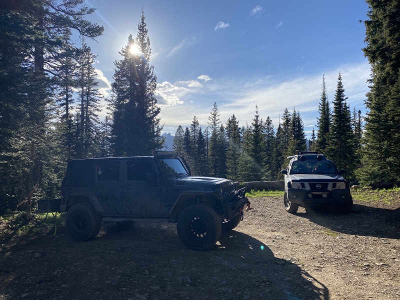
The hike into Lake Hope is real pleasant and we were very thankful for an easy final day after the steep ascents and couloirs of the previous few days. Walked up on this spot where the trail is washed out. We opted to hike up to a snow bridge on the way up the trail, and then opted to cool off our feet by walking through the water on the way back. 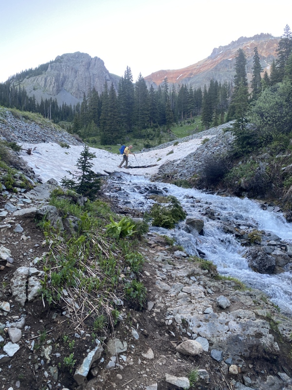
We had this one brief sighting of San Miguel Peak on the journey up. Although, we still are probably only seeing the northwest ridge and not the actual summit. With each ledge we climbed, we wondered if we'd ever see San Miguel this day. 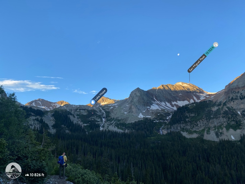
I didn't capture the Lake Hope trail detour to the bridge very well, so I don't have any photos of that. Mostly because on the way up, we walked right on past it while we enjoyed the morning, flowers and conversation. We did take the detour on the way down. It was partially cairned and seldom used, so the trail wasn't always obvious. Probably the first 'choose your own adventure' of the day if you take the detour. Trust your map and follow the contour to the dam. The basins play tricks on your mind and navigation skills...where is San Miguel Peak? Not in this photo... 
From the dam at Lake Hope, follow the typical ledge(s) to the upper basin. The lower portion was decently cairned and easy to follow going up. Coming down, the route was a little harder to distinguish through the vegetation. 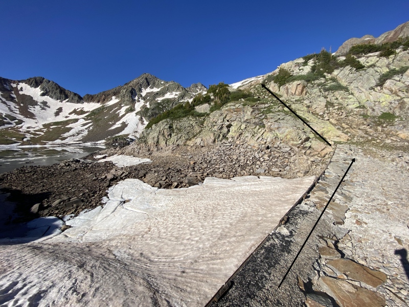
I believe we ended up staying more to the left on the upper ledge. We both wished we would have brought our cramp-ons so we could have just taken the snow up. Perhaps the second 'choose your own adventure' of the day. PS...still no sign of San Miguel Peak's summit. 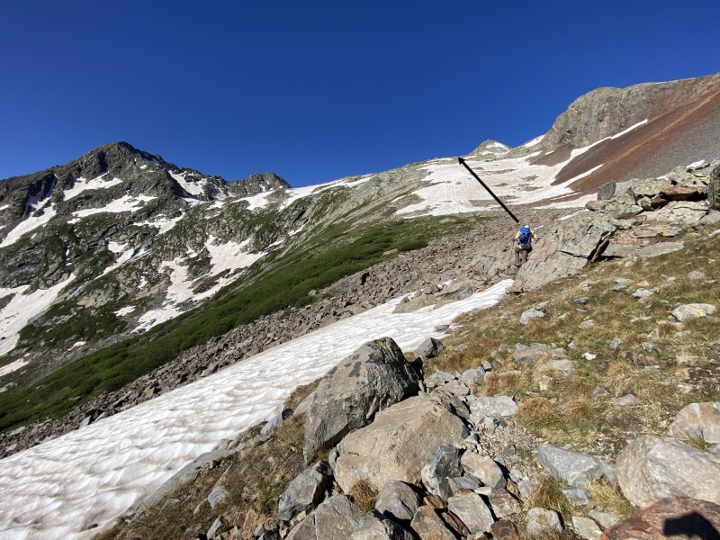
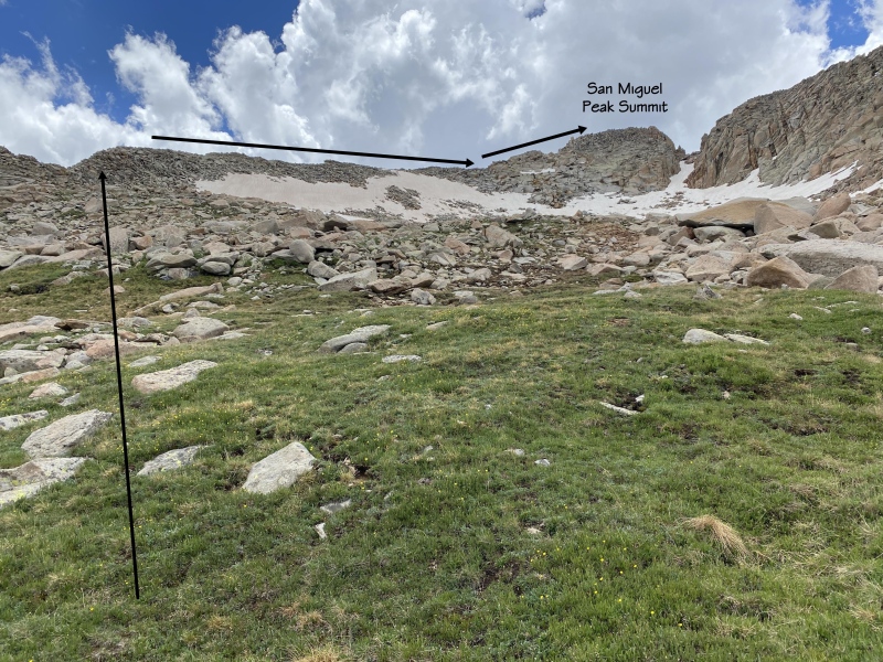
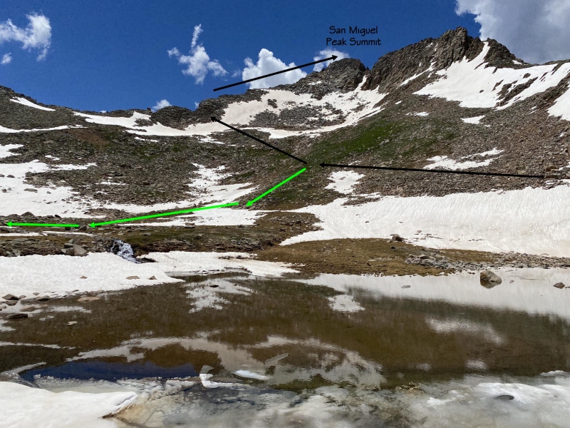
Once you arrive to the upper basin, the elusive true summit of San Miguel Peak finally reveals itself. Although it may appear that the high-point on the right is higher, the left high-point is the actual summit. Don't let you imagination and common sense detour you to the right...go left! From this point, you can take whichever less or more traveled road you desire. We chose to go around the upper lake to the right on the way up, and then down around the left on the way down. (This is also where those who enjoy misery and pain would start heading up the northeast ridge...don't do it...that's not why you are here.) 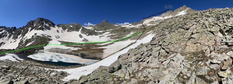
We found a nice grassy spot dead center below the couloir. It was melted out at the top by this point in the year, so we didn't beat ourselves up too much for not bringing the appropriate gear for couloirs today. We decided to drop our gear (gave the unseen critters a firm warning to stay away), and go light up the scramble of the southeast ridge. 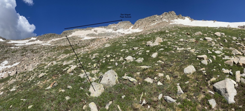
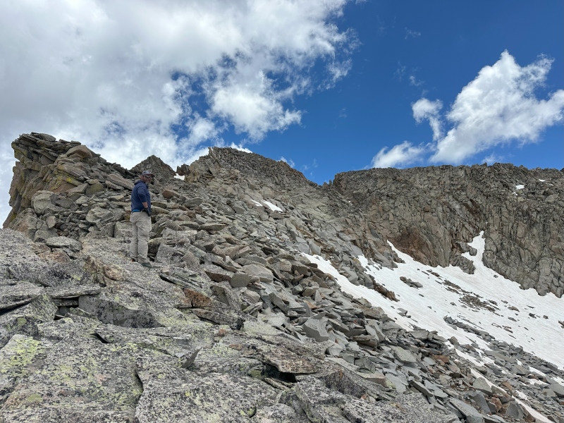
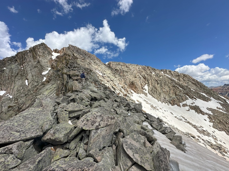
The journey up the southeast ridge was just pure adrenaline soaked fun! Mixture of class 2/3 that involved rock hopping, hands pulling and route finding amongst mostly solid rock, little-to-no scree or talus, and with some extreme exposure on your left and unreal views abound that get better with each step. The ridge is expansive enough that you can flirt with exposure on the left, or keep it unquesy on the right. 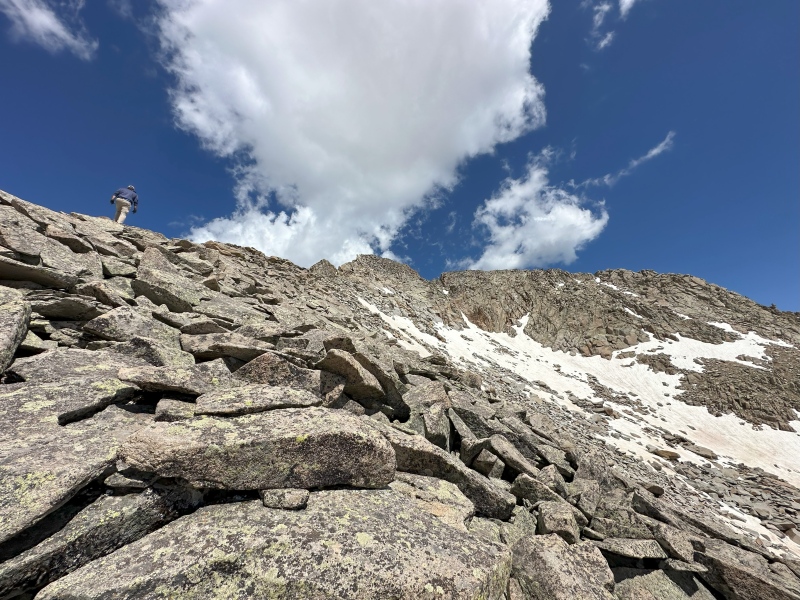
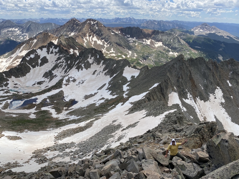
The solid rock and scrambling takes you all the way to the proper summit. We were all smiles from the bottom to the top! This was the perfect way to end our week in the San Juans! 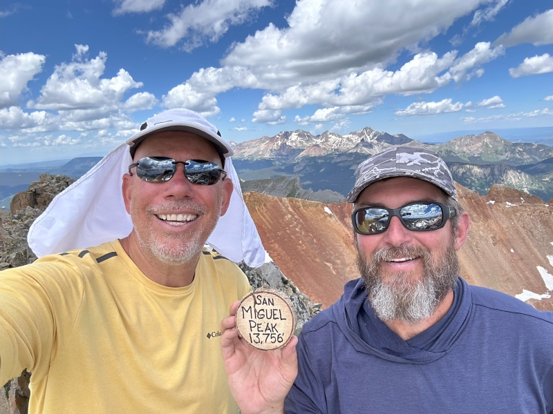
Here are couple shots from travels back that show our routes up and down, as well as the amazing views that were over our shoulders on the way up, and thankfully in full sight on the descent! 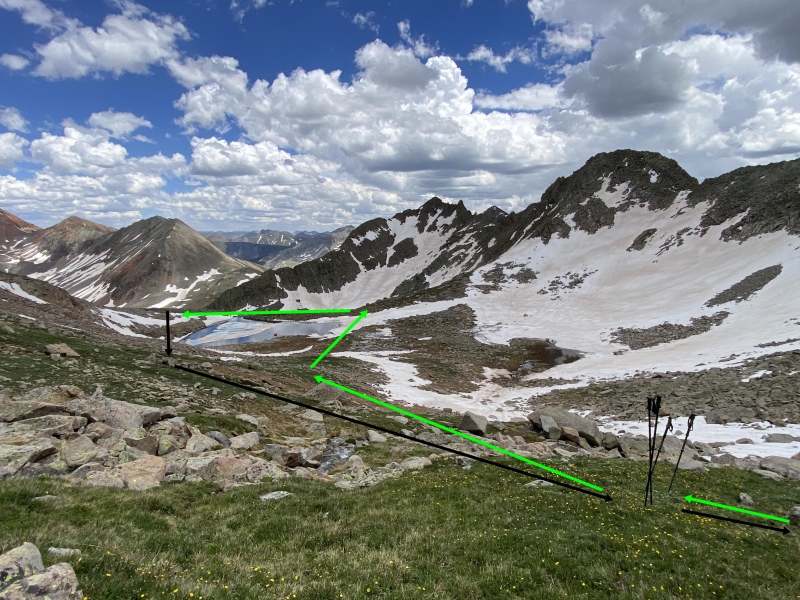
I hope the opportunity presents itself to climb San Miguel Peak again. It really was a five-star adventure. The couloir would be fun, but I don't think I'd want to pass up that scramble! 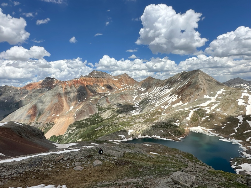
Quick cautionary note for the descent. The snow melt off and kitty litter made the rock slabs of the ledges a little precarious from time to time. Another moment where we wished we had our cramp-ons and could have sailed down the snow. Very doable, but worth mentioning. It was one of those areas where you don't notice the risk going up, but you feel the uneasiness on the return down. Regardless, still a highly recommended hike! Hope you enjoy as much as we did! Thumbnails for uploaded photos (click to open slideshow):  Nice little car camping spot at the lower parking lot")
 Snow bridge on the way up, rock hopped on the way back")
 Brief glimpse of San Miguel")
 Lake Hope")
 Let the scrambling begin!")
 Soaking in the joy!")
 Cliffs to the left, views to the right")
 Looking back down the ridge")
 All smiles from the summit!")
 Descending back down to Lake Hope")
 Same typical route from Lake Hope")
 Upper ledge above Lake Hope")
 Upper basin entrance point")
 Towards the southeast ridge")
 The southeast ridge")
 Alternate route down for funsies")
 One last look back")
|
| Comments or Questions | ||||||
|---|---|---|---|---|---|---|
|
Caution: The information contained in this report may not be accurate and should not be the only resource used in preparation for your climb. Failure to have the necessary experience, physical conditioning, supplies or equipment can result in injury or death. 14ers.com and the author(s) of this report provide no warranties, either express or implied, that the information provided is accurate or reliable. By using the information provided, you agree to indemnify and hold harmless 14ers.com and the report author(s) with respect to any claims and demands against them, including any attorney fees and expenses. Please read the 14ers.com Safety and Disclaimer pages for more information.
Please respect private property: 14ers.com supports the rights of private landowners to determine how and by whom their land will be used. In Colorado, it is your responsibility to determine if land is private and to obtain the appropriate permission before entering the property.


