| Report Type | Full |
| Peak(s) |
Pico de Orizaba, 18,490' |
| Date Posted | 12/21/2024 |
| Date Climbed | 11/29/2024 |
| Author | DanielL |
| Additional Members | Angela Langemann, lauratyree |
| Pico de Orizaba: Star of the Morning |
|---|
|
El Pico de Orizaba, a.k.a. Citlaltépetl (a name meaning "el lucero de la mañana" according to a local), is not a 14er nor a Colorado peak - in fact, it's the tallest mountain in Mexico! However, I thought it worth sharing our experience as I'm grateful to this community for fostering and educating my love of the mountains. I hope this is helpful for anyone planning to climb this beautiful peak in the near future. First, I will share our story and then add some details about the mountain and our experience at altitude. A Thanksgiving AdventureGetting ThereMy sister Angie, my wife Laura, our friend Jenna and I arrived in the town of Tlachichuca on Wednesday and stayed at the Canchola’s hostel. Their operation is somewhat pricy but very dialed-in and covers lodging, supplies such as fuel and climbing gear, transport to and from the trailhead (which requires 4x4 to access), and several experienced guides. We did not need a guide but were grateful for the hospitality and transportation they gave us. After a very early flight from Denver, we enjoyed a great sleep even at the town’s elevation of 8,000’. 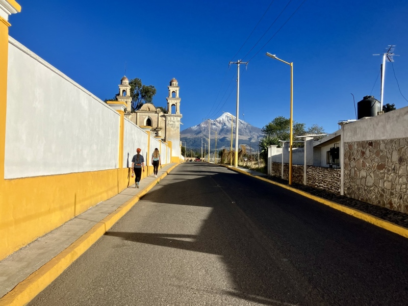
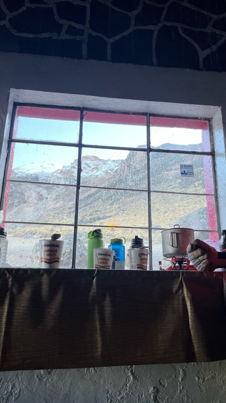
On Thursday morning (happy Thanksgiving!), we enjoyed a delicious breakfast courtesy of Maribel and one of the guides drove us up the rough road to the refugio Piedra Grande. The mountain is in a national park and we had to pay a couple fees - a 110 peso fee that was apparently for road maintenance, and then a park fee that was covered by the Cancholas. The refugio is a small hut at 13,900’ that can accommodate 40-50 people, and there is space for a few tents on the hillside above the hut. 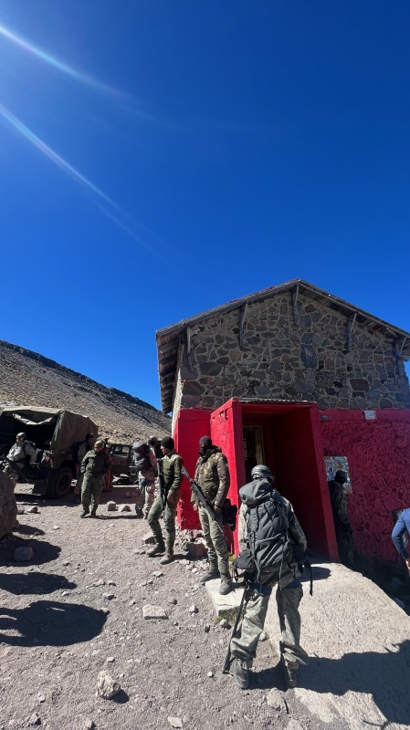
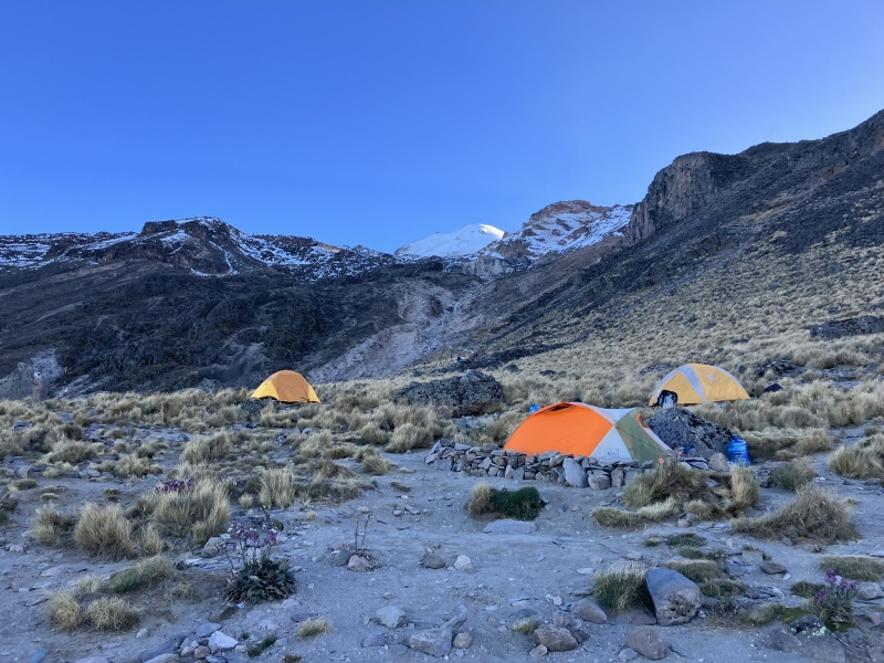
We opted to bring tents, since we'd heard the hut can be noisy or even completely full at times. Our original plan was to consider hauling our overnight gear to a camping spot along the route, and we heard of a few good options between 15-15,600’ referred to as “los nidos”. In the end, we decided to just camp at the base for a few reasons - concerns about sleeping at high altitude without much time to acclimatize, the amount of water we would need to haul, and uncertainty about cold and snow at “los nidos” since we had three-season tents and summer sleeping bags. The Cancholas provided us with two large jugs of water so we could stay hydrated. We found that at least 3-4 litres of water a day was necessary for us, especially as we acclimatised, and some climbers said they consumed closer to 5 litres daily. We were grateful we didn’t need to haul all that up to a higher camp! Instead we prepared our packs with the next day’s load and hiked up to 15.2k to get used to the altitude. We were happy with our pace of 1,000’ vertical/hour and got a look at the Labyrinth, a jumbled section of rock and snow that can confuse climbers in the dark. Satisfied, we returned to base and enjoyed a dinner of ramen noodles, tea, and pasteles at the hut. We turned in around 6:30 that evening but despite feeling warm, we got very little sleep. At that elevation, an elevated heart rate even at rest is hard to get used to without several days of acclimatisation. We only had half a day and half a night before summit day. 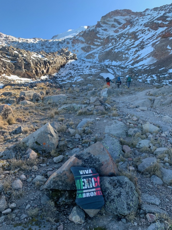
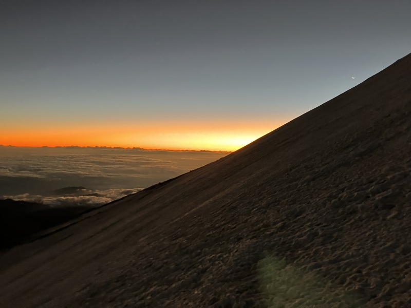
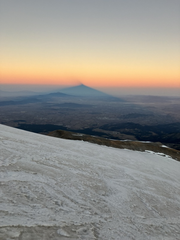
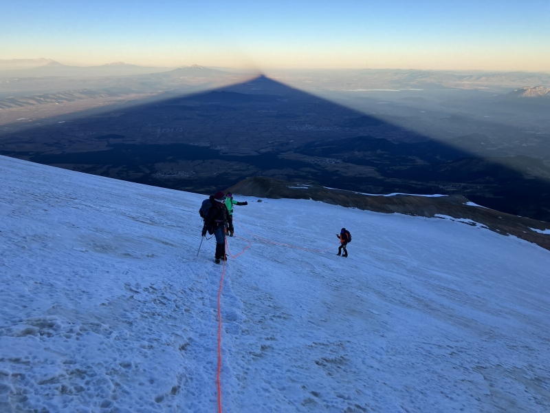
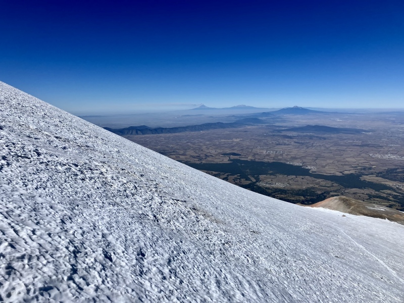
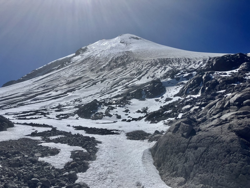
Burn that Turkey, Er, RamenWe were up at midnight and on the move just past 1am. Several other climbers were already ascending the steep path from the refugio to the Labyrinth. At 15.3k, the trail became icy and snow packed and we donned our crampons. Shortly past this, we reached the base of the Labyrinth at 15.6k. We were just over two hours to this point. It took us just over a half-hour to climb the 500’ of traversing ascent through this area. Since we were early in the dry season (Nov-March), the entirety of the Labyrinth was snow covered but previous groups had established an excellent path that made for easy route finding. Above this, the slope angle abated and we turned right to approach the upper mountain. With our sights set on Denali in 2025, we had decided it would be good practice to rope up for glacier travel and move as a team on the upper mountain. At 16.7k (four hours in), we roped up as we were about to step onto the Jamapa glacier. I took the lead and we slowly ascended the upper mountain. Local guides had set an excellent switchbacking path that facilitated our ascent up the 30-40 degree slope. A steady east wind of about 20 mph required all layers on and face covered. It was getting light at this point and we enjoyed a breathtaking view of the sunrise to our left, the conical mountain shadow on the plains to our right, and an end to the nighttime slog. 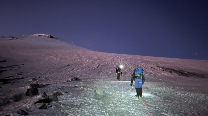

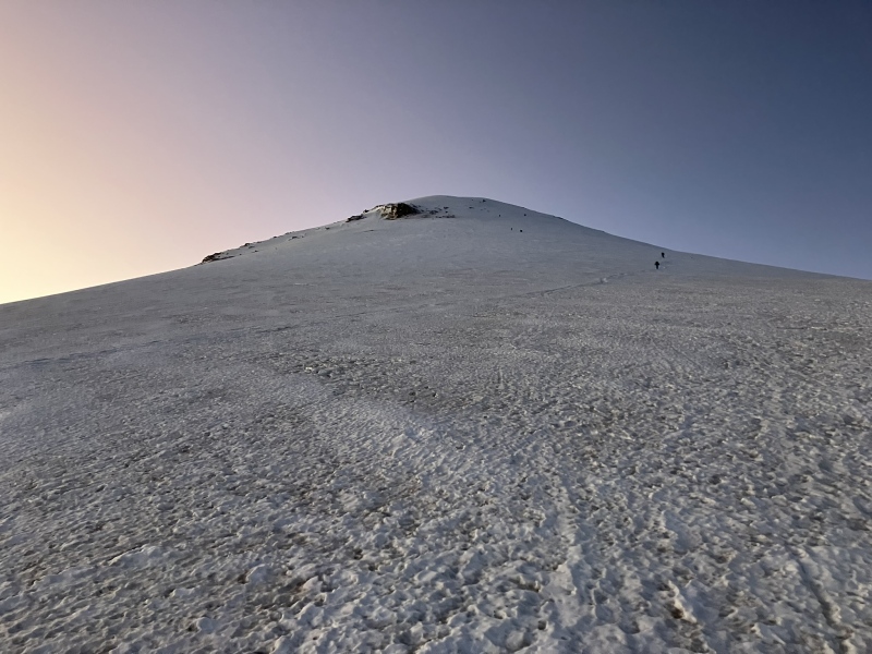
As we neared the crater rim, we continued to slow and one of our group was showing signs of fatigue and discomfort. She mentioned cold feet, low energy, and just "not doing great". We took periodic breaks and steadily pressed on, but my mind was constantly on AMS and whether it was wise to push for the summit or turn around. The two others were getting cold and they needed to move more quickly. I knew we would see sunlight on the crater rim but was unsure if the wind would worsen. Surprisingly, I wasn't struggling much with cold or altitude effects. A group leader must take several factors into consideration. We stopped and radioed often to check in on each other. Everyone wanted to keep going. We pressed on, eventually reaching the crater rim at 18.3k (eight hours in). The contrast was night and day; moments before, we were nearly numb with cold in the morning shadow of the north face. Now we were in minimal wind and intense sunshine. We warmed very quickly! 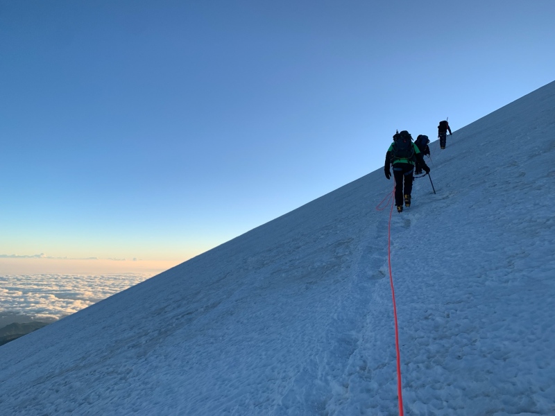
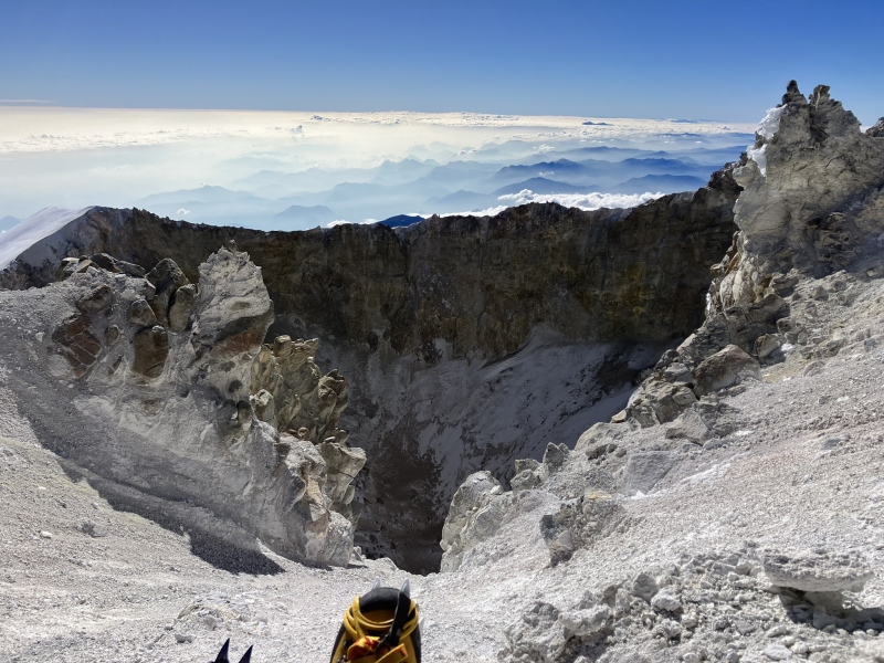
After a few moments of sunshine and warm liquids, everyone was feeling much better. I knew we'd made the right decision to keep going. We stashed the rope and pushed forward for the remaining 15-minute hike up the crater rim. Soon, we were on the summit of Mexico and the third-highest point in North America! 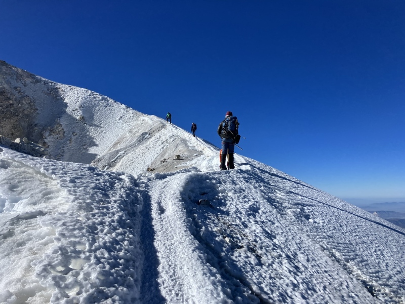
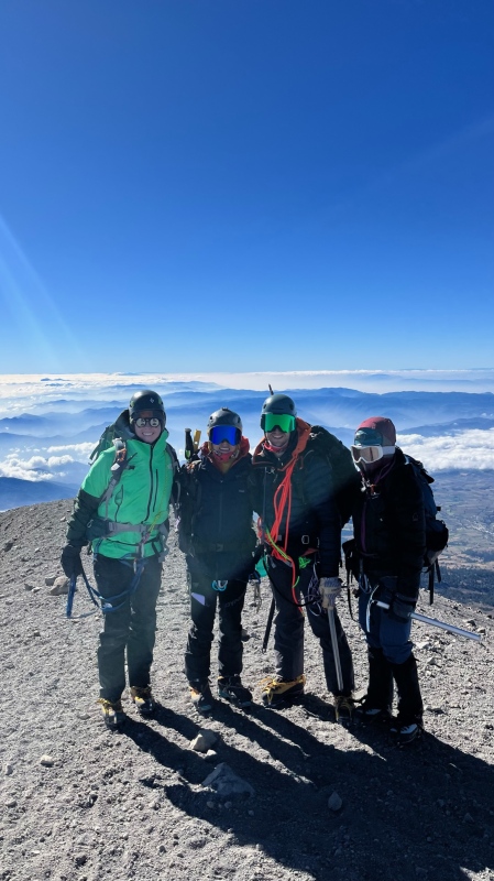
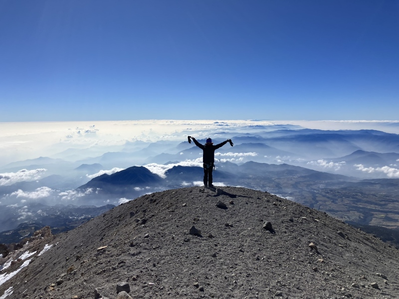
After a few photos and water, we were ready to descend to lower elevation. I chatted on the summit with a couple who'd ascended in just over 3 hours (speedy local climbers!). We descended quickly in the warm morning sun. 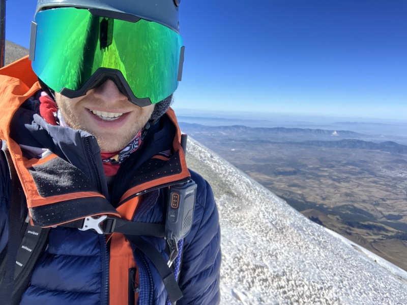
At 16k, I had enough cell signal to message the Cancholas that all was well and we were on schedule. At last our sore feet and tired bodies made it to camp. Our driver was already waiting for us and a few hours later we were enjoying a hot meal. It didn't take us long to go to bed for a long 12-hour sleep. We enjoyed the next day in Mexico City, eating delicious tacos and churros and seeing the sights of the historic city centre. 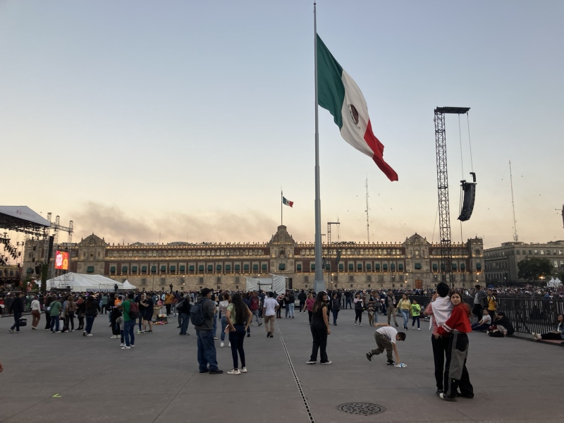
Knee Pain and Summit FeverI've been fortunate over the years in that I've rarely needed to turn around short of a mountain summit. While ambition to reach the mountaintop is admirable, the mindset of "I just have to get to the top" can jeopardise good judgment and care for team members. I have often wrestled with a degree of so-called "summit fever" when climbing 14ers and other Colorado peaks, even though many of these are easily accessible as overnight or single-day trips from town. Interestingly, it has been through an ongoing knee injury that God is helping me overcome this mindset and just enjoy the gift of the mountains. I have sustained an intermittent knee injury over the past few years, and it flared up a few months ago after a bit too much mountain biking one weekend. Any cycling or mountain descent seems to aggravate it. A few recent alpine outings in Colorado had all ended in a shortened itinerary and a sort, hurting knee that made for a slow limping descent. I was discouraged about whether I would need to forfeit a summit attempt of Pico on our trip. While descending Square Top a few weeks ago, I was reminded that activity-limiting injuries happen to mountaineers all the time. In the "worst-case" scenario, I could stay at camp and cheer on my teammates in their summit bid. Their success would be my success. I didn’t want to be a liability high on the mountain my knee were to flare up badly, as this would slow down the group and could present a hazard in poor weather conditions. Rescue efforts are always time-consuming and certainly not always possible. These reflections leading up to our trip helped me to let go of the "need for the summit". It was a privilege to be on the mountain, enduring high altitude challenges, enjoying the Mexican culture, and sharing fellowship with family and friends. After descending on our “recon” hike without much knee pain, I figured it was reasonable to attempt the summit the next day. During the summit push, even as we got to 18k (so close to the summit!) I had none of my usual desperation for the summit. I offered to descend if others were too cold or struggling with altitude. In the end we all reached the summit, but it was just the cherry on top - the adventure was worthwhile regardless. There is risk involved in being on a mountain and we accept that. I am glad we pushed onto the summit instead of turning around (plus getting into the sun was a game changer!). It takes discernment to know what is a red flag versus just discomfort, to make appropriate adjustments, and to just go for it in the right moment. While I made a few mistakes along the way, I was grateful to not worry about making the summit and to instead focus on pacing our group, looking out for crevasse hazard (minimal this time of year), staying en route, and interacting with other teams. I hope this will prove valuable with future endeavours such as Denali in the near future. Fortunately, I experienced minimal knee pain on the upper mountain descent, though I was hobbling on the lower half to the base. Use of a knee brace and some disciplined strength training prior to this climb were definitely worthwhile! Misc InformationThe glacier: it has been receding over the years and currently goes from about 16.9k to the crater rim on the north face of the mountain. November is the start of the "dry" season, and as such there is more snow than in subsequent months. However, this may be the safest time to ascend as crevasses are few and small, and the snow is still somewhat “fresh” and less iced out. A local guide explained that by February, crevasses have widened and there can be hard ice that crampons might not penetrate. After March, black ice ("hielo negro") forms to the degree that protection becomes necessary for most climbers to travel safely on the glacier. I saw one small crevasse, about an inch thick, and a couple cracks in the snow but that was all. All the same, I’m glad we roped up as it was good practice for future glacier travel. Earthquakes: we learned these are common in the area, though generally very small. We experienced a mild earthquake on Thursday, but it was too weak for us to notice beyond some rockfall off a cliff band while on our acclimatising hike. Bigger earthquakes are possible and may require self-arrest if on the glacier to avoid falling. If it happens, don't worry - you're not hallucinating! Altitude: the standard Jamapa Glacier route starts at 13.9k and ascends to 18.5k, so altitude is obviously a challenge of this climb for the average Colorado hiker. We found it difficult to sleep at 14k and I was regularly thirsty. Within our group, team members experienced low energy, loss of appetite, mild nausea, and dehydration during the summit attempt. I felt okay with 2.5 litres of liquids during the morning, but at least 3 would have been better. Several climbers we met said they spent multiple days acclimatising at the base before they summit. Coming from Denver, we had an advantage over most international climbers and we were on a tight schedule with 1 night at 8k, half a night at 14k, then summit day. I think 1-2 more days to acclimatise would have helped team members who felt stomach sickness. Each person's body is unique and no matter how physically fit, it’s hard to know how each of us will adapt to high altitude. It is essential to hydrate before, during the ascent and during the descent as well. Drinking 4-5 litres per day would not be excessive. Camping: there are a few places to pitch a tent on the hillside above the Refugio. We made note of three sites below the Labyrinth ("los nidos") between 15k and 15.6k, which all turned out to be dry and would be suitable for three-season tents. Each site is somewhat exposed to wind, though low rock walls have been built to provide some shelter. There could be a small risk of rockfall at the two lower sites, though we talked to one pair of climbers who camped at the first site near 15k and they didn't have any issues. The third of "los nidos" at 15.6k is right at the base of the Labyrinth. Above the Labyrinth, local guides mentioned a high camp is possible near the base of the glacier; this would be a long haul with all the water to carry, but has been used on occasion. Wind/cold and gear: it was windy nearly the entire ascent. I think the topography makes a big difference - less irregular gusts and more steady wind, perhaps coming off the gulf to the east. It was constantly breezy at the refugio and carried a lot of dust that irritated my eyes. Up high on the mountain, the wind was likely no higher than 20mph but got quite cold. The Mountain Forecast prediction of 5mph winds and 25 degree conditions seemed inaccurate; I’m not sure how cold it was but with wind chill and our slow pace, the cold was a challenge. Lesson learned - always have hard shells and a down layer handy. As far as gear, I wore La Sportiva Nepal boots with thick wool socks and had intermittent cold toes. I had considered bringing double boots, but appreciated the lighter weight of the Nepals given my knee troubles. I wore Kinco gloves, which are low-cost and work amazingly well in mild CO winter conditions. That said, I found whichever hand held the axe would get cold; I had heavier-weight mittens in the pack and would have been wise to throw these on. I wore softshell and hardshell pants, and five layers on upper body to keep my core adequately warm during the ascent (base wool layer, fleece, synthetic hoody, hardshell jacket, 800 FP down jacket). Several climbers were wearing a heavier down parka. Thumbnails for uploaded photos (click to open slideshow):  Our objective from the town of Tlachichuca")
 Below the Labyrinth on our warm-up hike")
 Base camp")
 At the Refugio Piedra Grande. Mexican military like to train in this area.")
 The sun never felt better!")
 Slow and steady...")
")
 A remarkable sight")
 On the upper mountain")
")
 The long-awaited dawn arrives")
 Approaching the Jamapa glacier")
 Free concert in Mexico City!")
")
 Mexican volcanoes in the distance")
 Magical clouds")
 Along the crater rim")
 Living the dream at 18k")
 Our Thanksgiving Ramen feast!!")
 On the summit!")
|
| Comments or Questions | |||||||||
|---|---|---|---|---|---|---|---|---|---|
|
Caution: The information contained in this report may not be accurate and should not be the only resource used in preparation for your climb. Failure to have the necessary experience, physical conditioning, supplies or equipment can result in injury or death. 14ers.com and the author(s) of this report provide no warranties, either express or implied, that the information provided is accurate or reliable. By using the information provided, you agree to indemnify and hold harmless 14ers.com and the report author(s) with respect to any claims and demands against them, including any attorney fees and expenses. Please read the 14ers.com Safety and Disclaimer pages for more information.
Please respect private property: 14ers.com supports the rights of private landowners to determine how and by whom their land will be used. In Colorado, it is your responsibility to determine if land is private and to obtain the appropriate permission before entering the property.


