| Report Type | Full |
| Peak(s) |
Mt. Democrat - 14,154 feet Mt. Cameron - 14,248 feet Mt. Bross - 14,178 feet Mt. Lincoln - 14,293 feet |
| Date Posted | 12/05/2024 |
| Date Climbed | 10/14/2024 |
| Author | 123tqb |
| New to Summit County |
|---|
|
New to Summit County
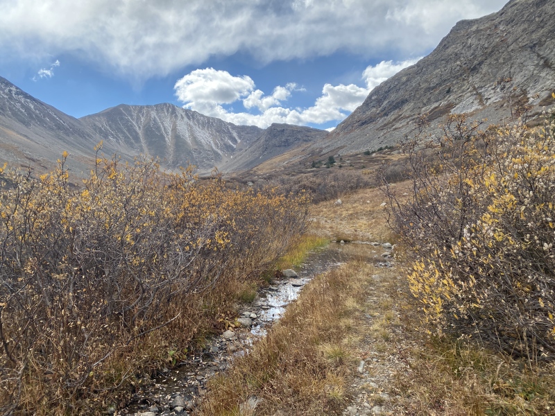
Going back through my photos from 2024, I just realized that I had never written up a report for this outing. I had recently moved to Summit County and was more or less unemployed at the time, and didn't have the chance to find partners for the day. I'd had Mt. Democrat's North Ridge on my radar for a few years, after flipping through Gerry Roach's Colorado's Fourteeners guide. Class 3 is great! I started at 13:00 after getting some errands done for the day, with a fairly promising weather outlook for the afternoon. I'd already done the Lincoln Amphitheater route on my birthday in late November a few years back, and misremembering it I figured it'd be the easiest way back to the car at the end of the day (spoilers: that route is loose and sucks). I parked at the Montgomery Reservoir, which was now conveniently only a 45 min drive from my new place. Since it was late in the year and would be getting dark in just a few short hours, I opted to trail run (ish) the road up into the Wheeler basin. You can get a good idea of what the route is going to look like on the approach, as well as dream about skiing big spring lines off Democrat's north face. 
Getting well up into Wheeler basin now, I found an old mining road that conveniently angles right towards the North Ridge. It was faint, but not too hard to follow. The only part of my plan that could backfire was that it appeared a snowstorm was moving in. I religiously checked the weather forecast for my location, and it appeared the snow would only last for a few minutes. Anyways, it looked like all the clouds were gathering over me and Lincoln, and were avoiding Democrat in its entirety. 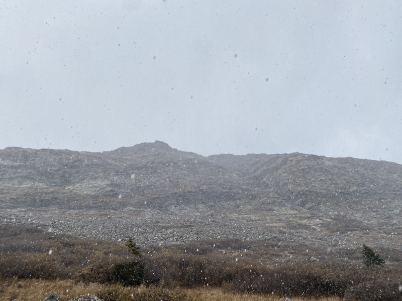
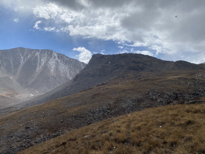
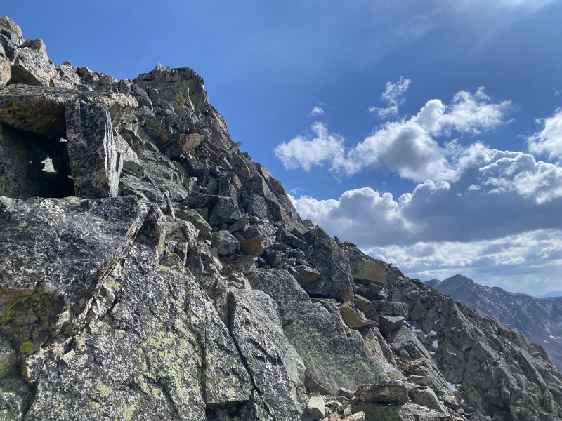
Once I reached the end of the mining road I took a straight line up to the start of the ridge. I was relieved that the snow was slowing down, but still mentally prepared for the fact that I may have to turn around. The worst case scenario in my mind was blasting through the Class 3 portion of the ridge and descending into the Kite Lakes drainage if it really got too bad. I continued up the ridge on easy Class 2 terrain for the time being. I still made quick work of the ridge, knowing that I was on a time crunch before dark. Again, the very worst case was that I'd be on the upper mountain after dark, and I could easily navigate known-to-me terrain with the help of a headlamp, if necessary. I reached Pt. 13,460' eventually, ready to start on some fun Class 3. Now fully in the sunlight with no scary clouds to the west, I was feeling more confident about continuing up. 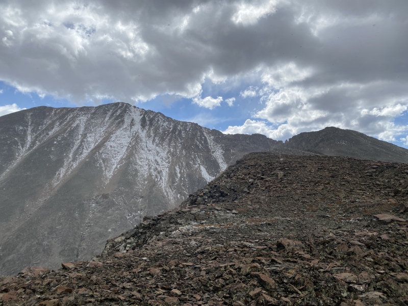
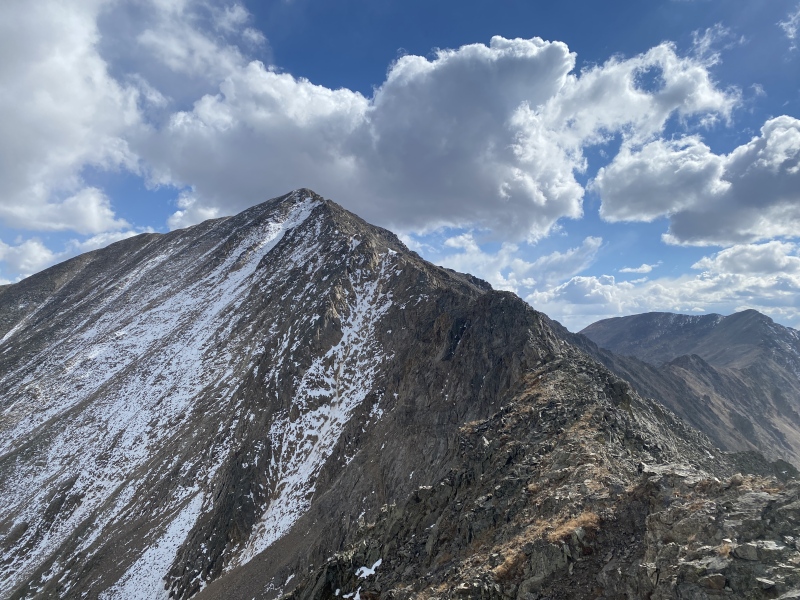
I was exciting to get in some scrambling now. The crux lasted for a good bit of the ridge, with some exposed downclimbs into notches and a few easy climbs up steep pitches. I was on Class 3 terrain for maybe 20 minutes in total, but it was worth it. The scrambling was super fun and exposed in parts. Now all I had left was the slog up to the summit. 
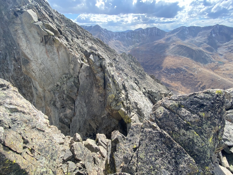
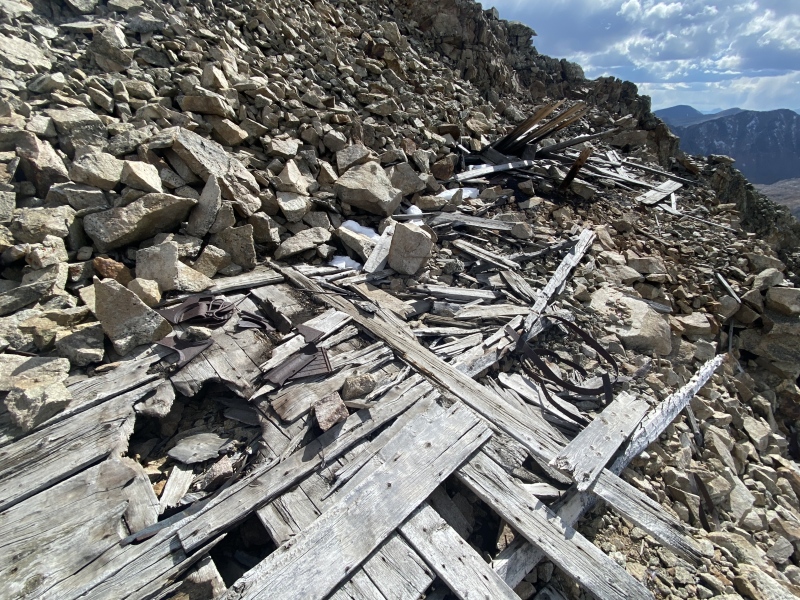
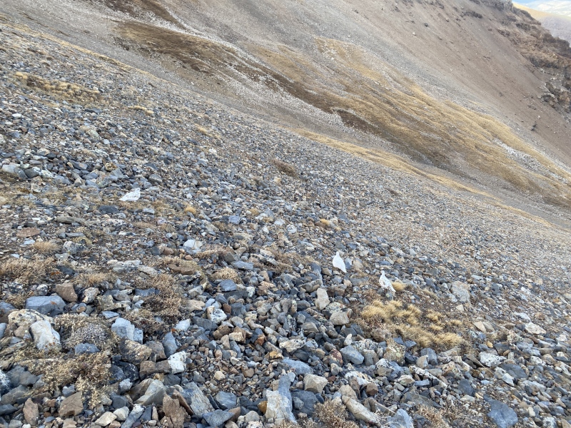
There wasn't a trail up to the summit, I figure this route doesn't see all that much traffic. I did pass some old mining ruins, but otherwise it was just an ascent up somewhat loose talus. I reached the summit at 15:00. 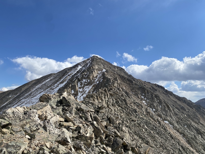
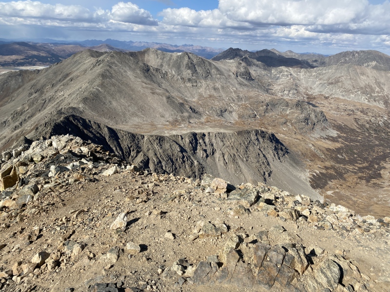
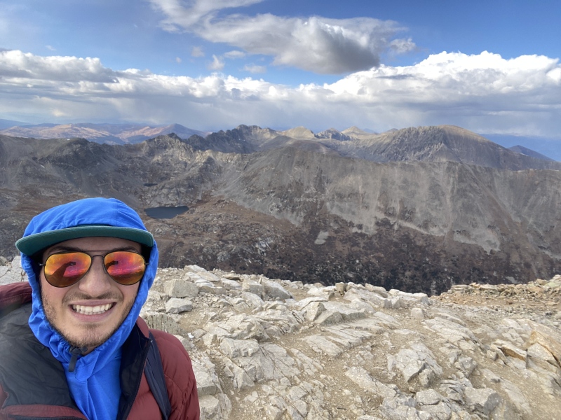
There was only one other party on the summit, and they had come from Kite Lake. I asked, and it seemed like I'd be the only one continuing on to the rest of the group. I did a bit of jogging down to the Democrat-Cameron saddle, then continued up with tired legs. I had already summitted Cameron before, same with Lincoln, but never Bross. Of course, I didn't summit it, because that would be illegal trespassing and I never do things like that. Or at least, I'd never publicly post about something of that nature. I didn't take very many photos of the route from here—at least until the descent off Lincoln—because the trail is fairly obvious. I reached the summit of Lincoln at about 16:15. Now to get back to the car. To descend Lincoln Amphitheater, you head down east, crossing several mining roads as you head down the drainage. It's incredibly loose and annoying, but at least I saw some ptarmigans on my way. 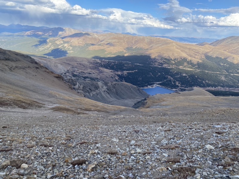
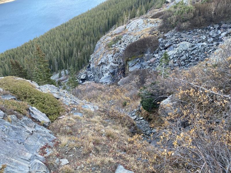
Once on the rock glacier, aim for the skier's left side of the drainage. You'll come up to the moraine, and you want to go as far left here as you can to find the approach trail for the ice climbs. It's all steep and annoying, the whole way down. Eventually, you'll make it back into the forest, where you can follow a climber's trail back to the trailhead. I was back at the car by 17:30, with a good bit of trail running to help my day go faster. 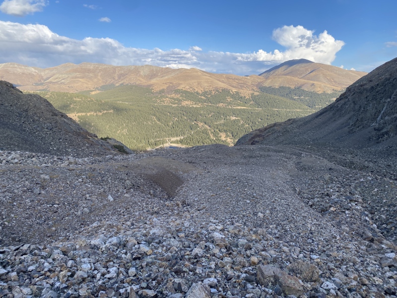
Thumbnails for uploaded photos (click to open slideshow): ")
")
")
")
")
")
")
")
")
")
")
")
")
")
")
")
")
")
")
")
")
")
")
")
")
|
| Comments or Questions | |||
|---|---|---|---|
|
Caution: The information contained in this report may not be accurate and should not be the only resource used in preparation for your climb. Failure to have the necessary experience, physical conditioning, supplies or equipment can result in injury or death. 14ers.com and the author(s) of this report provide no warranties, either express or implied, that the information provided is accurate or reliable. By using the information provided, you agree to indemnify and hold harmless 14ers.com and the report author(s) with respect to any claims and demands against them, including any attorney fees and expenses. Please read the 14ers.com Safety and Disclaimer pages for more information.
Please respect private property: 14ers.com supports the rights of private landowners to determine how and by whom their land will be used. In Colorado, it is your responsibility to determine if land is private and to obtain the appropriate permission before entering the property.


