| Report Type | Full |
| Peak(s) |
Mt. Rainier (14,411') Colchuck Peak (8,705') Dragontail Peak (8,860') Colonial Peak (7,771') Camp Muir (10,000') Alki Beach (0') |
| Date Posted | 11/09/2024 |
| Date Climbed | 08/01/2024 |
| Author | jfm3 |
| Washington Cascades Mini Camp |
|---|
|
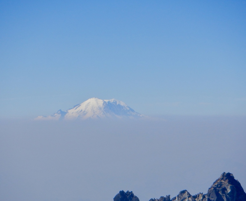
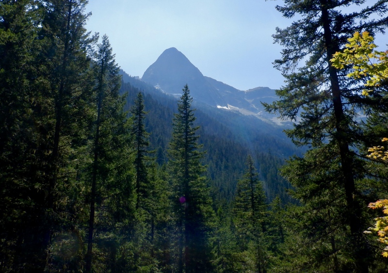
Washington Cascades Mini Camp July 31 - August 5, 2024 After last year's 2-week mega tour in Chamonix and Switzerland, I went shorter and closer to home for this year's summer mountain trip. I've wanted to go to the Cascades in Washington for several years. The glaciated volcanoes, rugged shorter peaks and easy accessibility made this range a good choice. 2 of my cousins live in Seattle and one of my good friends has lived in Twisp for several years, so I had several local sources of information about routes, conditions and logistics. July 31 I flew from Denver to Seattle, then rented a car and drove from Seattle to Wenatchee via I-405, I-90 and US-97. The plane passed close to Mt. Rainier on the way in, and I saw the summit at nearly eye level for a few moments. The glaciers gleamed in the sun and small clouds clung to the summit cone. I also saw Colchuck Peak and Dragontail Peak, tomorrow's objectives, out the other side of the plane. I got another quick view of Rainier on the drive near Issaquah. The mountains gradually gave way to rolling prairie hills and HEAT. It was 97 degrees in Wenatchee at 6 PM, down from over 100 earlier in the day. The big hills to the east of the city are completely devoid of trees. I can't imagine being up there in the middle of the day when it's that hot. I stayed in a very basic room at the Travelodge and walked down the street to Sweetwood BBQ for dinner, where I ate an immense beef brisket sandwich and several enormous pieces of cornbread to fuel up for tomorrow. August 1 Colchuck Peak + Dragontail Peak Attempt: https://www.strava.com/activities/12040864028 Colchuck Peak and Dragontail Peak are 2 8,700' mountains on the west side of the Enchantments Range near Leavenworth. The two peaks are accessible from the Enchantments Traverse (https://www.trailrunproject.com/trail/7005246/enchantments-traverse), a mega-popular route that goes through the center of the Enchantments. The route is roughly equivalent to the Four Pass Loop in that it can be run/hiked in a single day or done as a 1 or 2-night backpacking excursion. Because of the popularity, overnight travel requires a permit that is apparently very difficult to get (https://www.fs.usda.gov/detail/okawen/passes-permits/recreation/?cid=fsbdev3_053607). Single-day use doesn't require a permit, but the usual day use difficulties of small parking lots that fill up quickly and getting from the finish back to the start do still exist. A trip report on this website earlier this summer detailed an excellent snow climb of both of these mountains. My focus for this trip was mountaineering and reaching summits, not trail/mountain running, so I thought these 2 peaks fit my objectives. In addition to the very informative trip report, I also used the Washington Trails Association website (https://www.wta.org/) as a planning resource for the trip. 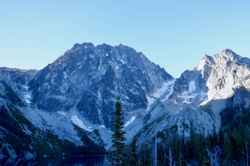
This climb was as hard as the advanced 14ers and I didn’t even get Dragontail. Definitely a tough introduction to an entirely new mountain range. I left Wenatchee just after 4 AM and the sky in the east was already in pre-dawn twilight. It was still 80 degrees, on the way to a high of 102. I can’t comprehend these temperatures deep in the mountains- Colorado is never like this. It took about an hour to get to the trailhead. The Swiss-style buildings in Leavenworth reminded me of Midway, Utah, where I have traveled many times for cross-country ski races at Soldier Hollow, the 2002 (and 2034!) Winter Olympic venue. To really get the authentic Swiss style the buildings have to be in a field with cows and huge peaks directly above. The road beyond Leavenworth was paved, then bumpy dirt, and there was plenty of parking in the day use area. Several shuttle vans dropped people off and there were many more groups gearing up. I loaded the pack and set off, excited for the day. The approach to Colchuck Lake was slower than I expected. The trail was fairly flat for the first several miles and the dirt was often interrupted with rocks and roots. My heart rate was very low but I guess even at low elevation a 25 pound pack with snow climbing gear slows me down. I did pass several groups, and got passed by a few runners. I was barely comfortable in light pants and a light longsleeve- it was already warm even in the shade. Colchuck and Dragontail loomed overhead as I reached the lake. Both Aasgard Pass and Colchuck Glacier looked especially tall and imposing, rising almost as high as Dragontail itself. The traverse around the lake was tedious, with many small rollers and a wending path. I followed the cairns through some of the larger boulders on the south shore, then turned upward to climb the steep slope to the glacier. 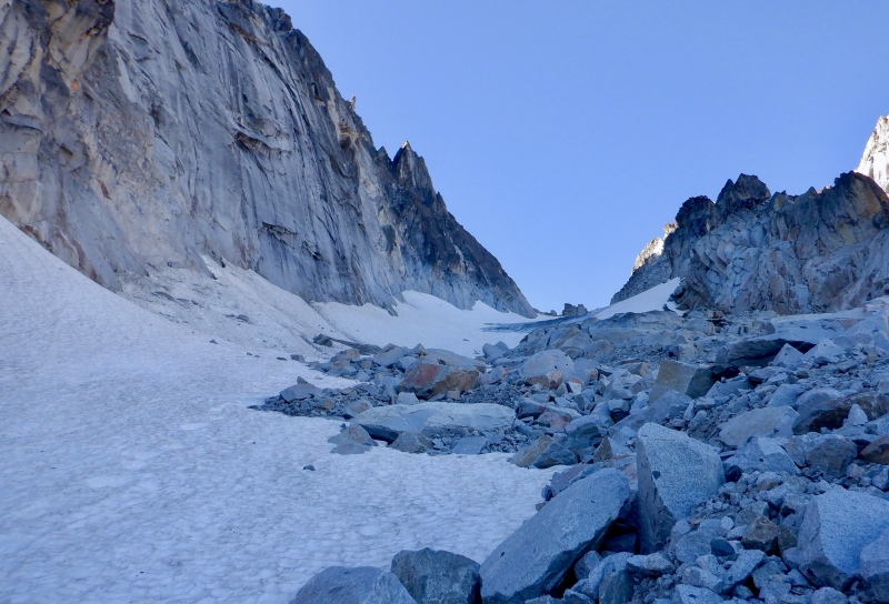

Moraines are miserable. It’s amazing that so much dirt and rock can actually be so loose, with every step dislodging something. This wasn’t the worst moraine I’ve ever encountered (that would have to be the bottom of Gorner Glacier in Zermatt) but it was very steep. I’m sure it’s much easier to climb in June when the snow extends down to the lake. I followed a faint path through some talus, then had to make my own way through larger boulders and thick willows. I kept the creek on the left, then eventually ascended right next to the water. I found a route without too much thrashing and eventually cleared the willows. The sun was still behind Aasgard Pass and there was a light breeze so I was comfortable. There was some loose rock near the top of the slope. I gained the bottom of the big ridge next to a waterfall, taking a few steps in the sun before moving back into the shade. The ridge ascent to the glacier was quite steep. There was a path through all the rock and dust but it was loose and tedious. The north face of Dragontail towered overhead. The glacier didn’t look quite as steep as I got closer but it appeared boots and 2 axes were still appropriate gear. I took a long break at the edge of the snow to put on all the climbing gear and check the map. I didn’t hear any rockfall off Dragontail but I did hear 2 voices echoing from somewhere above, climbing the face. 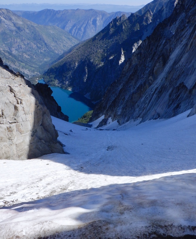
The glacier ascent was fun. The snow was steep but not intimidating and the whole climb was in the shade, providing an excellent surface for the crampons and axes. I aimed for the middle, then traversed east to climb around a section of thin water ice. Flowing water was audible underneath and some rocks stuck out. The crampons crunched nicely on the snow/ice mix. I did keep one eye open for rockfall but I didn’t see or hear anything come down. The snow got steeper near the top and I used a few low dagger swings to ascend the very top below Banshee Pass. I could see Mt. Baker and Glacier Peak to the north and the view down to Colchuck Lake was very impressive. The summits of Colchuck and Dragontail were still lost in all the crags above but I knew there wasn’t much vert left. I took off the crampons and ice axes and put on lighter layers, as it was much warmer in the sun. A few steps up the loose dirt and I was on the pass. 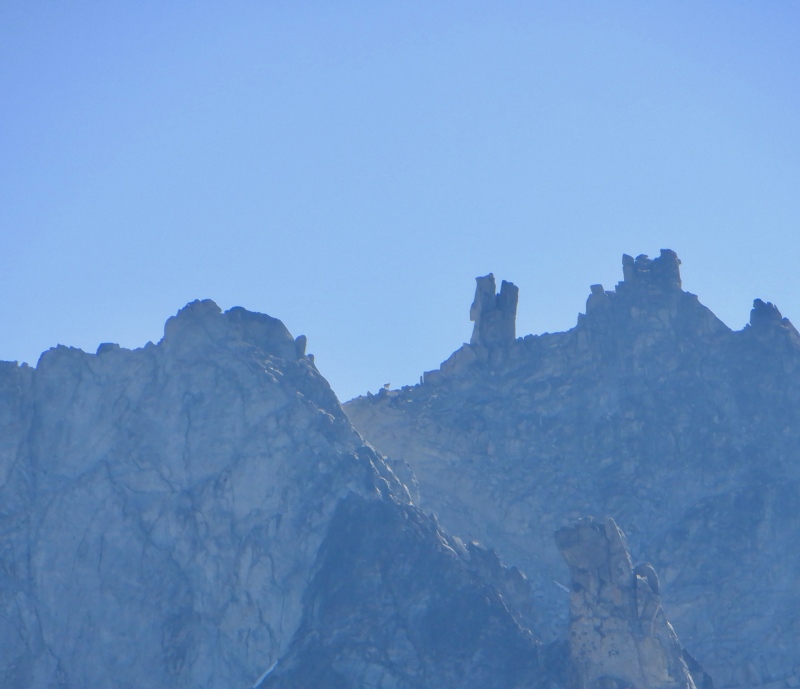
I was expecting a sweeping vista all the way to Oregon but instead I was met with a very thick wall of smoke to the south. The upper summit cone of Rainier was visible but everything below that was covered in a deep brown haze. There was no snow at all on either Dragontail or Colchuck. I knew Colchuck was the easier summit so I turned west and started up. I should have taken the boots off and gone with shoes instead. The terrain was a mix of sand and slabby rock that was occasionally loose. There wasn’t a trail and I couldn’t find any cairns so I stayed close to the north cliffs and found the easiest way up. I looked over at Dragontail and saw a lone mountain goat standing on a block near the summit, acting as a sentry on the mountain. 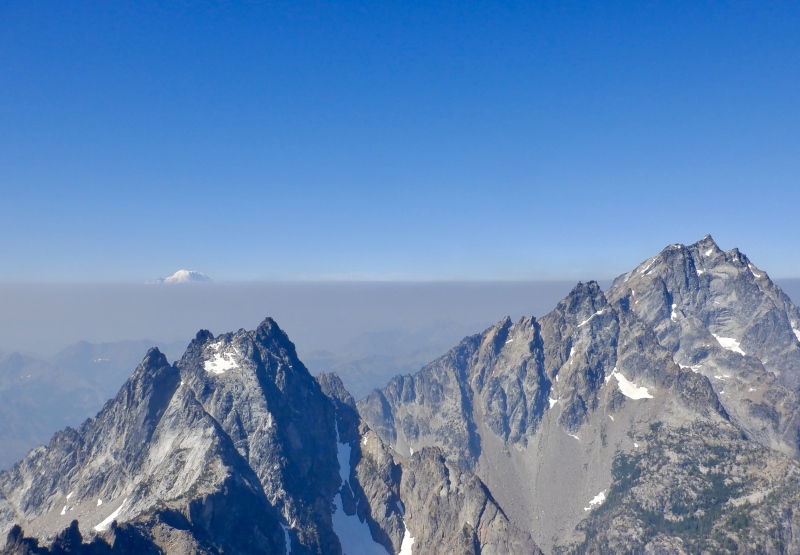
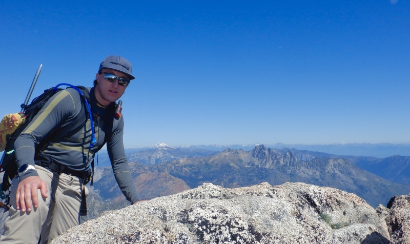
After 500’ the hill flattened considerably and it was a slow walk to the summit block. From this higher vantage point I could just make out the summit of Adams above the smoke. I carefully climbed up the east side of the summit block and found a solid perch next to huge exposure off the west side. Mt. Baker and Glacier Peak were visible to the north. Colchuck Lake glittered far below and Dragontail was at eye level. The steep, serrated ridges of Argonaut and Stuart split the sky to the west. I scanned the whole horizon with the binoculars, ate and tried to fend off the swarming bugs. I hunkered down when looking to the north and west. I get mild vertigo when looking through the binoculars while I’m close to exposed terrain. 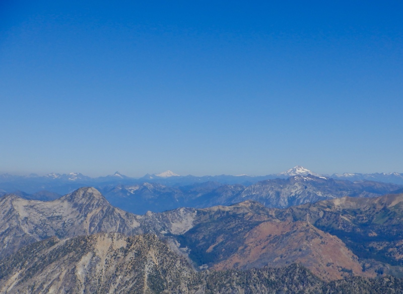
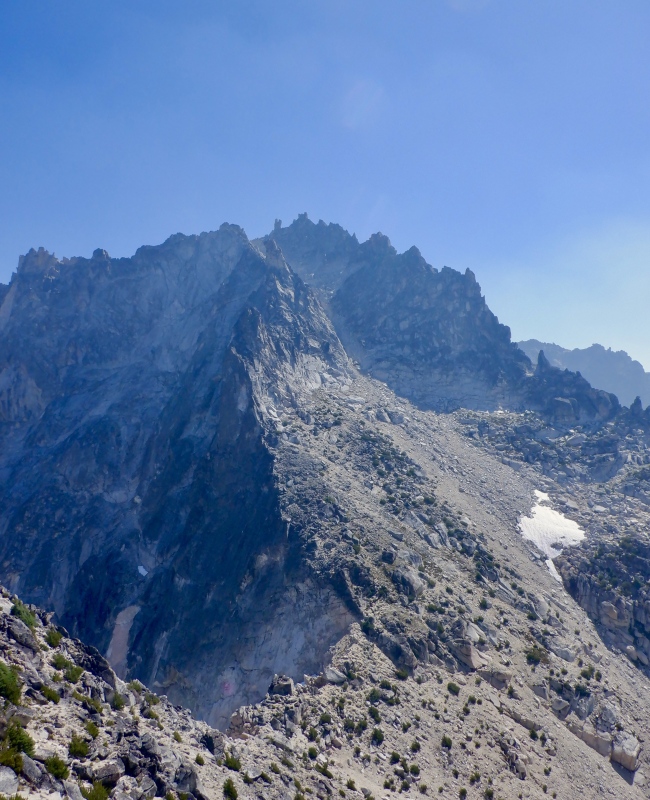
I looked over to Dragontail and considered the rest of the route. There was absolutely no snow in Pandora’s Box Couloir. I’d have to climb the whole thing with the snow gear on my back, then traverse across the south side of the mountain to the summit. The couloir looked to be fairly steep moraine chunder, and it would surely be a slow, difficult slog. I’d then have to switch back to snow gear to descend the glacier on the east side to Aasgard Pass, then deal with the huge descent back to Colchuck Lake, also on loose terrain. I still had a 2.5 hour drive to Seattle once I got back to the car. Time didn’t seem to be on my side. It was also hot. The forecast was for 65 degrees at the summits and it felt even warmer. Surely the snow on Dragontail would be in rough shape, since it had already been roasting in the sun for 4 hours. I decided I would likely skip Dragontail and just descend Colchuck Glacier back to the lake. 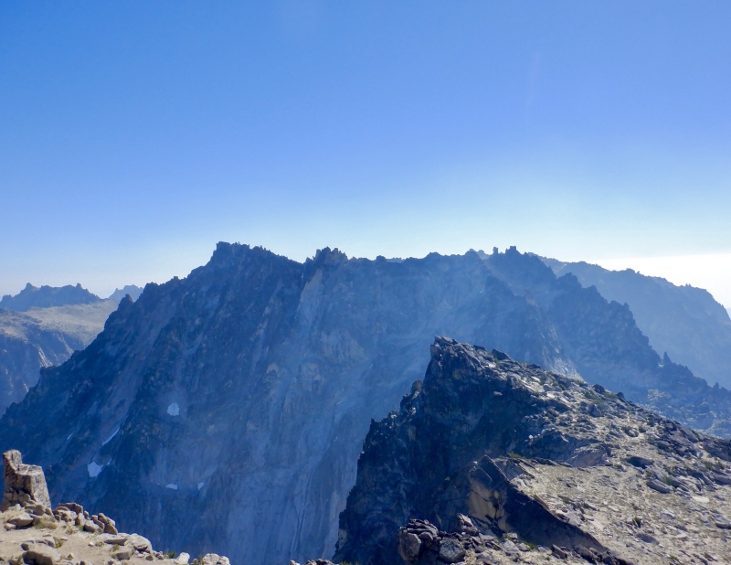
The descent back to Banshee Pass was slow. I really should have switched back to shoes. I drifted too far south on the steep part of the slope and ended up in some rock that was too smooth to downclimb in boots, so I had to go back up a ways and stay closer to the north side. It was tedious and hot. I got back to the pass and gave no thought to Dragontail. The conditions and time of day just weren’t right. August is too late to do this as a mountaineering route. I need to be up here in early June, when all the moraine crap is covered in a much easier surface. I also need to start in the dark, which wasn’t really possible today with the long travel day yesterday. At least I got one summit. I’ll be back eventually for Dragontail. I put on the crampons and ice axes and stepped onto the glacier. I faced in for the steep upper section, then faced out and side-stepped down to the water ice. The east side was still shaded under Dragontail’s huge wall so the snow was still firm. I faced in again to get through the middle section, then cautiously plunge-stepped down to the moraine. I took a long break at the edge of the snow to change to summer layers and pack up all the climbing gear. This climb is another confirmation that I should get a pair of Aequlibriums. The full boots were overkill for this route, but shoes and light crampons alone probably would have been too slick on the glacier. The hybrid boots will be a key piece of gear for next summer. 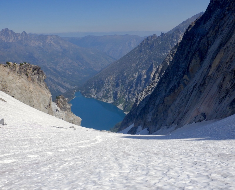
The 1,200’ descent down the moraine to the lake was fucking brutal: long, steep and roasting hot. The backs of my hands were sweating, which only happens when the temperature is in the ‘uncomfortably hot’ range. I hiked very cautiously down the ridge, slipping often on the scree and small rocks. I felt slightly unbalanced with the heavy pack and descended facing in many times. The slope on either side of the ridge was surprisingly steep and I didn’t want to fall over if I lost my footing. The descent down the lower talus and willows was endless. I did not pick a good line and I had to backtrack often, trying to find a safe way through class 4 wet rock and death willows. It was so tedious. I was able to cool off in the water but the lake never seemed to get closer and it was such a struggle to find solid footing. It took me well over an hour to go from the glacier to the lake. I finally stumbled onto the trail and went right to the water. I took off my pack and did a full submersion. The water was pleasantly cool and very refreshing after roasting on the rock. Aasgard Pass looked very tall and very difficult. 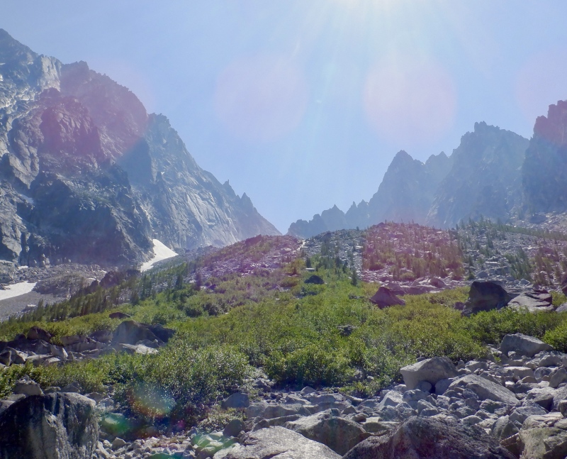
The hike from the lake back to the car was long and hot, and veered into deathmarch territory a few times. It was well over 80 degrees and even the big trees below the lake didn’t do much to cool down the air. There were many ravenous, biting bugs flying around all over the place. They left me alone while I was moving but any time I stopped they swarmed. There must be some sort of ancient instinctual response to insects flying near one’s face because several times I almost lost my shit as buzzing things darted in close. I had to stop to refill water in one of the creeks and it was a very unpleasant 3 minutes as I struggled to get the camel back into the full pack while also slapping every inch of exposed skin as bugs tried to eat me. I hiked steadily but the usual descent complaints bounced around in my head: the pack was too heavy, the trail seemed way shorter on the way up, it was too hot…..eventually I got to the parking lot. That was a long, tough day for just one summit but the views from the top were great. 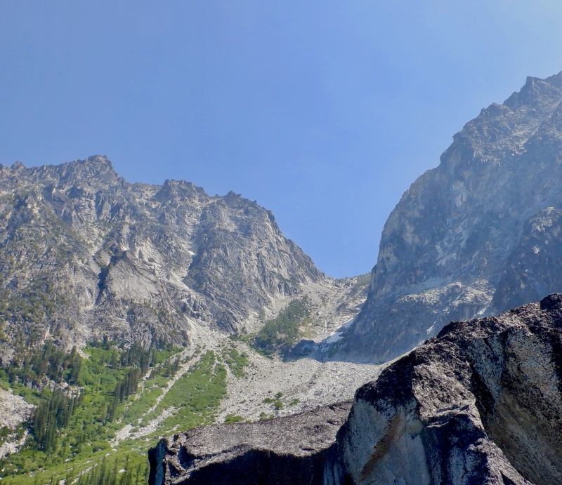
I did a cursory packing job in a surprisingly insect-free parking lot, then followed a line of cars down the road. It was 97 degrees in Leavenworth. I stopped at HeidleBurger for fried chicken and a chocolate shake. The drive to Seattle took about 2.5 hours via US-2 and I-405. The sky was tinted orange with smoke the whole way. There wasn't much traffic and the forested mountains loomed above the highway the whole way. Stevens Pass was a big descent but otherwise it was hard to tell that I was several thousand feet above sea level. I stayed with my cousins in Seattle the rest of the trip. Their apartment is just up the hill to the southeast of the Mariners stadium, with excellent views of the Olympic Range and distant views of Rainier. It was great to sleep in blasting AC after such a hot day. August 2 Instead of the mountains, I went to Alki Beach on the west side of Seattle. I spent a few hours reading and dunking in the 56 degree water. It was cold, but not frigid. This was the first time I've been in the Pacific Ocean (or, at least, a somewhat inland extension of it). 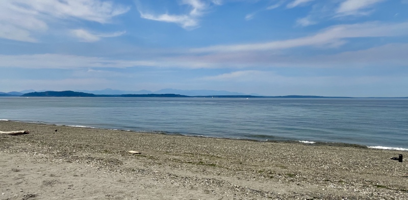
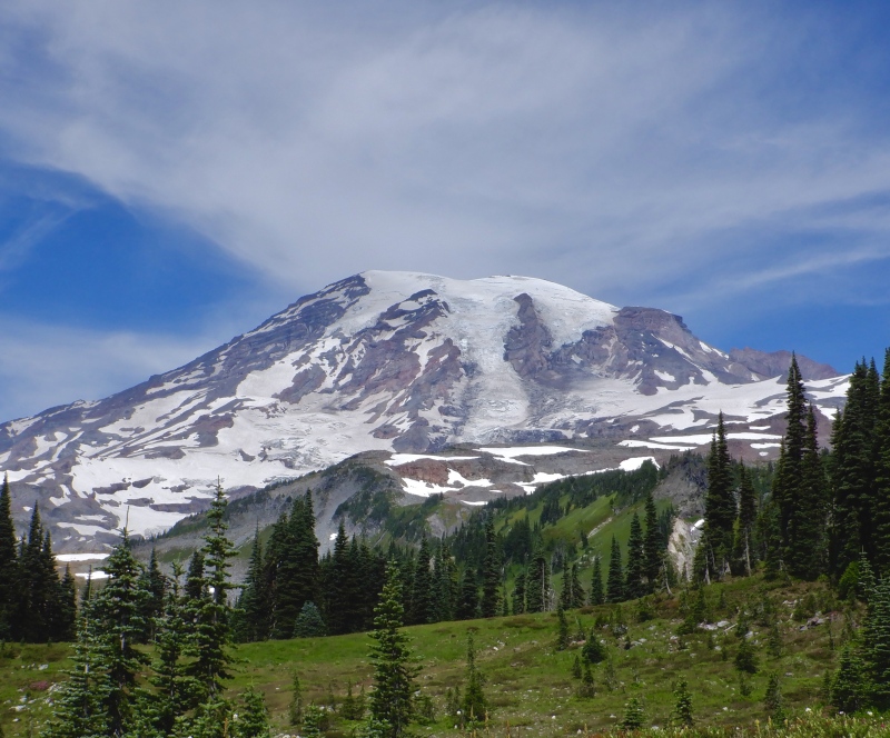
August 3 Mt. Rainier Camp Muir: https://www.strava.com/activities/12056613215 The second mountain outing of the trip was a mountain run to Camp Muir on Mt. Rainier. Climbing above 10,000' on the mountain requires a permit (logistics: https://www.nps.gov/mora/planyourvisit/climbing.htm conditions: http://mountrainierclimbing.blogspot.com/?m=1) but all travel below that elevation doesn't require any special access. Camp Muir, at 10,000', is the halfway point of the Disappointment Cleaver route on the south/southeast side of the mountain. The route follows any of the multiple trails from the Paradise parking lot up to Pebble Creek, then goes up the Muir Snowfield. The snowfield is low-angle and I was very comfortable using running shoes and strap-on crampons. I carried a short ice axe but didn't really need it. The crux of the day was driving to the parking lot at Paradise. Mt. Rainier National Park requires vehicle reservations after 7 AM (https://www.nps.gov/mora/index.htm) for the southern road through the park. The roads on the north side of the park are much less traveled and do not require a vehicle reservation. All reservations were sold months before I even planned the trip, so I had to get to the park and through the entrance gate before 7 AM. The park is ~2 hours of driving from Seattle, so it was a very early morning. This was a simple route but it was really fun- it reminded me of being in the Alps. I got gas in Tacoma and followed the narrow roads through the forest to the national park. Rainier was visible from 60 miles away, looming above the horizon. It was hard to appreciate the vertical scale because there is nothing else around it. The sky around Rainier was clear despite low clouds in the trees. There was a line of traffic at the park entrance, trying to beat the vehicle reservation time. I got through without a problem and followed the traffic up the road to Paradise. The roads in national parks always seem way longer than they actually are. Perhaps there is a rule about what grade they can have. It took another 30 minutes of driving to climb up all the smaller ridges to the large parking lot. 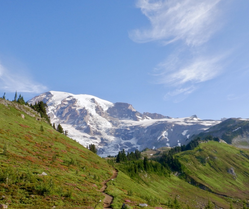
The whole Paradise area was already crawling with people. The mountain towered 9,000' above, and I was able to locate Camp Muir. I loaded the pack and started from the visitor center. The trail was asphalt for the first half mile, then graded dirt and excellent talus steps up to Panorama Point. There were several parallel trails that all led to the same intersections, probably to disperse the crowds and prevent a conga line on just one trail. There were thousands of people going up the hill. I passed many, feeling great as I gazed up at the summit. The glaciers on the south side of the mountain seemed close enough to touch. Crevasses and seracs split the smooth ice near the bottom and water cascaded down an enormous moraine to the west. I took a side trail around Panorama Point to bypass the crowds and stopped at ~7,200’ at Pebble Creek. People dotted the snowfield above but it was much less crowded than the dry trails below. I took a break to put on the crampons, pants and windbreaker, then started up. 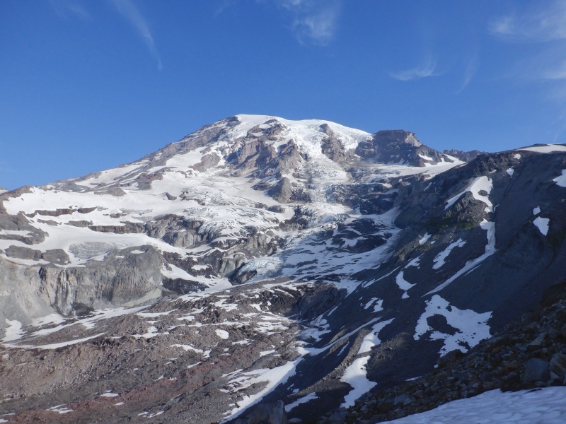
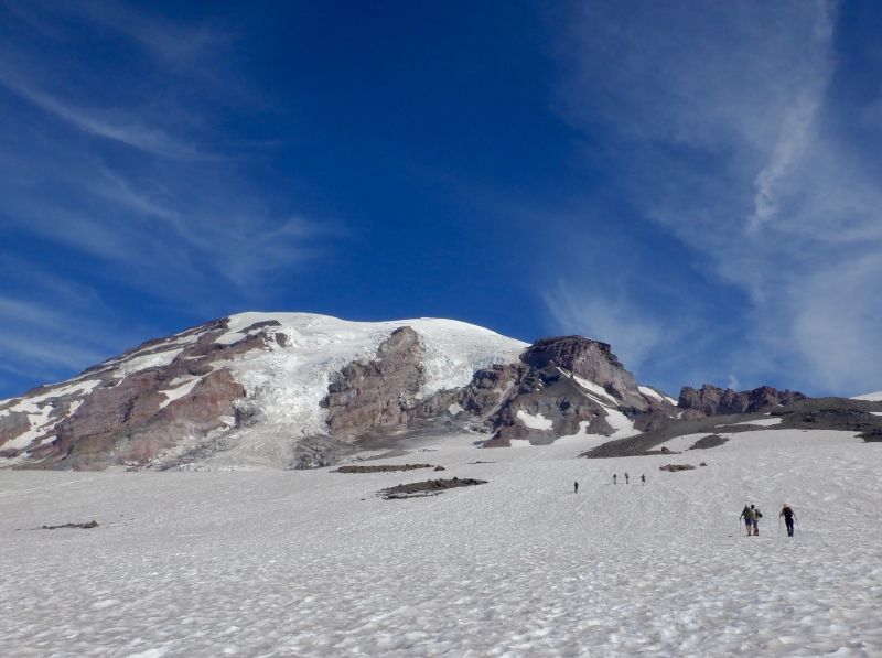
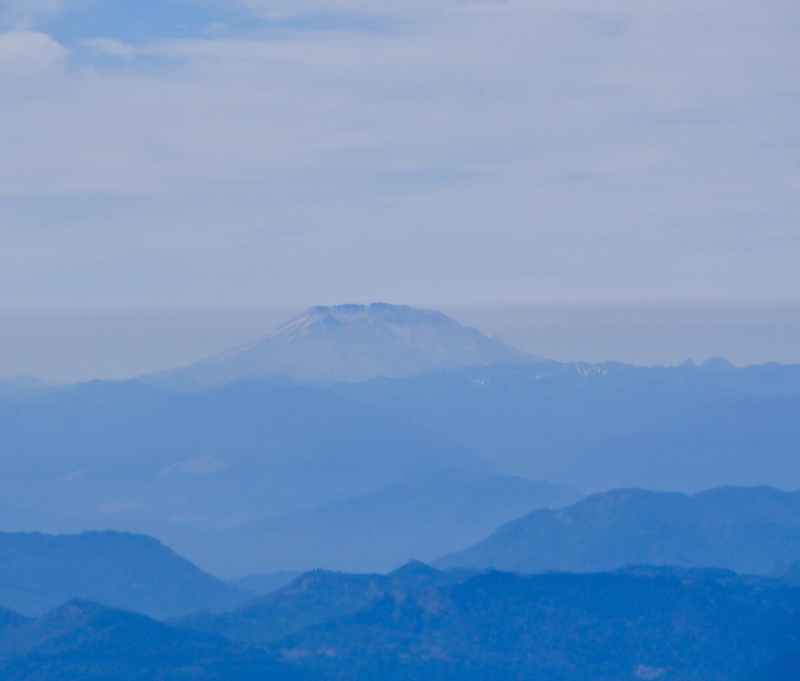
The snowfield climb was almost 3,000 vertical feet but I could see Camp Muir the entire time. The snow was slick in a few places but overall it was firm with enough crunch for good traction with the crampons. There were 3 slightly steeper slopes on which I used the ice axe as a walking stick. The view to the east was blocked by a higher rock ridge but the glaciers to the west were still visible, and the summit loomed overhead as I gained elevation. I was almost too warm with the long layers but I left them on. An occasional breeze cooled the air and the clothing acted as a second layer of sunscreen. I hiked at a steady pace and passed more people. The scenery to the south slowly opened up above 8500’. Mt. Adams and Mt. St. Helens appeared, far above an indistinct green forest rolling across the uneven ridges below. Compared to the summit far above, Camp Muir didn’t look far away, but it still took 90 minutes of steady hiking to get to the top of the snowfield. I was accosted the whole way by some kind of bee, buzzing around my ears. Just leave me alone already. 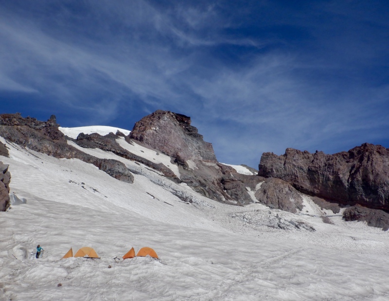

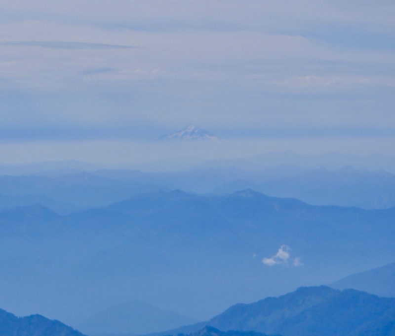
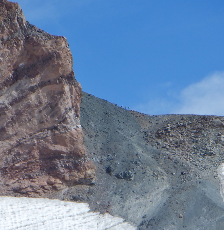
I took a long break at the camp. There are several outhouses, a large seating area built out of rocks and a few huts used by the guiding companies for equipment storage. Several tents were pitched on the glacier just up the hill. Several guided groups were packing up and starting their descent. A few other people were coming down the last of the DC route to the camp. Several large cliffs blocked much of the view to the upper mountain but the view to the south was exceptional. The full cones of Adams and St. Helens were visible and even part of Mt. Hood could be seen through the distant cloud layers. Paradise was far below and I could see most of the ascent route. I ate, put on more sunscreen and slowly scanned in all directions with the binoculars. Hopefully I’ll stand on top of at least some of the other volcanoes in the next few years. 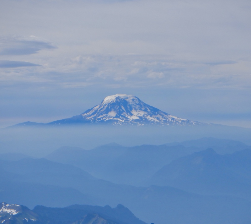
The descent down the snowfield was AWESOME. It took about 27 minutes to descend the 2,800’ of snow and it was probably the best running I’ve ever done in my life. The snow was firm enough for the crampons to bite in but the upper layer was sugar slush. I was able to take large strides on the steady downhill grade and each footfall slid a few inches before the crampons stuck. I felt like I was running under reduced gravity with the soft surface. The 3 short shelves were slick enough that I just hiked, but even then I took large steps and surfed down the snow. I guess this is what plunge-running is, and it is absolutely outrageous. I didn’t ever have to use the ice axe to steady myself. I passed several climbing groups and many other people hiking to and from the camp. I realized how awesome the descent was going to be after just a few minutes, and I was grinning the whole way down the snow. This short segment was seriously some of the most enjoyable, unique travel I’ve ever done in the mountains. I was disappointed to reach the rock. I could have run down the snow to the center of the Earth. 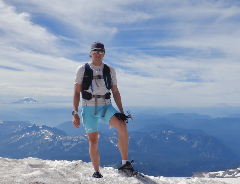
I took off the crampons and put on more sunscreen, then waded back into the crowds. I took a longer loop on the east side of Panorama Point to get back to Paradise. The trail went through the bottom of a large moraine and descended down through the forest. There were thousands of people and passing was difficult in places. The scenery of the upper mountain mostly remained the same as I scurried over the lower ridges. The lower mountains to the south were indistinct in the haze of clouds and light smoke. I ate on the move, dunked my hat in some of the creeks and made it to the parking lot in about an hour. I took more pictures of the mountain, reviewed the watch and GPS summaries and went in the gift shop to get a few souvenirs. This was a great introduction to the mountain. If the upper part of the DC route is in good condition, an alpine-style ascent is probably a reasonable way to climb to the summit. I will definitely be back at some point to attempt it. 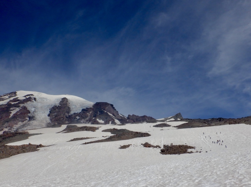
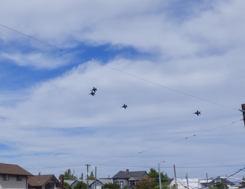
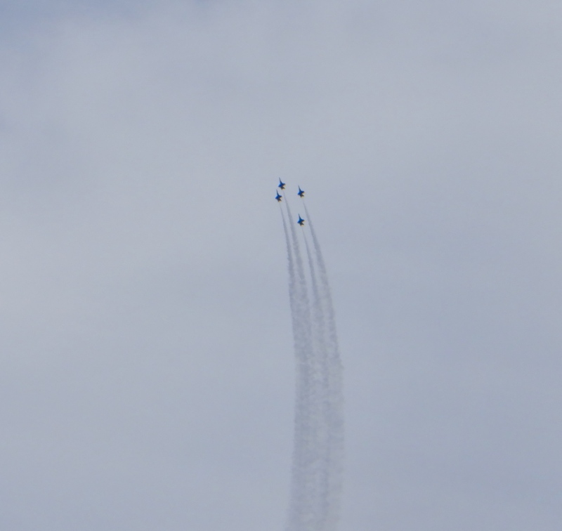
The drive back to Seattle took longer than I expected. I ate the rest of the food on the twisty drive down to the park entrance. There was a long line of vehicles waiting to get in. I took the road to Puyallup, instead of going back to Tacoma. Rainier was visible to the east, rising very high above the farmland. After an hour of driving through tiny towns I hit endless traffic and suburbia. It took a long time to finally reach a highway. I kept driving north and eventually got on 405 and then 5. I drove by Boeing Field as the Blue Angels C130 took off and circled around in the sky. There were planes of every size parked on the tarmac. The F16s took off shortly after I got home. They flew directly over the city and made several passes right over the neighborhood. I watched them from the roof for awhile. The low and near passes were loud enough to make my teeth rattle. The group of 4 planes was easy to find with the smoke trails looping all over the sky. What a neat spectacle. 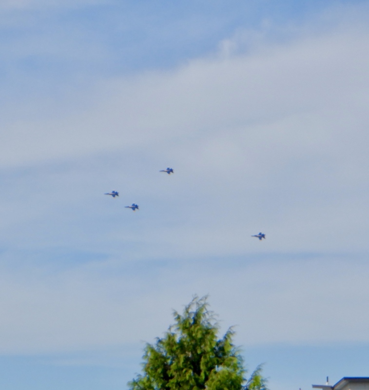
August 4 Colonial Peak Attempt: https://www.strava.com/activities/12065455421 The final mountain of the trip was Colonial Peak. This is a 7er near Diablo Lake in North Cascades National Park (https://www.nps.gov/noca/index.htm). It is part of a group of high summits around a large glacier field, and is much more of an alpine excursion than the lower peaks nearby. I couldn't find many reports on this one. There were a few on the WTA website, and (as always) a summary and brief route description on SummitPost, both clearly indicating it was a difficult, isolated climb. I thought this would be the hardest summit of the trip and I was right. I gave it a good effort but there was a lot of mountain remaining when I turned around. I left Seattle at 4:45 and drove up I5 a ways, then took a 2-lane road through forests and farmland to WA20. There was a light mist that glowed as the sun rose. The mountains slowly grew taller as I went east. I could see Three Fingers clearly for awhile. There wasn’t much traffic on the way into the national park. A few cars were already in the parking lot, likely for overnight parties climbing the other glaciated peaks in the area. I geared up, liberally applied bug spray and started up the trail. I reached Pyramid Lake in an hour. The dense forest provided plenty of shade but it was very humid so I was still covered in sweat. I couldn’t see anything to the south through all the trees so I simply focused on the trail. The lake is more like a pond because it’s so small. I paused to eat, then looked at the map and thought about the very steep ridge climb that awaited me. 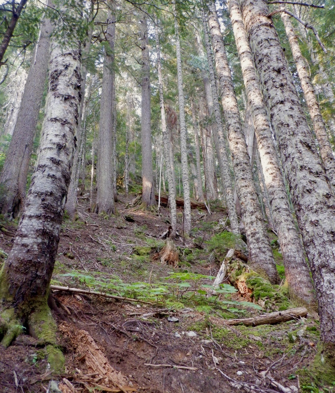
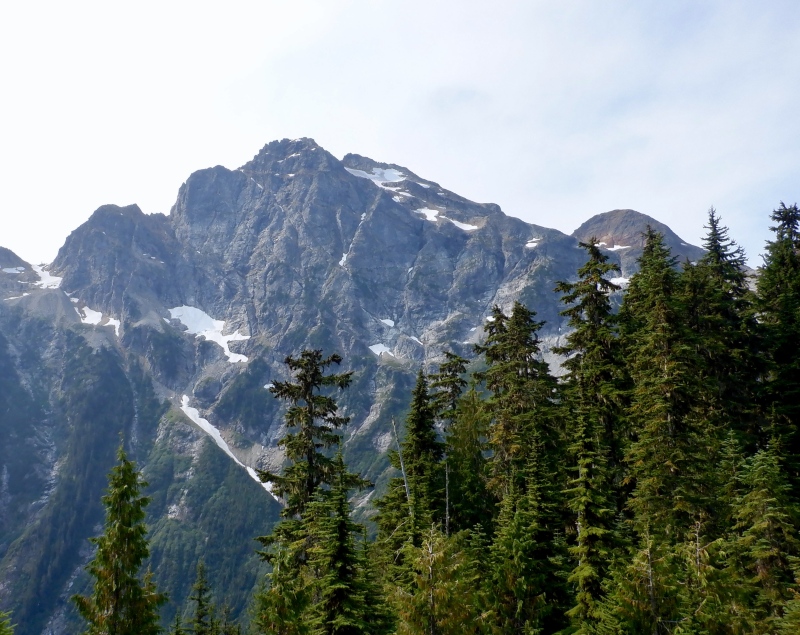
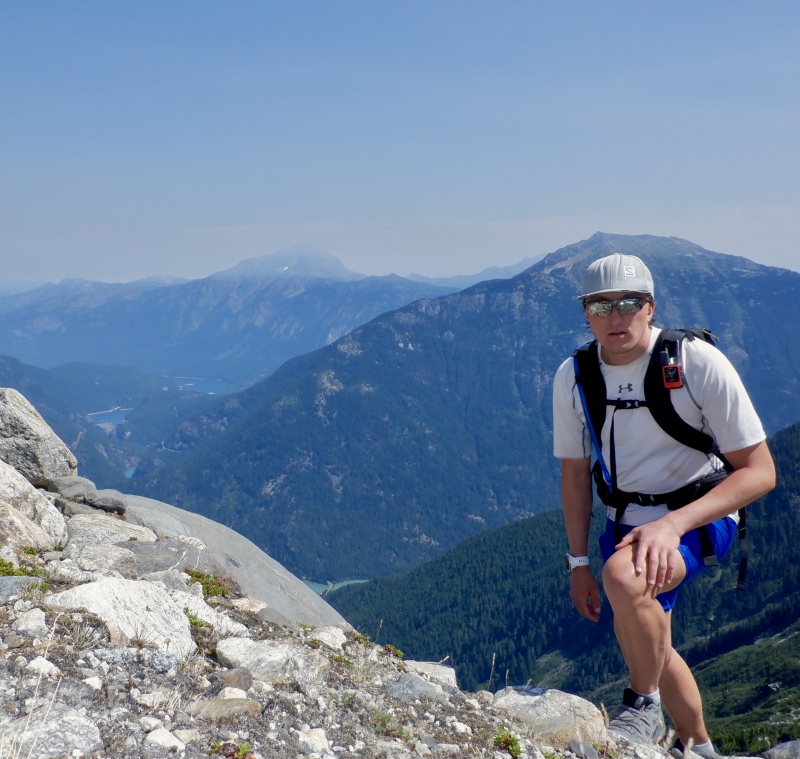
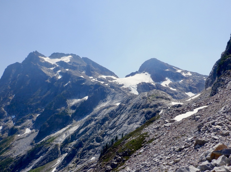
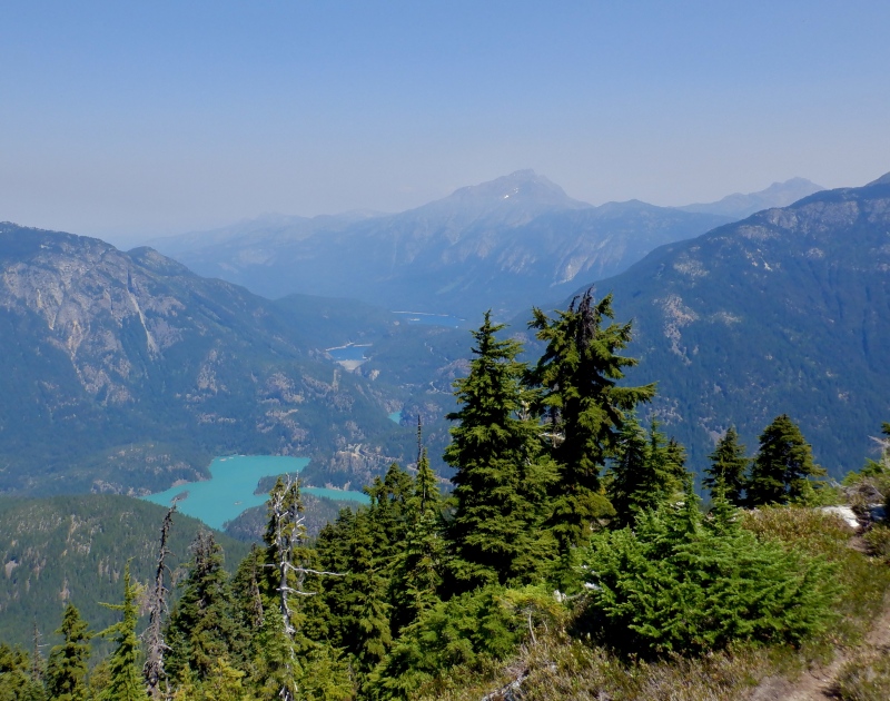
The forest ascent to the col below Pyramid Peak was one of the hardest sections of trail I’ve ever hiked anywhere. It was twice as long and twice as tall as the Vestal Basin climb, and much steeper. There was a trail the whole way but it was so steep and rugged that I was often climbing up class 3/4 dirt and trees, using roots and branches as belays. The trail went straight up the slope and was absolutely unrelenting. I stopped every 30 minutes to eat and drink. It was hot even in the shade and the forest was so dense I couldn’t even see the sky. Looking at the altimeter didn’t help either. I had thousands of feet to ascend and no way to gauge my progress. After an hour I reached the short flat spot about 2/3 of the way up. I saw the upper part of Colonial and I wasn’t encouraged. The summit still looked very distant, there didn’t seem to be much snow on the moraine and Colonial Glacier looked way more exposed than I expected. I was immediately doubtful I’d get to the top. But, it was still early, and I had to at least get up this damn ridge. I followed the trail through dense willows and pines and took a look at the even steeper hump that awaited. Good god it was steep. I laboriously climbed and eventually made it to the treeline. The summit didn’t look any closer and the traverse across the Pyramid cliffs looked more complicated than I expected. Peaks stretched endlessly to the north and a screen of smoke hung on some of the mountains to the east. The turquoise waters of Diablo Lake were visible far below. 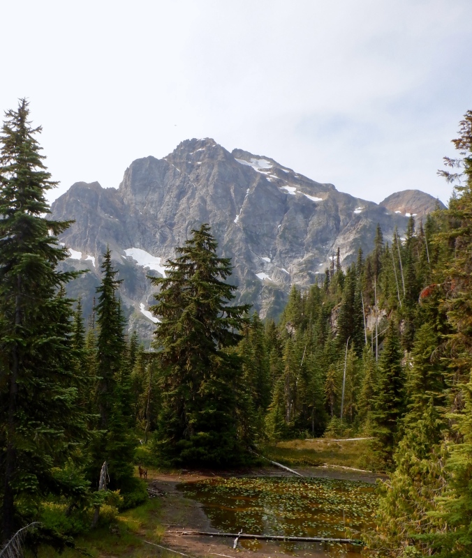
I took a break below the final hump of the ridgeline to eat and assess the next part of the route. The cliffs on the east side of the hump were way too tall and steep to traverse, so I figured there was an easier way around on the west side. I opened my pack to put on sunscreen but discovered I left it in Seattle, in the pack I used yesterday. Great. I followed some trail segments over the hill, then crossed some rocks below the huge cliffs of Pyramid and high above the creek that flowed all the way down to the car. I went over the small saddle and discovered a surprisingly good path across the moraine to the waterfall. The rock was fairly stable and there were even a few cairns. Two different groups were descending from climbing Snowfield Peak. They reported all the glaciers in the area were down to blue ice. Not exactly the surface I wanted to travel on with just shoes and light crampons. I passed under a waterfall, over a lingering snowdrift and through a larger talus field to reach the enormous silty waterfall pouring over the cliffs below Colonial Lake. 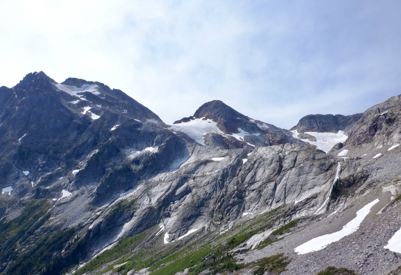
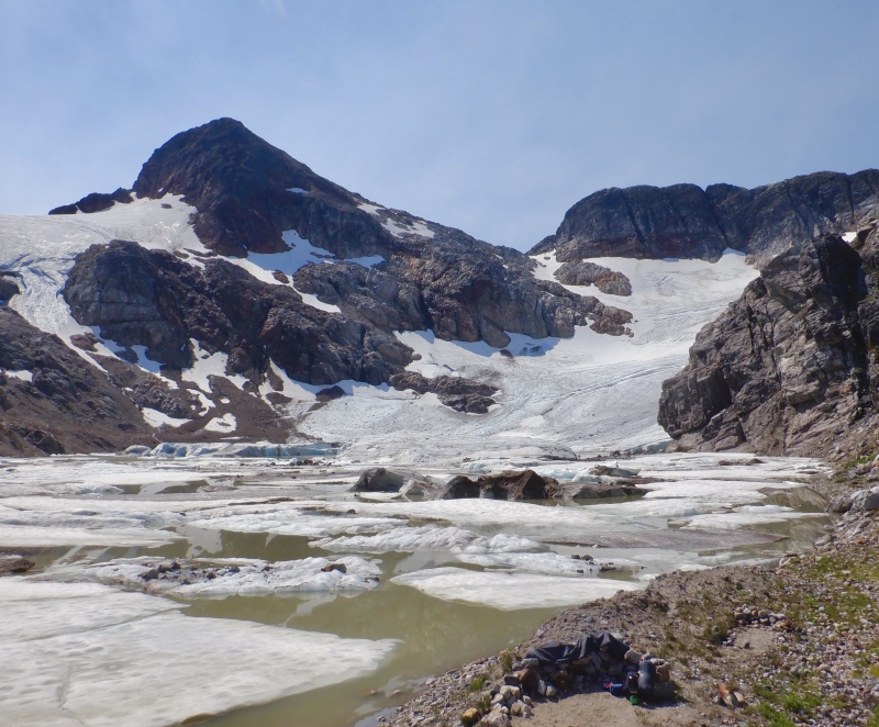
The rest of Colonial Glacier came into view. The lake was a tan-green color from the glacial sediment, and many large chunks of ice sat halfway submerged in the water. The glacier on the south side ran all the way to the edge of the lake and more water poured in from the cliffs on the west side. I intended to cross the creek on a snow bridge but my first step on the snow collapsed it. Huge chunks broke apart and fell 6 feet down to the water. It looked so solid but clearly it was just about hollowed out from the raging torrent. I went north, found an intact snow bridge and dashed across. I could see another group descending Colonial Glacier in the distance. I followed some cairns up to a broad ridge above the lake and stopped at a flat spot to consider my options. 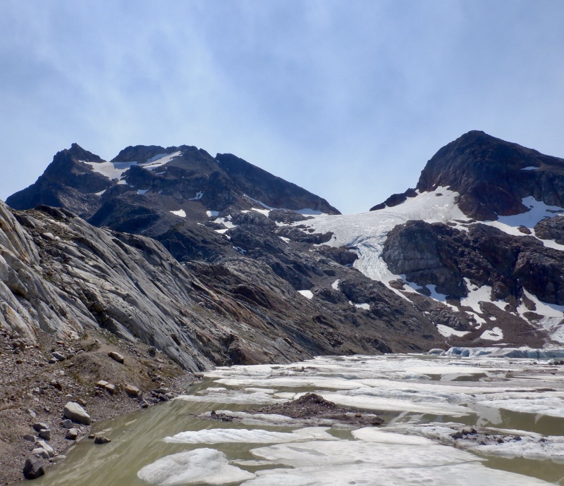
It didn’t take much thought to decide to turn around. I was still 1700’ below the top. No sunscreen meant I had to either get burned or put on long layers and roast in the heat. The climb up the loose moraine would be slow and tedious, and even worse on the way down. The glacier was quite steep and I didn’t have the right gear to safely traverse it. And, the summit was not right at the top of the glacier. There was at least some traversing to the east, with unknown rock quality and exposure on the south side. As with Dragontail, August is just too late in the summer to climb these mountaineering routes. The best way to climb this mountain is to have a dry approach up to the Pyramid cliffs, then travel on consolidated snow all the way up the moraine to the summit ridge. I ate, took pictures, looked through the binoculars and enjoyed the scenery. I knew it would be a difficult descent so I tried to relax before starting the long march back to the car. 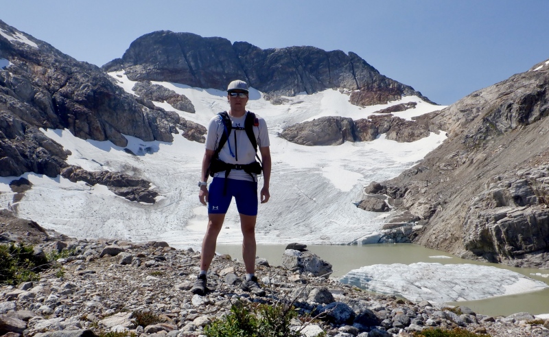
The descent/traverse through the moraine to the ridge was simple enough. I crossed the creek at the same snow bridge, followed the stable path through the rock and refilled water at one of the waterfalls coming off the Pyramid cliffs. I cooled off in the creek and tried to ignore the sunburn developing on my arms. The upper third of the ridge was very hot. There wasn’t much shade and the sun beat down mercilessly. The trail was no harder to follow than it was on the ascent, but with such steep terrain I had to go slowly. I faced in to climb down the steeper sections of trees and rocks. The heat was even worse in the willows. I applied bug spray several times through the day so at least the insects mostly left me alone. The elevation melted away steadily but it still took almost as long as the ascent to get to the forest. The lower ridge descent wasn’t as bad as I expected. Every step dropped at least 1 foot in elevation. The dark earth and all the trees/roots made for a very pleasant surface, so I was never worried about slipping or tumbling down the hill. The shade helped cool me down slightly but it was still hot. 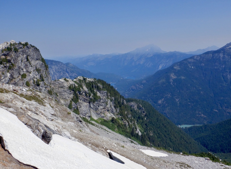
I didn’t recognize much of the terrain- the light was different on the way up and the trail looked completely different from above. I took a very brief break at Pyramid Lake, then trudged onward. The remaining miles back to the car didn’t take too long. The reduced angle was much easier on my legs and the wider trail seemed like a paved road compared to the goat path on the ridge. I dunked my hat in the creek several times and continued to eat. I reviewed the stats on my watch and GPS on the guardrail next to the road because the car was in full sun. I dumped the rest of the water on my head, tossed everything in the back of the car and got on the road. 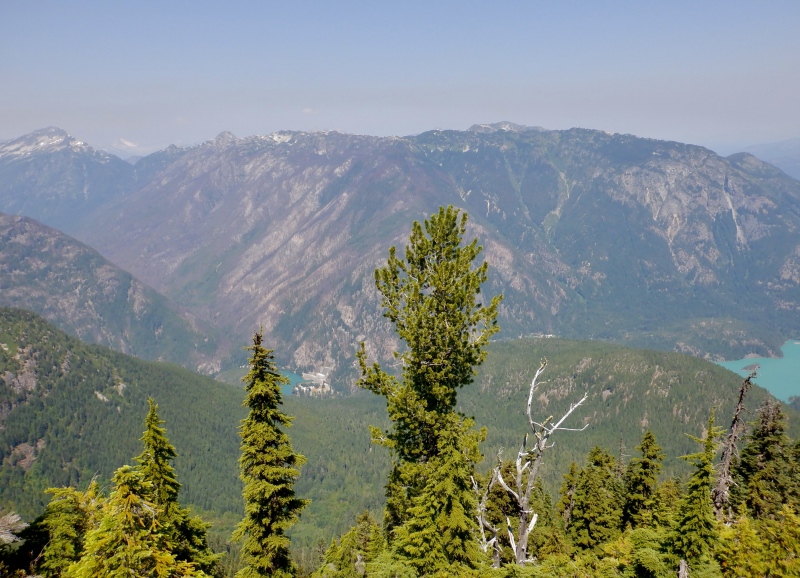
It took almost 3 hours to get home. I took WA20 all the way to Mt. Vernon, where I stopped to eat, then took I5 all the way back to Seattle. It was over 90 degrees in the national park. It’s so strange to see temperatures like that deep in the mountains. I stopped at the visitor center to get a few stickers. The mountains slowly decreased to hills as I drove west. Rainier came into view near Everett. With mostly clear air and the evening sun it was very easy to see- the glaciers and rock stood out starkly against the sky. 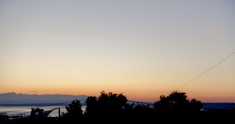

This was a good trip. It's always great to go to new mountains and expand my abilities on different routes. It was great to stay with my cousins in Seattle but the driving to and from the mountains each day took a lot of time. Camping/staying much closer to the trailheads, like I do at home, would increase my summit chances. It will probably be a few years before I come back to the Cascades but I will certainly make more trips to climb the volcanoes and attempt other routes. Washington Cascades Mini Camp Totals When I was planning this trip, I also considered climbing Mt. St. Helens and/or Mt. Adams. However, the logistics for both of these ended up being too difficult, so they will have to wait for another time. The south side of Mt. Adams is a straightforward snow route in the summer season. There are few or no crevasses, it isn't very steep and there is no long approach. However, the mountain is a long way from Seattle. There is road access to both the north and south side of the mountain, but the north side (much closer to Seattle) is only complex routes with significant glacier travel. It wasn't reasonable to get to the south side from Seattle, climb the mountain and drive back in a single day. There are also reports that the road to the south trailhead is quite rugged, perhaps beyond what a standard rental vehicle could handle. Mt. Adams information https://www.trailrunproject.com/trail/7036712/mount-adams-south-climb-lunch-counter-approach https://www.fs.usda.gov/recarea/giffordpinchot/recarea/%3Frecid%3D80023 https://www.fs.usda.gov/detail/giffordpinchot/alerts-notices/?cid=stelprdb5435984 Mt. St. Helens is a shorter and easier climb than Adams, though it's still a long drive from Seattle. The main difficulty with this mountain is the red tape. Access to the southern route April 1-October 31 requires a paid permit, which of course sell out very quickly months ahead. There is a permit quota for each day, to avoid overcrowding. I didn't know this when I started looking at the details, and by the time I learned a permit was necessary there were none available. The permit is free and without quotas during the winter season. So, any non-winter climb requires planning far in advance. Mt. St. Helens information https://www.trailrunproject.com/trail/7034465/mount-st-helens-summer-climbing-route-monitor-ridge https://www.trailrunproject.com/trail/7054020/loowit-loop https://www.mshinstitute.org/explore/climbing-permits/current-conditions.html https://www.fs.usda.gov/detail/giffordpinchot/alerts-notices/?cid=fseprd528656 I think the best way to climb St. Helens and Adams is to stay in Portland, which is very close to the southern routes. Mt. Hood is also nearby, so staying in Portland would allow for a volcano trifecta with minimal driving. Thumbnails for uploaded photos (click to open slideshow):  First view of Dragontail and Colchuck")
 At the bottom of Colchuck Glacier")
 Looking down on Colchuck Lake")
 At the top of the glacier")
 A mountain goat standing sentry on Dragtontail")
 South view to Argonaut, Stuart and Rainier from the summit of Colchuck")
 North view from the summit of Colchuck")
 East view to Dragontail from Colchuck")
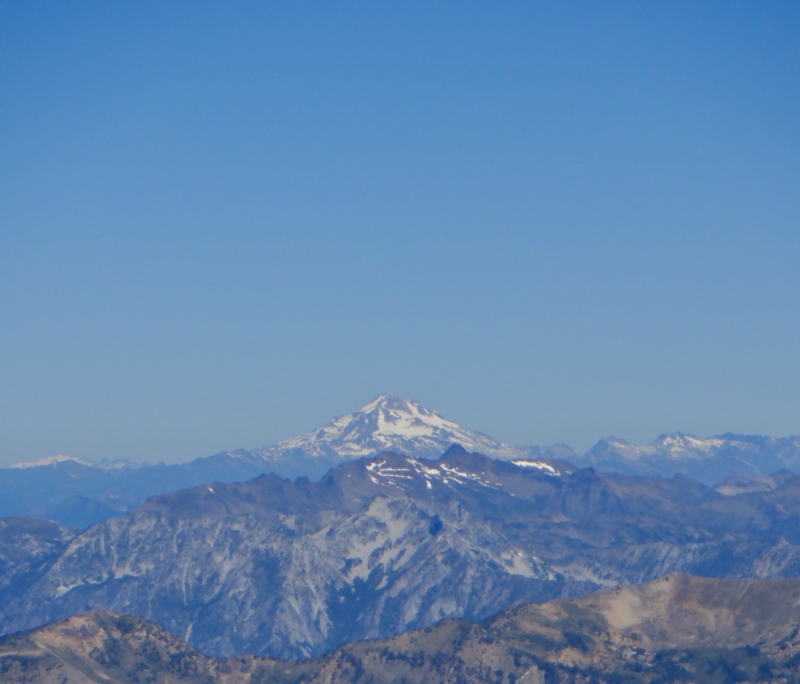
 Zoom on Glacier Peak from the top of Colchuck")
 On the summit of Colchuck. Not much room to position the camera for a self-timer shot.")
")
 Descending Colchuck Glacier")
 Zoom on the very top of Rainier above the smoke")
 At the bottom of the wretched moraine slope")
 The huge west wall of Aasgard Pass")
 At Alki Beach, looking west to the Olympic Peninsula")
 Starting up the trail on Rainier")
 The enormous moraine below Nisqually Glacier")
 Starting up the Muir Snowfield")
 A camp dug into the glacier at Camp Muir")
")
 Zoom on Mt. Adams")
 Zoom on Mt. St. Helens")
 Zoom on Mt. Hood, way down in Oregon")
 Climbers descending the upper mountain")
 At Camp Muir just before I started the descent")
 All kinds of people on the Muir Snowfield")
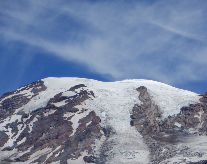
 Zoom on the huge summit")
")
 Blue Angels above Seattle")
 Blue Angels above Seattle")
 Blue Angels above Seattle")
 Starting up the massive forest slope")
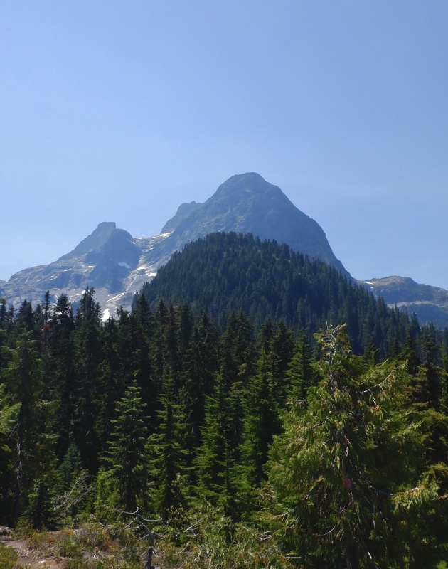
 First view of Colonial Peak")
 Closer zoom of the upper mountain")
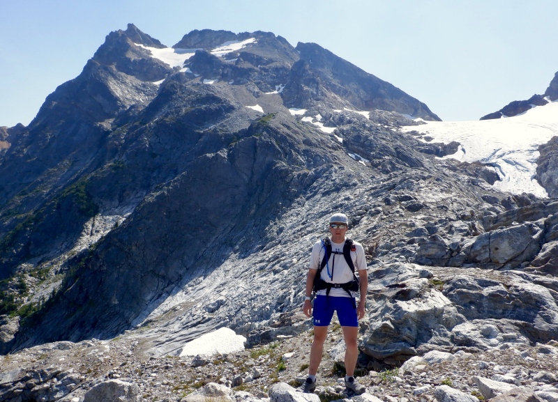
 Finally above the treeline")
 The bottom of Colonial Glacier")
 Colonial Lake with the summit above")
 At Colonial Lake")
")
 At the turnaround point")
 Crossing the moraine to the forest")
 A last look at the upper mountain")
")
 Partial view of Diablo Lake")
 Looking back at the upper hump of the forest climb")
 Somehow I was up there")
 Sunset over Puget Sound")
 The top of Rainier was faintly visible from Seattle")
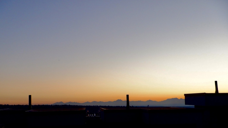
 Sunset over the Olympic Peninsula")
|
| Comments or Questions | |||||||||||||||||||||
|---|---|---|---|---|---|---|---|---|---|---|---|---|---|---|---|---|---|---|---|---|---|
|
Caution: The information contained in this report may not be accurate and should not be the only resource used in preparation for your climb. Failure to have the necessary experience, physical conditioning, supplies or equipment can result in injury or death. 14ers.com and the author(s) of this report provide no warranties, either express or implied, that the information provided is accurate or reliable. By using the information provided, you agree to indemnify and hold harmless 14ers.com and the report author(s) with respect to any claims and demands against them, including any attorney fees and expenses. Please read the 14ers.com Safety and Disclaimer pages for more information.
Please respect private property: 14ers.com supports the rights of private landowners to determine how and by whom their land will be used. In Colorado, it is your responsibility to determine if land is private and to obtain the appropriate permission before entering the property.