| Report Type | Full |
| Peak(s) |
Longs Peak - 14,259 feet |
| Date Posted | 11/26/2024 |
| Date Climbed | 10/20/2024 |
| Author | bangerth |
| Additional Members | bmcqueen, djbateman |
| Longs Peak Northwest Couloir |
|---|
|
Sometime in late 2023, I found myself unexpectedly with a free weekend but none of my frequent hiking partners were available. So I asked Brad McQueen whether he was. He was indeed, and proposed the Northwest Couloir of Longs Peak -- which I knew nothing about and couldn't find much about either, other than that you need a rope and have to climb through a hole at some point. That sounds appealing to me, and I love going on routes I don't know much about. But people reported the first snow on Longs already, and I must admit that I just didn't feel ready for a technical climb with snow, given that I have fairly minimal experience with ropes. In the end, I redirected us to try another route I couldn't find anything about, on nearby Mount Meeker, for that weekend (see this report). But I promised Brad that we would do the Northwest Couloir the next year -- and set myself a calendar reminder for 11 months later. From what little one can find on the route, it talks about the potential for triggering rock fall onto the Ledges below where of course plenty of people cross, and so we wanted to choose a date later in the year where perhaps fewer others would be out there -- in hindsight, even though we did not actually trigger any rocks, this was a good decision because indeed the people crossing below are completely exposed to what you'd accidentally kick down on them. ScoutingLongs' Northwest Couloir starts about halfway between the Keyhole and the base of the Trough, as you cross the Ledges to get from the former to the latter. During the summer and fall 2024, I ended up on a couple of hikes that allowed me to look around some parts of the route already. The first one was a trip up Longs on the usual Keyhole route. I had made good time on the way up, and so on the way down allowed myself to scope out the bottom of the Northwest Couloir as I was coming back along the Ledges. The following picture shows where you'd angle up: 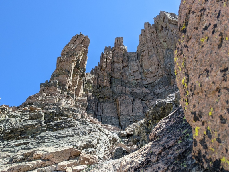
It doesn't look very steep, but it took me a good half hour to find a good way to get into it given that everything that wasn't a slab was either wet and slippery from running water, or loose scree perched at the critical angle where just looking at it will make it start to slide. In the end, staying far right allowed me to find a steep ramp with hand holds that got me up the first bit, roughly to the bottom of the enormous palisades in the picture. From there, the couloir angles up to the right, out of view. This was about as much time as I was willing to spend that day, and so I left it at just getting through the bottom-most 200 vertical feet or so; the rest would reveal itself once we were going to be back. The other trip, in early fall 2024, allowed me to see some of the bigger picture from a voyage of off-trail exploration across the valley (on Thatchtop). From there, one has a great view of Longs' west side: 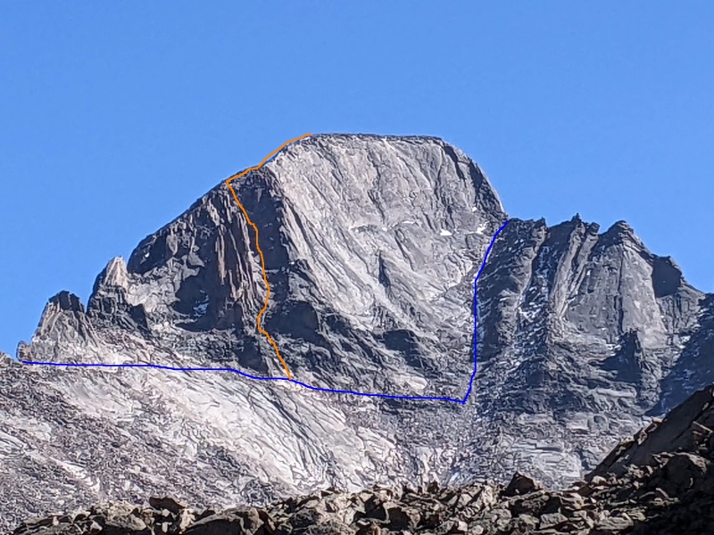
The route most people take is the blue one, with the Keyhole at the left, then crossing along the Ledges, and finally ascending the Trough on the right. The Northwest Couloir is in orange (sure looks steep!), showing the palisades you will always have on your left, along with the final stretch atop the Keyhole Ridge from which you can look down on the people in the Trough. We're doing itThe alarm to settle on a date had gone off sometime in late September, and in the end, Brad and I had settled on October 20 to go for it. It had snowed a little bit around a week into October, and I was worried that that would make the whole situation too difficult. But we got lucky, the weather held until the evening of the day we went out and for some reason, very little of the snow from earlier in the month seemed to have settled in the couloir itself. (The north face we used to return did have perhaps 8" and in some places more -- but other than the place where you rappel, the north face has little technical difficulty.) I talked another one of my friends, Dan Bateman, into coming along too; he has a goal of doing Longs Peak from as many directions as possible, and so this kind of thing was right up his alley. Having him along also brought a second person (other than Brad) with technical experience to offset my complete lack of rope skills. So, off we went. There is not much to report about getting to the Keyhole and a bit beyond; all of us had been on that part of the route many times, none of us were particularly excited about the long hike in, but you just have to get through it. The fun of course starts once you get through the Keyhole and, perhaps twenty minutes later, to the base of the NW couloir. This is how it looked the day of: 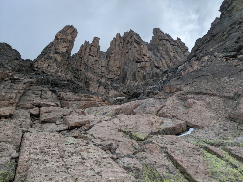
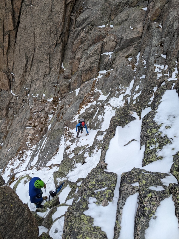
The look is pretty much the same as in the picture above, but what a difference these three months made: All the wetness had disappeared, and neither of us had much trouble with the first part -- each one finding a different route according to one's favorite terrain. I stayed mostly to the left of the picture, heading for the base of the cliffs. Brad was sort of in the middle, and Dan hugged the walls on the right. That would remain our arrangement for the next hour or so. Once you round the corner to the right in the picture above, you actually get to see where all of this leads: 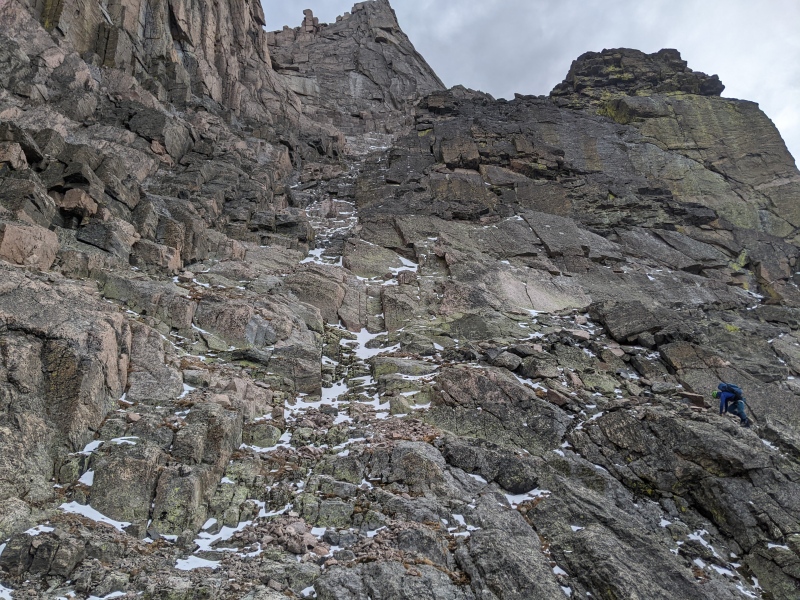
I love these sorts of places: It's fairly steep, and you don't just get to scramble for a couple of minutes over one obstacle, but it is sustained. At the top of the picture, you get to see an interesting rock formation that I think has been described as a "horse head" and that will guide your way for a good long while. I think it's appropriate to think of it as a horse given that on the other side of the mountain, there's a clearly visible camel -- animals all around on that mountain! Once on this stretch, you have to settle in on a lot of scrambling. There is not much evidence that people take this route on a regular basis. In particular, there doesn't seem to be a "standard" way up, and as before we spread out. In the picture above, Dan enjoyed his slabs on the right. I found happiness on the big blocks on the left. Brad gave the center a chance but (I think) in the end found the going just too arduous and joined me on the left. Here's another picture from a bit higher -- the horse head is just out of view on the left: 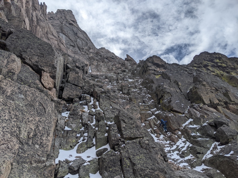
And here is a picture looking down that shows how steep that place is: 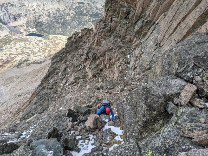
I really enjoyed the views back while climbing -- both looking down the couloir as in the picture above, as well as of the palisades that line the whole couloir. Longs has so many interesting rock formations, with the giant Diamond face, of course, as well as the palisades next to Keplinger's couloir, the curving wall to the left of the Trough (also visible in the long-distance picture above), or just the big wall on your right as you go up the Loft Couloir. This view definitely compares well to all of the other places on the mountain: 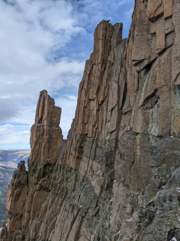
Eventually, however, the couloir is coming to an end in a headwall. I got perhaps a bit over-excited climbing up and got myself stuck on a ledge that I could neither climb up from, nor easily back down. I was fortunate that Dan was right above me and could rescue me by fixing a rope that gave me the 30 seconds of protection to get around a corner and onto safe ground. This is the view from my momentary prison: 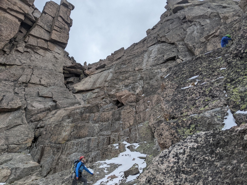
It is, at first, hard to see where to go from there. The wall itself is clearly too steep to climb without equipment for "ordinary" people. It's possible that getting out to the right could work, but the solution -- found a long time ago of course -- is to look at a stack of rocks wedged into a crack on the left side of the headwall: 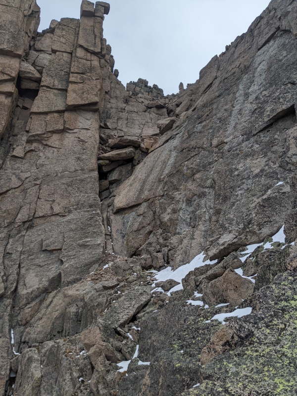
It is straightforward (well, unless you get yourself stuck, of course) to climb up to the ledge where I took this picture from, and to cross over from there. The vertical distance from the ledge to the bottom of the wedged rocks is perhaps 20 feet and not difficult either. It's getting around and on top of the rocks that's tough: The rocks are overhanging, and the slab to the right of the crack is steep and smooth. You would not fall all the way to the bottom of the couloir (or indeed to the bottom of Glacier Gorge) if you slipped on it, but you'd be falling the 20 or so feet, and the outcome would likely not be good. This is where the rope comes in: There is an old piton somewhere in the crack between the slab and the rocks, and a number of good places to put your own protection. Dan ably demonstrates how this is done: 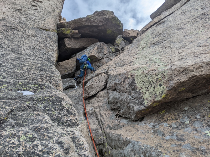
Once you made it across the rocks, on some 5.low, you get to the real fun part of the route : You climb into a hole below one of the rocks, crawl around a bit, and emerge on top. Check out where the rope goes in this picture: 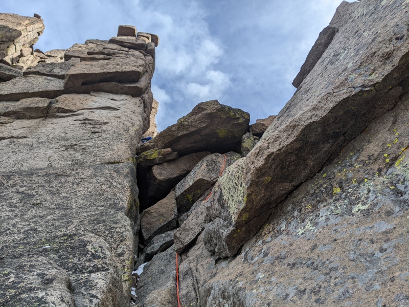
Hilarity ensues at this point. The exit from the hole is narrow, and it goes down on the outside. There is no "obvious" way how to best get out of it, and everyone chooses a more or -- mostly -- less elegant way. Here's me coming out, feet first: 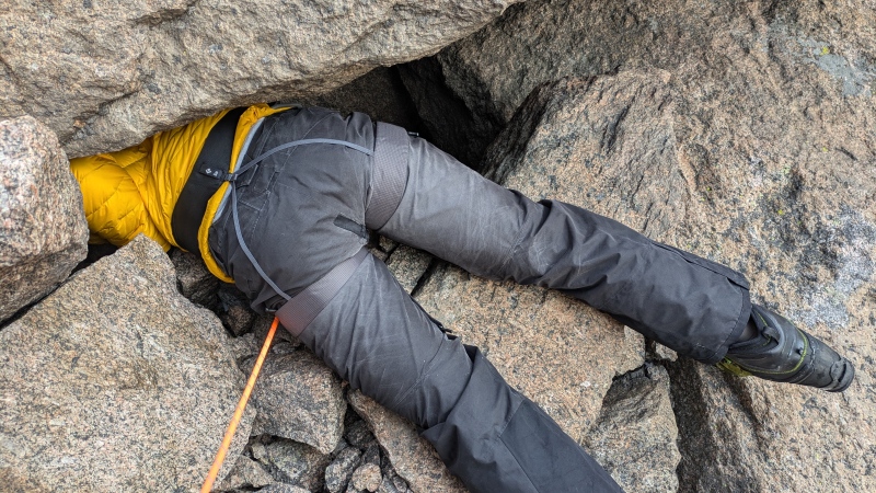
Brad, after a couple other attempts, at least makes it look respectable: 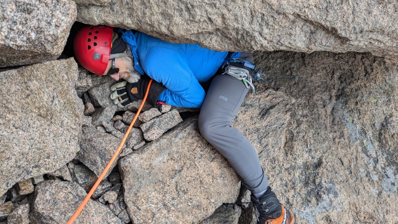
Dan claims that he crawled straight out, head first, but who really knows -- we couldn't see him from below, and for all we can tell he might have been as graceful as either of us :-) Regardless, we shared a lot of laughter for those few minutes, it's just hilarious wiggling through that place! Once above the rock, the views opens up again onto an upper couloir with a right fork: 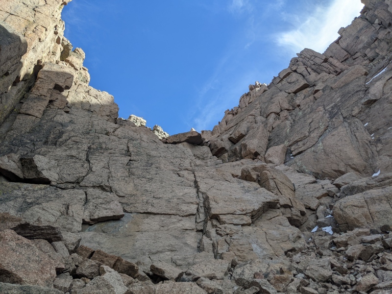
There's also a branch that goes off to the left: 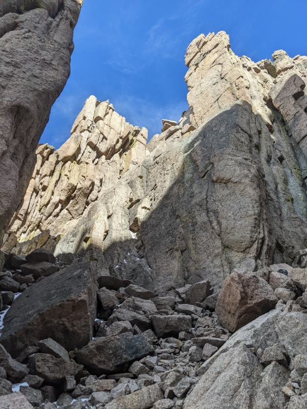
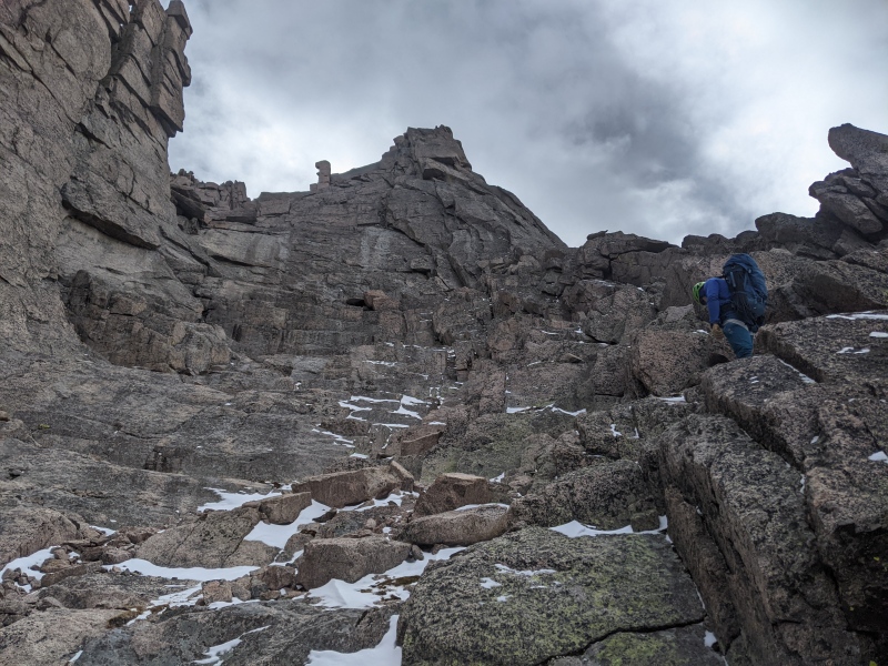
The summit lies off to the right, so we took the right fork. It continues on being steep, and one has another 30 or 45 minutes of great scrambling and views into the valley below: 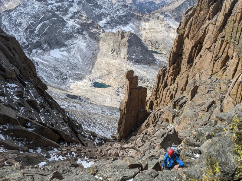
Eventually, a ramp terminates the couloir to get up to the Keyhole Ridge that comes up from the Keyhole itself and directly leads to the summit: 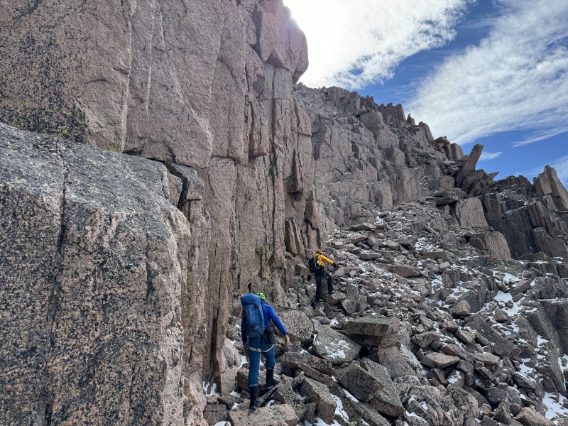
I must have -- once again! -- gotten too excited at this point, since I have no pictures from there on all the way to the top. It's still a decent distance along the ridge to the top (perhaps 45 minutes? an hour?) but the difficulties are over: It's neither steep nor particularly technical, just a regular ridge walk. The only picture we have is one that Brad took of Dan on a see-saw rock perched right at the edge, looking down on the top of the Trough: 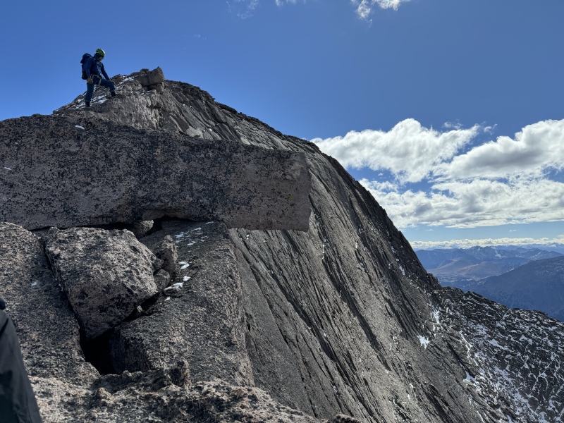
It's a cool view from there, seeing groups of people huffing up and down the Trough, and making it over the choke stone at the top of it. At the end of the ridge, one enters the huge summit plateau from its NW corner, from which it's a couple of minutes to the actual high point. This was my fifth time to the top of Longs, but I cannot recall ever having had no wind and just lovely sunshine -- what a day to be high! 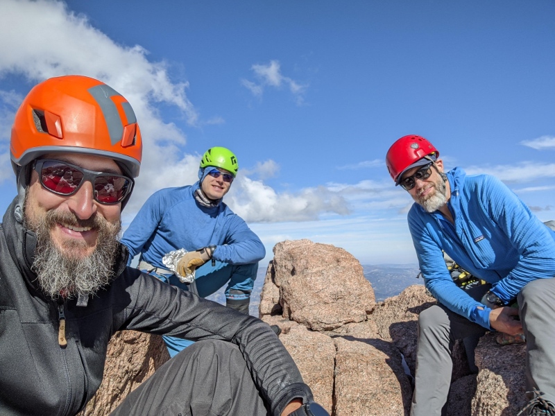
We ate, laughed, and enjoyed ourselves for half an hour, and then took the Cables Route back down to the Boulderfield. From there, it is of course quite a long walk still, but the difficulties are over. SummaryWhat a route! I would do that again in a heartbeat -- so much fun, so many hours of excellent scrambling on steep terrain, plus a hole you have to crawl through! I believe it took us 14 hours to do the whole thing, time that I could not have spent in a better way and with better company! Thumbnails for uploaded photos (click to open slideshow): ")
")
")
")
")
")
")
")
")
")
")
")
")
")
")
")
")
")
")
")
")
|
| Comments or Questions | |||||||||
|---|---|---|---|---|---|---|---|---|---|
|
Caution: The information contained in this report may not be accurate and should not be the only resource used in preparation for your climb. Failure to have the necessary experience, physical conditioning, supplies or equipment can result in injury or death. 14ers.com and the author(s) of this report provide no warranties, either express or implied, that the information provided is accurate or reliable. By using the information provided, you agree to indemnify and hold harmless 14ers.com and the report author(s) with respect to any claims and demands against them, including any attorney fees and expenses. Please read the 14ers.com Safety and Disclaimer pages for more information.
Please respect private property: 14ers.com supports the rights of private landowners to determine how and by whom their land will be used. In Colorado, it is your responsibility to determine if land is private and to obtain the appropriate permission before entering the property.