Download Agreement, Release, and Acknowledgement of Risk:
You (the person requesting this file download) fully understand mountain climbing ("Activity") involves risks and dangers of serious bodily injury, including permanent disability, paralysis, and death ("Risks") and you fully accept and assume all such risks and all responsibility for losses, costs, and damages you incur as a result of your participation in this Activity.
You acknowledge that information in the file you have chosen to download may not be accurate and may contain errors. You agree to assume all risks when using this information and agree to release and discharge 14ers.com, 14ers Inc. and the author(s) of such information (collectively, the "Released Parties").
You hereby discharge the Released Parties from all damages, actions, claims and liabilities of any nature, specifically including, but not limited to, damages, actions, claims and liabilities arising from or related to the negligence of the Released Parties. You further agree to indemnify, hold harmless and defend 14ers.com, 14ers Inc. and each of the other Released Parties from and against any loss, damage, liability and expense, including costs and attorney fees, incurred by 14ers.com, 14ers Inc. or any of the other Released Parties as a result of you using information provided on the 14ers.com or 14ers Inc. websites.
You have read this agreement, fully understand its terms and intend it to be a complete and unconditional release of all liability to the greatest extent allowed by law and agree that if any portion of this agreement is held to be invalid the balance, notwithstanding, shall continue in full force and effect.
By clicking "OK" you agree to these terms. If you DO NOT agree, click "Cancel"...
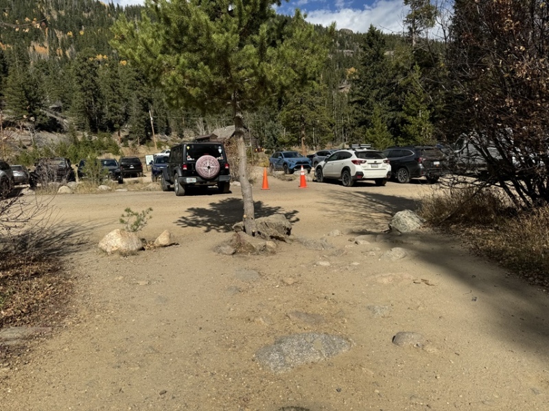
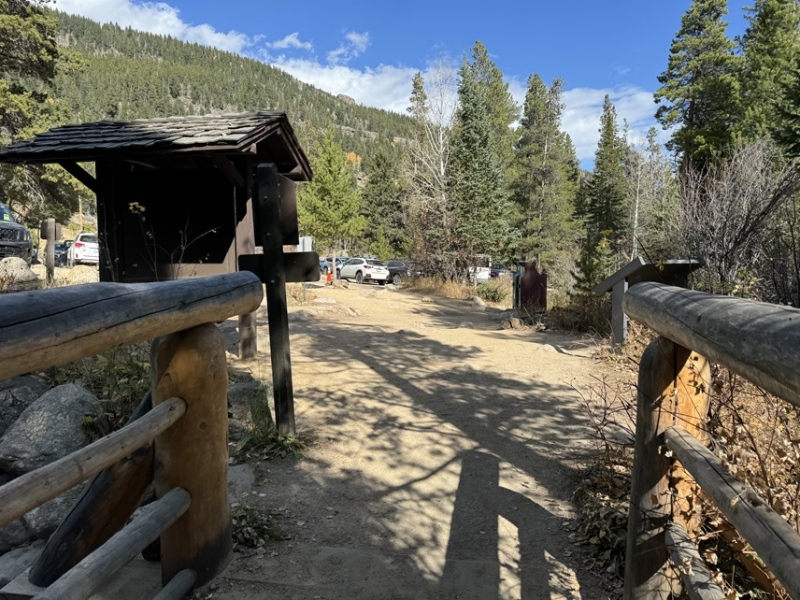
This hike, while long, was much easier than anticipated. I arrived at the Wild Basin Trailhead inside Rocky Mountain National Park and was on the trail at 4am. I’m sure most of you know this, but the park has an entrance fee, and timed entry for this trailhead between the hours of 9am-2pm. The trailhead holds dozens of vehicles, and there’s a bathroom there.
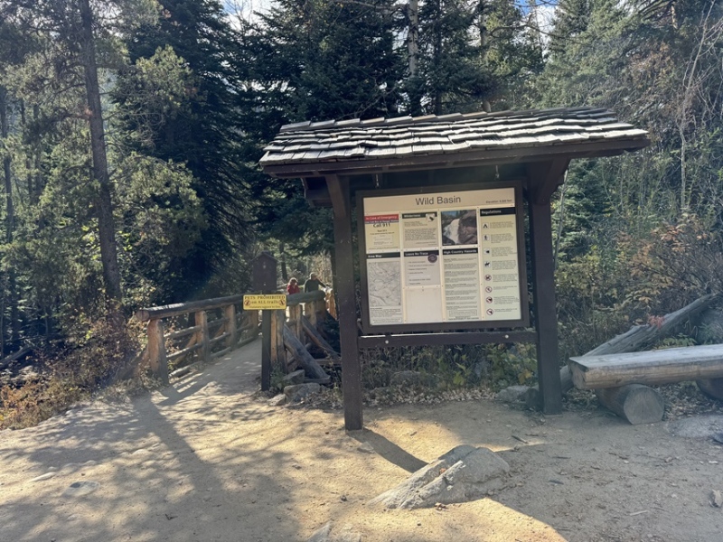
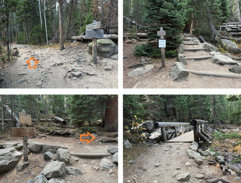
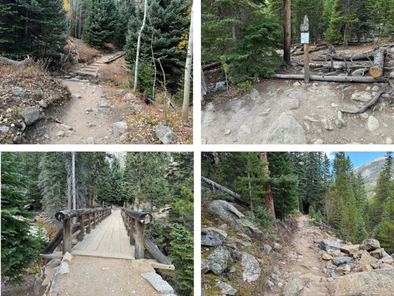
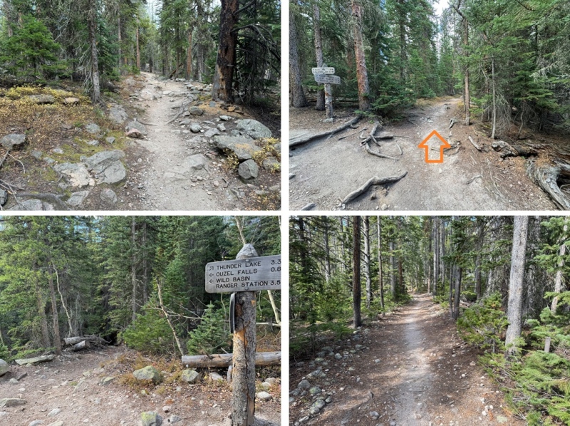
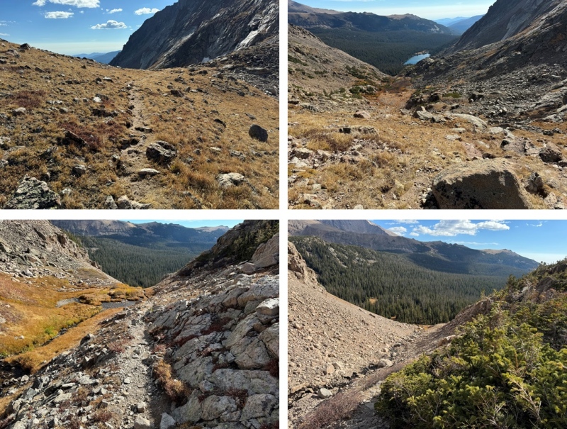
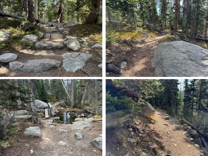
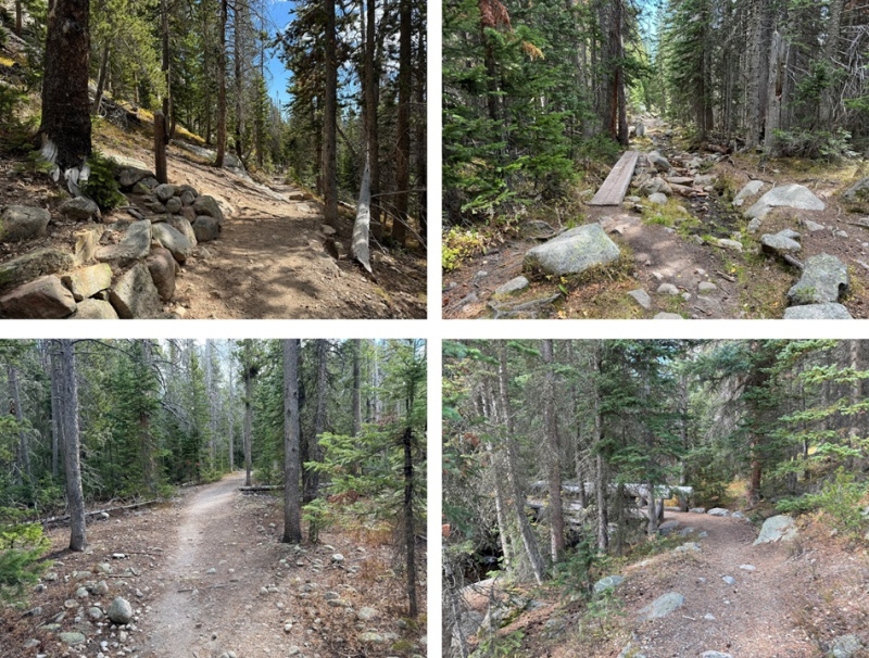
The trailhead starts at the west end of the parking area and is clearly marked.
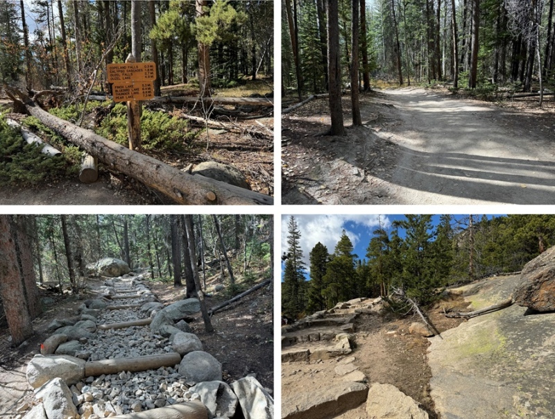
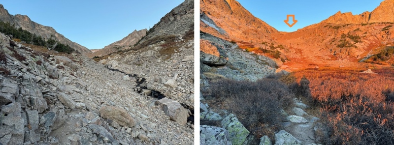
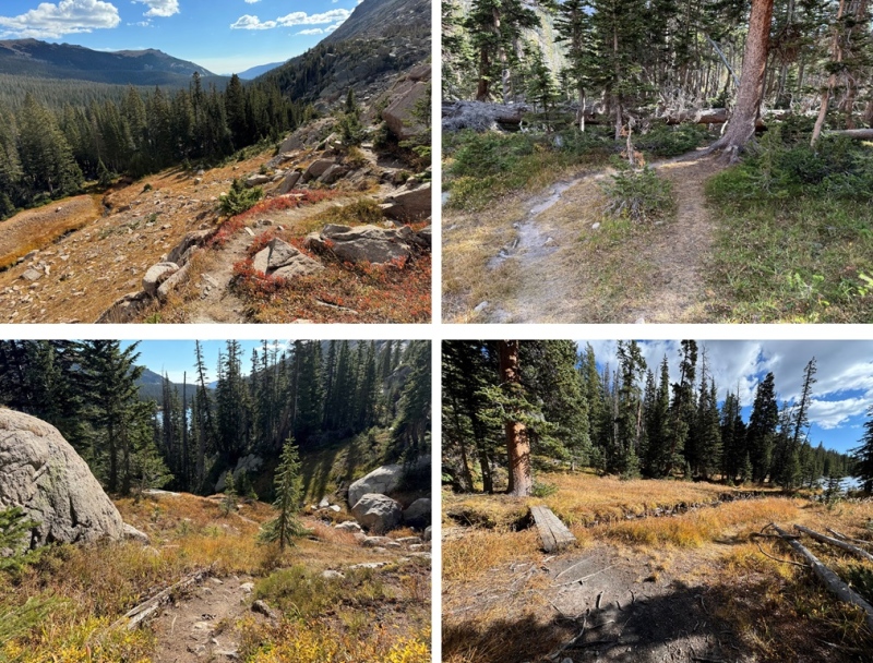
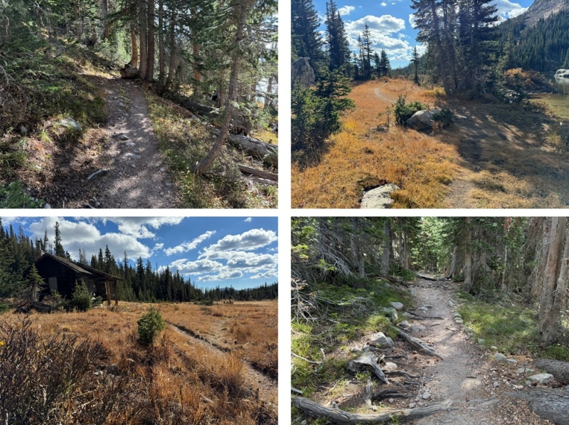
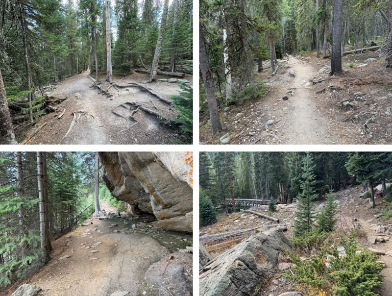
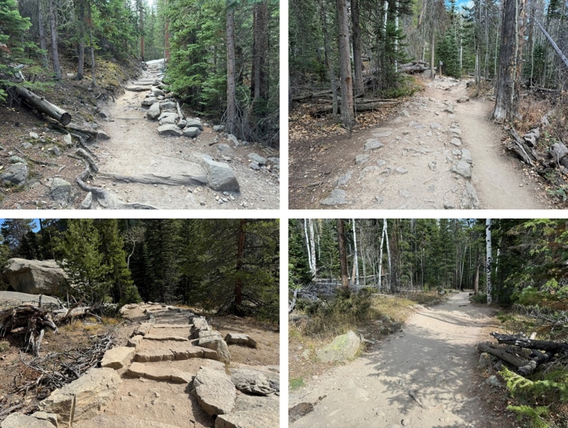
I followed the trail all the way to Thunder Lake. This is a class 1 trail with many junctions, but they are all clearly labeled. I just kept heading towards Thunder Lake, and if Thunder Lake wasn’t on the trail sign (which it wasn’t always), I followed the signs to Ouzel Falls, and then Thunder Lake was on all the rest of the signs. Along the way I passed Calypso Falls and Ouzel Falls. Here are some pictures of the trail and junctions to Thunder Lake:
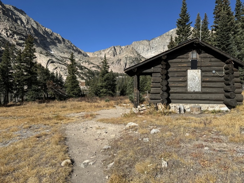
After hiking for a total of 7.2 miles I made it to Thunder Lake, and the Patrol Cabin (which was now boarded up for the winter).
Here the trail continues, skirting the north side of Thunder Lake, then continuing into the trees, heading west all the way up to Lake of Many Winds.
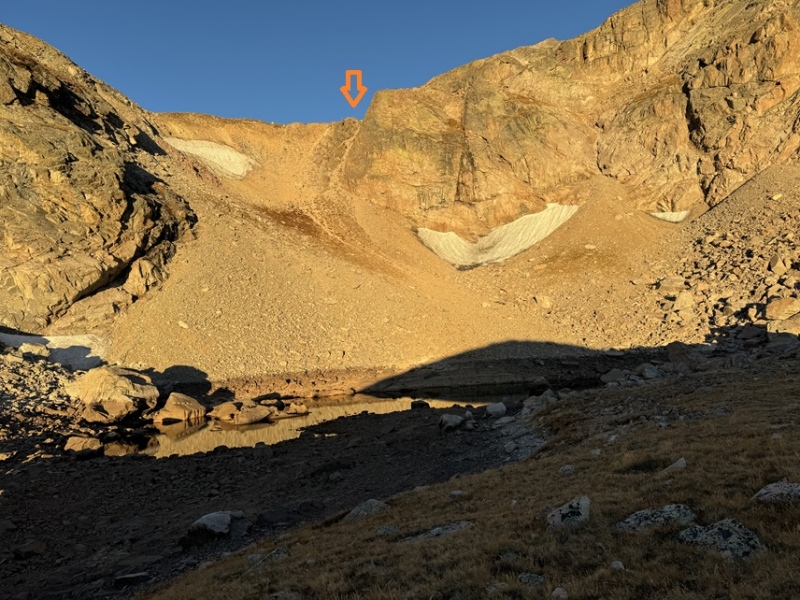
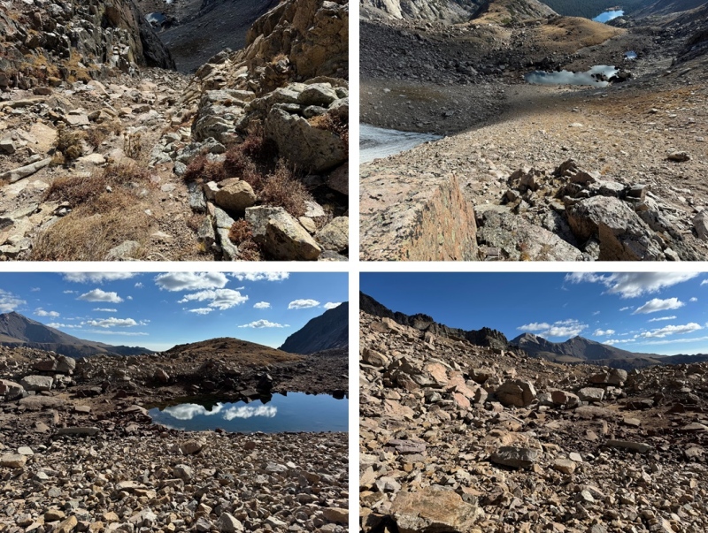
At Lake of Many Winds the trail stops, but the route finding is class 2 and easy to figure out. I kept heading west, aiming for the saddle between 12er Tanima and Mt Alice, otherwise known as Boulder-Grand Pass.
This part is choose your own adventure, but the remainder of the hike is class 2. You’re just trying to gain the saddle. I’d been here before (when I was climbing Isolation), and just went down the scree, which worked well. However, this morning I wanted to try the gully to the right. It was more solid than the scree and offered hand and foot holds. You can take the scree up as well, as all routes here lead to the same place.
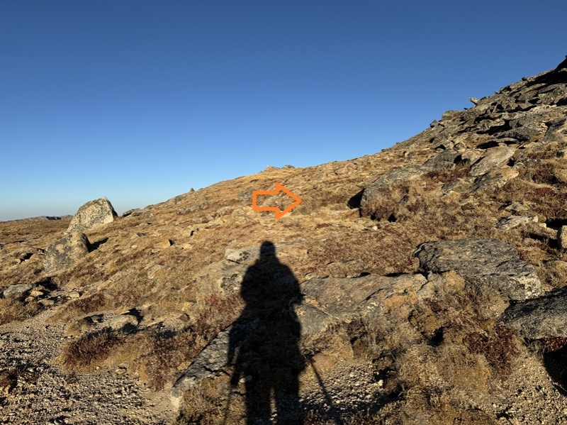
Once at the saddle, I turned right and ascended the ridge north. The true summit is to the west (as per LoJ and my Peakbagger app, and summit register placement).
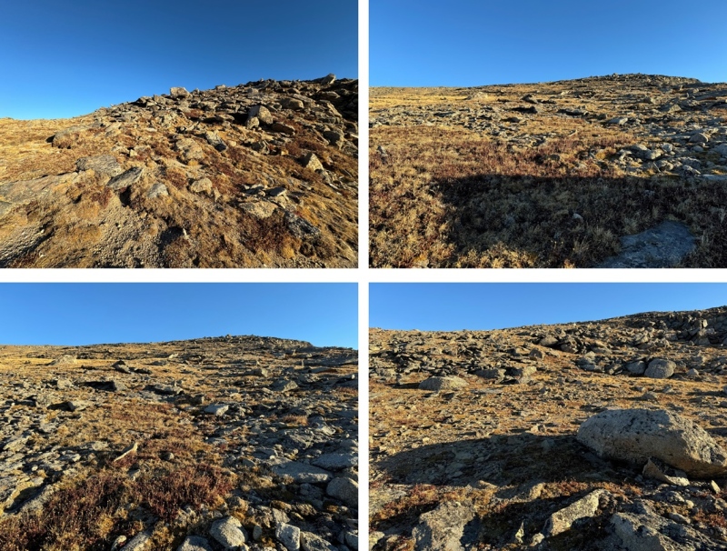
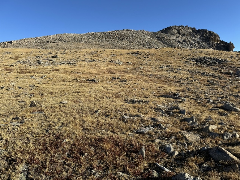
This ridge has a gentle slope and is filled with tundra and large boulders. I was easily able to navigate around the boulders, staying on tundra most of the way. I just kept heading north. I gained 1250’ of elevation in about 1.1 miles to the summit from the pass.
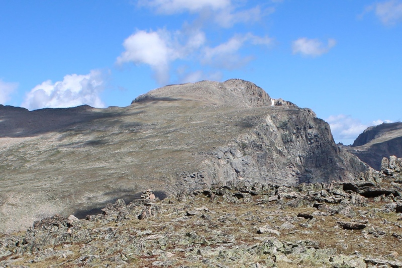
Eventually I could see the summit of Mt Alice come into view
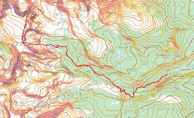
This is the overall route I took to get there
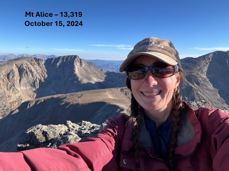
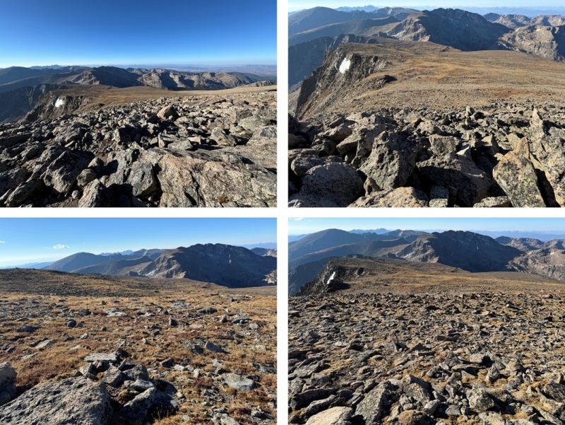
The boulders here were stable, and rock-hopping was quick. Before I knew it, I was at the summit of Mt Alice (which had a cairn and a summit register, but the register was open and empty).
I summited Mt Alice at 9am
Mt Alice:
Now to head back to Boulder-Grand Pass, I turned around and headed south, back the way I’d ascended.
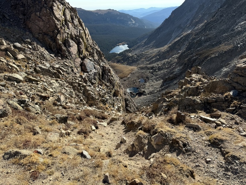
I took the same gully back down to Lake of Many Winds
And then picked up the trail that would lead me back to Thunder Lake.
I skirted Thunder Lake to the north, then followed the clearly marked trail signs for the Wild Basin Ranger Station back to the Wild Basin Trailhead
I made it back to my truck at 12:45pm, making this a 19.98 mile hike with 5159’ of elevation gain in 8 hours, 45 minutes.
On to the next trailhead!
Thumbnails for uploaded photos (click to open slideshow):
Just kidding. But for others who are contemplating Mt. Alice and who like lakes
it might be worth mentioning that an alternative to the out and back version is
(on ascending) to veer off the Thunder Lake trail at the marked turnoff and go by
Lion Lakes 1 and 2, and Snowbank Lake. One also ascends Alice by the hourglass
ridge, which looks kind of imposing but is actually kind of fun (even for hikers of
pretty average ability like me). (I know you know all this and had good reasons for
doing it the way you did it.) I like your suggestion of avoiding the scree below
Boulder-Grand Pass by using the gully off to the north side of the scree mess.
Hiker Mike: Yes, this was an ok time, but I've found class 1 trails go quicker, and since the elevation gain for much of this hike was gradual, it was almost unnoticeable. After doing Pikes Peak from Barr a few times I could do the entire hike up and down in about 7.5 hours. It's amazing what a good trail and not stopping for breaks does for route finding and hiking times. For this hike, Strava gave me 8 hours 15 minutes, but I knew my time car to car was longer, so I changed it in the trip report to make it longer and reflect my actual hiking time (I think Strava discounted my phone calls at the summit and time watching the sunrise at Thunder Lake)
MathGuy, you're correct. There is a loop option, which is arguably much more fun! I had 2 reasons for not doing the loop:
1: I get a lot of questions from interested hikers with limited experience but who are enthusiastic to hike a peak, asking if the route I take is the easiest one, so I try to make a point of either taking the easiest route on my first ascent or figuring one out. My goal is to get as many people up and down safely, and there's a large contingent of hikers who are afraid of class 3, so that usually means taking the easiest route. Just trying not to scare them off hiking some amazing peaks!
2: Most north facing slopes across the state have had snow this week and last week, and while the snow doesn't bother me so much, especially since it's minimal, the black ice that forms when it melts and then freezes overnight does, and I don't like to do class 3 with a thin layer of ice. Isolation had snow on its north face, so I assumed Alice did as well. I was just trying to avoid that potential drama :) I'd much rather the route was full of snow than laced with black ice.
Caution: The information contained in this report may not be accurate and should not be the only resource used in preparation for your climb. Failure to have the necessary experience, physical conditioning, supplies or equipment can result in injury or death. 14ers.com and the author(s) of this report provide no warranties, either express or implied, that the information provided is accurate or reliable. By using the information provided, you agree to indemnify and hold harmless 14ers.com and the report author(s) with respect to any claims and demands against them, including any attorney fees and expenses. Please read the 14ers.com Safety and Disclaimer pages for more information.
Please respect private property: 14ers.com supports the rights of private landowners to determine how and by whom their land will be used. In Colorado, it is your responsibility to determine if land is private and to obtain the appropriate permission before entering the property.


")
")
")
")
")
")
")
")
")
")
")
")
")
")
")
")
")
")
")
")
")
")
")
")
")
")
")
")
")
")
")
")
")
")
")
")
")