Download Agreement, Release, and Acknowledgement of Risk:
You (the person requesting this file download) fully understand mountain climbing ("Activity") involves risks and dangers of serious bodily injury, including permanent disability, paralysis, and death ("Risks") and you fully accept and assume all such risks and all responsibility for losses, costs, and damages you incur as a result of your participation in this Activity.
You acknowledge that information in the file you have chosen to download may not be accurate and may contain errors. You agree to assume all risks when using this information and agree to release and discharge 14ers.com, 14ers Inc. and the author(s) of such information (collectively, the "Released Parties").
You hereby discharge the Released Parties from all damages, actions, claims and liabilities of any nature, specifically including, but not limited to, damages, actions, claims and liabilities arising from or related to the negligence of the Released Parties. You further agree to indemnify, hold harmless and defend 14ers.com, 14ers Inc. and each of the other Released Parties from and against any loss, damage, liability and expense, including costs and attorney fees, incurred by 14ers.com, 14ers Inc. or any of the other Released Parties as a result of you using information provided on the 14ers.com or 14ers Inc. websites.
You have read this agreement, fully understand its terms and intend it to be a complete and unconditional release of all liability to the greatest extent allowed by law and agree that if any portion of this agreement is held to be invalid the balance, notwithstanding, shall continue in full force and effect.
By clicking "OK" you agree to these terms. If you DO NOT agree, click "Cancel"...
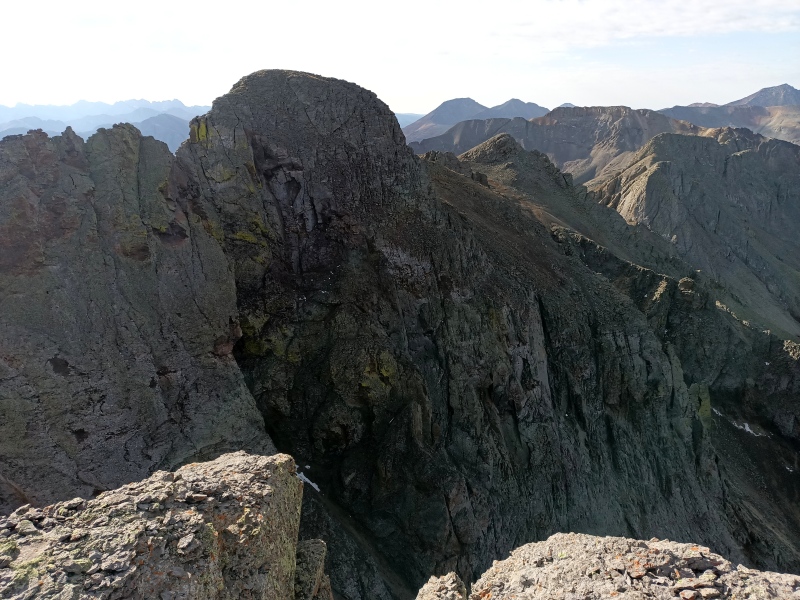
This San Juan Mountaineers-named peak [LoJ] has about as helpful a name as "North Point" (also coined by the San Juan Mountaineers [LoJ]) in distinguishing it from innumerable summits that lie north of something recognizable. But in this case the recognizable thing is South Lookout Peak, itself no cakewalk, and the sheer, rotting spires of the slightly lower (by 22 feet) summit to the north appear impregnable from its top. The 1932 SJM climber's guide notes only that a first attempt was rebuffed, with details in the October 1932 edition of Trail & Timberline (p. 149). I was not able to find any trace of this issue or article online, nor any other record of an ascent; it would be interesting to learn which route was attempted, and when the peak was first climbed. Based on photos from South Lookout and possible weaknesses indicated by LiDAR slope shading, I thought we might find a ledge system on the east side that would get us close to the summit pinnacle.
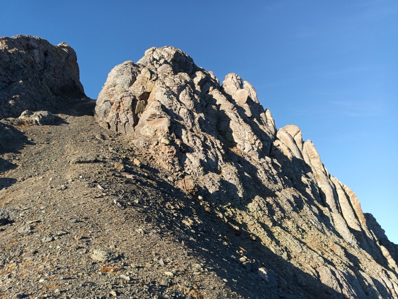
Packing a 70m rope and a ludicrous rack, Jonny and I set off from a switchback on the Ophir Pass road down the informal trail leading south to Paradise Basin. In just over an hour's easy hiking we arrived at the scree gully leading to the deep saddle between the main summits of South Lookout and the North Summit.
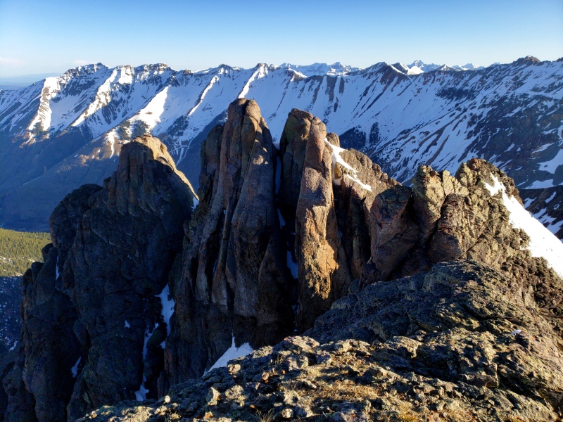
First light on S LookoutApproaching east gullyJonny reconnoiteringApproach gully and east buttress
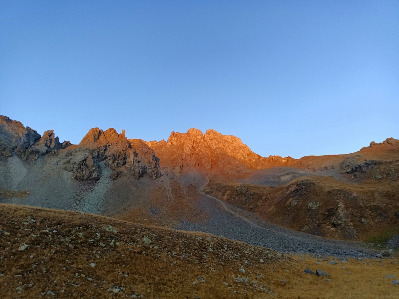
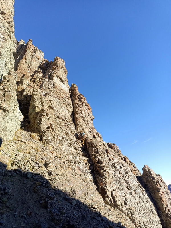
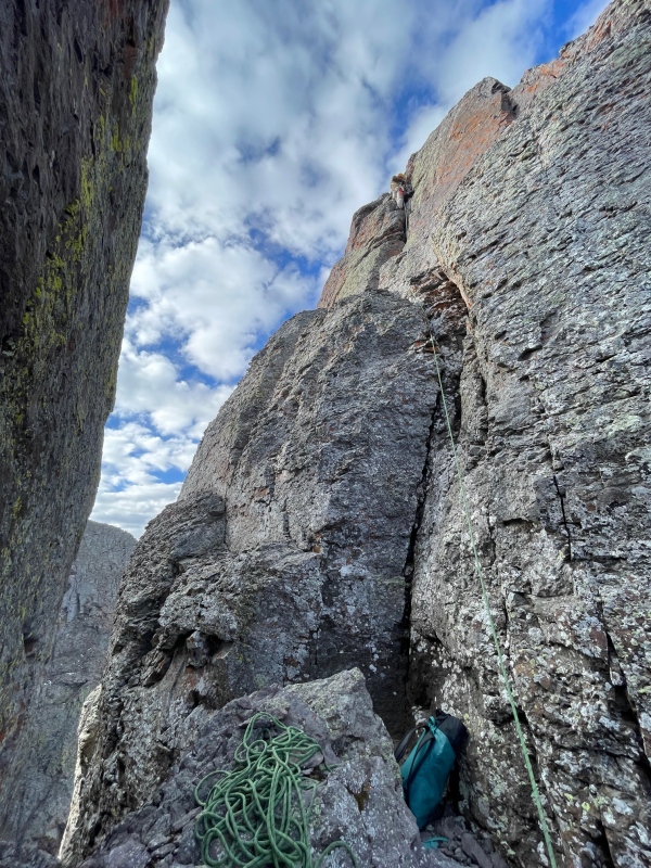
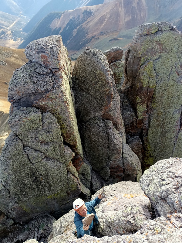
In the gully we passed up some attractive chimneys and dihedrals on the lower east buttress en route to my suspected path of least resistance. Just below the saddle, a faintly sloping ledge crossed the east face of the buttress to our right. We scrambled across, then climbed left up 20 feet of extremely exposed 4th class ramps to easier slopes below the eastern pinnacles. Continuing up to an improbable formation at the crest, we peeked around it to find we were a stone's throw from the summit. Laughing that we'd brought all the gear for nothing, we dropped back down and circled to the north side, tiptoeing west across an airy ledge towards the final scramble.
Approach "ledge"Eastern pinnacles, view to S LookoutNorth side ledge (summit not visible)
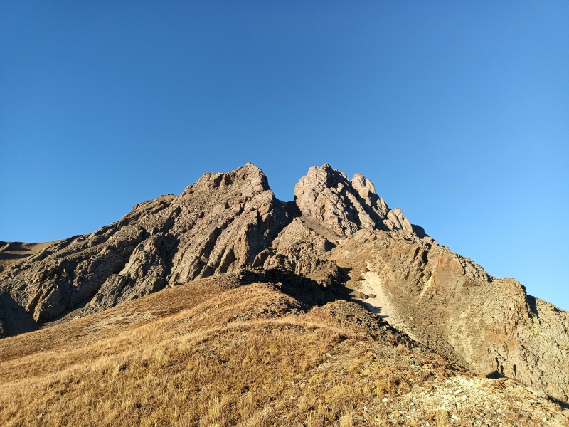
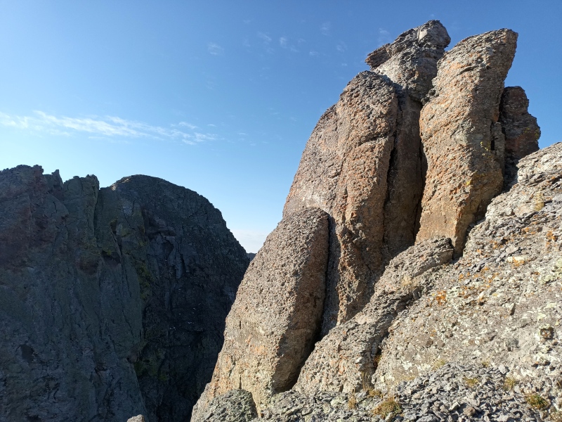
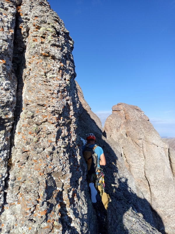
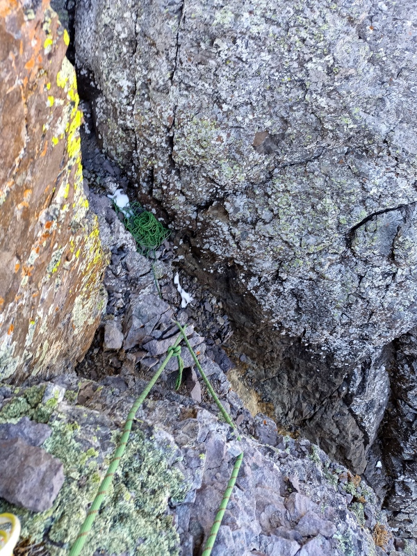
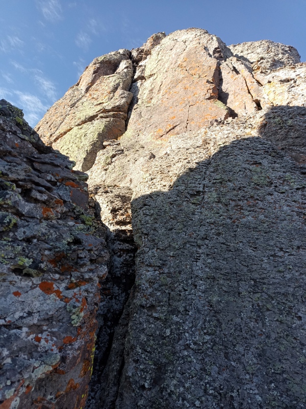
But the ledge ended abruptly, a 10-foot gash separating us from the summit pinnacle. Anchor options at the dead end of the ledge were scarce; thankful now that we'd brought wide gear, we fixed one end of the rope with the #4 and #5 cams and rappelled into the notch. All that remained was a surprisingly fun 40-foot pitch of 5.easy climbing to the top, with abundant hand cracks offering ample protection. We built some cairns on the summit, and Jonny excavated a boulder on the north side for a short and direct rappel back to the notch. Climbing back up the short headwall to the dead-end ledge proved to be the crux of the technical difficulties.
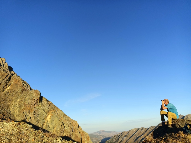
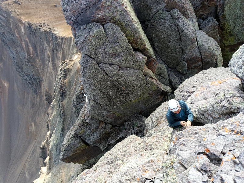
The gash. Also the 5.4 crux on returnSummit from dead-end ledgeSummit pitch from notch (Jonny)Jonny climbing. Dead-end ledge is snow patch to leftView to eastern pinnacles, Jonny cleaning 1000 lb of loose rockS Lookout from N Summit
Returning to the upper east buttress, we debated rappelling one of the south-facing chimneys back to the approach gully, and in the process we found a rappel anchor with a mix of very new and worn and faded tat. Ultimately we decided to just downclimb the 4th class ramps, which was terrifying. After that we scrambled back across the approach ledge, and a quick scree surf down the east gully whisked us to grassy slopes and a pleasant hike out from Paradise Basin.
My GPS Tracks on Google Maps (made from a .GPX file upload):
Yeah, we were surprised at how "easy" it turned out to be. This is one we weren't sure had a route we'd be ok with, considering the rock quality.
The original plan was to traverse over South Lookout from Clear Lake, but we were trying to cram this into a half day and figured we'd lose too much time navigating its north ridge.
The North Summit of South Lookout Peak was attempted on August 17, 1932, by Charles Kendrick, Bob Scott and Dwight Lavender during the CMC 1932 Annual Outing and reported by Lavender in Trail and Timberline. They approached up a "box" couloir to its top and huddled under an overhang while it rained. When the worst was over "we swung around to the north face via a loose and difficult traverse to a ledge about ninety feet below the highest point and perhaps half a dozen yards to the west. At this point we roped."
"At forty feet up in the base of a moderately respectable chimney I drove the first piton and hung a karabiner. Sixty feet up and the second piton was driven and a karabiner hung to it. From this point I belayed Chuck to the first piton; then climbed on to a little shelf where a breathing spell was possible. A third piton was driven here, and not having more karabiners I had to untie and thread the rope through the eye of the piton and tie in again. Another difficult tussle and I found myself on the summit of a small gendarme. To gain the main peak meant one of two things; drop down perhaps fifty feet and try a new route or make a jump from the gendarme to a four-inch crack in the perpendicular wall of the peak. The later was foolhardy, while the former would have required too much time."
"It was heart breaking to turn back with the top scarcely twenty-five feet above, but it was the only thing to do. Chuck rappeled on the single rope. I reached him on two rappels on the doubled rope. The climb as far as we went (perhaps because we were forced by the wet rocks to keep nailed boots on, plus the down sloping holds) was more difficult than anything we had done before."
I don't have any information on the first ascent. Allen Greene of the CMC wrote in a trip report to Ice Lake Basin in 1957 that "since then (1932 outing) the region seems to have been quite neglected, and indeed it is hard to find a club member these days who has visited the area or even knows of its existence."
As always your ready access to rare documents is impressive and appreciated!
It sounds like they approached from Ophir, up the western Y-couloir that is commonly skied, and traversed onto the north face from there. At their highpoint they must have been on the opposite side of the summit pinnacle, since our route up the last 40 ft. of its east face would have been easy climbing for Lavender. That assumes they had correctly oriented to the highest point, which isn't always a given. In any case it sounds like a more difficult route than ours. Their pitons must be in place still.
At least 40. I was gripped by how much more gripped I was than Jonny.
Caution: The information contained in this report may not be accurate and should not be the only resource used in preparation for your climb. Failure to have the necessary experience, physical conditioning, supplies or equipment can result in injury or death. 14ers.com and the author(s) of this report provide no warranties, either express or implied, that the information provided is accurate or reliable. By using the information provided, you agree to indemnify and hold harmless 14ers.com and the report author(s) with respect to any claims and demands against them, including any attorney fees and expenses. Please read the 14ers.com Safety and Disclaimer pages for more information.
Please respect private property: 14ers.com supports the rights of private landowners to determine how and by whom their land will be used. In Colorado, it is your responsibility to determine if land is private and to obtain the appropriate permission before entering the property.
")
")
")
")
")
")
")
")
")
")
")
")
")
")


