Download Agreement, Release, and Acknowledgement of Risk:
You (the person requesting this file download) fully understand mountain climbing ("Activity") involves risks and dangers of serious bodily injury, including permanent disability, paralysis, and death ("Risks") and you fully accept and assume all such risks and all responsibility for losses, costs, and damages you incur as a result of your participation in this Activity.
You acknowledge that information in the file you have chosen to download may not be accurate and may contain errors. You agree to assume all risks when using this information and agree to release and discharge 14ers.com, 14ers Inc. and the author(s) of such information (collectively, the "Released Parties").
You hereby discharge the Released Parties from all damages, actions, claims and liabilities of any nature, specifically including, but not limited to, damages, actions, claims and liabilities arising from or related to the negligence of the Released Parties. You further agree to indemnify, hold harmless and defend 14ers.com, 14ers Inc. and each of the other Released Parties from and against any loss, damage, liability and expense, including costs and attorney fees, incurred by 14ers.com, 14ers Inc. or any of the other Released Parties as a result of you using information provided on the 14ers.com or 14ers Inc. websites.
You have read this agreement, fully understand its terms and intend it to be a complete and unconditional release of all liability to the greatest extent allowed by law and agree that if any portion of this agreement is held to be invalid the balance, notwithstanding, shall continue in full force and effect.
By clicking "OK" you agree to these terms. If you DO NOT agree, click "Cancel"...
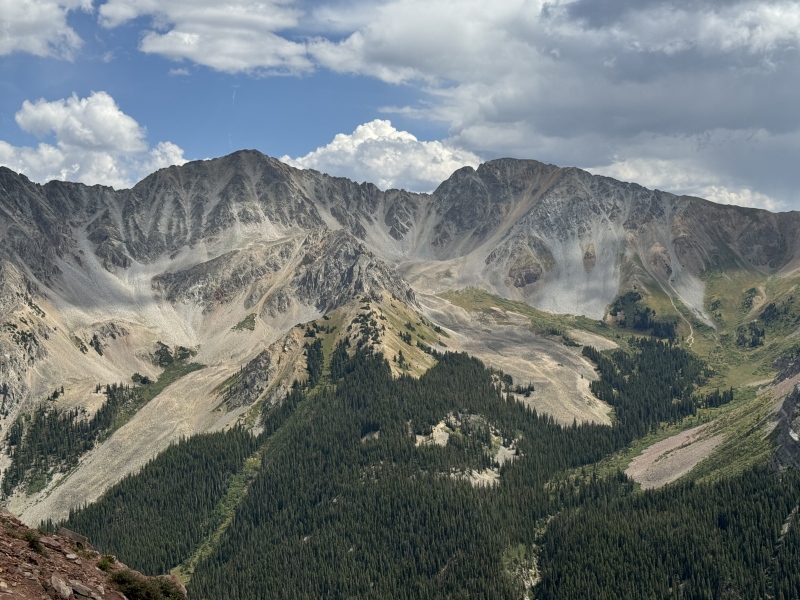
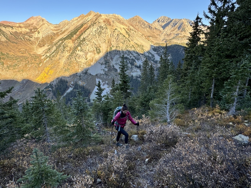
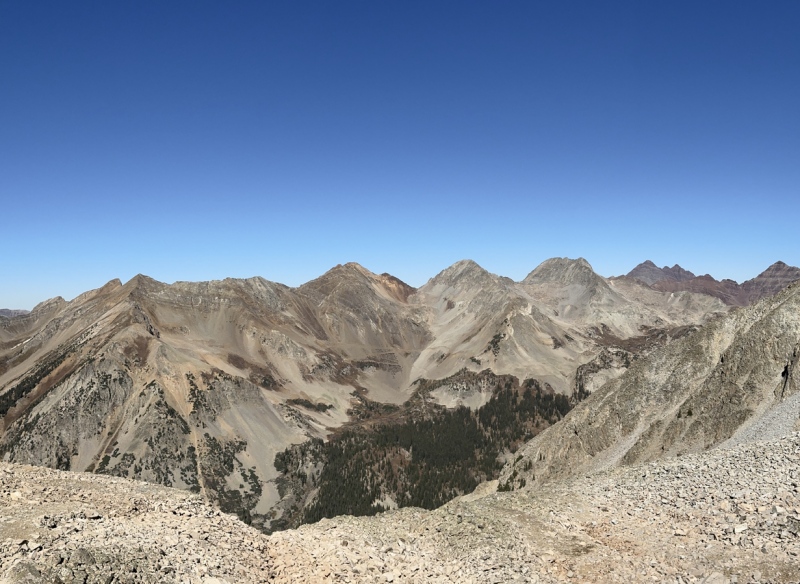
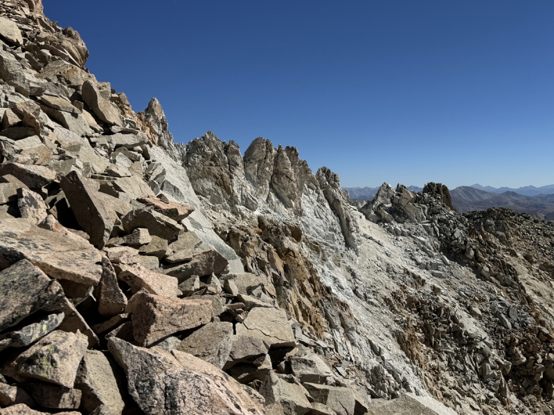
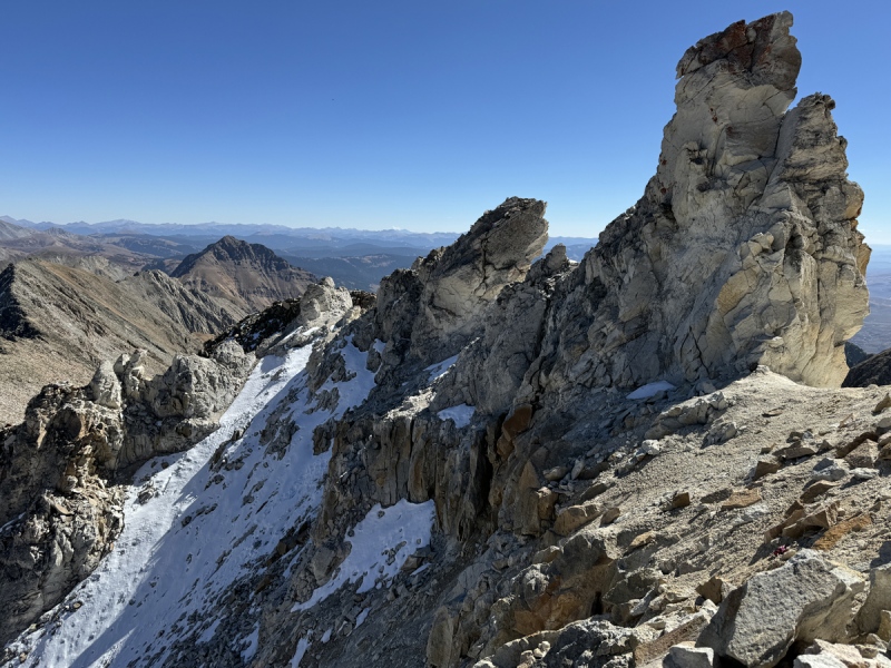
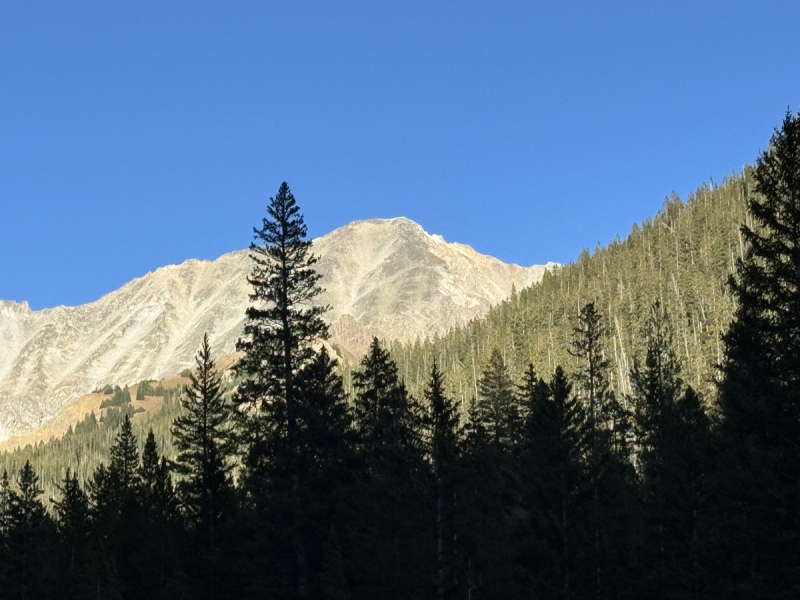
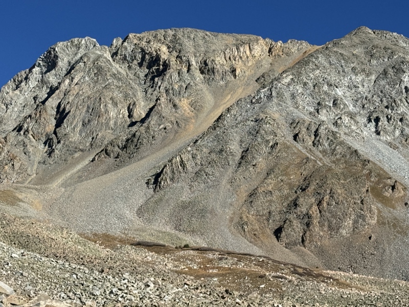
White Rock, White Benchmark and Queen Basin (right) from Virginia Basin Ridge.
We had plans, such glorious plans.
“man plans, god laughs”
First: For those that have tagged both White Rock and White Benchmark on the same hike, kudos to you. Well done.
For years I’ve been looking at Red Mountain outside of Gothic. I’ve looked at possible routes and debated which was best. But I always kept going to back to doing a loop with White Rock, White Benchmark and a 12er point on the way to Red.
Such were the plans we made. But far more than that, we took off work on Friday to do this. Which would give us a rest day on Saturday. And Sunday would be a ridge between the Belleviews. Once all this was completed, we would only have one more peak to get for our Crested Butte list to be complete. Oh, such glorious plans.
Spoiler Alert… as if you didn’t know already, that didn’t happen.
Of the six peaks and points on the agenda for the weekend, we got one. One.
White Rock, #62 on our list.
The short version: White Rock is a shitty hike. It’s all steep slopes and miles of boulders. We decided it is by far the worst hike we’ve done in CB. We would rather hike Golden Tops or Precarious again, then repeat this pile of loose rocks. It took way longer than expected.
With that said: I have an idea for those that want to do both peaks in one hike. See toward the bottom... Stats at the very bottom.
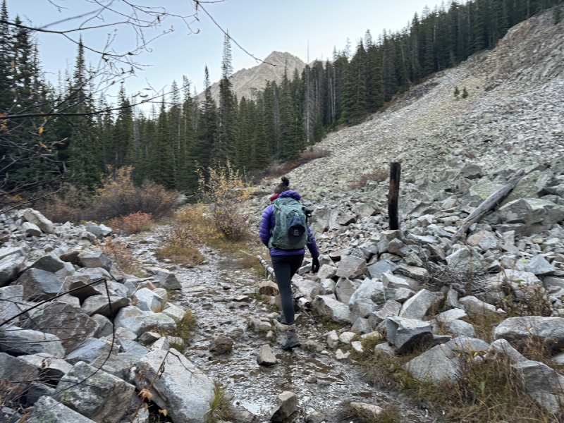
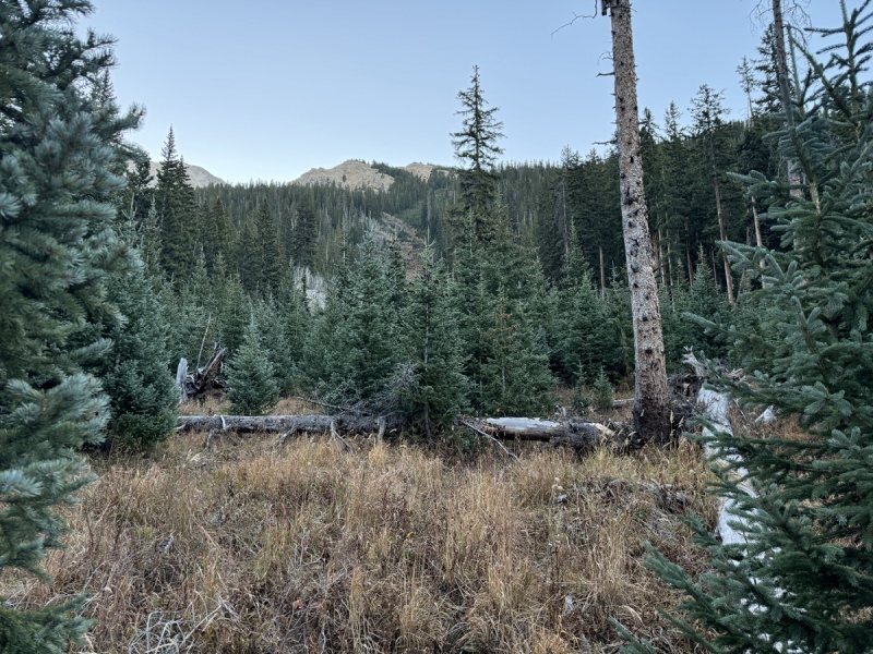
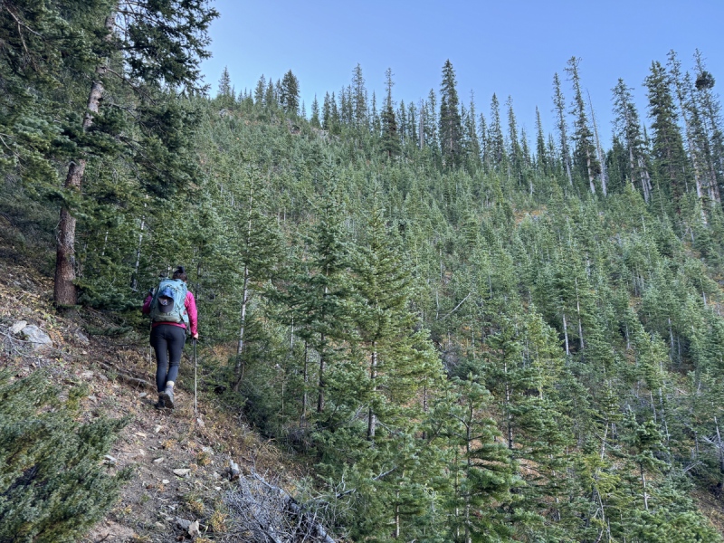
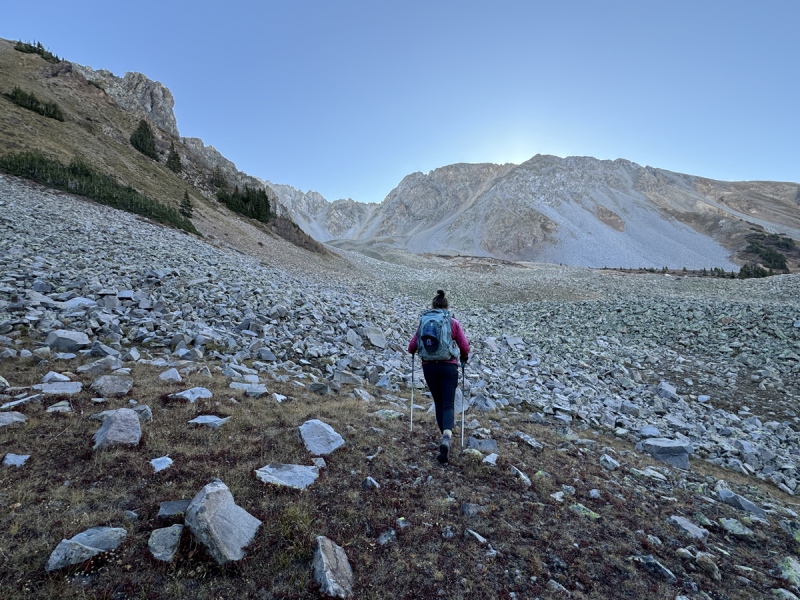
Trailhead views
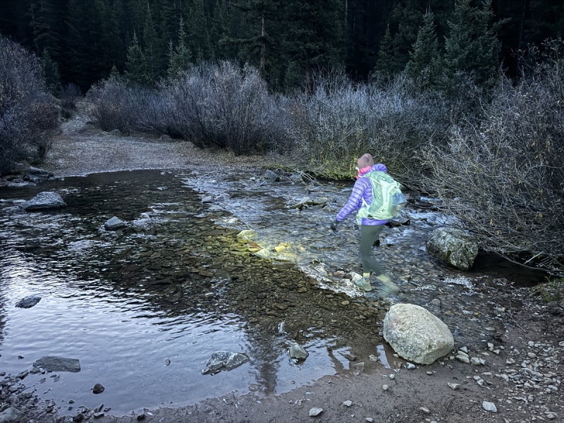
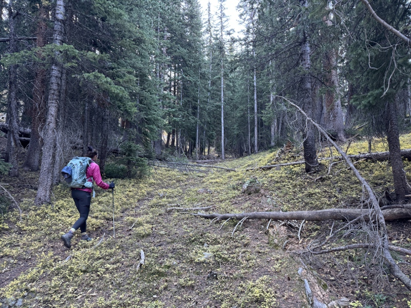
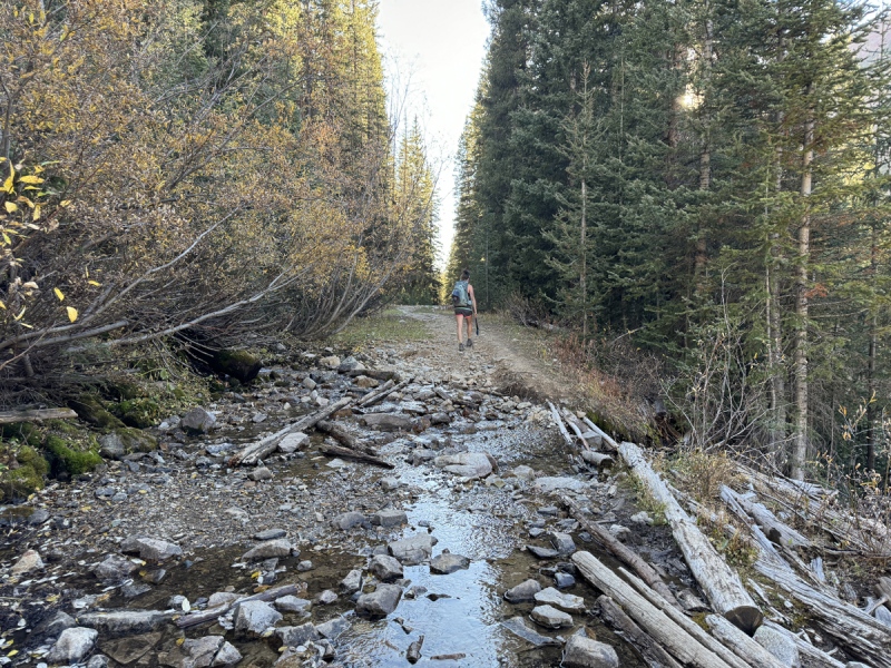
Crossing Copper Creek at 2 miles
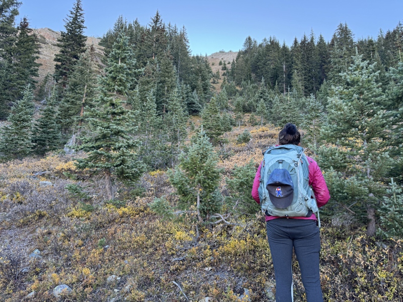
Queen Basin drainage
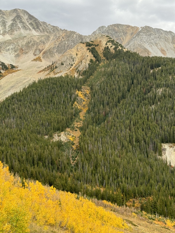
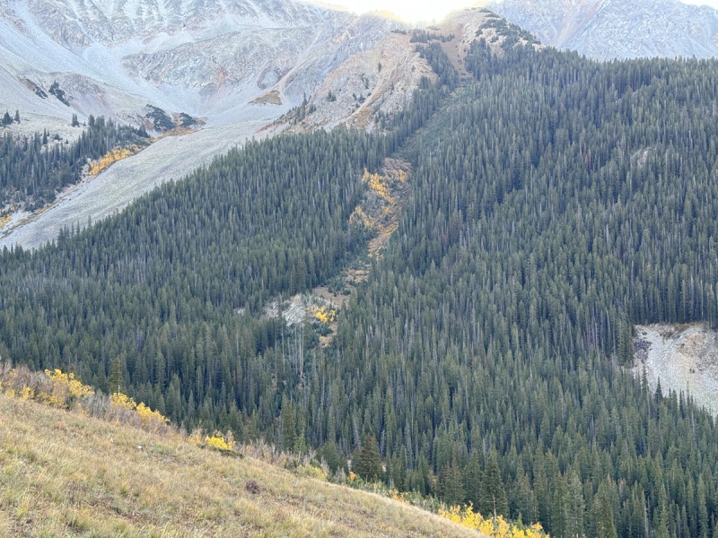
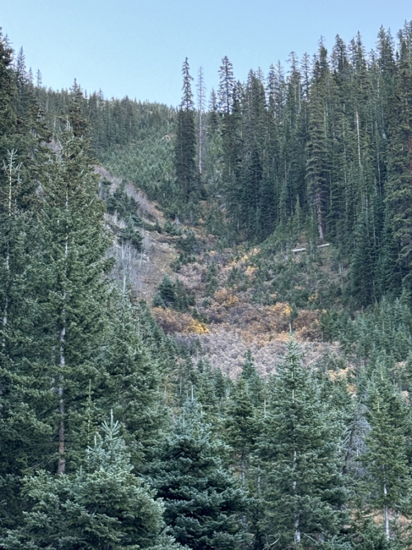
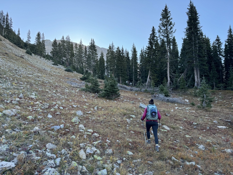
Boulder field, you know you are getting close to the avy path.
Looking up the avy path, near 3 milesLook at the avy path area from 13,043 hike.Look at the avy path area from 13,043 hike.
The long version:
We were going to follow, Ben’s TR & track to White Rock from the west, Judd Falls. Then cross over to the east and drop down instead of that nasty ridge traverse. Head to the SE saddle to gain Benchmark, then go backdown to hike over to Red, southwest of Benchmark. Then bushwhack back to the Copper Creek trail to make this a loop. Yep, grand plans.
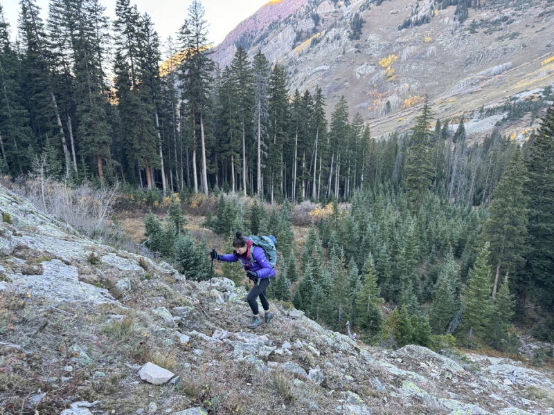
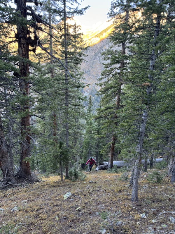
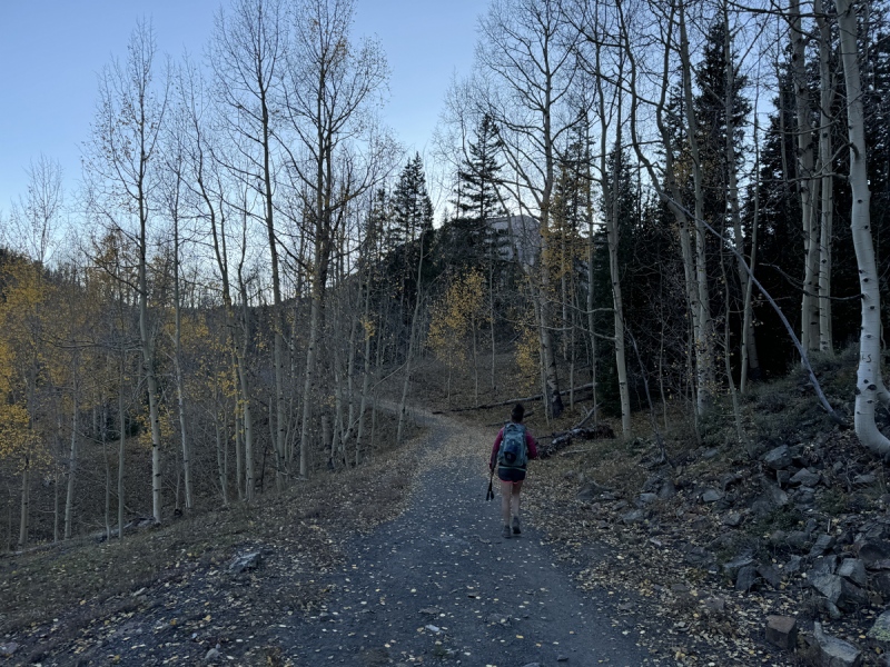
We camped at one the designated dispersed sites that are no longer dispersed along Gothic Road. Alarm went off at 5 a.m. and we started moving around. By the time we got ready and drove up to Judd Falls TH and started walking, it was 5:50 a.m.
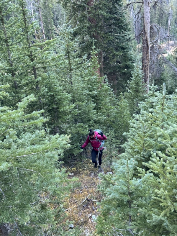
That was close to our schedule. We wanted to walk the trail in the dark and have light when we got to the avy path that is the route up to Queen Basin. We had a quick snack and took off layers and headed up, just to the left of that path. The trees are spaced out better and you don’t have to deal with so many willows and small aspens in the path. (This was our second time up to Queen Basin this way.)
Far left of the avy path, has a short rocky section.
View of avy... we stayed left, in the trees, and up
Less bushwhacky on the left
Less bushwhacky on the left
Near 11,200, we left the large trees and headed into upper part of the avy path into small evergreen trees
Near 11,500, shadow of White across the way on the slope of 13,043
Near 11,500... see the rocks above... go right...
This route is steep. Near 11,200, we left the large trees and headed into upper part of the avy path into small evergreen trees. Still steep, but much easier than the path below this.
Near 11,500, you can see the rock wall, slope, above, and we went right to the other side of the path, into large trees again. We followed a game trail through the trees to another gully like formation which leads to Queen Basin near 11,600. There is one line of trees that blocks your view of the basin until you pass through it like a curtain. Then behold… a shit ton of boulders.
In the trees on the right, following a game trail to Queen Basin
Curtain of trees at Queen Basin
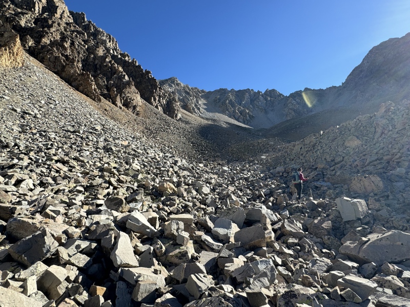
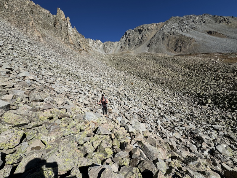
In Queen Basin... boulders abound
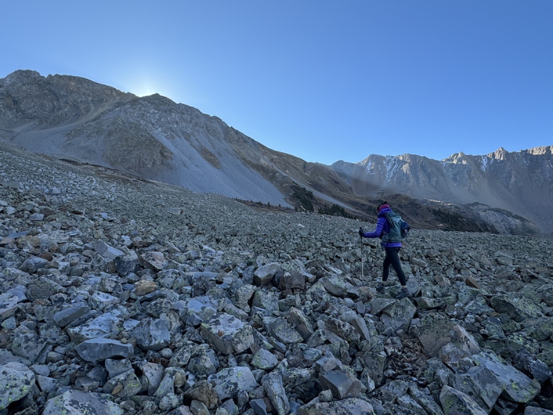
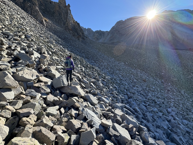
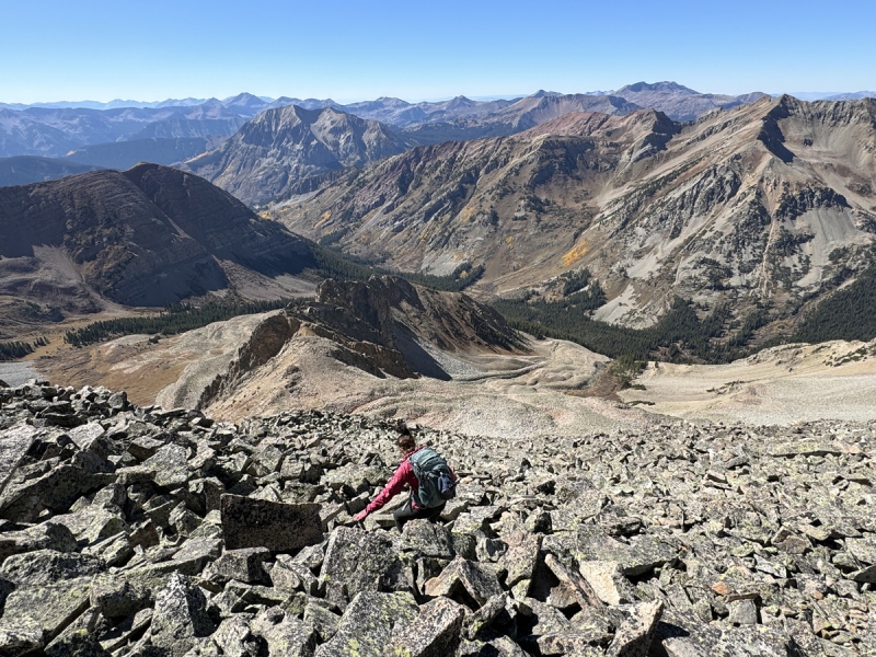
Yep, this where this hike gets tedious. So many boulders. They really won’t stop until the summit. There will be a few short stretches of other terrain, but it always goes back to boulders.
We stopped and had a quick snack. Once on the boulders, it felt like the temperature dropped. The rocks were still holder the evening temperature. The sun was just about to come up over Benchmark. When it did, it changed the temperature quickly.
More boulders.
More boulders.
boulders
boulders
boulders
boulders
Turned the corner to find some dirt and ground cover.
More boulders.
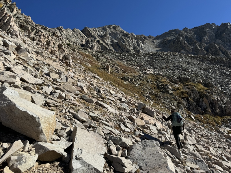
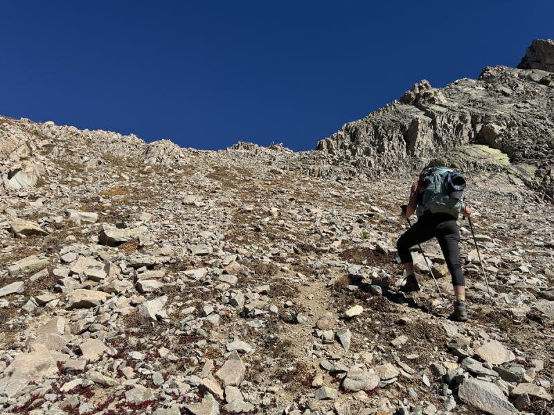
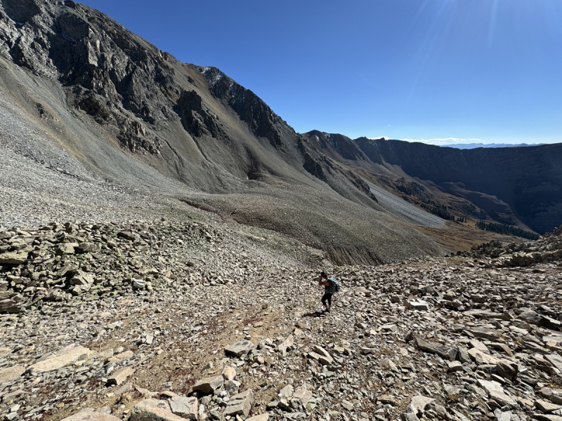
We could see the ridge and went up on loose dirt and rocks.
boulders, near the turn toward the ridge
Going up to the ridge
up to the ridge
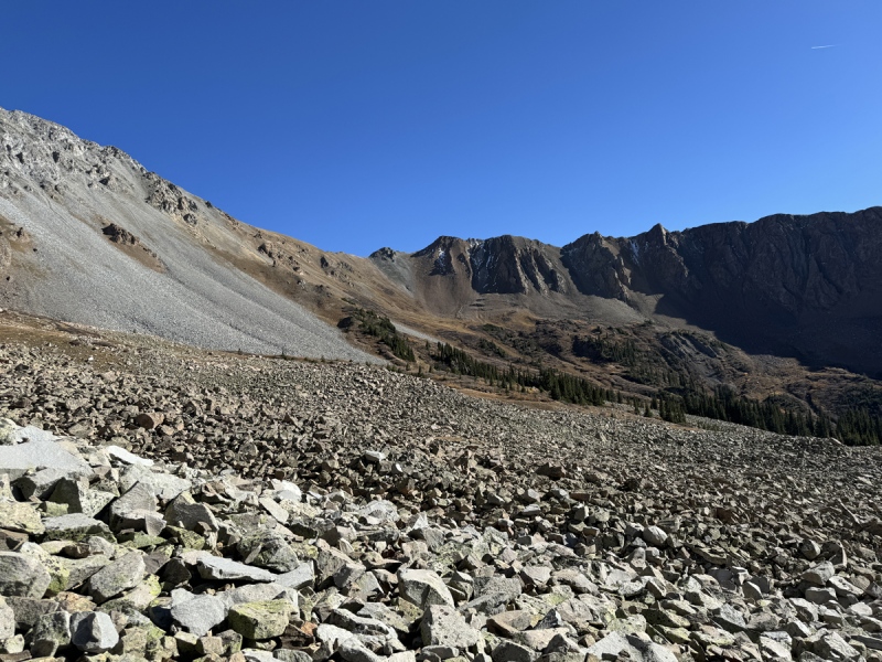
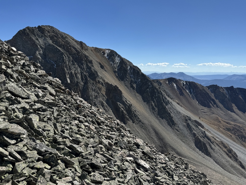
View from the bottom of the ridge, 13,043, Golden Tops, Cassi, Precarious
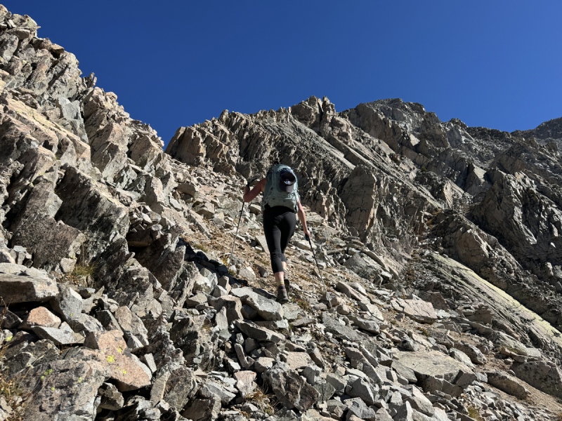
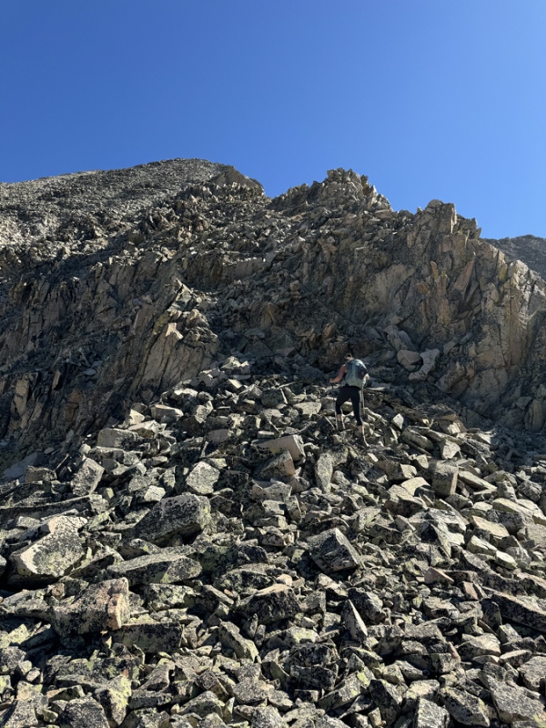
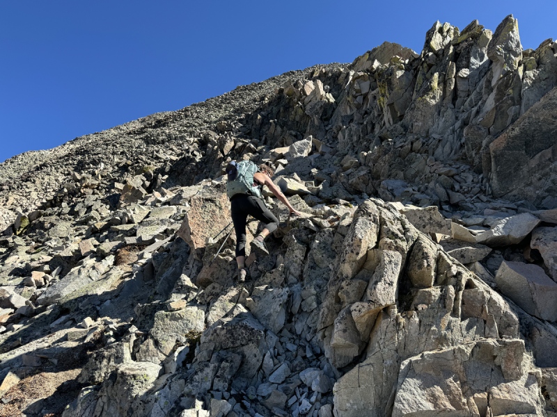
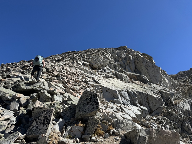
The ridge looked scrambly. It was for about 100 feet.
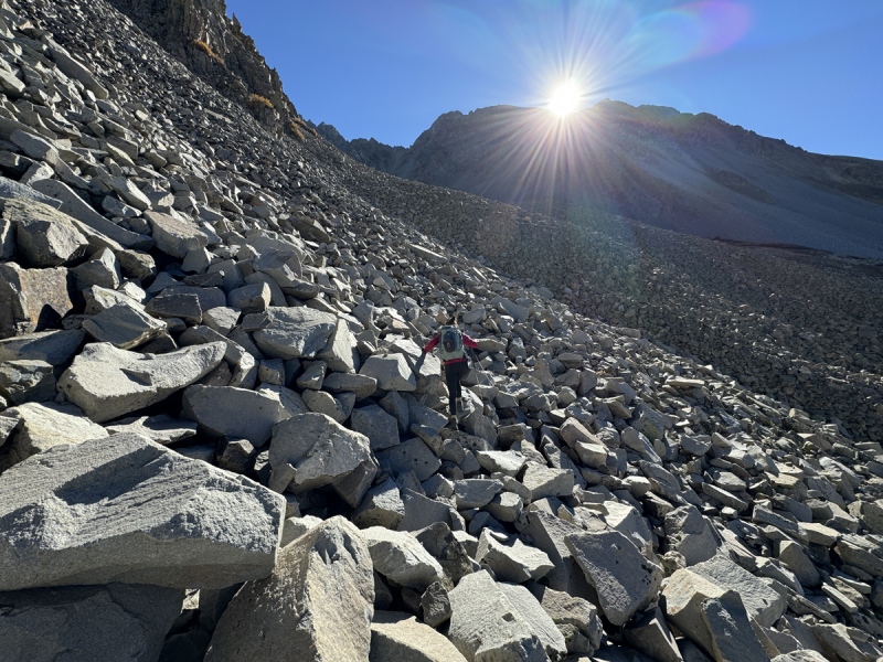
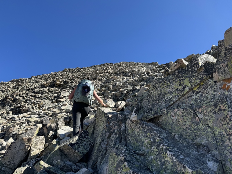
Then more boulders.
All the way to the top.
A lot of them moved which made this more tedious. You can tell very few people hike this peak.
Looks like a scramble, but it's not
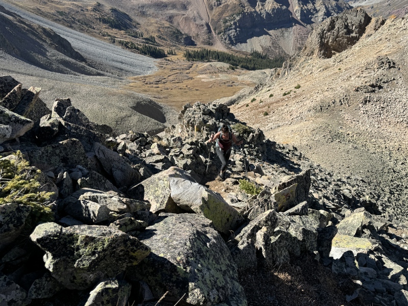
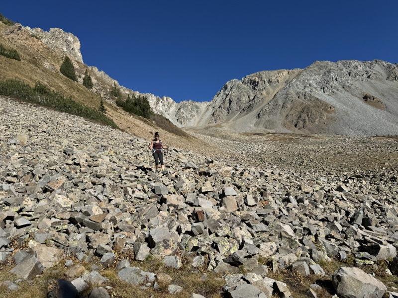
On the lower ridge
Lower ridge
The boulders begin, again...
boulders
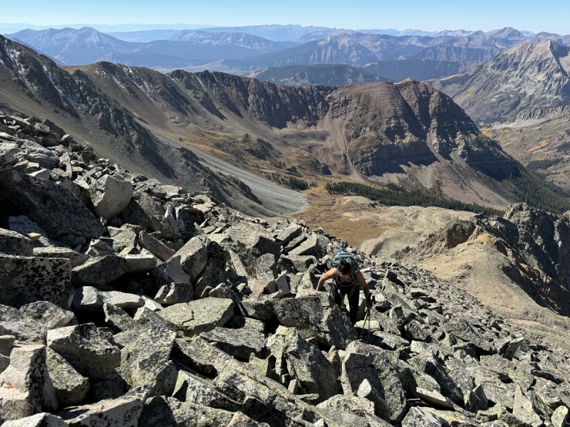
In the ridge... Red Mountain behind
More boulders
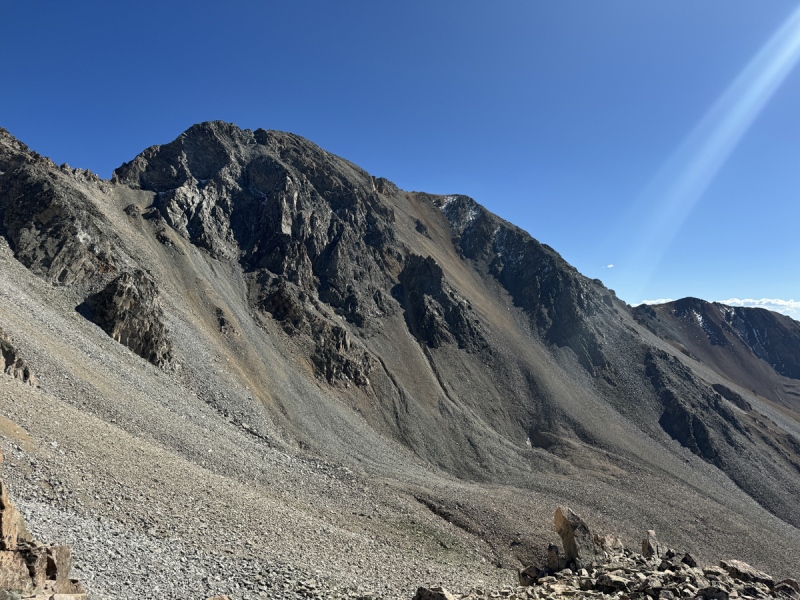
A glimpse at the white towers
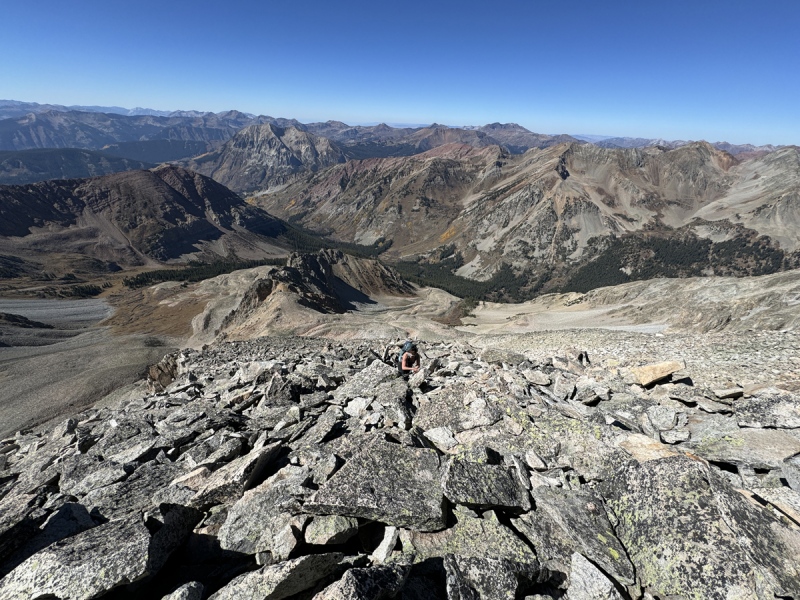
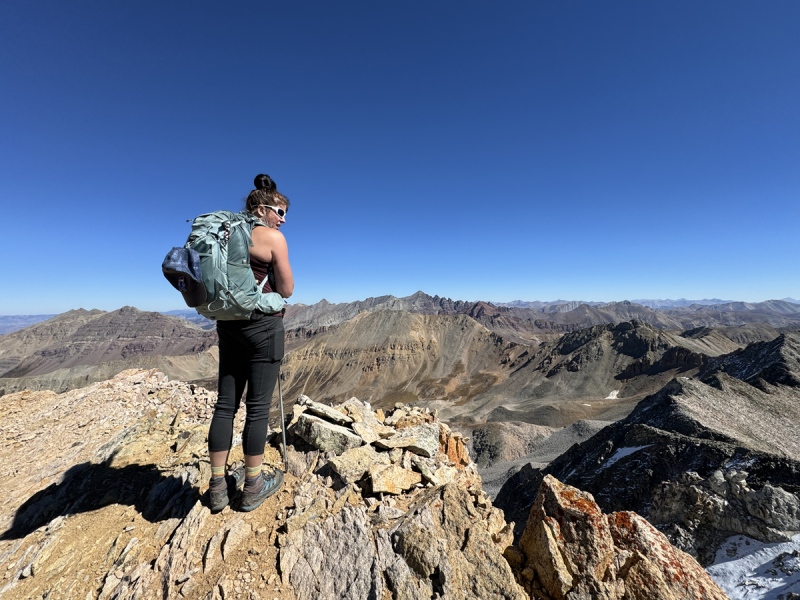
Summit! 6 hours later....
We reached the top and were tired.
It took us 6 hours to reach the summit of White Rock. For context Ben and Whiley did it in 3:15. I thought we were in good hiking shape. But now, I feel like I was in better share in August. What the hell? They are fast as #$%^&. I thought we were making OK time, but obviously not.
I had brief thoughts that this loop was in trouble today. But, I thought we could make up some time on easier terrain.
That didn’t happen.
Had snacks. Signed the registry. Then looked down.
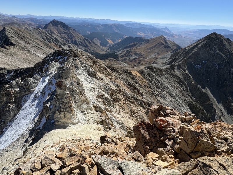
Looking down at the white towers, ridge to Benchmark
Climbing down
Snow on the route... on the loose route
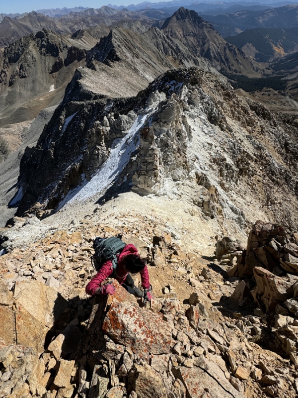
The summit was a loose Class 3 scramble on bad Elk rock to drop down the other side. We went down. Then the white towers were crumbly. The white dirt was loose. I went down the right side to look, no good, and a no-fall zone.
The left side, I was shocked to find so much snow still on the mountain. That crappy soft white dirt was loose enough, now it had several inches of bad snow covering it. The snow on the steep loose dirt was what gave us pause. If we could have known what was under there, it might have changed our minds. Or if we would have come up from the east side, it might not have looked so bad.
We waffled back and forth. It probably would have gone without too much trouble. Probably. Maybe. Maybe not. Ugh. We decided that wasn’t something we wanted to cross. So, we decided we would follow Ben’s route back down and to cross Queen Basin toward Benchmark’s southern saddle.
Going back down
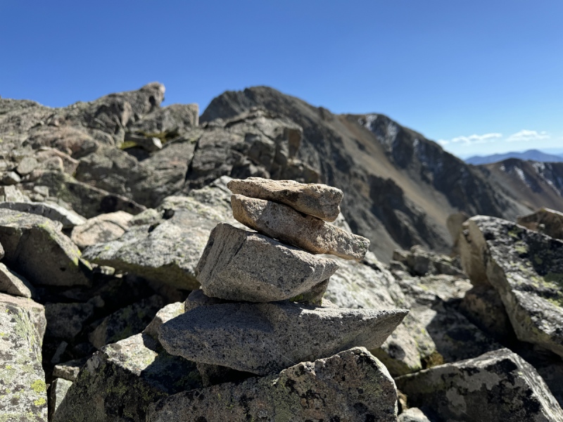
Only cairn we saw all day was at 13,000 feet
boulders
more of those boulders
Looking across Queen Basin to a saddle to reach Benchmark
So back up the loose Elk rock to the summit. And then back down the wobbly boulders.
At one point, Staci sat down and said she just felt defeated. Yep, I felt that too. Because I knew deep down, this day was over. It was a one-peak day and our finishing plans were done for the season. But I didn’t want to say it out loud just yet.
We knocked down boulders. Some just rolled. But nothing went tumbling down the slope. Just enough movement that we had to check each rock, each step. And even then, as we moved, some rocks shifted balance. Ugh.
We finished the ridge, and went back down toward the boulders. More tedious steps.
We kept looking up at White Benchmark. And did some bad math about time, distance and gain. The math wasn’t in our favor. I even checked my water bladder. That wasn’t in our favor either.
Well, that 6 hours up and an hour plus on the summit, then the time back down took way too long. We were running low on water, stamina and desire. It was here, we finally admitted that our hiking agenda was over. It was time to go back down to the trailhead and camp.
At 3 p.m., nine hours into this sucky hike, we decided to call it a day.
Back on the trail... about 12 hours in...
White and the white towers from the Copper Creek crossing. The ridge up is in view.
Not as many leaves as the weekend before.
Once off the boulders we took a long break, finished our pizza and ate some snacks, at the edge of Queen Basin.
My idea of the loop was done. Now I had to figure how we would hike Benchmark and Red. Together? Separate? An odd loop? An out and back? From which direction, east, west, south? Which trailhead: Judd Falls, Deer Creek, Teocalli? Too much to figure out now.
We headed back to the avy path slope and then down to the trail. The only other beings we saw were all the cows set loose for fall grazing.
But let me tell you something about cows. They like comfortable trails and care nothing about Leave No Trace. They made this ultra smooth path, just off the main Copper Creek Trail. You don’t even have to look down to miss rocks.
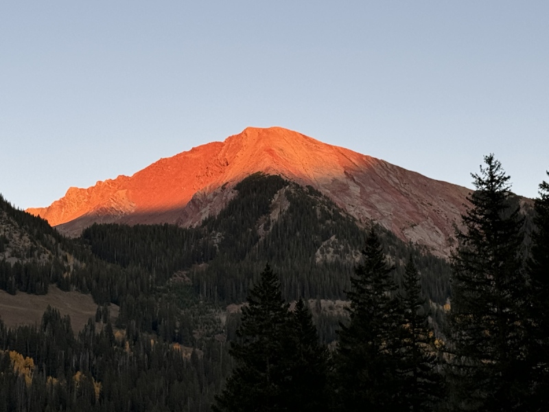
We saw a couple people near Judd Falls. We were the only vehicle at the upper TH. We got back to camp in time to see Avery Peak light up red with the sunset.
We finished setting up camp: canopy, gas fire pit, Camp Chief stove. We took hot sponge baths. Drank wine. And ate stew. The stew was probably an omen… Right before we walked out of the house… the stew, or about half of it, fell on the floor. Think “The Office,” Kevin, and chili. Should have known then something was going to happen.
The Idea for Getting Both Peaks:
For those that want to hike both, hike Benchmark first, from either direction. There is a gully of what looks like dirt and scree that comes off Benchmarks southern ridge and comes down in a northwest direction into upper Queen Basin. Ends near 12,200. I think it will go. At least go down. Might be too loose to climb / hike up it. But scree surf that thing all the way down. It doesn’t look like there are any significant rocks in the way. Only question… is it easy enough to get into the gully from the top. Looks OK. But those that have seen the top of the ridge would know for sure.
When I get up there, I’ll take a look and add some photos here.
The benefit of doing this… you don’t have to back track down Benchmark’s ridge and then go down and across Queen Basin. It puts you in a good spot near the turn to White’s lower ridge. It would save you time and at least one mile.
For those that have been up there, any thoughts on this route?
White Benchmark: Check out that dirt and scree gully top to bottom.
Check out that dirt and scree gully
From another angle, check out that dirt and scree gully
Back at camp, we kept asking each other what are plans were for the rest of the weekend. Our friend Megan was going to join us Saturday to camp. But what about Sunday? Do we stick to our original plans?
We decided to not hike the rest of the weekend. Which meant, we decided we were not going to try and finish our CB list this fall. We knew we had limited weekends, and probably couldn’t take off more time from work and other responsibilities.
This decision was awesome. Lists are great, but they can become a burden and remove the fun of hiking these peaks. I remember when we were getting close to finishing the 14ers, that list kept the tension up. We both kind of settled in to just camping and enjoy the views for the weekend. Next summer and fall will be fun in CB. Just a few more peaks and points to go for our “inner” ring of peaks around CB.
While at camp, I added another “point” to the list. A 12er point, just north of Avery, kind of a large fin. We could see it perfectly from camp. Not sure is Staci really gets irritated at me for adding peaks and points, but she loves to come to CB. When we first started, I think we only had 30 or 40 peaks on the list. So, I think she’ll be OK with this. Now, which trailhead to start at for this point?
Avery Peak at sunset.
The new point added to our list.
The Ugly Numbers
The Trail: TH to Avy Path 9,800 to 10,450: 650 gain 5:50 a.m. to 7:25 – 1hr 35min 3.1 miles
The Slope / Avy Path to Queen Basin 10,450 to 11,600: 1,150 gain 7:30 a.m. to 8:50 a.m.: 1hr, 20min 0.7 miles (1,000-foot bushwhacky slope in 0.4 miles) Running Total: 3.8 miles, 1,820 gain, 3 hours
Across Queen Basin to the Turn 11,600 to 12,300: 700 gain 9:05 a.m. to 10:25 a.m.: 1hr 10min 0.6 miles 10,000 boulders (yep, took way to long) Running Total: 4.4 miles, 2,540 gain, 4hr 30 min
The Turn and to the Ridge 12,300 to 12,600: 300 gain 10:35 to 11 a.m. 0.1 miles Running Total: 4.5 miles, 2,850 gain, 5hr 5 min
Ridge to Summit 12,600 to 13,523: 923 gain 11 a.m. to 12:25 p.m.: 1hr 25min 0.3 miles Running Total: 6hr 30min, 3,735 gain, 4.8 miles
Summit Time 12:25 p.m. to 1:55 p.m.
Summit down to end of Queen Basin 1:55 p.m. 4:00 p.m.
QB to TH 4:15 p.m. to 6:20 p.m.
Totals 8.8 miles, 12hr 30 min, 3,750 gain (nearly 3,100 feet of gain in 1.7 miles)
If you want to see some trip reports for a bunch of other CB area 12er and 13er peaks, check out our blog.
My GPS Tracks on Google Maps (made from a .GPX file upload):
I have done both peaks together from Queen Basin, and overlapped part of your route/proposed route but got up White BM differently and down White Rock differently (for better or worse lol).
So to get up White BM from Queen Basin, you want to be farther south than the scree gully, your intro photo on the right side shows nice grass basically all the way to the ridge just north of PT 12832 on the map, Go up that!
Then I went down the scree gully (and found a weather balloon!) before going up essentially your upper White Rock route. I went straight down the west face of White Rock, picking up the more open treed/grassy slope on the left side of your intro pic (parallels the large scree field), crossed a small talus field and finished in open grass to just before the main trail crosses the side creek I was no paralleling. I can mark up a map and email you if you'd like!
PS - I want to go back and ski the scree gully, and possibly the west gully on White Rock. Those could be good snow climbs!
I've heard many stories like this about the infamous White Rock and finally got a good look at it when I did a big loop in Conundrum basin a few weeks ago however Marmot put out a good TR https://www.14ers.com/php14ers/tripreport.php?trip=21977 that makes it seem less than tedious. Per usual IMO the Elks are best enjoyed with snow as I get a little frustrated when I can't move as quickly as I like because I don't trust the dry rock. Seeing what you and your better have done this summer together is impressive. Bravo!
Caution: The information contained in this report may not be accurate and should not be the only resource used in preparation for your climb. Failure to have the necessary experience, physical conditioning, supplies or equipment can result in injury or death. 14ers.com and the author(s) of this report provide no warranties, either express or implied, that the information provided is accurate or reliable. By using the information provided, you agree to indemnify and hold harmless 14ers.com and the report author(s) with respect to any claims and demands against them, including any attorney fees and expenses. Please read the 14ers.com Safety and Disclaimer pages for more information.
Please respect private property: 14ers.com supports the rights of private landowners to determine how and by whom their land will be used. In Colorado, it is your responsibility to determine if land is private and to obtain the appropriate permission before entering the property.

")
")
")
")
")
")
")
")
")
")
")
")
")
")
")
")
")
")
")
")
")
")
")
")
")
")
")
")
")
")
")
")
")
")
")
")
")
")
")
")
")
")
")
")
")
")
")
")
")


