| Report Type | Full |
| Peak(s) |
"Proposal Peak" - 13,339 feet |
| Date Posted | 10/01/2024 |
| Date Climbed | 10/01/2024 |
| Author | WildWanderer |
| From Eureka Gulch |
|---|
|
Proposal Peak – 13,339 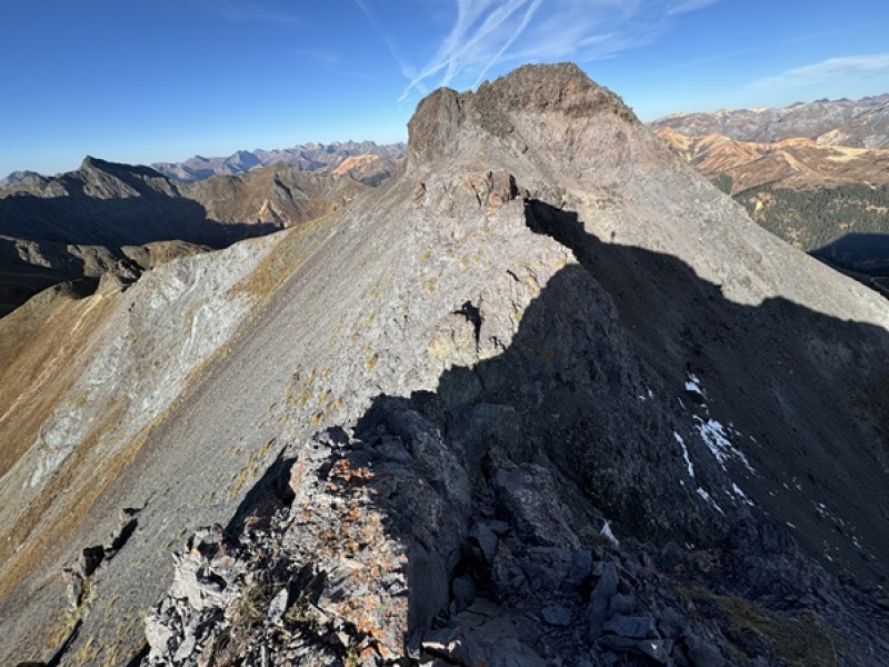
RT Length: 3.4 miles Elevation Gain: 1652’ I drove up Eureka Gulch Road to 11930’ and parked on the side of the road. This is a dirt road but can be driven in a high clearance 2WD. From my parking spot, I could see the route before me. 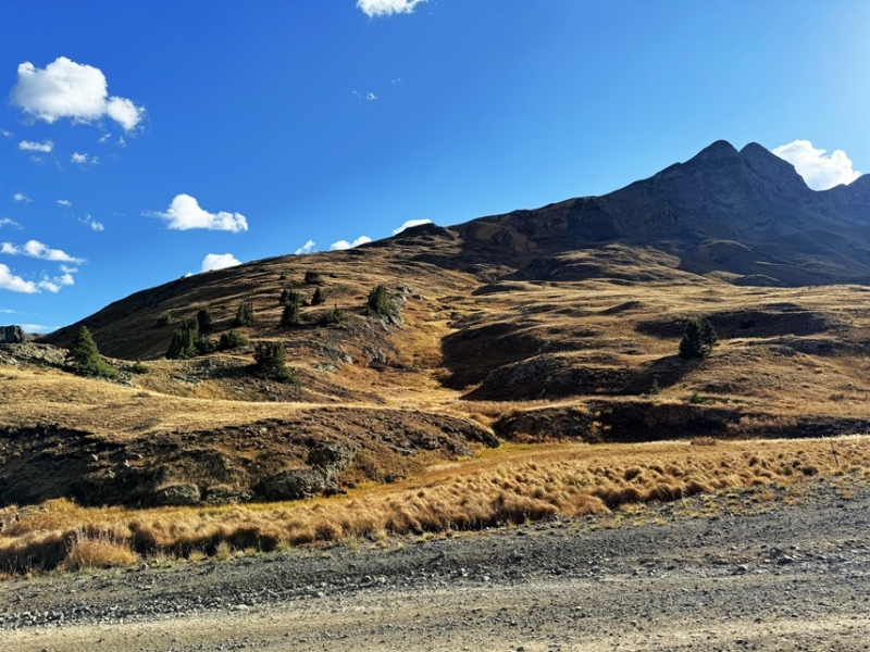
On my way in I went right, which ended up giving me needless elevation gain I would lose later. Instead, head south/southwest and use the route to the left. Game trails pick up there that will lead you to McCarty Basin. 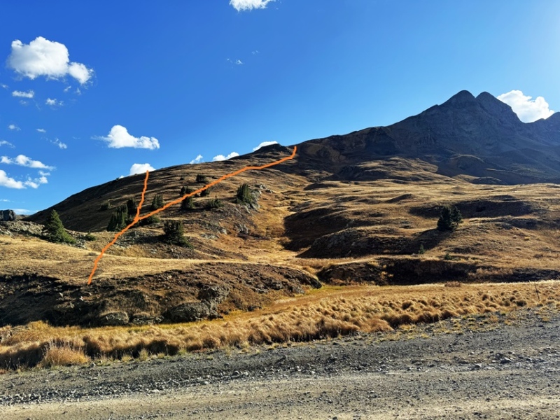
I was on the trail at 6:45am. I started out by heading south/southwest up the tundra 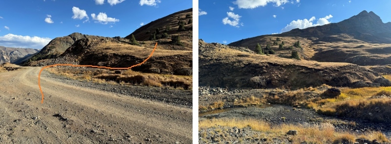
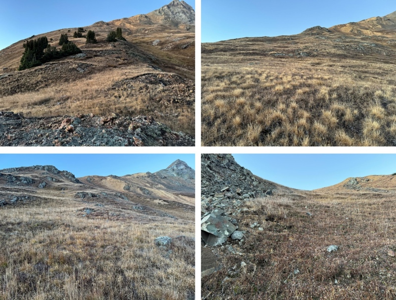
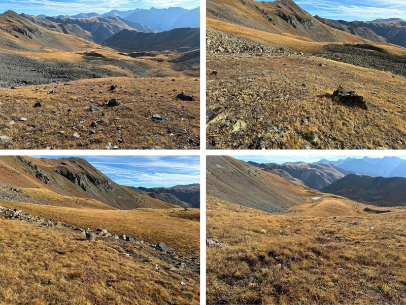
As you can tell, I’d ascended too high and had to lose elevation to head into McCarty Basin. However, I could now see my route to Proposal Peak 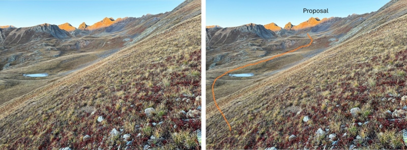
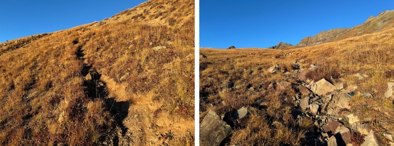
I dropped down into McCarty Basin, and followed the tundra southwest 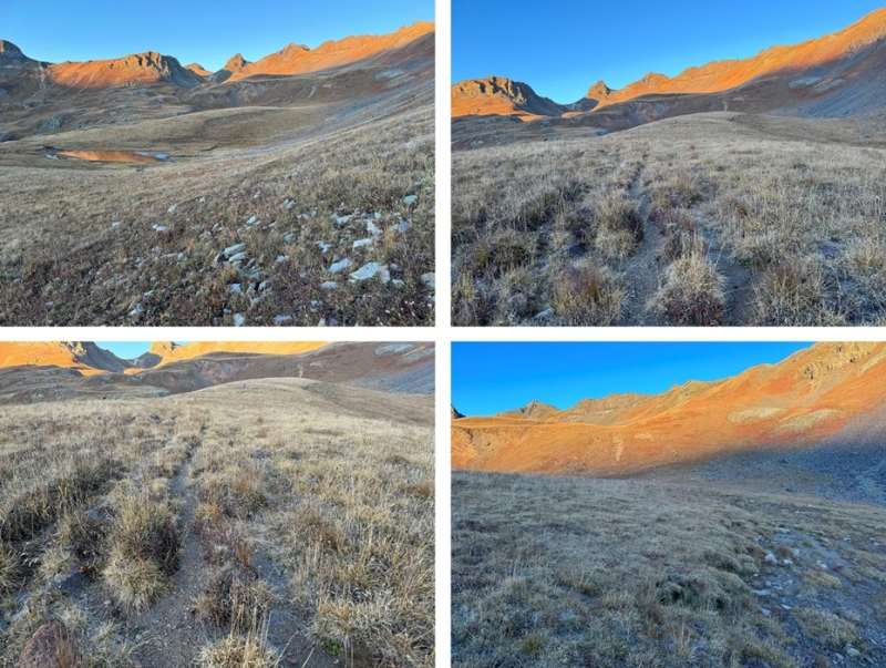
I came to a game trail, that brought me to the upper basin 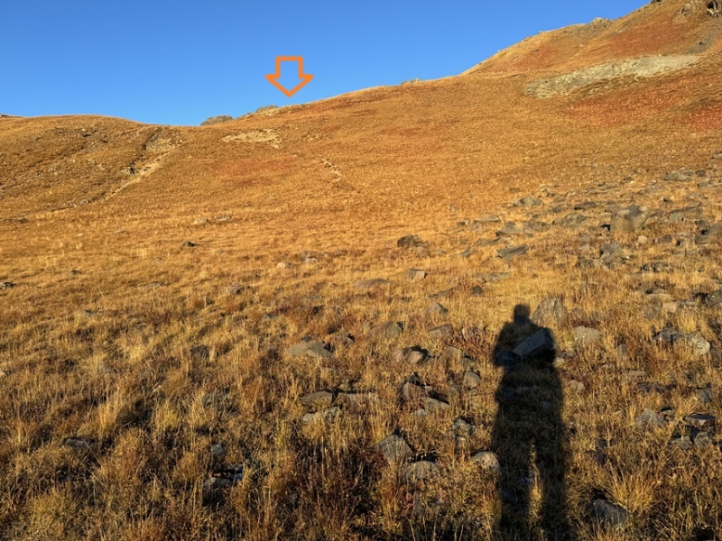
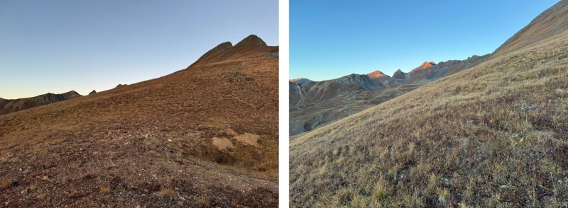
I could now see my route to the ridge. If you want to keep this hike class 2, ascend to the saddle on the left, and skirt around the south side of the peak. This will include steep scree, but it will remain class 2. I chose to gain the ridge (the class 3 option). 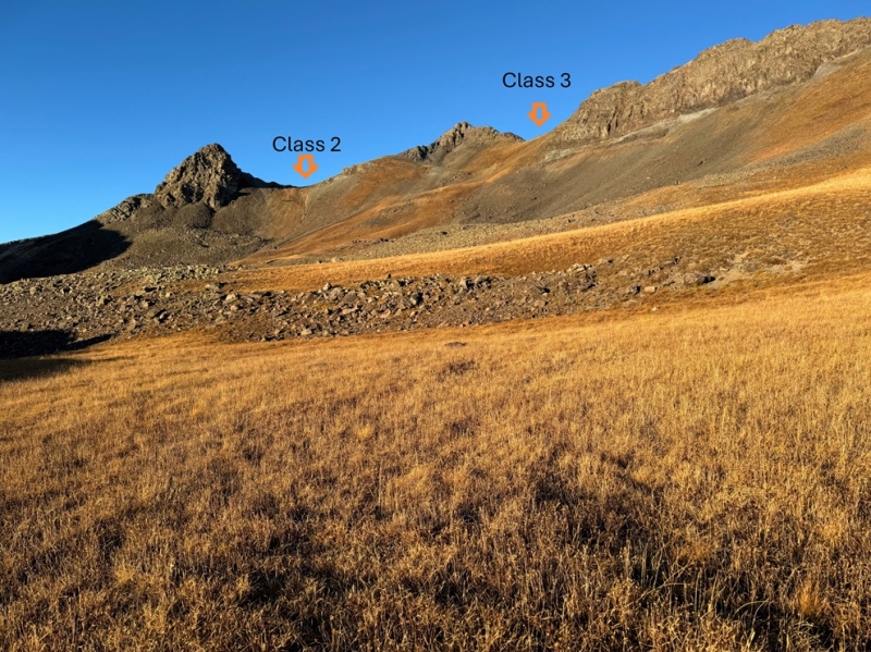
I was able to follow the tundra all the way to the ridge 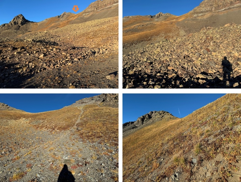
Once on the ridge I could see the true summit of Proposal Peak to the southwest. 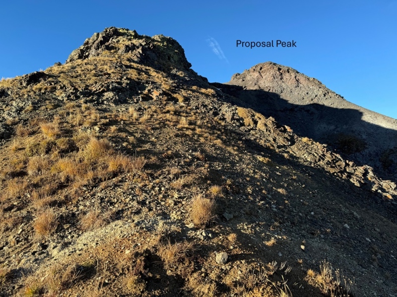
I continued following the ridge south. This was all class 2. 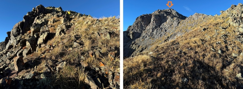
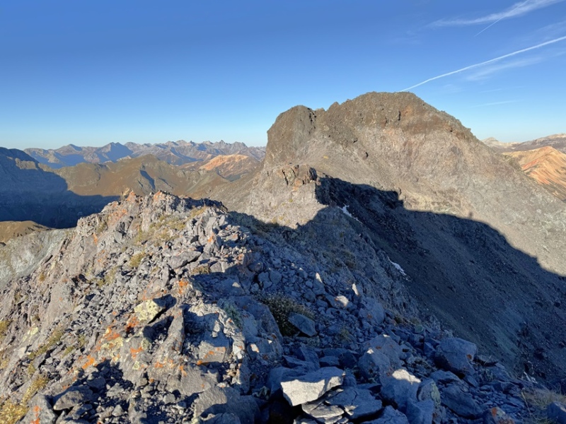
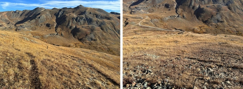
Until I came here. There’s a short difficult class 3 section here. I would dare to say it borders on class 4 (if you’re short like me). It was much harder to navigate down than up, and so steep I couldn’t get a good picture of it looking down (I have a better one on the way back). I turned and faced the mountain and headed down. Be careful here: the rocks break off, so make sure you have a solid hand hold before committing your weight to a move. The ridge proper goes here at class 3, and it’s a very short section. 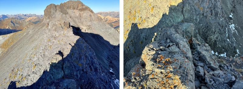
Here’s looking up at what I downclimbed: 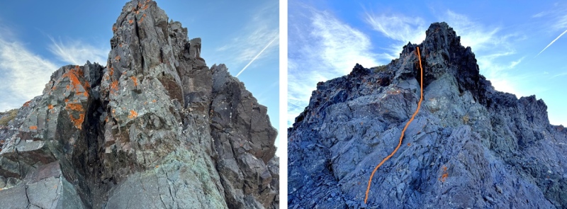
Now for another short class 3 section, sticking to the ridge proper, before an easy class 2 hike to the summit. 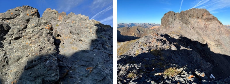
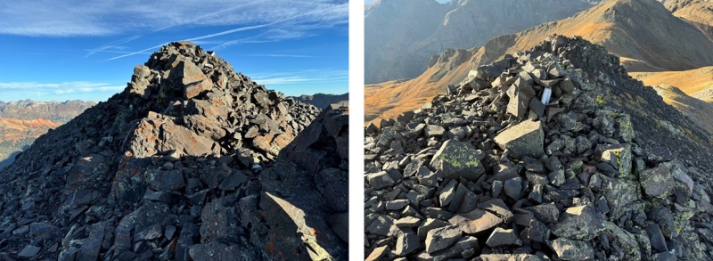
I summited Proposal Peak at 8:15am 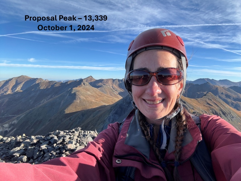
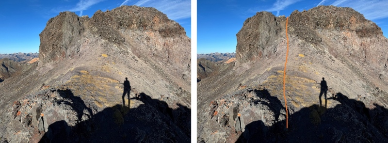
Proposal Peak: Now to head back. I took much of the same route on my way back down. I followed the ridge to the class 3 section 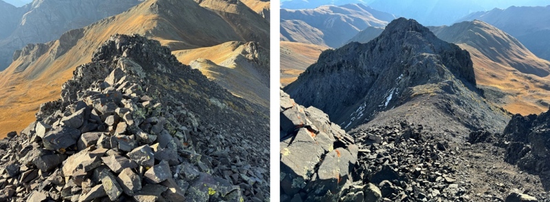
And then climbed back up the class 3 chimney. This was much easier to navigate climbing up. 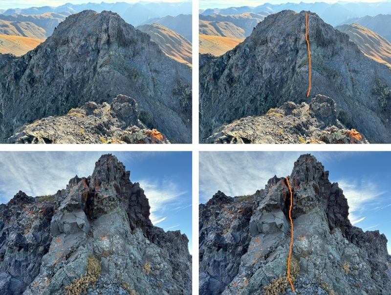
I now followed the ridge northeast, and then descended the gully back down to the basin. 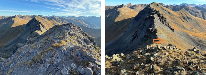
Here’s a look at my route through McCarty Basin 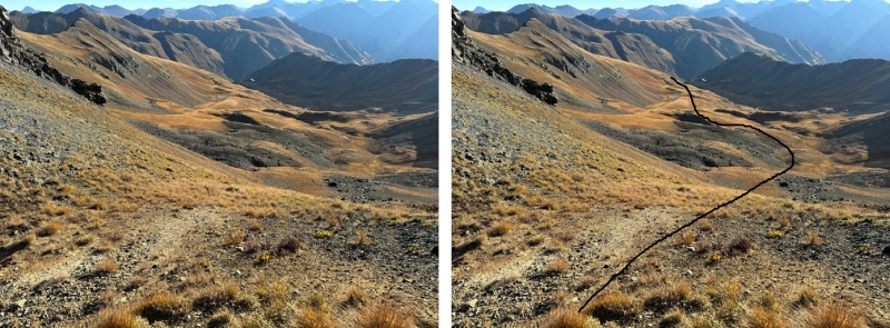
On the right side of a small pond I found a game trail that would lead me almost all the way back to my truck. 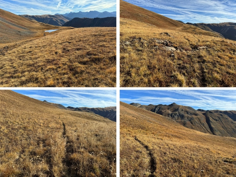
With the road in sight, I followed the tundra north back to my truck 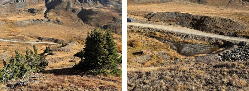
I made it back to my truck at 9am, making this a 3.4 mile hike with 1652’ of elevation gain in 2 hours, 15 minutes. 
On to the next trailhead! Thumbnails for uploaded photos (click to open slideshow): ")
")
")
")
")
")
")
")
")
")
")
")
")
")
")
")
")
")
")
")
")
")
")
")
")
")
")
")
")
")
|
| Comments or Questions |
|---|
|
|
Caution: The information contained in this report may not be accurate and should not be the only resource used in preparation for your climb. Failure to have the necessary experience, physical conditioning, supplies or equipment can result in injury or death. 14ers.com and the author(s) of this report provide no warranties, either express or implied, that the information provided is accurate or reliable. By using the information provided, you agree to indemnify and hold harmless 14ers.com and the report author(s) with respect to any claims and demands against them, including any attorney fees and expenses. Please read the 14ers.com Safety and Disclaimer pages for more information.
Please respect private property: 14ers.com supports the rights of private landowners to determine how and by whom their land will be used. In Colorado, it is your responsibility to determine if land is private and to obtain the appropriate permission before entering the property.


