| Report Type | Full |
| Peak(s) |
13,043 13,016? |
| Date Posted | 10/01/2024 |
| Date Climbed | 09/28/2024 |
| Author | JQDivide |
| Additional Members | FoodieHiker |
| Two Sort of Random 13er Points |
|---|
|
13,043 & 13,016 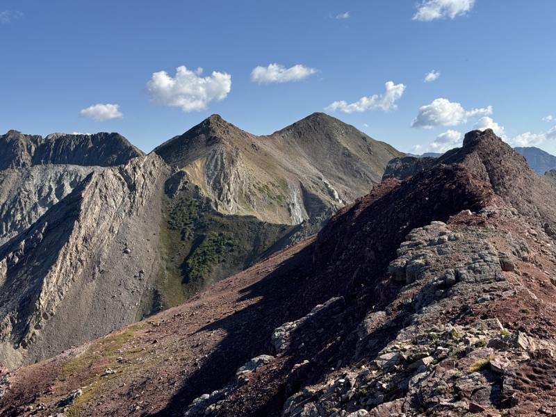
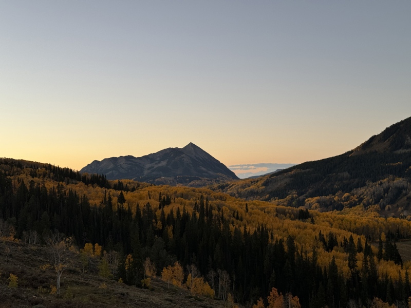
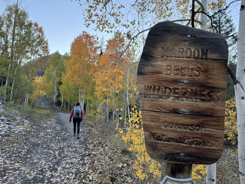
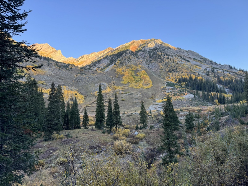
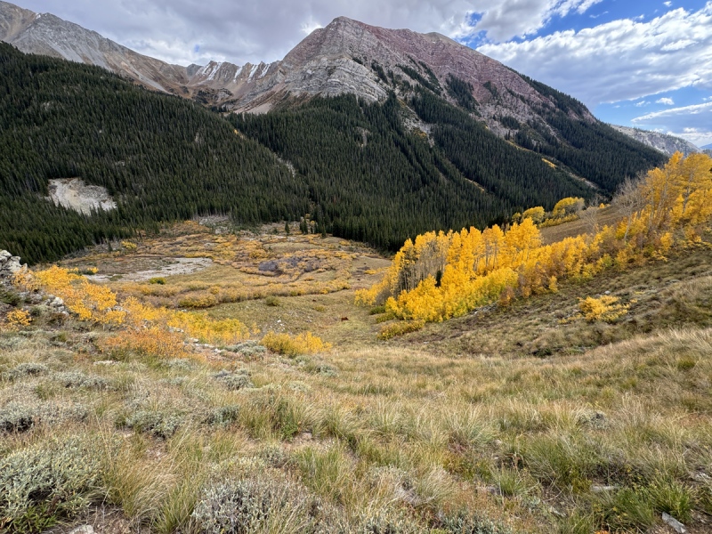
Prologue We tried to hike 13,043 & 13,016 a couple weekends ago as part of a loop with Avery Peak and Pt. 12,789. When we got to 12,789 we realized the ridge would not go. There is a huge cliff wall that drops off 12,789 and you also can’t drop down the other side and go around. The topo map lied. Surprisingly, we saw a group of four people and dog on these 13ers that day. Who else hikes these random things? (13,016 – I can’t find this listed on any topo map. But that is what the GAIA app on my phone read on the summit.) We now had to decide which way to go up for these points. We had two options. One idea was to hike up Copper Creek Trail to an old mine road north of the peaks and come back to them. We decided against that, based on what we saw from 12,789. I’m glad we did, because if that ridge and route would go, it would have been tough. We decided to just go up the southeastern end of the ridge / slope that leads to 13,043 from Copper Creek. This is basically across the way from Queen Basin and just north of Virginia Basin. I can’t find a name for this basin. Neither of these peaks are named or ranked. I’m guessing it’s not ranked because the long ridge between 13,043 and Golden Tops doesn’t drop enough. None the less, they are on our list. 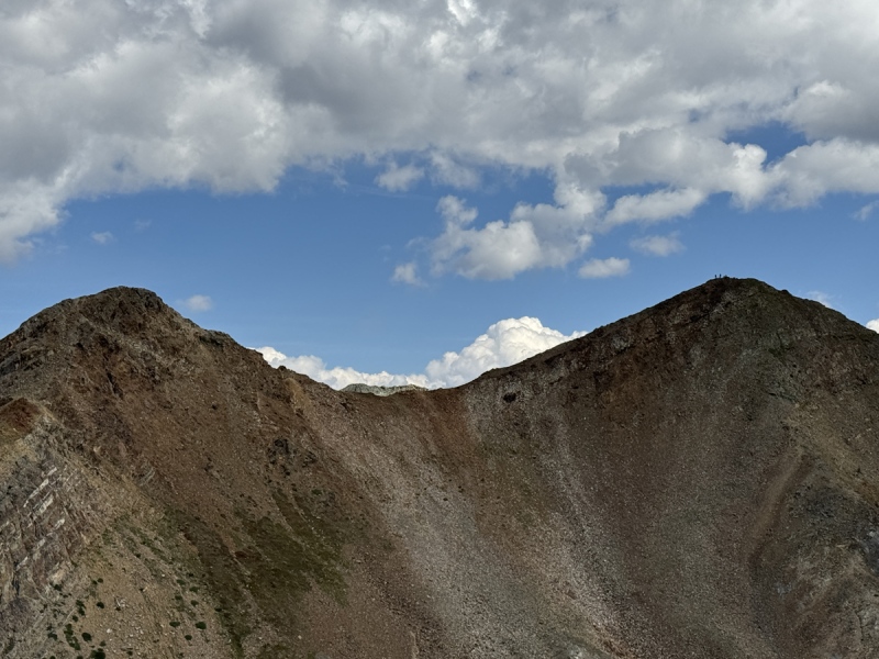
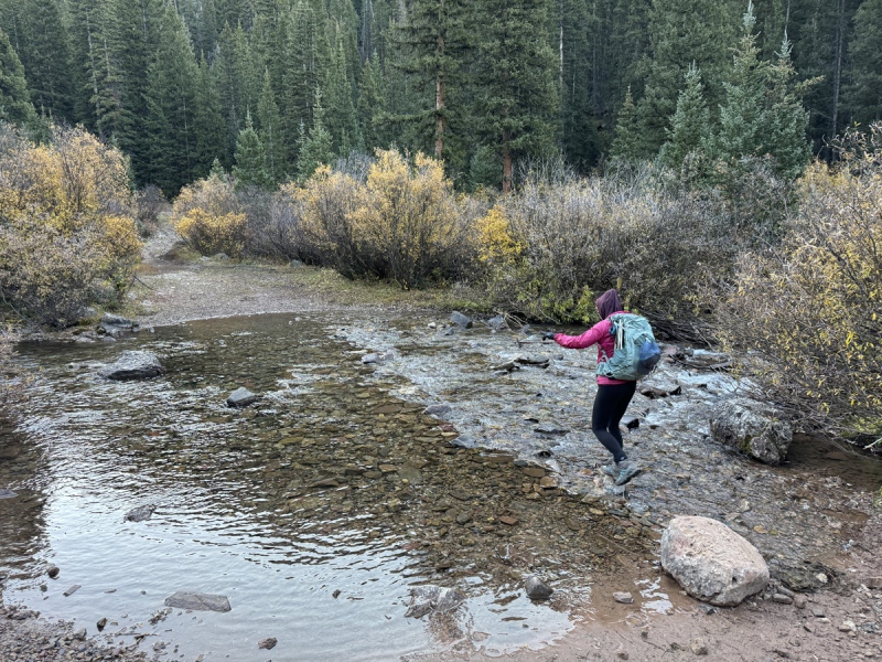
Starting Out We left the upper Judd Falls Trailhead about 6:40 a.m., a little later than planned. Two hunters left before us. Two hikers were walking up the road as we were getting our gear together. We’d meet all four later. We’d been up this trail a couple times and knew the way. The later start allowed us to see some early morning fall colors. A runner passed us going to Triangle Pass. We’d meet him again later too. About an hour into the hike, we came to a drainage, a low creek crossing. This comes out of Queen Basin. But this is where we could see the route toward 13,043. We went just a little past this creek and found a ‘cow path’ down toward Copper Creek. The fall grazing is still going on as cows were everywhere. We crossed a small creek then came to the main creek and quickly found one of the few spots to cross. But this led us into Willow Hell. (8:00 a.m.) I’m glad I’m tall and could see a little bit above the willows. I realized we were fighting our way deeper into a long path of willows instead of out of it. We could have been in there for 100 yards. 

Elk Hunt Once out of the willows I looked up toward the basin, which narrows before dropping into the Copper Creek drainage. There above us were the two hunters. Of the seven people in this entire drainage this morning, what are the chances four of us we would going up this obscure route? Well, this is public land, open to all of us. I was hoping we would not do anything to disrupt their hunt. Some hunters put in a lot of time and effort into scouting for big bull elk. I didn’t want to be the reason they failed. I hoped they would stop and wait on us so we could talk. They didn’t. Not sure if they were cussing us, wondering what the hell we were doing, or just trying to get to their location. We lost sight of them in some brush and trees. That made us a little nervous. I know they saw us. Makes me wonder if we should be wearing the blaze orange this time of year. A couple minutes later, near the ‘pinch point’ of the basin, a small heard of elk came out. We saw several cows and some calves. One hunter took aim, but didn’t fire. They were probably 50 yards apart. We were another 50 yards behind and below the hunters. The elk stopped. But no shot. I could have had a great shot with a scoped rifle from where we were. I don't have any photos because we were kind of hiding behind some trees to not spook the elk. The elk began moving horizontally left to right, and a little up, as if they were going around the shoulder of the ridge to the next drainage. Then a small bull elk appeared. Still no shot. I was surprised. Obviously, the hunters weren’t there to fill their freezer or waste a bull tag on a smaller set of antlers. I’m guessing they wanted a nice head mount for their wall. The elk left. I thought again, the hunters might want to talk. But they moved up. So we stopped and had breakfast then moved up. 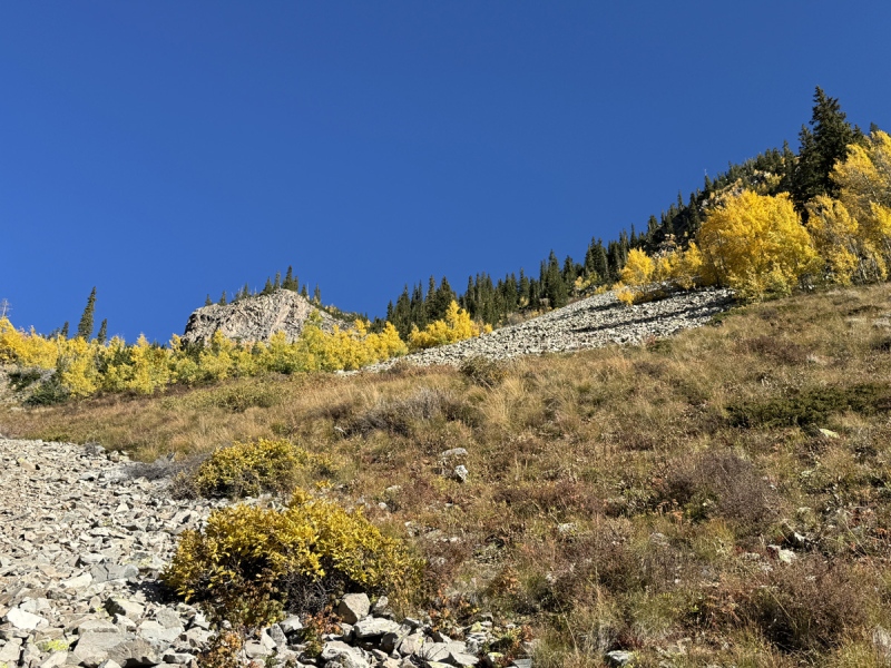
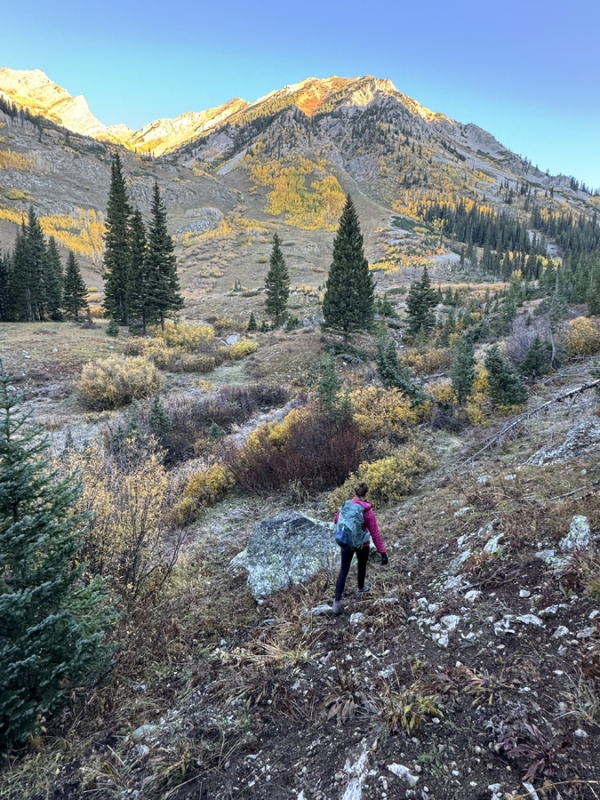
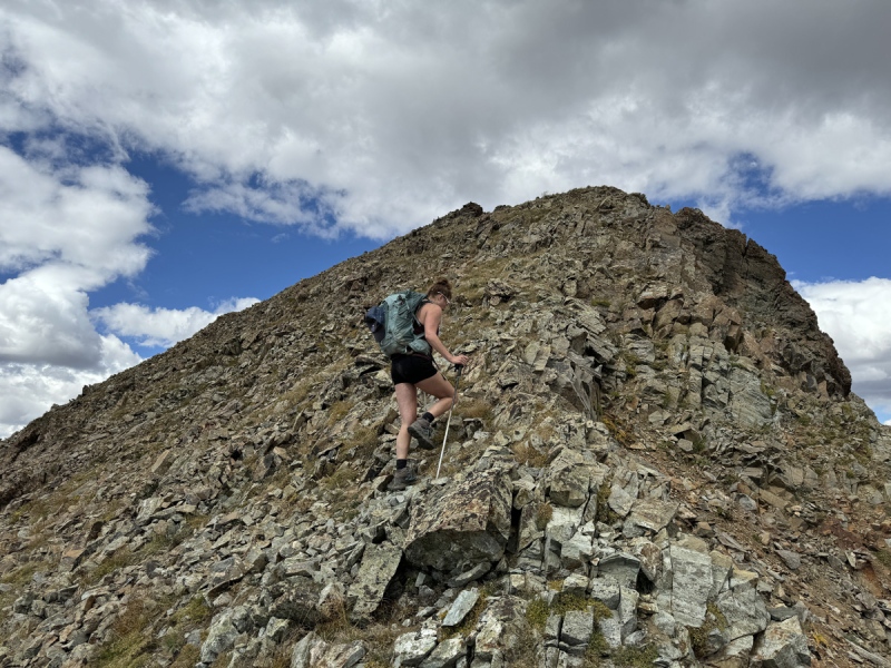
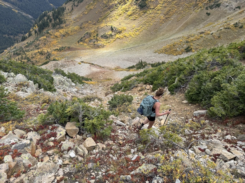
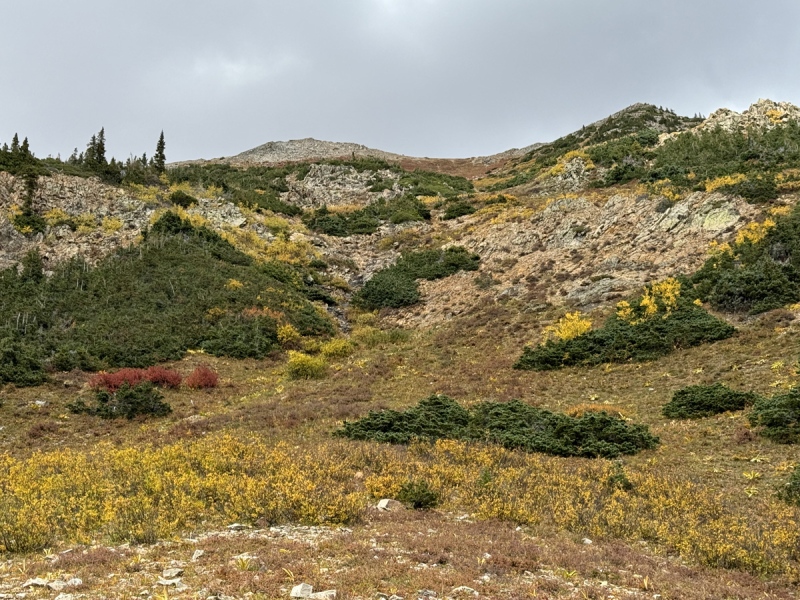
The Slope At the pinch point, near 11,000 & 9:00 a.m., we could see where the hunters followed a small creek into the basin. We turned right and up. We had seen this route idea from 12,789 the other week and from Copper Creek Trail. We followed a talus / boulder field, seemed easier than the thick vegetation. It was getting hot. I say hot, it was probably 60 degrees and sunny. Oh, that Colorado sun is warm. Staci pulled off the coat and leggings and put on shorts. Up we went. It was a struggle. No trail. Steep uneven terrain. Rocks moved. Or vegetation didn’t hold. We had general sense of direction, mostly straight up. But we did have to make a few choices of left or right. We were following the trees up this section. One thing about this route up, the trees provided some much-appreciated shade at times. At 12,000 and 10:40 a.m., we stopped for a snack before the push to the ridge. Just before treeline ended, there was a surprise. So many times, especially hiking in the CB area, a grouse would scare the crap out of me. I’d accidently flush it. The instantaneous and exaggerated wing beats always startle me. Well, hiding under one of the last trees, two grouse waited on us. We got to the tree and they both sprang up. I got startled. But Staci screamed. I’m sure the hunters heard her. One grouse flew above her. The second flew away and immediate turned around and headed toward her. She screamed again. I couldn’t stop laughing. She usually makes fun of me when the grouse spook me. Staci hasn’t screamed that loud since she was attacked by bees on Bellview. 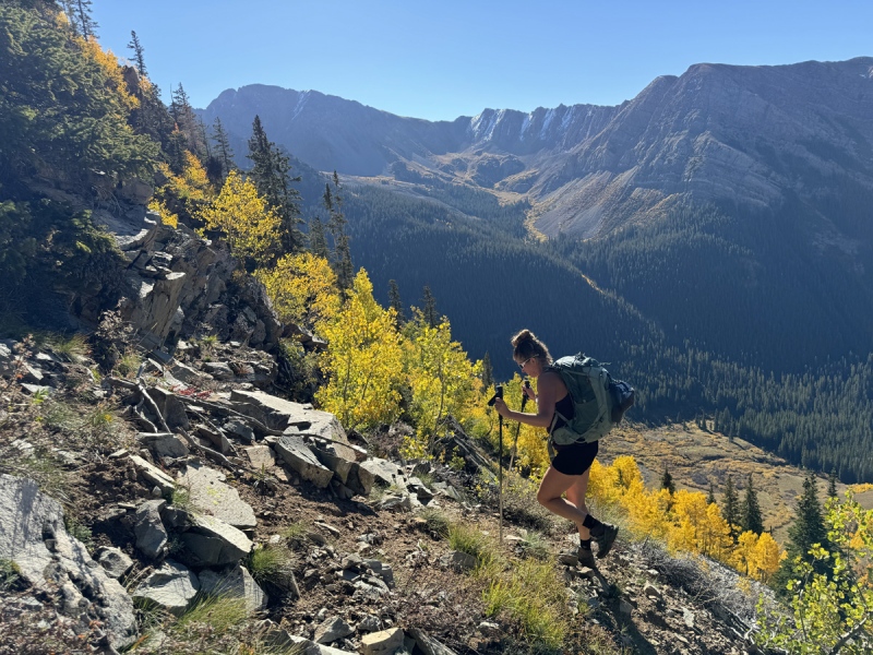

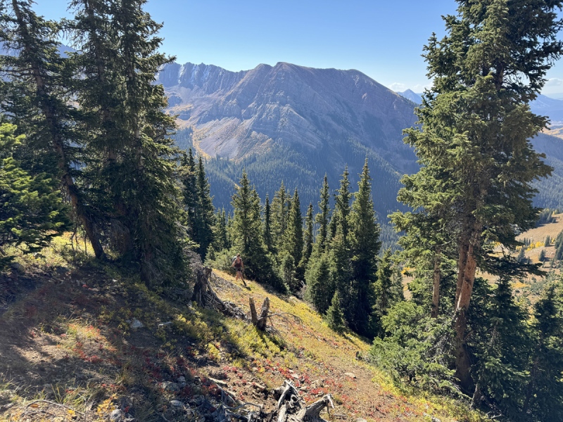
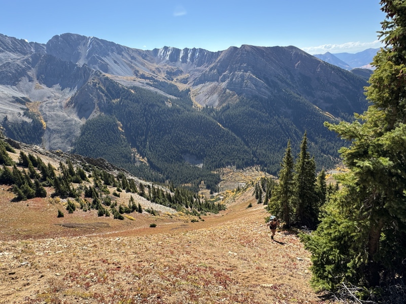
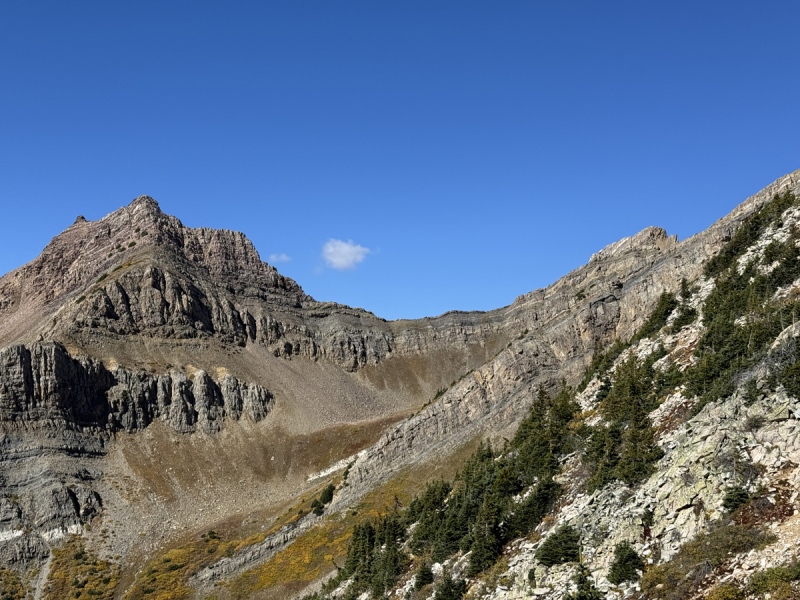

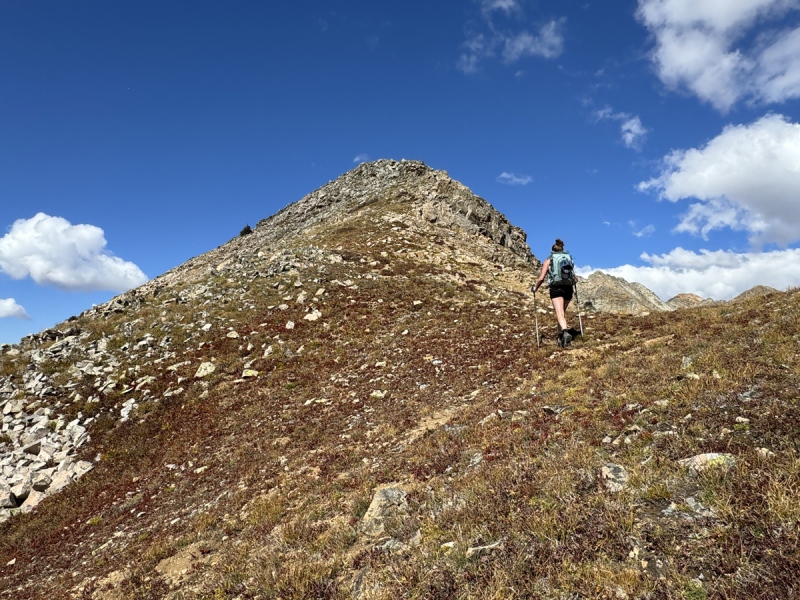
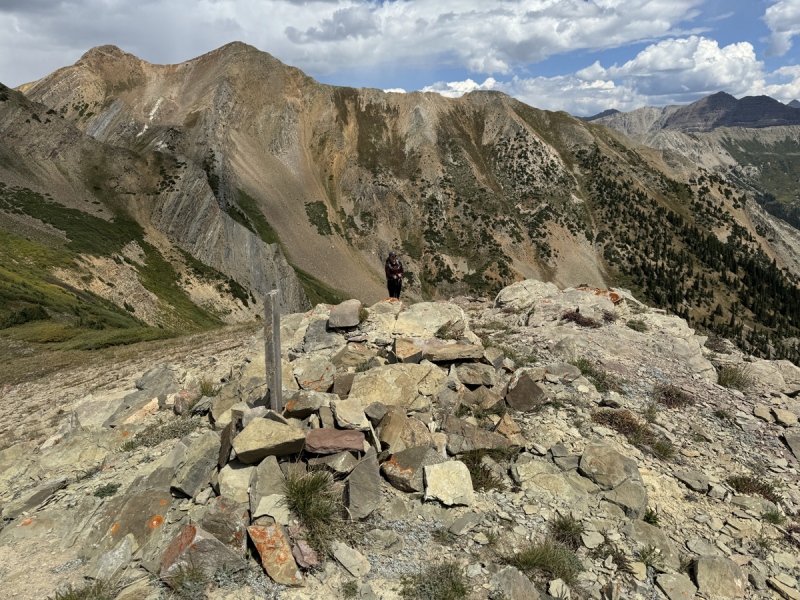
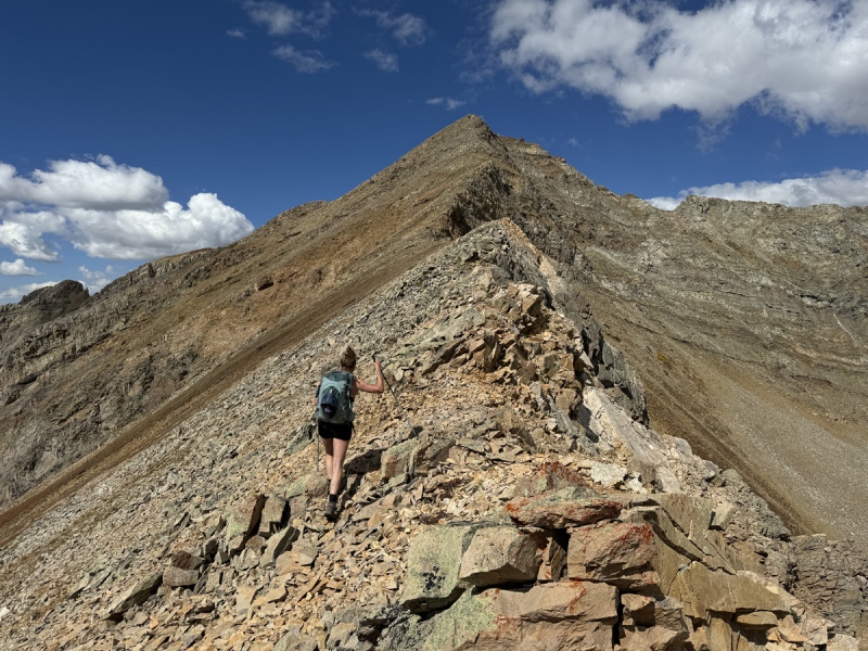
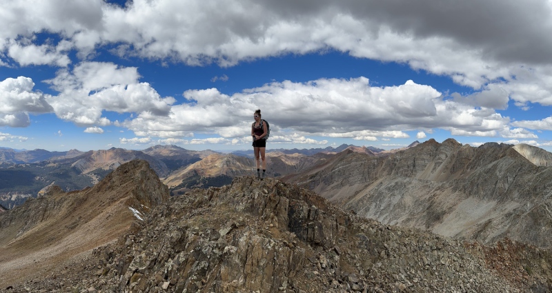
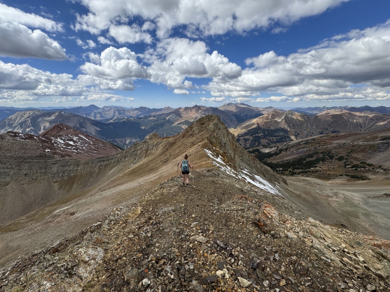
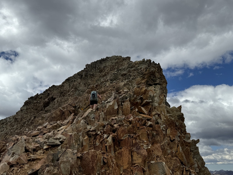
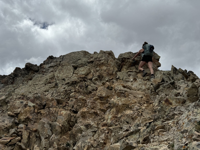
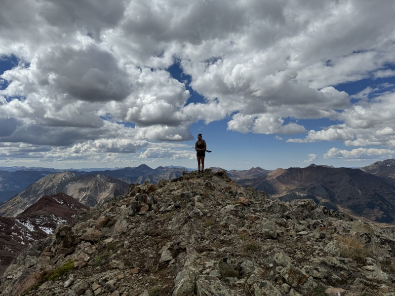
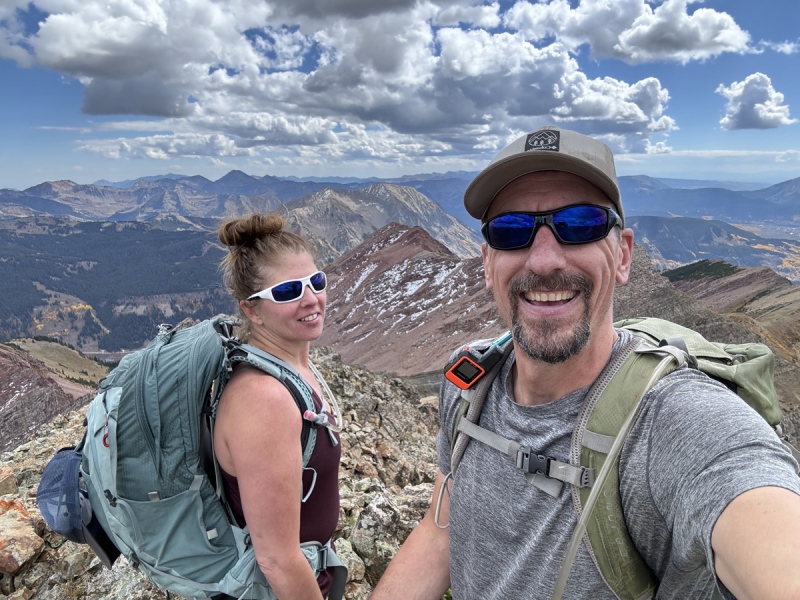
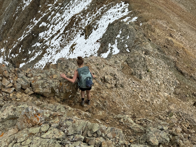
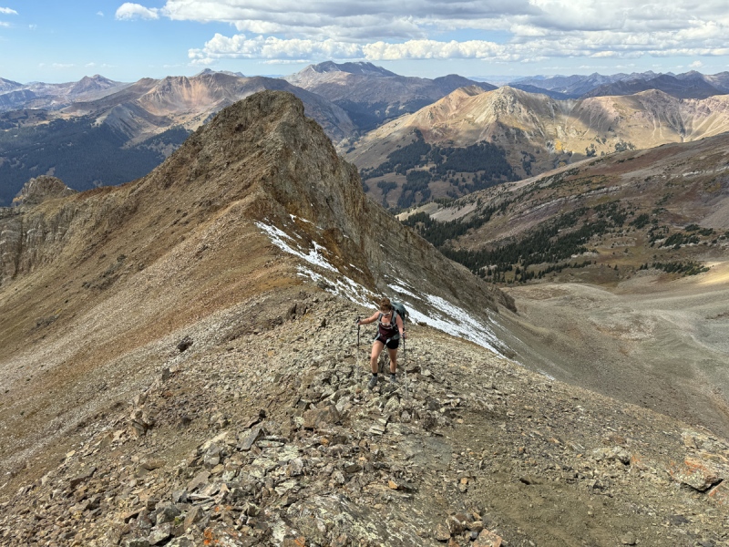
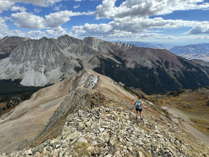
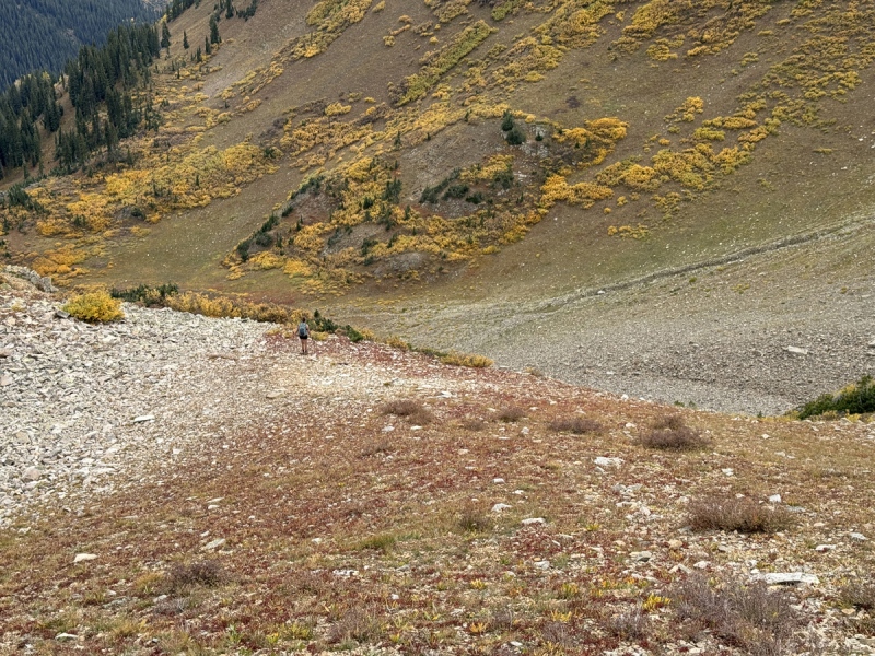
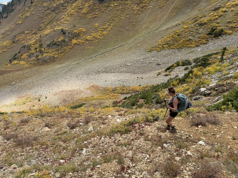
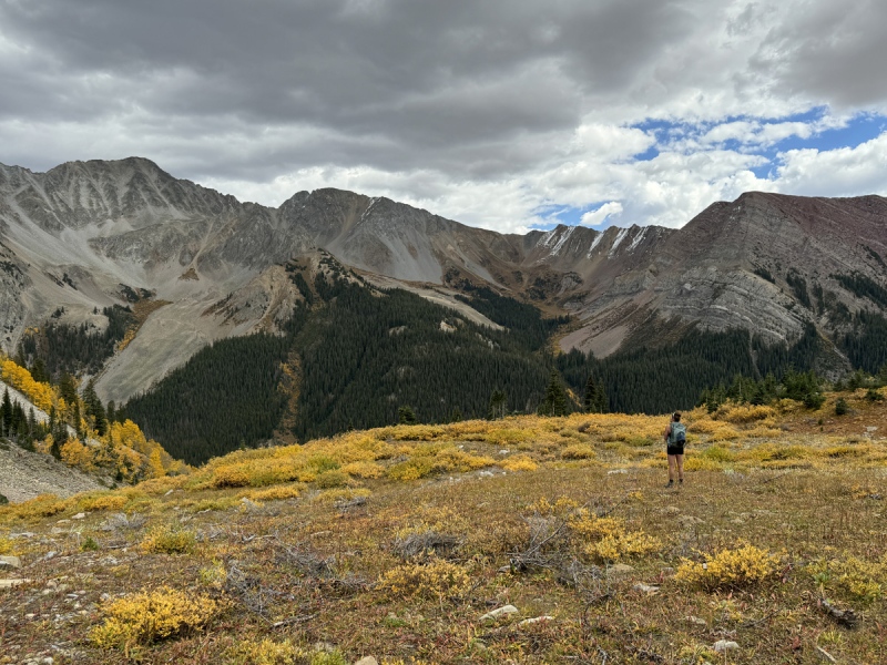
The Ridge and Summits We got to the ridge near 12,600 and 11:40 a.m. at about 4 total miles. But here’s the deal with this slope. From the creek to the ridge is just over a mile, depending on your exact route, and 2,200 feet of gain. That’s an ass kicker. It’s steeper than the incline and without any trail. The ridge had some nice views. One view was of the old mine road we thought was a route option. We realized here, it really wasn’t. Glad we came up this way. We turned northeast and began the ridge walk. I wasn’t sure what to expect, but I did know there would be some ups and downs based on what we saw from 12,789. Speaking of 12,789, from this vantage point we could see the huge drop that led to the connecting ridge to the 13ers. It definitely did not go. This ridge turned out to be rocky walk to the two summits. We stayed ridge proper most of the time and it worked. There were a few times we didn’t that were obvious choices. It was about 0.4 miles to 13,043. That took us about 50 minutes to hit the summit, 12:30 p.m. We only stayed a minute, as the clouds were building. We went down the other side toward 13,016. It was a quick walk. This peak had a little bit of scrambling to reach the summit, which was fun. Easy Class 3 or hard Class 2. No need to bring a helmet, just give each other space. That right side was a bit airy. We reached this point at 12:50 p.m. We took a few minutes to take in the sights. I put my phone down on the highest point and my GAIA app said 13,016 for elevation. So, that’s what I’m going with until I see something official. We were heading down six minutes later. We were back on 13,043 heading down the other side by 1:15 p.m. We felt an occasional rain drop, but it never really rained. 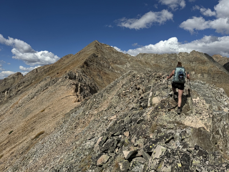
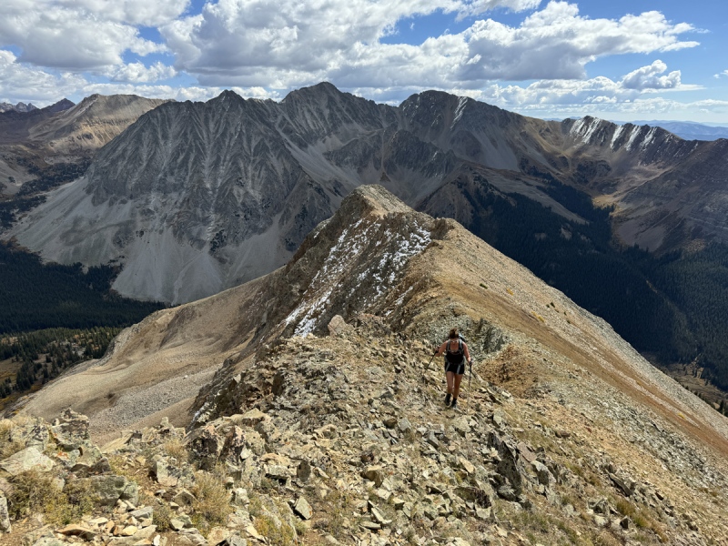
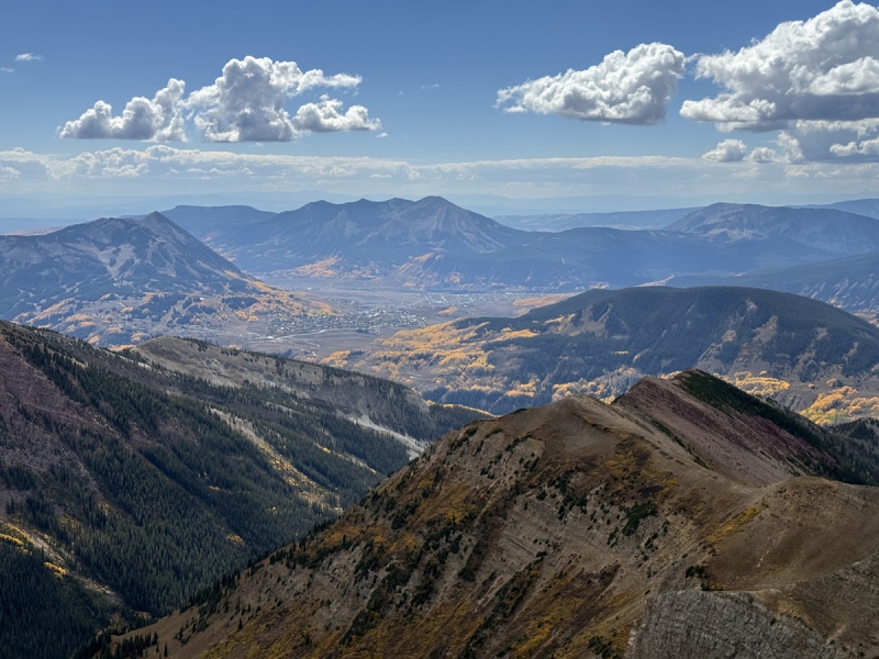


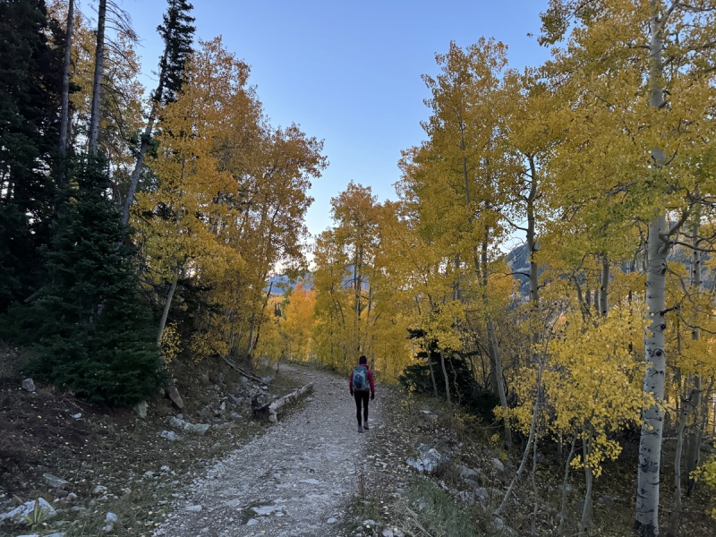
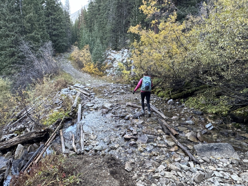
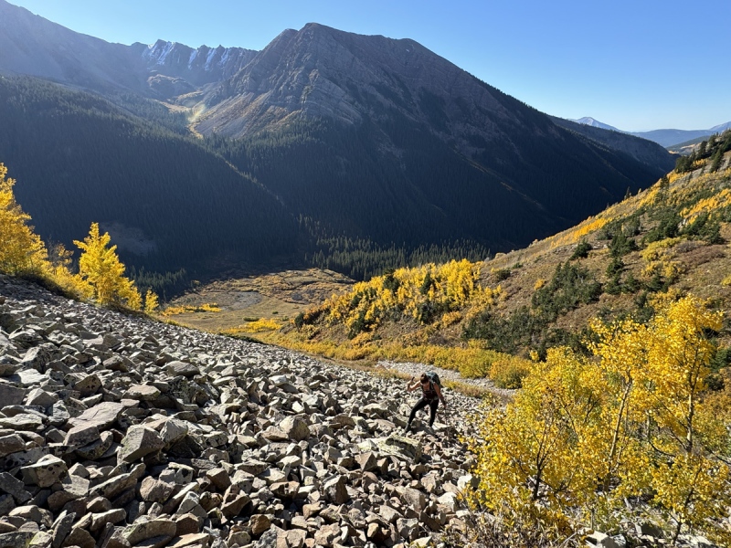
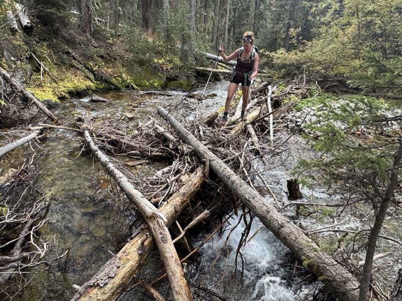
Another Slope We had a different exit strategy then the slope we took up. From 12,789 we had watched the group of four hikers struggle to go down the slope just to the right or east of the summit. It looked rough from our vantage point. There were a few faint ribs that broke the ridge and slopes into sections. The slope or section closer to the one we took up, looked good. We stopped for a snack and to put on microspikes… they are good on dirt too. It was rocky near the top, but mostly ground cover for the next 800 feet. Then a mix of rocks, ground cover and small willows. After that it got loose, then very loose. It was tedious for a bit, but I think it was a good call. This would be a good way up, unless you wanted the use the shade of the trees. It took us about 40 minutes to get to the bottom near 11,400. From here we moved down and followed the thin creek to the pinch point. At 3:00 p.m. we were back on our original track. That loop took six hours. The slope up took a lot more time than expected. From here we decided to not retrace our steps back across the creek and to the trail. We moved right or south to avoid the willows by the creek. We did go through a very short willow patch up high, but that provided us with a clear route to the creek. The creek, we couldn’t cross here. So we turned south again and followed the creek for a bit until we found a natural bridge made of downed trees. From here it was short walk to meet the trail, about 3:45 p.m. It was a slow tired walk on the trail back to the trailhead. We got back just before 5 p.m., just over a 10-hour day. With peaks numbers 60 and 61 completed on our Crested Butte List, we only have a handful more to finish our “inner list.” The hikers we saw walking before us, came by. They had just done White Benchmark. Linda is about to finish the ranked 13ers. She has less than 50 to go. As for the runner, Troy, we saw him running Deer Creek Trail on Sunday. We did a gorgeous aspen hike Sunday morning before heading home. 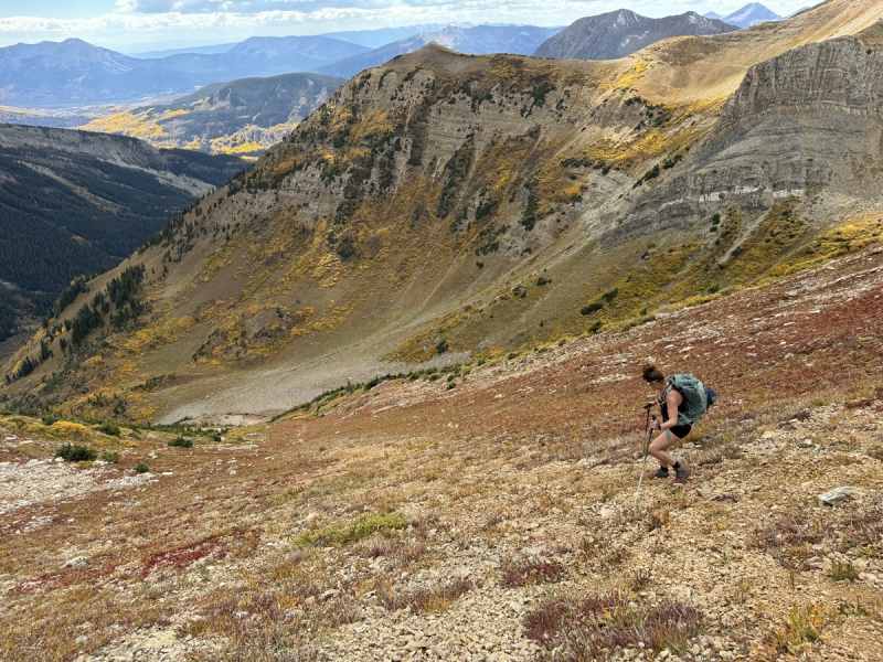


Stats Distance: 8.75 miles 
If you want to see some trip reports for a bunch of other CB area 12er and 13er peaks, check out our blog. Thumbnails for uploaded photos (click to open slideshow): ")
")
")
")
")
")
")
")
")
")
")
")
")
")
")
")
")
")
")
")
")
")
")
")
")
")
")
")
")
")
")
")
")
")
")
")
")
")
")
")
")
")
")
")
")
")
")
")
")
|
| Comments or Questions | |||
|---|---|---|---|
|
Caution: The information contained in this report may not be accurate and should not be the only resource used in preparation for your climb. Failure to have the necessary experience, physical conditioning, supplies or equipment can result in injury or death. 14ers.com and the author(s) of this report provide no warranties, either express or implied, that the information provided is accurate or reliable. By using the information provided, you agree to indemnify and hold harmless 14ers.com and the report author(s) with respect to any claims and demands against them, including any attorney fees and expenses. Please read the 14ers.com Safety and Disclaimer pages for more information.
Please respect private property: 14ers.com supports the rights of private landowners to determine how and by whom their land will be used. In Colorado, it is your responsibility to determine if land is private and to obtain the appropriate permission before entering the property.


