| Report Type | Full |
| Peak(s) |
Brown Mountain - 13,347 feet Red Mtn No.1 -12,598' |
| Date Posted | 09/29/2024 |
| Date Climbed | 09/22/2024 |
| Author | vonmackle |
| A Neapolitan Autumn Amble |
|---|
|
2024 Introvert Fall Gathering- Loop Hike from Ironton via Corkscrew and Gray Copper Gulches
Stats: Milage- 10 mi Elevation Gain- 4,380 ft Participants- Me Whitehouse Mountain has been on my to do list for the past few summers, and I was hoping to squeeze it in to this summer's hiking season. After seeing that the weekend forecast called for a rainy Saturday with likely snow in the mountains overnight, I decided to postpone the hike. I set to looking for an easier alternative, and Brown Mountain came to mind. I had hiked Gray Copper Gulch with Bertina several years ago and thought this would be a fun(?) way to do Brown. Looking at my map, I noticed I could potentially add Red Mountain No.1 to the hike as well. It also seemed like a good chance to check out Corkscrew Gulch since the road would be wet and therefore motorized vehicle dust would be reduced. Why not make a loop out of it? Shockingly, my cats let me sleep in until 6:30, so I was off to a relatively late start. The weather forecast for the day didn't seem promising, but I really just wanted to get out regardless of how much or little hiking I'd actually be able to get in. I pulled into Ironton a little after 7:30 and was amazed at the variety of color the aspens were displaying on 550 this year.
I quickly realized it would be a slow hike, not only because I'm a moderately slow hiker, but also because I couldn't stop pulling my phone out every couple of minutes in order to take pictures.
I gradually made my way up Corkscrew Gulch toward the snow line. It was in the low to mid thirties, starting to spit snow, and I was sweating my ass off in a t-shirt. Welcome to the season of the simultaneous hot/cold. A mad max golf cart full of passengers in puffy jackets rumbled past me.
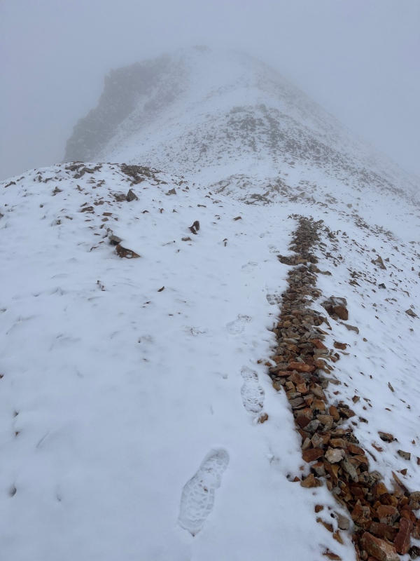
I was lucky to have only three vehicles pass me before I left the road to head up Red No.1, although I could hear many vehicles sputtering around below me throughout the day. Fortunately, I didn't have to deal with any dust.  By the time I left the road, I was surrounded by clouds. Visibility was limited, so I was glad to have the GPS app on my phone in order to occasionally verify that I was heading in the right direction. I still had my trusty map and compass with me for backup, but referencing a glowing rectangle is just a lot more convenient. Despite the snow and clouds, it was extremely calm. Little to no wind. The words that come to mind on every hike I do in the San Juans made their appearance- "Now THIS is living". I looked down at the thin coat of snow and realized I wasn't alone.
I found a little trail and made my way up to the summit of Red No.1.
No views today, but the extreme peacefulness more than made up for it. After a brief pause, I began making my way down to the saddle that separates Red No.1 and Brown. At this point I determined that I would just head down unless the clouds started breaking up before I reached the saddle. I had no desire to head up and down the roughly 1,500 vertical feet to and from Brown completely shrouded in cloud cover.
As I approached the saddle, I noticed the clouds were beginning to break. I started catching brief glimpses of the aspen trees in the valley below. The clouds were breaking up! I just might have a shot at Brown.
I reached some pretty ponds in the saddle at around 11,800 ft.
I crossed a road and started heading back uphill. I stared for quite a while at the steep grassy slopes in front of me.
As I headed back up into the clouds, the ridge line would only gradually reveal itself, creating a seemingly endless chain of false summits. I knew better than to think each of them were the true summit, but hope always got the best of me.
I finally stumbled my way onto the true summit.
Now it's just a slow painful descent back to the saddle. I know it's just mostly steep grass, but my legs really don't like going downhill anymore.
After reaching the saddle, I headed down a road that connects to the Gray Copper Trail a little ways down the valley.
I eventually caught up with the trail and headed down toward my car. Very nice!
Thumbnails for uploaded photos (click to open slideshow): ")
")
")
")
")
")
")
")
")
")
")
")
")
")
")
")
")
")
")
")
")
")
")
")
")
")
")
")
")
")
")
")
")
")
")
")
")
|
| Comments or Questions |
|---|
|
|
Caution: The information contained in this report may not be accurate and should not be the only resource used in preparation for your climb. Failure to have the necessary experience, physical conditioning, supplies or equipment can result in injury or death. 14ers.com and the author(s) of this report provide no warranties, either express or implied, that the information provided is accurate or reliable. By using the information provided, you agree to indemnify and hold harmless 14ers.com and the report author(s) with respect to any claims and demands against them, including any attorney fees and expenses. Please read the 14ers.com Safety and Disclaimer pages for more information.
Please respect private property: 14ers.com supports the rights of private landowners to determine how and by whom their land will be used. In Colorado, it is your responsibility to determine if land is private and to obtain the appropriate permission before entering the property.
 View toward Ironton on the descent from Brown

 Looking up valley toward Red Mountain Pass

 Heading up the road to Corkscrew Pass
 Red Mtn No.2 makes an appearance
 Dinosaurs!

 Yup, I'm either on Red Mountain or the surface of Mars


 Steep grassy slopes heading into the clouds toward Brown
 View down to the saddle from the start of the grassy slopes
 Oh, hello!


 The ridge that eventually connects with Abrams to the north
 View down valley toward Storm Peak
 Finally a look back at Red No.1
 A look back up toward the initial slopes heading up toward Brown


