Download Agreement, Release, and Acknowledgement of Risk:
You (the person requesting this file download) fully understand mountain climbing ("Activity") involves risks and dangers of serious bodily injury, including permanent disability, paralysis, and death ("Risks") and you fully accept and assume all such risks and all responsibility for losses, costs, and damages you incur as a result of your participation in this Activity.
You acknowledge that information in the file you have chosen to download may not be accurate and may contain errors. You agree to assume all risks when using this information and agree to release and discharge 14ers.com, 14ers Inc. and the author(s) of such information (collectively, the "Released Parties").
You hereby discharge the Released Parties from all damages, actions, claims and liabilities of any nature, specifically including, but not limited to, damages, actions, claims and liabilities arising from or related to the negligence of the Released Parties. You further agree to indemnify, hold harmless and defend 14ers.com, 14ers Inc. and each of the other Released Parties from and against any loss, damage, liability and expense, including costs and attorney fees, incurred by 14ers.com, 14ers Inc. or any of the other Released Parties as a result of you using information provided on the 14ers.com or 14ers Inc. websites.
You have read this agreement, fully understand its terms and intend it to be a complete and unconditional release of all liability to the greatest extent allowed by law and agree that if any portion of this agreement is held to be invalid the balance, notwithstanding, shall continue in full force and effect.
By clicking "OK" you agree to these terms. If you DO NOT agree, click "Cancel"...
Point 13,786 via South Face and Whitney Peak - Report
Climbing the south face of Point 13,786 isn’t overly difficult, but it is not simple: expect steep talus, loose scree, and broken ledges with cliffs that offer various route options, which can make navigation tricky.
Roach’s Colorado’s Thirteeners (Route 8.5 under Holy Cross Ridge) describes ascending Point 13,786 from the highest of the Seven Sisters Lakes. It involves steep talus to a ridge, followed by an easy scramble to the summit. Useful GPX file by Chipmunk, found on this website, follows Roach’s route up. See also WildWanderer report for lots of pictures.
The trailhead is accessible by most vehicles—definitely a Subaru—from Fancy-French Road, located just under 2 miles northeast of the Missouri Lakes Trailhead, which is about 2 miles from Homestake Reservoir Road. The route begins on the Holy Cross 4WD Road and then transitions to the Fall Creek Trail.
I followed a GPX route by Justiner (found on his Slowlans page), which aims to avoid some of the looser terrain on the south face. This route skirts the penultimate Seven Sisters Lake to the right, then climbs steeply up to a grassy ramp that leads above the last lake. After a short descent, you ascend stable boulders to a gully between cliffs, where you can use the walls for support before merging with the main trail for the final 500 feet to the summit. On the descent, I followed Chipmunk’s GPX file, cutting across at around 13,000 feet on stable terrain, avoiding regaining the altitude. I descended the ramp and contoured around 12,700 feet toward the saddle with Whitney Peak, following Chipmunk’s GPX again—although this section was tedious.
After summiting Whitney Peak, I descended its south slope straight down, which was steep but stable with plenty of grassy patches. Be cautious near the lower sections, as there are cliffs at the base. I navigated down a dry creek drainage through some steep willows, eventually reaching a flat, slightly swampy area. A short, easy walk through the forest brought me back to the Holy Cross 4WD Road at around 11,000 feet.
Stats:
Mileage: 10 miles
Elevation Gain: 4,250 feet
Time: 8 hours, 15 minutes
At 11,100 on Holy Cross 4WD Rd looking up Whitney Peak - option to descent with minimal bushwhack
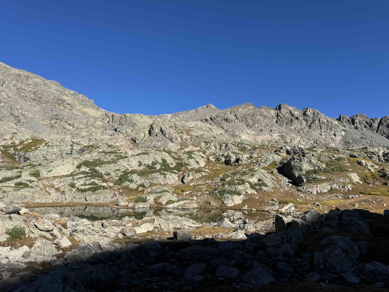
Penultimate Seven Sisters Lake with the summit in the center
This picture shows the convoluted terrain of the south face (the summit is not visible)
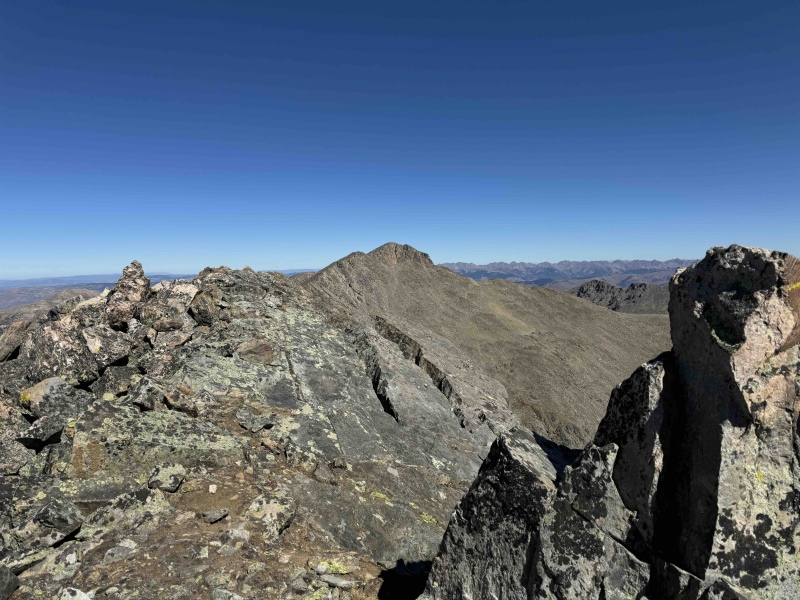
Holy Cross Ridge and Mount of the Holy Cross from the summit
Whitney Peak boulder
My GPS Tracks on Google Maps (made from a .GPX file upload):
Thumbnails for uploaded photos (click to open slideshow):
Comments or Questions
Caution: The information contained in this report may not be accurate and should not be the only resource used in preparation for your climb. Failure to have the necessary experience, physical conditioning, supplies or equipment can result in injury or death. 14ers.com and the author(s) of this report provide no warranties, either express or implied, that the information provided is accurate or reliable. By using the information provided, you agree to indemnify and hold harmless 14ers.com and the report author(s) with respect to any claims and demands against them, including any attorney fees and expenses. Please read the 14ers.com Safety and Disclaimer pages for more information.
Please respect private property: 14ers.com supports the rights of private landowners to determine how and by whom their land will be used. In Colorado, it is your responsibility to determine if land is private and to obtain the appropriate permission before entering the property.


")
")
")
")
")

