Download Agreement, Release, and Acknowledgement of Risk:
You (the person requesting this file download) fully understand mountain climbing ("Activity") involves risks and dangers of serious bodily injury, including permanent disability, paralysis, and death ("Risks") and you fully accept and assume all such risks and all responsibility for losses, costs, and damages you incur as a result of your participation in this Activity.
You acknowledge that information in the file you have chosen to download may not be accurate and may contain errors. You agree to assume all risks when using this information and agree to release and discharge 14ers.com, 14ers Inc. and the author(s) of such information (collectively, the "Released Parties").
You hereby discharge the Released Parties from all damages, actions, claims and liabilities of any nature, specifically including, but not limited to, damages, actions, claims and liabilities arising from or related to the negligence of the Released Parties. You further agree to indemnify, hold harmless and defend 14ers.com, 14ers Inc. and each of the other Released Parties from and against any loss, damage, liability and expense, including costs and attorney fees, incurred by 14ers.com, 14ers Inc. or any of the other Released Parties as a result of you using information provided on the 14ers.com or 14ers Inc. websites.
You have read this agreement, fully understand its terms and intend it to be a complete and unconditional release of all liability to the greatest extent allowed by law and agree that if any portion of this agreement is held to be invalid the balance, notwithstanding, shall continue in full force and effect.
By clicking "OK" you agree to these terms. If you DO NOT agree, click "Cancel"...
The drive to Imogene Pass is not for the faint of heart. You need a 4WD vehicle and a competent driver. Be prepared for narrow roads and large rock slabs with steep drop offs. The worst part is the very beginning (at the separation from Yankee Boy Basin) and at the very end. I drove in from the Ouray side. I didn’t drive all the way to the pass, but parked about a mile below at a wide turnout. I was on the trail at 6:30am, following the road south towards Imogene Pass.
Just before the final switchback to Imogene Pass I bypassed the road and took a game trail to the right, which led me back to the road and Imogene Pass.
The Telluride side was closed
From Imogene Pass I followed the road/ridge north
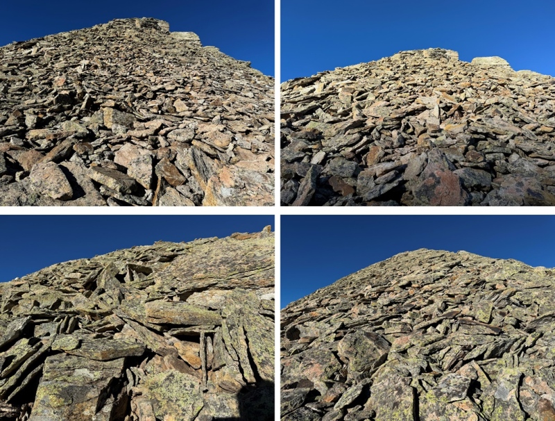
Maps show a trail here, but if there is one, it’s faint/has been destroyed by rockfall. This hike is class 2, but difficult class 2. Everything is loose. The talus and shale are not secure, and there’s exposure, so be mentally ready for more than a normal class 2 hike. Watch your step, as there are large metal wires strewn all about the ground on this ridge. There’s a trail until you hit this point, then you get to route find. From here I could see Chicago Peak. This is the route I took:
I then rounded the ridge, following the ridge proper
This is where the fun begins. You want to stay high, but not on top of the ridge. I pretty much followed the bottom of the rock outcroppings, traversing on shale. I started out staying to the right, then in the middle switched to the left to go around a large rock, and then took the ridge proper to the slope. Here’s an overall view of my route:
And some pictures:
From here it was an easy ridge hike on shale game trails to the summit. I followed the ridge north.
I summited Chicago Peak at 7:45am
Chicago Peak:
My next peak was Tomboy Peak, which I could see to the northwest. It looked too small to be a 13er from here, but that’s just because Chicago Peak is taller.
This is the overall route I took to get there
First, I continued hiking down the ridge until I came to a small saddle at 13220’. If you’re lucky, you’ll see the game trail to the right that will circle you back to the saddle.
I then turned left, and headed west towards Tomboy Peak, losing 400’ of elevation on very loose shale (no trails here, watch your step).
At the saddle, I headed straight up the ridge to the summit (also on very loose shale).
I summited Tomboy Peak at 8:40am
Tomboy Peak:
This was an out and back hike for me, so I turned around and headed back towards Chicago Peak. The pictures heading back are probably more useful than the ones coming in, due to the angle of the sun. First, I descended to the Chicago/Tomboy Saddle
And then to re-ascend to the ridge
Then to re-ascend Chicago Peak. I followed the ridge south.
After re-ascending Chicago Peak I continued following the ridge.
Here’s an overall view of my hike through the rest of the ridge.
After making it to the top of the ridge, I followed it south back to Imogene Pass
Once back at the pass I followed the road to my access trail, then the trail back to the road, and the road back to my truck.
I made it back to my truck at 10:30am, making this a 6.16 mile hike with 1975’ of elevation gain in 4 hours.
Thumbnails for uploaded photos (click to open slideshow):
Minor correction. The trail that leaves the road and goes to the pass summit was established by the Imogene Pass
Race runners. Only the mountain gods and goddesses run the trail. The rest of us mortals death march it. For several years, prior to his death, a man at the top of the trail would give everyone a hand up back to the road.
That's cool information! I assumed it was a game trail because of all the animal tracks.
Caution: The information contained in this report may not be accurate and should not be the only resource used in preparation for your climb. Failure to have the necessary experience, physical conditioning, supplies or equipment can result in injury or death. 14ers.com and the author(s) of this report provide no warranties, either express or implied, that the information provided is accurate or reliable. By using the information provided, you agree to indemnify and hold harmless 14ers.com and the report author(s) with respect to any claims and demands against them, including any attorney fees and expenses. Please read the 14ers.com Safety and Disclaimer pages for more information.
Please respect private property: 14ers.com supports the rights of private landowners to determine how and by whom their land will be used. In Colorado, it is your responsibility to determine if land is private and to obtain the appropriate permission before entering the property.


")
")
")
")
")
")
")
")
")
")
")
")
")
")
")
")
")
")
")
")
")
")
")
")
")
")
")
")
")
")
")
")
")
")
")
")
")


