Download Agreement, Release, and Acknowledgement of Risk:
You (the person requesting this file download) fully understand mountain climbing ("Activity") involves risks and dangers of serious bodily injury, including permanent disability, paralysis, and death ("Risks") and you fully accept and assume all such risks and all responsibility for losses, costs, and damages you incur as a result of your participation in this Activity.
You acknowledge that information in the file you have chosen to download may not be accurate and may contain errors. You agree to assume all risks when using this information and agree to release and discharge 14ers.com, 14ers Inc. and the author(s) of such information (collectively, the "Released Parties").
You hereby discharge the Released Parties from all damages, actions, claims and liabilities of any nature, specifically including, but not limited to, damages, actions, claims and liabilities arising from or related to the negligence of the Released Parties. You further agree to indemnify, hold harmless and defend 14ers.com, 14ers Inc. and each of the other Released Parties from and against any loss, damage, liability and expense, including costs and attorney fees, incurred by 14ers.com, 14ers Inc. or any of the other Released Parties as a result of you using information provided on the 14ers.com or 14ers Inc. websites.
You have read this agreement, fully understand its terms and intend it to be a complete and unconditional release of all liability to the greatest extent allowed by law and agree that if any portion of this agreement is held to be invalid the balance, notwithstanding, shall continue in full force and effect.
By clicking "OK" you agree to these terms. If you DO NOT agree, click "Cancel"...
Just wanted to share a few tips for anyone attempting Ogallalah via Junco Lake. First, the basics:
1.) It's still a looong day hike. I got off-route a bit and logged 20 miles, but it's surely 18 miles even without that. About 5300 vertical feet.
2.) You take the trails from Wild Basin trailhead to Bluebird Lake (optionally camping before Bluebird at the Upper Ouzel campsite)
Bluebird Lake at dawn, which is when you should be seeing it so you have enough time to complete this long hike
Then navigate from Bluebird to Junco Lake. Behind Junco Lake is the biggest challenge, ascending about 800 vertical feet to the easy tundra above, and then walk 0.7 miles or so over to the Ogallalah summit.
3.) You can keep it at Class 3 with good route finding, but I found rock climbing skills very useful in short sections to avoid unstable scree. It's definitely steep enough in places to give a person pause.
Now the tips:
1.) Leaving Bluebird lake to hiker's left, there are ~0.5 mi of grassy ramps from Bluebird to Junco. They have a lot of sudden cliffs that make finding the easiest path a bit of a labyrinth. On the way up, definitely consider marking a GPS route so you can find your way back - the visuals are very different on the way down and I got mildly lost and moderately frustrated finding my way back to Bluebird.
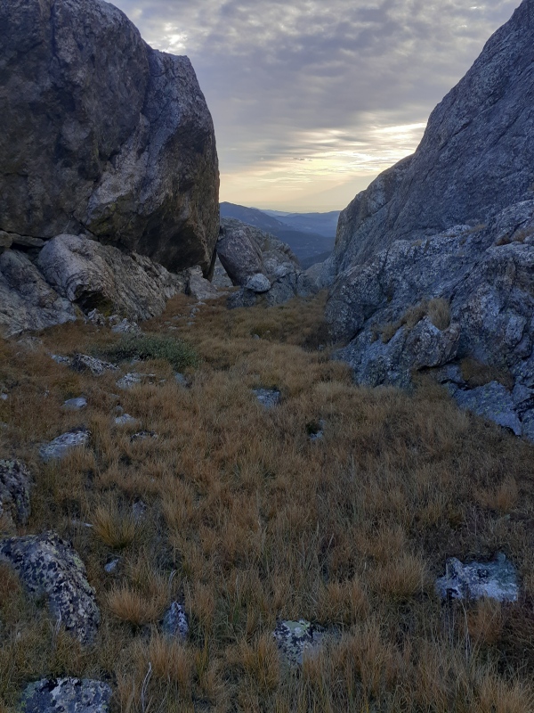
Shortly after leaving Bluebird, heading for that notch... okay, this ramp is not so grassy.... But a lot of it looks like this between Bluebird and Junco
2.) Coney Pass is NOT the easiest way from Junco to the walkable tundra above. Coney Pass connects Junco Lake to Coney Lake, and if you're looking at a map, you might see it as a way to summit Ogallalah, but the ridge from Coney Pass to the tundra above is definitely 5th class. One old trip report called it "5.6-ish". It was far more than I was going to free solo, so I had to downclimb halfway to Junco and find a different way.
View of Junco Lake. Ouzel Peak is out of frame off to the right. Take the Green route, not the Red route
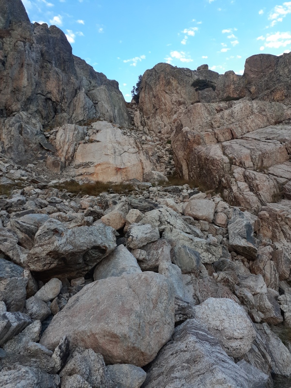
3.) The best way up from Junco lake is to take the grass ramps up the center of the wall, and then about halfway up, bear right to find a ridge of darker rock that is fairly stable. You can climb the edge of that ridge as steep Class 3 with exposure, or you can grind up the scree next to it and use it for navigation and stability. In so doing, you'll reach the tundra several hundred feet to the left of the lowest visible saddle point. It's possible that one of the drainages from that actual lowest point are viable, but they looked very unstable to me. Rocks were falling spontaneously every few minutes while I was there, and in one case became a fairly serious cascade of boulders.
4.) I strongly recommend making yourself a cairn, or have a good GPS marker, at the top of the wall. It is not easy to find your descent line when you come back, and there are cliffs galore if you get off track.
5.) Once you reach Junco again, you have to navigate back to Bluebird. This is tricky because the main drainage from Junco doesn't actually go to Bluebird, so it would be possible to get tracked off to the south (hiker's right now on the way back) too much and miss your ramps to Bluebird. Since you can't see this alternate drainage on the way up - and let's face it, you're probably tired by now - it's a little confusing when you're looking at the terrain on the way back.
6.) There are many ramps down to Bluebird as long as you're in the right drainage, but since I wasn't able to perfectly retrace my ascent path (even with my GPS tracker), I ended up doing a few low 5th class moves to get to better ramps. If that's not an option for your party, your navigation better be spot-on.
Thumbnails for uploaded photos (click to open slideshow):
Comments or Questions
Caution: The information contained in this report may not be accurate and should not be the only resource used in preparation for your climb. Failure to have the necessary experience, physical conditioning, supplies or equipment can result in injury or death. 14ers.com and the author(s) of this report provide no warranties, either express or implied, that the information provided is accurate or reliable. By using the information provided, you agree to indemnify and hold harmless 14ers.com and the report author(s) with respect to any claims and demands against them, including any attorney fees and expenses. Please read the 14ers.com Safety and Disclaimer pages for more information.
Copyright: Route information, text, risk factors, maps, GPX files, charts, photos, 14ers.com-created map imagery, flythroughs, and other content provided in this route description are copyrighted by 14ers.com and may not be copied, reproduced, republished, distributed, modified, or used to create derivative works without prior written permission.
Please respect private property: 14ers.com supports the rights of private landowners to determine how and by whom their land will be used. In Colorado, it is your responsibility to determine if land is private and to obtain the appropriate permission before entering the property.