| Report Type | Full |
| Peak(s) |
McHenrys Peak - 13,330 feet Powell Peak - 13,195 feet Taylor Peak - 13,157 feet |
| Date Posted | 09/16/2024 |
| Modified | 10/22/2024 |
| Date Climbed | 09/14/2024 |
| Author | Parkerzz |
| McHenrys to Powell and Taylor via the Notch |
|---|
|
I did this hike with 2 friends on a whim with the plan being made about 3 days in advance, the original plan was to just do McHenry's and have it be more of a chill day but then the idea of knocking out 3 13ers in one day came up and before I knew it the rope was packed and the rout was planned. I found it hard to find any trip reports that described the route we were planning in full, that being said I did find a couple of good routes. We slept in our car on a friend's property in Estes to get an early start and ended up starting around 4:30 AM but I would recommend starting more around 3 AM. The hike up Glacier Gorge was done in the dark with headlamps but this is easy on-trail hiking with very few turn-offs and easy terrain. 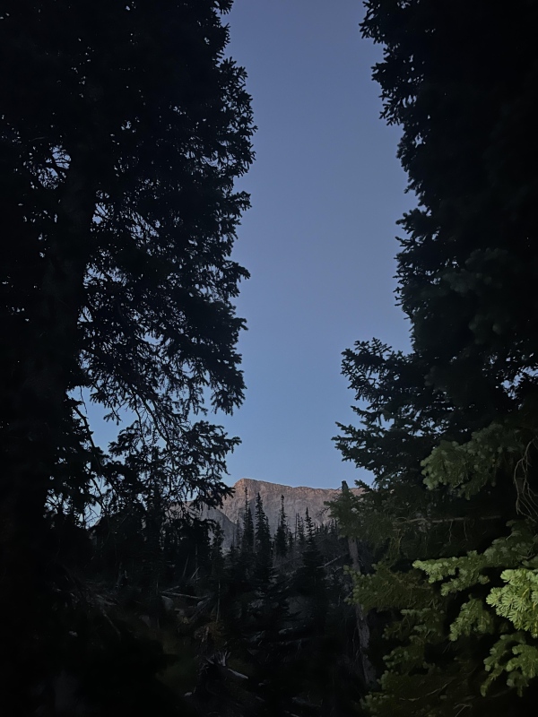
We took a small break at Black Lake to eat some food and see if we wanted to go up the slabs to the west of black lake under Arrowhead but ultimately decided to take the standard route to the east of the lake. 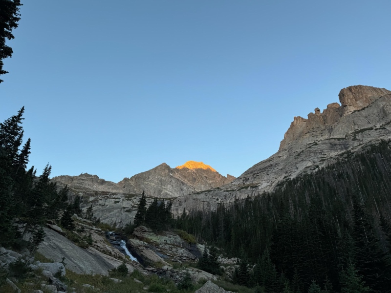
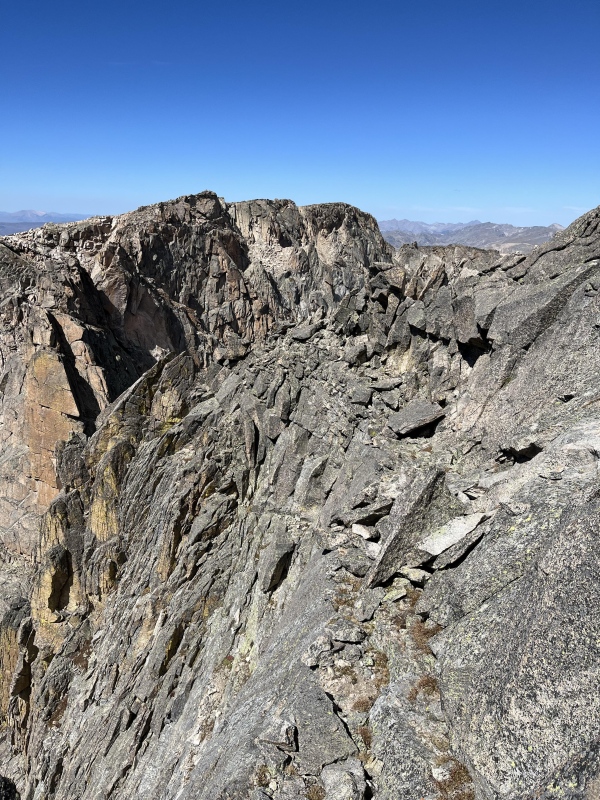
From the shelf above Black Lake, the trail becomes a mess of cairns and social trails, my best advice would be to stick to the large slabs and cairns while steadily making your way toward the base of McHenry’s and heading slightly right to avoid steep drop-offs down to Black Lake. As we got closer to the base of the mountain, we found a couple of cairns that led us to the class 2 to light class 3 gully that leads up to Stoneman's Pass. At this point, we put on helmets because a lot of the gully looked loose. We stuck to the right side of the gully, where there was more solid rock, and we could use the wall for help if needed. 
We popped out to the right of the Stoneman and took a small break before heading north up the tundra following the cairns. We cut over to the west below a rock pillar then headed up. Near the top of McHenry’s, we met some people who pointed us the right way but if you just follow a series of ledges to the west that zig-zag up the rock until you reach the top it won't exceed class 3. I will say that the ledges can quickly turn into class 4 if you want to take a more direct route up. However, there are plenty of cairns to follow to the peak. Once on the peak, we had great views of all the surrounding mountains and of Glacier Gorge. 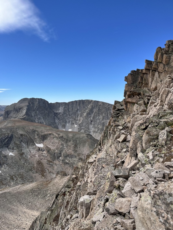
From here we made our way northwest along the ridge heading towards the notch, we then dropped down about 5 feet to the west to walk along a ledge that was marked with a cairn, this ledge continued to go down slightly. If you find yourself at the end of the ridge where its cliffs out to the north then you have gone too far. 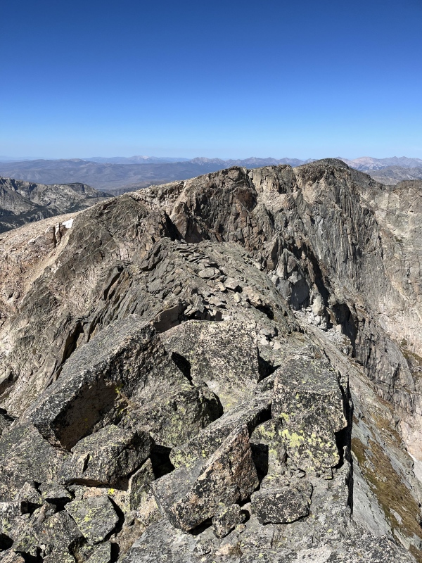
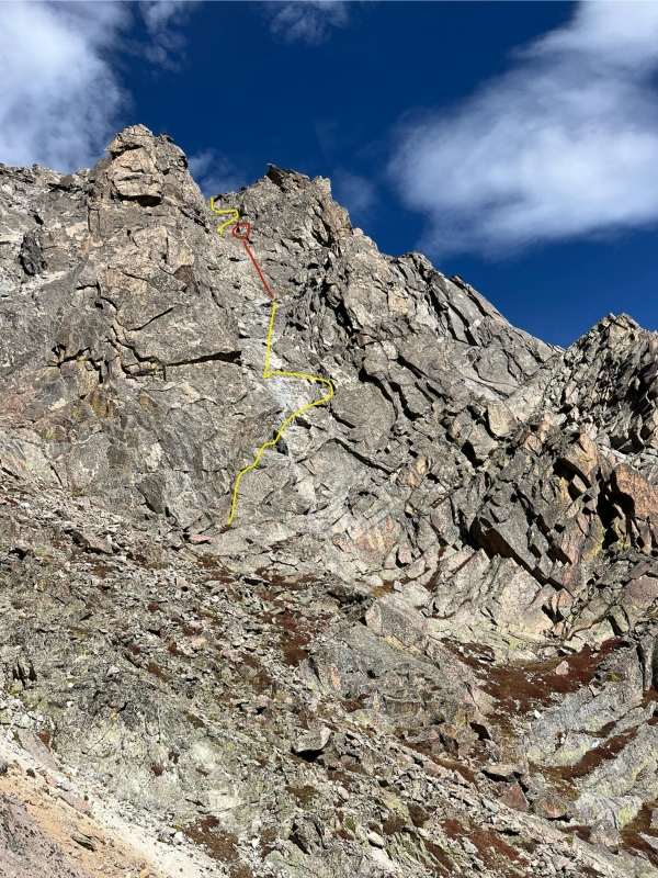
From the Ledge you will have to keep an eye out for a square rock below you by about 30 feet on the left-hand side of the gully, we did leave a strap and carabiner on the rock, but I wouldn't count on it being in good condition when you get there so bring your own. To get down to the anchor we took a series of ledges and cracks (class 3-4) to a grassy ledge next to the anchor. 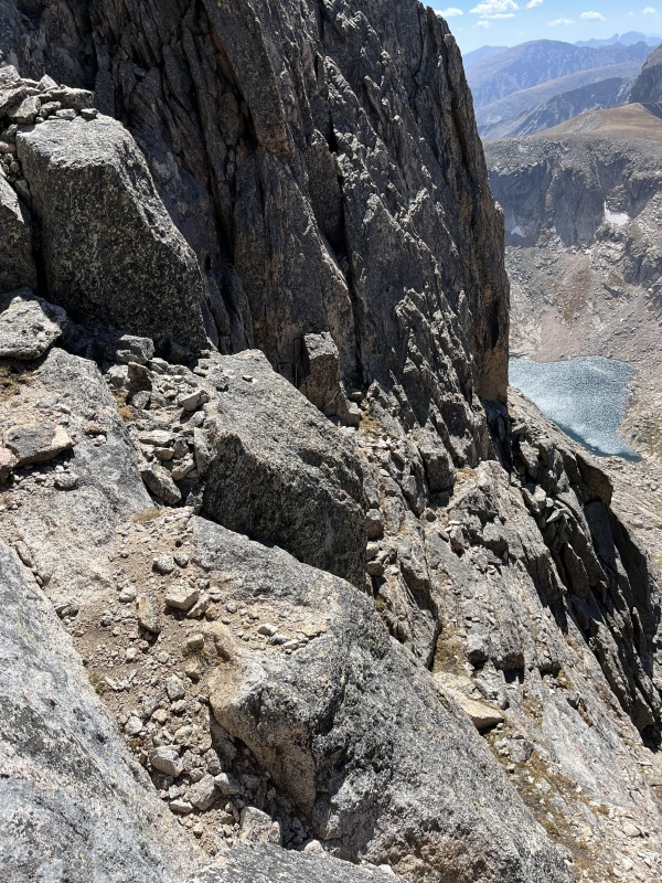

Once all three of us got down to the lower ledge we pulled down the rope and assessed our options. We didn't have enough webbing to make another anchor, but it would probably be possible to repel the next section. because of our lack of another anchor, we downclimbed a series of ledges and cracks that were class 4 to light class 5 with a couple far reach moves for my partners but not as much for me (6'5") but doable for shorter around (5' 10") this is an approximate guess just to give you an idea. This section should be taken slow because of the extreme exposure with nothing stopping you from taking a 300-foot-plus fall into a gully that drops down another 1000 feet. Descending this section has some good foot and hand hold though so if you take your time, it can be descended safely. 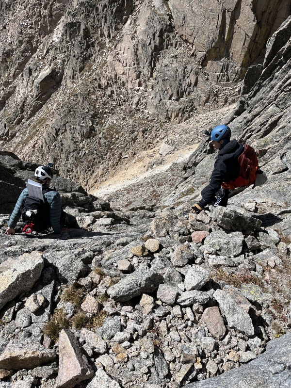
Once down into the middle of the notch, we took a long break to admire the views and take in what we just did. From here we headed northwest about 100 feet below the other side of the notch where we found a grass ramp with a cairn on it. Once rounding this corner with the cairn, we headed north towards a gully leading to the top of Powell. This section has relatively easy route finding, just know that if it becomes more than class 3 while skirting around the other side of the notch then you are too high and need to descend a bit. you want to continue around until you get into a class 2-3 gully. Once in the gully, you might be tempted to head for a grassy ramp on the left but when I went to the top of it and it didn't look like it went anywhere. We continued up the left-side gully until we saw a slab that led up to the left, we ended up taking this up which dumped us out onto the class 2 slope of Powell. You could probably continue all the way up the top of the gully but the route we took up the slab was class 2-3 solid rock which we appreciated. 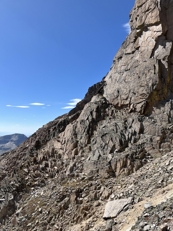
From here we peaked Powell where we took off helmets and then began our long walk over to Taylor Peak once on top of Taylor, we could see the top of Andrews Glacier which we would be taking down to the trail. So, we started the descent to the saddle between Taylor and Otis Peaks to gain access to the glacier. 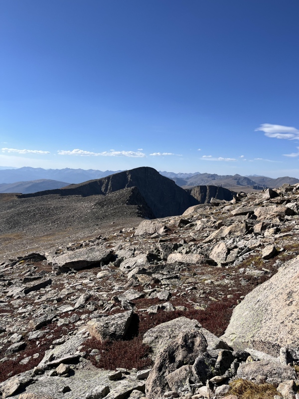
I feel like this is a good time to say that depending on the time of year and the time of day your gear for descending the glacier, the gear you need will vary. In September when we did this the glacier is mostly melted so it has steep drop offs that led to cracks ranging from a couple inches across and a few feet long to 5 feet wide and 20 feet long. We didn't get close enough to any to see how deep they ran but I would assume they were at least 10 feet deep. I would have felt a lot better if we had crampons and/or ice axes because of this and the whole lower half of the glacier was solid ice leading into a rock field that spread down the ice to the tarn. We reached the glacier at around 6:30 in the afternoon. We headed down the ridge of the glacier sticking to the middle and then dropping down to the right as it got steeper before heading to some rocks embedded in the ice where we traversed over to the boulder field off to the right. 
From here we headed towards the tarn where we met up with the trail and hiked out the Loch Lake-Glacier Gorge trail. If this route is above your comfort level you can hike out Flattop Mountain but this dose add a bit of mileage. In retrospect, we probably should have done this. At the end of the day, we hiked for around 20 hours and traveled over 15 miles with around 5k feet of elevation gain. But overall it was a super fun day with lots of challenges. 
Final notes: this hike is not for everyone, but it makes for an awesome day and great stories. The gear we brought, and I would recommend is a Helmet, sat phone, 210 for rope, harness, webbing, carabiners, and some sort of self-belaying device for first descent, we used a Gri Gri, depending on the time of year, Crampons, or ice axe. Make sure you are comfortable with repelling and up to class 5 downclimbing. You also need decent route-finding skills. Remember to be safe when attempting something like this and have fun!! the GPX is a bit confusing because of the downclimbs it had a hard time getting our exact position and then my phone died on the top of Powell so that's where it ends but the rest of the hike is reliably straightforward (I'm also really bad at remembering to unpause my tracking). Feel free to DM me if you have any questions about the route and I'll get back to you ASAP. Thumbnails for uploaded photos (click to open slideshow): ")
")
")
")
")
")
")
")
")
")
")
")
")
")
")
")
")
")
")
")
")
")
")
")
")
")
")
")
")
")
")
")
|
| Comments or Questions | |||
|---|---|---|---|
|
Caution: The information contained in this report may not be accurate and should not be the only resource used in preparation for your climb. Failure to have the necessary experience, physical conditioning, supplies or equipment can result in injury or death. 14ers.com and the author(s) of this report provide no warranties, either express or implied, that the information provided is accurate or reliable. By using the information provided, you agree to indemnify and hold harmless 14ers.com and the report author(s) with respect to any claims and demands against them, including any attorney fees and expenses. Please read the 14ers.com Safety and Disclaimer pages for more information.
Please respect private property: 14ers.com supports the rights of private landowners to determine how and by whom their land will be used. In Colorado, it is your responsibility to determine if land is private and to obtain the appropriate permission before entering the property.

