| Report Type | Full |
| Peak(s) |
Jagged Mountain - 13,833 feet |
| Date Posted | 09/11/2024 |
| Date Climbed | 08/18/2023 |
| Author | Slawson405 |
| Jagged Day Trip |
|---|
|
This post is from a trip in August of last year. I'd been eager to get at Jagged for a while now. I'd seen it from almost every vantage point in the San Juans through my centennial journey and I finally found an opportune time to get up there. I didn't originally plan to do it as a day hike, but I was in Vallecito/Johnson Creek for Jupiter the week prior. I backpacked it with my dog, and long story short I forgot a bunch of important things, and was surprised by how tired my legs were from humping my pack up to camp. I decided to look at Jagged as a day trip instead, as I thought I'd be more efficient without the pack, and just making a long day of it. Especially since almost 20 miles of it on Vallecito Creek is MOSTLY flat, but overall slightly rolling up and downs. I packed light and brought my water filter so I never had to carry too much water. I slept in the parking lot at the campground, and woke up at 2am to get ready to set off on the trail. I had some coffee and set off around 245. I'm not too bothered by hiking in the dark, but Vallecito on a weekday at 2am is a quiet dark place. That along with the constant deafening rush of the water in the creek made for the perfect environment to zone out in and crush the first few miles. I passed the first bridge near the campsites in the dark, and continued on to my next checkpoint Sheep Draw, and the bridge at the second creek crossing. I eventually made it to the third creek crossing in the dark. I had experience with it from my trip to Jupiter or else I would have missed it. I took my shoes and socks off and waddled through the water to keep my shoes dry which I highly recommend. There is a rope slung across two boulders on opposite ends of the creek and I slowly followed that in my headlamp and got across. My feet were numb by the time I made it out but I was glad to have dry shoes. After that i trudged on passed Johnson Creek, up to to confluence of Sunlight creek, where the sun finally started to show. 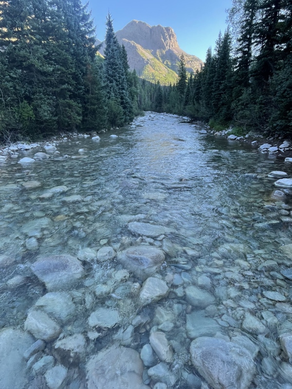
Sunlight Creek doesn't have an obvious path over it, I sort of rock hopped across and up to the trail. Sunlight Creek trail is pretty overgrown, I got soaked from all of the dew on all of the vegetation overhanging the trail. It comes and goes, and the lower part is slow going as the trail is obscured by vegetation, downed trees and game trails. Once higher on the trail it becomes more established and visible. I saw a few bears up here, but it was open enough that we had enough room to avoid each other and move on. You get your fist glimpse of Jagged just before you break out of tree line, and it really pumps you up. 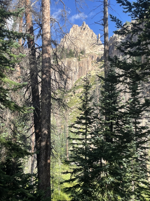
I kept working my way through the deadfall and across the creek. 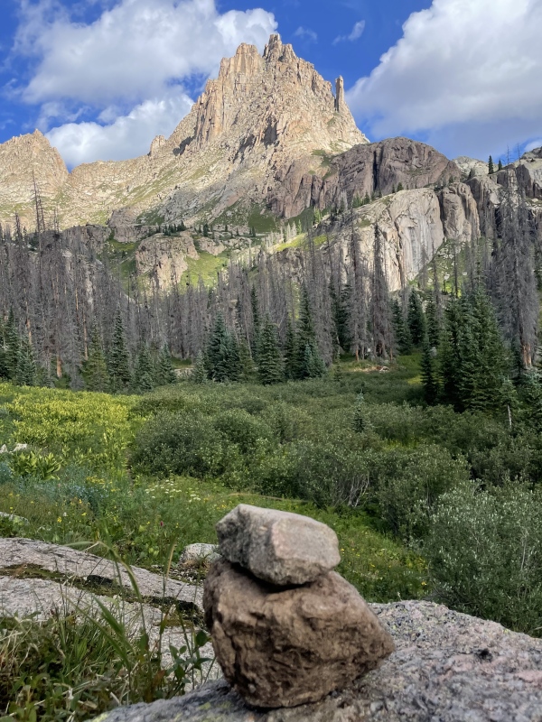
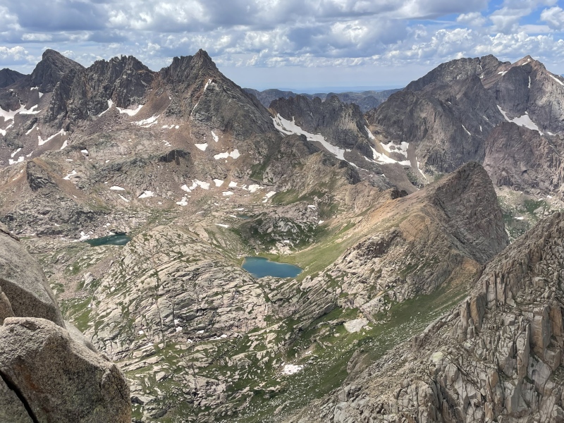
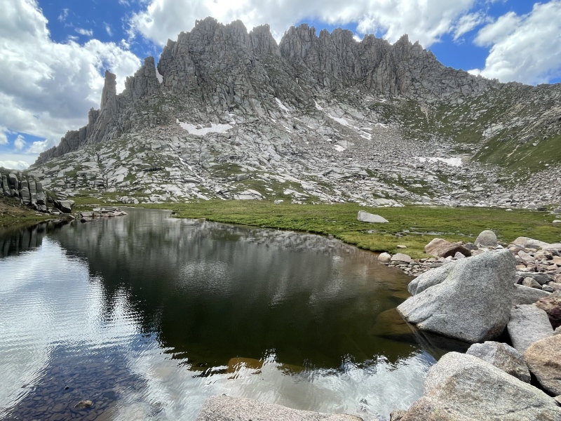
You start climbing out of that basin and up toward Sunlight lake, but you won't actually see it, you'll keep contouring grassy slopes up to a narrow, steep creek section leading up to the lake below Jagged. 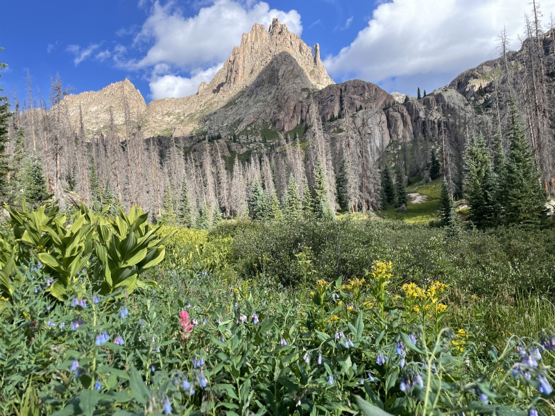
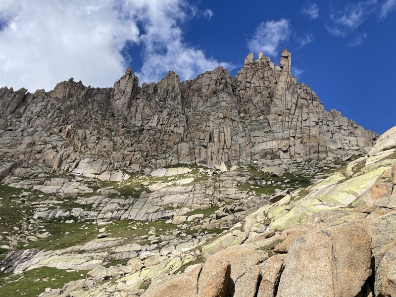
Once there, you can rest and preview almost the entire route before you start. Which is a good idea because once you are on it, it's really hard to see any of the route above you because it's so blocky and steep. I started heading toward the saddle and contoured left over on to Jagged. 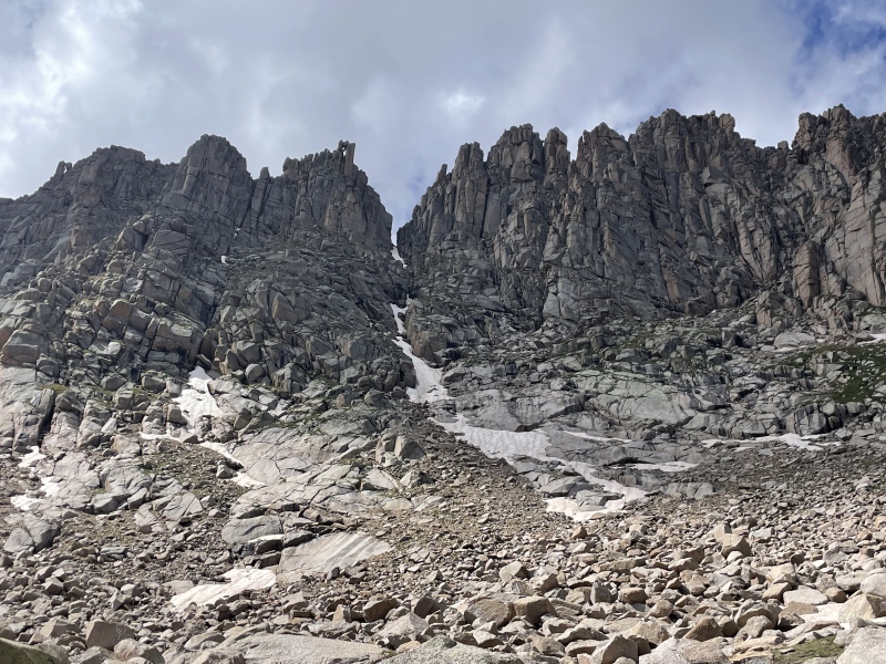
The first crux is obvious and you can see it well in advance. It's a steep slabby crack section running up about 40-50 feet. It's more awkward than technical. It's short lived, and you can take a look at the next couple moves above your head. I traversed left along some grassy blocks, and ascended just above the couloir as it seemed to offer some solid blocky climbing up. Once I saw Roach's 'Tiny Little Saddle' i peeled off back to the right and ascended up and over to see my next move. This is the second crux and people seem to tackle this guy either by grabbing the large block (if tall enough) and leveraging your way up and over, which is what I did to some effect, but I'm short so it took a couple mantle moves to get up. I didn't analyze this thing closely enough at first, but on the way down I took my pack off and shimmied my way in between the rock and cliff, and slipped under and through the block right down to the grass. 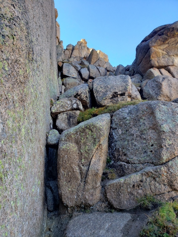
Have not heard of anyone going about it that way, but I'm pretty short and compact so it worked well for me. Passed this there are a few more easy scrambles to hit the saddle and dip down to the South side of the mountain. 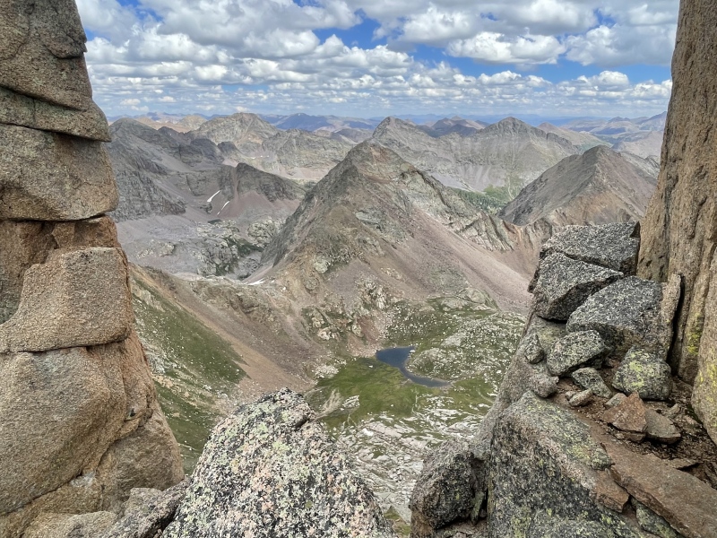
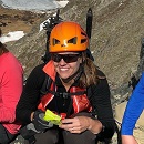
The exposure ramps up over here, and it's a pretty incredible view, maybe my favorite of all the centennials. You drop down some blocks to a ledge system. The "airy step around the block' is just that. It's airy, and super exposed. I was pretty impressed. I threw my pack through the cavey move to the left and skirted the right side of the boulder. 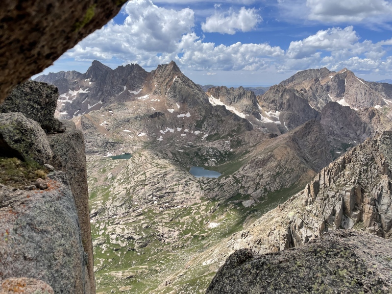
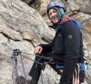
I actually took the lower ledges on the way back as they looked solid and offered some purchase over the exposure. They are easy to ascend/descend and are a less intimidating move than the exposed boulder itself. Onward to the third crux. The weird chimney right below the summit. I'm short, but confident in my climbing so I climbed as far as I could and then shifted my legs to the north side of the chimney and my back on the south. Just used my legs to push my back against the wall and shimmied my way up. Pretty straightforward and not too demanding. I took some pics and a video in the middle of this section as it was a unique way to summit a mountain in CO. After that, it was a hop and a skip to the summit. I reached the top around 11:30. Jagged itself has my favorite summit, it squeezes by Dallas, mostly because you're in the middle of the Wemi, the surrounding peaks, and the constant effort it takes to get up there. 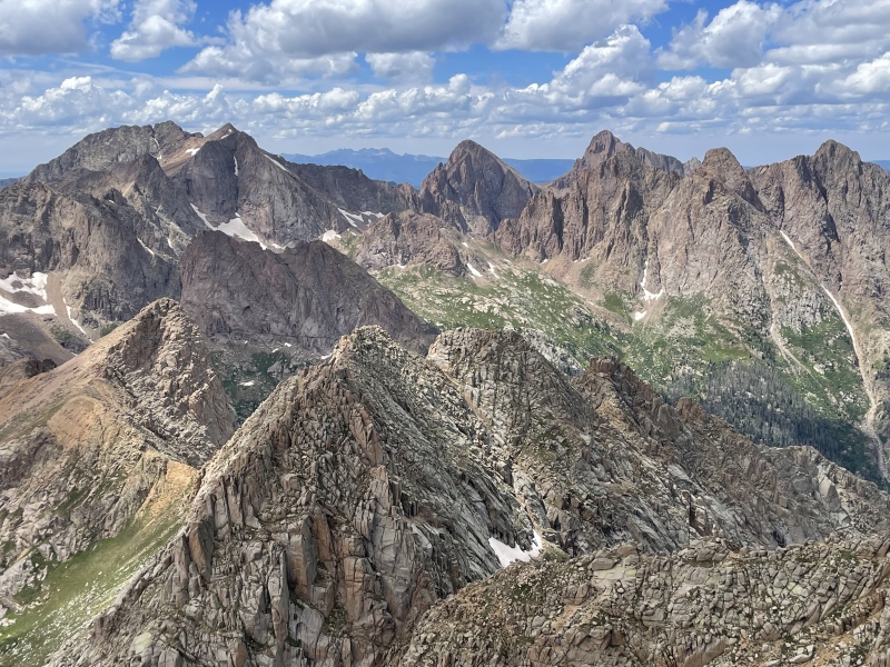
It's incredible and every direction offers a phenomenal view. I worked my way down the way I came. I took the ledges in lieu of the airy boulder, and i squeezed through the blocky chockstone on crux 2. I went by the lake below Jagged to snap some pics, and it's a really cool detour on the way down. 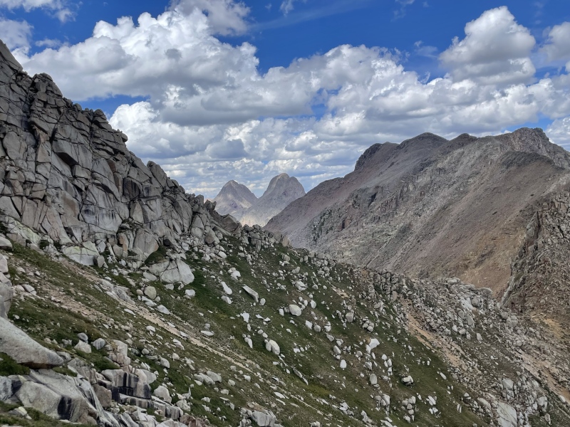
I filtered some water and started my trek down sunlight creek. It's not great for trail running, as its steep, has tons of roots and rocks, and my knees needed a break. Once down Sunlight Creek I was relieved to be back on Vallecito, but even with the low angle grad, it's still a long ways back to the car. I trail ran where I could on the flats, but it really is more rolling than flat. I put some music in and got in a nice pace toward Johnson creek and then the Third creek crossing. It started to get dark around the First bridge crossing, and that felt like the longest part of the trek as I was mentally tired at this point. I made it back to the car around 8. I accidentally drove a half mile or so before turning my track off, but it was around 38 miles and 6,800 ft of elevation round trip at around 17.5 hours. All in all I would say it is an easier day than the Arrow, Vestal, Trinities day trip as there is way less elevation. It's more of a mental battle with the 20 miles of rolling flats. I am super happy with my decision for the day trip. I felt like it was easier than hauling a backpack up sunlight creek over 2-3 days, and it felt like a big accomplishment for me. I was broken but very happy and stoked afterward. This was the ego-trip I needed to get me to try Vestal Basin in a day and get humbled.... Thumbnails for uploaded photos (click to open slideshow): ")
")
")
")
")
")
")
")
")
")
")
")
")
")
")
")
")
")
")
")
|
| Comments or Questions | ||||||||||||
|---|---|---|---|---|---|---|---|---|---|---|---|---|
|
Caution: The information contained in this report may not be accurate and should not be the only resource used in preparation for your climb. Failure to have the necessary experience, physical conditioning, supplies or equipment can result in injury or death. 14ers.com and the author(s) of this report provide no warranties, either express or implied, that the information provided is accurate or reliable. By using the information provided, you agree to indemnify and hold harmless 14ers.com and the report author(s) with respect to any claims and demands against them, including any attorney fees and expenses. Please read the 14ers.com Safety and Disclaimer pages for more information.
Please respect private property: 14ers.com supports the rights of private landowners to determine how and by whom their land will be used. In Colorado, it is your responsibility to determine if land is private and to obtain the appropriate permission before entering the property.