| Report Type | Full |
| Peak(s) |
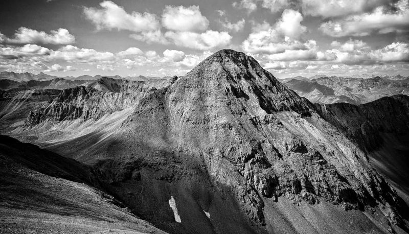
Jones Mountain - 13,867 feet Niagara Peak - 13,816 feet Dragon's Back Peak 12,973' |
| Date Posted | 09/15/2024 |
| Modified | 09/16/2024 |
| Date Climbed | 09/08/2024 |
| Author | ReginaThomas |
| Additional Members | Kiefer |
| This Dragon is not Toothless and Jones and Niagara |
|---|
|
This Dragon is Not Toothless Jones Mountain - 13,867' CO Rank 79 Niagara Peak - 13,816' CO Rank 101 Dragon's Back Peak - 12,973' CO Rank 654 Dates Hiked: 09/07/2024 & 09/08/2024 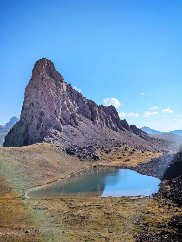
If you could describe the weather in the San Juans this summer in one word, it would be... wet. In fact as I am sitting here typing this long overdue report crashes of thunder are providing the background noise. My top priorities this summer were 13er Wildhorse Peak, and 12er (I know what is up with that?!) Dragon's Back Peak. Both peaks also happen to be right next to each other. Kiefer and I hiked Wildhorse Peak in early June while there was still snow on American Flats. It was gorgeous. My trip report for Wildhorse (and Sundog) can be found here: Wildhorse Trip Report Kiefer and my secondary goal (still in progress) is to finish all the peaks from Silverton to Lake City via both Engineer and Cinnamon Passes because with the added OHV traffic those trails are less fun each time. Thankfully Hinsdale County did some great work on Cinnamon Pass, so it has been less of a headache, but the San Juan side of Engineer is nothing short of a nightmare (to me). I will be very glad when we never have to drive that road again, but one more trip will be needed... we will get to why later in this report, but I bet you only need one guess! My dad called earlier in the week asking if he could come stay with us Thursday-Sunday while he attending a HOG (Harley-Davidson) Rally in Grand Junction. Of course, I said yes, and asked if I could join him on Friday. My dad and I have a tradition of taking scenic rides on his Harley for Father's Day and because, well, life happens, we have missed the past few years. We spent the day Friday riding over the Grand Mesa and making a loop up to Big B's in Paonia before heading back to Montrose. Kiefer got back from work in Denver later that evening and we decided in order to have more time with my dad we would kick off the weekend of hiking with Jones Mountain and Niagara Peak via Grouse Gulch, saving the harder peak for the better weather day Sunday. We left the house early Saturday morning and headed up the familiar road towards Animas Forks, turning off just shy of the ghost town onto the Grouse Gulch road which heads into the upper basin between Jones and Niagara. The road is narrow and it would be extremely challenging to pass, but thankfully we didn't run into any traffic. After you pass some obvious campsites the road gets much rougher, so the campsites are a good place to stop. We went too high and after some difficulty turning around parked at a good pullout just off the road at 11,800'. 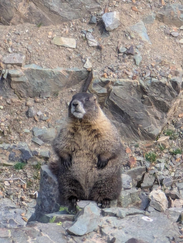
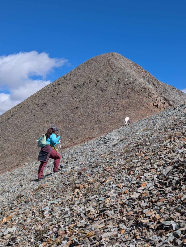
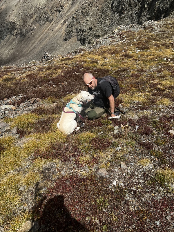
The route is straightforward up both peaks so we brought Kaiah with us, since we knew she would enjoy getting out of the house and having a few well deserved tundra rolls. The route follows the road until it eventually turns into a singletrack trail that traverses the slope below Jones. The trail continues through the rocky slope below to the saddle which made for quick progress. 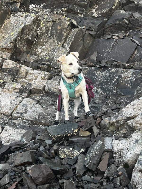
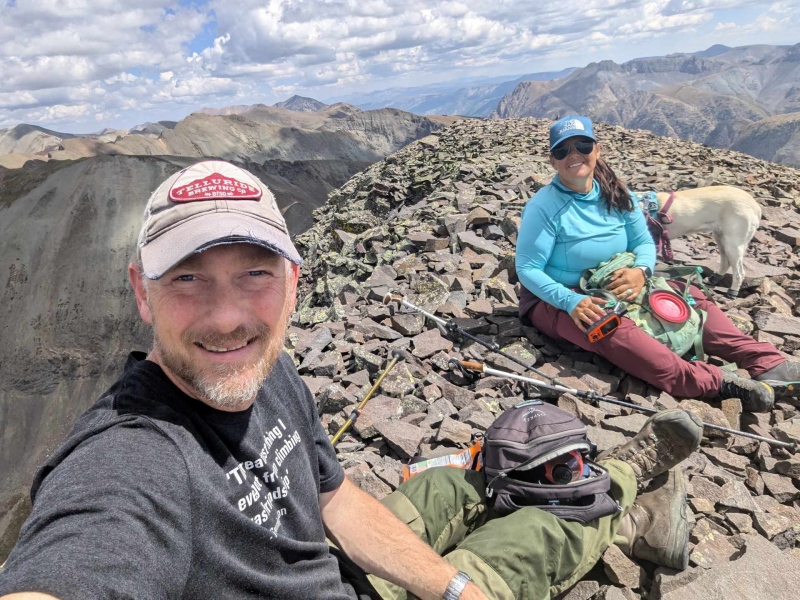
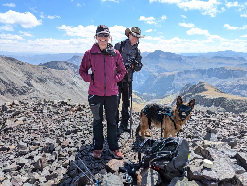
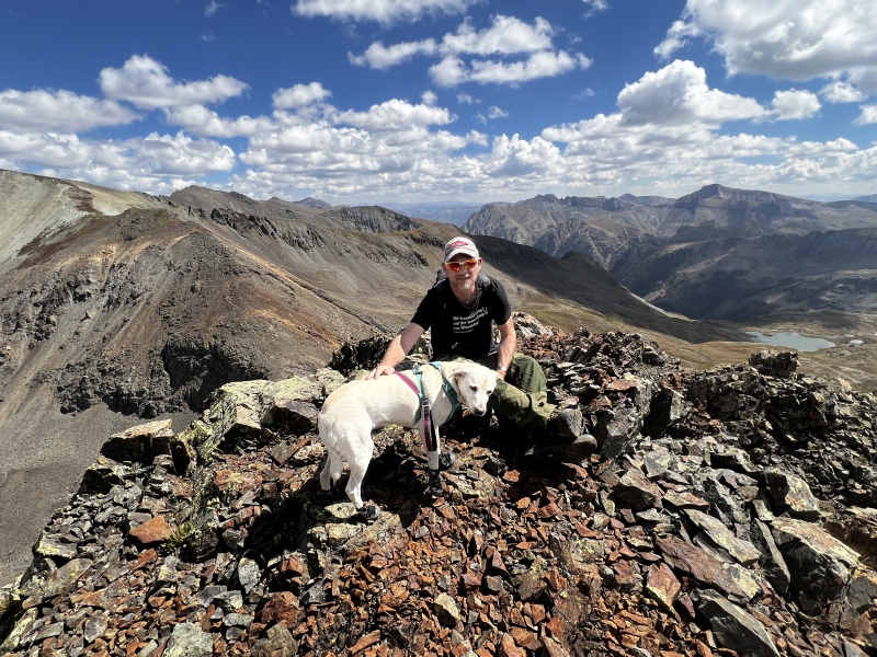
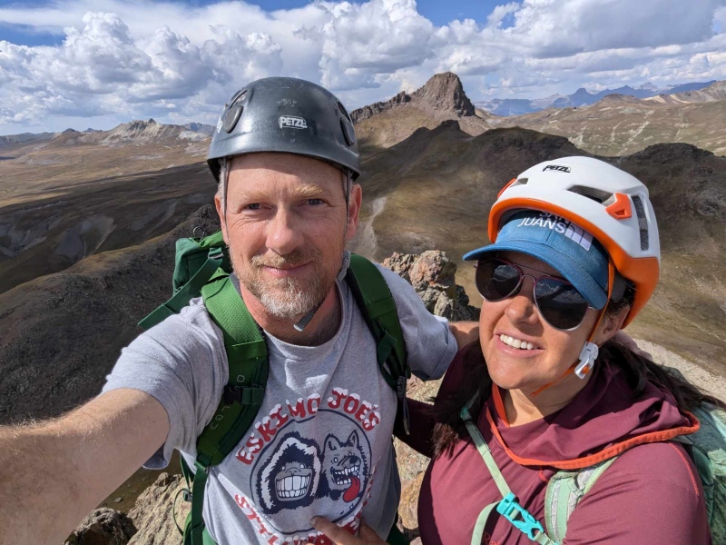
We elected to head up Jones first as it is the furthest out from the car and hike Niagara on the way back. There is an easy to follow trail all the way up Jones, but it is further than it looks to reach the summit from the saddle. Kiefer and Kaiah beat me to the summit by a few minutes (as expected) and as I ascended the last few feet I could hear voices stating "I read your trip reports all the time". I joined Kiefer and Kaiah and introduced myself to Ewa and Jeff who were hiking with their adorable German Shepard, Bailey. It was awesome to share a summit with some other 13er loving hikers! We chatted for quite a while and swapped stories, before they headed off toward American, and we reversed course toward Niagara. Let's definitely get together and XC ski guys! 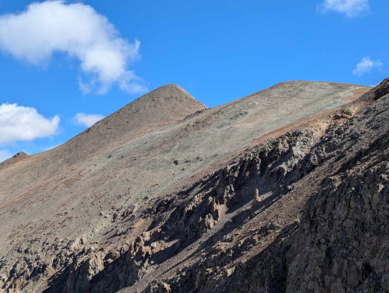
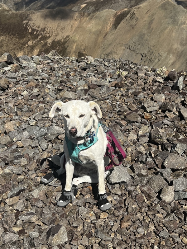
The hike back to the saddle went quickly, and soon we were headed up the slightly less established, and much steeper trail up the ridge of Niagara. We reached the summit quickly, had another snack and headed down. Speaking of snacks, after hiking North Hayden by happenstance we stopped off in Ouray and I bought a small cup of green olives, they were DELICIOUS, and now one of our newest snacks of choice is a packet of Oloves on the summit. Kiefer didn't enjoy them on Niagara as he thought they were a weird new type of fruit snack, but we have had them on nearly every peak since. Kaiah gives Niagara 0/10 paws, would not recommend. We had her booties with us to protect her little paws, but she did not like the fact that the trail was slippery and she would slide a bit getting back to the saddle. 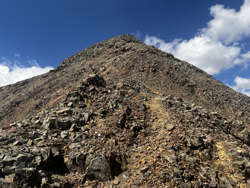

After we hit the trail and the tundra all was well again and she was able to enjoy some well earned rolls. On the way back Kiefer explored an old mine while we headed back to the truck. Thankfully once again there was no oncoming traffic and we were able to descend to county road 2 without incident and headed back into Silverton. After stopping for a quick snack at Thee Pitts, we were back on the road to spend the evening at home with my dad, and repack for Dragon's Back and Blackwall. 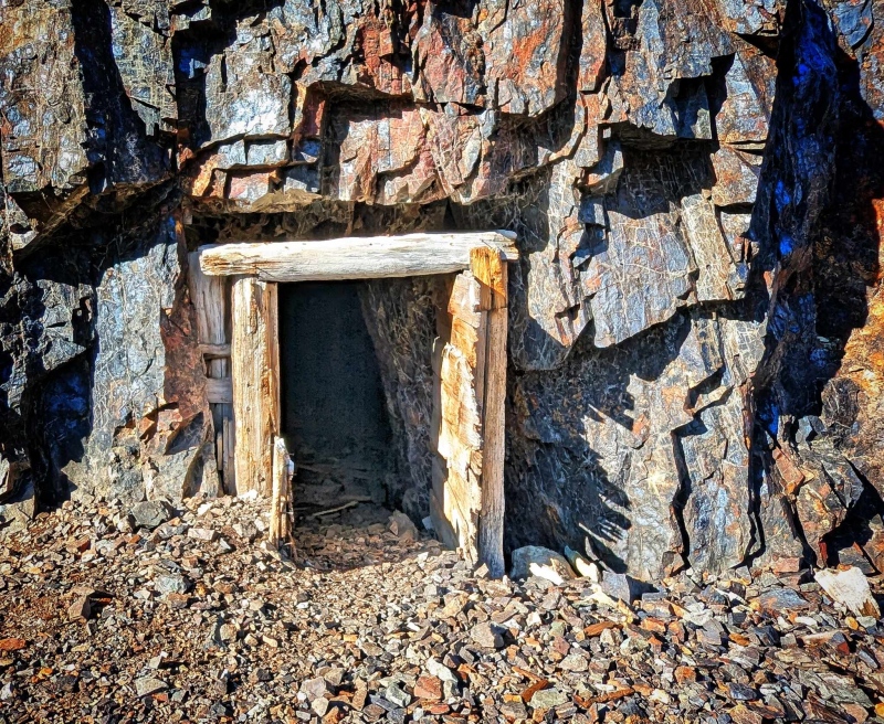
For starters, you will notice this is NOT a report for Blackwall Mountain, but that's all part of the fun of spending time in these mountains we love so much. Before we left I took a few minutes to study Alex Henes' trip report for Dragon's Back one more time, and took a few screenshots of the upper route. His report was invaluable. We were able to follow he and Kristi's exact track and it made for an enjoyable route up this beautiful peak. His report is linked here, give it a read, you won't be disappointed. The alarm went off way too early, as they always do, and Kiefer and I were once again out the door and headed up to Animas Forks, this time to head up the awful side of Engineer Pass. It's really only a few spots that are bad, but those spots definitely require a good driver. That driver is Kiefer. We took our time driving up the pass, and after reaching the crest dropped down and parked at the pullout that serves as the trailhead for the Horsethief Pack Trail. 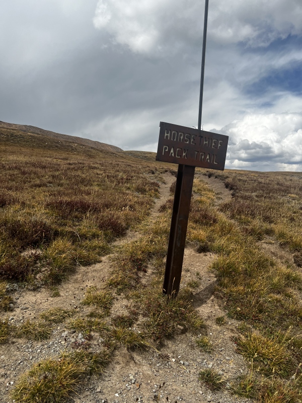
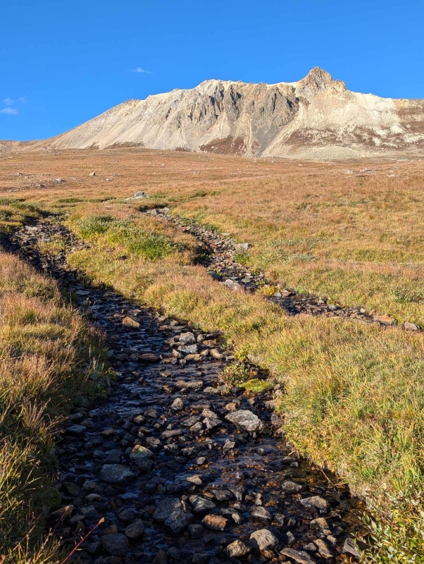
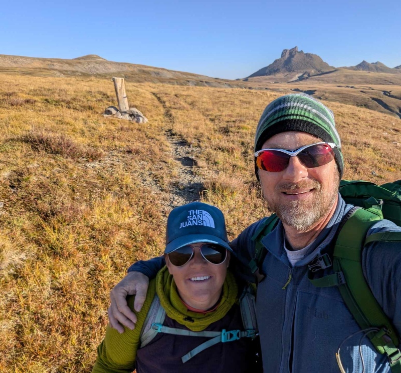
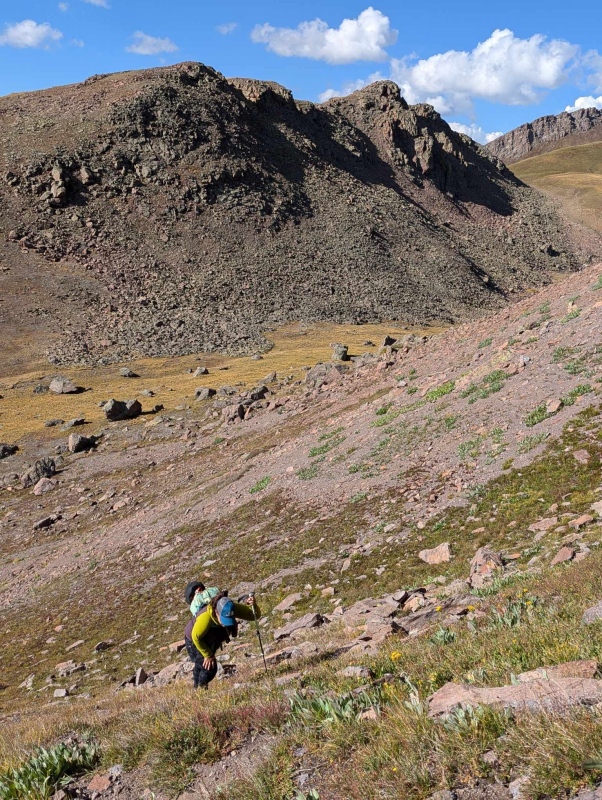
Would Colorado finally allow us to get up this beautiful peak? We shouldered our packs and started up the familiar trail. Last time (Wildhorse) the mashed potato snow slowed our progress significantly, but this time we were able to speed across the flats and soon we were skirting by Wildhorse Peak and enroute to the pass southwest of unranked 12er, 12,916'. 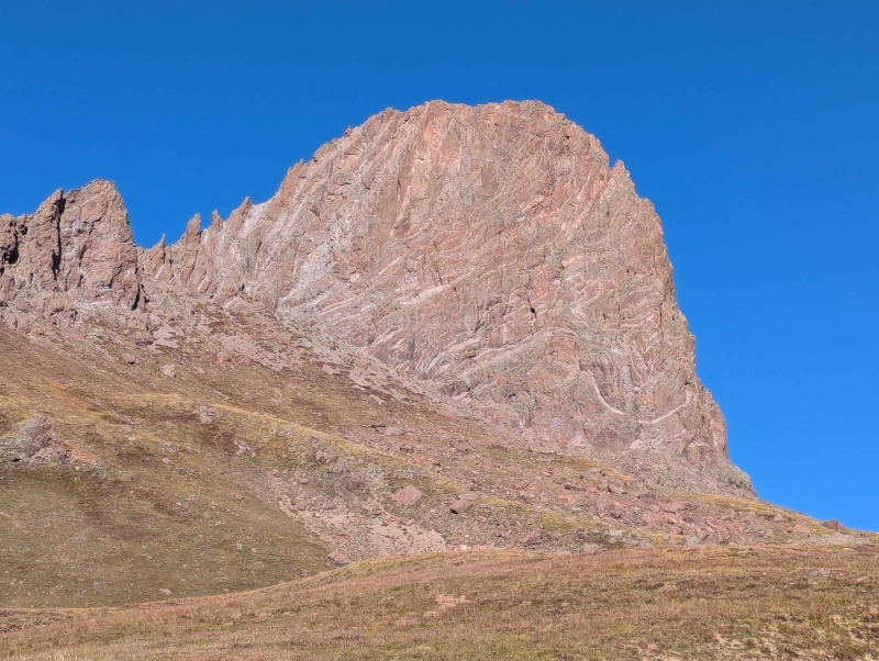
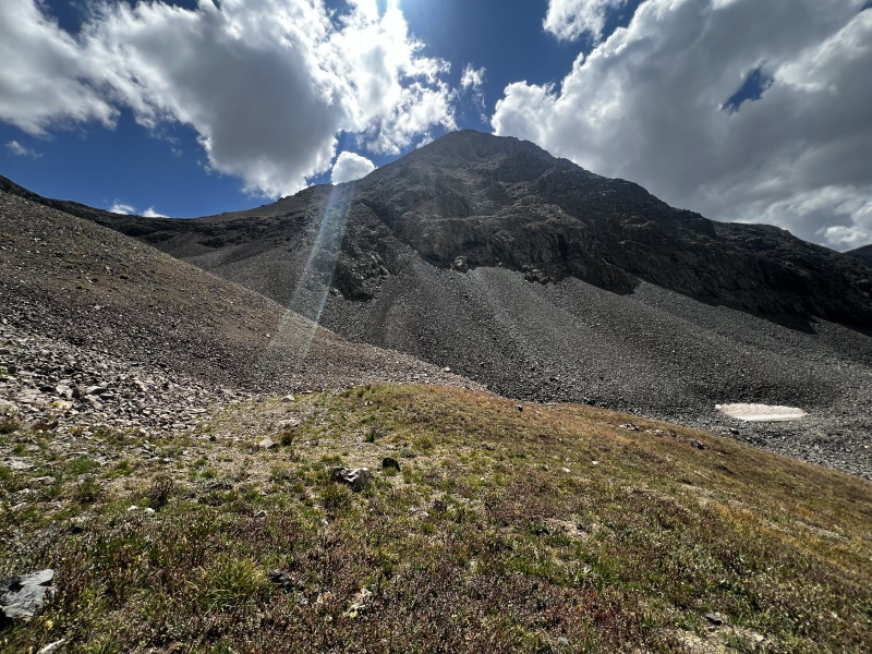
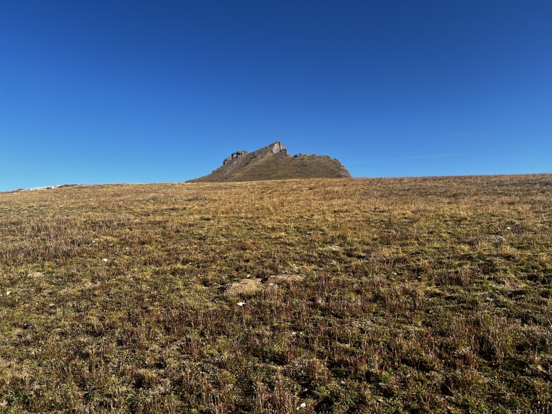
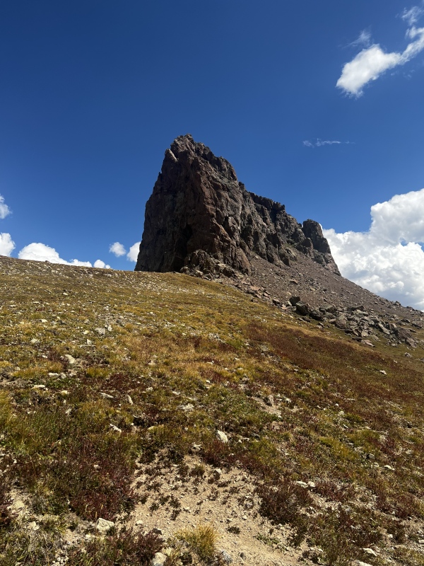
The day had started as a beautiful day as forecast (20%). It is important to note that with weather forecasting, 20% means 20% of the area WILL get storms, but we were feeling confident as we trekked the miles across the flats. As we stood on the pass looking at Dragon's Back and the pond below it we could see the clouds to the west beginning to get taller and more ominous looking. Kiefer at that point said, "Well I think we will get one of the peaks, let's go get Blackwall". I immediately said "No, I want Dragon's Back, we carried all this extra climbing gear up here, let's use it." "Are you sure? You're working on the San Juan 13ers, and Blackwall is the 13er." "No, like I told Alex when he was sending me beta, the 12er is the priority today, if we can only get one, it's Dragon's Back". I will admit my stomach dropped a bit looking at Dragon's Back from the pass. I had never seen the peak this close before, and it looks ferocious. It is a Dragon with teeth, and not toothless. This trip report got named while standing on that pass. 
We descended to the pond, hoping that Colorado would allow us a weather window to enjoy a snack at the pond, after summiting, OR even miraculously the weather would clear and allow a summit of Blackwall after all. 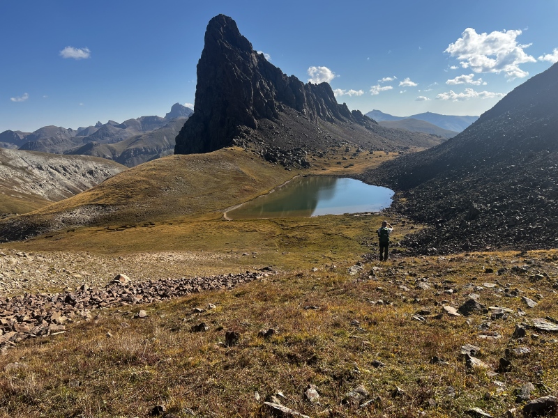
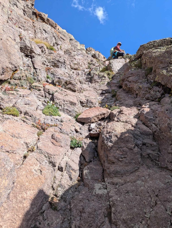
We skirted the pond to the left on a faint trail and were able to easily locate the access gully in Alex's report. This gully is the key to the route, and I cannot stress this enough, stay to the climbers left side of the gully. 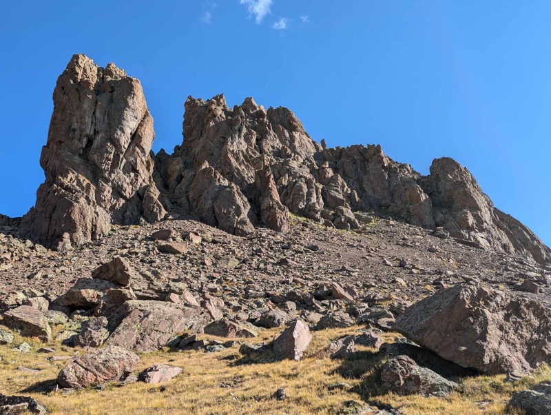
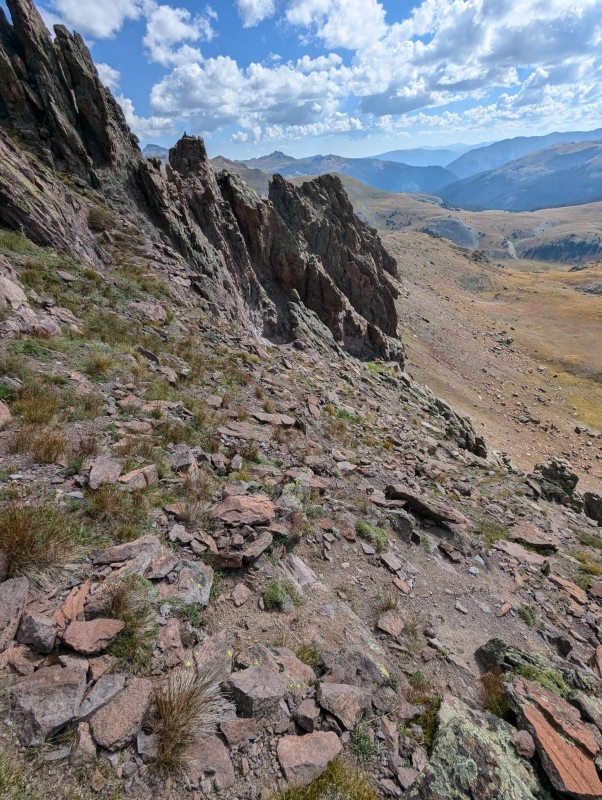
The gully is grassy, but filled with loose rock and kitty litter scree. Staying to the left allowed for us to use the left cliff wall as leverage. Another key point I would like to add is you do not go to the top of the gully to access the route. Kiefer and I reached the top of the gully, and Kiefer asked if we were still on track. I pulled up GAIA, and we were too high. I took a few steps down the gully, looked off to my right and saw the two blue rappel slings I had screenshots of, and the "kitty litter ledge". I told Kiefer to come down and join me and we got ready to cross the ledge toward the rappel station. There is a cairn in the center of the gully where you should turn left to access the ledge, however the rappel station, and ledge are easy to miss on the way up, so I recommend continuing to look up and to the left as you ascend. The ledge is about 2/3 way up the short gully. 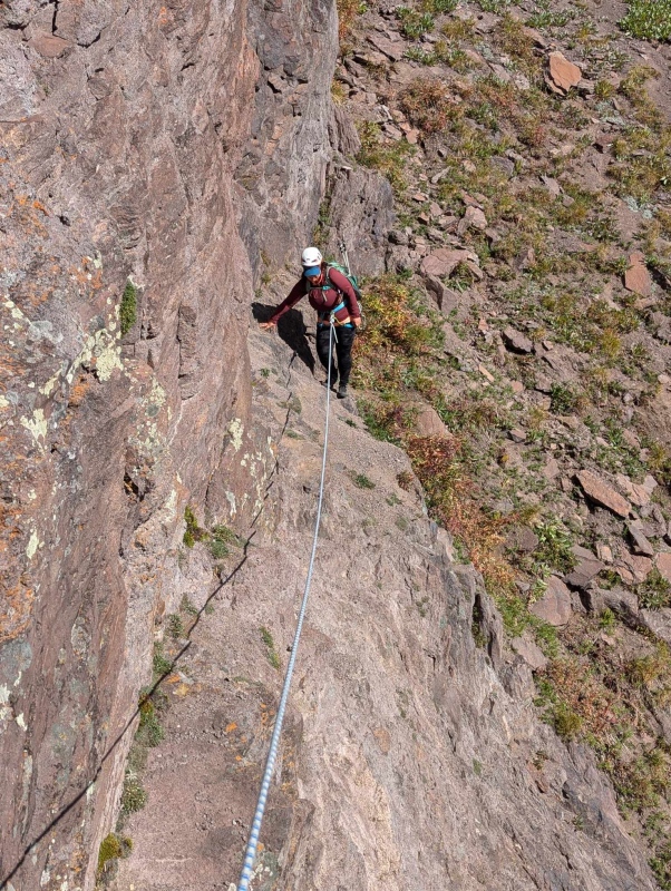
I will also say that the ledge is much easier than it looks. After reading Alex's report, I was actually more nervous about the ledge than the actual 4th-5th class climb to the summit. Kiefer and I were both a bit nervous about the ledge crossing, so since we had a 30m rope with us, we decided to use it, and after shimmying into our harnesses, Kiefer crossed the ledge with no protection, anchored himself to the slings and brought me across. Kiefer said it wasn't nearly as bad as he expected. After my first couple gingerly steps onto the ledge I wholeheartedly agree that it was absolutely not necessary to use a rope on this section, but hey, at least we got some practice in. From the kitty litter rappel station there is a short walk to a class 3 gully on the right. 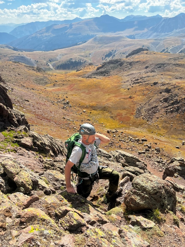
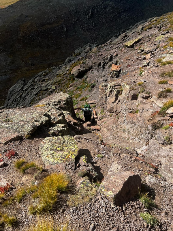
We scrambled the gully one at a time as the rock was mostly solid, but still had enough loose rock to be problematic in such a narrow gully. From the top of the gully it was another short walk/scramble over a small rib to access our route to the summit. The route starts with a short 20 foot class four climb up a rock face to a small ledge wide enough for two people to squeeze onto. 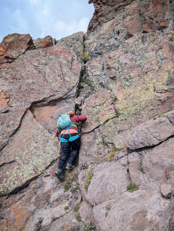
We roped up again here. Kiefer once again led the mostly class 4 pitch to access the summit ridge. There is a short 5.0 move about 3/4 of the way up. Holds are plentiful, but some of the flakes are loose, so test everything twice, because oh boy is it exposed. Kiefer once again anchored himself to the second set of rappel slings and I tied into the rope and climbed up. I found the climbing enjoyable and cleared the low 5th pitch with ease. 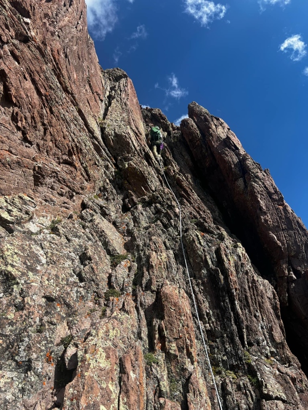
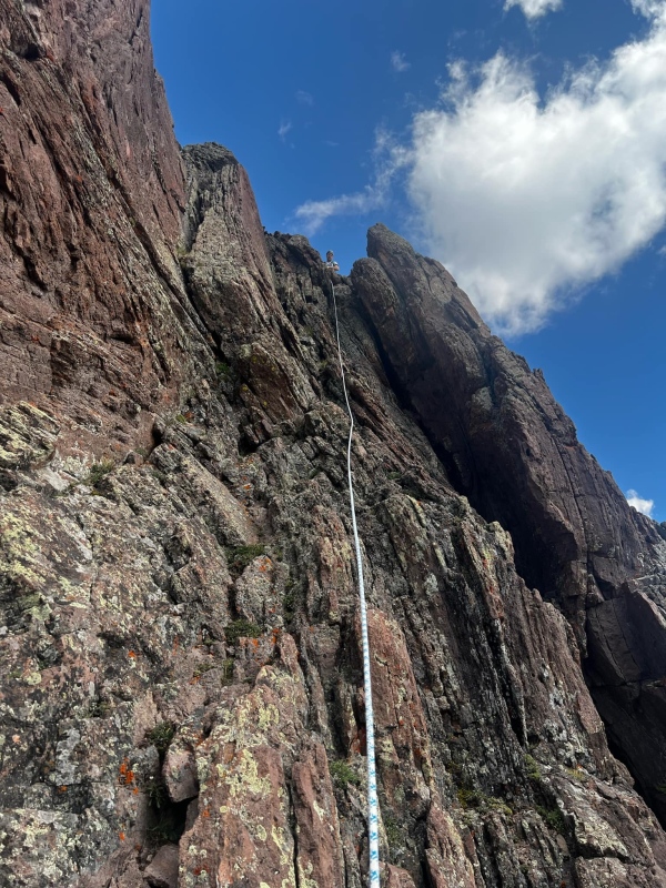
We untied and left our rope threaded through the rappel slings and headed up to the true summit. The summit was maybe 10 steps from the top of the climbing. 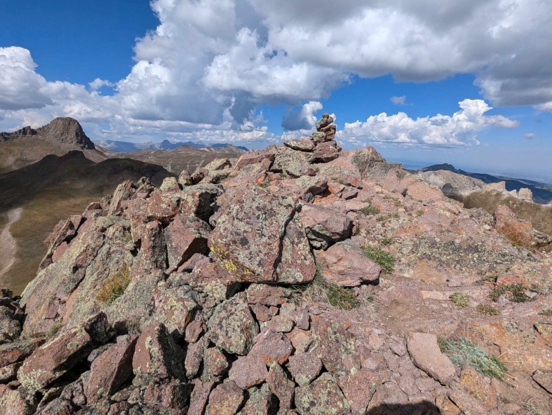
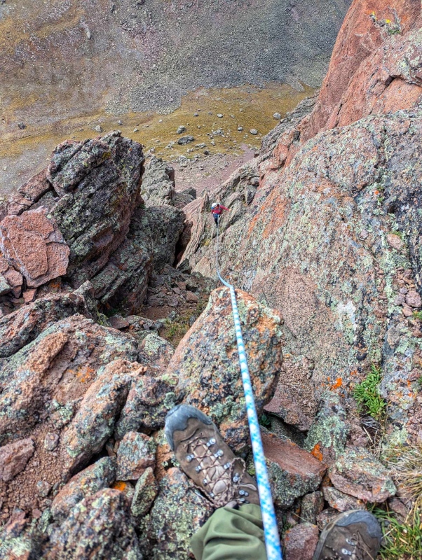
Just as the summit sharply rose from the pond below, the thunderclouds were now sharply rising into the sky. No time to relax and enjoy the summit today, and I guess one more trip to Engineer Pass is in order to get Blackwall, which while tantalizingly close was not in the cards today. American Flats is not an area where you can just eek out a summit, you have miles of nothing around you all around 12,400' to reach the car, so it is not a good place to be with incoming weather. We took our 10 steps off the summit, quickly reaching the first anchor. Kiefer tossed the rope down, and I prepared for my first true alpine rappel. "Remember Coffeepot? Kiefer had to lower you, and you couldn't do it" said the little nagging voice of doubt in my head. "Kiefer can I go first? I don't want to freeze up", Kiefer said sure and after double checking my harness and ATC I stepped backwards down the pitch. I didn't freeze up and dare I say I was having fun. The end of one of the ropes had gotten stuck above me so after a quick colorful metaphor, which scared Kiefer (OOPS) I was able to complete the first rappel. 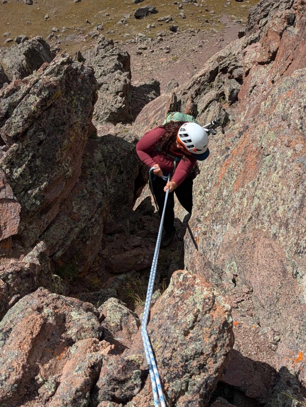
Our 30m rope just about reached the ledge we began the climb from but from where it ended it was an "easy" class 4 scramble back to the ledge. Kiefer shortly followed behind me, pulled the rope, bundled it back up into a nice little package and joined me on the ledge again. We both found the summit rappel to be awkward, as it is off camber and your body naturally wants to swing to the right, we both had to use a combination of rappelling and our left hands on the rock to keep us on track. 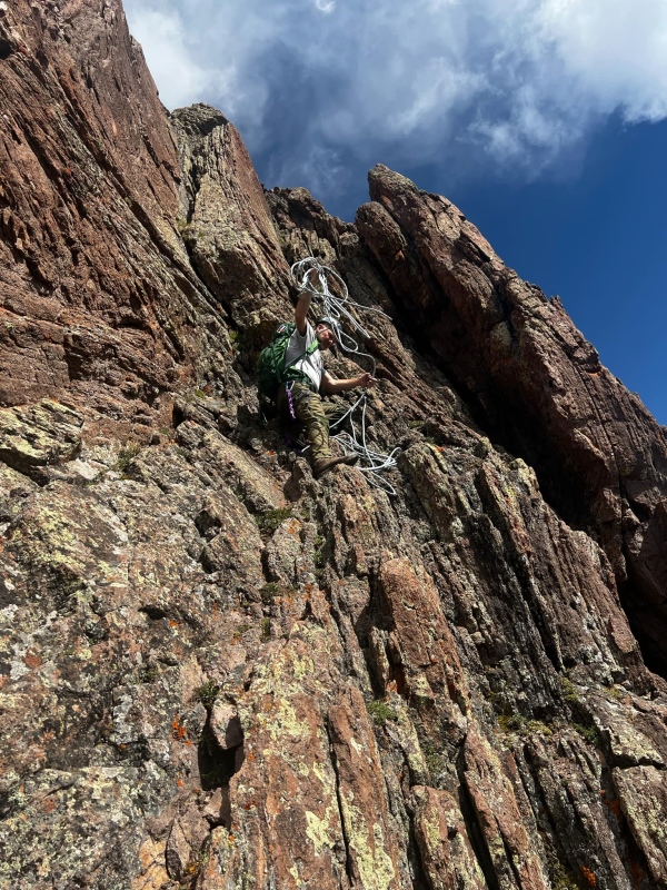
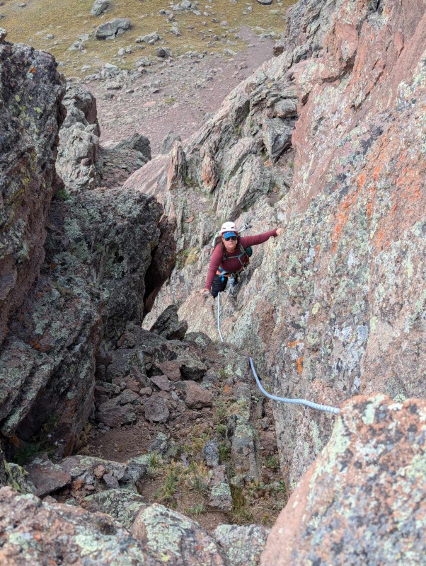
Kiefer led the class 4 pitch down the face as it is quite steep, and reachy in a few spots if you are short (which I am). Kiefer helped me spot some hand and foot holds and soon we were off the class 4 pitches and headed back down the class 3 gully. 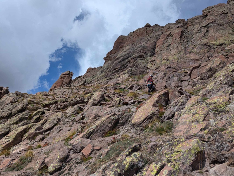
At this point a couple of small raindrops hit our hands. Great this will make for a fun crossing of the flats. We reached the kitty litter rappel and I again went first quickly dropping into the gully and retrieving Kiefer's abandoned pole from earlier. Remember what I said about the ledge crossing being not that bad? It's truly not. As I was ending my rappel and pulling the rope, Kiefer quickly hopped across the ledge and down the gully to join me. Regardless, I am glad I did both rappels, and I enjoyed them both. 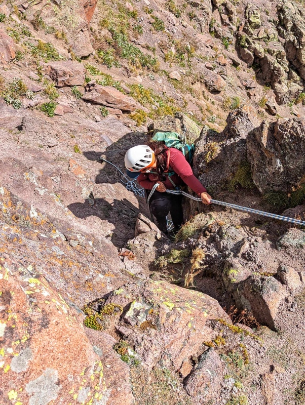
We descended the gully, this time hugging the climbers right side, and once again using the cliff wall for counter-pressure. The gully is thankfully short and soon we were rounding the small pond. We took a 2 minute break to get a quick drink and we were off hiking back up to the pass. 
We followed a lower game trail on the way back, and found it to be more efficient than our ascent route which was closer to 12,916'. I was giddy with excitement to have climbed Dragon's Back, but all around us (not 20%) the weather was threatening, and we could see the long expanse of American Flats ahead of us before reaching the truck. We knew off to the left if needed we could reach treeline in Palmetto Gulch, but this was a last resort that we didn't end up needing to use. Our progress was quick and before we knew it Wildhorse Peak was far in our rear view mirrors. We were maybe 1.5 miles from the car when we heard thunder to our east, but it was WAY to our east now, as we had already covered MILES. Blackwall wasn't even visible anymore and just the peak of Dragon's Back was poking out. I also should mention that most of the hike from Wildhorse Peak to the trailhead is at a slight uphill, with one ~200' climb out of a drainage that is needed. After the climb up the drainage the main Horsethief trail was once again in view with the familiar tall wooden posts marking the way. 
I didn't want to jinx us, but we were going to make it to the truck. All of the weather had formed a donut and gone around us, leaving us in the peaceful center. I told Kiefer I needed a drink and we took a quick break to rehydrate before finishing the hike out to the truck under gray but quiet skies. We reached the truck a mere 1.5 hours after leaving the pond below Dragon's Back. Were I to come back here for more than one peak, that pond would be a phenomenal campsite. 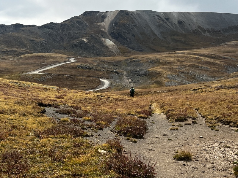
After reaching the truck I felt 100% fulfilled, sure we didn't achieve both objectives we had set out for, but on this day Colorado said we could only pick one, and we had to choose which one we wanted more. In this case Dragon's Back was the more worthy and fulfilling objective. My only regret was that we didn't have time to enjoy our olives and Red Bull at the small pond below the peak and take in the view! Hopefully this weekend when we return for our orphan Blackwall we can spend some time with our very toothy Dragon on the way out! As a bonus we got to see a want to be Honnold marmot on the way down the Lake City side of Engineer Pass!! 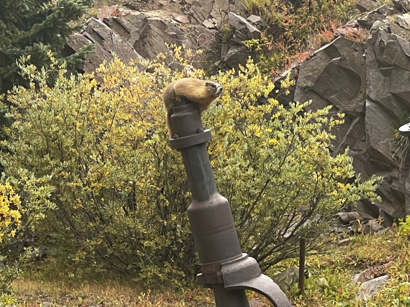
Thumbnails for uploaded photos (click to open slideshow): ")
")
")
")
")
")
")
")
")
")
")
")
")
")
")
")
")
")
")
")
")
")
")
")
")
")
")
")
")
")
")
")
")
")
")
")
")
")
")
")
")
")
")
")
")
")
")
|
| Comments or Questions | ||||||||||||
|---|---|---|---|---|---|---|---|---|---|---|---|---|
|
Caution: The information contained in this report may not be accurate and should not be the only resource used in preparation for your climb. Failure to have the necessary experience, physical conditioning, supplies or equipment can result in injury or death. 14ers.com and the author(s) of this report provide no warranties, either express or implied, that the information provided is accurate or reliable. By using the information provided, you agree to indemnify and hold harmless 14ers.com and the report author(s) with respect to any claims and demands against them, including any attorney fees and expenses. Please read the 14ers.com Safety and Disclaimer pages for more information.
Please respect private property: 14ers.com supports the rights of private landowners to determine how and by whom their land will be used. In Colorado, it is your responsibility to determine if land is private and to obtain the appropriate permission before entering the property.