| Report Type | Full |
| Peak(s) |
Pettingell Peak - 13,559 feet |
| Date Posted | 09/03/2024 |
| Date Climbed | 08/31/2024 |
| Author | tylerhohs |
| Additional Members | Dmagalha |
| Pettingell Peak East Ridge |
|---|
|
13er Pettingell Peak - East Ridge Trip Summary:
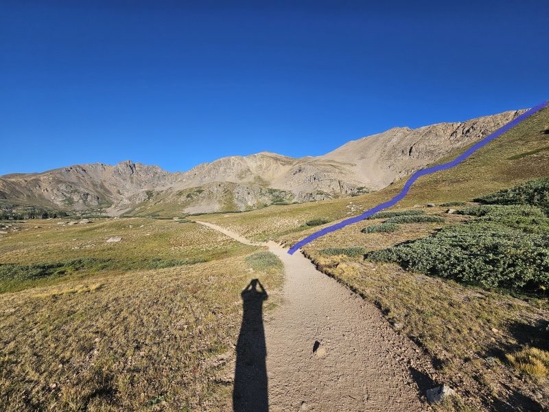
Great day in the alpine over labor day weekend with my brother Logan who was in town visiting and my buddy Dan (@dmagalha). We had perfect summer weather with not a cloud in the sky on this day and with an early start we were able to beat the heat. I figured a trip report was worth the effort as the east ridge route seems to be much less traveled than the standard class 2 south slopes from Herman Lake; I was able to find some beta but it wasn't as readily available many other routes so hopefully someone can find this of value in the future when planning an outing. We arrived at Herman Gulch and started our hike just after 6:30. We opted for this peak given the easy access from home (Denver metro area) as we had a limited window to get in a morning adventure and were aiming to get back to our families by noon. We set out with an intentional pace trying to make good time up the trail towards the lake where we would start our ridge ascent and traverse. Many know that the Herman Gulch trail and Herman Lake are no secret to Denver locals, but thankfully we were able to start early enough to avoid all of the crowds on our ascent. From the start of the trailhead to the summit, we saw only one trail runner heading up to the lake but otherwise had the mountain to ourselves on the way up. The map below depicts our route in entirety - I've also included our GPX tracks. 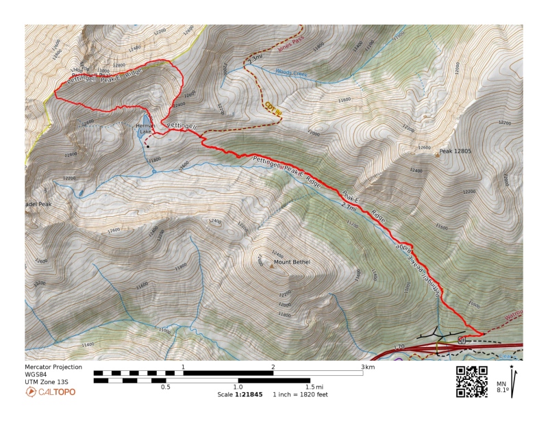
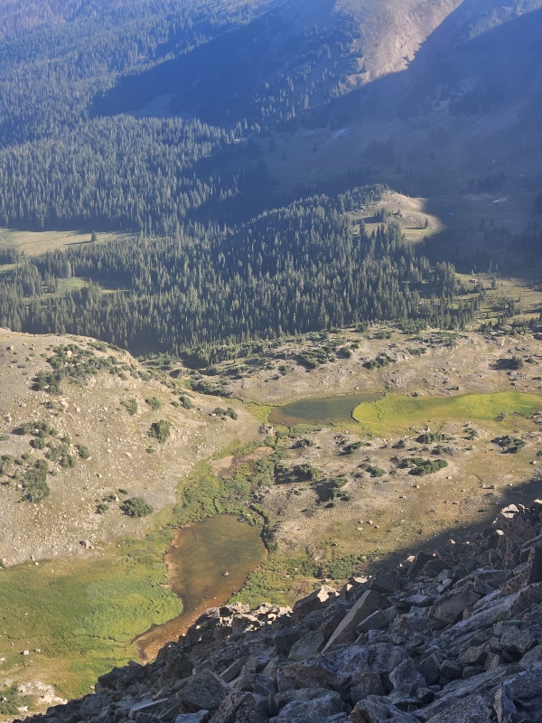
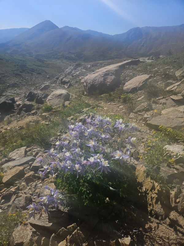
As we climbed towards the lakes basin, the views of Pettingell and The Citadel did not disappoint. Shout out to Dan for contributing many of the photos which will be included in this report. 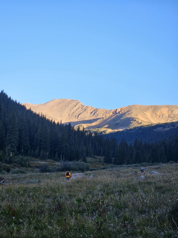
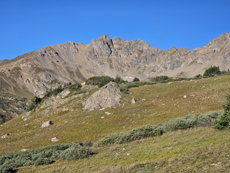
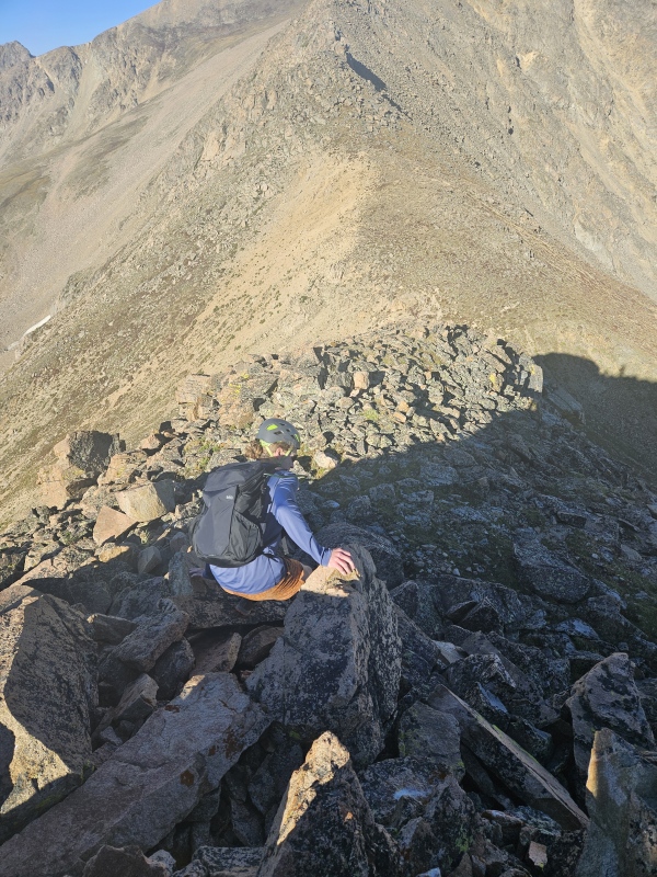
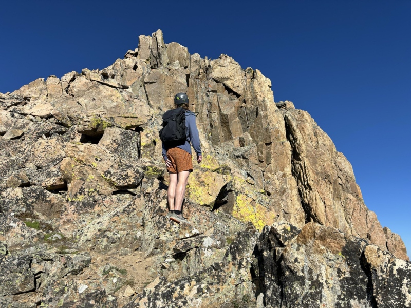
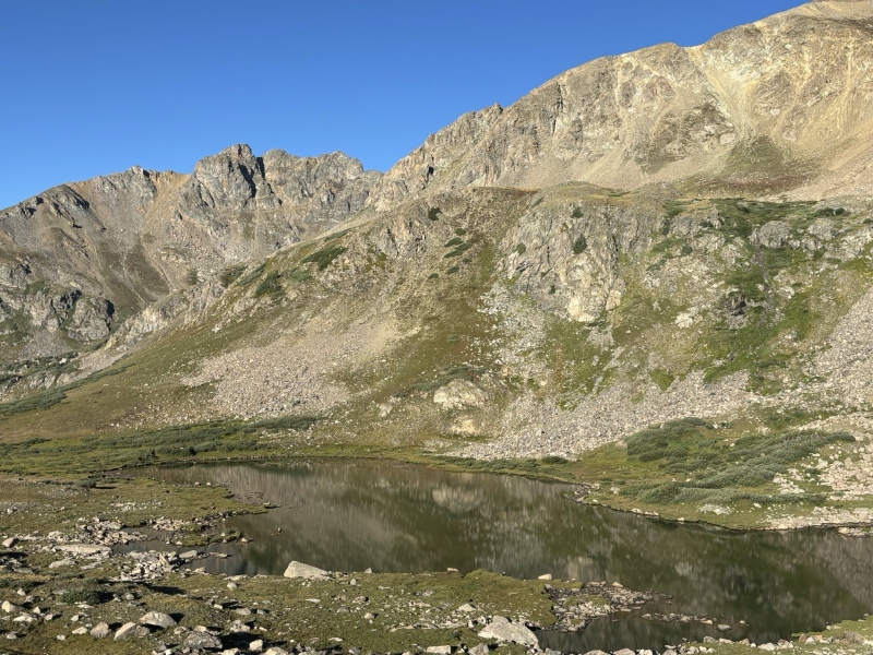
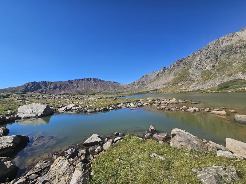
We made good time up the trail, reaching the junction with the Jones Pass trail in about an hour. From here we took a quick break and deliberated between if we wanted to ascend the grassy class 2 ramp directly north of the trail junction to gain the ridge, which clearly went from the junction, or if we wanted to explore a more direct path closer to the lake to gain the ridge. We opted for the latter which was a class 3 affair, probably slightly more direct and more fun (or at least we thought). For the class 3 more direct option, we continued past the trail junction towards Herman lake and right before the trail ascends into the lake basin, ascended a steep but short class 2 hill/bulge just north of the trail. At first we were uncertain if it would go because from below all you can really see is a fairly dramatic cliff band blocking the ridge, but after we gained the bulge, we had a more direct view and saw that there were several class 3 paths to gain the ridge proper and start the traverse. Photos below are my best attempt to describe the two options to gain the ridge and our ascent route. From the top of the bulge to the ridge, this is where we encountered our loosest rock of the day - there was a decent amount of scree and lots of loose talus - test holds accordingly. 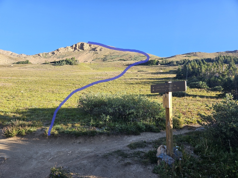
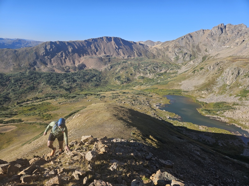
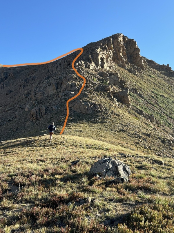
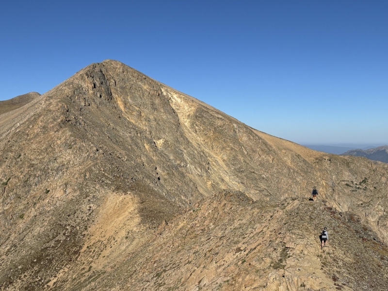
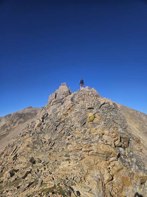
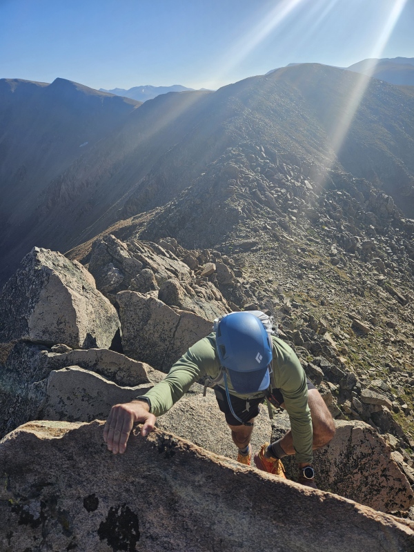
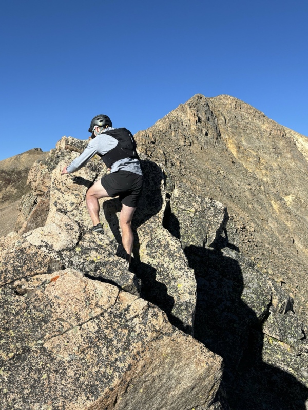
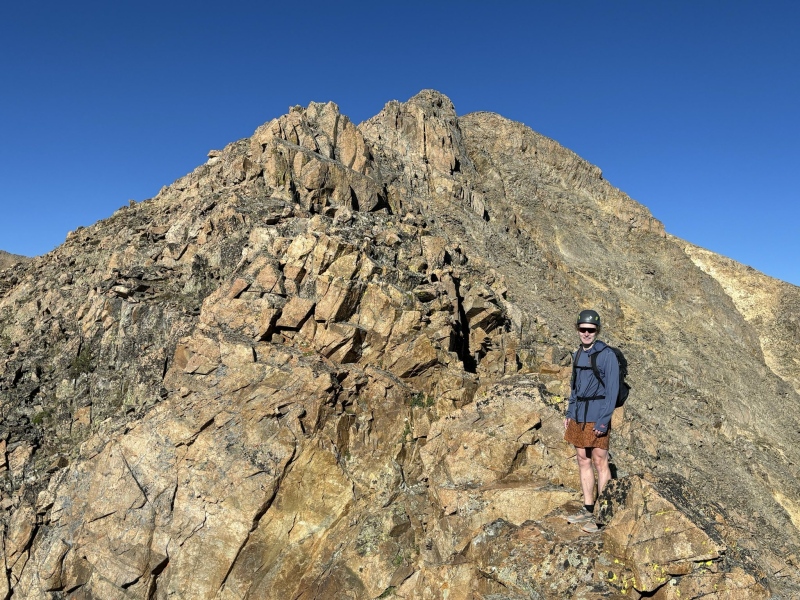
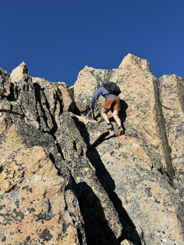
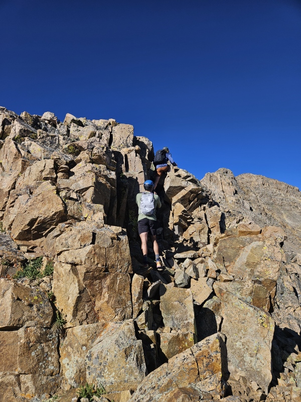
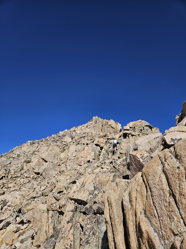
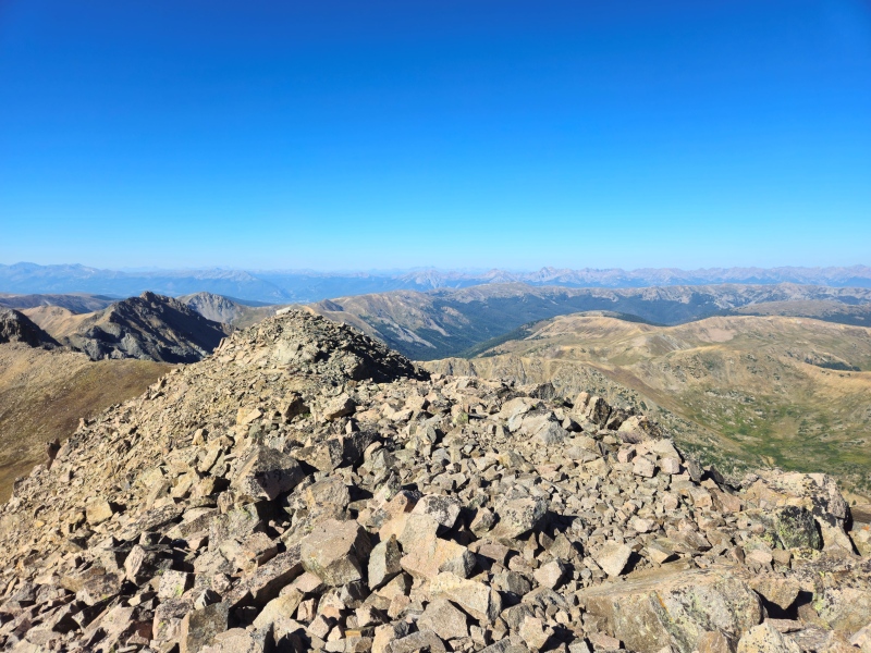
After we gained the ridge, the rest of the east ridge in all it's glory was in view. We stayed ridge proper for effectively the entire traverse, I've read previous trip reports that stated staying ridge proper was class 3+ in difficulty or even one that stated a class 4 move was required but I don't think anything exceeded class 3. Maybe one move up a large rock on the ridge proper was difficult 3 or low 4 but that particular move, and many of the more challenging moves can be avoided by traversing to climbers left. Exposure was moderate throughout most of the traverse with a few short sections of higher exposure to the north (climber's right). Routefinding was very straightforward if you stay ridge proper. Photo dump below including some of the more interesting/challenging sections of the ridge. 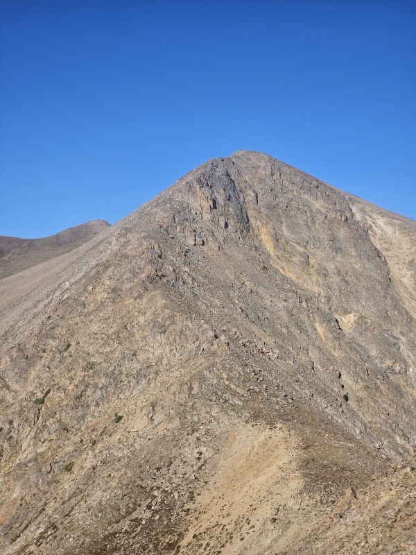
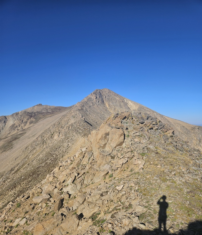


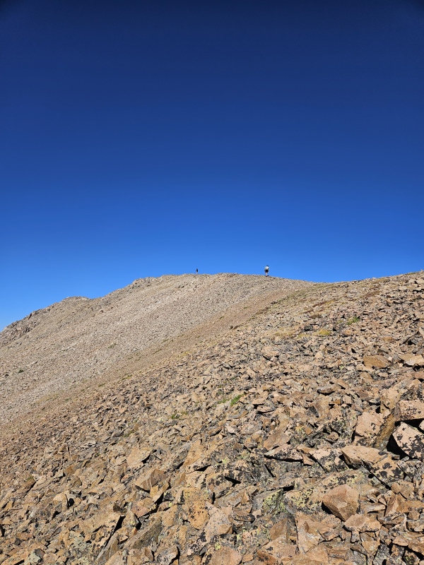
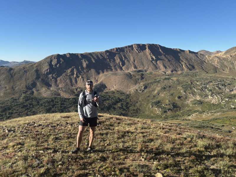
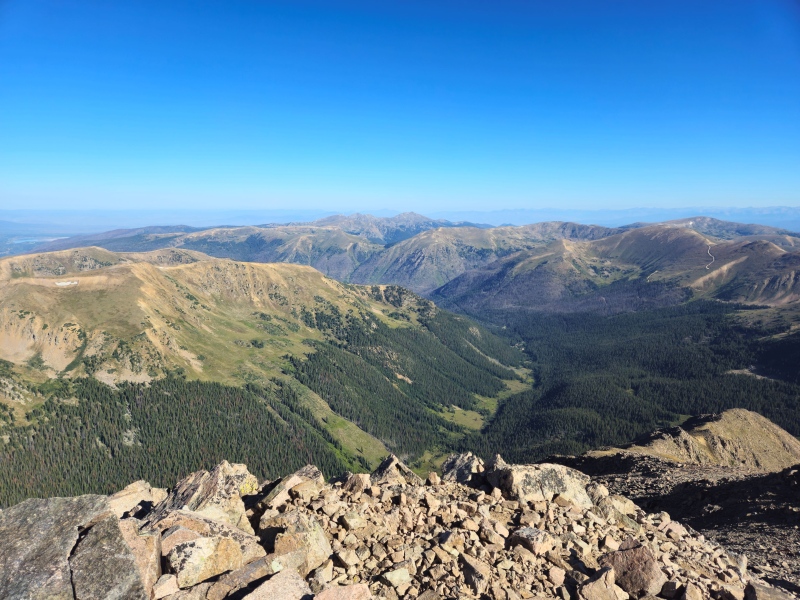
All in the ridge scramble took us 90 minutes from leaving the Herman Lake trail to the summit. A fun mix of class 2 and 3 terrain that kept you on your toes but wasn't exceedingly challenging. The rock was generally pretty solid although I did step on and dislodge a microwave sized rock and send it down the north side of the mountain that left me a few good scrapes and bruises on my lower leg on the way down; there were definitely some loose small and large rocks strewn throughout the ridgeline. We took about 15 minutes at the summit to have a snack and enjoy the views before we began our descent back down to Herman Lake. There was a summit/elevation sign and summit logbook left at the wind shelter so we snapped a selfie and a few summit photos and set off. We descended down the class 2 south slopes route that is described in detail on this site so I didn't snap many photos of the descent route but it's a fairly obvious path from the summit block - descend down to the saddle SW of the summit, then continue down the talus/tundra ramp keeping the cliff bands and Herman Lake to your right. Eventually you'll pick up the drainage that filters into the lake. 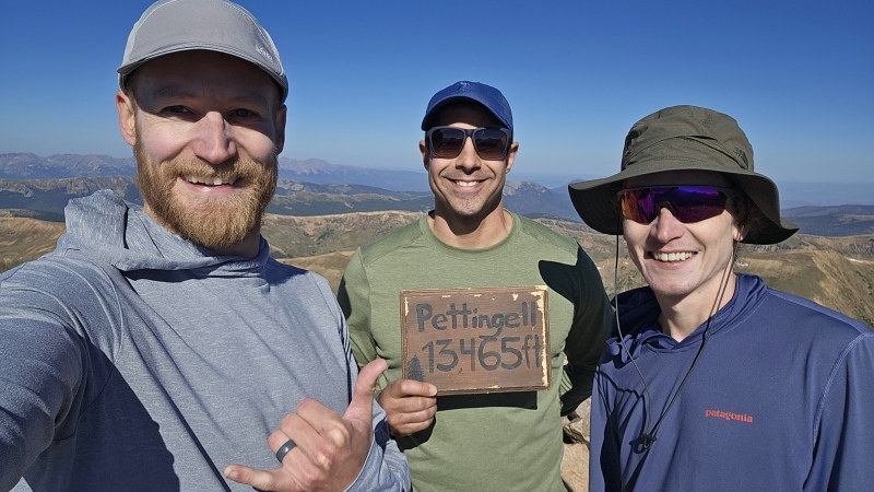

The descent took us about 30 minutes - there was an annoying amount of loose scree especially right above the lake.. poles would have been nice but none of us brought them. This is where our solitude ended as we regrouped with the hoards of hikers making their way up to the lake. After we picked up the trail back at the lake we decided to run back down to the car as we all run regularly as part of our fitness routines. Lake to car took about another 40 minutes, the descent and trail was very runnable and enjoyable but did require a high amount of hiker/dog dodging. All in a great day in the alpine and close to home to boot. Thumbnails for uploaded photos (click to open slideshow): ")
")
")
")
")
")
")
")
")
")
")
")
")
")
")
")
")
")
")
")
")
")
")
")
")
")
")
")
")
")
")
")
")
")
|
| Comments or Questions | |||
|---|---|---|---|
|
Caution: The information contained in this report may not be accurate and should not be the only resource used in preparation for your climb. Failure to have the necessary experience, physical conditioning, supplies or equipment can result in injury or death. 14ers.com and the author(s) of this report provide no warranties, either express or implied, that the information provided is accurate or reliable. By using the information provided, you agree to indemnify and hold harmless 14ers.com and the report author(s) with respect to any claims and demands against them, including any attorney fees and expenses. Please read the 14ers.com Safety and Disclaimer pages for more information.
Please respect private property: 14ers.com supports the rights of private landowners to determine how and by whom their land will be used. In Colorado, it is your responsibility to determine if land is private and to obtain the appropriate permission before entering the property.


