Download Agreement, Release, and Acknowledgement of Risk:
You (the person requesting this file download) fully understand mountain climbing ("Activity") involves risks and dangers of serious bodily injury, including permanent disability, paralysis, and death ("Risks") and you fully accept and assume all such risks and all responsibility for losses, costs, and damages you incur as a result of your participation in this Activity.
You acknowledge that information in the file you have chosen to download may not be accurate and may contain errors. You agree to assume all risks when using this information and agree to release and discharge 14ers.com, 14ers Inc. and the author(s) of such information (collectively, the "Released Parties").
You hereby discharge the Released Parties from all damages, actions, claims and liabilities of any nature, specifically including, but not limited to, damages, actions, claims and liabilities arising from or related to the negligence of the Released Parties. You further agree to indemnify, hold harmless and defend 14ers.com, 14ers Inc. and each of the other Released Parties from and against any loss, damage, liability and expense, including costs and attorney fees, incurred by 14ers.com, 14ers Inc. or any of the other Released Parties as a result of you using information provided on the 14ers.com or 14ers Inc. websites.
You have read this agreement, fully understand its terms and intend it to be a complete and unconditional release of all liability to the greatest extent allowed by law and agree that if any portion of this agreement is held to be invalid the balance, notwithstanding, shall continue in full force and effect.
By clicking "OK" you agree to these terms. If you DO NOT agree, click "Cancel"...
Converting my conditions reports on this to the brief writeup they should have been, for anyone interested in doing this loop or just the fun parts.
Jonny and I decided to go Storm to Bonita, linking the direct Storm to East Storm traverse with the direct Proposal to Emery traverse. I had it on good authority that Storm to East Storm goes, and we knew nothing about Proposal to Emery. We parked at the Gladstone townsite and hiked up the county road towards Velocity Basin, jumping off a ways below the lake to access Storm's NW ridge before the start of difficulties.
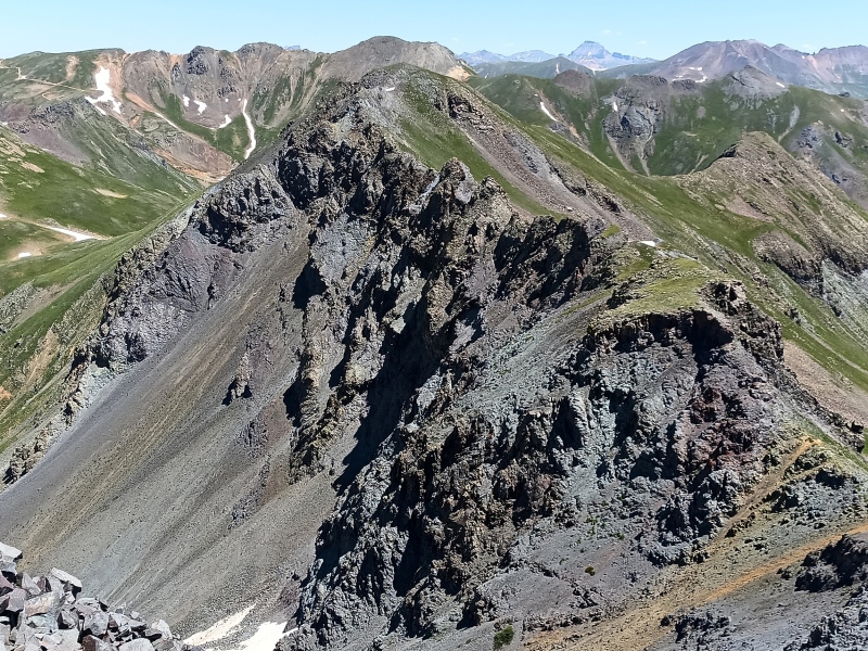
Storm Peak NW ridge: This was very cool and much easier than it appears. We stayed mostly ridge proper, with ledges on the east side to bypass some of the junkier knife edges. There are a couple narrow spots, and we encountered a bit of mandatory 4th class in the upper portions, but otherwise it's a pretty cruiser mix of class 2 and easy 3rd scrambling. It is loose, as is typical, and anyway if you're planning to traverse to East Storm it will warm you right up.
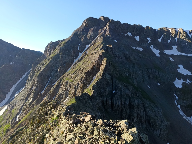
Storm to East Storm: We anticipated the extremely exposed, narrow section right off the summit heading east. The difficulty is probably only 3rd class, with bomber rock where it's most needed, but it is attention-getting. The rock in this first small saddle is unstable and best avoided given the consequences. We stayed ridge proper for the remainder of the descent to the saddle (top of the Grande Couloir), which is no harder than 3rd class but incredibly loose, take-turns terrain not well suited for a party of more than one.
From the saddle we climbed over the first bump on the ridge, which was a mistake as the descent of the other side we eventually committed to forced a couple ugly 5th class moves to get off it, probably the hardest (down)climbing of the day, and totally unnecessary. Skip it.
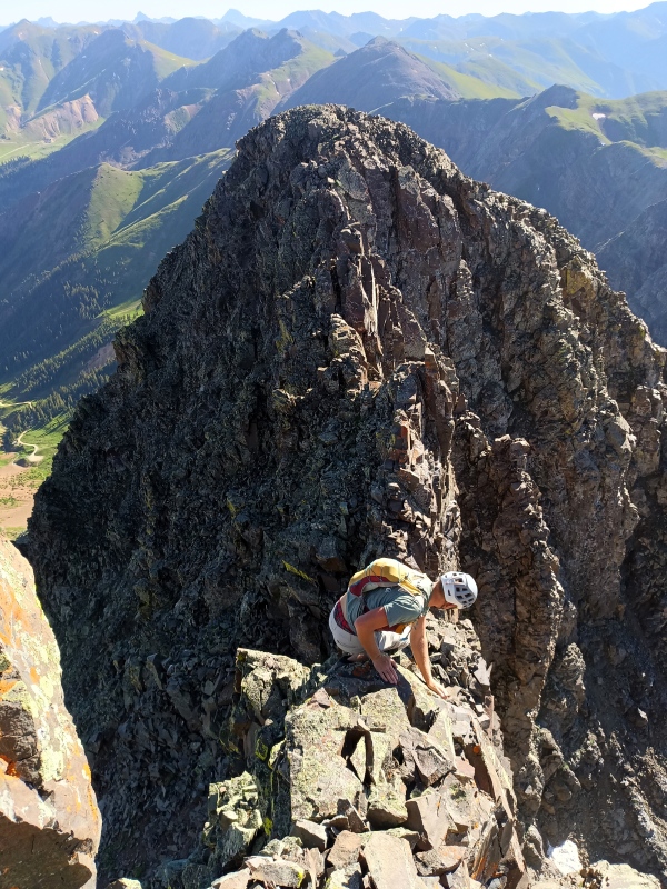
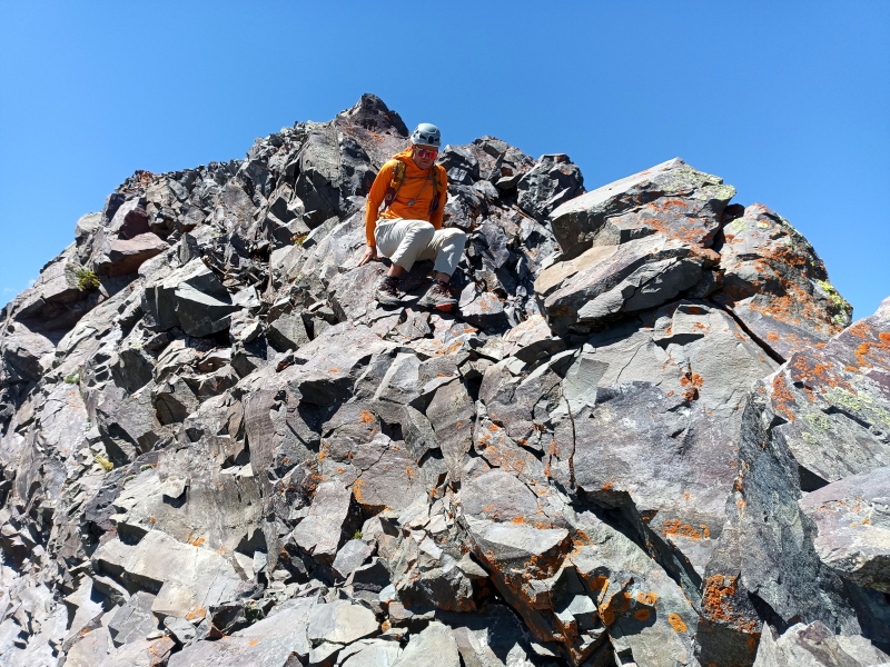
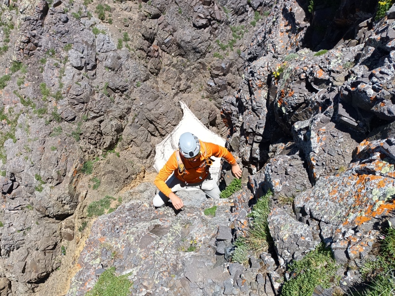
From the base of East Storm's west ridge we followed junky ledges east to an obvious gully weakness that required some funnish 4th class moves to access. This broad gully cuts back towards the west ridge, but instead of trending left we rambled straight up broken class 2+ slabs and followed another ramp to the right, around a corner, and into a narrowing slot (GPS confusion here) leading to steep grass just below the summit.
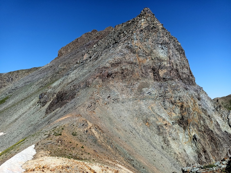
Our route is more properly the southwest face, although it does not stray too far from the ridge. The trashy prow at the butt of the west ridge looks cruxy, but we thought the rest should go directly at easy 5th class.
Upper E ridge of Storm, exposure crux of the dayUltra chossy end of Storm's E ridge4th class entrance to SW gully on East StormExit slot on East Storm's upper SW face
East Storm to Proposal: After weaving through the immediate choss towers we followed the long northeast ridge, picked up a trail briefly, then dropped to the East Storm-Proposal saddle and slogged up the 800-foot talus mound that serves as Proposal's south ridge. This sucks, and there's probably a better way (it's actually not the first time I've done it, so shame on me).
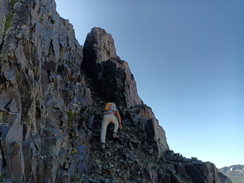
Proposal to Emery: The ridge direct goes at 4th class with a good deal of exposure and some sketchy narrows. Except for the initial short headwall right off the Proposal summit, all the difficult parts were descending, so this is probably best traversed north-south instead. The crux is an east-leaning mess of a fin that we ended up bypassing on the east side by downclimbing the face to a prominent V-slot and awkward ramp (4th class), but it likely goes at the same difficulty by more solid lichen-covered rock on the west side.
Main part of Proposal-Emery ridgeInitial spice, easy up but exposed down
Emery to Bonita: I've always used the standard gully to bypass the notch, so we did that first, but to satisfy my curiosity we had a look afterwards. Finding it reasonable, we climbed directly back up the 4th class headwall towards Emery and then took a second lap down the bypass gully and continued on to Bonita.
Notch on Emery
We descended Bonita's west slopes to CR 51 and from there followed a long-abandoned mining road I'd mapped out with LiDAR back down to the graded dirt of Cement Creek. For parties wanting to move faster it's best to take CR 51 down to Gladstone.
Note the random doglegs off the ridge to Proposal were me trying to wrangle some water from a stingy few snowbanks.
My GPS Tracks on Google Maps (made from a .GPX file upload):
One thing I've learned since becoming a SAHM is that the spice level referred to in romance novel reviews is not the same kind of spice as in TRs ;)
Still surprised this traverse goes... It looked impossible when we were there for the snow climb. One of my favorite spots in the sjs! Exposure in the crux photo is the real deal!
Caution: The information contained in this report may not be accurate and should not be the only resource used in preparation for your climb. Failure to have the necessary experience, physical conditioning, supplies or equipment can result in injury or death. 14ers.com and the author(s) of this report provide no warranties, either express or implied, that the information provided is accurate or reliable. By using the information provided, you agree to indemnify and hold harmless 14ers.com and the report author(s) with respect to any claims and demands against them, including any attorney fees and expenses. Please read the 14ers.com Safety and Disclaimer pages for more information.
Please respect private property: 14ers.com supports the rights of private landowners to determine how and by whom their land will be used. In Colorado, it is your responsibility to determine if land is private and to obtain the appropriate permission before entering the property.


")
")
")
")
")
")
")
")
")


