Download Agreement, Release, and Acknowledgement of Risk:
You (the person requesting this file download) fully understand mountain climbing ("Activity") involves risks and dangers of serious bodily injury, including permanent disability, paralysis, and death ("Risks") and you fully accept and assume all such risks and all responsibility for losses, costs, and damages you incur as a result of your participation in this Activity.
You acknowledge that information in the file you have chosen to download may not be accurate and may contain errors. You agree to assume all risks when using this information and agree to release and discharge 14ers.com, 14ers Inc. and the author(s) of such information (collectively, the "Released Parties").
You hereby discharge the Released Parties from all damages, actions, claims and liabilities of any nature, specifically including, but not limited to, damages, actions, claims and liabilities arising from or related to the negligence of the Released Parties. You further agree to indemnify, hold harmless and defend 14ers.com, 14ers Inc. and each of the other Released Parties from and against any loss, damage, liability and expense, including costs and attorney fees, incurred by 14ers.com, 14ers Inc. or any of the other Released Parties as a result of you using information provided on the 14ers.com or 14ers Inc. websites.
You have read this agreement, fully understand its terms and intend it to be a complete and unconditional release of all liability to the greatest extent allowed by law and agree that if any portion of this agreement is held to be invalid the balance, notwithstanding, shall continue in full force and effect.
By clicking "OK" you agree to these terms. If you DO NOT agree, click "Cancel"...
Stats – 24.68 miles, 6,447 feet of elevation from Brush Creek Trailhead via Upper Slate Lake according to Strava
Reason for this report
I wanted to post this trip report as it is an alternative route to climb Peak L that is not really documented well on this site. The standard route to climb Peak L is the southwest ridge which includes the famous knife edge and final steep face climb to the summit. Gore Galore, Joe Kramarsic, of this site has a wonderful history on this route and Peak L that I really enjoyed reading here Peak L Trip Report 12/18/2016 | 14ers.com. Most every trip report on this site takes the southwest ridge, so I figured a report on the northeast ridge option could be useful. I hope this is helpful to some in the future if even just using it as a descent option for this magnificent peak.
Background
I live in Eagle so I have the amazing privilege of having the Gore Range as my “backyard” peaks. I can frequently see the peaks in the distance even on local mountain bike rides from my home. I have slowly, since moving to Eagle 9 years ago, taken routine trips into the Gore picking away at the wonderful list of peaks in the range. Last year I had the amazing opportunity to hunt goats in the range and spent 6-7 days chasing goats all over the west side of the range ultimately getting one practically right in knee knocker pass. During these outings I climbed Peak C (after getting the goat) and Peak G, which left Peak L as the last major obstacle to complete the ranked 13ers in the Gore.
I had been to upper slate lake once before on a west to east side adventure starting at pitkin lake trailhead, climbing through might pass near West Partner, then ascending and traversing QRST before heading out to brush creek trailhead using a car shuttle with a few local friends on a big day. Jorts on this website wrote a report of that day that can be seen here Peak Q Trip Report 09/23/2021 | 14ers.com. On this trip Peak L is just such a beautiful peak across the valley, so I had always wanted to get back in there to climb it but as people who have been into upper slate lake basin can testify - it is not an easy trip.
Finally, after a few years of hoping to get back into this beautiful place the stars seemed to align for a free day and a good forecast of 10% chance of afternoon thunderstorms despite being in a recent solid monsoon pattern in the high country. When climbing QRST I thought L looked easier from the northeast ridge compared to the standard southwest ridge from afar and it looked like grass could be used from upper Slate Lake all the way to the saddle between Peak L and Gore thumb. With my wife and kids, I try to limit my exposure to steep fourth class terrain if possible and often opt to take easier/safer routes up peaks if possible. So, I was very interested in this north approach to the summit block as it seemed like it would be less exposed from viewing it from afar.
I have the fortune through my buddy, Jorts, to have my hands on one of Gore Galore's Gore Range guidebooks and he mentions the northeast ridge as class 3. However, I could not find any information of people using it as their main ascent of the peak. I reached out to Gore Galore asking his recollection of this route and he assured me the grassy slopes to the saddle of Gore Thumb and L was simple enough and the climb of the northeast ridge looks daunting but can be kept at class 3. So, with this information in hand I planned to climb this route. Many people seem to descend peak L’s summit block by this ridge to go on to MNO but I had not seen any information of the ascent to the saddle, so I greatly appreciate Joe’s insight for the route.
I know the standard route of Peak L is a highly regarded scramble and most will still want to do the southwest ridge but I do think the northeast ridge is much less exposed, so some may prefer it to climb this beautiful peak by this route. If peak L is the only objective an ascent of the southwest ridge and a descent of the northeast ridge using the grassy slopes between Gore Thumb and L to get back to the lake could as Roach says make a “grand tour” of Peak L.
The Climb
I’m fortunate that my in laws have a home in Frisco so I set out the evening before after helping get the boys to bed and slept in Frisco. On the drive up to Frisco the Gore were getting hammered by an impressive thunderstorm. I was a bit nervous about brush creek road in my Jeep Renegade Trailhawk. It has been a great car for me, but it is not a usual Jeep in terms of its 4x4 capabilities especially if a road was slippery.
I woke up at 3:30AM and made the drive to the road. It was slick and very potholed in some spots. About half a mile up, the road really steps up and become impassible for a vehicle like mine but an alternative road to the right bypasses this tricky section. I was fortunate to get by this spot as otherwise this day may have ended very early. The rest of the road was slick and a bit exciting, but I fortunately made it to the trailhead no worse for the wear.
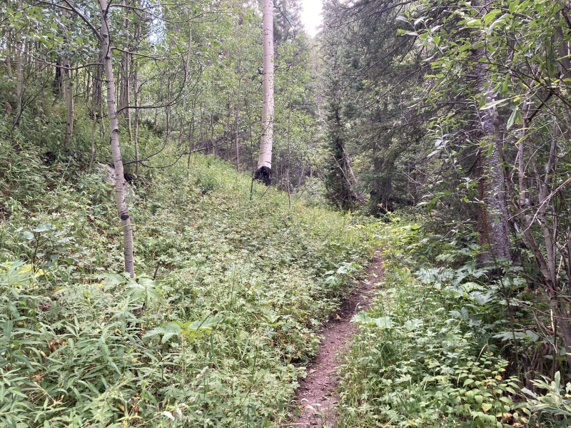
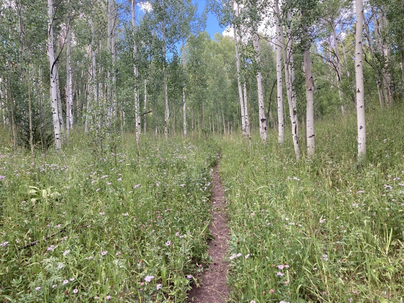
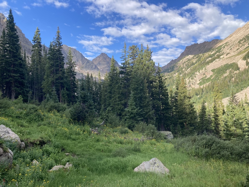
There were no cars in the trailhead and the climb was on a Thursday, so I knew I was likely in for a very secluded and quite day. I took off at 5AM with headlamp up the brush creek trail with rain pants on getting soaked in the tall grass from the previous days rain. You are on the brush creek trail only a short time until you hit the Gore Range trail and turn left. You follow this all the way to the obviously marked slate lake trail and turn right to begin the ascent up into the upper basin.
The initial brush creek trail right after leaving the carLush gore range trail on the approachSome more of the gore range trail
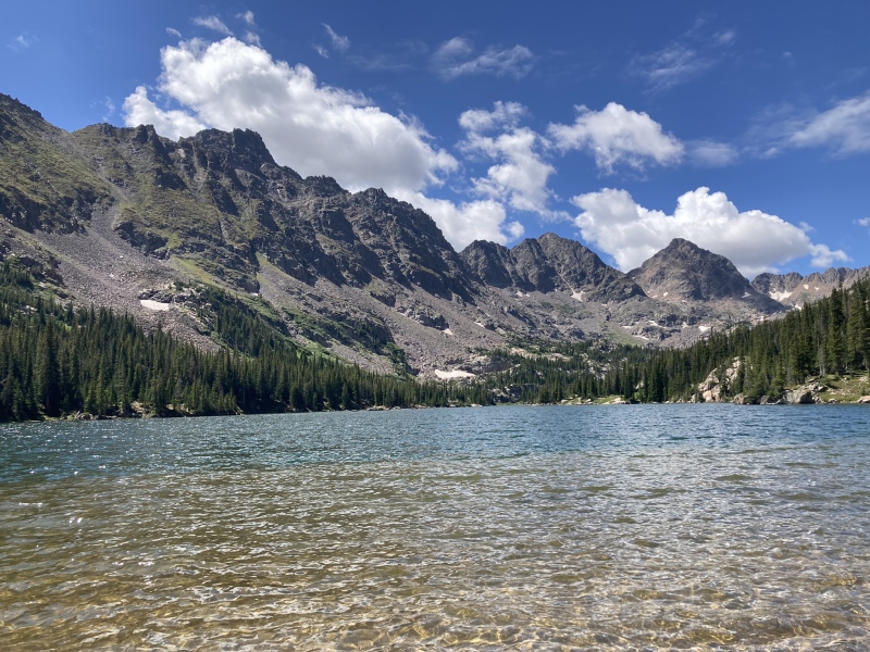
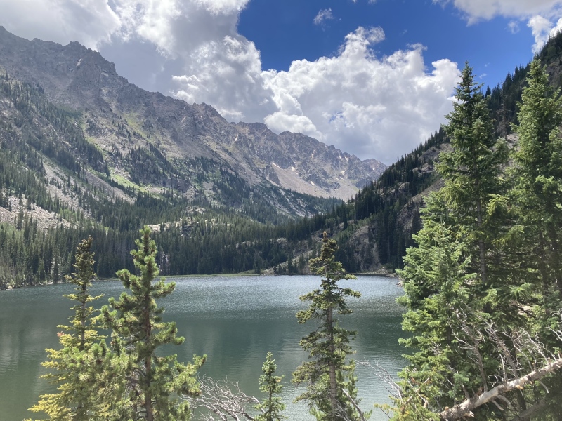
At the lower slate lake trail, I started hearing elk calls and bugling about 7AM. As a hunter this always gets me very excited as elk are my favorite creature in the world. I wondered if I would see them and sure enough about a half mile up the trail I ran into the herd. I ultimately saw about 4 rag bulls and many cows but never saw the big herd bull as he was higher up the hill. After this wonderful encounter I continued up the trail to upper slate lake which you reach just about 10 miles into the outing. The trail is very nice, and I was able to maintain about 3 mph to the lake on the hike in.
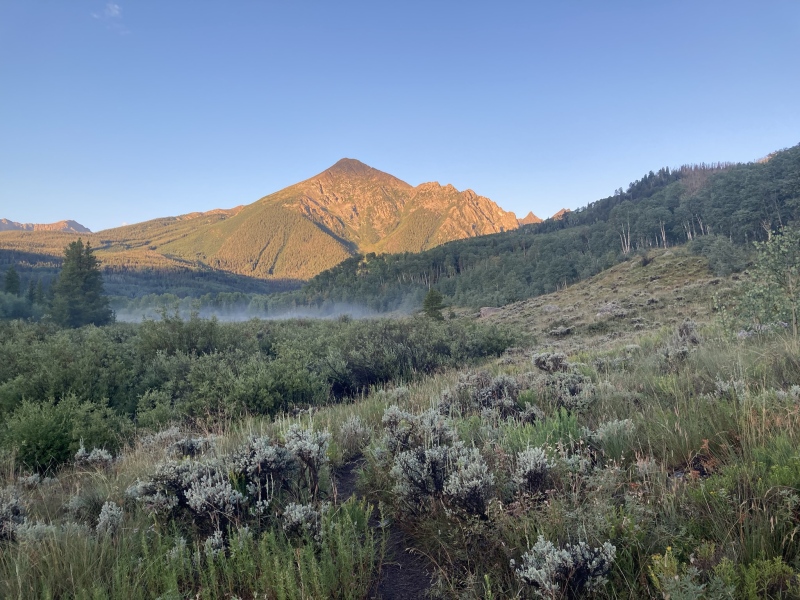
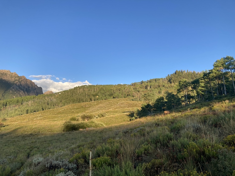
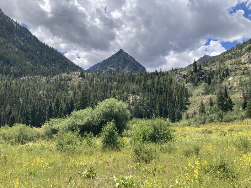
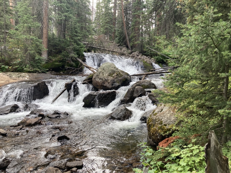
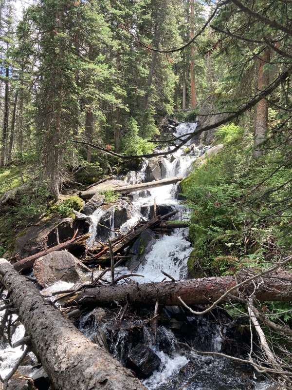
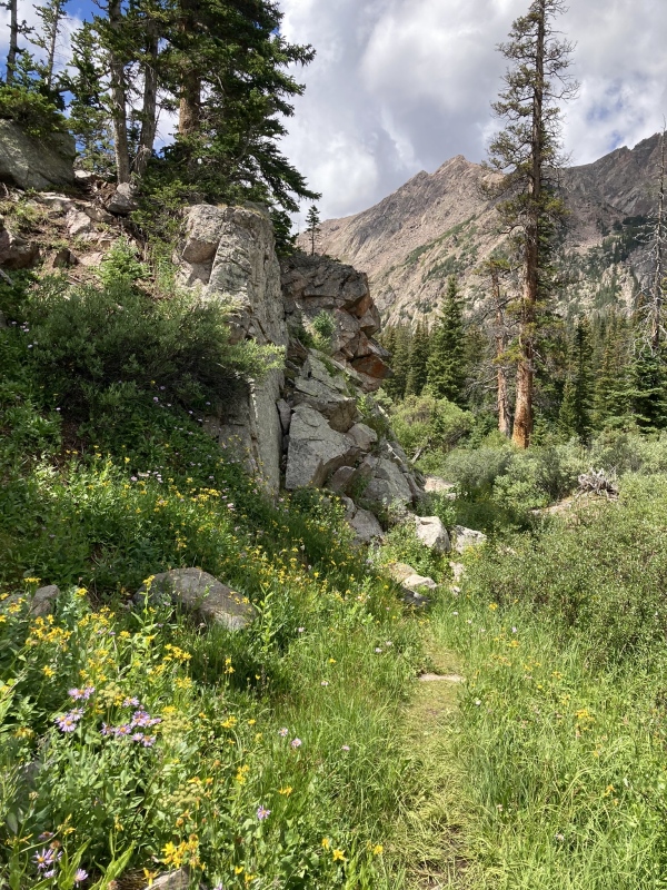
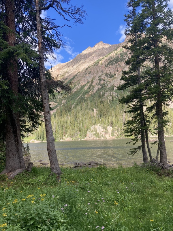
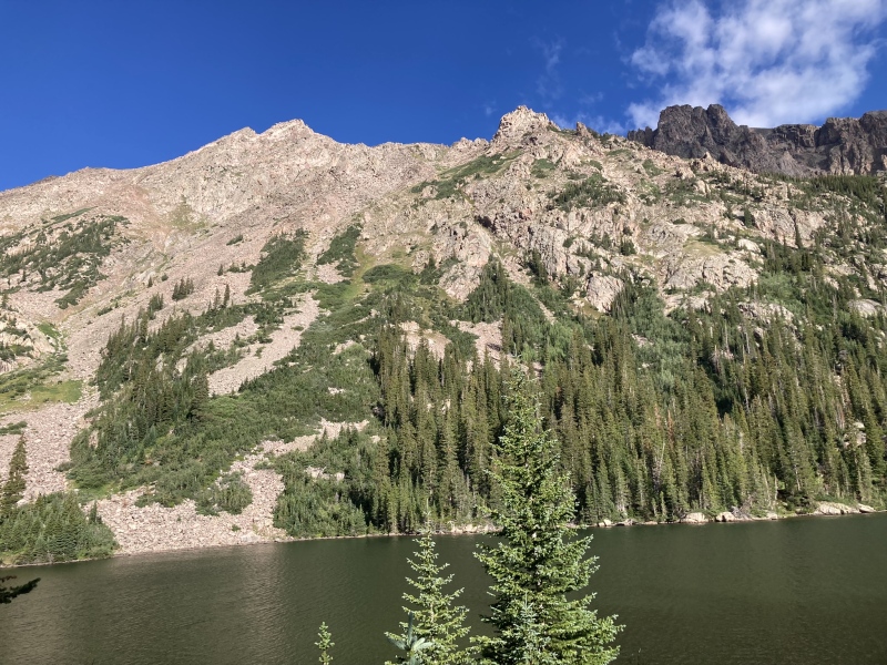
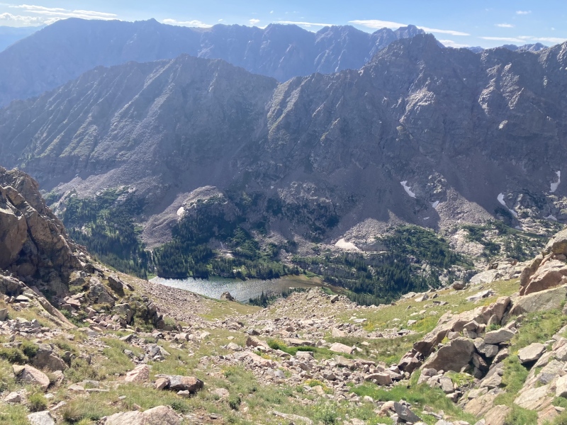
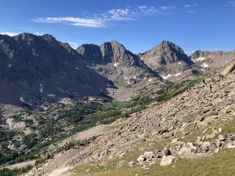
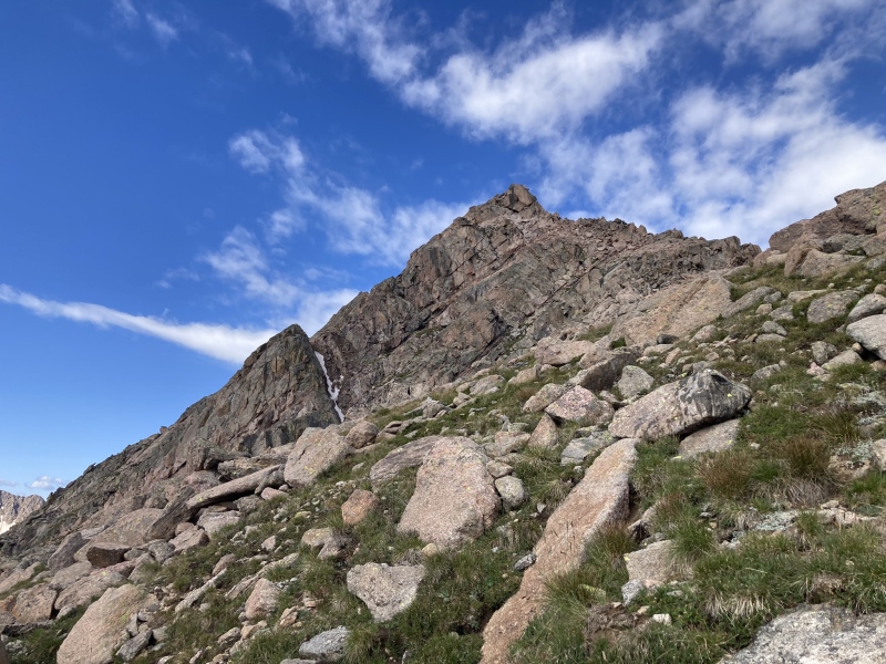
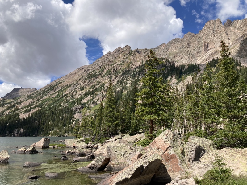
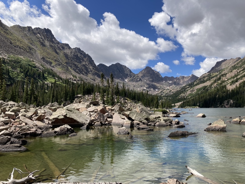
Right after turning off onto the lower slate lake trail where I started hearing the elk bugling and cow callsA few of the elk herd eating grass as I rounded the cornerAt the end of the approach meadows finally about to start gaining some elevation in earnestFirst views of Peak L far left and Gore Thumb ridge on the approach. The first time you see L is about 6.5 miles or so into the hike when you round a corner on the slate creek trailBeautiful cascades abound on the slate creek as you approach the lakesMore cascades along the creekRight before reaching upper slate lake Peak L is dominating the view! The typical southwest ridge is the left ridge and northeast ridge is right ridge on the upper summit towerPeak L standing tall from the first view of upper slate lakeHeading around upper slate lake Peak Q starts to show off along with newly ranked Peak RFrom upper slate lake looking up at the intended ascent route up talus and grass, this picture doesn't show it well but typical steep Gore grass can be used for most of the ascent to the saddle
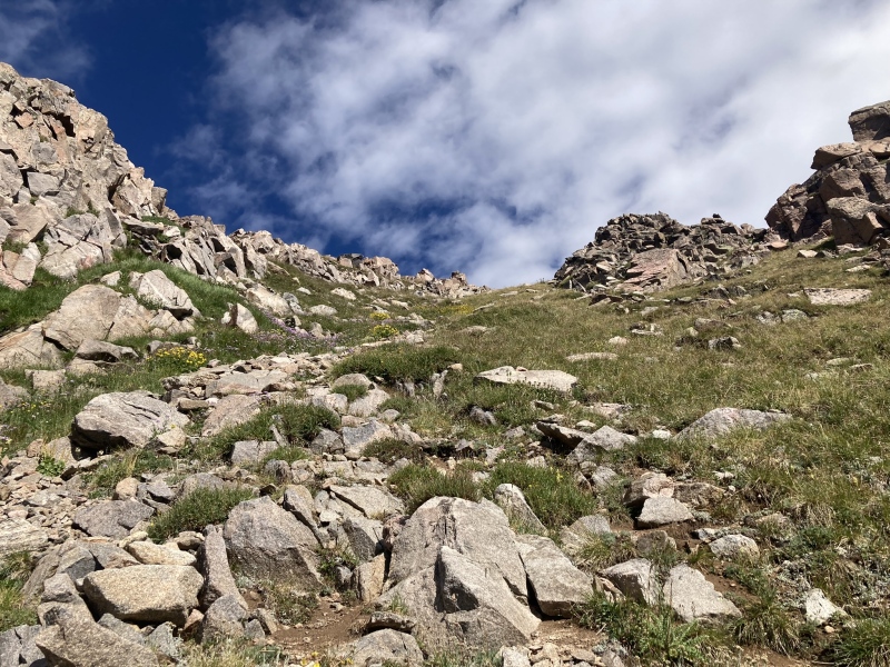
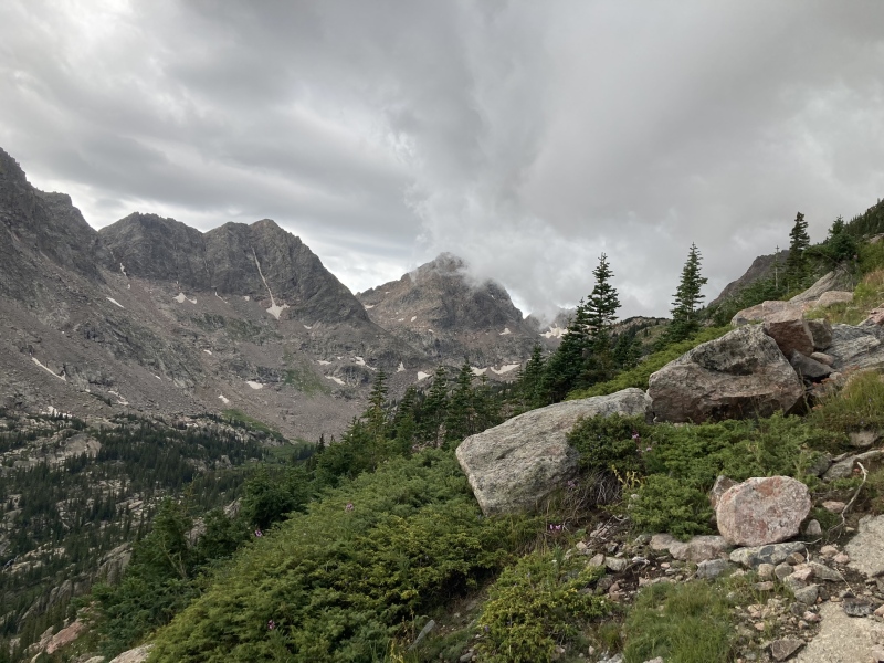
From the lake, Peak L is obvious, and I worked my way to the west side of the lake and then bushwacked across the creek and started my ascent up to the Peak L-Gore Thumb saddle. There is some bushwacking to get across the stream and up onto the talus and grass above the lake. There are several ways one could ascend to the saddle and there is some talus, but it is mostly a grassy ascent all the way to the saddle and then even slightly up on the northeast ridge. I got a bit too far right on the ascent for easiest passage and corrected this on the decent. If using the GPX attached to this report, the easiest route would be using the climbers left ascent route. Either way, I was on grass to nearly 13,000ft on this route. The towers of Gore Thumb were impressive from near the upper part of the ascent.
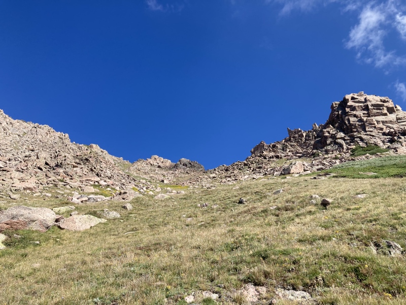
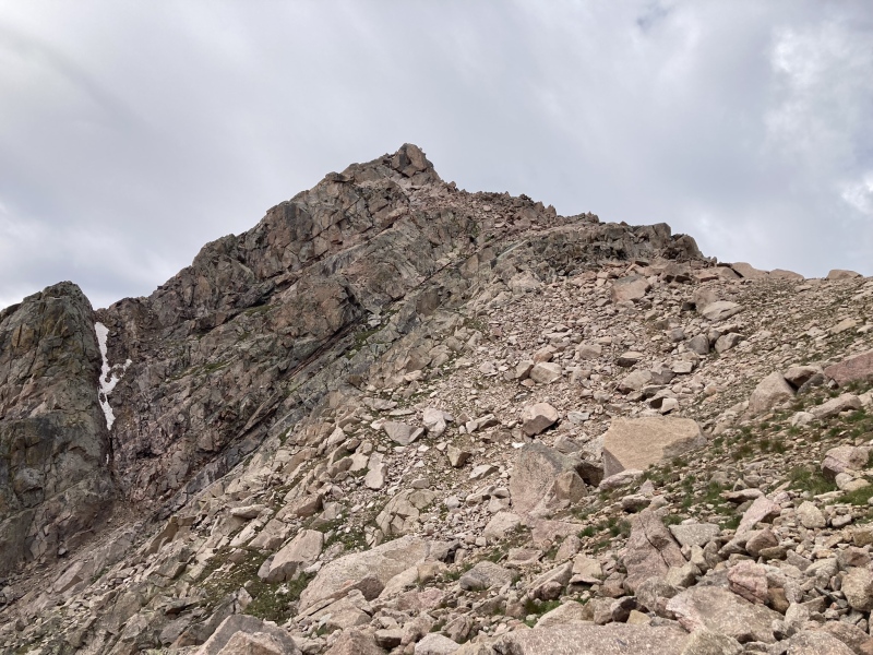
Lower down on the climb to the saddle, initially there is some bush whacking and talus but then it becomes even more grassA little more than half-way up the ascent gully to access the Peak L/Gore thumb saddleLooking back down on upper slate lake on the climbAs you ascend the views of QRST really start to get impressive!Nearing the top of the saddle still on grassLooking back down nearing the saddleViews of Gore Thumb's several towers from nearing the saddlePeak L's summit pyramid starting to get very close. The northeast ridge is the right ridge seen just before finishing the ascent climb on grass
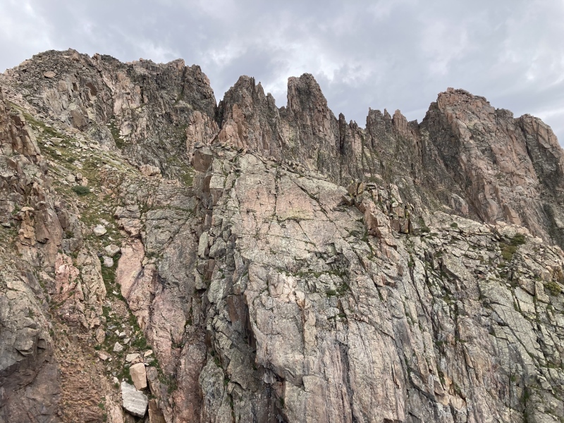
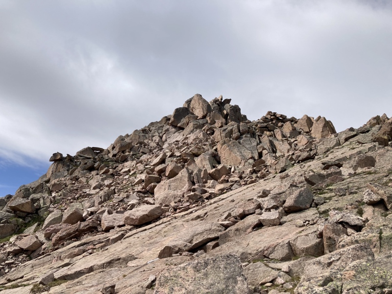
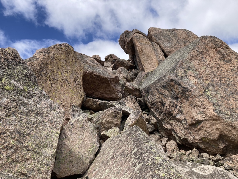
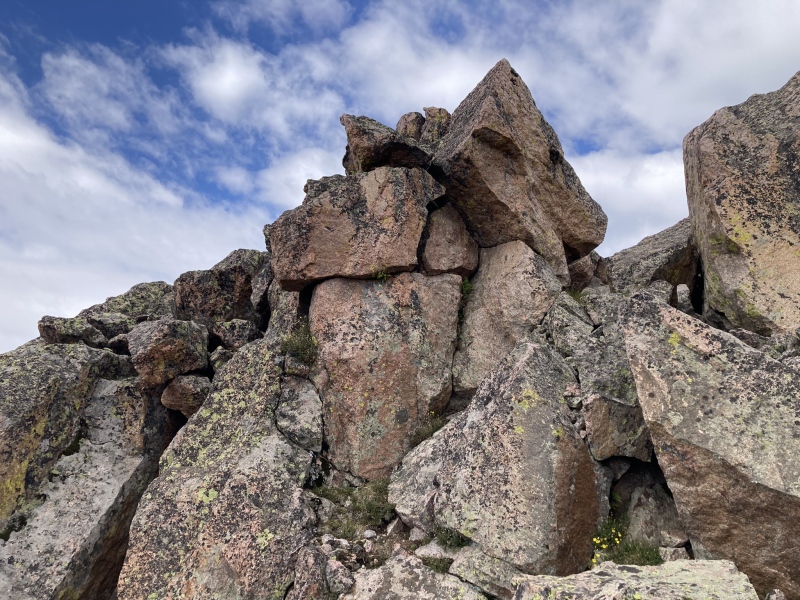
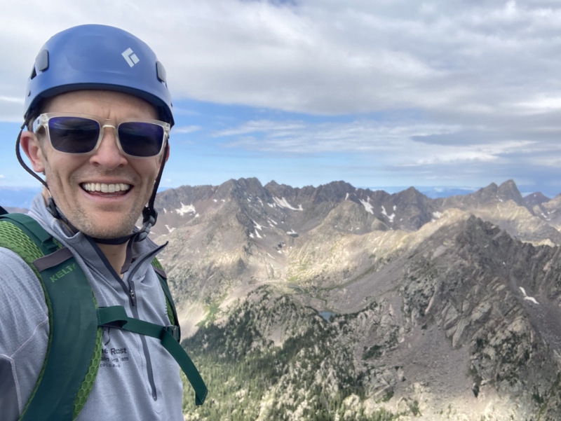
I crested the saddle and was surprised to see storm clouds and rain to the north and east considering the 10% rain forecast. I could tell this rain was heading my way despite it being earlier then 10 AM so I quickly engaged the northeast ridge which is mostly made up of large blocky steps that you can weave over and through. I felt I encountered a few unexposed class 4 moves but mostly the ridge was class 3 and felt very secure with minimal overall exposure. The scramble steepens just before the top and abruptly the spectacular and tiny summit revealed itself. From there I just had to walk a short distance on the beautiful summit ridge to the high point which is an exhilarating spot. I summited nearly right at 10 AM making for a 5-hour trip from the trailhead.
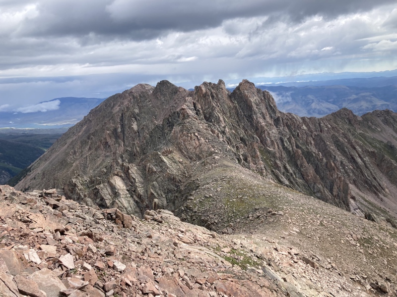
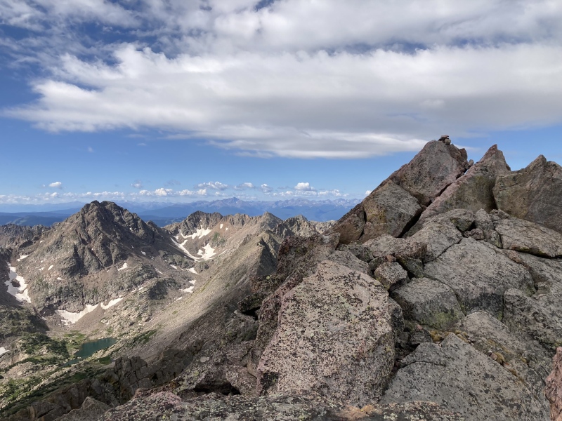
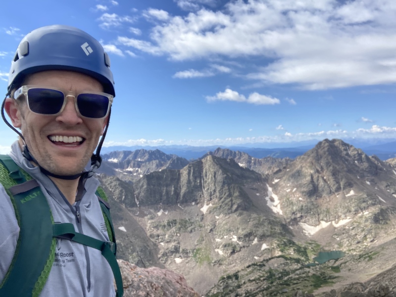
Peak L from the Saddle, about to start the scrambling section of the climb, the top looked difficult but was blocky and secure scramblingHigher up on the northeast ridgeLooking back on Gore Thumb and over to Peak N where I could tell rain was in the distanceSome of the blocky terrain and 3/4th class but unexposed climbing near the summitMore of the scrambling just below the summit on the northeast ridgeAbove the steeper scrambling left a minor scramble to the beautiful and tiny summit which had a cairn on top but no register. It's a stunning summit in the heart of the Gore! Peak Q looking amazingSummit with Q and R in backgroundSummit shot from other side with Ripsaw in the background
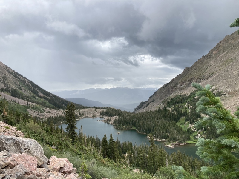
By this time, it was clear the rain clouds were coming my way. I had contemplated trying for N but also was not certain I wanted the exposure of the traverse solo. Therefore, the approaching rain made it a very easy decision to save N for a separate Gore outing to finish the ranked 13ers in the range for me. Fortunately, there is nothing ever wrong with another day in the Gore! I quickly retreated down the northeast ridge blocky scramble and then the grassy slopes towards the lake with the rain getting closer. I ultimately just made it to the trees around the lake before some grapple and rain fell. No lightening came out of this early storm, and it passed quickly. It was fun seeing moody clouds swirl around Peak Q up the valley as the storm blew through. After the rain passed, I decided to circumnavigate the lake as I am not certain if or when I will go back into upper slate lake basin and wanted to really soak the place in since it is so special. I would not really recommend this if you were going for speed or ease as it is much harder bush whack without the climber's trail on the other side of the lake, but it was great to make a loop around the lake with such beautiful views if you have the time.
The rain arriving as I just about reached upper slate lakeMoody storm clouds swirling around peak Q up the valley as the short-lived storm blew throughTSRQ looking up the valley from the head end of the lake as I circled around itLooking back up towards L and Gore thumb area on the circumnavigation of upper slate lake
Parting view of this stunning place prior to dropping back down to the trail and starting the trip back to the car
After lunch at the lake, I decided to start the trek home. Previously when we did QRST I completely missed lower slate lake on the run out. You don't see it directly from the trail and have to cross the creek and climb 10 feet up to see down on the lake. I made a point to cross the stream and enjoy the view this time. There are some wonderful camp sites just above lower slate lake. After enjoying this classic Gore view, I finished the trek out to the brush creek trailhead. I saw my first soul of the day at about mile 19 right when I got to the Gore range trail and did not see another individual the entire day. On the drive out I spotted a bear on the lower road and enjoyed watching him for about 10 minutes before making the drive home to the family satisfied with an incredible day on an incredible peak. The northeast ridge may not be as classic of a scramble as the southwest ridge, but it was a great day on a great peak none the less!
The worthwhile view of lower slate lake on the way out
I am so blessed to have the Gore as my backyard peaks! God is good! I love you Kim, Bryce, and Nolan! Again, if using the GPX I attached to this report for the ascent to the Peak L/Gore thumb saddle use the climbers left line for easiest passage to the saddle
My GPS Tracks on Google Maps (made from a .GPX file upload):
I enjoyed your conversation about risk taking and documentation of this option for L. I enjoyed L's standard (although you've got to pick the line carefully on the last pitch if you don't want it to get intense) and might try this if I revisit someday. Feel free to send me a line if you want a partner for N. I'd love to get that one.
I never knew the eastside could be so beautiful, simply stunning from the lake. Just about all my trips were on the westside from Vail, except one. I wish there was easier access from the east. My one time was from Rock Creek. I like to call the THs in Ten Mile Canyon the Southside, but a true east trip just once.
Tornadoman - I completely understand that skills and risk tolerance varies wildly so like putting these up when it could help some people just realize there is a different option. I certainly have taken on my fair share of exposed class 3 and 4 but as I age and my boys get bigger Im all for less exposure when possible. Id love to have a partner for N Ill keep you in mind! Considering it as an early summer snow climb as the talus hop seems to not be loved by many!
Boudreaux- the gore truly are stunning. As an eagle guy, Ive always said west side is the best side for the gore but there really isnt a bad day in the gore! This was my first east side only climb of the gore as every other peak Ive climbed in there I started on the west
Love the TR and the alternate route for getting L. Great photos too! I really appreciate this because I also opt for less exposure when possible these days because getting older has a way of doing that I guess.
Caution: The information contained in this report may not be accurate and should not be the only resource used in preparation for your climb. Failure to have the necessary experience, physical conditioning, supplies or equipment can result in injury or death. 14ers.com and the author(s) of this report provide no warranties, either express or implied, that the information provided is accurate or reliable. By using the information provided, you agree to indemnify and hold harmless 14ers.com and the report author(s) with respect to any claims and demands against them, including any attorney fees and expenses. Please read the 14ers.com Safety and Disclaimer pages for more information.
Please respect private property: 14ers.com supports the rights of private landowners to determine how and by whom their land will be used. In Colorado, it is your responsibility to determine if land is private and to obtain the appropriate permission before entering the property.


")
")
")
")
")
")
")
")
")
")
")
")
")
")
")
")
")
")
")
")
")
")
")
")
")
")
")
")
")
")
")
")
")
")
")


