Download Agreement, Release, and Acknowledgement of Risk:
You (the person requesting this file download) fully understand mountain climbing ("Activity") involves risks and dangers of serious bodily injury, including permanent disability, paralysis, and death ("Risks") and you fully accept and assume all such risks and all responsibility for losses, costs, and damages you incur as a result of your participation in this Activity.
You acknowledge that information in the file you have chosen to download may not be accurate and may contain errors. You agree to assume all risks when using this information and agree to release and discharge 14ers.com, 14ers Inc. and the author(s) of such information (collectively, the "Released Parties").
You hereby discharge the Released Parties from all damages, actions, claims and liabilities of any nature, specifically including, but not limited to, damages, actions, claims and liabilities arising from or related to the negligence of the Released Parties. You further agree to indemnify, hold harmless and defend 14ers.com, 14ers Inc. and each of the other Released Parties from and against any loss, damage, liability and expense, including costs and attorney fees, incurred by 14ers.com, 14ers Inc. or any of the other Released Parties as a result of you using information provided on the 14ers.com or 14ers Inc. websites.
You have read this agreement, fully understand its terms and intend it to be a complete and unconditional release of all liability to the greatest extent allowed by law and agree that if any portion of this agreement is held to be invalid the balance, notwithstanding, shall continue in full force and effect.
By clicking "OK" you agree to these terms. If you DO NOT agree, click "Cancel"...
Report Type
Mini
Peak(s)
Unnamed 13642 - 13,642 feet
Mount Bellview - 12,527'
No Bells permit? No problem! You can easily climb the Bells, "Thunder" and "Lightning Pyramid", and "Len Shoemaker"/13,642 (hereby affectionately "Len") from the East Fork trailhead in Crested Butte, saving yourself the hassle of a permit at the cost of some extra distance and vert. That's exactly what Whiley and I did for "Len", our last ranked thirteener in the West Maroon Creek drainage.
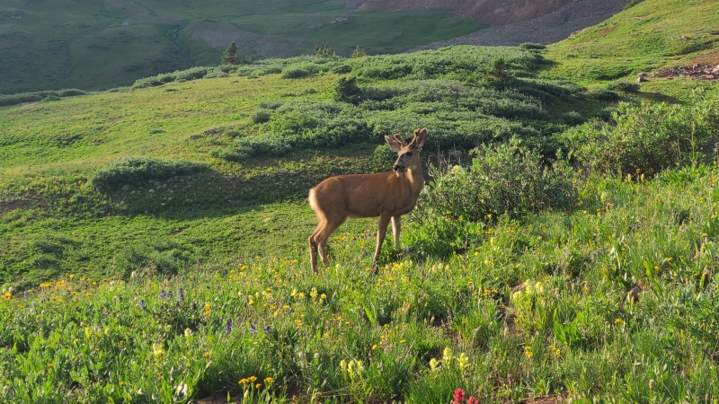
From East Fork there's a great, Class 1 trail to West Maroon Pass and down into West Maroon Creek. The trail is hammered in due to Four Pass loop hikers/runners. The wildflowers were amazing when we went, here's a deer nomin' 'em.
Hell yeah buddy, get some.
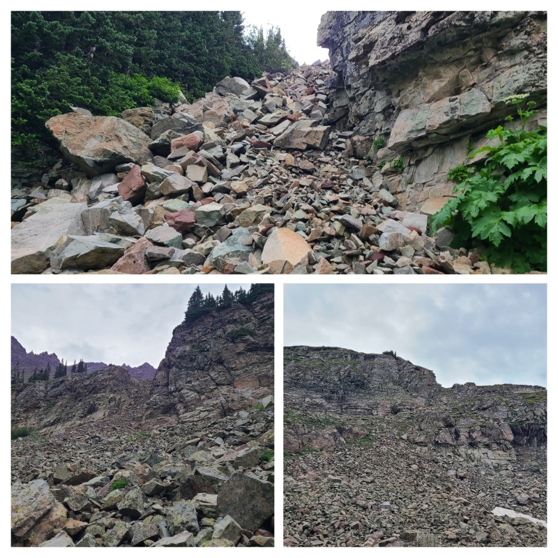
We continued on the trail to about 10,650', then went up the first white rock gully. It's super obvious when coming in this direction, less so in the opposite. Two more gullies atop that planted us in Len Shoemaker Basin.
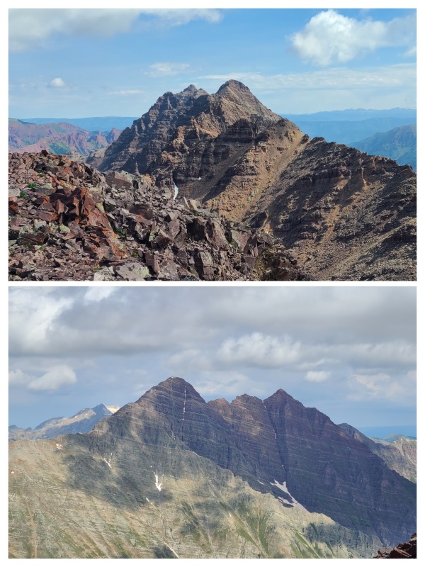
First, second, third gullies."Len".
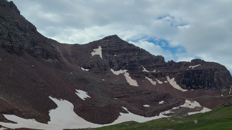
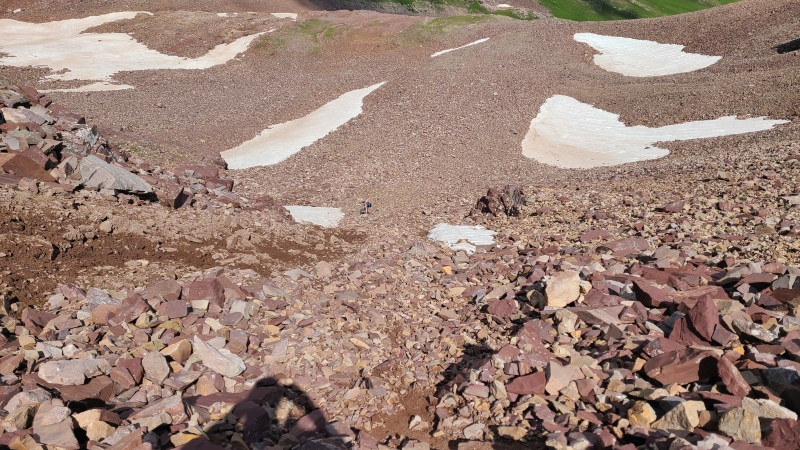
The walk across the basin is easy, and then you have to climb a steep slope of suck.
Mmm, steep slope of suck.
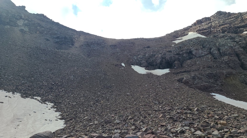
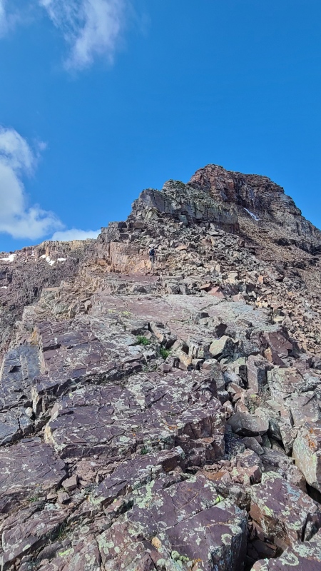
Loose sand, dirt, scree, and talus (the bigger, the more stable), roughly Class 2+, leads to the ridge, which is where the fun is.
Mmm, fun.
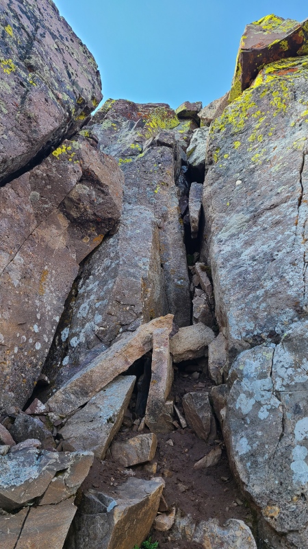
A short walk leads immediately to one of two Class 3 cruxes on the ridge.
Mmm, Class 3 crux. OK, I'll stop.Mostly walking or fun Class 2+.Second Class 3 crux. Mmm...
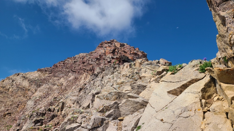
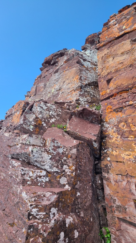
There's some exposure along the ridge, and some rotten rock, but overall "Len"'s summit ridge is a blast and all too short.
Mmm, Pyramids and Bells. dodges rotten tomatoes
Afternoon storms were on the way and we still had a peak to do, so back down the ridge, steep slope of suck, basin, and gullies we went.
Typical suck.
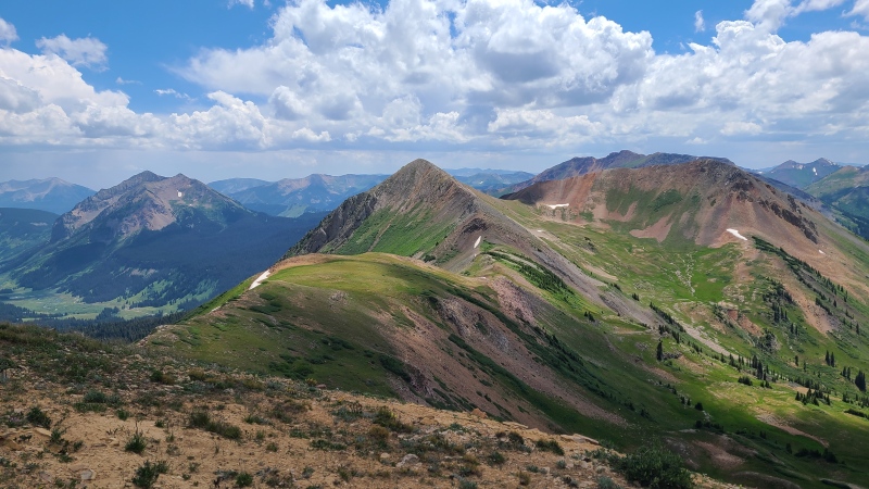
We slogged back over West Maroon Pass, attempting to ignore the hordes of tourists, and dropped to 11,700 in the East Fork before leaving the trail south and following the ridge up Mount Bellview (not to be confused with thirteener Belleview Mountain). Tundra gave way to scree and views.
Mount Bellview center, Gothic Mountain left.
We were just shy of 8,000 vert on Bellview so we continued along the ridge to its formerly soft-ranked neighbor to cross the finish line, then took steep grass northwest then west to the Trail Riders trail and back to our vehicles. Skipping the twelvers saves about 2.3 miles and 1,100 vert, and doing "Len" from East Fork saves about infinite permit bullshit. Do yourself a favor: take alternative approaches.
(Don't forget to check out the last three photos on this report, which I didn't put inline. The geology around "Len" is Mmmazin'.)
Statistics
Climbers: Ben Feinstein (myself), Whiley H. Trailhead: East Fork
Total distance: 19.71 miles Total elevation gain: 8,378 feet Total time: 11:00:42 Peaks: One ranked thirteener, one ranked twelver
"Len Shoemaker Peak"/Point 13,642
Mount Bellview, 12,527'
Splits:
Starting Location
Ending Location
Via Time (h:mm:ss)
Cumulative Time (h:mm:ss)
Rest Time (m:ss)
East Fork Trailhead
"Len Shoemaker Peak"
4:47:43
4:47:43
3:39
"Len Shoemaker Peak"
Mount Bellview
4:34:52
9:26:15
3:19
Mount Bellview
East Fork Trailhead
1:31:08
11:00:42
Trip End
My GPS Tracks on Google Maps (made from a .GPX file upload):
Very good info. I Just climbed Len-Lightning-Thunder-Pyramid yesterday. The Len shoemaker basin is absolutely stunning and is such a great break from the crowds that flock to the other basins in the area, and all the other routes in general!
@Joel: We dropped into the basin because there's some crummy looking Maroon scrambling to be done along the ridge from the pass to Bellview. I think Whiley's done it and said it wasn't particularly inspiring, but I could be misremembering. Either way we had weather to beat and dropping and following grass was easier. Taking the ridge probably would have been an equal amount of vert ups and downs, if not more. Here's a full photo album, there's a handful of photos looking back on the ridge from Bellview towards the general area of the pass at the end: https://photos.app.goo.gl/hFBcy47sKD5V7jPv7.
thanks, I might holler at Whiley and see what see remembers.
those points are on our list.
Joel
Caution: The information contained in this report may not be accurate and should not be the only resource used in preparation for your climb. Failure to have the necessary experience, physical conditioning, supplies or equipment can result in injury or death. 14ers.com and the author(s) of this report provide no warranties, either express or implied, that the information provided is accurate or reliable. By using the information provided, you agree to indemnify and hold harmless 14ers.com and the report author(s) with respect to any claims and demands against them, including any attorney fees and expenses. Please read the 14ers.com Safety and Disclaimer pages for more information.
Please respect private property: 14ers.com supports the rights of private landowners to determine how and by whom their land will be used. In Colorado, it is your responsibility to determine if land is private and to obtain the appropriate permission before entering the property.

")
")
")
")
")
")
")
")
")
")
")
")
")
")
")


