| Report Type | Full |
| Peak(s) |
"Phoenix Peak" - 13,904 feet La Garita Peak - 13,725 feet |
| Date Posted | 08/19/2024 |
| Modified | 05/02/2025 |
| Date Climbed | 08/15/2024 |
| Author | masonzastrow |
| A Different Way to Slog up Phoenix |
|---|
|
As someone just starting to look at Centennials, it's clear that there's a different appeal from 14ers. Many of the Centennials are entirely off-trail, remote, and far beyond the luxurious, paved trailheads of Yale and Bierstadt. Aside from my accidental summit of Holy Cross Ridge, I had yet to complete one entering my August 2024 road trip, the rest of which I plan to write up seperately. After two weeks in the San Juans, I would be embarking on my first Big Expedition (!!!) into the world of Centennials. My last 14er stop was San Luis in Creede, and I was attracted to the nearby Phoenix but when looking at trip reports, nobody seemed particularly thrilled at the route. Bushwhacking and difficult stream crossings made this peak more of a slog than a triumph. Also on my list for the back half of this trip was Wheeler Geologic Area, a stunning outcome of the caldera that formed the basin Creede sits in. Upon eruption of the ancient volcano, ash was distributed all over that area. At Wheeler, the ash was eroded into towering hoodoos and monoliths, with caves, canyons, and crags. And on a map, hey, Phoenix and Wheeler ain't too far apart. I started mapping out a potential route for this trek way back in April. A trail above Wheeler will take you all the way to 12,500, then it's just a few miles of ridge hiking between Halfmoon Pass and Phoenix. If the standard route for Phoenix isn't pleasant, this can't be much worse, right? Eight hours and zero showers after I stood on top of San Luis, I was at the practical end of Pool Table Road, for my Nissan Juke at least. The road was better than I expected, I only had to slow down for potholes once or twice. The restrooms at Hanson's Mill were clean and stocked too! After reading for a bit, I reclined my passenger seat and set an alarm for 7:30. The goal for tomorrow was just to get to Wheeler, about eight miles away.
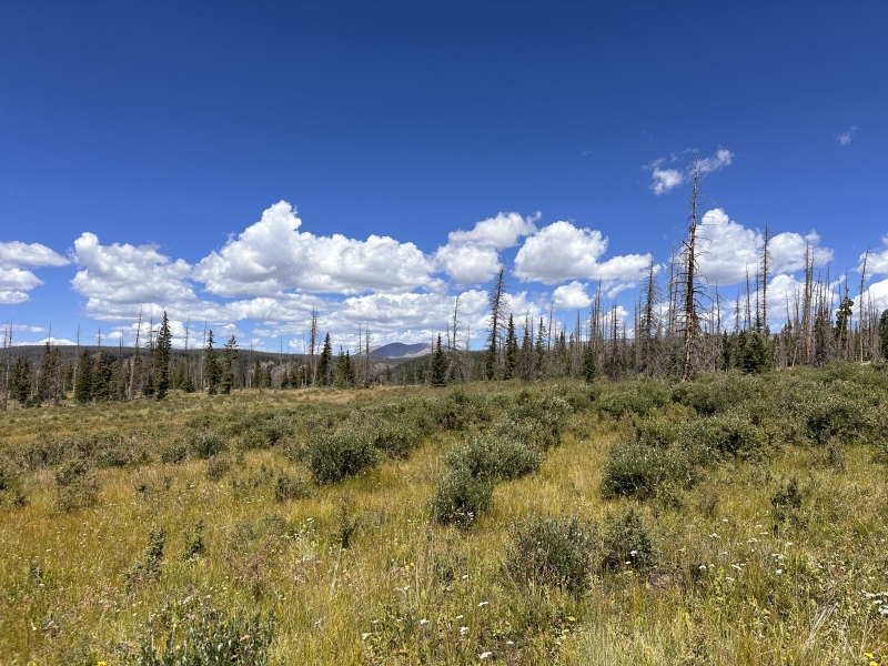
The next morning, I hit the trail with the sun already shining, a strange luxury after two weeks of alpine starts. I was happy to see that the path was always easy to follow, if overgrown in places. Between Hanson's Mill and Wheeler, you'll gain almost no net elevation, but to do this you need to dip low to East Bellows Creek and regain the plateau. Although this is never difficult, I took a couple of breaks with my pack carrying gear for three days away from a resupply.
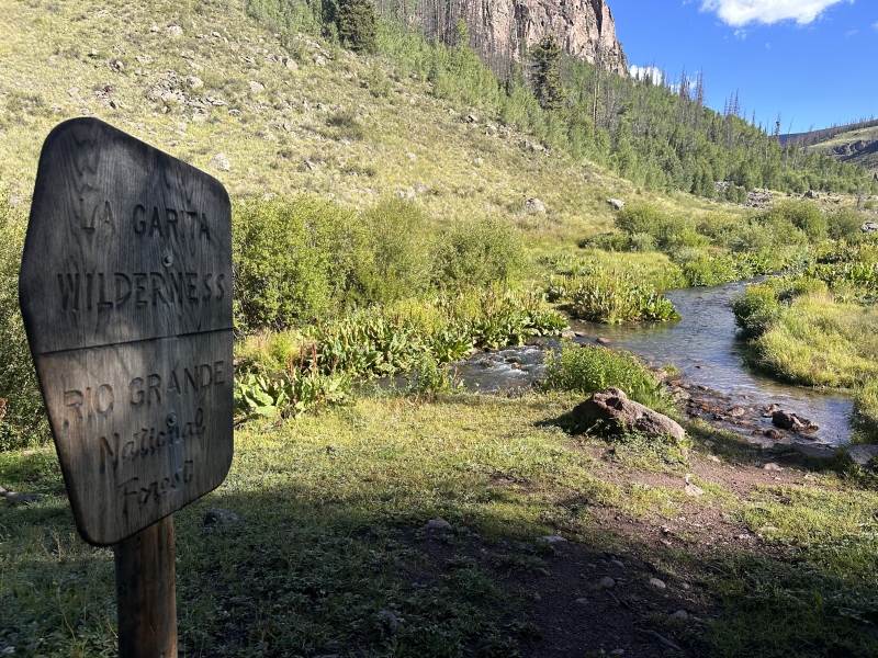
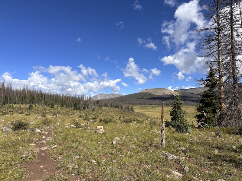
At around 5.5 miles, the trail unites with the road and starts going downhill, entering the drainage of a small creek that might be called West Bellows? You'll see signs for Wheeler, describing where camping is and isn't allowed. I crossed the narrow creek and turned left, finding a grove with a fire pit and a few fleshed out camping spots. Be careful where you set your tent, there're plenty of pine beetle victims just waiting for a reason to topple. I found an area with some living trees and a few thick-trunked dead ones upwind. 
Before sunset, I walked a little further up to Wheeler to see the formations in the waning light.
I was very fortunate to have an August day with no potential for rain in the forecast, so I decided on a 5:30 start for my summit push. Your first goal is to bypass Wheeler. In the early light, I'd recommend staying right at the loop junction. This allows for a good view of the formations on your way down, which the East side of the loop doesn't particularly showcase. 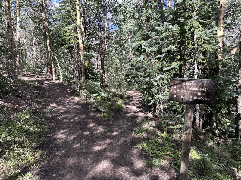
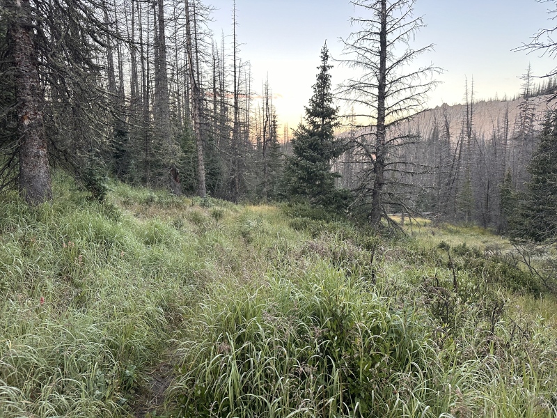
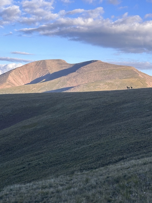
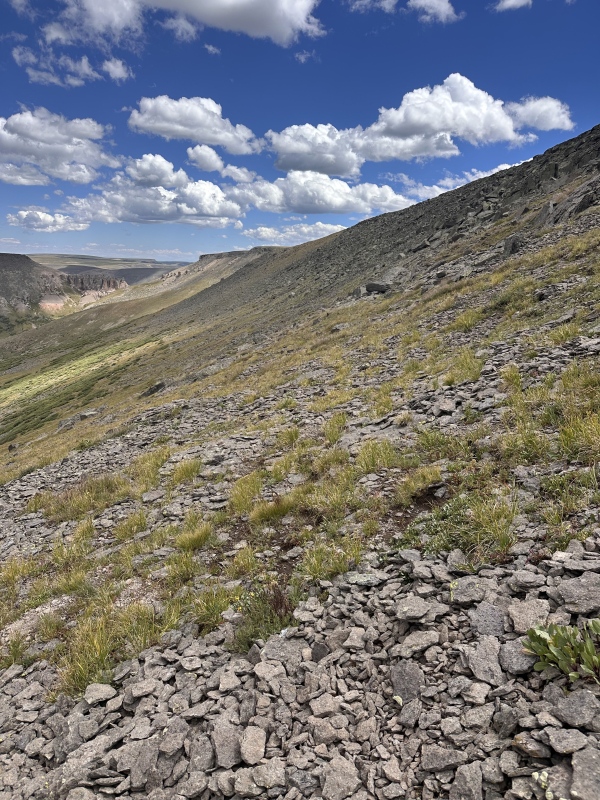
From the top of the loop, begin a mostly switchback-free trip to the top of the pass. This is easy hiking, you quickly pass treeline and enter a patch of willows. I was following a heard of elk around this area, who were so kind as to pose for a photo. 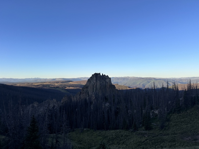
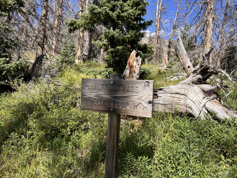
I am one of the very few AllTrails apologists on this site. I like the UI but mostly upload GPX tracks from this site for actual navigation. This method, although safe, isn't particularly pleasant or intuitive. To regain the ridge after this dip, you need to sharply turn right and meet the saddle of a plateau to the west and a round rock outcropping to the east. Turning around the drainage below that saddle leaves you on some loose soil. In my best effort to leave no trace, I decided to return a different way. This route eroded too much. 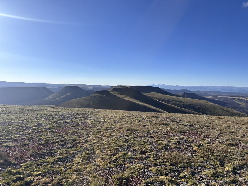
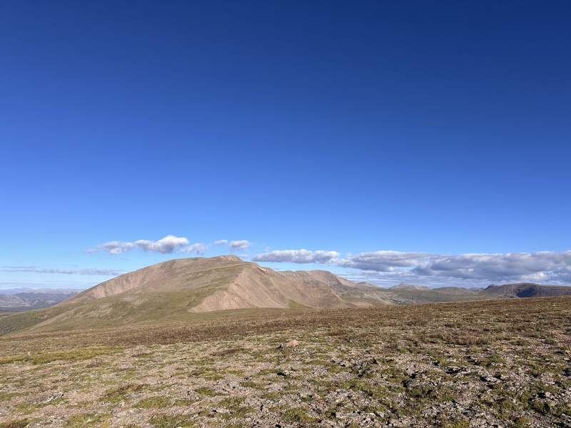
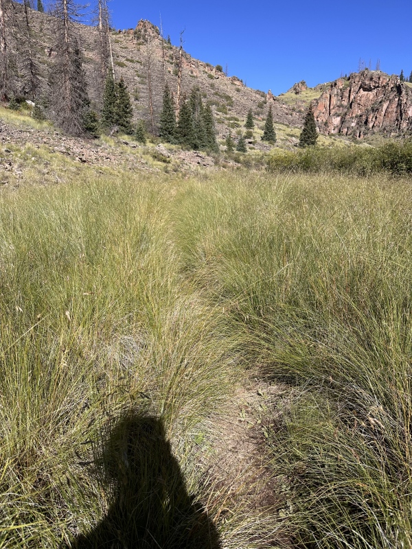
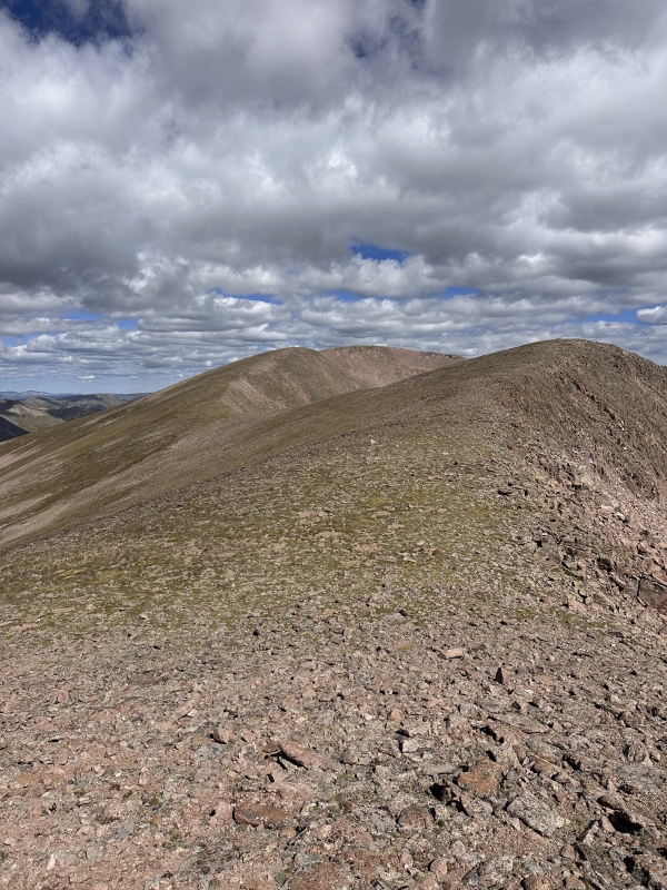
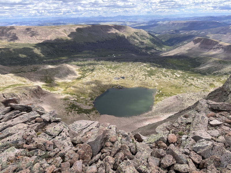
Just beyond the plateau is a small rise, then begin the journey up La Garitaita. Up to the ridge is easy hiking with a couple short talus fields. Once you get to the ridge itself, it all becomes talus, which becomes looser the closer to the summit you get.
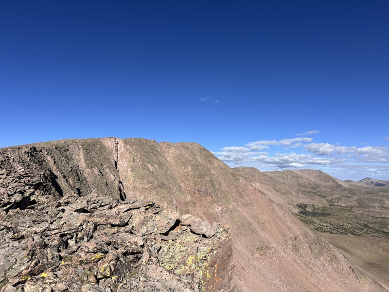
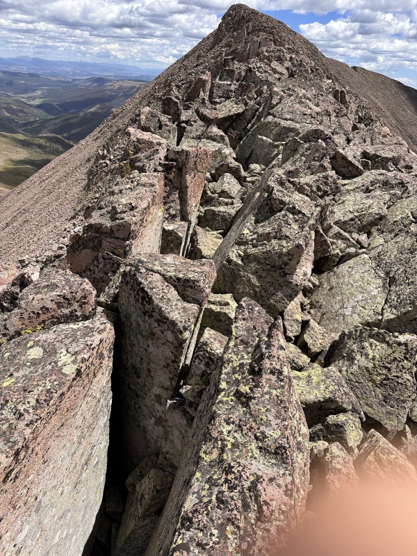
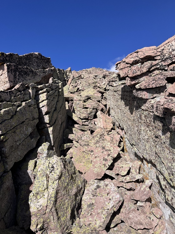
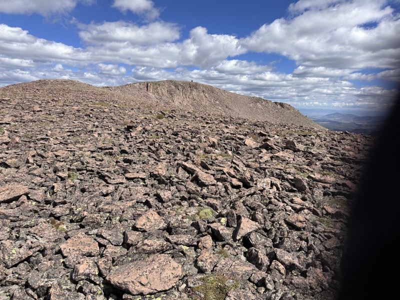
The next section is without a doubt the most fun section of this long ridge traverse. Between La Garitaita and La Garita is a series of horizontal columns of rock with huge gashes in them. The rock is very stable, but has deep fissures making this skyline walk a game of high-stakes hopscotch. If anyone reading this does the standard route of Phoenix and La Garita, I'd encourage them to swing over too this subpeak as well, its well worth it. 
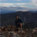
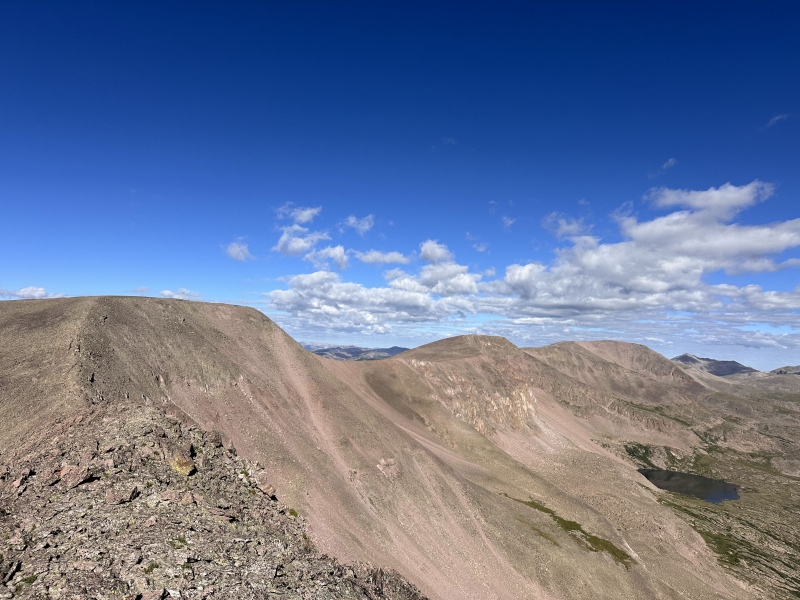
Finally on top of La Garita, I looked back and examined my options. Halfmoon Pass seemed twenty miles away (in reality, it was about four) and I nearly called it. I was on top of a peak, overlooking all of La Garita wilderness, I can be happy. But I had The Hunger in me too. I had a perfect weather day, I was already here, I was well supplied, I should go for it. I dumped my pack on top of La Garita and headed west, armed with a poncho, my poles, and a Clif Bar. Phoenix is another two miles in each direction, with an annoying subpeak at the halfway point. In my frustration, I named this point La Guardia. 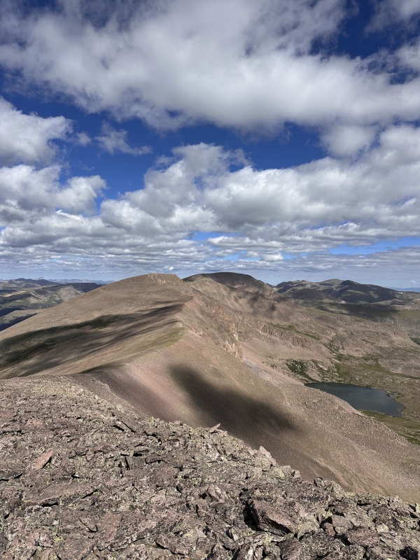
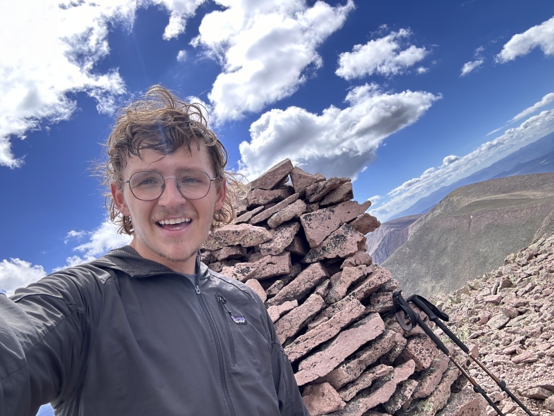
I had finally made it to the summit, nine miles away from camp. I enjoyed my Clif Bar, and reflected on the route. This was my first time looking at a map, saying I think it goes! and sending it. With that said, I also understand why this isn't an established route for Phoenix. Online, I hadn't been able to find any reports of it, despite it being obvious to me. It's just so long. If you had a 4x4 to drive up to Wheeler and went in one push, it would still be 18 miles round trip. It's never particularly steep, the rock is never particularly poor, camping is easy and accessible, but as a noted hater of Barr Trail, I'm not sure why I thought this would be my cup of tea. If this was the only route for Phoenix, I'd probably be annoyed at it. But it was of my own creation and I'm proud of that. (I'll add, I'm under no illusion that I'm the first person to climb Phoenix from Wheeler, I just hadn't seen it posted anywhere before) 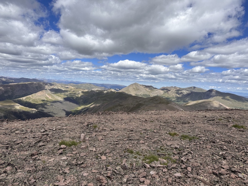
On the way back, I took the same path all the way until the east end of the plateau. I decided this time to bypass the erodable soil by climbing up to the round rock, bypassing it on the right, and going on the north side of the initial mesa. This ends up being worse than the right side. 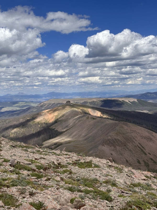
These rocks are a more sustainable surface than the south side, although slightly less pleasant to traverse.
Upon turning southeast, the terrain gets steeper and there are spikey plants everywhere. This is the annoying part.
Nearly back to the pass, I realized that the roof of the mesa is actually probably the best route. It looks like it can be accessed from the very eastmost point, slightly to the north, potentially light class 3. Getting down from the west side would be very easy, although I didn't take a picture. 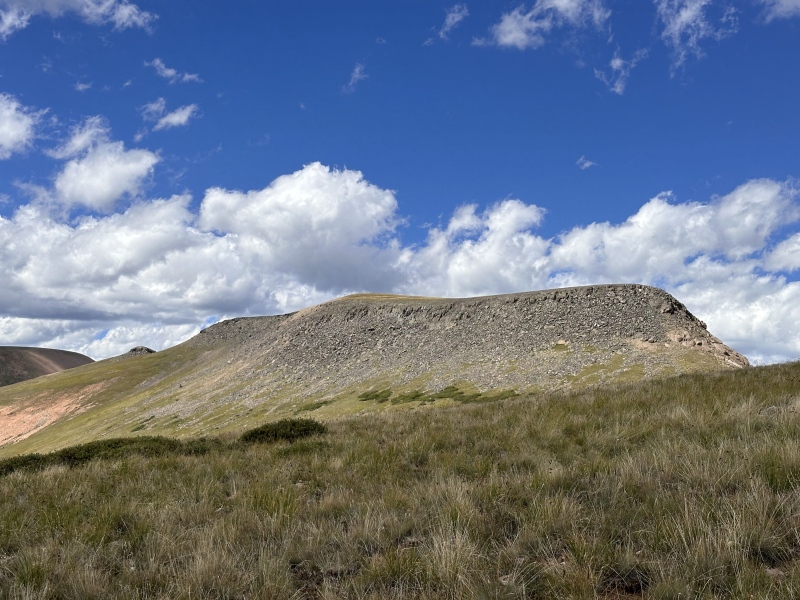
On the way back down from the pass, turn right on the loop and enjoy the amazing views of Wheeler. 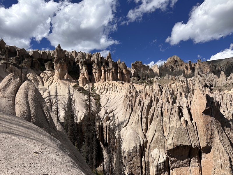
I came back to my tent after an 18 mile, 5,000 foot day, and was excited to lay down at last. The hike out the next day was uneventful, aside from a minor back tweak that slowed my progress considerably. Reflecting on the route in total, I wouldn't do it again. The grindy aspect of Centennials is part of why we love them, but this is more of that than I desire in a day. Seeing Wheeler is a real treat and I'd encourage everyone to check it out without the peak bagging. Over three days I saw only about seven people, it was a really special and remote few days because of that. Thumbnails for uploaded photos (click to open slideshow): ")
")
")
")
")
")
")
")
")
")
")
")
")
")
")
")
")
")
")
")
")
")
")
")
")
")
")
")
")
")
")
")
")
")
")
")
")
")
")
")
")
")
|
| Comments or Questions | ||||||
|---|---|---|---|---|---|---|
|
Caution: The information contained in this report may not be accurate and should not be the only resource used in preparation for your climb. Failure to have the necessary experience, physical conditioning, supplies or equipment can result in injury or death. 14ers.com and the author(s) of this report provide no warranties, either express or implied, that the information provided is accurate or reliable. By using the information provided, you agree to indemnify and hold harmless 14ers.com and the report author(s) with respect to any claims and demands against them, including any attorney fees and expenses. Please read the 14ers.com Safety and Disclaimer pages for more information.
Please respect private property: 14ers.com supports the rights of private landowners to determine how and by whom their land will be used. In Colorado, it is your responsibility to determine if land is private and to obtain the appropriate permission before entering the property.