| Report Type | Full |
| Peak(s) |
Henry Mountain - 13,272 feet Square Top Mountain - 13,007 feet Fossil Mtn - 12,763ft Fairview Peak - 13,224 feet Terrible Mtn - 12,134ft |
| Date Posted | 08/18/2024 |
| Date Climbed | 08/10/2024 |
| Author | cloudkicker |
| Additional Members | Kcmartinez22, kyrawhitworth, tokku1, RyanOlsonDDS |
| A weekend with Hank Hill & friends |
|---|
|
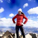
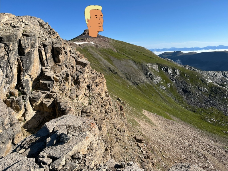
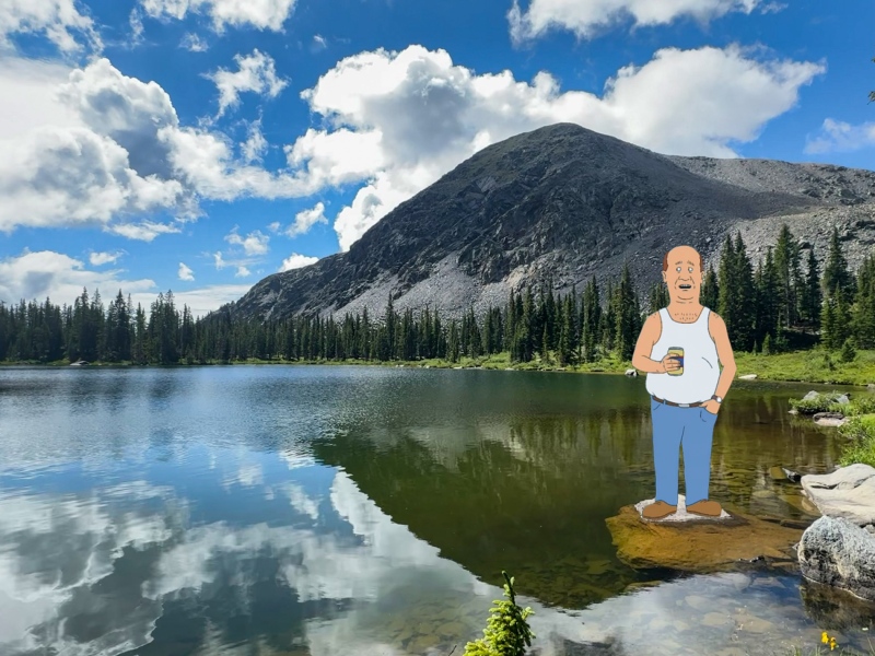
A weekend with Hank Hill & friends Intro In the days prior, both our plan A weekend (spicy San Juan scrambles) and our plan B (spicy Sangres traverse south of the Crestones) would be punted for later. Colorado’s monsoon had finally made its appearance this summer, and with it came a forecast of rain, thunder, and shrunken climbing windows. We were looking for safer peaks to cram into early mornings before the possible 10am storms would roll through. Somehow, I landed on this group of 13ers and 12ers that lay northeast of Gunnison, in the western reaches of the Sawatch range. I had never heard of Henry Mountain before, despite a fair share of obscure summits under my belt. I blame the Mandela effect for that… this peak and its dozens of past ascents definitely did not exist before I heard of it. Thanks to my love for fire lookouts, however, I knew of Fairview already. After the maps and this website enlightened me to Henry’s presence, I made the executive decision to bastardize its name once and for all. This mountain would no longer be referred to as Henry Mountain. We would call this mountain Hank Hill. 
Saturday
Range: Sawatch, Fossil Ridge Wilderness
Peaks: Fossil Mountain, Square Top Mountain B, Henry Mountain
Stats: 10 miles round trip, 3700ft gain
Trailhead: Gold Creek Campground, elevation 10,000ft
Route: Bill Lake, Mount Dale, Boomhauer Mountain, Hank Hill, and Lake Dauterive
Kyra met Kat and I in Poncha Springs on Friday afternoon. She hopped in Kat’s jeep, while I drove my trusty Xterra separately. We headed up and over Monarch Pass through intermittent rain and thunder. The Gold Creek Campground is north of the small village of Ohio City, and just down the way from Pitkin. The road between Ohio City and Gold Creek is easy dirt road, and the road between Ohio City and Pitkin is paved. I held out hope the entire drive that we’d find vacant dispersed sites either at the campground itself or nearby. To my excitement, the entire 6 site dispersed campground was empty, and its restrooms had been serviced just a couple days before. I laid claim to site 3, while Kat and Kyra took site 4. Tokku arrived just before dark and claimed a piece of site 3 as well. 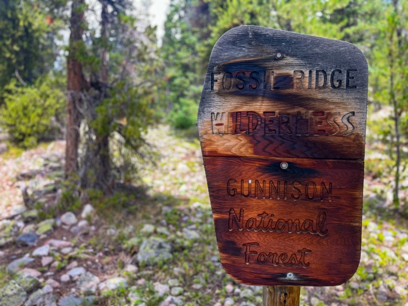
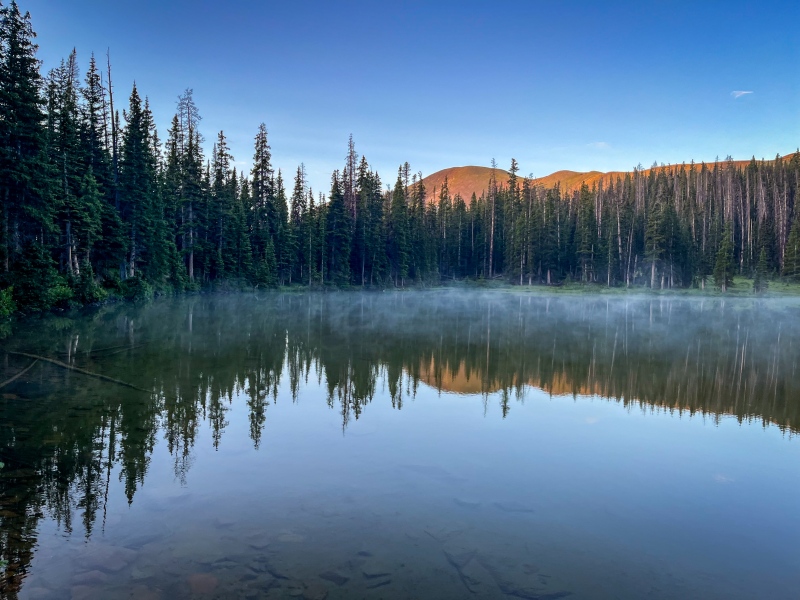
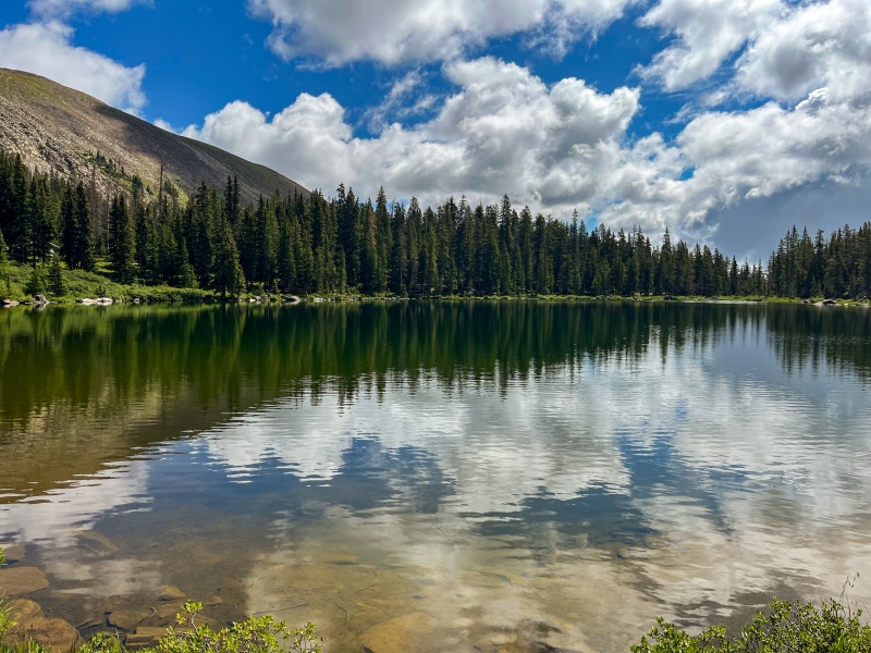
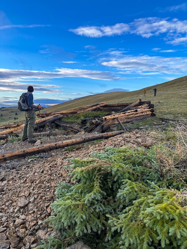
We began at 5am sharp straight from the campground and made quick work of the 2.1 miles and 1500ft up to the lake. 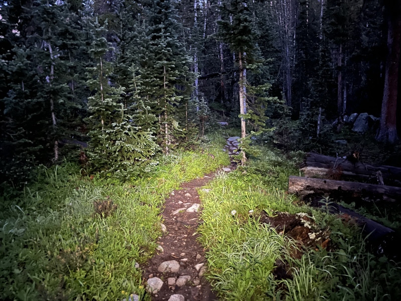
The sun began to rise just as we arrived at the lake. A layer of mist emanated from the surface, creating an ethereal scene as we snapped photos and enjoyed our first snack. 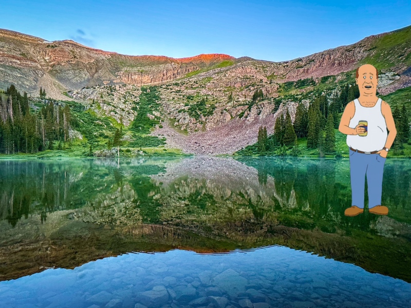

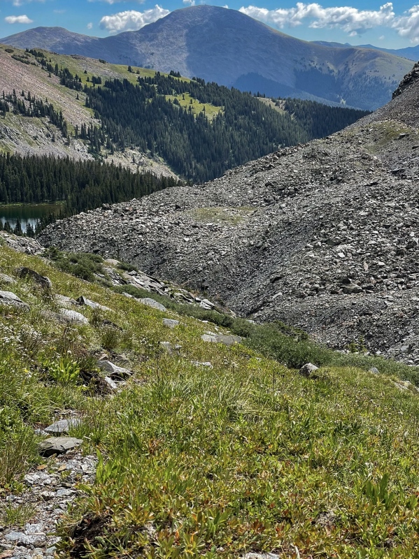
The route from the lake to the ridge is fairly obvious. Right of the lake, you can gain a grassy slope by traversing a short way across a small field of talus and scree. The grass is steep but easy to climb, lined by small cliff bands you can either go around or through. We made quick work of this slope, and soon found ourselves gazing up the last few hundred feet of rugged ridge to the first summit. 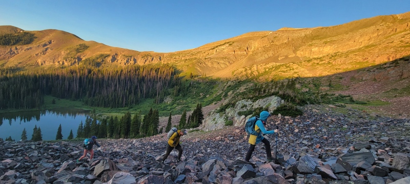
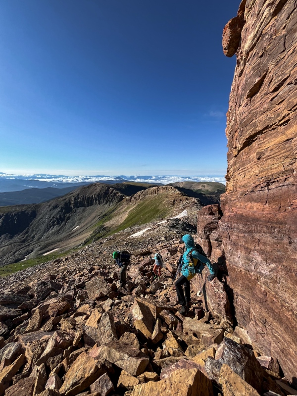
I spotted a cloud inversion on the edges of the horizon and unfortunately wandered ahead and out of earshot from Kat and Tokku, hoping to get a better view of the inversion. A little higher up the ridge, Kat called up to Kyra and I, reporting that she took a fall while we weren’t looking. The talus crossing at the start of the ridge was slippery from the Friday night rain. She had lost traction and fell straight into a boulder that was poking up, its entire purpose in this world seemingly to cause injuries. She had taken a significant impact to her chest, and was now experiencing pain with every breath. Tokku guessed it was probably a broken rib. After a few minutes of assessing the injury, Kat took some ibuprofen and insisted on continuing the final 100ft to the top of summit #1. 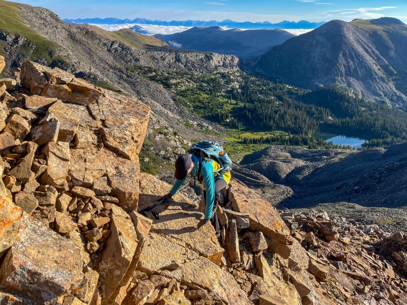
We reached the top at 12763ft. We again assessed Kat’s condition. Kat insisted that the pain was less bad on gentle or flat terrain, which would make up much of the remaining route. I surmised that maybe it’s just a contusion and not a crack. Either way, Kat was fully resolved to proceed along with us beyond our first summit. If it got worse, we could always bail off Square Top towards Lamphier Lake, as that route would be similar enough to our ascent in stats and difficulty. The mood began to lighten a little as we traded our worries for jokes and some King of the Hill references. 

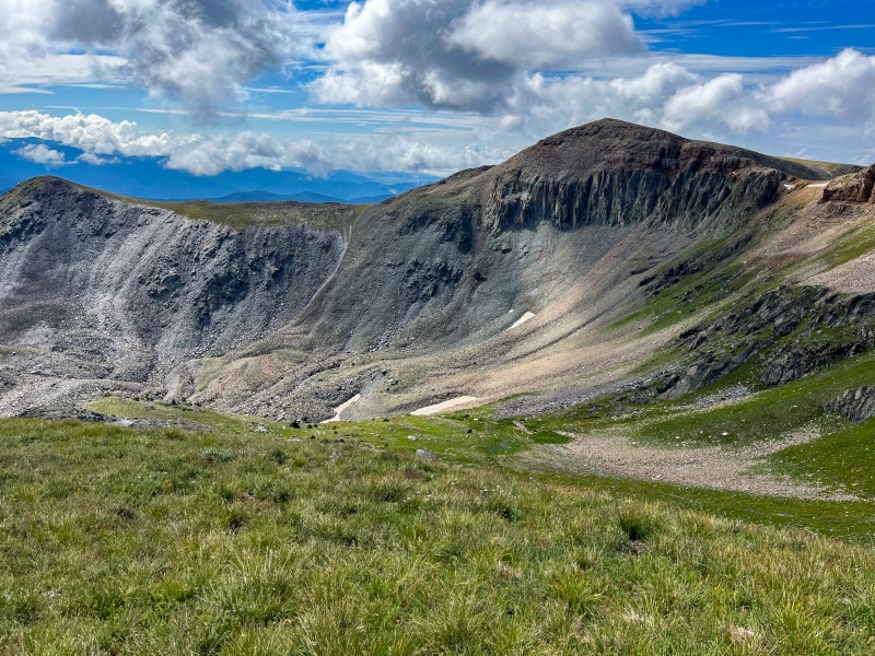
The cloud inversion refused to burn off, and there were no towering cumulus in our immediate vicinity. The weather would cooperate for another couple of hours at least. So on we pressed, towards Boomhauer Mountain. 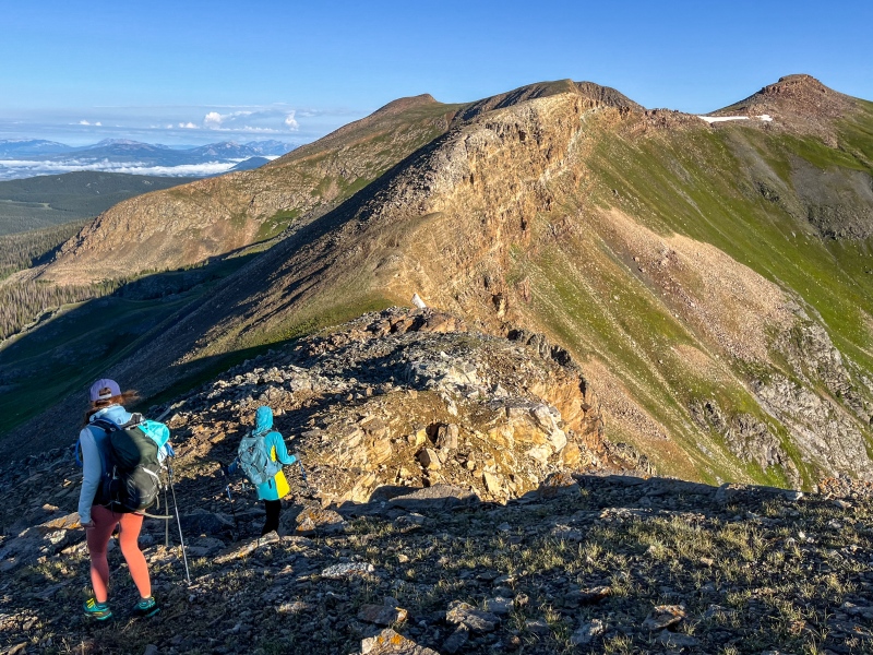
The ridge between Fossil and Square Top is short but somewhat dramatic, with a smidge of exposure. I would liken it to the uppermost portion of Humboldt Peak’s east ridge, with a little bit of Half Peak mixed in as well. A little catwalky in places, but overall easy to navigate. For the most part, it was more of a stroll on top of flat blocks than a scramble. 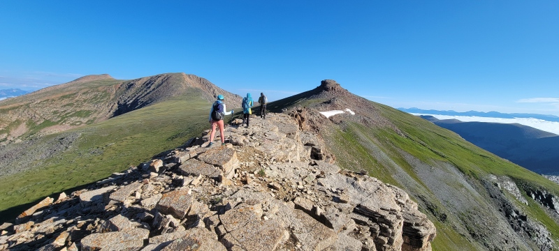
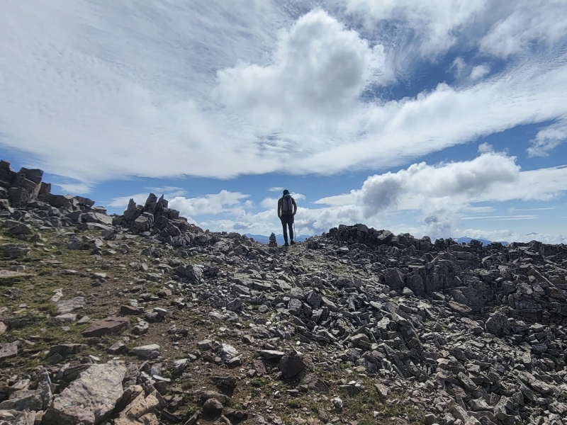
Skirting around the summit crown and up its weaknesses was overall easy and quick. Before we knew it, we were on top of our first 13er of the weekend! 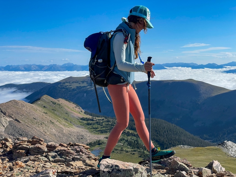
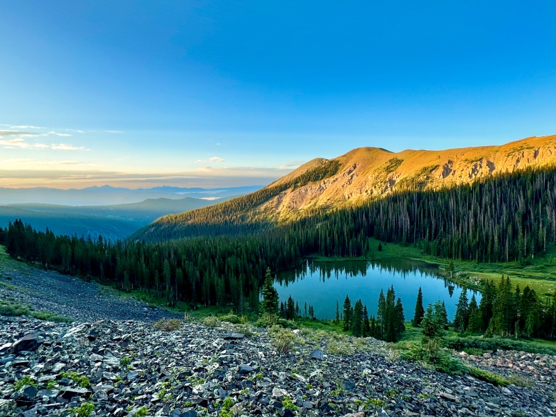
We spent minimal time on the summit of Square Top. Kat’s injury and also the threat of inevitable storms still loomed over us. The route off Square Top to Henry is simple — head north off the summit for a minute or two before finding a ramp that faces Henry, and take that down to grassy slopes and the saddle. 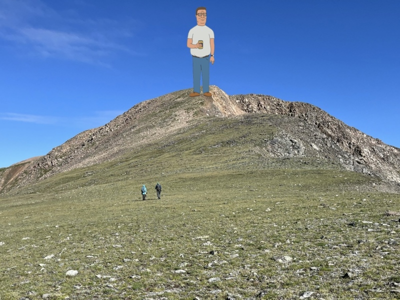
From the saddle, we spied a large family of mountain goats hanging out near the top of Hank Hill. When we reached the summit, they were long gone. 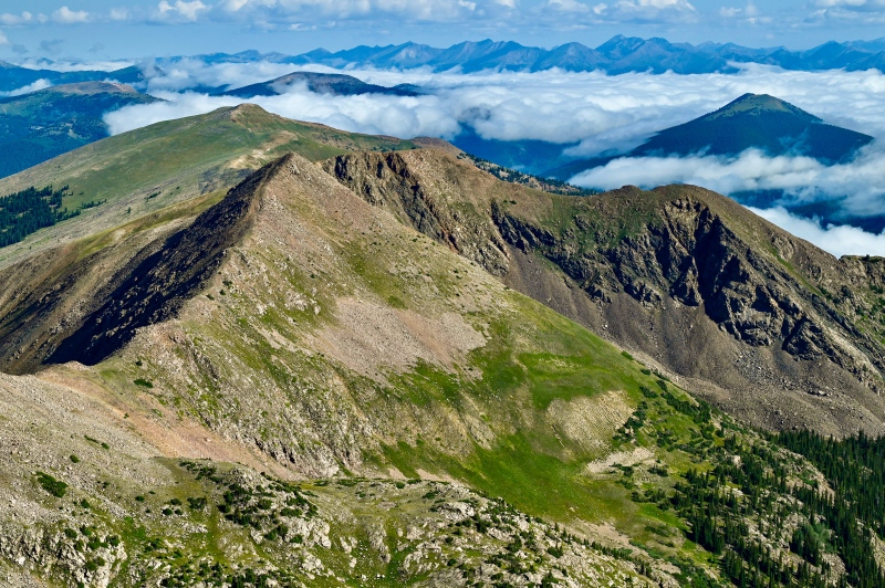
The views from Hank Hill were phenomenal. We could see all the crispy bois in the Elks — Snowmass, Capitol, the Maroon Bells, Pyramid, C&C — while also plenty of the range’s 12ers and 13ers — Mount Crested Butte, the Ruby Range from Owen to Purple Mtn, Treasury and Treasure, Cathedral, Teocalli, and so on. To the north and east we spied - Anderson and Petroleum, Grizzly, the Three Apostles, La Plata, Harvard, the Chalk Rock to Emma Burr ridge, Princeton, and so on. 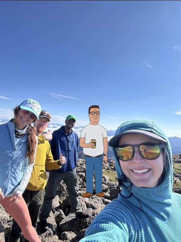

After some snacks and summit chilling, it was time to skedaddle. Kat took a couple more ibuprofen for the way down. We were in awe the entire time how well she was doing, trooping on and holding normal conversations with us through the apparent pain. 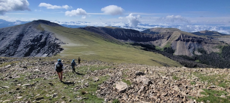

I would’ve shared my GPX for this climb but I made the mistake of getting us off route just below Lamphier Lake. The normal way down is easy - IGNORE THE SPUR TRAILS and take the South Lottis trail all the way from the lake on down to the trailhead. The trail stays on the north side of the Lamphier Creek drainage through much of the steep sections. Near the lake, we inadvertently left the trail, taking a spur trail across the creek not realizing it was just a way to access the east shoreline of the lake and some backpacker’s campsites. Roughly 45 minutes of annoying bushwhacking off trail (including a couple sketchy deadfall crossings) and we were finally back on route. Don’t do like we did. Follow the easy trail all the way down. 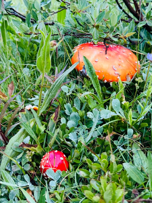
The rest of the trail went smoothly and quickly. Kyra found a giant King Bolete (penny bun) mushroom and hauled it all the way back to camp, eager to show her husband Ryan later that night, promising the skeptics in our group that we would later enjoy its delicacies. Camp, Pitkin, Camp Again Back at camp, Tokku and Kat cooked up some chicken sausages for lunch. Kat was still in pain but intent on spending as much of the weekend as possible with us. We ate a nice full lunch and lounged about for a little while, before retiring to our sleep spaces for naps — Tokku and Kat in their vehicles, Kyra and I in our tents. While napping, it began to heavily rain. The storm we were anticipating as early as 10am had finally come through, around 2pm. Rain can be so relaxing when camping, as long as your rainfly is doing its job. Mine always does. The timing couldn’t be any better. The rain stopped right at 3pm, the exact point in time we had planned to get up and head into Pitkin. We had made arrangements to meet Ryan at The Stumbling Moose Lodge & Grill, where we’d share drinks and an early dinner. Two recommendations here regarding Pitkin:
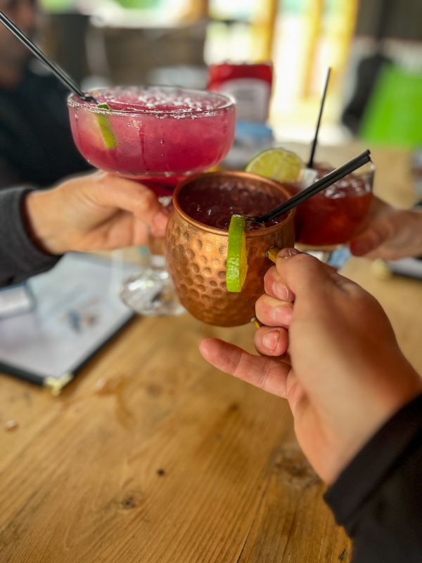
As we waited for Ryan to arrive, we sat on a cute covered patio sipping our Huckleberry cocktails, watching the occasional traffic crawl up and down Pitkin’s Main Street. Tokku and Kyra faced off in a game of throwing axes on the front lawn of the establishment. Ryan arrived and we all put our dinner orders in with the waitress. I ordered the green chile burger with a chicken filet and a side of fries. Kat got the jerk chicken tacos. Ryan got the shrimp and fries, and Kyra and Tokku got burgers. Everything was delicious and the service was fast and friendly. Again, highly recommended. I asked a local (the lodge owner’s son) which road would be best to drive up to Fairview Peak since Google Maps was clearly trying to bamboozle us. Turns out the best road is the Terrible Mountain Road (CR770) which begins one block away from the Stumbling Moose in Pitkin. We made our way back to camp with plenty of daylight left. We shot the shit and did normal camp activities, one of which is banned during certain parts of summer but less frowned upon after lots of rain… if you know what I mean. Ryan sliced up the King Bolete mushroom and cooked it on a pan over the “activity”. I was seriously not expecting that mushroom to taste so good. Kind of a subtle meaty taste. I learned a lot from Ryan about foraging for mushrooms and what to look for in Colorado. I doubt I’ll find one that big (or worm-free) any time soon though. 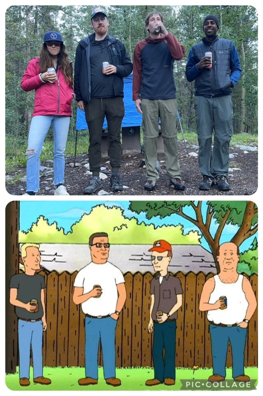
Not long after sunset, we all headed to sleep. An extremely loud crack of thunder and simultaneous flash woke everyone up around midnight. I stayed awake for awhile counting the seconds between lightning and thunder, but eventually drifted back to sleep. Sunday  Range: Sawatch, Fossil Ridge Wilderness
Peaks: Terrible Mountain, Fairview Peak
Stats: 4.20 miles round trip, 1469ft gain
Trailhead: Terrible Mountain Road, 11,800ft
Route: Peggy Hill, Bobby Hill
At 5am I checked on Kat. She informed me she would be heading back to Salida right away to visit the hospital and check on her injury. We had hoped it would somehow hurt less after some sleep but sadly that was not the case. We said our goodbyes to Kat, took down camp, and headed back to Pitkin. In Pitkin, we left Ryan’s FJ and Tokku’s Subie in the public parking spaces across from the general store. Everyone piled into my Xterra, and we began up the Terrible Mountain Road. The road wasn’t hard and I’d agree with most peoples assessments that it’s fully subaruable, at least up to treeline. We made it to the spot I originally planned to park, at 11400ft. My google maps pin had somehow shifted higher up on the road and so I kept driving. The shelf (and lil off camber spots) was slightly heady but it went just fine. 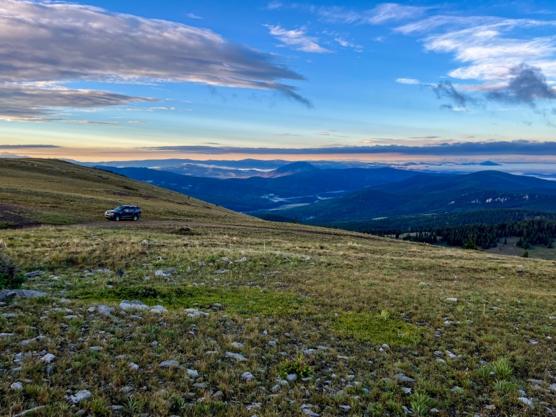
We started on the southern flanks of Terrible Mountain as a glorious sunrise painted the peaks and valleys all around us. Ryan and Tokku headed off right away while I dawdled at my car making some final adjustments. 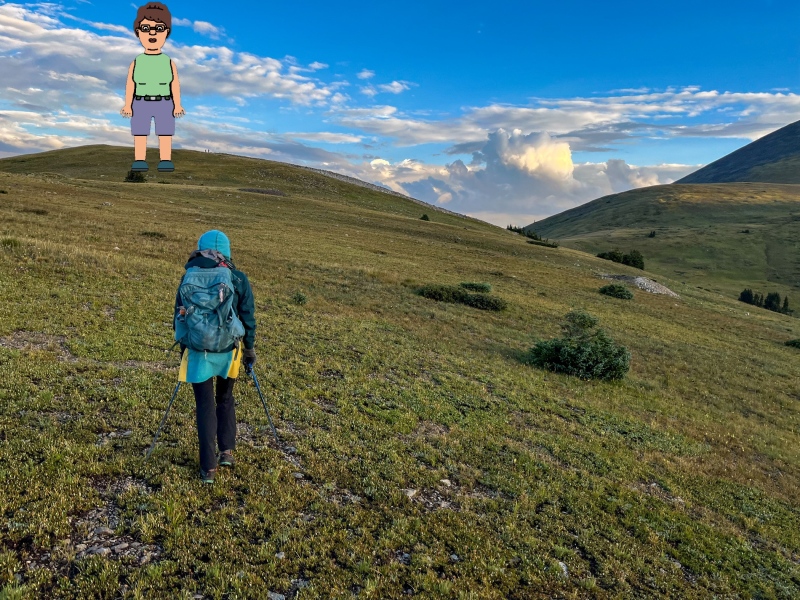
10 minutes after leaving the car, we were already on top of Peggy Hill. 

Not much to say about Peggy Hill other than she’s literally the worst. Especially when she tries to teach Spanish. It was a great day so far, although just west of us Hank, Dale, and Boomhauer were becoming socked in and impossible to view. This was somewhat foreboding. 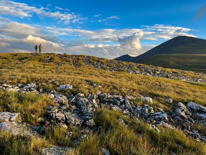
Just 2 minutes spent on top of Terrible, and we were off for the main prize of the day. 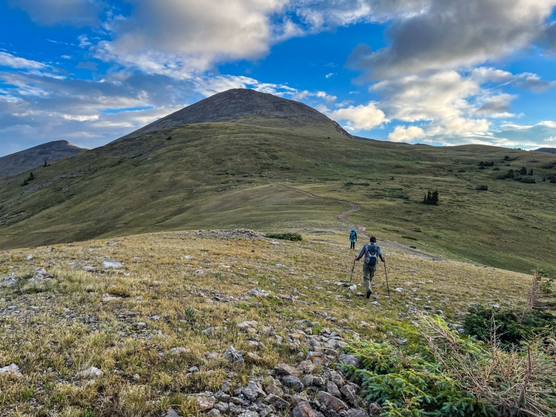
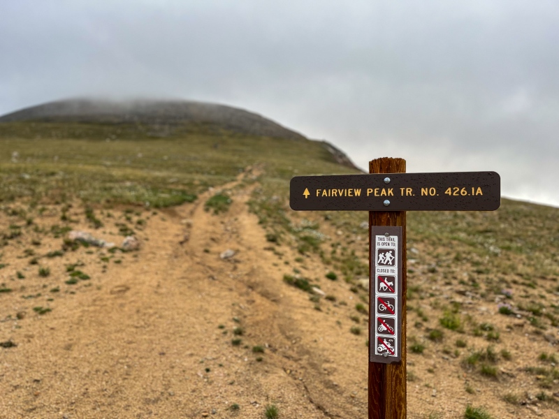
Our view of the upper reaches of Fairview soon disappeared and the entire mountain became shrouded in clouds. 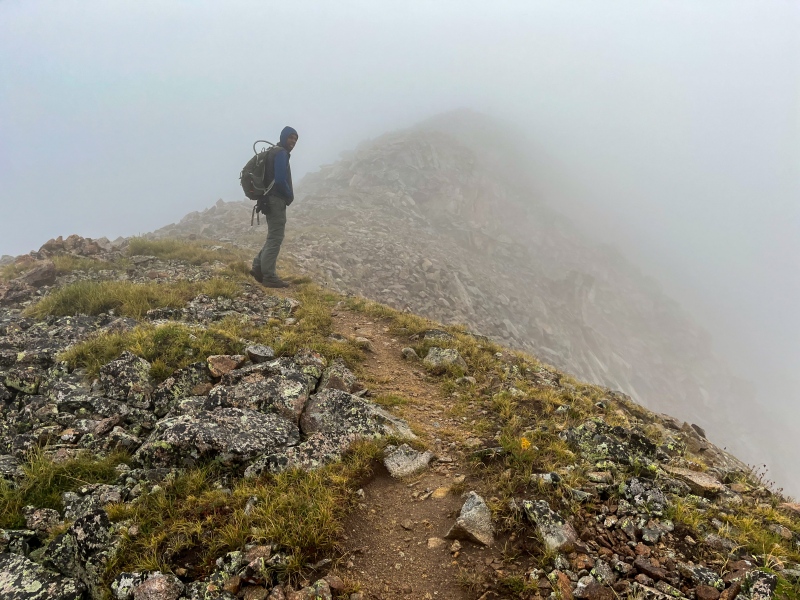
There is a nice class 1-2 trail through the talus all the way from the end of the road to the top of the mountain. The trail is about as nice as some of the 14er trails elsewhere in the Sawatch. It made for easy going as I kept an easy conversation with Tokku. 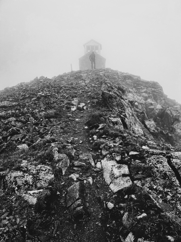
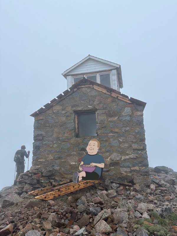
We made it to the highest fire lookout in North America, and my 11th overall! Maybe not my favorite lookout — I’ve been to several in Washington that blow the Colorado ones out of the water — but that is subject to revisions. I do want to give this one another visit when the views are actually… ya know… fair. 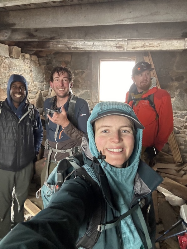


The wind was whipping outside with some fake snowfall mist, so we were eager to boogie on down and get back to Pitkin before the long march home. Traffic has been absolutely horrendous near Fairplay all summer and we wanted to get ahead of the game. So on down we went. 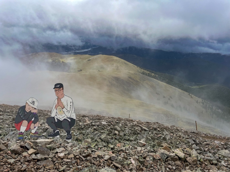
Instead of climbing back over Terrible, we hiked the road all the way back to Bepis. It was easy walking. My Xterra would have totally made it all the way to the end of the road. There really weren’t any obstacles that I could see, other than the need for some semblance of a hike forcing one to park lower. Everyone piled back in and we drove on down the shelf road, back into the trees, and made our way back down to Pitkin at 10am. I dropped off Ryan, Kyra and Tokku and bid everyone farewell. Traffic was very easy coming back home, and I made it back with plenty of time to take an afternoon nap. I got in touch with Kat and the doctors confirmed that it was a broken rib. She’s one of the healthiest people I know and she will recover. If it weren’t for that slippery death talus on the Fossil ridge, this would have been a flawless trip. It was a solid 9 out of 10 though. The camping was amazing, the company was great, and the mountains were a mess of fun I tell ya hwhat. I usually wrap these up with something interesting, clever or insightful, but I’ll just quote a wise philosopher instead: ”Don’t point your finger at me, woman. You’re the one who parks him in front of the TV and makes him watch all them muppets.” - Hank Hill Thumbnails for uploaded photos (click to open slideshow): ")
")
")
")
")
")
")
")
")
")
")
")
")
")
")
")
")
")
")
")
")
")
")
")
")
")
")
")
")
")
")
")
")
")
")
")
")
")
")
")
")
")
")
")
")
")
")
")
")
")
|
| Comments or Questions | ||||||
|---|---|---|---|---|---|---|
|
Caution: The information contained in this report may not be accurate and should not be the only resource used in preparation for your climb. Failure to have the necessary experience, physical conditioning, supplies or equipment can result in injury or death. 14ers.com and the author(s) of this report provide no warranties, either express or implied, that the information provided is accurate or reliable. By using the information provided, you agree to indemnify and hold harmless 14ers.com and the report author(s) with respect to any claims and demands against them, including any attorney fees and expenses. Please read the 14ers.com Safety and Disclaimer pages for more information.
Please respect private property: 14ers.com supports the rights of private landowners to determine how and by whom their land will be used. In Colorado, it is your responsibility to determine if land is private and to obtain the appropriate permission before entering the property.