Download Agreement, Release, and Acknowledgement of Risk:
You (the person requesting this file download) fully understand mountain climbing ("Activity") involves risks and dangers of serious bodily injury, including permanent disability, paralysis, and death ("Risks") and you fully accept and assume all such risks and all responsibility for losses, costs, and damages you incur as a result of your participation in this Activity.
You acknowledge that information in the file you have chosen to download may not be accurate and may contain errors. You agree to assume all risks when using this information and agree to release and discharge 14ers.com, 14ers Inc. and the author(s) of such information (collectively, the "Released Parties").
You hereby discharge the Released Parties from all damages, actions, claims and liabilities of any nature, specifically including, but not limited to, damages, actions, claims and liabilities arising from or related to the negligence of the Released Parties. You further agree to indemnify, hold harmless and defend 14ers.com, 14ers Inc. and each of the other Released Parties from and against any loss, damage, liability and expense, including costs and attorney fees, incurred by 14ers.com, 14ers Inc. or any of the other Released Parties as a result of you using information provided on the 14ers.com or 14ers Inc. websites.
You have read this agreement, fully understand its terms and intend it to be a complete and unconditional release of all liability to the greatest extent allowed by law and agree that if any portion of this agreement is held to be invalid the balance, notwithstanding, shall continue in full force and effect.
By clicking "OK" you agree to these terms. If you DO NOT agree, click "Cancel"...
While hiking to East Buffalo Peak last September, I tried to eyeball the bushwhack down from West Buffalo Peak on the loop route Bill describes on this site. The route didn’t look very geezer-friendly, and with limited time and energy, I never made it to West Buffalo. So, I started looking for an alternative route to West Buffalo.
Looking at a map revealed a route from the west, via the Fourmile Creek trail. This route was taken by scottda in a TR from July 2014, but the trail conditions I experienced and the mileages I recorded are different enough from his that I’m posting a new TR of this route.
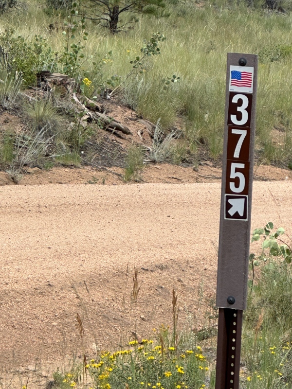
The Fourmile Creek Trailhead is accessed from Buena Vista. Turn east onto main street from the stoplight in BV. The second stop sign is North Colorado Avenue. Drive north on this road for 2.4 miles and then turn right on 375. Follow this road for 6.7 miles until it ends at the Fourmile Creek Trailhead. There are branches off this road, so stay on the main road, except for a sharp right turn about 5.3 miles in, where the road straight ahead is 377. If you have a low clearance vehicle, it’s probably best to stop about 0.3 miles from the end of the road.
Turn Right Here
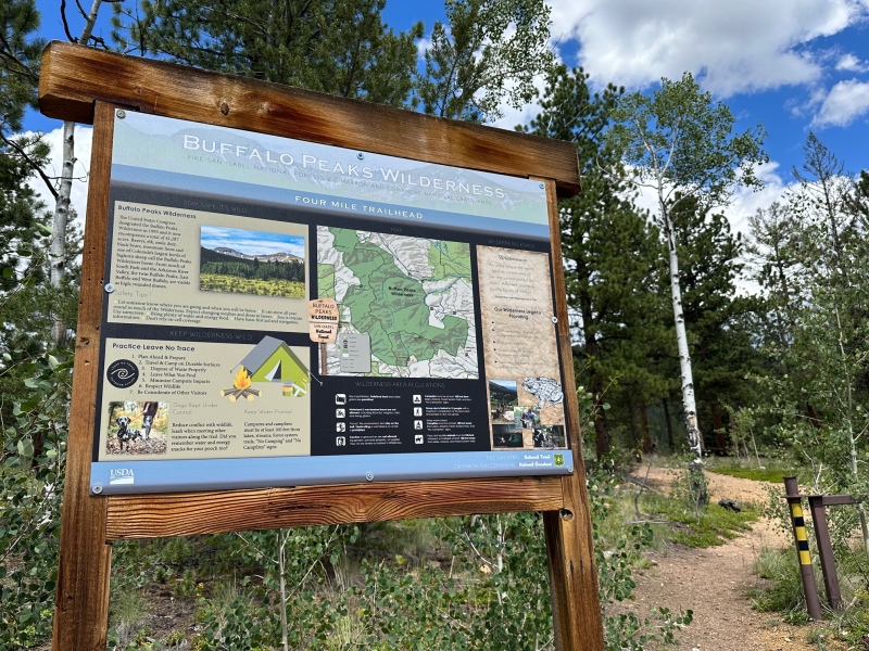
The trailhead at approximately 9470' elevation
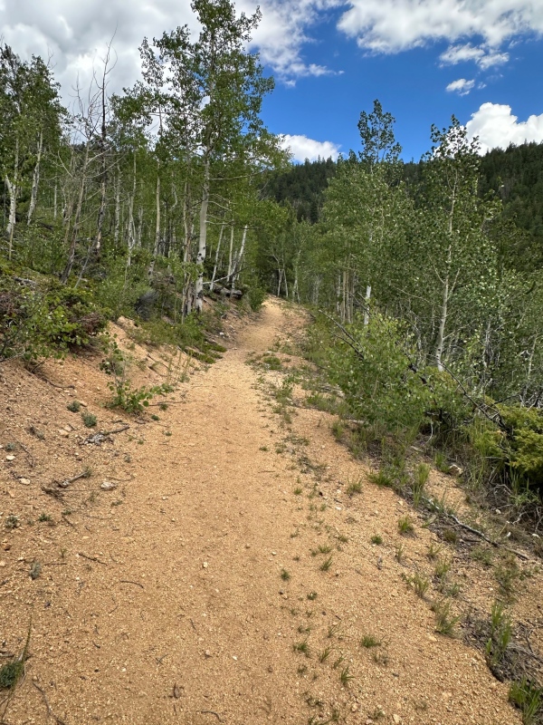
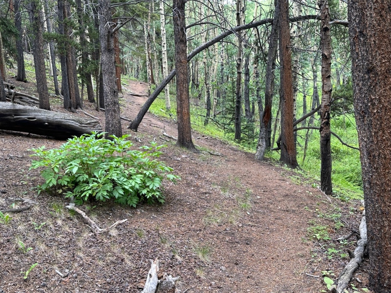
The route follows the Fourmile Creek trail north for 4.5 miles to a high saddle. This is an excellent trail, not a single downed tree, fewer rocks and roots than many trails, and many sections of packed dirt cushioned by a soft layer of pine needles. The terrain is a mix of aspen and pine forest.
Early section a highway, probably an old jeep road
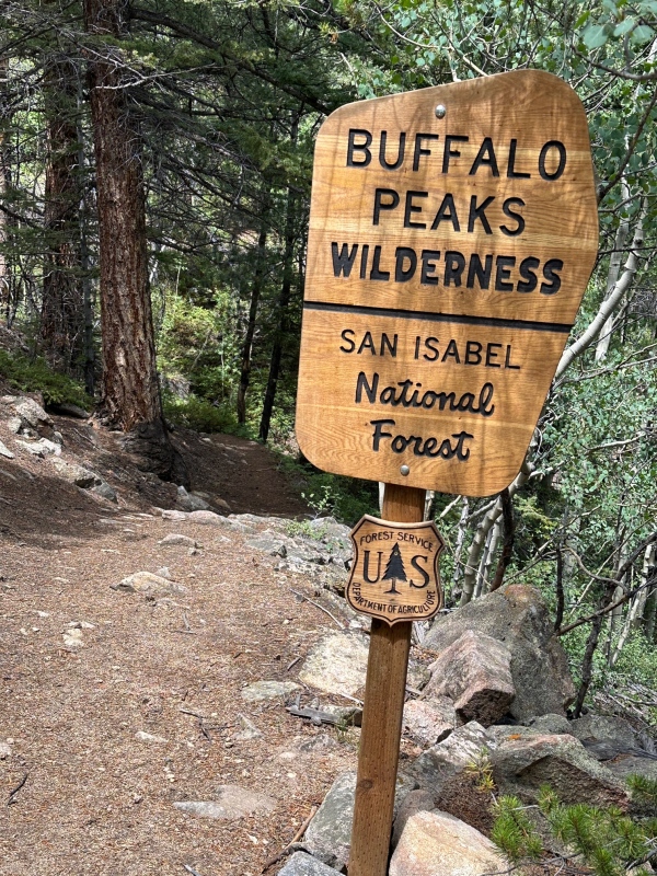
Enter the Buffalo Peaks Wilderness just over a mile in. Trail narrows here.
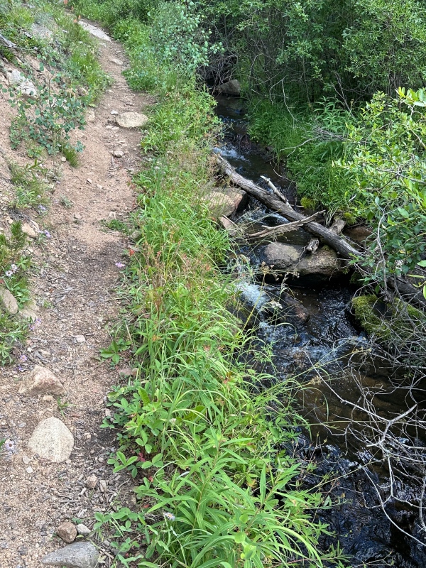
Trail sometimes next to the creek
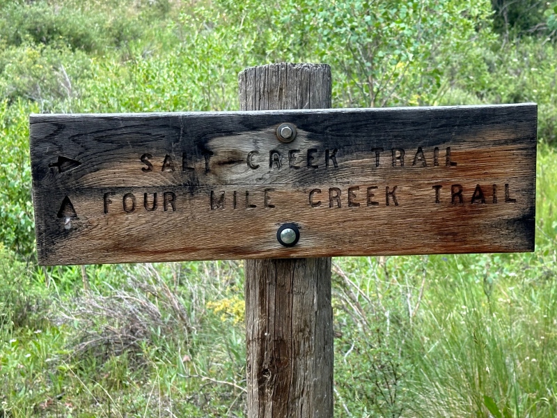
Keep left at intersection with Salt Creek Trail, about 2 miles in
Trail section cushioned by pine needles
After reaching the saddle at about 11,400’ elevation, the route follows the Park/Chafee county boundary all the way to the summit. Turn right (east) into the woods, and in 0.2 miles emerge onto a steep grassy slope. Continue east to the top of the ridge at 12,000’. This is the most difficult section of the route, good footing but lung-busting. I don’t know when steep grass becomes class 2, but I think this is still class 1. After reaching the ridge, the route follows the ridgeline to the summit, mostly high alpine grass, a few rocky areas. The route loses about 100’ of elevation at 12,900’, but otherwise ramps straight up to the summit.
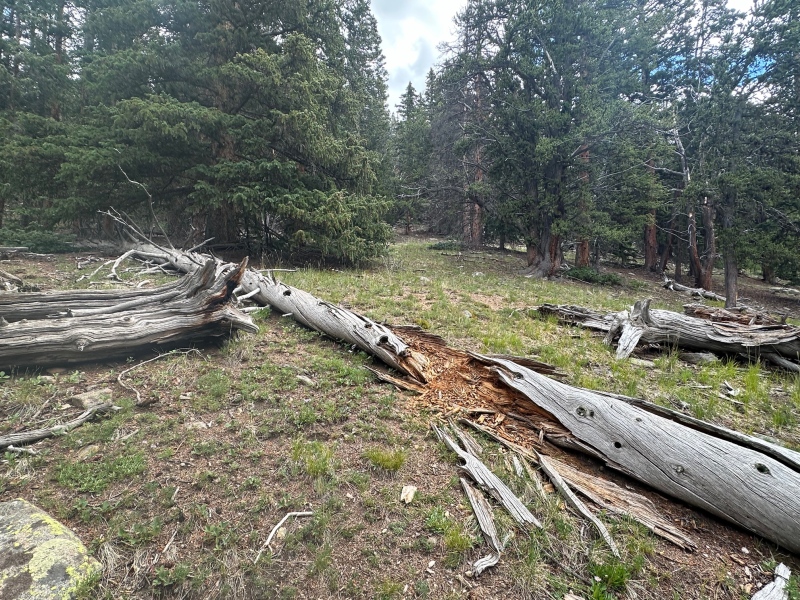
Entering the woods, looks like others have walked over this log
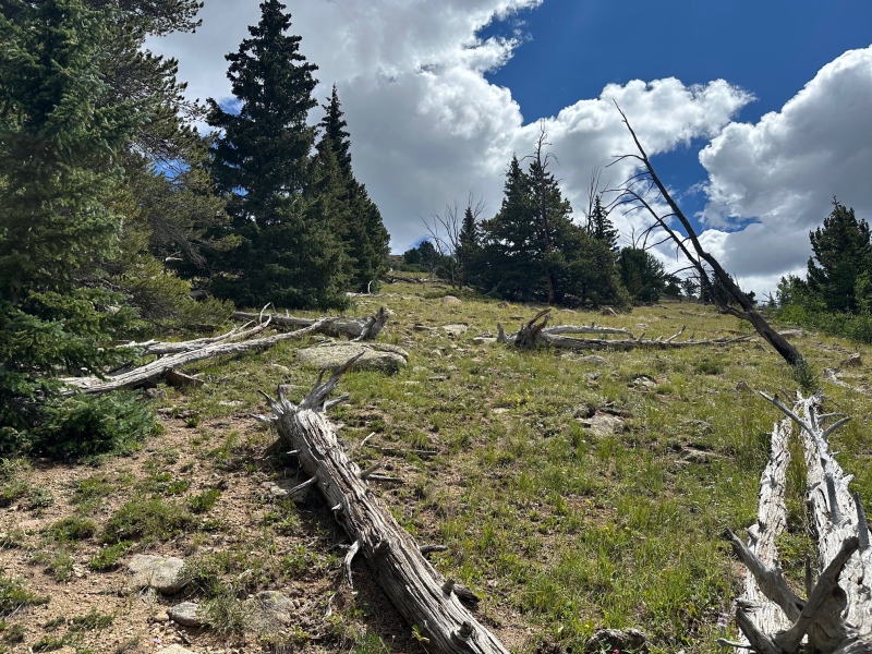
Emerge from woods onto grass
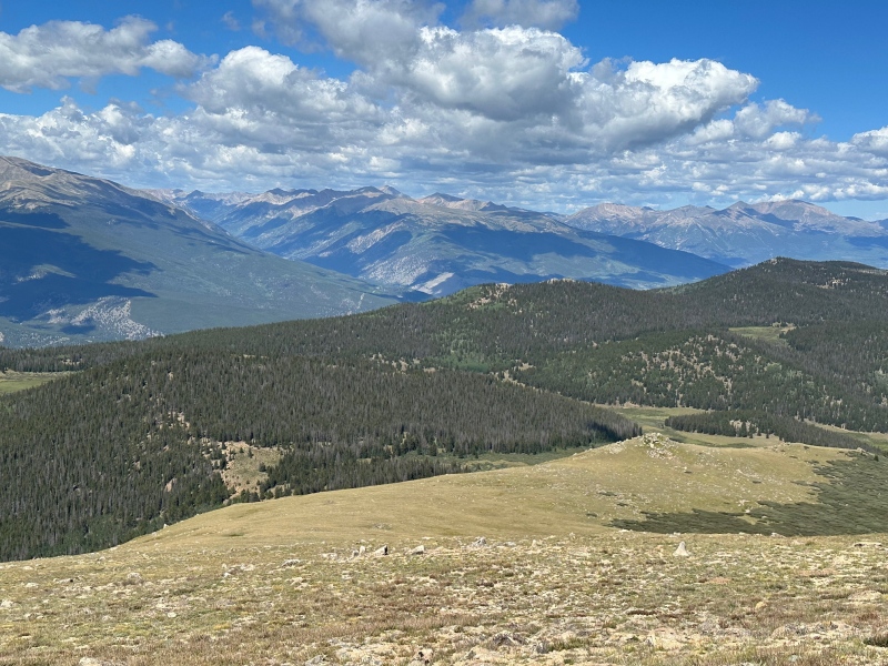
Looking back at the northwest ridge from about 12,900', Sawatch in the backgrouund
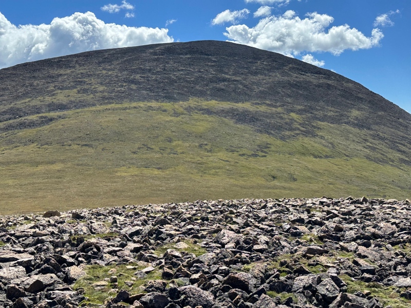
Looking towards the summit from the bump at 12,900'
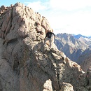
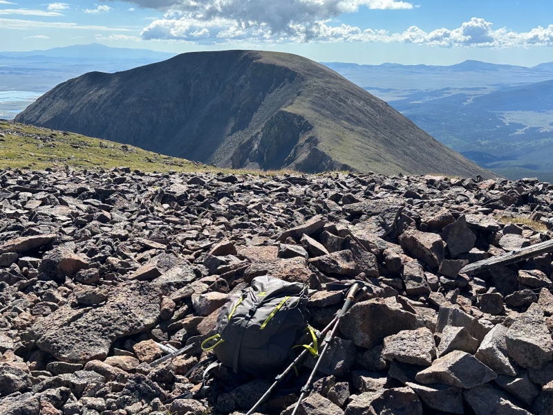
On the summit looking at East Buffalo
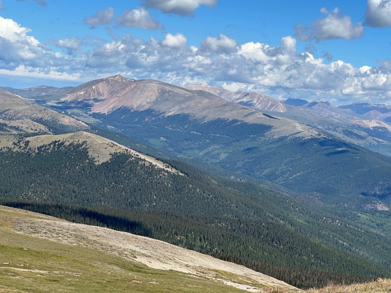
View northeast toward the other Mosquitos
A significant advantage of this route over the standard approach from East Buffalo is that it avoids the loose class 2 section on East Buffalo. In previous reports, WildWanderer describes this section as difficult class 2, and user "scrambling" describes it as 2+. I agree with these assessments. I like to avoid loose terrain when possible and feel safer and more comfortable on solid Class 4 than loose Class 2. I’ve never seen any official statistics, but I’m suspicious that more accidents occur on loose terrain. For others with similar tastes, I highly recommend this Fourmile Creek route to West Buffalo. For trail-runners, it’s an easy class 1 route with great views. As with many 13er routes, I saw no one else on the trail, and no other vehicles at the TH.
Mileage: 12.9 miles
Vertical gain: 4200’ (3850’ elevation TH to summit, plus some ups and downs)
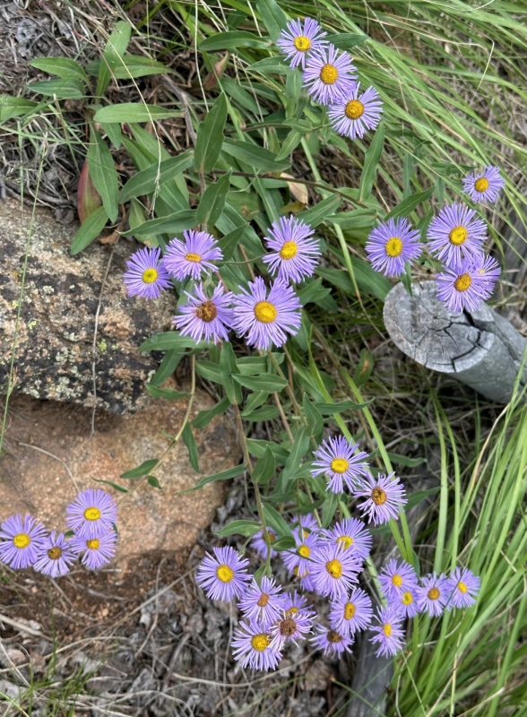
Asters
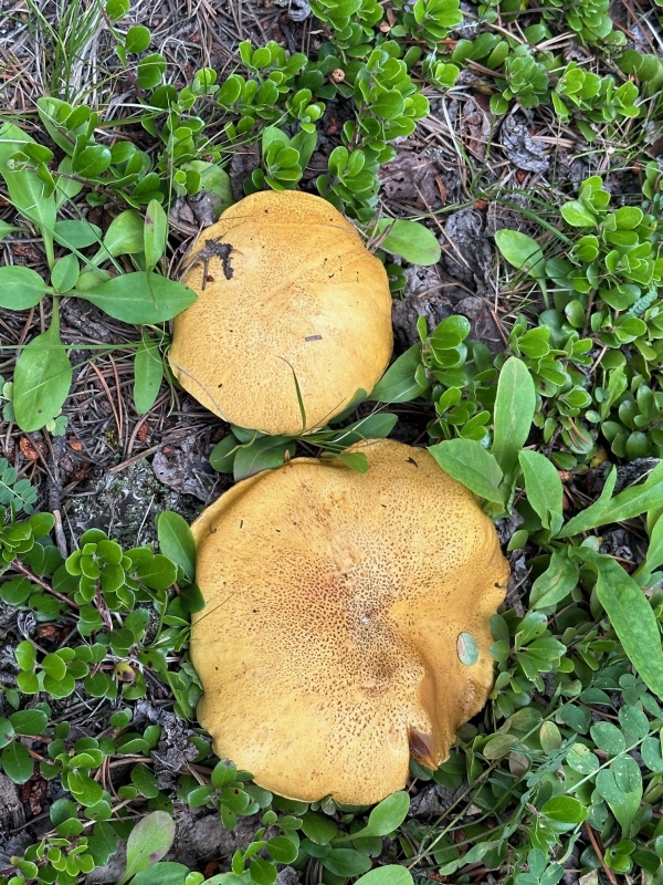
Mushrooms. Thought these were boletes because of rounded top, but fins rather than sponge underneath. Any mycologists out there to identify these?
My GPS Tracks on Google Maps (made from a .GPX file upload):
I logged a GPX file on my GPS and meant to save and post it. But accidentally erased it when I went hiking the next day (I'm a technologically challenged geezer). The place where it might be useful is the 0.6 miles from the end of the trail to the top of the ridge. I have an app on my phone called Pocket Earth, and its map shows the county line between Park and Chafee counties, which I generally followed up to the ridge, where the rest of the route is obvious. The route you take from the saddle to the ridge is not crucial, just don't go too far south or you'll end up in an aspen forest. Something may be stored on my Garmin watch. I've never tried to download anything from it, but will try.
Edit: I see a track in the Connect app on my phone that picked it up from my Forerunner 955. If someone can tell me how to get it from there to my Windows computer, I can post it to my TR.
Edit #2: I'm making progress, uploaded .gpx file. Larger than usual, still trying to figure out how to downsize it.
Okay, take your time! Hope to try West Buffalo Peak next month.
Caution: The information contained in this report may not be accurate and should not be the only resource used in preparation for your climb. Failure to have the necessary experience, physical conditioning, supplies or equipment can result in injury or death. 14ers.com and the author(s) of this report provide no warranties, either express or implied, that the information provided is accurate or reliable. By using the information provided, you agree to indemnify and hold harmless 14ers.com and the report author(s) with respect to any claims and demands against them, including any attorney fees and expenses. Please read the 14ers.com Safety and Disclaimer pages for more information.
Please respect private property: 14ers.com supports the rights of private landowners to determine how and by whom their land will be used. In Colorado, it is your responsibility to determine if land is private and to obtain the appropriate permission before entering the property.
")
")
")
")
")
")
")
")
")
")
")
")
")
")
")