| Report Type | Full |
| Peak(s) |
Mt. Sneffels - 14,155 feet |
| Date Posted | 02/12/2025 |
| Modified | 04/29/2025 |
| Date Climbed | 07/23/2024 |
| Author | ECF55 |
| Spectacular and Horrendous - Sneffels Southwest Ridge from Blue Lakes Approach |
|---|
|
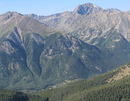
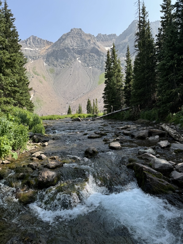
Sneffels Southwest Ridge from the Blue Lakes Approach (South Slopes descent) 23 July 2024 (Tuesday) Hike Times: 5:33am - 5:38pm MDT (12h 5min hike duration) Distance/Elevation: 13.3 miles / 5,186 ft (MapMyRun estimates) Mountain Conditions: Full summer conditions. The Lavender Col gulley snowbank had just retreated. Weather Conditions: Abnormally dry and stable (western heat dome). Warm conditions and minimal clouds all day. Some Canadian wildfire smoke filtering in, but it was minor and significantly better than the Front Range that week. Crowds: Generally sparse on the Blue Lakes approach. Numerous campers at Lower Blue Lake. Encountered at least fifteen hikers on the South Slopes as most people start in the Yankee Boy Basin. If you've ever seen Mount Sneffels from Dallas Divide, you'll never really forget the view of that mountain. Sneffels is an ICONIC mountain set within an iconic range. It's extraordinarily picturesque and Classic Colorado. 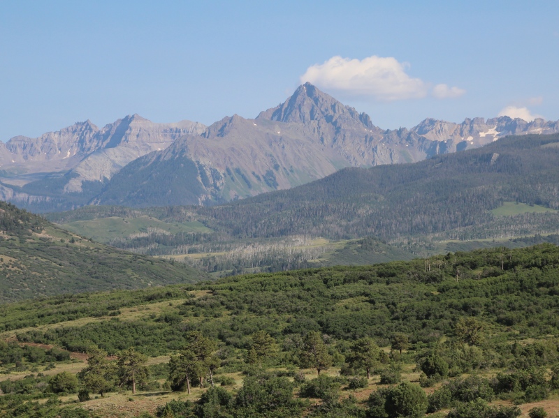
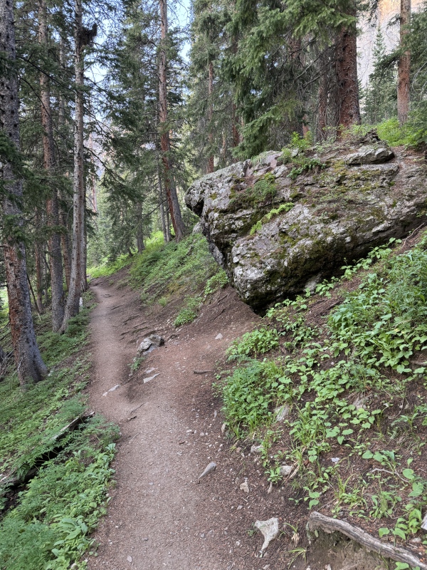
Mount Sneffels is considerably more intimidating than most of the Sawatch peaks as you admire its contours from afar. I first saw this peak in 2019 en route to Telluride and it was not something that I ever expected to attempt. However, after collecting some experiences above treeline on Class 3 terrain (Kelso Ridge) and dealing with San Juan scree (Oscar Peak and Wasatch Mountain), I decided I to give it a go. The Blue Lakes approach was also a convincing factor because...wow. Mount Sneffels is a formidable hiking challenge and it nearly broke my confidence, even after years of experience. The Southwest Ridge and South Slopes are both difficult terrain to ascend AND descend, with steep gradients and abundant loose rock, talus and unconsolidated dirt throughout. The Sneffels Blue Lakes approach also adds considerable distance and elevation gain compared to the Yankee Boy standard approach [Yankee Boy 2WD: 8.25 miles, 3400 ft vs. Blue Lakes 13.3 miles (+61%), 5100 ft (+50%)], making an already challenging climb into an epic mountain adventure. It's a big day for normal humans and a huge day if you are an East Coaster still acclimating to the higher altitude (It was Day 3 for me in Colorado when I did this hike, which was just dumb and I was really huffing and puffing near the summit...). I strongly recommend that you wait for a good weather window for this hike because once you commit to the Sneffels summit, it's a slow grind both up and down and you really don't want to be caught on that ridge during a weather event. Regardless of the difficulty level, the accompanying scenery around this mountain is outstanding. The Blue Lakes approach has some of the best views of any hike I've done in Colorado, with dramatic mountain scenery and idyllic alpine lakes abound. I give this hike a strong recommendation, but bring your A-Game because it's a huge day with a high misery factor on the descent. Blue Lakes Access Road In order to access Sneffels from the Blue Lakes approach, you need to get to the Blue Lakes Trailhead via CR 7 (turn south on CR 7 from CO-62 west of Ridgeway). Overall, CR 7 is a high quality access road. It's generally flat and not too rocky/rutty compared to the more notorious mountain roads in Colorado. The last stretch of CR 7 that runs through National Forest is less well-maintained, but I made it in a 2WD SUV rental without issue. Overall, it took me >45 minutes to make the 9 mile drive in the pre-dawn darkness, so factor that into your planning. Approach Trail to Blue Lakes (Spectacular!) The Blue Lakes approach trail starts at the south end of the trailhead parking lot and was easy to find. It's a high quality trail through nice spruce/doug-fir forest and it has a decent but not unreasonable gradient. The trail has rockier sections along some of the hillsides, luxurious dirt path along flatter sections, and some built-in log stairs in a couple of the steeper slopes, but on the whole, the Blue Lakes approach is a very well engineered trail that efficiently gets you up to the Lower Blue Lake (3 miles and 1600 feet). I thought it was a joy. 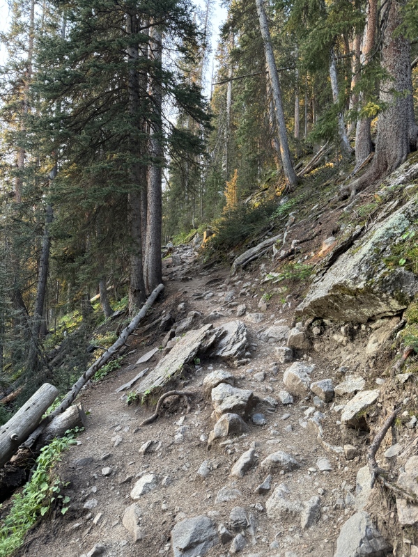
The trail is mostly forested until it doglegs hiker's left and you find yourself at the foot of the Sneffels Range front. At that point, the trail crosses some alpine meadows (i.e., avalanche chutes) that are loaded with wildflowers with clear views to the high peaks. You really appreciate that you're heading up to the high country and I was all smiles. 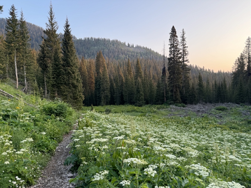
The second clearing offers a direct view to Sneffels and it really looms, even if it's not that far as the crow flies. I'll be honest--the roughness of the peak it and its towering stature gave me some jitters. But I was energized to keep hiking up into the basin. 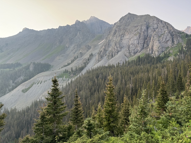
After another half mile, you reach Lower Blue Lake and the accompanying campground. It's a nice flat area that is very popular with campers and I saw numerous tents. Scenery around the lake was superb. The trail continues east and crosses the East Fork of Dallas Creek across some boulders. You should be able to easily get across the stream without getting wet. 
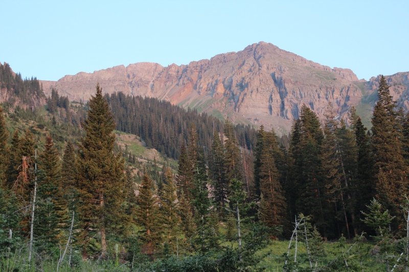
A note about trail overuse. A lot of people complain that post-pandemic Instagram has ruined the Blue Lakes approach and that social trails are destroying sensitive alpine vegetation--especially around Lower Blue Lake. The US Forest Service recently announced plans to implement a permitting system in 2026 to address overcrowding of the Blue Lakes Wilderness Area. My personal opinion is that the overuse damage was obvious, but I expected worse based on the reports and the damage is no where close to the overuse observed in popular East Coast trails. However, the area is no longer the pristine masterpiece it was a couple decades ago and "hiker metering" is probably the only way to get thing back under control. There are also too many dogs for my liking in these parts. I know there are dog lovers out there, but nobody really wants to hear your dog barking repeatedly in the high country. Blue Lakes and Gaining the Pass (Spectacular!) After you cross Dallas Creek, the trail steepens as you climb into the upper valley. Lower Blue Lake lies at the head of the main [glacially-carved] valley, whereas Middle and Upper Blue Lakes are one level higher in a hanging valley to the east. Gaining the elevation to reach the hanging valley is a nice leg burner and a harbinger for things to come. You hit treeline in the segment between Lower and Middle Blue Lake, and lord have mercy do the views open up. There are INCREDIBLE views of Lower Blue Lake and Dallas Peak from the trail. A little further up, there's a lovely rock perch that gives you a wide angle view of the lake with an exciting cliff drop-off immediately below you. It's not surprising why this place has become so popular in the social media era. The views are really that good. 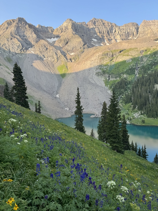
The trail winds its way up the valley and you eventually get to Middle Blue lake where the terrain flattens out. It's a brief and welcome respite. S4 Peak looms large to the west and is framed nicely by the valley. 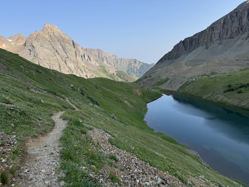
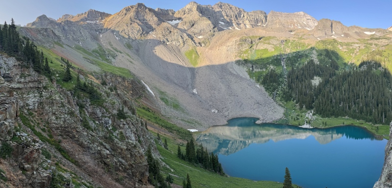
Just a little further up the valley is Upper Blue Lake, which is dramatically encircled with the Sneffels Range crest (the Block Tops, T1 and T3). There is also a big rock glacier encroaching on the far end of the lake. I reached Upper Blue Lake just as the sun was clearing Blue Lakes Pass and was mesmerized by the optics of the light reflecting off of the mountains and across the smooth lake, even though the sunlight had not yet reached the lake itself. It was a real optical curiosity and made an interesting hourglass effect of light on the lake. 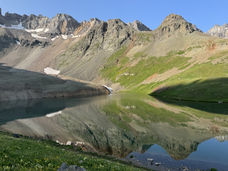
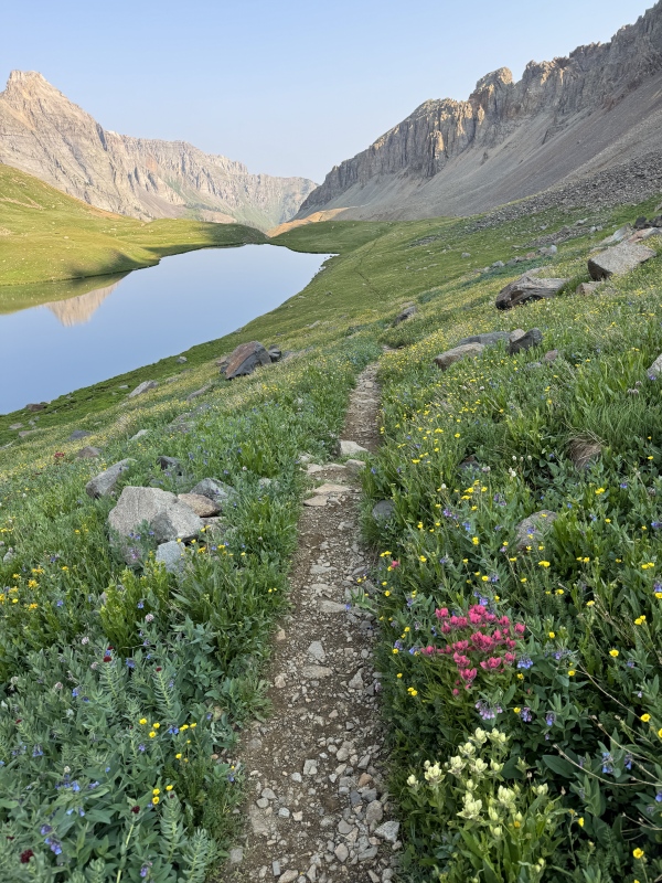
Most Blue Lakes hikers turn around at Upper Blue Lake and this makes sense. The remainder of the hike to Sneffels is considerably more difficult with a moderate-to-high misery factor. The next challenge is to gain the ridge and reach Blue Lakes Pass. The saddle sits high above Upper Blue Lake, and the trail includes some sixteen switchbacks through steep alpine meadow and eventually loose scree tundra near the top. It's high quality trail, but you still need to ascend ~1200 feet in 1.2 miles. My lack of acclimation was very apparent during this phase of the hike, but I was able to keep moving along. The views of the alpine scenery were exhilarating as I took my deep breaths. 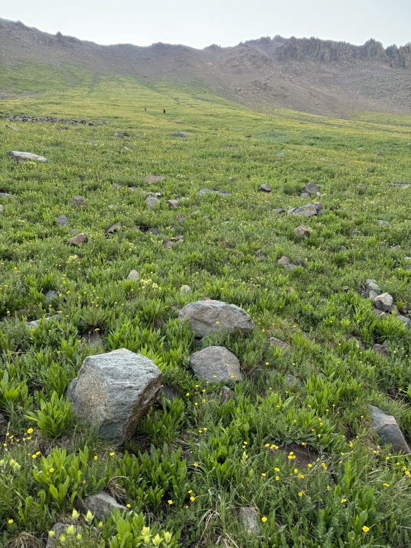
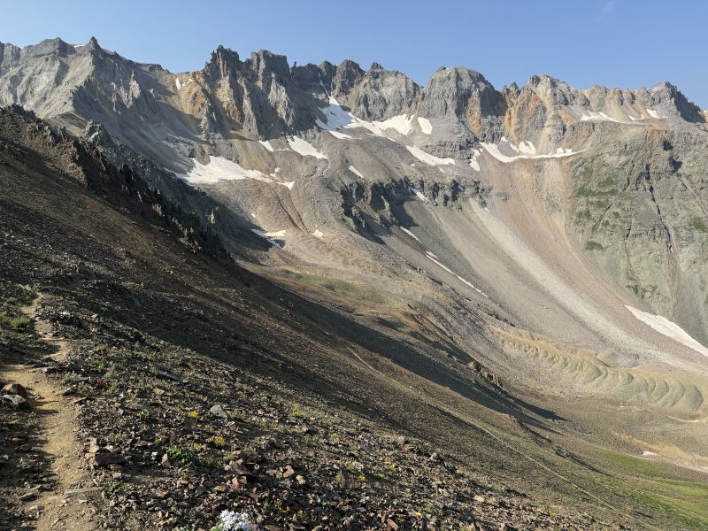
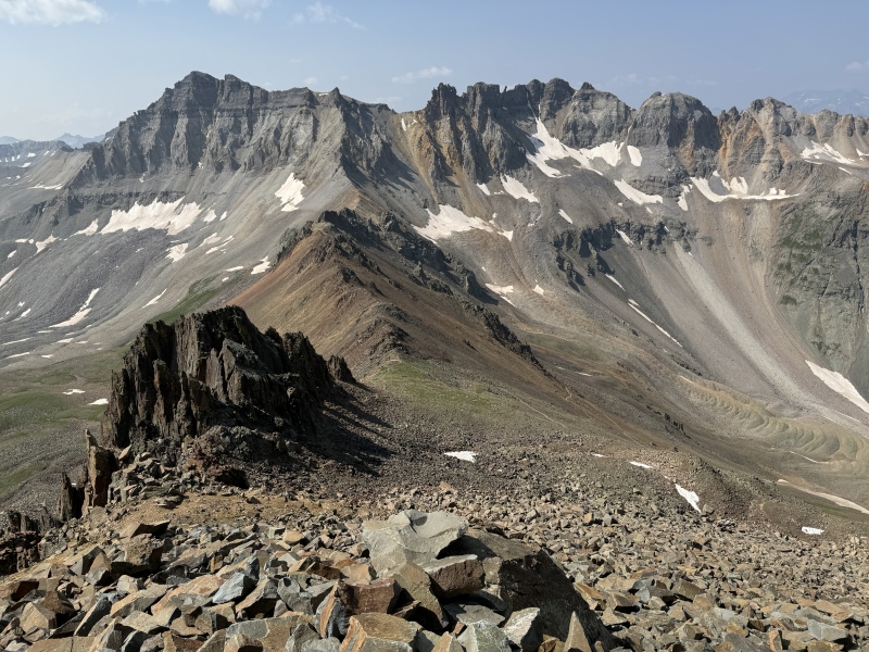
I reached the Blue Lakes Pass saddle at 10:20am. My time splits were fine/not great at this point; it had taken me a little under five hours to ascend 5.7 miles and 3650 feet. The Blue Lakes approach to the saddle is enough gain for some Front Range and Mosquito Range 14er hikes, but it's still 0.5 miles and 1150 feet short of the Sneffels summit. I also dramatically underestimated the amount of time it would take to ascend the ridge and descend the horrendous slope to get back to the pass. (Turns out it would be five hours for me to ascend/descend 1450 foot / 1.5 mile summit loop. Woof.) If you are planning this hike yourself, think carefully about timing and inclement weather risk. My forecast called for 0% chance of rain, so I wasn't really concerned with weather and didn't get the earliest alpine start. But it's something to consider when planning a hike during a strong monsoon pulse. Commitment after starting the ridge is considerable. Southwest Ridge Ascent (Spectacular!) After reaching the Blue Lakes Pass, the Sneffels Southwest Ridge looms large just to the north. The whole ridge is basically in sight from the saddle. It's a beautiful, steep, messy, rocky ridge and I thought there was generally no significant exposure until the final pitch just below the summit. Rock fall risk is real and I wore my helmet, but the giant rock pillars and spines break up the gullies and somehow keep the risk manageable compared to e.g., Kelso Ridge. Finally, I would say that there are only a handful of real Class 3 pitches on this route with the majority of the ridge being a REALLY steep and messy Class 2 hike. It's slow-going but there are incredible views all along the way. Bill Middlebrook has a great Sneffels Southwest Ridge route description on the site, so I will try not to duplicate his excellent content. My interest is to provide impressions as someone early in his Class 3 journey, this being my second attempt after Kelso Ridge. 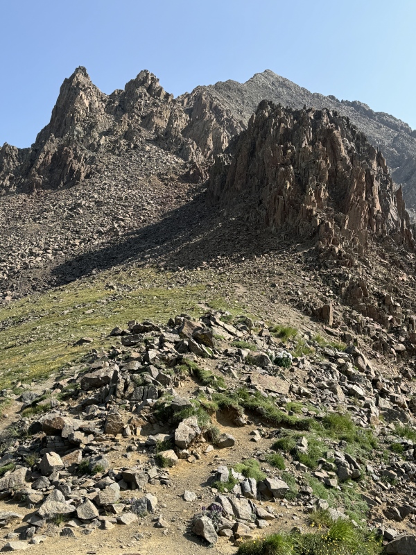
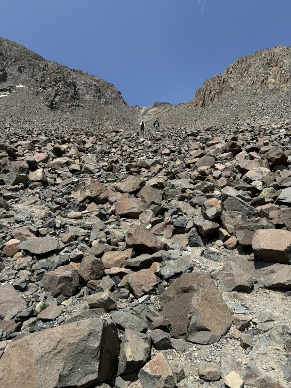
Sneffels Southwest Ridge has a series of stages between the saddle and the summit. The initial stage is to hike up the big lower rock gully towards to two giant "cat-ear pinnacles" nearly half-way up the ridge. The target is the left shoulder of right pinnacle. In between are lots and lots of rocks that you need to navigate. Sneffels talus is blockier than typical Telluride San Juan talus and I thought it was more stable some of my other hikes in the region. But it's slow and tedious making your way up the very steep slope. 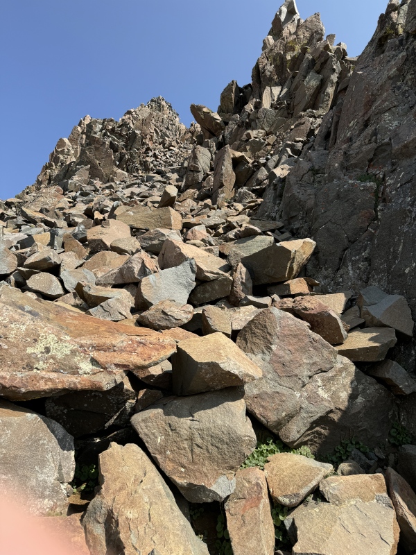
The top of the initial gully in between the giant cat-ear pinnacles has the first Class 3 rock pitch. It's a short pitch that requires only a few moves and it didn't take much time to quickly ascend to the top. If this pitch is a problem, it is probably best to turn around and take the South Slopes route. 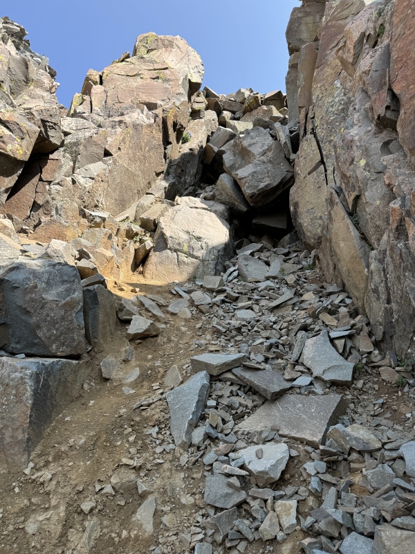
At the top of the short rock pitch, there's a small notch in the mountain that allows access to the east side of the ridge. From that threshold, you can admire a giant Gash where it looks like a big chunk of the ridge was chopped out with some giant coarse tool (Bill calls it a Notch, but Sneffels already has too many notches). Navigating through the Gash involves hiking down a dirty gully, maneuvering around the pinnacle obstacle, and then trudging up a loose gully to reach a big, steep rock pitch that will take you back to the ridge. 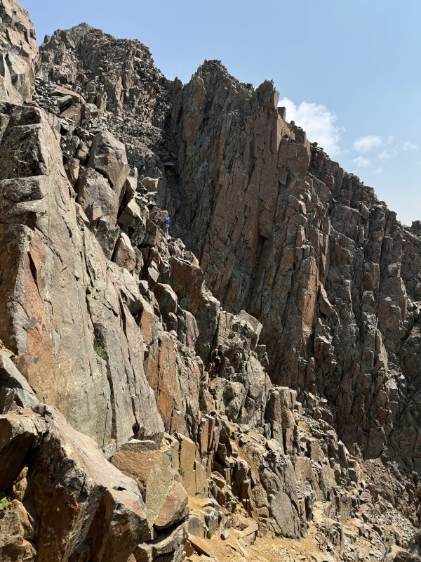
The rock pitch at the top of the Gash loose gully offers the best climbing of the day. It's a nice steep section that has high quality rock and requires legitimate Class 3 moves to climb to the top. I think this pitch is the crux of the route and a couple of the moves would be trickier with a shorter body frame. Regardless, I thought the pitch was great fun and there are plenty of good hand-holds and foot placements. 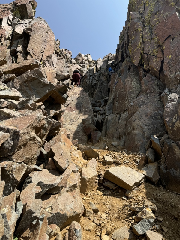
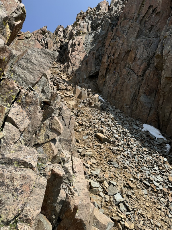
There is a series of Difficult Class 2 scrambles above the Class 3 pitch. Nothing technical, just steep and tedious terrain. The views also really open up with the Wilson Group becoming visible behind Dallas Peak. 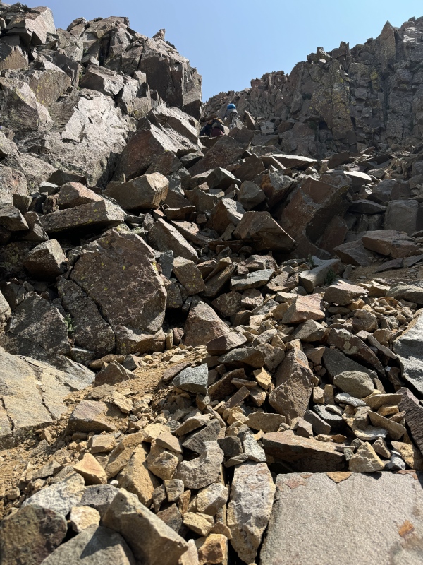
The messy, rocky gully continues up and passes the kissing camels towards another small notch that gives you access the the summit ridge. Keep trudging away! 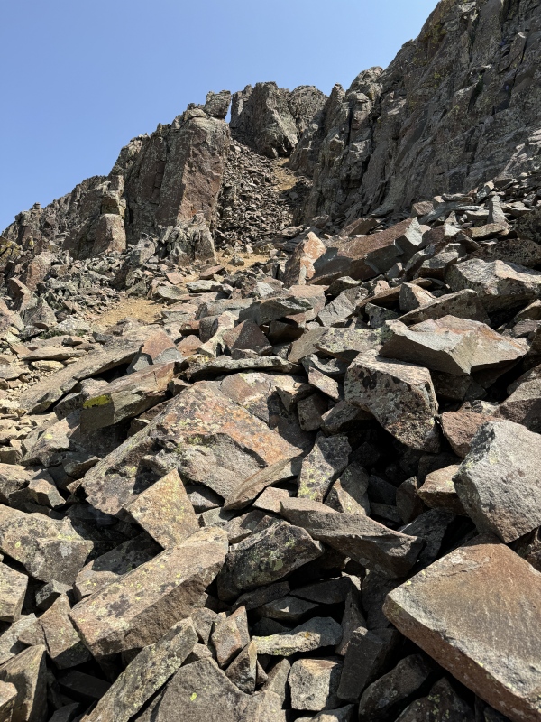
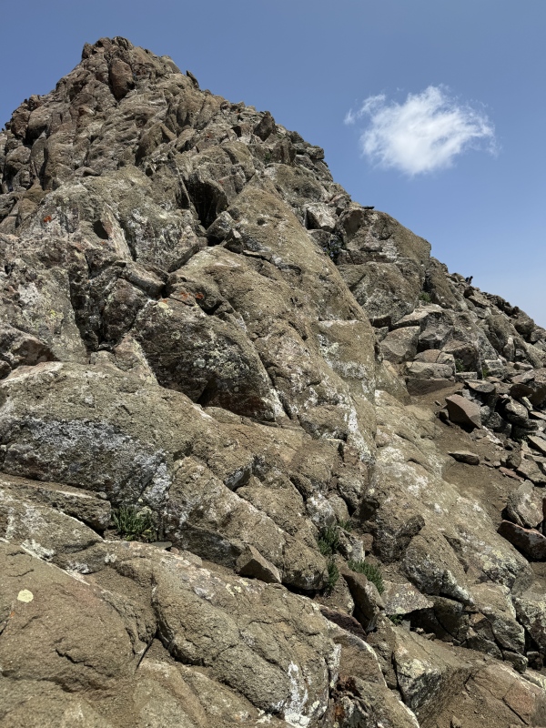
When you finally clear the rocky gully and reach the summit ridge through the upper notch, the summit is right there in front of you. There's still ~450ft of gain over 0.15 miles, so--if it's not obvious--it's a very steep summit push! The lower portion is littered with rocky talus, but the area immediately under the summit has excellent exposed igneous rock on a very steep ridge (talus-free!). It's airy and stunning up there. Unfortunately for me, I was freaking dying with the altitude on the final summit push. I had a very hard time catching my breath and was starting to develop a headache, which are classic early signs for AMS. My pace slowed to molasses, but I took some Advil, drank more water, persevered and eventually reached the top. [My plan was to descend via South Slopes, so my only real option was up.] 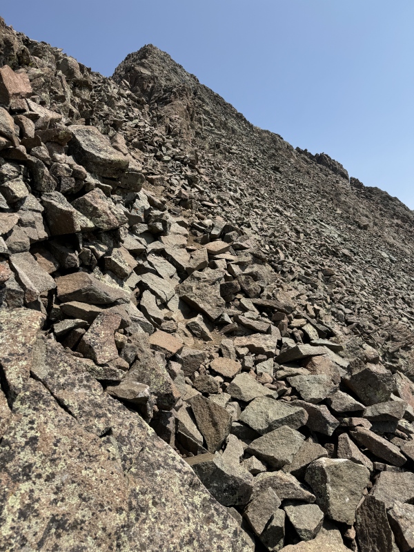
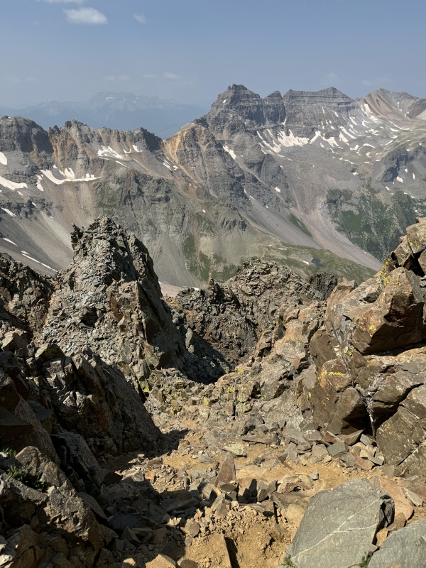
Sneffels Summit! (Spectacular!) Mount Sneffels' summit is as good as any that I have seen. There's great, rugged mountain scenery in almost every direction and you have clear views to the three Blue Lakes that you passed earlier in the day. Canadian wildfire smoke was slowly filtering in, so I didn't have those crisp views that really knock your socks off, but the San Juan air quality was fine and significantly better than the Front Range that day (Denver hit an AQI of 172!). 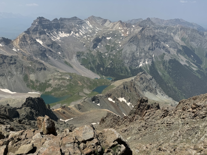
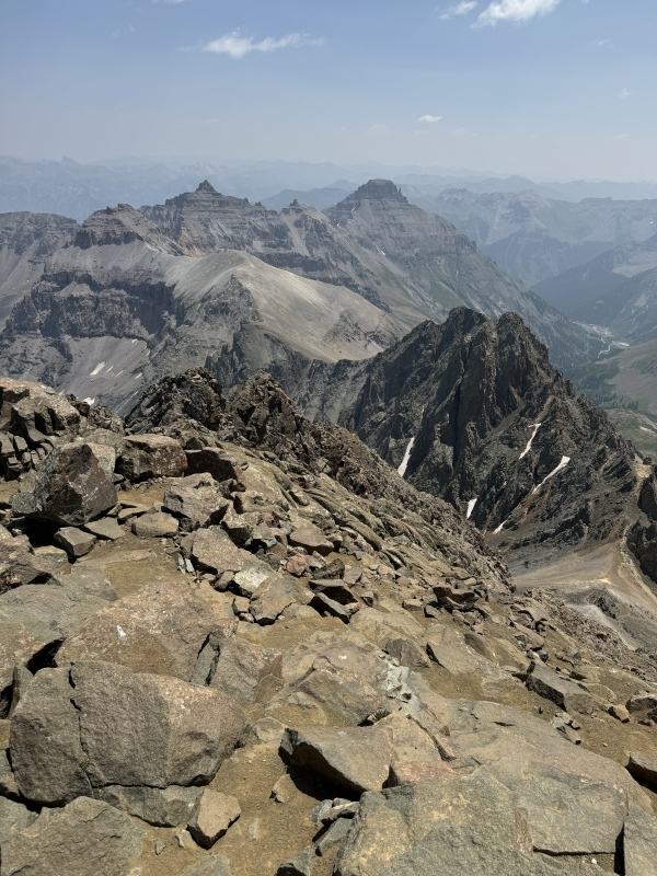
A note about the geology. Most of the San Juan peaks around Telluride are composed of stacks and stacks of volcaniclastic deposits from stratovolcanoes (~30Ma) topped with volcanic tuffs erupted from a series of Yellowstone-class supervolcanoes just to the east (~28Ma). Dallas Peak is a great representative example, where you see thick volcanic deposits of the San Juan Formation at its base (thousands of feet of near-source pyroclastic breccias and outflow volcaniclastics from scattered stratovolcanoes) and lighter colored, horizontally-bedded volcanic deposits on the upper third of the peak (nonwelded to densely welded rhyolitic ash-flow tuffs from at least three caldera-collapse supervolcanic eruptions). It's magnificent stuff! However, Mount Sneffels is distinctive from its immediate neighbors in that most of the rock in the mountain is from an intrusive stock of intermediate (dacite) magma that intruded into the existing volcanic deposits. This dacite rock has a different feel from typical Telluride-area San Juan scree in that it is slightly more competent rock that erodes into bigger blocks along steep slopes with numerous gullies and gendarmes. Rock talus and scree are abound, except in the area immediately around the summit that is steep sloped, talus-free exposure of excellent quality igneous rock. South Slopes Descent (Horrendous!) After you reach the Sneffels summit, you basically have two options to get back to the saddle, including (a) going back down the Southwest Ridge and dealing with the Class 3 terrain on the descent or (b) taking the non-technical but horrendous South Slopes, which involves descending down a series of horrible rock/dirt slopes and then dealing with a 300ft bonus ascent to re-gain the Blue Lakes Pass saddle. I chose the latter, but it's unclear to me which option takes less time to get back to the saddle. [One data point: I started descending approximately the same time as a different group that chose the ridge descent and we met again on the saddle. However, the South Slopes descent time really depends on how well you are able to plunge step down the slope, and I utterly failed in my attempt to do this, which meant SLOW GOING.] Heading down the South Slopes for the first time is tricky because you haven't scouted that side of the mountain. The only safe South Slopes descent option is the Lavender Col gully, and the only way to pass into this gully is through the Notch, i.e., the Sneffels feature famous for its Class 3 "Notch Move." If you miss the Notch on your descent but continue down, you will likely end up in one of the numerous dangerous, terrifying gullies on Sneffels' eastern slopes. There are memorable accounts from folks who descended this way and got into really bad spots. I spent a little time searching for the Notch, not knowing exactly what I was looking for. However, when you see that V-shaped notch in the big rock wall, it's pretty obvious. 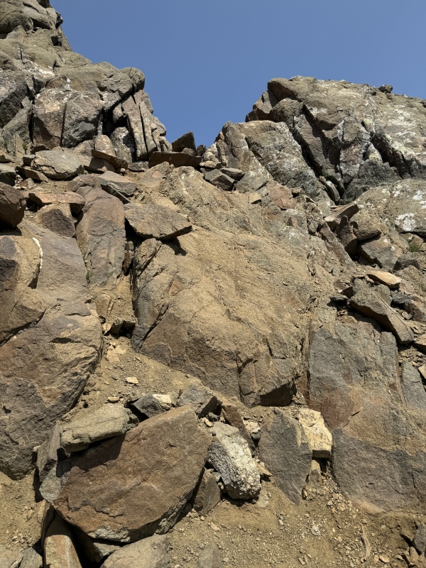
I had some anxiety about the Notch Move when I started the descent, but for me it was totally manageable compared to Southwest Slopes Class 3 maneuvers. The Notch Move is a little awkward, but there were enough spots for my hands to ensure stability, and there honestly wasn't any exposure if I were to lose my grip. It was fine. 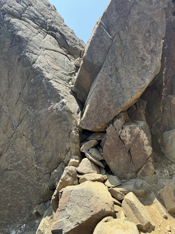
After passing though the Notch, you find yourself at the top of the Lavender Col gully, a steep ~400 foot gully with a dirt surface covered in big, angular talus blocks. There was nothing technical about descending this gully, but it's slow, tedious stuff. I hiked along the north wall (hiker's left) for stability. On the whole, it was fine. [One item of mention: the Lavender Col gully has a snow bank near its top that is usually the last thing to melt on Sneffels. By early summer, the snow is bulletproof in the morning and and people without proper gear often turn around, finding the snow bank impassable. Check out the Conditions Reports to understand what you will be dealing with before you start!] 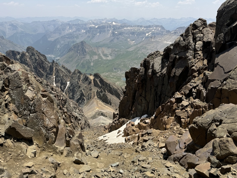
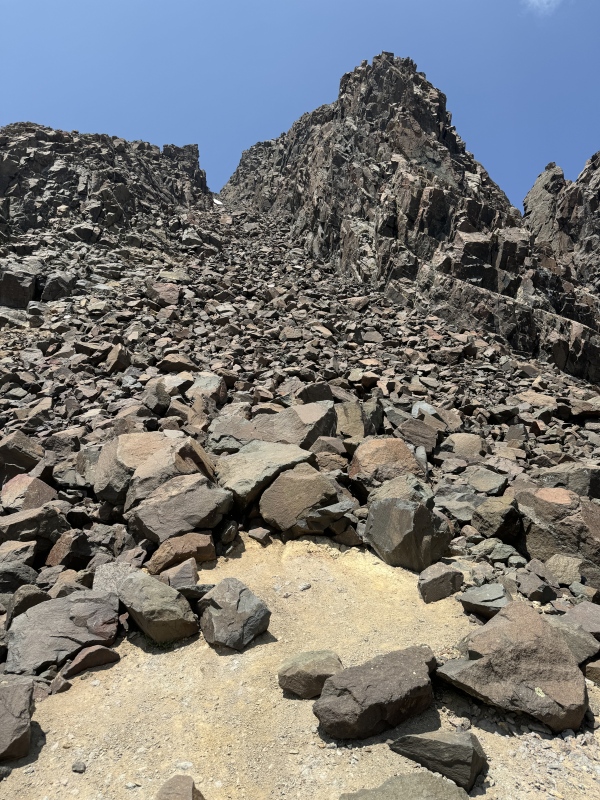
What I didn't appreciate at the Col was that the worst part was still in front of me. The South Slope is an 800 foot pile of poorly consolidated dirt and rock from Sneffels and Kismet that are slowly sliding down the mountain. It's a steep mess of crap. I thought the South Slope was horrible and no fun at all. It was a real Type 3 Fun experience (not fun at the time, not fun in retrospect) with high misery. I tried a couple strategies on descent, but really any time that I got moving too quickly, I ended up losing balance and sliding down the slope (sometimes hitting rocks). I thought it was demoralizing and confidence crushing, and I questioned my life choices. In the end, I took slow steps one-at-a-time and eventually made it to the bottom after an hour of tedium. 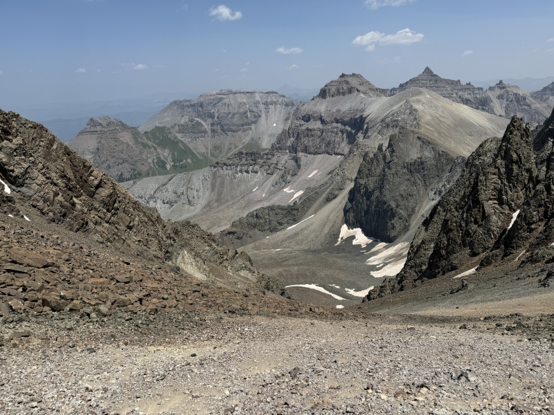
I had some equipment issues that made my life difficult on the South Slopes. One of my poles needed tightening and it kept telescoping whenever I leaned on it. I also had microspikes in my pack, but I was so weary that forgot to put them on. I think spikes would give traction in that loose dirt and help with stability. I was really happy to reach the bottom of the South Slope. When I got to the grassy flats, I linked back up with the two hikers that I met at the Gash. Their down experience was very bad because they had unfortunately missed the Notch and descended some other nightmarish East Slopes gully. They described their experience as really scary, super loose and ridiculously steep. Read Bill's Route Description! It might save your day! There's ~300ft of gain on Class 1 trail to reach the Blue Lakes Pass from the grassy flats. In retrospect, it was fine, but at the time, I thought it was salt in the wound. However, from that connector trail, you get perfect views of the Sneffels Ridge and Slopes and can piece together your day's experience from a single vantage point. 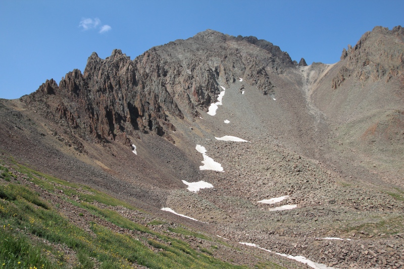
By the time I finally made it back to Blue Lakes Pass, I was thoroughly defeated. While the trail was only 1.5 miles for the loop back to Blue Lakes Pass, it had taken me over five hours to get back to the saddle. These are brutal splits, but honestly, very little of what I have hiked up to this adventure was representative of Sneffels' difficulty and terrain. You should plan accordingly and consider weather windows. Return to the Trailhead (Spectacular!) I reached the saddle at 3:15pm. From there, it's basically all downhill, but there's still 5.7 miles of high quality trail remaining. I pulled myself together, clocked in some respectable descent splits, and reached the trailhead at 5:38pm. This was hours later than my planning estimate, but at least I have some more accurate Class 3 pacing data for me (!). The Blue Lakes scenery never fails to impress and it sustains you through the return trip. 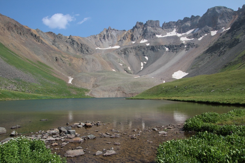
Final Thoughts on Sneffels Most of my Colorado 14er experience up to this point has been Sawatch and Front Range peaks, which have a very different character from Sneffels. Kelso Ridge is the only Class 3 hike that I had done before this hike, but Sneffels is a different beast. There are a number of items to consider with Sneffels if you are still early in your Class 3 experience: - Sneffels Southwest Ridge is much steeper than anything I've done in the Sawatch and is generally very rocky and loose. The route finding is also more involved than typical Class 2 hike-ups, which forces pauses and reflections. I would highly recommend starting with a Kelso Ridge or Sawtooth before attempting Sneffels Southwest Ridge. - I usually "make up time on descent," but the Sneffels descent options are frankly all difficult and slow. I think being near Sneffels' summit with inclement weather rolling in would be a very scary place to find myself. Adding water to those rock surfaces would also complicate rapid descent. Know your forecast and keep an eye on the sky! - I believe that the biggest part of my misery and slow pace was my poor acclimation. Sneffels's summit has ~60% of the oxygen of my East Coast residence and I allowed only three days of acclimation before attempting this hike. That was clearly not enough time, but honestly the human body won't properly respond to higher altitude stimulus for 2-3 weeks. Poor acclimation is the cost of jetting in and hiking on vacation, so I will quit my whining. But Coloradans should be able to clock in faster times! - I was completely demoralized when I reached my car. I was also exhausted after a 12 hour hiking adventure and wasn't sure if I should do any other 14er hikes. However, it only took a couple days for this "Type 2 Fun" experience to take root, and the incredible alpine views overtook my South Slopes misery (and acclimation challenges). Three days after this hike, I gave it another go and successfully summitted Shavano with time splits that were representative of my other Sawatch Class 2 14ers hikes. It's funny how the mind works. - Even with the difficulty of the day, I would offer that this route is the classic hiking option for Sneffels. Yankee Boy basin offers better off-road driving, but the lush scenery from the Blue Lakes Approach really makes this big hike a memorable day in the mountains. With enough time, I may even want to do this hike again! ;) Good luck with your adventures! Thumbnails for uploaded photos (click to open slideshow): ")
")
")
")
")
")
")
")
")
")
")
")
")
")
")
")
")
")
")
")
")
")
")
")
")
")
")
")
")
")
")
")
")
")
")
")
")
")
")
")
")
")
")
")
")
")
")
")
")
")
|
| Comments or Questions | ||||||||||||
|---|---|---|---|---|---|---|---|---|---|---|---|---|
|
Caution: The information contained in this report may not be accurate and should not be the only resource used in preparation for your climb. Failure to have the necessary experience, physical conditioning, supplies or equipment can result in injury or death. 14ers.com and the author(s) of this report provide no warranties, either express or implied, that the information provided is accurate or reliable. By using the information provided, you agree to indemnify and hold harmless 14ers.com and the report author(s) with respect to any claims and demands against them, including any attorney fees and expenses. Please read the 14ers.com Safety and Disclaimer pages for more information.
Please respect private property: 14ers.com supports the rights of private landowners to determine how and by whom their land will be used. In Colorado, it is your responsibility to determine if land is private and to obtain the appropriate permission before entering the property.