| Report Type | Full |
| Peak(s) |
Mt. Sneffels - 14,155 feet |
| Date Posted | 08/14/2024 |
| Date Climbed | 07/31/2024 |
| Author | Willy the Kid |
| Taking the Scenic Route up Sneffels |
|---|
|
*This is my first TR on this site, and while I have read many others, my craftsmanship could definitely be a bit better. Please forgive any strangely formatted photos, paragraphs, etc. If you are looking for beta for the Southwest Ridge, skip to "Day 2: Summit." If you are looking for times and mileage/vertical, skip to the very end, or "More Yapping." *All photos are from me, except for the one from the route description. How It All Started: The existence of the Blue Lakes Trail first came into my knowledge sometime last winter, when I saw a great photo somewhere online captioned: "Blue Lakes Trail, Colorado." It very well could have been one of those places that floats around in your head for awhile before eventually fading away, at some point soon after I found out you could access Mount Sneffels from there, a cool looking 14er. Now there were two places floating around in my head, so they occupied just a little bit more space in the back of my mind. Just a few weeks later, my birthday came around, and as a gift, my (awesome) Aunt gave me "one adventure, big or small." So, I quickly proposed that her, me, and my (awesome) Dad backpack the Blue Lakes Trail, and my Dad and I climb Sneffels while she holds down the fort. My Aunt, who isn't as keen about climbing or 14ers as my Dad and I am, as she lives on the East Coast, happily agreed to the backpacking to the lakes, and was equally happy that my Dad and I wouldn't force her up a 14er. After some planning for the backpacking and also figuring out some other San Juan peaks to climb while we were out there, the trip was official, and nobody (me) could wait until summer rolled around, bringing with it the promise of homework-less evenings and lots of fun on not snow-covered mountains. Now, to the real report: Day 1: Ascent After driving down from the Denver area and hiking around the Highland Mary Lakes near Ouray for a day, we packed up our bags, got some breakfast, and headed out to the Blue Lakes Trailhead in the late morning. We made some final adjustments to our packs and started up the trail, taking frequent breaks in the heat of midday for photos and water. 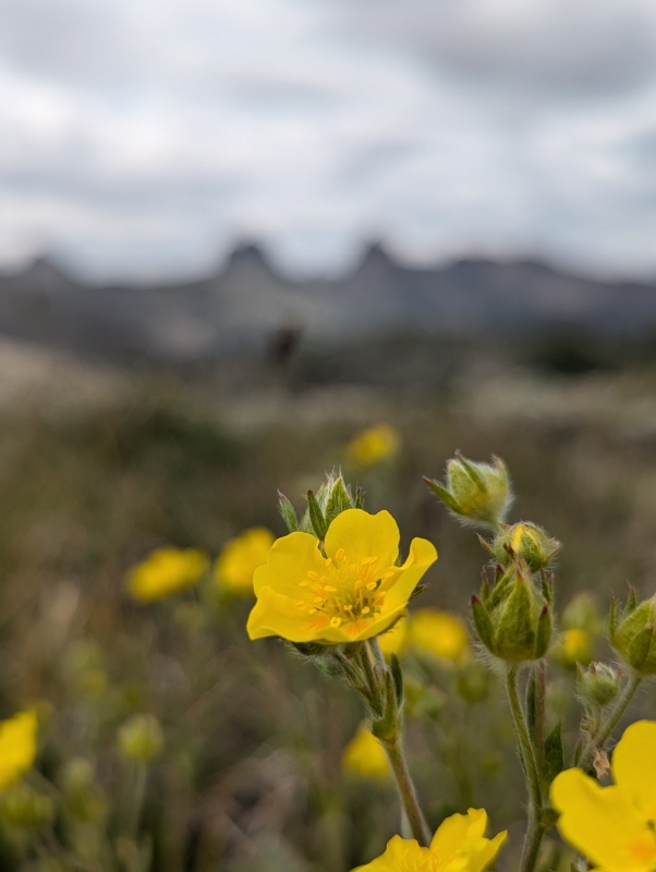
I think I was expecting a long walk through the forest up to the lake, but I sure was wrong. Apart from the first 500 or so vertical feet, there were meadows and avalanche run-outs quite frequently, which cleared the trees just enough to make for some seriously great views. If only there weren't so many day hikers! 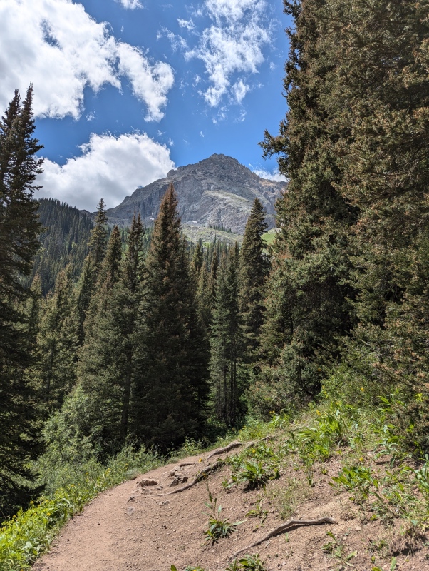
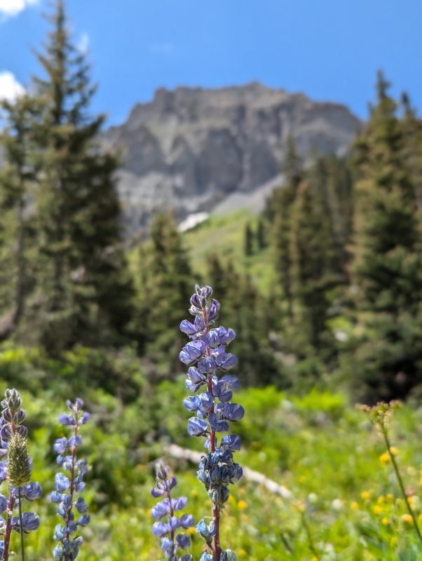
Once we reached the lake, we scouted around for a decent looking campsite, and eventually found a great one with room for both of our tents, a cooking area, and even a smooth log to sit on! After we got our tents set up, we moseyed on over to the lake, which is one of the few places in this state that I can say with confidence literally took my breath away. Blue Lakes sounds like a very generic name, but it really couldn't be more accurate of a description. And, to top it all off, there were flowers literally everywhere! I don't think I've ever seen a field with so many different varieties of healthy, vibrant flowers like the field on the side of Lower Blue Lake. It is sad to see how many social trails there are weaving through it, but luckily, there is a gravel trail that winds its way around the meadow that seems a bit too good to be unmaintained, so you can still enjoy the meadow without trampling flowers. 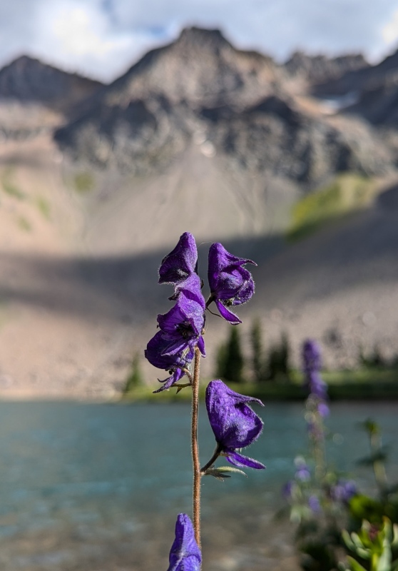

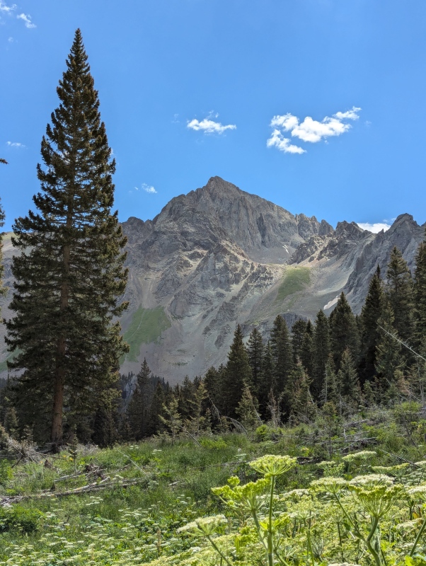
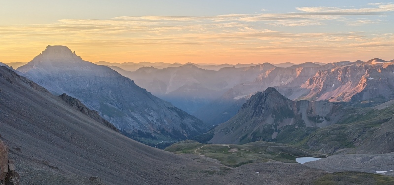
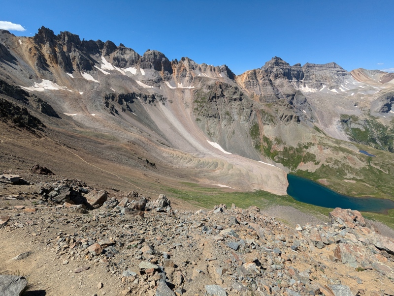
The lake was great, but after a little while, we decided that we had soaked it in enough (and we would be there for a lot more time than just that evening), so we filtered some water and retreated back to our tents to laze around and let the day-hiker crowds dissipate a little bit more before we cooked up some dinner. I personally brought two entire books, and was grateful for the company of them for this down time. A few hours of snoozing around later, we all got a little hungry and decided it was time for dinner, and so a meal of freeze dried Mac n' Cheese was quickly rehydrated and eaten. After a little more exploration around the lake and discussing our various plans for the next day, we separated into our tents again. Before we had gone out of cell phone range, I checked the weather for our summit day, and it was going to be perfect: not a chance of precipitation and sunny all day. However, not wanting to get caught high on Sneffels during an unforecasted storm, my Dad and I still decided to start early, ideally making it to Blue Lakes Pass and starting up the ridge around sunrise around 6, which would give us a lot of time to summit and get back below Blue Lakes Pass before storms usually move in, even on a normal day. We set our alarms for 3:45, even my (awesome) Aunt, who wasn't going with us to the summit but still wanted to bid adieu for the morning. Finally, we reviewed the route description one last time, read a little bit, and fell asleep. Day 2: Summit The sound of our alarms pierced the quiet night of the forest, and we quickly emerged from our tents, ate some dry cereal, got out our snacks from our bear canister, and made some final adjustments to our daypacks. We were surprised to see that a trio of headlamps from a larger group that had set up camp next to us the night before was also out and about, but they left a few minutes before we did. Finally, we said goodbye and set off into the darkness around 4:15. Right off of the bat, there is a creek crossing to follow the trail right as you are leaving the campsites, which would be difficult to find in the dark. We scouted it out the evening before, which I would highly recommend doing to make your day just a little bit easier if you are starting in the dark. After that, the trail is smooth sailing up to the switchbacks to the pass, where there are a few thin/eroded sections above 12,500. To our surprise, the trio of headlamps that we had seen in the campsite next to ours was just a few yards ahead of us almost the entire way up to Blue Lakes Pass. As we approached the pass in the predawn light, some views finally started coming out behind us, and we reached the pass just before sunrise at 6, which just like the lake, is one of the most beautiful sights I've ever seen. It's hard to describe the view, so I'll just let my pictures do the heavy lifting. 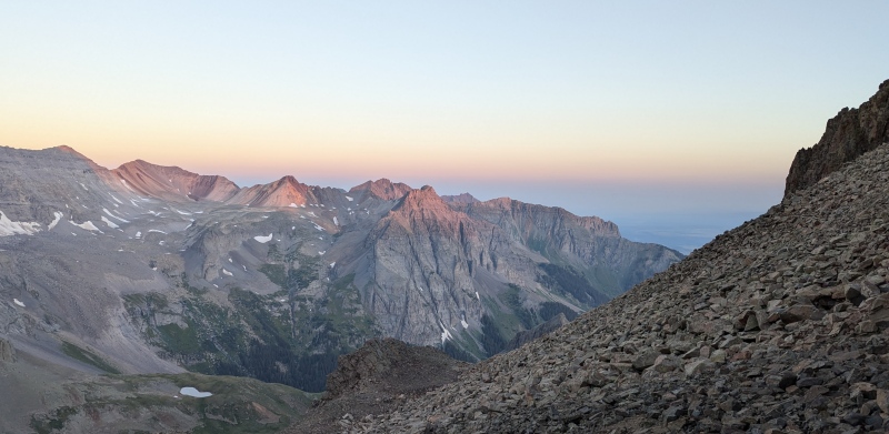
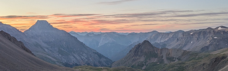
On the pass, we met up with the trio of headlamps we had been trailing, who ended up also planning to go up the Southwest Ridge. Their big group that had set up next to us was a family backpacking trip, and the trio's members were brothers in law who all enjoyed the mountains and decided to do a little bit more than just going up to the lakes. After a little bit of chatting, they asked if we would be up for combining forces to go up the ridge to make route finding a bit easier, which we agreed to. After all, five minds is better than two! After a quick snack and some photos, my Dad and I shrunk our trekking poles, put on our helmets and gloves, and started up the ridge. The first part of the route is pretty straightforward, you just shoot up the obvious gully, climb a short pitch, and turn right into a notch. The 50 foot descent after the notch to bypass the pinnacle is pretty nasty, though, be careful about rockfall and loose dirt. The re-ascent around the pinnacle is probably the most unpleasant part of the ridge, as it is steep, super loose scree; this is the only part of the ridge where I accidentally knocked a few rocks down (all stopping after just a few feet, thankfully). This is the part of the ridge that I would highly recommend having a helmet for, which you should have anyways for a mountain like Sneffels. I've read about multiple injuries sustained from rockfall on this route, and if there is one place where it is likely, it is in this gully. The steep pitch to exit the super loose gully is seen in photo #25 of the route description, and is the crux. While the rock on the actual scrambling is solid, there is a landing about halfway up with some loose rock that you could potentially knock off onto a partner below, so be careful there. The crux move, I would say, is the very top of the pitch, where you have to make a somewhat dynamic move to get your foot up to hip level onto the only feasible foothold. This might be a bit tough for shorter people; I am 5' 6", and it stood out on this route (I climb 5.11+ at the gym, but this was only my second real Class 3 route, for what it's worth). The 'big move' might be avoidable by picking a different line than us, which would be hard for a small width pitch like that, but you won't know if you're going a different way until you're done, so just be prepared. 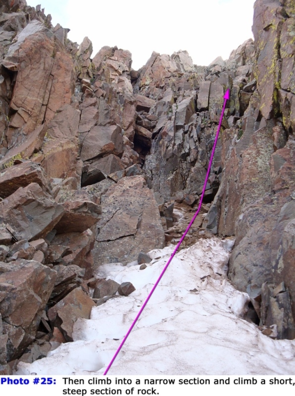
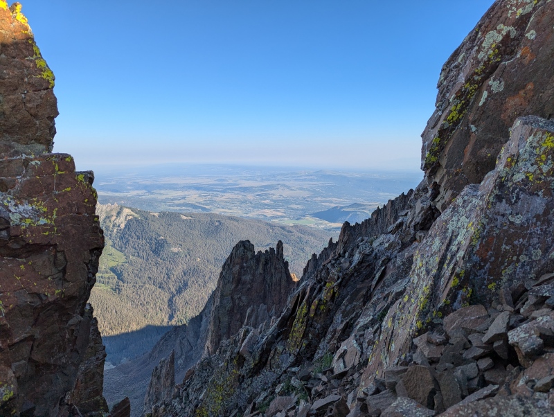
After the crux, you can't immediately match up photos from the route description to guide you up. However, there is really only one way up: continue up the gully you are already in. After a short amount of climbing, you should be able to match up route description photos again, and you will see the Kissing Camels on your left, which are really neat. 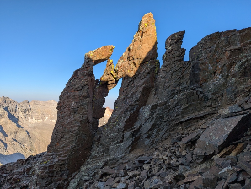
After the exit back to the ridge, the route is very straightforward, just continue up. The rock gets more solid the higher you go. Also, this depends on preference, but we found the climbing to be easiest, most enjoyable, and least exposed just to the right of the ridge. There was a faint climber's trail that guided us most of the way, and if you can find it, I'd stick with it. We finally made the summit around 8:15 and spent a good long time snacking, soaking in the views, and chatting with some guys from Texas that had come up the standard route. The weather was pretty much perfect; not too hot, not too cold, and no wind whatsoever. We couldn't have asked for better conditions. 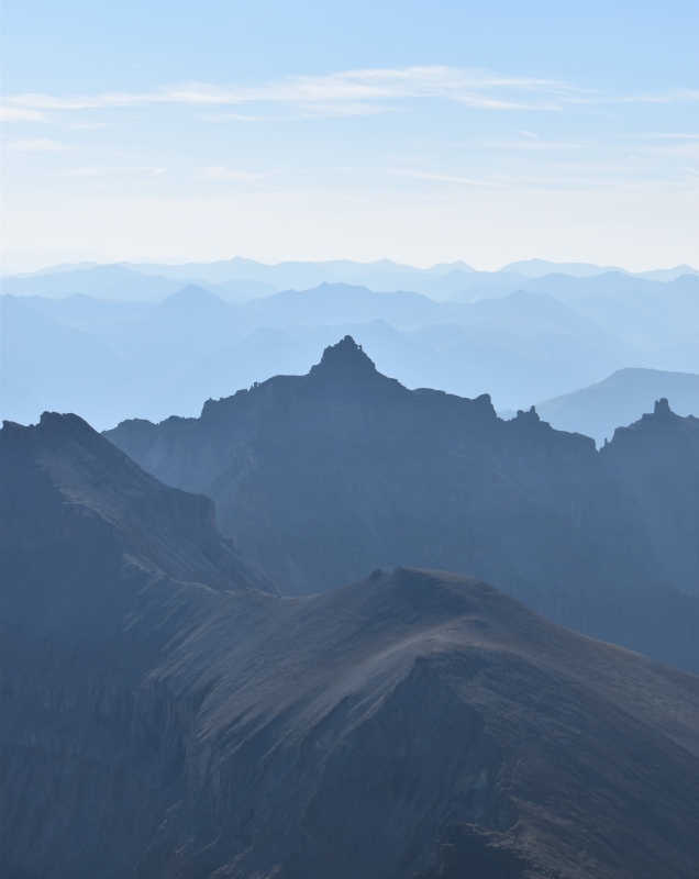
At about 9, we started our descent. The notch is every bit as blind as people make it out to be for down climbing, if you can get help to find footholds, take it. However, I didn't find the exposure to be bad at all. You'd have to practically jump to fall more than a few feet. That's just my opinion, though, everybody handles exposure differently. The initial gully that you descend isn't that bad, just a bit loose in spots. We all stuck to the skier's left, hugging the wall as much as possible, which I think is the best way to go. The longer gully after that is the real bad one. It's about 800 feet of purely nightmarish scree. There isn't really a great way to go down it, but sticking on the edge of the slippery, hardpan dirt and the loose talus, stepping on rocks rooted in the ground when possible, worked okay for me and my Dad. Except for the instances where we both slid onto our butts. And when my Dad somehow broke one of his poles in half when he slipped. Moral of Sneffels: steep scree sucks. I don't think it was nearly as bad for us as it was for one of the guys in the trio, though, who was experiencing some painful knee issues and had to take it a lot slower than us. We eventually ended up pulling ahead of them on the descent because of that, but the guy with knee issues pulled through and made it back to the campsites safely. Kudos to him! After taking a break at the base of the slope, my dad and I started back up to the pass, reaching it at about 11. We took another short break there to soak in the views one last time before starting down the 16 switchbacks (yes, I counted) to the Upper Lake. 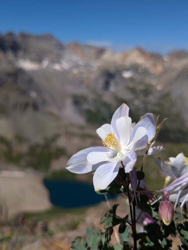
On the switchbacks, we began seeing more of the typical dayhiker crowds of this trail, including a guy with a bunch of dogs who had all apparently just thru-hiked the entire Colorado Trail! Those are some tough doggos! Anyways, walking through the verdant tundra above Upper Blue Lake again is almost as good a feeling as finally getting off of that scree slope of terror, especially with all of the flowers that are typical this time of year. 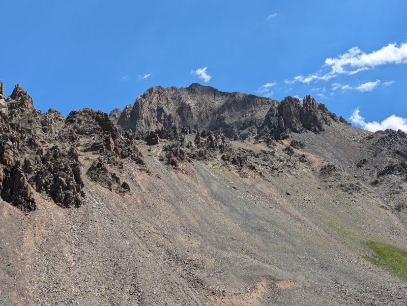
The further we descended, the bigger the crowds got, but everything went smoothly. A lot of the social media photos of the Blue Lakes Trail come from a lookout a few hundred feet above Lower Blue Lake, which is pictured below. 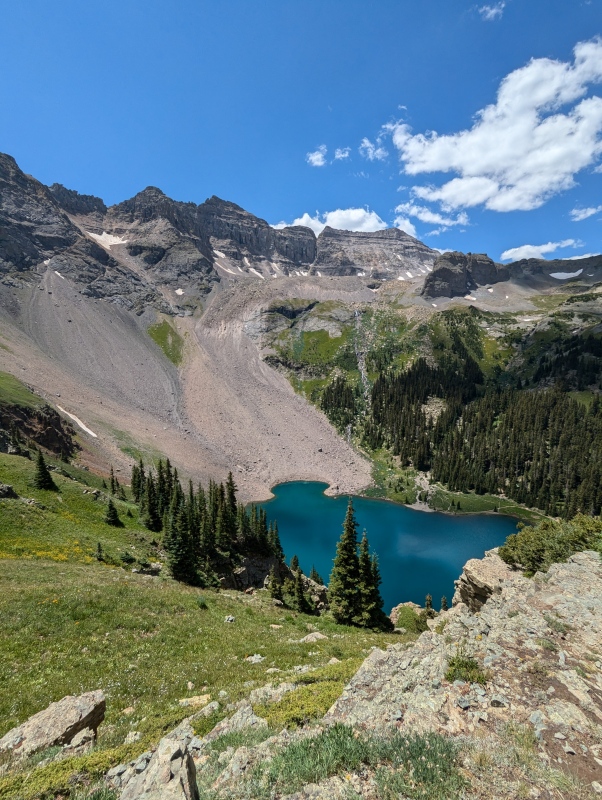
Lucky for us, the views were amazing the whole way down, and we couldn't have asked for a sunnier summer day to enjoy them with. 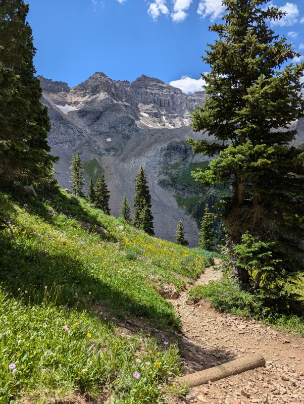
Eventually, we reached the creek that we had originally crossed in the dark, and found our way back through the maze of campsites to our tents and my Aunt. We finally reached refuge around 12:30, and were happily greeted by my Aunt, who became even happier once she saw our photos from sunrise. After a little bit of talking and a snack, we relaxed, content with the knowledge that we had successfully summited, had a great time, and wouldn't have to descend back to the trailhead until the following morning. The rest of the day was relaxed, filled with exploring the lake, reading, cooking, and talking, and the only thing that could have been better was our application of bug spray. We all got eaten alive until the moment we zipped up our tents. Day 3: Descent The next morning, we stopped by the lake one last time, packed up our bags, and started on down the trail. 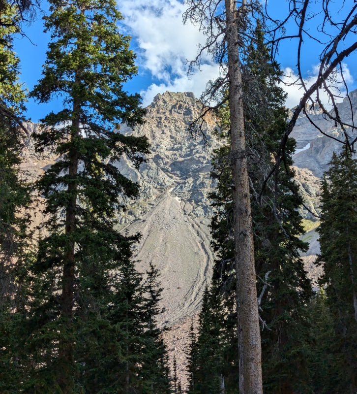
The descent back to the trailhead went smoothly, and it was nice talking with some other people who were hoping to summit Sneffels the next day. 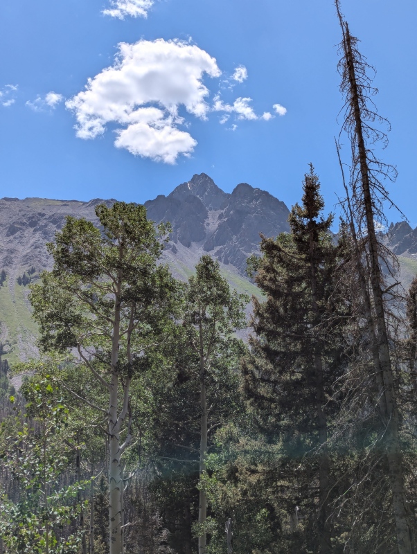
Then, we reached the car, which had been the mirthful gateway to this experience, and would be the almost melancholic way out. It's always sad how fleeting the mountains feel, no matter how long you stay up there. However, my Dad and I's trip was not over, as we were going to climb a few almost as beautiful peaks near Lake City in the days to come while my Aunt flew back home from Telluride. Before I go yap on even more about this trip, I would like to thank them both for making it happen. Anyways, here is some more yapping: More Yapping: Overall, I think this is a great way to climb Sneffels, and even if you don't do the Southwest Ridge, I would highly recommend backpacking up from Blue Lakes if you can find the time. The Southwest Ridge is fun, and the rock is solid where it matters. It certainly is daytrippable, but sunrise from Blue Lakes Pass is something special, and you would need to ascend nearly 4000 feet in the dark to make that happen on a daytrip. I would also highly recommend staying two nights as opposed to one to give yourself some time to breathe and soak in the lake a little bit more. I'm not sure if the permit system that might be in place next year will change things, but this truly is a great place to be. Like almost everybody, I agree that ascending the ridge is way more pleasant and fun than going up and down the scree gully, and anyone comfortable with scrambling should at least take it up. Now, it seems I have run out of things to yap about, so here are some of our times for summit day, moving at a (I think) fairly average pace, without any jogging, breaks included. We left camp at Lower Blue Lake at about 4:15 and were at the pass around 6, leaving it around 6:15. We reached the summit around 8:15, left it around 9, and were back at the pass just before 11, getting back to Lower Blue Lake at about 12:30. The one part of the day where I think we might have been able to move a little quicker if we weren't in the bigger group would be the scramble up the ridge, where we had to stop and wait several times for everybody to safely get up a section before continuing on. I tracked 6.7 miles, 3500 vertical feet RT for the day, about 3.5 miles, 1800 vertical feet one-way from the trailhead to the lake, and about 13.5 miles, 5300 vertical RT for the entire trip. I hope this report was either useful or entertaining to someone! Stay safe out there. Thumbnails for uploaded photos (click to open slideshow): ")
")
")
")
")
")
")
")
")
")
")
")
")
")
")
")
")
")
")
")
")
")
")
|
| Comments or Questions |
|---|
|
|
Caution: The information contained in this report may not be accurate and should not be the only resource used in preparation for your climb. Failure to have the necessary experience, physical conditioning, supplies or equipment can result in injury or death. 14ers.com and the author(s) of this report provide no warranties, either express or implied, that the information provided is accurate or reliable. By using the information provided, you agree to indemnify and hold harmless 14ers.com and the report author(s) with respect to any claims and demands against them, including any attorney fees and expenses. Please read the 14ers.com Safety and Disclaimer pages for more information.
Please respect private property: 14ers.com supports the rights of private landowners to determine how and by whom their land will be used. In Colorado, it is your responsibility to determine if land is private and to obtain the appropriate permission before entering the property.

