Download Agreement, Release, and Acknowledgement of Risk:
You (the person requesting this file download) fully understand mountain climbing ("Activity") involves risks and dangers of serious bodily injury, including permanent disability, paralysis, and death ("Risks") and you fully accept and assume all such risks and all responsibility for losses, costs, and damages you incur as a result of your participation in this Activity.
You acknowledge that information in the file you have chosen to download may not be accurate and may contain errors. You agree to assume all risks when using this information and agree to release and discharge 14ers.com, 14ers Inc. and the author(s) of such information (collectively, the "Released Parties").
You hereby discharge the Released Parties from all damages, actions, claims and liabilities of any nature, specifically including, but not limited to, damages, actions, claims and liabilities arising from or related to the negligence of the Released Parties. You further agree to indemnify, hold harmless and defend 14ers.com, 14ers Inc. and each of the other Released Parties from and against any loss, damage, liability and expense, including costs and attorney fees, incurred by 14ers.com, 14ers Inc. or any of the other Released Parties as a result of you using information provided on the 14ers.com or 14ers Inc. websites.
You have read this agreement, fully understand its terms and intend it to be a complete and unconditional release of all liability to the greatest extent allowed by law and agree that if any portion of this agreement is held to be invalid the balance, notwithstanding, shall continue in full force and effect.
By clicking "OK" you agree to these terms. If you DO NOT agree, click "Cancel"...
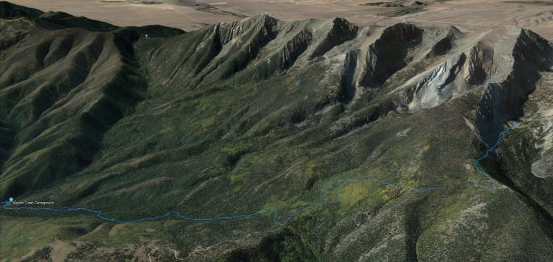
In our semi-serious attempt to bag the county highpoints, we hit a snag. That snag is Bushnell Peak. Bushnell peak is a 13,112' mountain in the Sangre De Cristo range, to the North of the Sangre 14ers. It's somewhat isolated, with no trail to the summit. Although not a difficult mountain, it presents some challenges. The "standard route" starts from the Hayden Creek Campground at 7800', and winds up the Rainbow Trail to the trail junction. In total, you climb about 5,500' of elevation gain and ABOUT 14 miles RT, 3 miles of which are off-trail. There are other routes that are less popular such as accessing the summit from the West but about the same difficulty level as this route.
Attempt 1: 9/1/2019
Route: Backpack from Hayden Creek CG to Bushnell Lakes.
We made it up the lakes OK, although it was a bit of a grind since we started around 11AM. We also found out later that one member of our party was newly pregnant and that was slowing her down a little. We pitched our tent at 11,070' next to Bushnell Lake. Unfortunately weather moved in that night and the wind was whipping our tent fiercely all night. We didn't sleep well and were cold and tired. In the morning it continued to be very windy and cold conditions. We decided to go back down to the trailhead instead of attempting to summit with the weather and how we were feeling. FAIL.
First attempt: stopped at lower Bushnell Lake
Attempt 2: 8/29/2020
Route: Dayhike from Hayden Creek CG to Bushnell East Ridge
This route looked promising, a bit shorter and maybe a little sporty. Unfortunately for us, weather moved in early. We got up to 12,100' and turned around and headed back. We were doing pretty good on time but the ridge proved to be slow going and much more challenging than anticipated. The combination of these two factors lead to our decision to abandon this attempt.
Second attempt. Stopped near the crux of the Bushnell East Ridge
Attempt 3: 8/30/2024: Dayhike from Hamilton Baldy trail access
Doing some map recon, I was trying to find the easiest / best trail access to Bushnell. I decided that to "beat" this mountain I needed a small advantage to tip the scales in our favor. I found a road that looked like it went right up the Rainbow Trail near the Bushnell Junction. I scoured the internet for trip reports using the Hamilton Baldy access point, and found none. I also discovered that different maps had the road depicted differently. With that in mind, I took a trip out to the Rainbow Trail with my son to scout this potential access point. It INDEED is an excellent access point, but with some caveats.
PROS: Closest and highest access to Bushnell Peak. Straightforward navigation. Saves about 5 miles RT and 1,500' vertical.
CONS: You end up driving 40-50 minutes on a sometimes rough and sometimes confusing dirt road to get there (10 miles)
GPS tracks of the drive from HWY 50 to Hamilton Baldy trail access
So on 8/29 we drove up the road and reached our starting point. Some interesting things about this area are: it is seldom used, there are some fantastic campsites in the area, and sometime you can get 4G / 5G cell phone service depending on the weather and the exact location you are standing.
As the sun set we were rewarded with some wonderfully clear views of stars and the milky way before clouds moved in, thunder started cracking, and we received some sporadic but intense bursts of rain. The rain quickly subsided and there was little wind to disturb us.
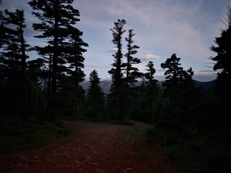
Night falls on "Hamilton Baldy"
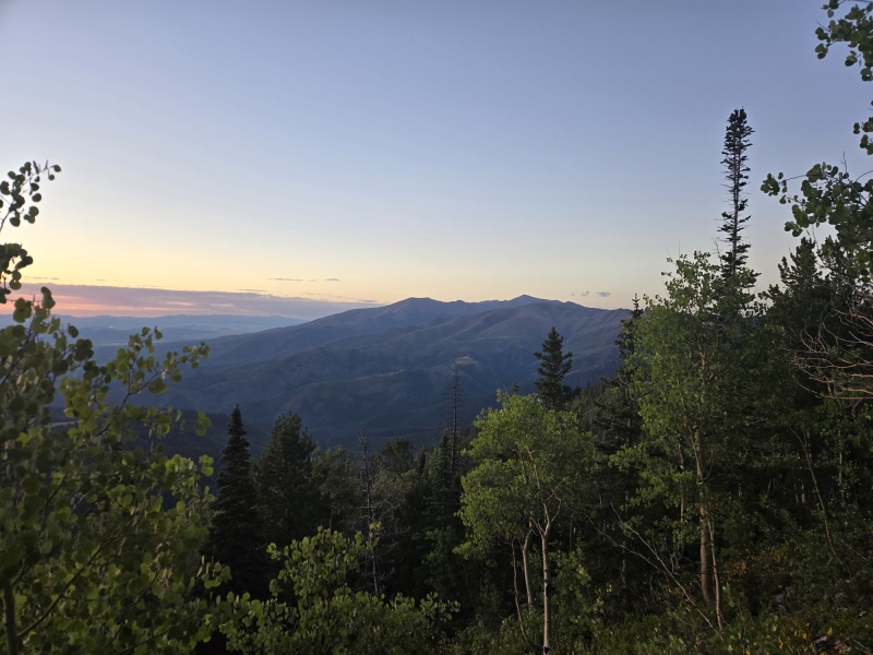
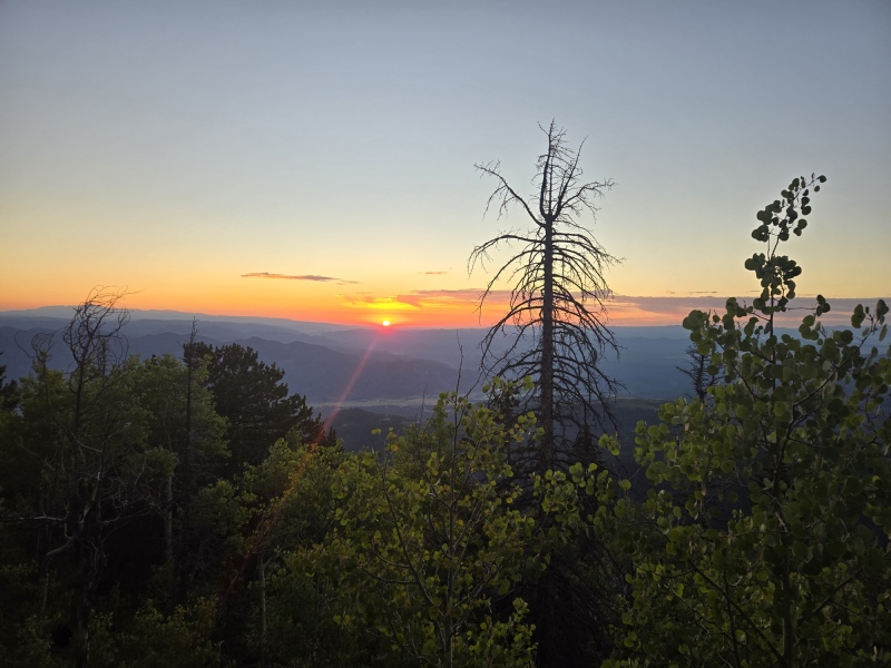
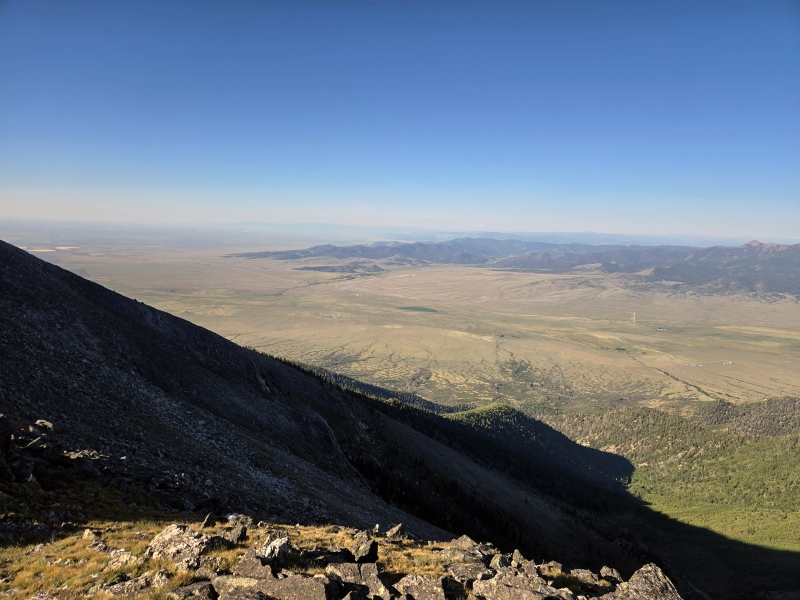
We woke at 5AM and departed for the trail at 5:20 AM - still very dark. From the Hamilton Baldy parking area it's only about 100 yards to the Rainbow Trail / Bushnell Lakes junction, and completely flat. The Bushnell lakes trail starts off heading West and gently climbing, before switching back and climbing up the side of the mountain proper. The first 30ish minutes we climbed in the dark, which was great because as the sun rose we got some fantastic views of the area.
Looking SE from the trail
Looking East from the trail as the sun rises... you can see the road way down below.
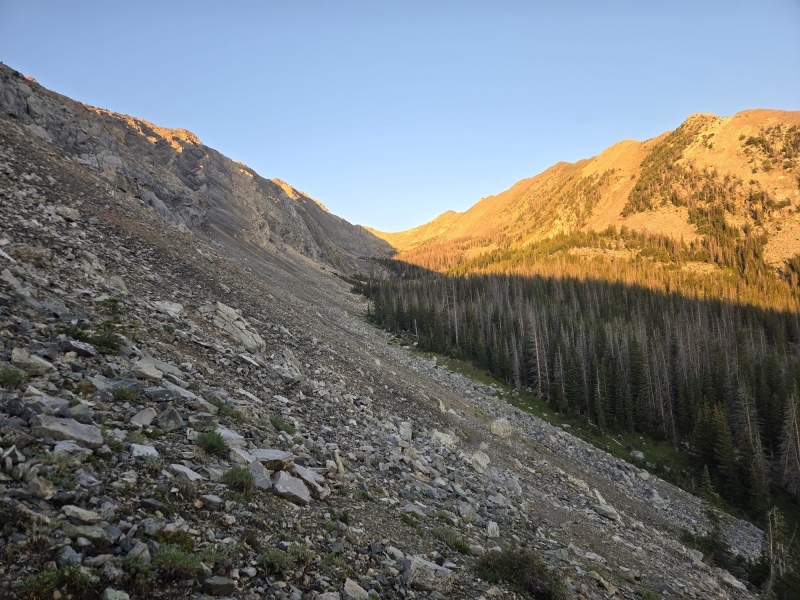
We quickly started climbing into the Bushnell lakes drainage as the trail traverses the lower slope of Bushnell.
Entering the Bushnell lakes drainage, finally.
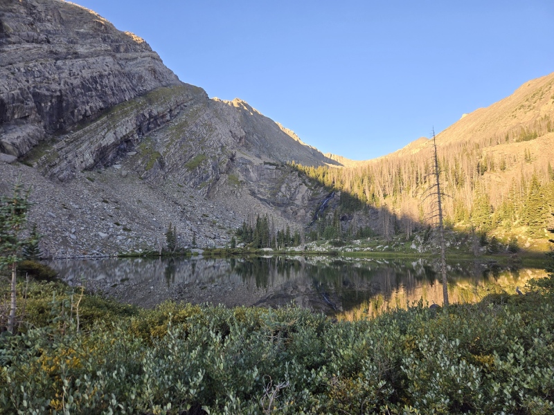
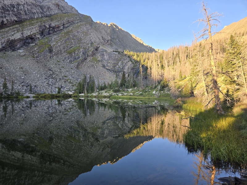
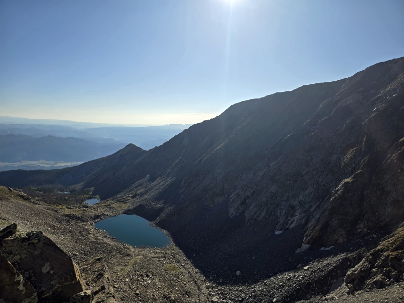
The Bushnell Lake drainage is beautiful and wouldn't be a terrible place to camp, especially if you like relative solitude.
Approaching the lowest lake
I love these reflection shots
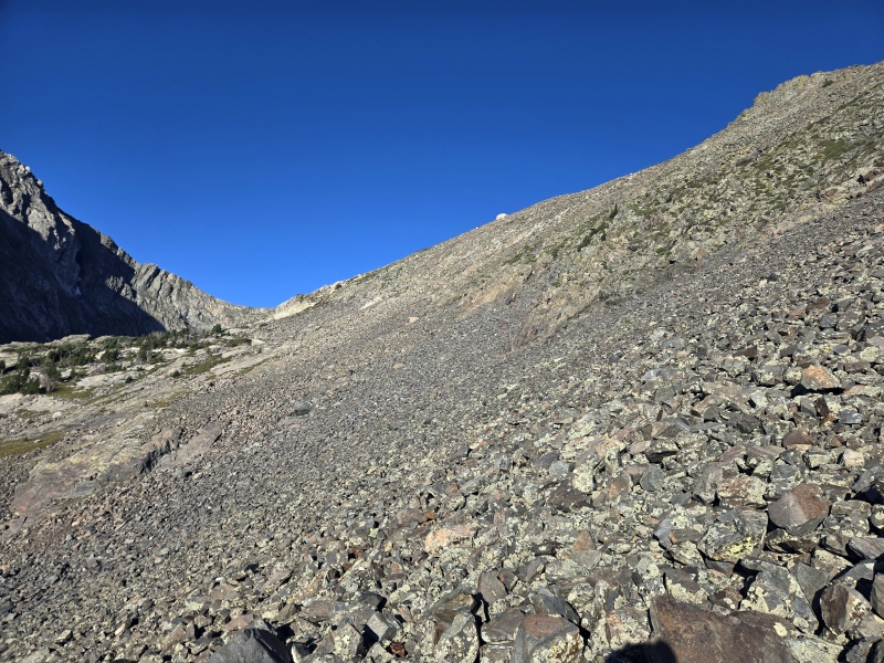
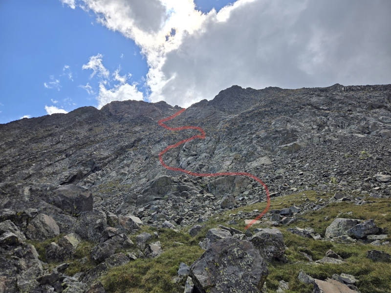
Once the first lake is reached, the trail becomes faint, but there's some light trails on the north side that make this part relatively painless. We just kept working our way "west and up". Eventually we reached the upper drainage at the base of the 3rd lake, and took a more or less direct route to the ridge. We called this the "white pylon" and we used it as a waypoint for navigation. We ended up gaining the ridge to climber's left (West) of the white pylon.
you can barely see the "white pylon" on the ridge, we traversed for a while and then aimed for climbers left.
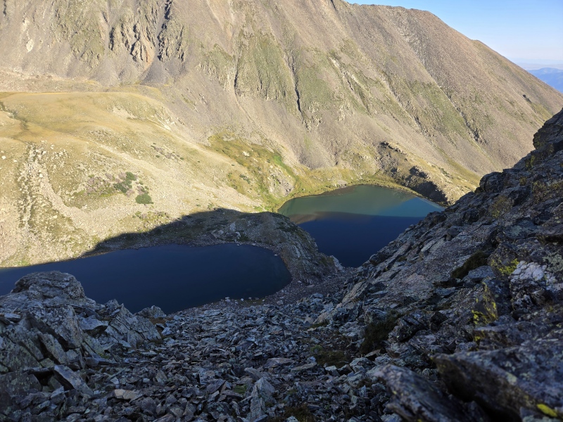
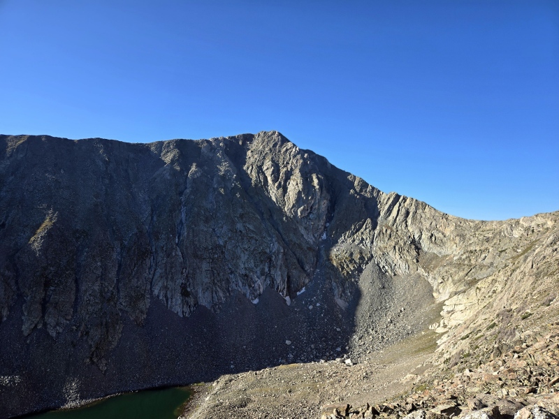
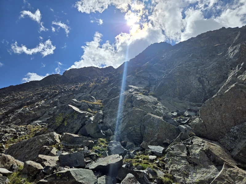
The ridge wasn't too bad, but we did end up skirting around some ridgetop obstacles always to the South (climber's left) as we worked our way up the ridge. There are a few places of extreme exposure to the North side, so use caution. It does get pretty exciting just under UN12730, I would put this as Class 3 with some exposure, there may be a class 2 path with some careful routefinding.
Stout Lakes from above - watch out for areas of intense exposure
Bushnell Peak as seen from across the valley
Once the saddle of UN12730 - Bushnell was attained, it was pretty easy going with some circumnavigation to the North (climber's right). From the bottom of the saddle, the summit of Bushnell is visible, and closer than it looks. The "crux" of this route is what we dubbed "white castle", a white buttress on the ridgeline. This can be ascended directly for easy class 3, or circumnavigated to climber's right for a class 2 route.
Looking East from the Saddle
Looking West from the Saddle
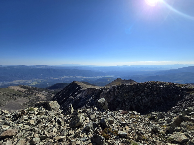
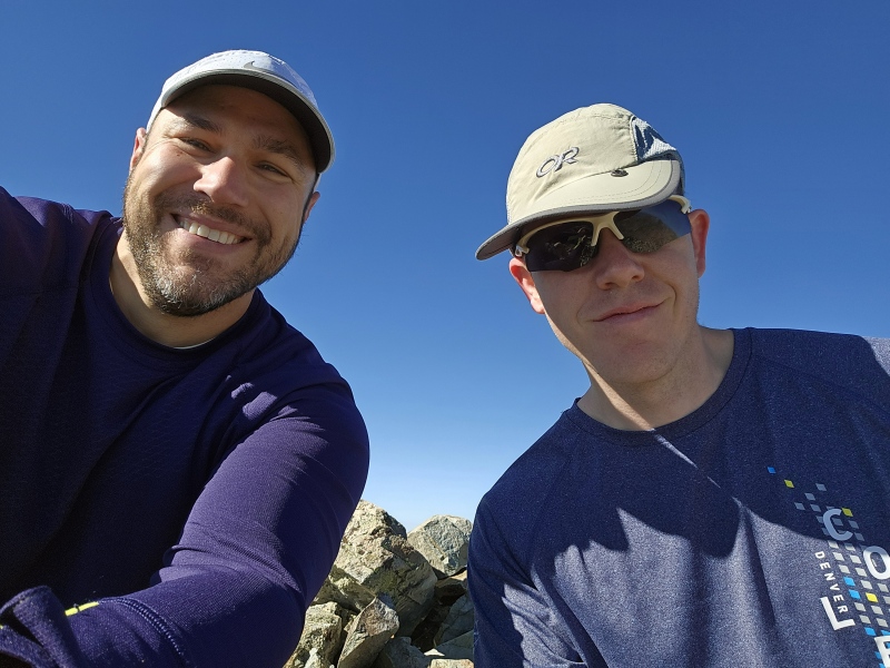
Before we knew it, we were (finally) standing on the summit of Bushnell Peak! This small summit has panoramic views in every direction - yes, there isn't a higher peak for at least a dozen miles in any direction. You've got a nice view of Shavano / Tabeguache to the north, and the Crestones to the South. To my surprise, we once again had good 5g coverage at the summit; you have a clear LOS to the Valley to the West - featuring HWY 285 and the metropolis of Villa Grove. We ate snacks and took some photos.
Looking East from the summit. You can see the ridge of deception center of the picture.
Why not?
And this is where the story starts to turn. We decided to take the Bushnell Ridge down instead of coming back the way we came. From the summit, it looks so quick and easy to return this way; and it had been 4 years since we were on that ridge to remember what it was like. I even had GPS tracks halfway up the ridge to ensure we didn't get lost. Win-win right?
The deception is that the difficult part of this ridge is completely hidden from view from the top. The first part of the ridge is very easy going, open with no exposure, just a grassy slope to tromp down. However, after 15-20 minutes things get a lot more complicated. The ridge narrows tremendously. The exposure increases dramatically. Soon you are faced with rocky class 3 downclimbing with exposure on both sides. The rock is generally good, but I HATE exposed downclimbing like this. We skirted the first 3 obstacles by dropping down on the sides to the right or left. But eventually our luck ran out. We were faced with a very narrow ridgeline with incredibly steep drops on both sides. Neither side looked like there was a feasible workaround. First we tried the South aka "sunny side" of the ridge. It didn't look good. There was a large slab of solid rock with good exposure below and devoid of obvious handholds. Next we checked the dark side, the north. Also looked bad.
And that's when we decided to bail on the ridge. We made this decision knowing that it was a dangerous choice. In fact, several people have died making similar decisions on other mountains. We were taking an unknown route down a steep slope with no trail or route known. I would never recommend this choice to anyone.
The first 50' of the bailout route were easy, but it quickly became more treacherous as we carefully navigated grassy ledges and rocky outcroppings. We were afraid of slipping and falling, or getting cliffed-out as we made our way down the steep slope. This is where our bond as team-mates really came into play. My stress levels were through the roof, but we kept talking to each other. "I think this will work" "This way is no good" etc. It didn't help that the rock quality on the north face was pretty bad. We had to check and double-check holds before trusting them with our weight. Rocks were dislodged and we had to be careful about our team positioning to avoid injury. As we descended slowly, traversing grassy ledges, we could see the tops of some cliffs directly below us- certainly not reassuring. I was so nervous that I deliberately did not take any photos during this time. As we worked our way down, we angled to the left, shooting for a grassy ledge underneath a near-vertical rock slab. I think it took about an hour to work down to that point. After slow progress, it finally looked like we were going to make it.
The waves of relief washed over us as we finally reached more hospitable ground near the foot of the upper lake. I realized that I had been clenching my jaw, and had cramped my jaw muscles. I hadn't drank a drop of water or snapped a single photo. But we knew we made it, and everything else to follow was just a slog. So we slowly worked our way down the Bushnell lakes drainage, getting lost several times. In hindsight, climbing up about 50-60' up the south side and retracing our earlier steps probably would have made things easier.
Looking up after reaching "the bottom" of the slope
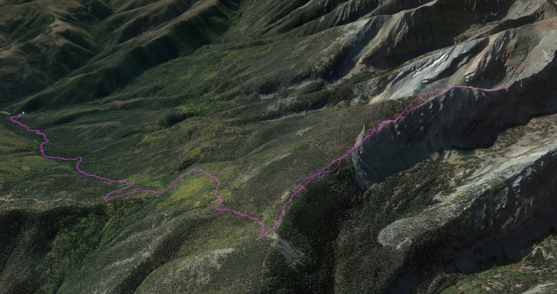
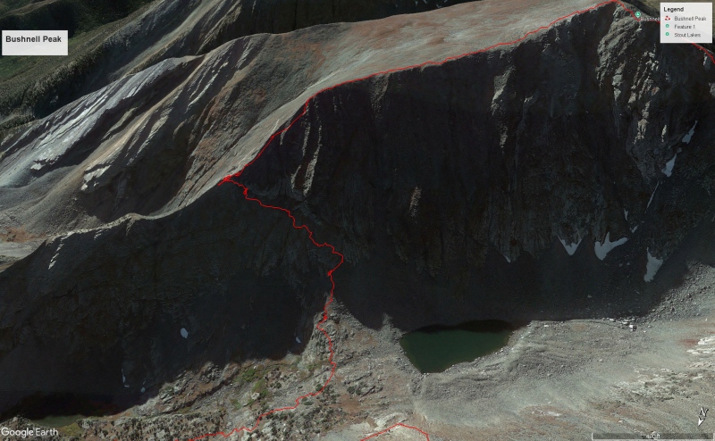
Rough depiction of the descent route... note that the upper half is hiddenGoogle Earth depiction of our descent route using KML tracks. I don't necessarily endorse this route.
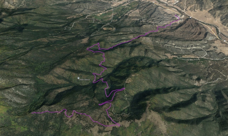
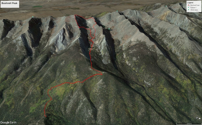
Google Earth depiction of the entire route
Final tally: 8.6 miles, ~4,000' of gain. I am proud that we summitted, but wary of the route we took. I would not recommend what we did to anyone except extremely experienced climbers. In fact, I would caution anyone on the Bushnell East ridge route without a strong climbing team and extreme comfort with exposed moves on mostly good rock. The West side approach is probably the safest choice based on what we could see from the top, and trip reports that I've read.
Bushnell is a mountain, and we survived climbing it. But I don't think we'll be back... ever.
My GPS Tracks on Google Maps (made from a .GPX file upload):
Nice work! I attempted Bushnell last year in November without success. I started from Hayden Creek, and on the way back took a short detour to the top of Hamilton Baldy. It's great to know that makes for a viable approach as well. There is a TR from 2012 that describes how intense the East Ridge can get.
One question I have for you: you mentioned gaining the initial ridge near the "white pylon" via a direct route. How bad was the scree? I tried to gain the same ridge further east of there (before the final lake) and couldn't get far up the steep scree slope. If the spot where you ascended is better, I may give it another go soon.
Thanks for your comment! Once we started ascending directly it was very good, there was some grass which really helps hold the slope together. Prior to ascending, we DID have some side-hilling on loose talus for maybe 200 yards, honestly wasn't great. Until we reached the saddle, it was relatively slow going. Due to the nature of the route, I would recommend a climbing buddy if you can find one, and do not be deceived into taking the East Ridge. We spread out a little to avoid hitting each other with dislodged rocks.
From the saddle to the summit isn't too bad, it goes quickly and the rock quality is fine.
Caution: The information contained in this report may not be accurate and should not be the only resource used in preparation for your climb. Failure to have the necessary experience, physical conditioning, supplies or equipment can result in injury or death. 14ers.com and the author(s) of this report provide no warranties, either express or implied, that the information provided is accurate or reliable. By using the information provided, you agree to indemnify and hold harmless 14ers.com and the report author(s) with respect to any claims and demands against them, including any attorney fees and expenses. Please read the 14ers.com Safety and Disclaimer pages for more information.
Please respect private property: 14ers.com supports the rights of private landowners to determine how and by whom their land will be used. In Colorado, it is your responsibility to determine if land is private and to obtain the appropriate permission before entering the property.


")
")
")
")
")
")
")
")
")
")
")
")
")
")
")
")
")
")
")
")