| Report Type | Full |
| Peak(s) |
Unnamed 13155 - 13,155 feet Unnamed 13110 - 13,110 feet Unnamed 13108 - 13,108 feet |
| Date Posted | 08/10/2024 |
| Date Climbed | 07/19/2024 |
| Author | astranko |
| 2wDriver - Bushwhacking Nellie Creek East |
|---|
|
The information on climbing these peaks is broadly already available in other reports. They are Class 1/2 peaks that can be easily tagged in a collection from Nellie Creek Trailhead, especially the upper trailhead. Where information is lacking is if you are a bum like me: I am proudly 4x4-less. I make an effort to use my Chevro-legs to get where I can in lieu of gasoline. A great and indomitable Prius takes me where I want to go. One of the fortunate results of this is that I get to "Be the Beta." Often my routes look different because I am starting at a different place than others. Sometimes this is a good idea, and other times it's not. I'm writing this report to expand the information available to others like me! I started my day using my Toe-yotas at the Nellie Creek 2wd Trailhead. I was fortunate enough to catch a ride up about half the road from a passing car. I'm cheap, not stupid, ya know? The first objective is UN 13,155, a 13er connected via beautiful ridge line up to Uncompahgre. As seen in the GPX track, I broke from the Uncompahgre trail around 12,100ft and took the path of perceived least resistance across the basin. This was mostly done in the dark by beating on the GPS and making good guesses. I was at the saddle at approximately sunrise. 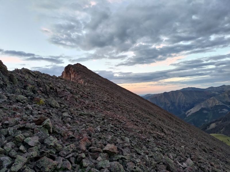
The ridge from the saddle has a faint social trail leading simply to the summit at Class 2. 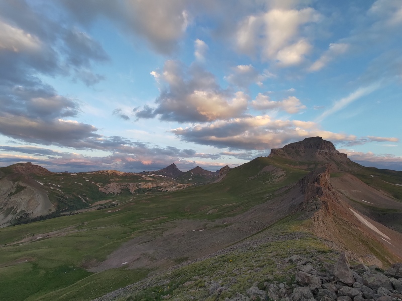
Retracing myself through the basin, I regained the trail and took it to the pass between Nellie Creek and Big Blue Basin. 
The ridge to UN 13,110 is quick work on mostly grass. As you near the summit area, it becomes broken Cimarron rock that navigates like a simple maze. You can either run on top of it or through it's contours. It is a real treat and worth visiting. 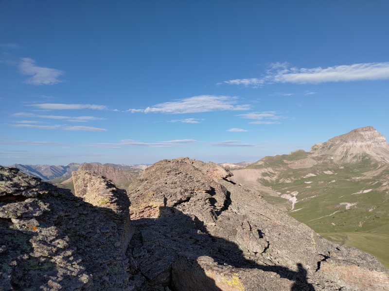
The traverse over to UN 13,108 has the opportunity to be quite silly. There is an obvious-in-retrospect cliff band that can be easily navigated around either from dropping earlier or later than I. The dead center of the band went at... too much for the day. 5.easy. From the top there are lines that look like they go, and they do, but ultimately it will be faster just to go around. 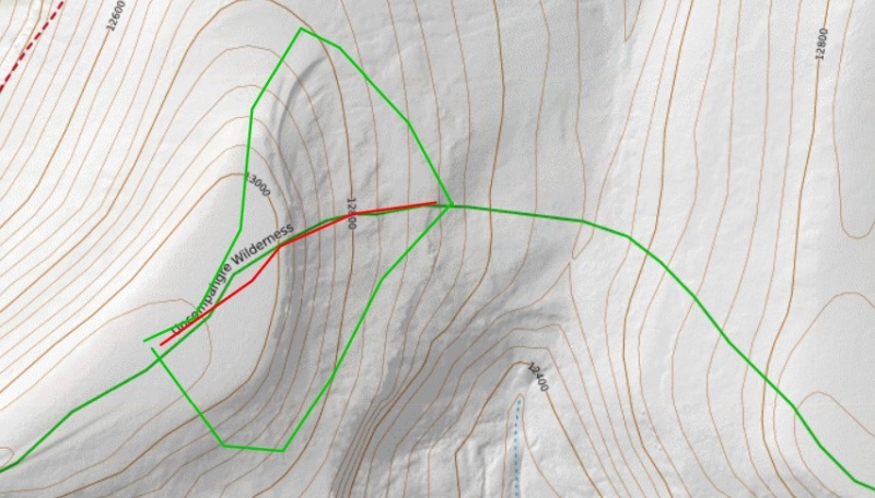
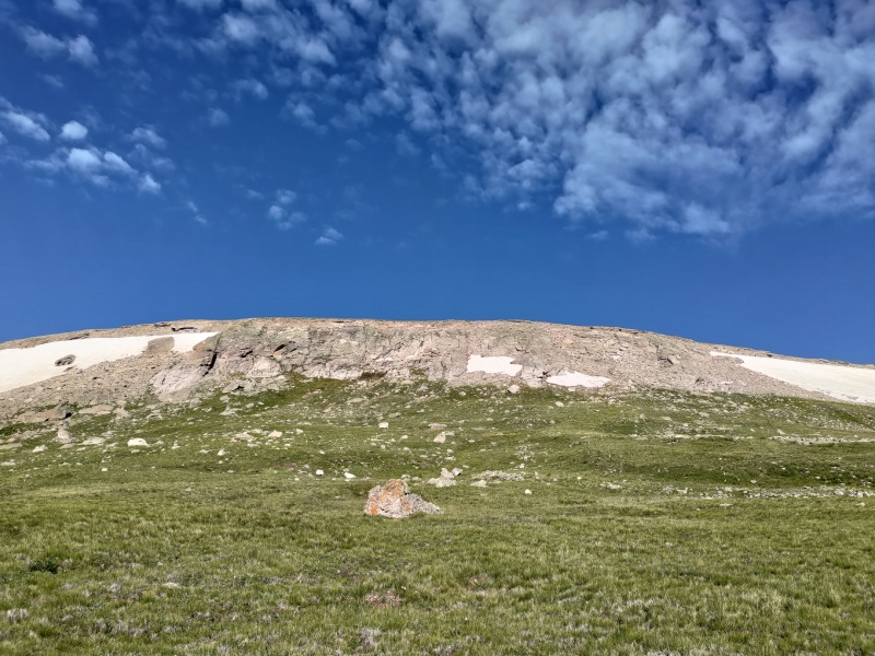
The rest of the ascent up to UN 13,108 is uneventful: grass, some chiprock, some talus, and more grass. Easy as can be. 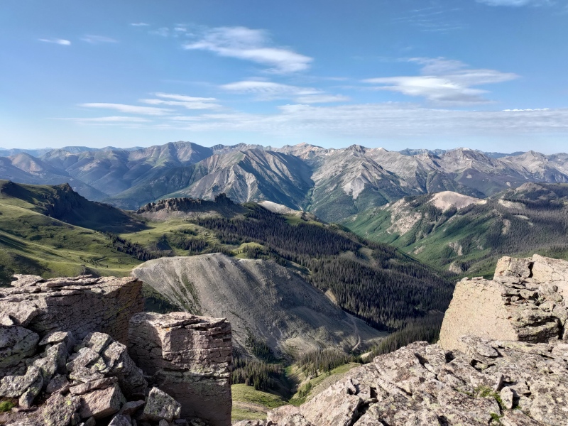
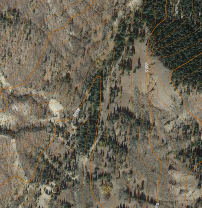
Now for the real beta. The goal was to intersect with the old "Jeep Trail" as seen on the old USFS quads. I was initially heartened by scanning satellite imagery and seeing the remnants of what appeared to be an old, overgrown road bed there. The goal was to take grass to near treeline, do a short bushwhack onto the old road bed, and cruise back to the Nellie Creek Road. This is not what happened. 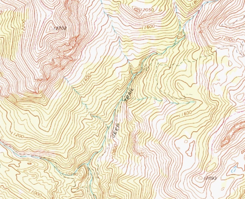
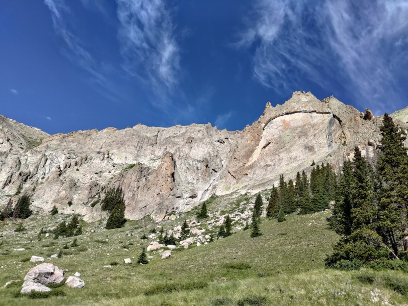
The descent into the valley from the saddle between UN 13,110 and UN 13,108 was easy. More grass, talus, and grassy talus flew by, aided by game trails. The views in the basin were wonderful. 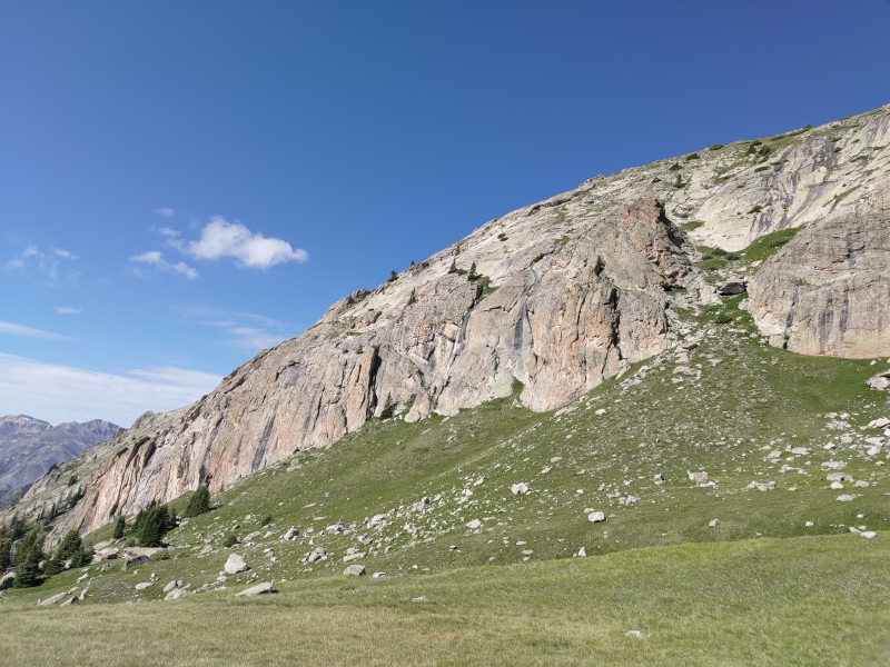
The satellite views were clearly taken in fall: summertime grasses and brush choked the lower valley, slowing travel and eating my legs. The section from 11.6k to 10.8k took an awful hour to do only about half a mile. The road bed is there and available from 10.8k downwards, but the process of getting to it was written in blood and shirt snags. Time took its toll on the old road. Anywhere it had approached the river, it has worn away to nothing, leaving decaying sandy slopes and dense brush. I have done (I think) a lot of bad bushwhacks, but this one left an impression on me. What it lacked in length it made up for in density and intensity. It was easier work to punch it uphill at 13k. Once you can breach the brush sufficiently and get down far enough, the old road was easy to find and use. 
The road bed connects to the stub road off the Nellie Creek Road at 10.6k. From there it was a simple run back to the car. All and all, the mountains are great. They were quiet, interesting, and beautiful. The bushwhack, unsurprisingly, not so much. If you find a way through that doesn't suck, more power to you. Thumbnails for uploaded photos (click to open slideshow): ")
")
")
")
")
")
")
")
")
")
")
")
|
| Comments or Questions | |||
|---|---|---|---|
|
Caution: The information contained in this report may not be accurate and should not be the only resource used in preparation for your climb. Failure to have the necessary experience, physical conditioning, supplies or equipment can result in injury or death. 14ers.com and the author(s) of this report provide no warranties, either express or implied, that the information provided is accurate or reliable. By using the information provided, you agree to indemnify and hold harmless 14ers.com and the report author(s) with respect to any claims and demands against them, including any attorney fees and expenses. Please read the 14ers.com Safety and Disclaimer pages for more information.
Please respect private property: 14ers.com supports the rights of private landowners to determine how and by whom their land will be used. In Colorado, it is your responsibility to determine if land is private and to obtain the appropriate permission before entering the property.


