Download Agreement, Release, and Acknowledgement of Risk:
You (the person requesting this file download) fully understand mountain climbing ("Activity") involves risks and dangers of serious bodily injury, including permanent disability, paralysis, and death ("Risks") and you fully accept and assume all such risks and all responsibility for losses, costs, and damages you incur as a result of your participation in this Activity.
You acknowledge that information in the file you have chosen to download may not be accurate and may contain errors. You agree to assume all risks when using this information and agree to release and discharge 14ers.com, 14ers Inc. and the author(s) of such information (collectively, the "Released Parties").
You hereby discharge the Released Parties from all damages, actions, claims and liabilities of any nature, specifically including, but not limited to, damages, actions, claims and liabilities arising from or related to the negligence of the Released Parties. You further agree to indemnify, hold harmless and defend 14ers.com, 14ers Inc. and each of the other Released Parties from and against any loss, damage, liability and expense, including costs and attorney fees, incurred by 14ers.com, 14ers Inc. or any of the other Released Parties as a result of you using information provided on the 14ers.com or 14ers Inc. websites.
You have read this agreement, fully understand its terms and intend it to be a complete and unconditional release of all liability to the greatest extent allowed by law and agree that if any portion of this agreement is held to be invalid the balance, notwithstanding, shall continue in full force and effect.
By clicking "OK" you agree to these terms. If you DO NOT agree, click "Cancel"...
| Long Hot Day & Made the call to 911 for Help |
|
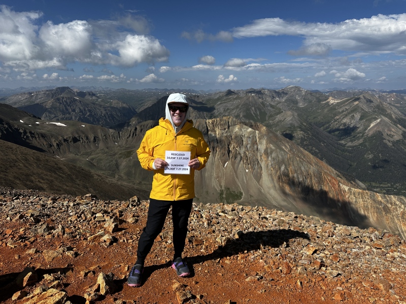
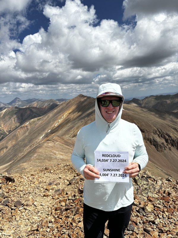
Climbed Saturday July 27. Got to trailhead and probably had 40 cars up there, parking was tight. Many people camping overnight in the meadow. We made the 35 minute drive from Mill Creek Campground up to the trailhead, leaving the campsite at 5am and arrive to trailhead at 535. Our group of 18 guys loaded up and got ready to start on the trail at 6am.
Be ready for long bathroom lines as there are only 4 toilets at the base of the trail head and this serves many people. Weather was pretty warm to start the day and got hotter throughout the hike. Estimated temps at the summit were mid to upper 80's with extreme sun and winds, to be expected at that elevation.
We had some slow rollers in the group and made it to the 2 mile hike and then waited for our slower hikers to catch up. Lost about 45 minutes there, but continued on after that. The route is very clear going up through the valley with more switchbacks as you make your way to the ridge at approximately 13,000'
Once past the ridge we continued up to Redcloud. The trail is not marked well here as there are large, loose boulders and rocks. The rock field had several spots where people looked to make their own way, by scrambling straight up. There were a few orange flags on the switch backs and so we used those at our guide for continuing to summit. Climbing without poles was very difficult for our group that didn't have them because of the loose rock and shifting footing.
Once to the summit of Redcloud we had a clear view of Sunshine and the path over. Don't be deceived, what looks like an easy dirt path actually has a lot of loose rock fields and 1000' + of elevation gain to get to Sunshine. We told our group you needed to be at 70% still in the tank to make the climb over to Sunshine and then re-summit Redcloud. We did a check on water/fuel too and everyone was good. we had a clear view of Sunshine and the path over. Don't be deceived, what looks like an easy dirt path actually has a lot of loose rock fields and 1000' + of elevation gain to get to Sunshine. We told our group you needed to be at 70% still in the tank to make the climb over to Sunshine and then re-summit Redcloud. We did a check on water/fuel too and everyone was good.
The route to Sunshine was more difficult than expected, very steep/tight switchbacks going up to the summit. Once there the views all around are amazing.  We had a few in our group that were really spent and needed extra time to rest. One member said he had given everything he had, this was scary because we had to re-summit Redcloud and had a 6 mile journey back to base of trail. We had a few in our group that were really spent and needed extra time to rest. One member said he had given everything he had, this was scary because we had to re-summit Redcloud and had a 6 mile journey back to base of trail.
We started sending guys back to Redclould and the group splintered into 2-3 smaller groups as some were running low on speed/energy. Our last 2 guys were really struggling and we kept back 2 of our strongest guys to help them down the mountain. As I got down to the ridge line I got a text from our guys till on Redcloud to call 911 because we had a guy getting delirious and we didn't know if he could make it down. I made the call with spotty reception and 911 said they'd get an ambulance to the trail head. My group continued down the mountain and quickly lost cell service for the next 3 hours.
After gettin to the trail head we did not see any emergency services or S&R. We had no cell service at trailhead and so after leaving water and electoylyte mix for our guys we headed back to camp to call 911 and see where the help was. Back at camp I had several calls/text from 911 and S&R. They let me know they were sending up a S&R guy to the trailhead to asses the situation. They said they only had one ambulance for the county and couldn't send it to the trailhead to wait.
It was a scary couple of hours not knowing what was going on with our friends still coming down. By 6:30pm the last of our group arrived and the S&R supervisor shuttled our guy down to the ambulance near Lake City to get checked out. EMT's checked his BP, glucose, etc and told him if they administered and IV they'd have to take him to Gunnison for an overnight stay at the hospital. He declined that and was dropped back at camp where we continued to monitor him and give him water, salty snacks, etc.
Thanks to Sam, our mountain angel who waited with our other guy for 2 hours while the last 3 made it back from Sunshine. We had a few Garmin SOS devices to get help if needed.
Moral of the story is don't be a "macho man" and push yourself past what you are capable of. It put several in our group at risk because they were on the mountain way too long and storms were rolling in. We even encountered a group of 2 going up to try and summit at 3pm and we begged them to turn around but they refused. Hope they are ok. This mountain is challenging and you must be ready for the challenge or things can get bad quickly. This had some of the worst cell coverage of any of the 14ers I've done so far. So make sure to have some type of GPS Satellite device if you need to call for help.
I went up the mountain with 3.5 liters of water and ran out of water 3 miles from the trailhead. Fortunately I had water purifying tablets and there was a stream to get water from. I am glad we did the hike and it was fun to capture 2, 14ers in a day for my first time. But it was also a reminder to me to always be prepared for the worst and keep yours eye open on your trail mates and don't be afraid to make the call too send them back down if they are not looking good or performing well that day.
Thumbnails for uploaded photos (click to open slideshow):


|
Caution: The information contained in this report may not be accurate and should not be the only resource used in preparation for your climb. Failure to have the necessary experience, physical conditioning, supplies or equipment can result in injury or death. 14ers.com and the author(s) of this report provide no warranties, either express or implied, that the information provided is accurate or reliable. By using the information provided, you agree to indemnify and hold harmless 14ers.com and the report author(s) with respect to any claims and demands against them, including any attorney fees and expenses. Please read the 14ers.com Safety and Disclaimer pages for more information.
Please respect private property: 14ers.com supports the rights of private landowners to determine how and by whom their land will be used. In Colorado, it is your responsibility to determine if land is private and to obtain the appropriate permission before entering the property.