| Report Type | Full |
| Peak(s) |
Sunshine Mountain - 13,329 feet Unnamed 13094 - 13,094 feet |
| Date Posted | 07/23/2024 |
| Date Climbed | 07/20/2024 |
| Author | WildWanderer |
| From MM 14 on CR 20 (Rose Cabin) |
|---|
|
PT 13,094 and Sunshine Mountain – 13,329 
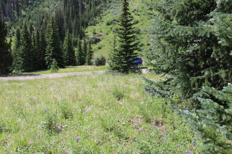
RT Length: 8 miles Elevation Gain: 3171’ I parked at MM 14 off CR 20 in Lake City, just before the turnoff for 22, at 10900’. 
I was up early, but it rained until about 6:15am, so I was on the trail at 6:30am. As you can see by looking at the topo map, I didn’t ascend the same way I ascended, mainly because it was terrible. Down wasn’t great either, but a bit more manageable. I’m going to describe the route to ascend how I came down. Note: There are tons of mining roads in this area, and they don’t all meet up. From my parking spot, I needed to be here. 
The best way to do this is climb to the left of the gully, navigating through the aspen trees to treeline. This is choose your own adventure quest, but it doesn’t last long, and is manageable if you have good route finding skills and can follow game trails. 

It’s important to note I passed 2 different mining roads before I hit the one I was looking for, at about 11600’ 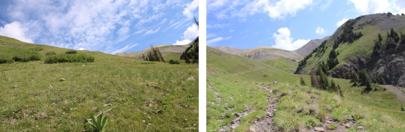
I followed this road as it curved around the mountainside north. The road was overgrown, and lost in places, and intersected with a lot of other roads. I just kept turning left if there was an option, heading north. 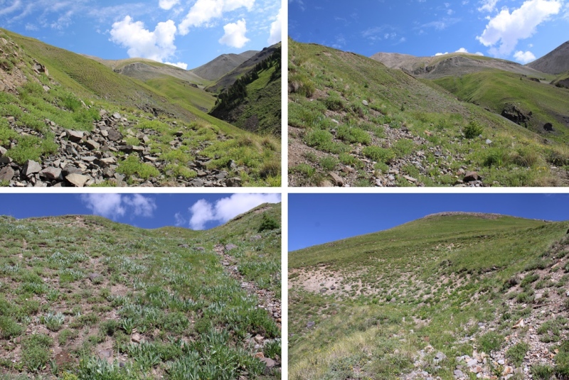
Once in the upper basin, I could clearly see PT 13094. This is the route I took to get to the ridge. 
I walked the mining road for a while, and then it turned into a game trail. This is a good game trail I followed east until I came to a sketchy part. You’ll know it because the dirt turns black. Here I turned northeast and aimed for the ridge, using fainter game trails. (On my way down I realized this game trail probably goes all the way to the saddle, but I felt confident in my decision to turn and head for the ridge here. 

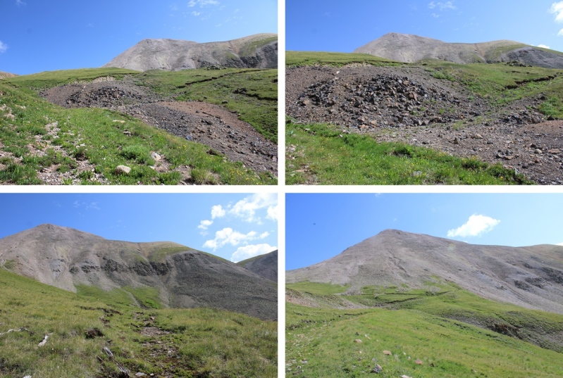
I made my way to the ridge 
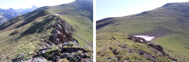
At the ridge, I could see PT 13094 to the northwest 
The terrain here was very rocky, and those rocks were loose. This is how I started my climb, avoiding the rock slab and climbing it to the right 
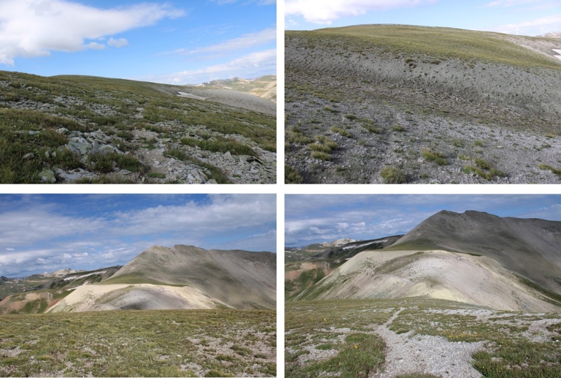
From here, it was a rocky climb northwest along the ridge to the summit. This was all class 2 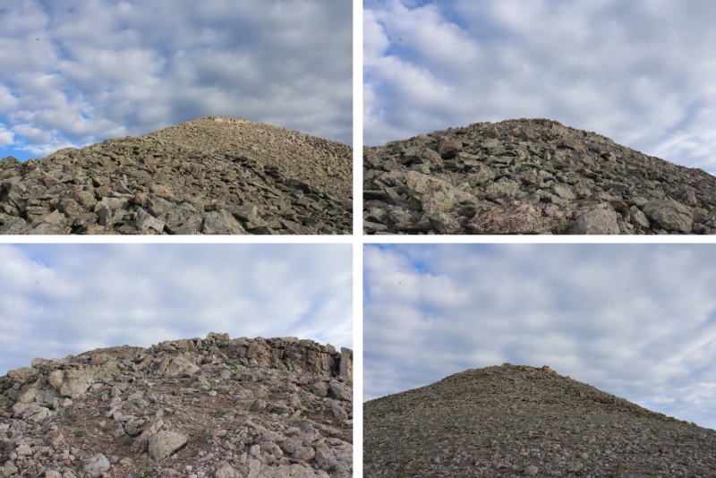
I summited PT 13094 at 7:30am 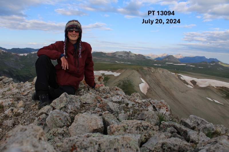
PT 13094:
My next objective was Sunshine Mountain, to the northeast 
After the initial downclimb off 13094, this was a simple ridge hike on tundra. This is the overall route I took: 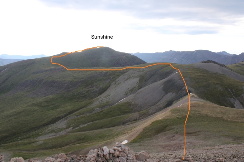
First, I downclimbed the rocky section 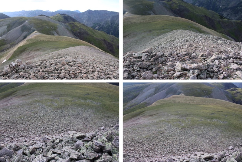
Then headed towards the sunshine/13094 saddle 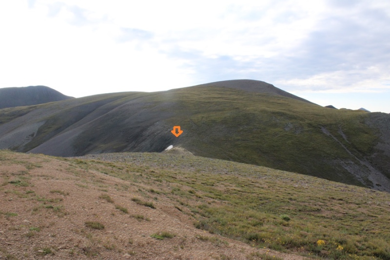
From there I picked up a solid game trail that led me to the ridge, then down to the saddle. 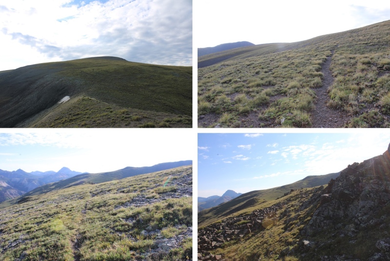
From the saddle I followed the tundra east 570’ towards the summit. 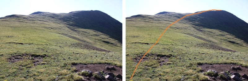

There was a short rocky section towards the summit, with tons of game trails to the right to keep it class 2, but honestly, going over the rocks is probably class 2 as well. 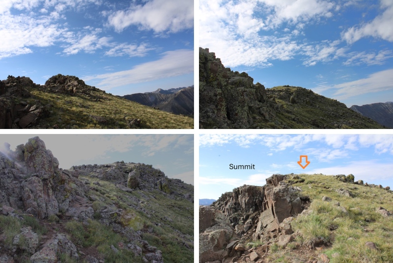

I summited Sunshine Mountain at 8:45am 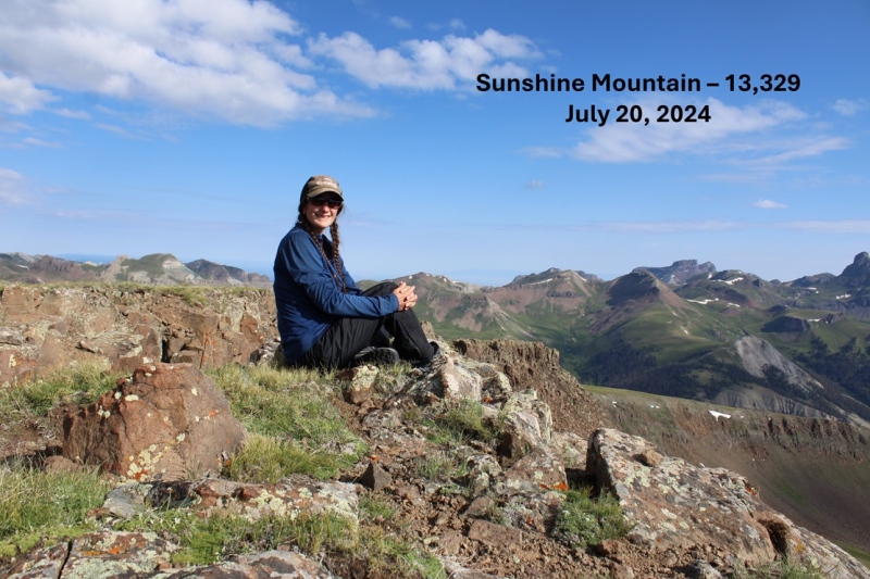
Sunshine Mountain:
I turned and made my way back down the tundra ridge, and to the saddle 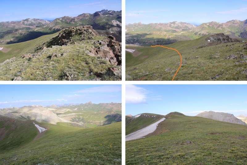

I made my way towards the left side of PT 13094. Here’s a little hint to help you descend: There’s a wooden post sticking out of the ground about 20 feet after you should descend. Use this as a visual for where to start heading down the side of the mountain. 

Back on the game trail, I turned right and followed it back to the mining road 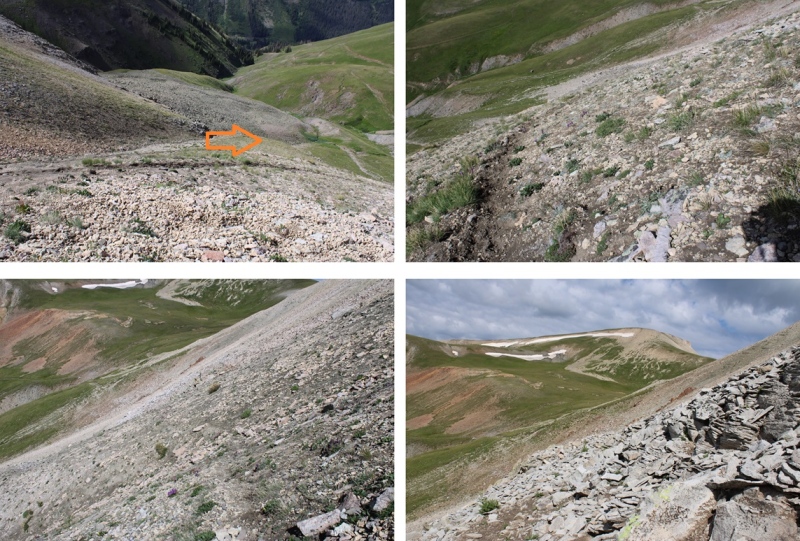
Then I took the mining road back to about 11600’ 


From here, I could see my truck parked below, and just made my way back to it, bushwhacking the entire way. 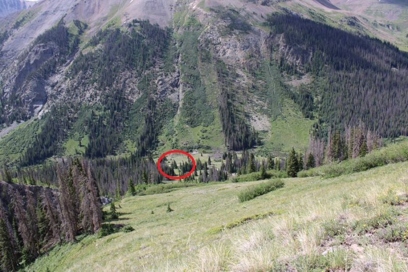

I made it back to my truck at 10:30am, making this an 8 mile hike with 3171’ of elevation gain in 4 hours. 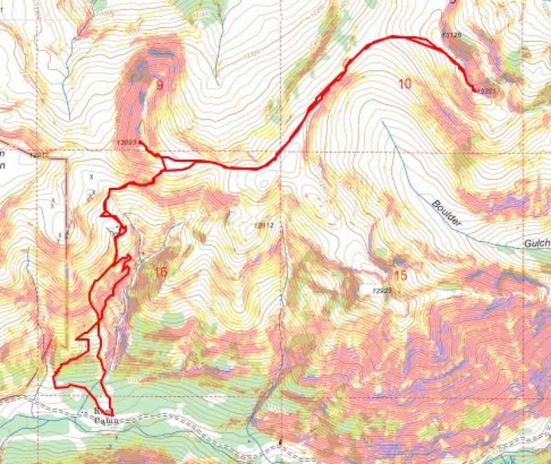
On to the next trailhead! Thumbnails for uploaded photos (click to open slideshow): ")
")
")
")
")
")
")
")
")
")
")
")
")
")
")
")
")
")
")
")
")
")
")
")
")
")
")
")
")
")
")
")
")
")
")
")
")
")
")
")
|
| Comments or Questions |
|---|
|
|
Caution: The information contained in this report may not be accurate and should not be the only resource used in preparation for your climb. Failure to have the necessary experience, physical conditioning, supplies or equipment can result in injury or death. 14ers.com and the author(s) of this report provide no warranties, either express or implied, that the information provided is accurate or reliable. By using the information provided, you agree to indemnify and hold harmless 14ers.com and the report author(s) with respect to any claims and demands against them, including any attorney fees and expenses. Please read the 14ers.com Safety and Disclaimer pages for more information.
Please respect private property: 14ers.com supports the rights of private landowners to determine how and by whom their land will be used. In Colorado, it is your responsibility to determine if land is private and to obtain the appropriate permission before entering the property.

