| Report Type | Full |
| Peak(s) |
North Twilight Peak - 13,084 feet Twilight Peak - 13,162 feet South Twilight Peak - 13,105 feet West Needle Mountain - 13,060 feet Babcock Peak - 13,161 feet Spiller Peak - 13,134 feet |
| Date Posted | 07/18/2024 |
| Modified | 07/20/2024 |
| Date Climbed | 07/06/2024 |
| Author | VeraUndertow |
| Additional Members | SasMaster22 |
| Silver Twilight, A San Juan Highlight |
|---|
|
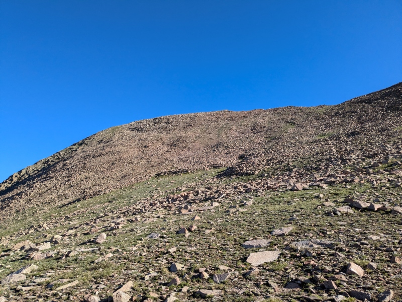
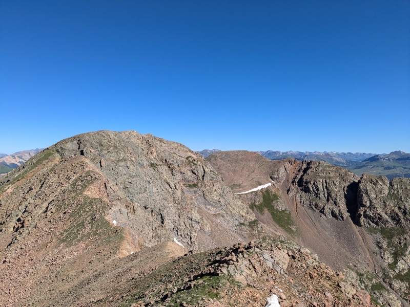
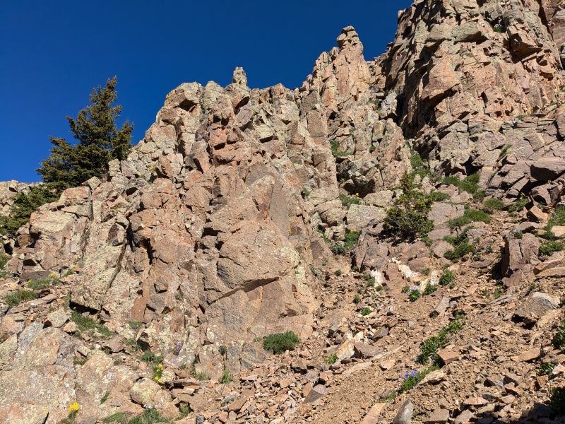
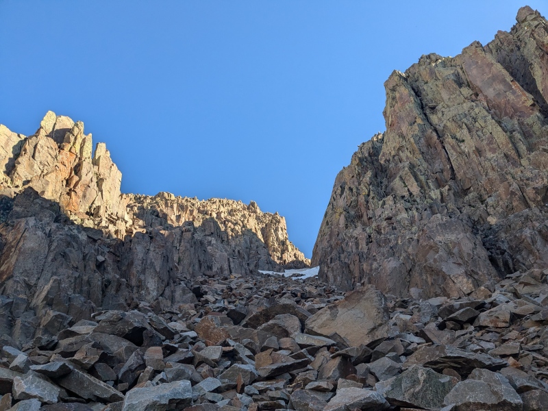
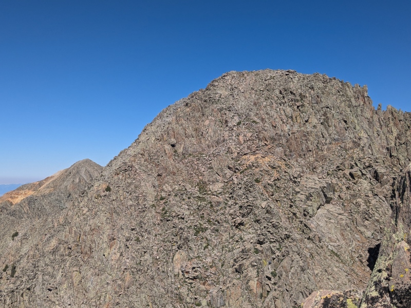
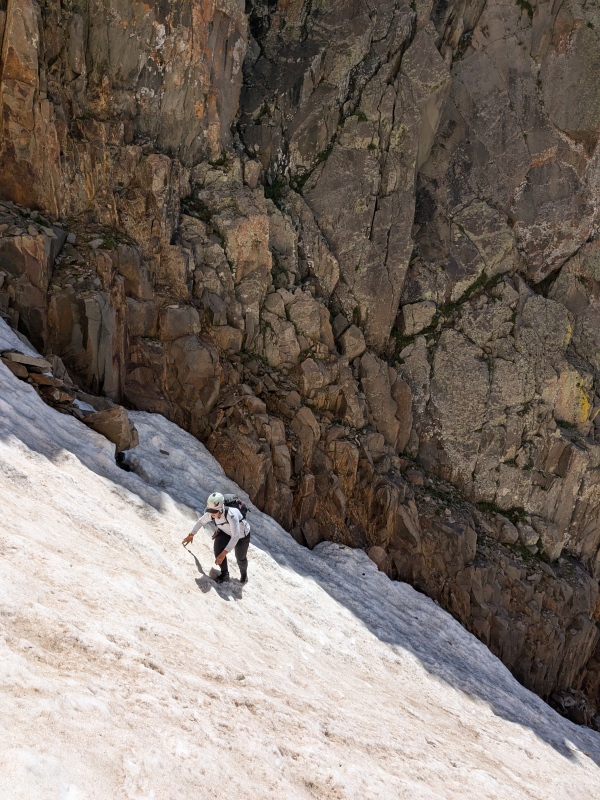
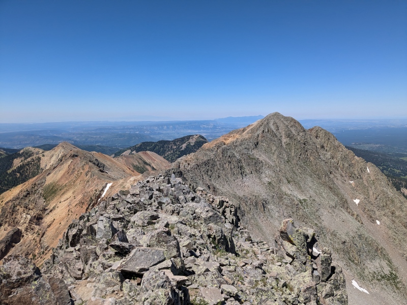
Low Elevation, High Fun 13ers in the Southwest San Juan In what is surely a peakbagging tradition for many, I was in the San Juan for the long holiday weekend trying to maximize my peaks and head to some areas I haven't been to in a while. For most people based out of the F-range (or honestly everyone) the San Juan Mountains are the biggest hurdle to overcome in successfully completing the 13ers list. This year the weather participated and the forecast was 4 perfect weather days, I was able to get 5 new summits in the La Garita then 4 the next day off Cinnamon Pass before heading over to Molas Pass area for another big day. The Twilights and West Needle 7/6/24 Starting from Andrews Lake overflow lot at 5 AM I hiked up great trail past Andrews lake and hopped on the Crater lake trail for about 1 mile before it splits and there is a Weminuche wilderness registration area. Go right to stay on Crater lake trail and stay on this trail for another 4.5 miles or so. Pretty quickly it drops down a bit over one of the terraced hills that are common in this area, some cool weird geography. After a small stream crossing the trail had a good amount of standing water and mud on it in places. The trail was braiding from people walking around the mud and the braided trail segments had mud in them as well, eventually I gave up and embraced the mud as there wasn't much hope of keeping my feet dry. I walked past Crater Lake 2 hours after starting, which was a pace I was feeling pretty good about. I took a trail that wraps around the north side to the east of the lake that stops being obvious after you go around another smaller lake and up to the top of the hill. From here I dropped around 50 feet of elevation through willows then I tried to stay as high as possible on the low angle terrain as I contoured around the east ridge of North Twilight on mostly grassy terrain. To the left the views start to open up and you can see Pigeon Peak and the rest of the Needles area as you come to a rocky side slope/ gully feature at around 11,550 ft where chose to drop slightly and sidehill some looser talas to gain a grassy ledge. I followed this ledge up to a lake and the amphitheatre that I would use to ascend up to the North Twilight-Twilight saddle. As I got to the lake I was supposed to hear a dog and see two people camping, they were very friendly and we talked for a second before I moved on up the south east slopes toward what looked like a huge cornice at the top of ridge, trying to see if there was a weakness. About halfway up the amphitheatre like bowl the talus slopes gave way to a nice grassy slope and I was able to see that the south side of the ridge had no cornice and just a short Class 3 scramble guarding it, so I headed that way and after a short scramble I topped out on the ridgeline only to see the cornice was about 3 feet tall at its maximum. Fun how perspective Anyways I walked around it and was on the broad talusy saddle and south slope of N Twilight, which was about 309 vertical feet above me. I headed up that way just picking the path of least resistance, but anyway you want to go will work from here pretty much as it's gentle and class 2 the whole way. 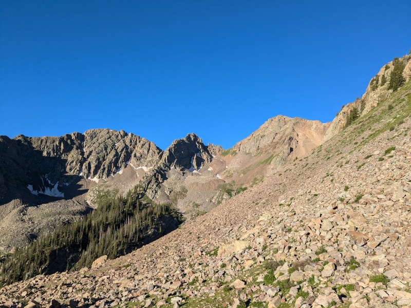
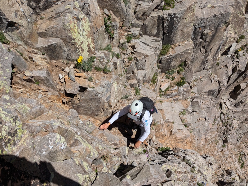
From the summit of N Twilight I looked over at Twilight which has a large notch between the sub summit closer to N Twilight and the summit of Twilight as the trip reports aren't abundantly clear on how to get to it. I saw a pretty obvious bypass on the west side, a downsloping ramp that led right into the west side of the notch starting at around 12850 ft. On my way back over I wanted to double check the sub summit to see if another route was available, nope sure enough, if you start scrambling up at all you have gone too high, as the entire sub summit ends in cliffs at the notch. Anyways the scrambling up was actually really fun and solid C3 on good Wemi rock, so I quickly climbed back down, onto the ramp and found the gully with the chockstone as mentioned in Jorts report and called a dry waterfall in Otinas report. With no snow on it, the moves were quite easy though the dirt on some of the steps made it a little loose and slippery in places once above the chockstone. Once you reach the top of the notch, you get back to the solid class 3 scrambling. I climbed up and wrapped around to the west slightly as there was some class 4 if you stay right on the direct line up the ridge, but there are a plethora of fun and solid options so choose your line and have fun. Once you gain the top the ridge here, it's a short stroll over to the true summit, which has some truly spectacular views of the Needles region of the Wemi. 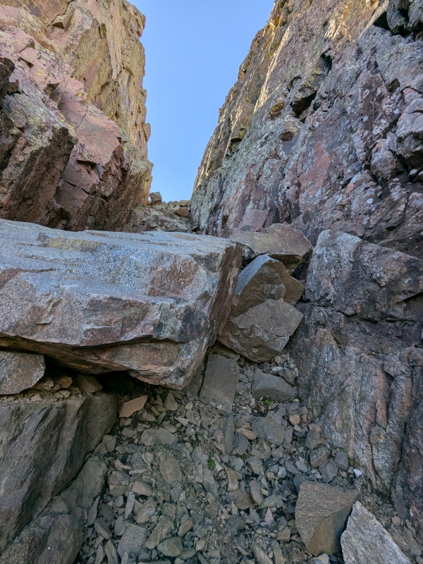
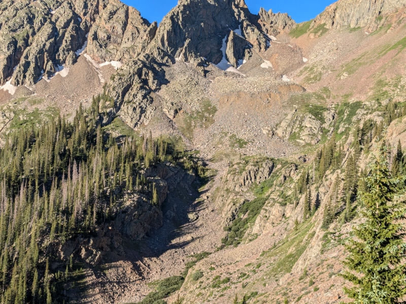
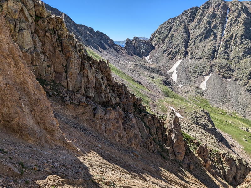
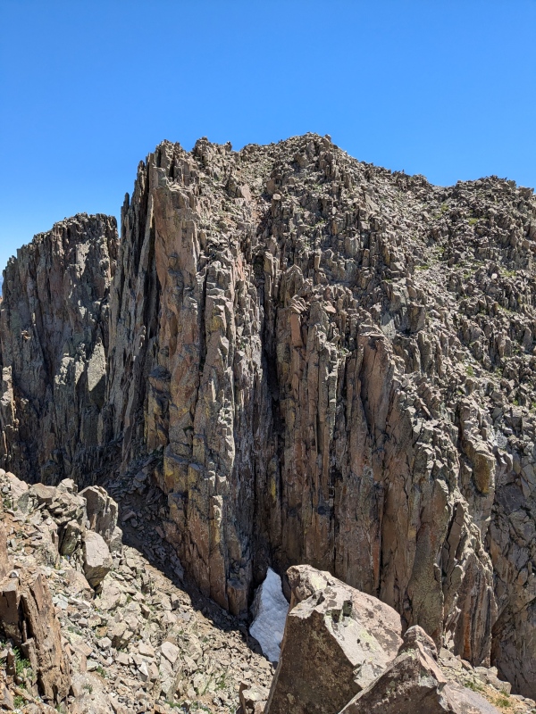
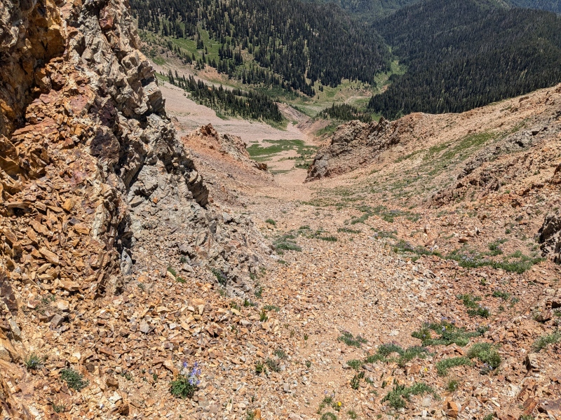
From the summit of Twilight getting over to South Twilight is pretty easy, just some steepish tundra and rocks and I think it took less than 25 minutes to get between the two. I sat for a bit at the summit and enjoyed the views a while and studied West Needle and my route too it, trying to spot any obvious difficulties, as the weather was still a perfect cloudless day and I knew it was forecast to hold. There is a large couloir that runs down from the saddle between the lower fin looking 12er closer to my vantage point and S Twilight which has cliffs on both sides. While I couldn't see the entry into the couloir I could see a nice grassy ramp that would get me out of it and into the basin heading towards West Needle. I headed down the steep but grassy slope towards the couloir which eventually changed to talus and then small cliff bands with scree and talus so I headed more directly toward the couloir not wanting to loose any more elevation as I could see larger cliffs forming below me guarding access to the couloir. I saw a large fin in the middle of the couloir but just above my grassy ramp exit on the far wall and angled toward the fin. As I approached the cliff edge I saw two smaller fin like features coming off the couloir wall beneath me and some class 3+ or 4 chimney features I knew I could comfortably downclimb to get into the couloir. It was about 30 ft of downclimbing with solid and plentiful holds to reach the coulie which reminded me of the coulie on Vermillions standard route right before the final summit block, in that it was slippery hardpan dirt with very friable rock bands that were waiting to crumble, luckily this is less steep and exposed than the one on Vermillion and easy enough to get across. I observed a really funky little rock sculpture at the top of the couloir and climbed under the fin and was quickly across to my exit ramp which had a use trail on it so obviously quite a few people had been here before. The climbers trail goes up towards the saddle between the two 12ers but I wasn't sure how good it would be as it sidehills the whole way over to West Needle, so I chose to drop slightly and gain some flatter terrain that was larger stable rocks on my way across the basin. I will say on the way out I used the trail and was surprised by how well worn it actually was so it could be a good move if rock hopping isnt your favorite. 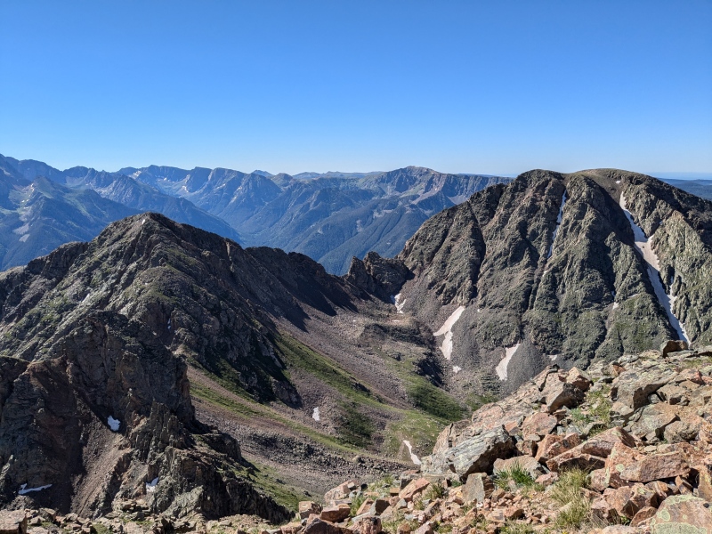
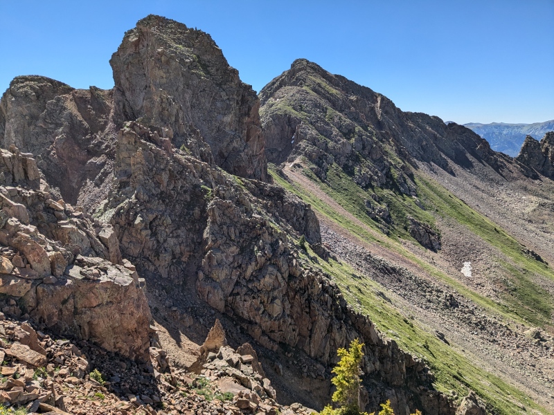
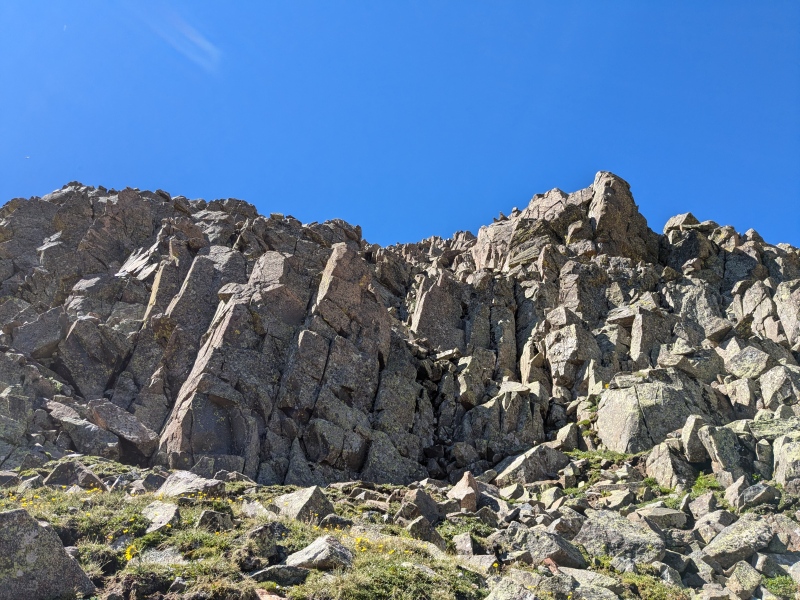
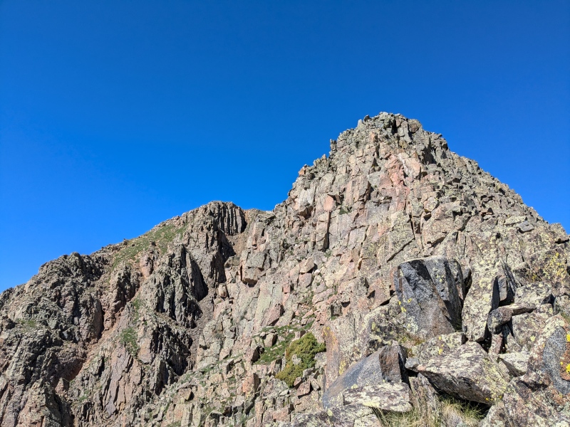
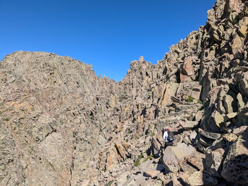
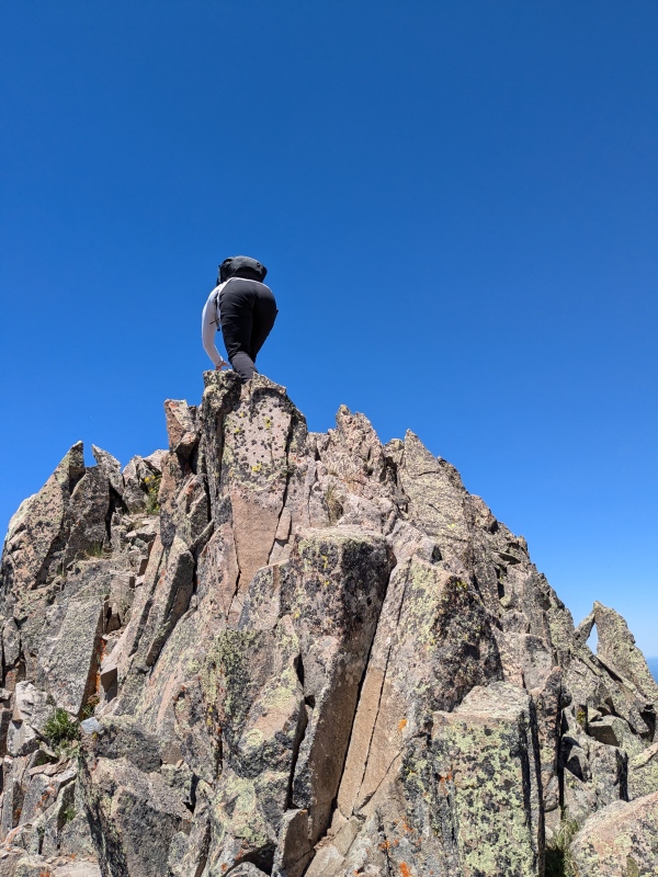
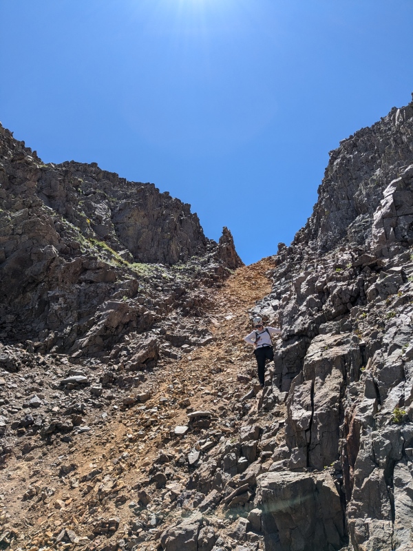
I made my way toward where the two gendarmes meet the ridge, eyeing an obvious gully that goes up and to the left (east) as one possible way to gain the ridge, but as I got closer I realized anyway would go. As I was planning my route up, I spotted two climbers on the ridge above me so I tried to take some photos but my phone's zoom is not great. I started upward and opted for some difficult class 3 as it was the lowest entrance to the solid rock, from here I feel like the route hangs west of the ridge for a bit as you make your way through one obvious weakness in the face about 300 feet up from the entrance I took to the face. Once above that I just gained the ridge crest which stays at class 3 until the second notch as I worked my way west. After the higher notch I had swung out onto the north face slightly, and heard the voices of the two climbers I had spotted earlier, and found a little class 4 climbing to regain the ridge. I had a short conversation with the second person of the group and they were doing W Needle, then onto the Twilights as a day trip as well. I didn't look for a class 3 option but the way this mountain seems to go is anyways you choose so I am sure an easier option is available, maybe on the south side. From here the ridge eases of slightly after a bit more class 3 and you find yourself on the summit plateau, I couldn't tell which of the two summit bumps were higher so I made my way to the further one just to be sure. It took me around 7 hours from leaving the trailhead to make all 4 summits, of course I knew the hardest part would probably be getting from this summit back to the Crater lake trail, so I reversed my route, but took some slight variations since anywhere in the general area seemed to work in most cases. I took the gully down to get off the scrambling section, it was loose and mostly unpleasant so I am glad I opted for some more solid rock on the way up. As I climbed down this gully and around the corner I saw another climber about to head up, truly a busy day on West Needle, with all parties day tripping the group. 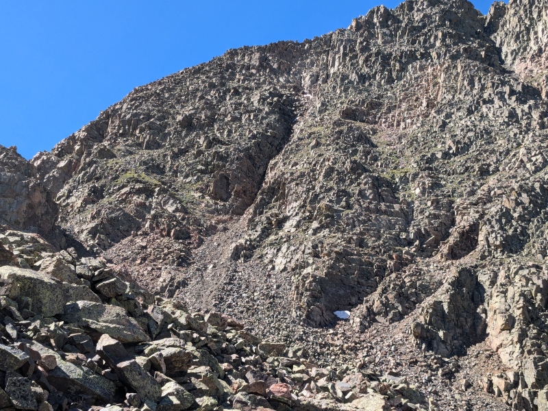
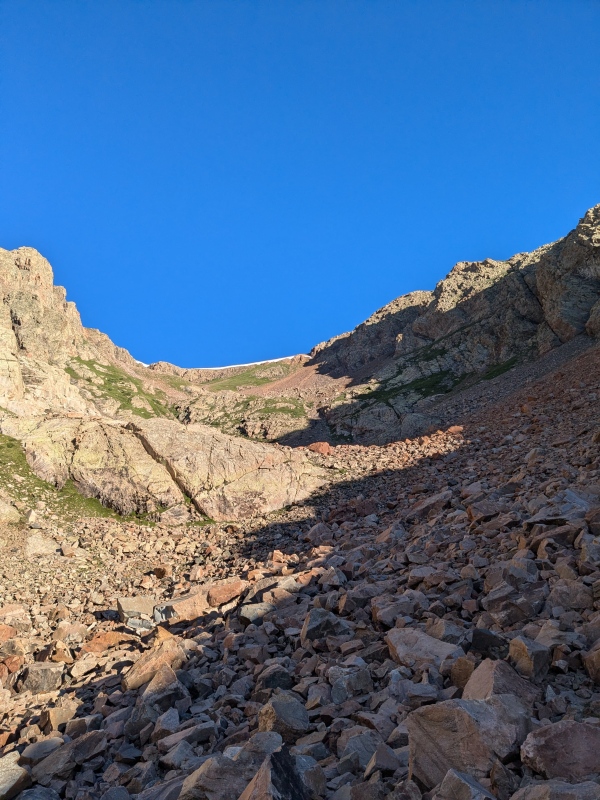
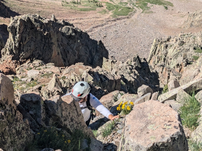
I made my way across the rocks toward the climbers trail which lead me to the saddle between the two 12ers, so I could exit this basin to get back on the east side. After crossing the saddle, I spotted some trail fragments but it is interesting how quickly it disappeared into a sea of loose rocks. As I descended I tried to eye the earliest possible way to start heading north so I could exit back towards the trail without loosing to much elevation. I spotted a grassy ramp that headed north back toward the initial lake I had seen the folks camping at, that started right after a large buttress, so as soon as I could I contoured across under the large buttress to try not to lose to much elevation. You are able to stay basically at treeline if you cross early enough and then you end up above 2 separate gully drainages that will allow you to cross back toward the trail. The first gully you come to is actually really nice and pretty mild, the middle one looks pretty cliffy and full of willows and the highest one is the shelf that I took on the way up to gain N Twilight - Twilight saddle. I thought you climbing back up to the lake to take the shelf I already went up but the gully right beneath me looked fine and it just meant I had to do a little bit more talus hopping on low angle talus so not the worst thing. I spied a large boulder on the opposing ridge that I was aiming for to get out of the basin and basically made a beeline for it, ascending around 200 feet on the far side as I did. From here there is a large pile smaller boulders in a field and it looks like you can go either way, I stayed above them to the west, as that was how I had come in. Once I got across the field I entered the woods and was able to spot my path I had made traversing them earlier that day. I found the trail without to much fussing which was nice at this point in the day 8.5 hours since I started. Knowing I had just 5.5 miles of trail and cell service I threw on some podcasts for the hike out and that kept my mind occupied as I walked out much slower than I walked in. On the way out I got passed by the two climbers I had seen on the ridge earlier as they were now trail running out. I made it back to Andrews Lake TH about 11.5 hours round trip and packed up and headed to Durango to meet up with Sarah for the last day of my long weekend in the San Juan. 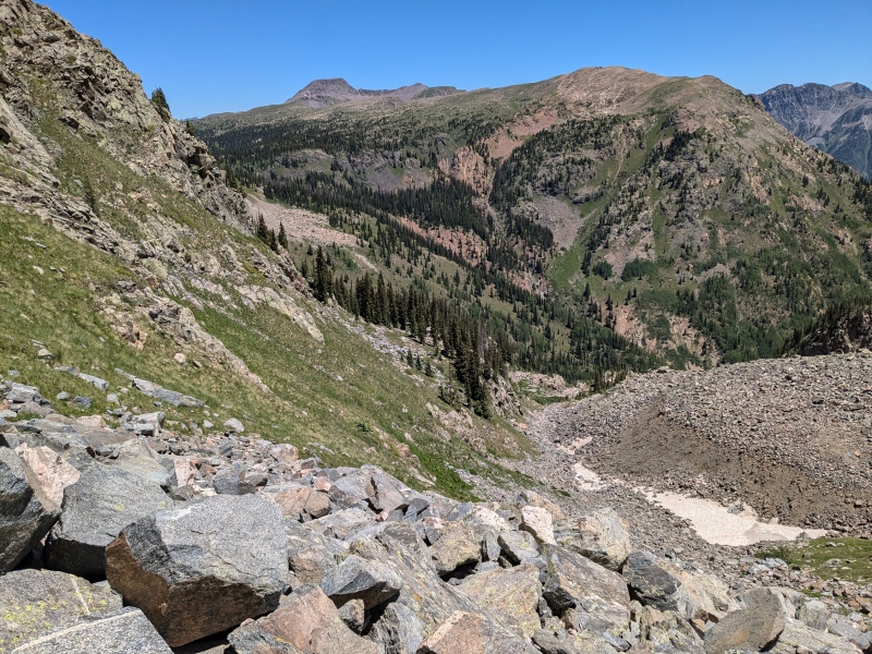
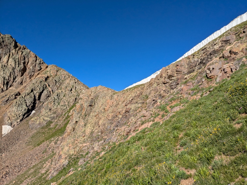
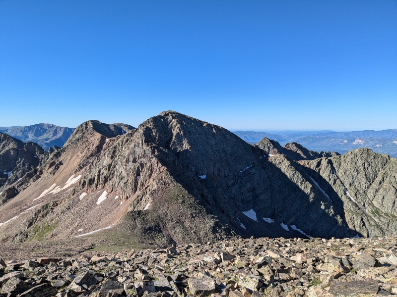
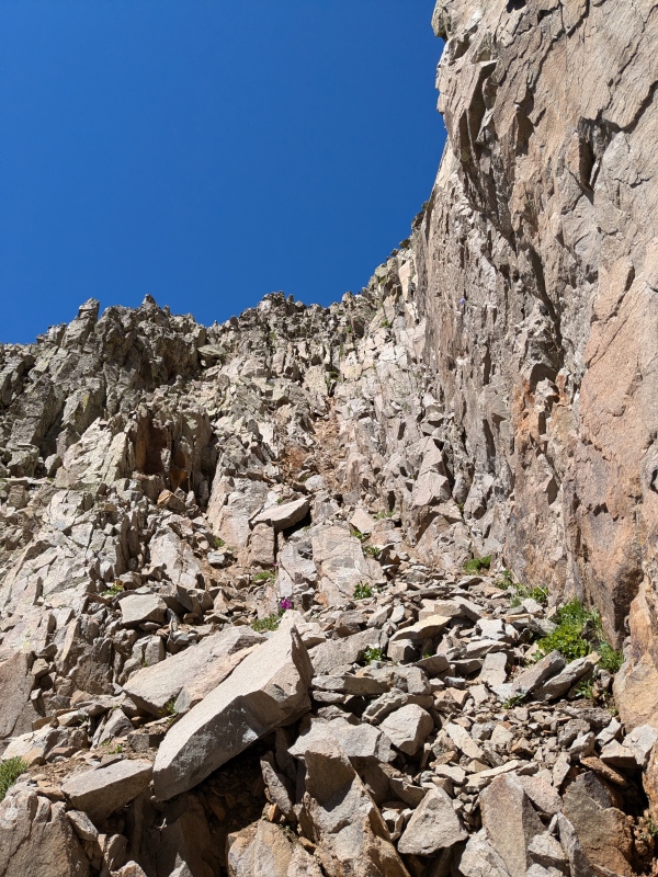
Babcock to Spiller Traverse 7/7/24 My first time ever checking out the Durango area group of 13ers known as the La Platas. They look like some really cool peaks and I was excited to see what they are all about, besides what I had heard, which is that they are loose. Sarah had spent the previous day climbing Centennial, Moss, Lavender and Hesperus so Babcock and Spiller would nicely tie up the subrange for her. We made our plans and actually slept in our vehicles right at the little pull after Boren Creek Rd. It says no camping but I haven't had a problem sleeping in my topper anywhere with that sign yet. We planned to get up at 6AM and Sarah volunteered to drive her Jeep up the road as high as we could get it, I personally was happy to walk as I heard the road was narrow and rough, but will not turn down a ride if someone else wants to drive. Even though I fell asleep at 9 PM I was still sleeping deeply when my alarm went off at 6AM but I actually fell pleasantly rested so that was nice. We got ready and I hopped in the Jeep and away we went up the road, after the first two switchbacks, there is a gate made out of Aspen trees and wire that is kind of silly to open and close but I hopped out and opened it as Sarah drove through. We were able to make it up two more sets of switchbacks and park at the outside of the hairpin completely out of the way since the Jeep is so much shorter than a truck or SUV. We were only stopped from going up at least 4 more switchbacks due to some smaller trees that were blocking the road, and if we had a saw, it would have taken probably 20 or so minutes to cut through them. The drive probably saved a little over a mile and 600 feet of vertical, which is appreciated on day 4 (for me) and 3 (of 4 for Sarah, who also joined me day one in the La Garita). We probably started walking about 6:45 or so, I honestly didn't keep track of time this whole day but we weren't breaking any records with our pace today and I was quite content with that. The hike up the road is fine, it's honestly not a bad road, just exceptionally narrow with very few places to turn out if there ever were two vehicles on it at the same time. As we got higher the views of the peaks started to expand and I was eyeing a descent route from the south ridge of Spiller. The trip report by Chicago Transplant details the different couloirs that separate the 3 Babcock summits well, so definitely have that image handy to reference if you aren't 100 percent sure, but the one you want is the east most large couloir heading up the south side. As we discussed to make sure we agreed on the route someone passed us where we were standing, about to depart the road, they were moving quite fast and carrying a larger bag than you would expect for an object like this. They made great headway up the couloir and out of sight and we never saw them again, I theorized that they were some sort of wraith or maybe they were launching a parasail wing from the top of Babcock. Hard to know for sure, but I like the idea of them being a wraith as we didn't hear them knock a single stone except one obvious one right in front of us, a red herring of sorts? 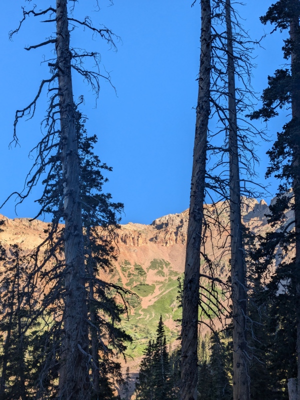
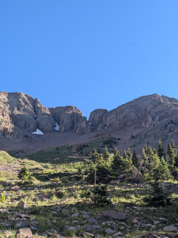
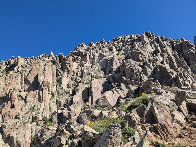
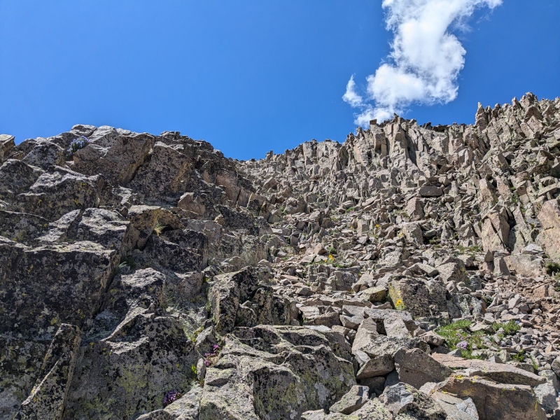
Anyways Sarah and I made our ways up the couloir trying not to dislodge any of the very loose rocks, I found better luck staying on the medium sized talus versus the smaller choss. Eventually we reached the split where you stay left at around 12,750 ft as there is a fourth summit block up here that is lower than the other 3 and that creates a fork in the couloir. From here we could see the start of the summit block and the solid scrambling, a much needed and appreciate sight. We found a C4 exposed way to gain the ridge as the easier gully is slightly higher up and there was a section of snow in the couloir blocking easy access with only micro spikes and no ice axes for traction. Once above this 25 ft class 4 section of scrambling the summit block is really only class 3 unless you seek out harder moves. We made our way up the ridge crest since that is where the best scrambling is, but hit a pretty gnarly section of ridge between the false summit and true summit, so we dropped down around 50 feet on the south side and contoured to the west till we hit a gully that would take us up the 60 feet to the true summit. Babcock is an interesting mountain, it has 3 summit blocks that are probably all within 30 feet of elevation from each other, but from the summit of Middle Babcock you can tell this is the true summit. 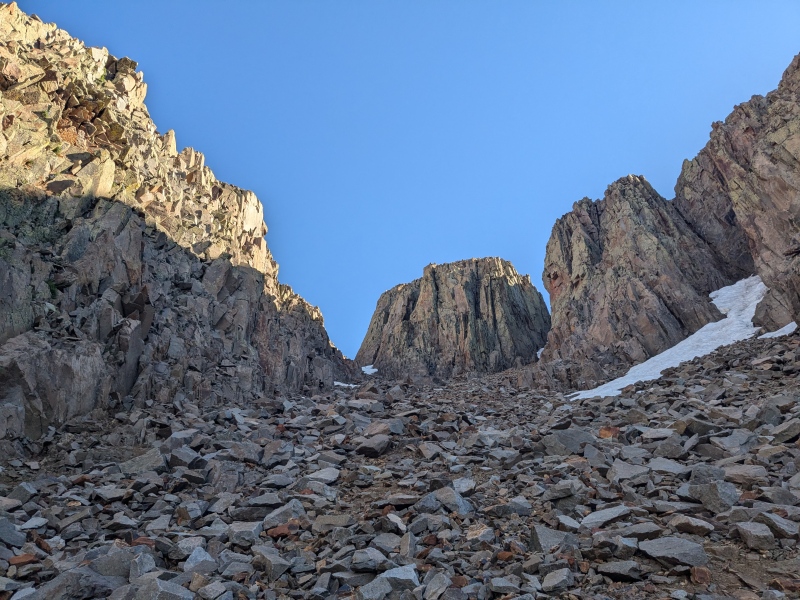
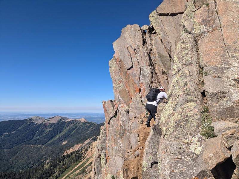
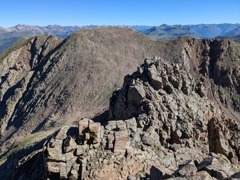
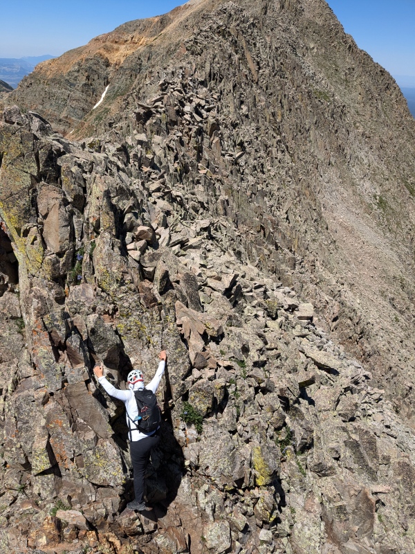
Since our goal was to scramble the classic knife ridge over to Spiller, we needed to get over to the west summit of Babcock. Luckily there is a large cleft in the rock that runs horizontally from east to west that allows easy passage from Babcock's East to West couloirs, so we scrambled back down the summit block to just above the Class 4 section we used to gain the summit block from the couloir. Instead of heading down to the east on the C4, we went down to the west on easy class 3 into the bypass, as you enter into the bypass there is one section of steep downclimbing, possibly a single unexposed Class 5.easy move that is about 5-6 ft tall. After that it was easy enough class 3, just a fair amount of loose dirt and some rocks to try not to knock onto Sarah as we headed over to the west couloir. As we got into the west couloir there was a good amount of snow still hanging about, but the right side was dry and solid rock for about 150 feet of the 200 vertical feet we needed to cover to get up to another class 4 gully we had spotted from Middle Babcock summit, and could now see from where we standing in the couloir. To get there we had to cross to the west side of this couloir and gain the last 50 ft of vert across the steep snow. We both donned our microspikes and I used my trekking pole with no basket to create a little extra security but having an ice axe would have made me a little more comfortable. If you're paying attention on the drive up the road you can see if there is still snow in the couloir to know if it's worth bringing your axe and spikes. Once across the snow I took my spikes off and started climbing up the loose class 4 section to gain the summit block of West Babcock. This feature was probably my least favorite part of the day, just because Sarah was right below me and I pulled a rock right out of the ground while pushing on it, trying not to pull it out. I tried to climb more to the left so I wasn't directly above her, luckily it was a short section maybe 125 vertical feet before it mellowed out again to easy class 3 to the summit. There is an easier gully that probably goes at class 3 from higher up the couloir, but this would have required another 100 ft of vertical gain on the steep snow and the class 4 wasn't bad, just another loose gully in a day of loose gully's. Anyways, we were quickly at the summit of West Babcock, and eyeing the traverse over to Spiller, which is quite an aesthetic looking ridge. 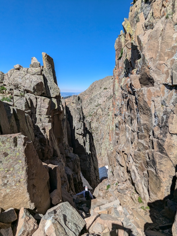
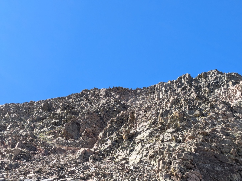
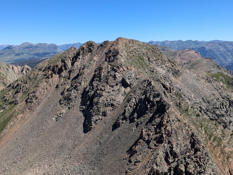
I won't describe the route in detail since the ridge basically just goes directly on the crest, and if you need to bypass a small section, there was an easy to find bypass generally on the north side of the ridge. Heading from West Babcock the ridge crest was rather broad in most places and the immediate exposure was less than I would expect from a knife ridge, but the closer we got toward Spiller the better the scrambling and higher the exposure. From about the halfway point onward the exposure ramps up and the ridge becomes a proper knife edge in places. There was really only one section of class 4 staying at or near the crest of the ridge, a small downclimb into a notch and the up-climb directly after it, again there was a bypass around this section if you dropped around 50ft to the north side, but the rock on this ridge is surprisingly solid so if you are comfortable with the scrambling, each part of the ridge will go. 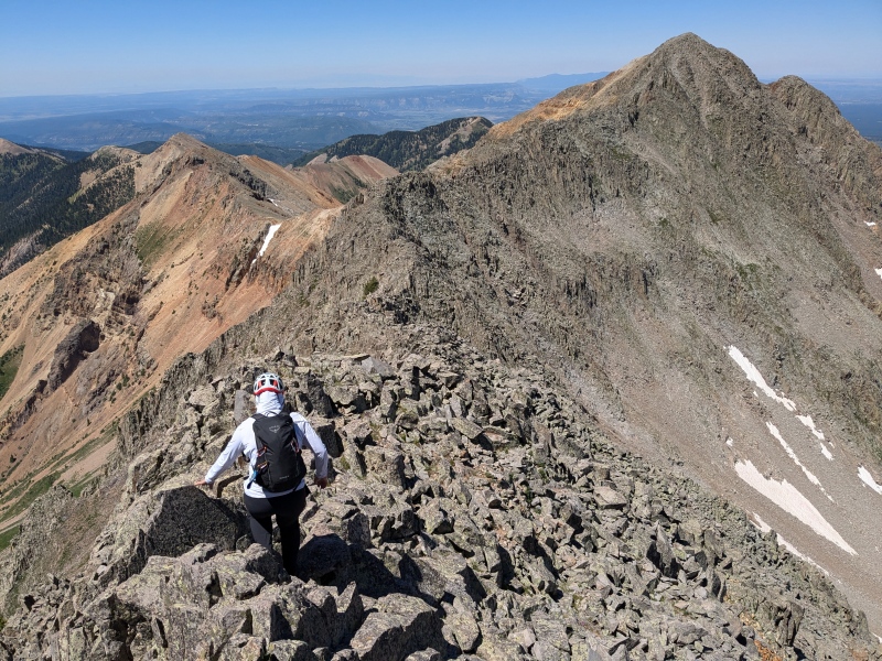
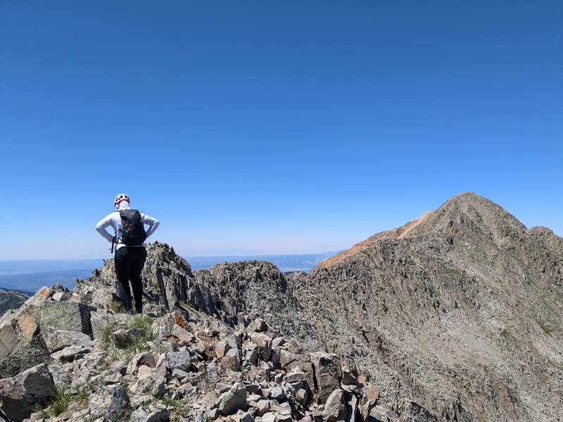
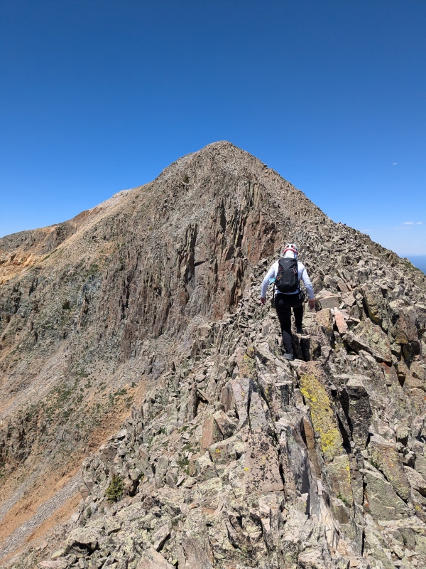
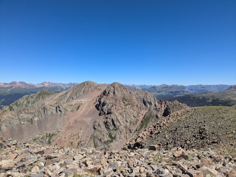
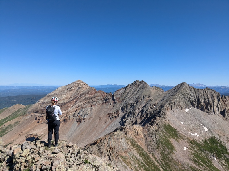
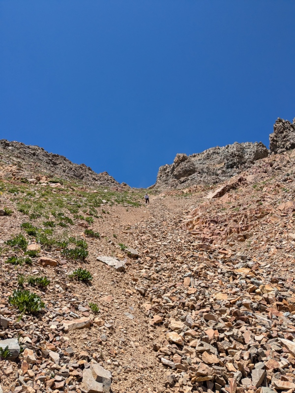
Eventually you come to a large notch just before the final summit push on Spiller, from here it seems the standard route is to drop down a loose gully filled with yellow/orange rock, losing 100-150 ft of vertical. There was an obvious and well defined climbers trail that we aimed for as descending the yellow/orange gully, once I reached the climbers trail we had around 350 feet of class 3 scrambling to reach the summit of Spiller. On the climbers trail there was looser dirt and scree, so again I chose to scramble up the edge, with some slightly harder moves but it was more solid and more fun, with less risk of kicking a rock at Sarah. We took some time on the summit of Spiller, knowing we had finished most of the real fun and excitement for the day and now just had a bunch of loose rocks descending. Spiller is the furthest southwest 13er in the state which is a cool and unique position to be in as you can see Hesperus, Lavender, Moss and Babcock quite well but the bulk of the San Juan are in the distance and all of the rest of the subranges of Colorado are hidden from view behind them. It was a little hazy but I could make out the La Sals in Utah as well just over the west shoulder of Hesperus, and of course since you are in the four corners region you can see Arizona and New Mexico as well. 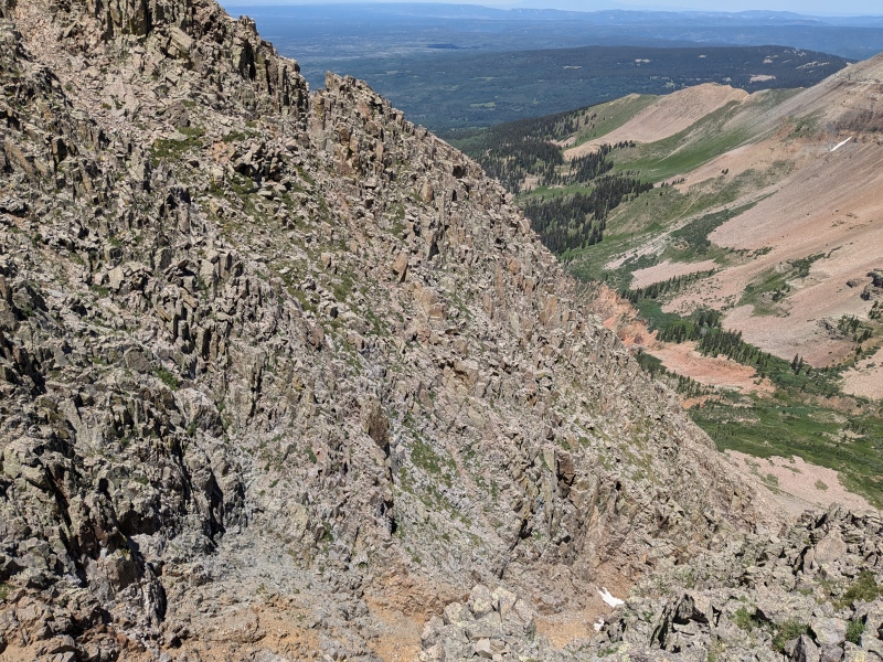
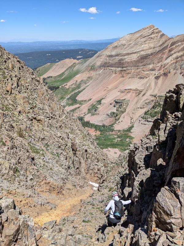
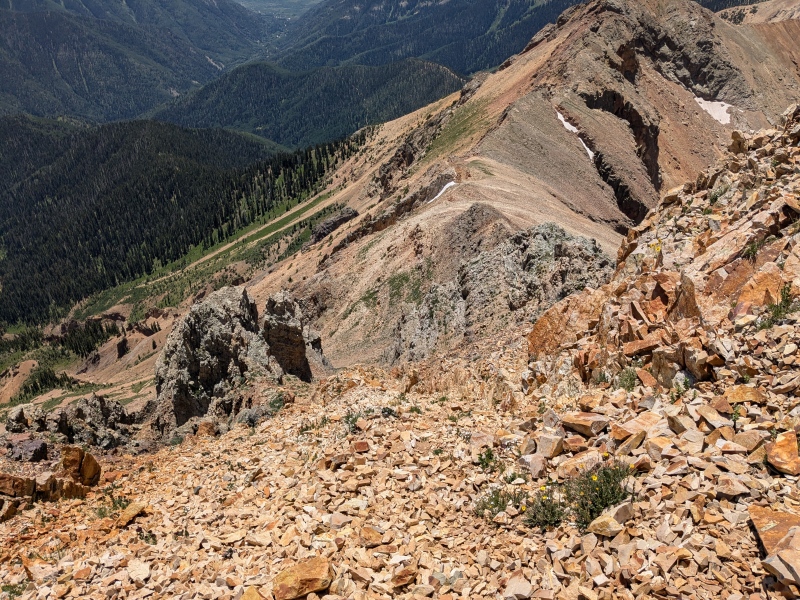
After taking in the view for a bit, I knew it was just about time to get moving since I had to drive back to Denver and work the next day, so we headed down the south ridge of Spiller which looks like it should go at class 2, but has just a few little sections of easy class 3 towards the bottom. In general the route is obvious, just follow the climbers trail downward, near the first little scrambling section the trail goes around to the east and you end up above a large, steep and loose gully that looks like it will go, but don't get sucked in, look to the right and follow the climbers trail to rejoin the ridge crest. From here there are a view little bumps of class 3 to work over on the way toward the notch in the ridge where you can descend back to the road. The notch at around 12700 ft had a slight climbers trail leading down on the skiers right, and a bunch of choss on the left, there was also a large opening in between two large cliffs about halfway down that looked like gates or the Argonath for those who are familiar with LOTR. After about 200 feet down the climbers trail peters out, but the scree skiing started to get good, which really made descending this loose choss field a much more enjoyable and rapid experience. Once below the mid way cliff band the scree starts to turn to smaller talus and the angle decreases to its less scree skiing but the rocks are still small enough you can walk down them and they aren't a risk of tipping. We made it from the ridge back to the road in probably 20 minutes or less for 1400 vertical feet of descent. Then after dumping the rocks out of our shoes, headed down the road back to Sarah's jeep after another beautiful weather day, on a long weekend in the San Juan full of perfect weather days. 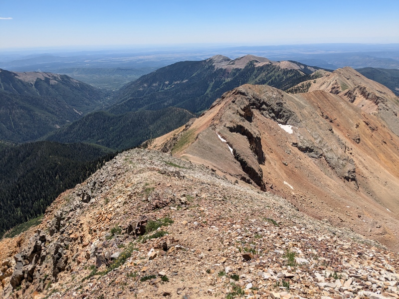
Some notes about route direction, for the Twilights I don't think it matters much which way you go but I do think starting with West Needle and getting the hardest and farthest peak done with, and avoiding the temptation to scramble to the false summit of Twilight on your way to North Twilight might make sense, especially if you are trying to beat a storm as getting back to the trail from N Twilight will be easier and quicker slightly. For Babcock to Spiller, I absolutely would recommend starting with Babcock and heading toward Spiller, descending the choss from the south ridge of Spiller was fun and would be miserable to head up in my opinion. While this route did have a lot of loose gully travel, the scrambling was very good, and I enjoyed it enough to say its worth doing at least once! Thumbnails for uploaded photos (click to open slideshow): ")
")
")
")
")
")
")
")
")
")
")
")
")
")
")
")
")
")
")
")
")
")
")
")
")
")
")
")
")
")
")
")
")
")
")
")
")
")
")
")
")
")
")
")
")
")
")
")
")
")
|
| Comments or Questions |
|---|
|
|
Caution: The information contained in this report may not be accurate and should not be the only resource used in preparation for your climb. Failure to have the necessary experience, physical conditioning, supplies or equipment can result in injury or death. 14ers.com and the author(s) of this report provide no warranties, either express or implied, that the information provided is accurate or reliable. By using the information provided, you agree to indemnify and hold harmless 14ers.com and the report author(s) with respect to any claims and demands against them, including any attorney fees and expenses. Please read the 14ers.com Safety and Disclaimer pages for more information.
Please respect private property: 14ers.com supports the rights of private landowners to determine how and by whom their land will be used. In Colorado, it is your responsibility to determine if land is private and to obtain the appropriate permission before entering the property.

