Download Agreement, Release, and Acknowledgement of Risk:
You (the person requesting this file download) fully understand mountain climbing ("Activity") involves risks and dangers of serious bodily injury, including permanent disability, paralysis, and death ("Risks") and you fully accept and assume all such risks and all responsibility for losses, costs, and damages you incur as a result of your participation in this Activity.
You acknowledge that information in the file you have chosen to download may not be accurate and may contain errors. You agree to assume all risks when using this information and agree to release and discharge 14ers.com, 14ers Inc. and the author(s) of such information (collectively, the "Released Parties").
You hereby discharge the Released Parties from all damages, actions, claims and liabilities of any nature, specifically including, but not limited to, damages, actions, claims and liabilities arising from or related to the negligence of the Released Parties. You further agree to indemnify, hold harmless and defend 14ers.com, 14ers Inc. and each of the other Released Parties from and against any loss, damage, liability and expense, including costs and attorney fees, incurred by 14ers.com, 14ers Inc. or any of the other Released Parties as a result of you using information provided on the 14ers.com or 14ers Inc. websites.
You have read this agreement, fully understand its terms and intend it to be a complete and unconditional release of all liability to the greatest extent allowed by law and agree that if any portion of this agreement is held to be invalid the balance, notwithstanding, shall continue in full force and effect.
By clicking "OK" you agree to these terms. If you DO NOT agree, click "Cancel"...
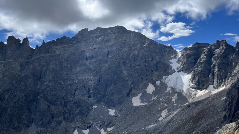
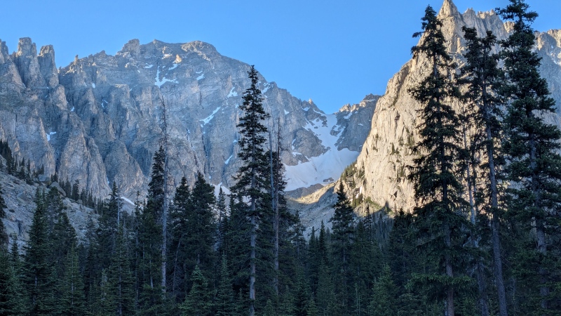
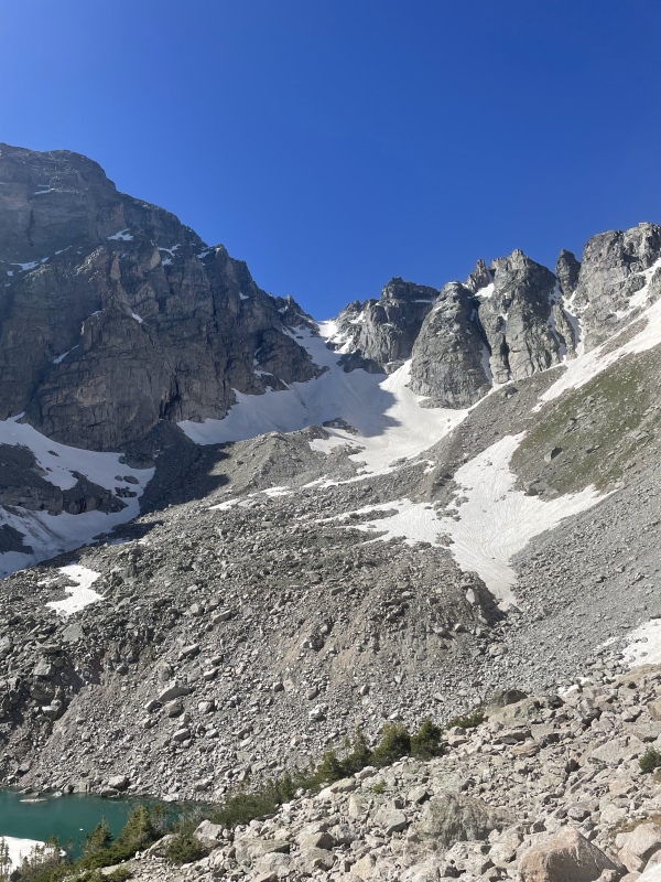
I first laid eyes on this route last September while climbing nearby Lone Eagle Peak. What was this magical snowfield that looked so enticing, even so late in the year? I snapped a picture of it and later confirmed its identity as Fair Glacier, "the finest mountaineering route on Apache and one of the best climbs in the Indian Peaks," according to Gerry Roach. I was sold. Even better was that it could be climbed from the west, saving me a long drive from my home in Grand County to the standard Long Lake Trailhead in Brainard Lake Recreation Area and the accompanying headache of coordinating road openings, permits, and weather.
Hello, beautiful. Apache Peak and Fair Glacier in mid-September 2023.
Timing was everything: we had to wait long enough for the approach to melt out, but not so long that the snow hardened into glacial ice and crevasses began to yawn open. A stable weather window was also essential. The opportunity arrived in early July and I sent a text to my friend Kate, inviting her to join me and Bill (climbingcue) on this outing.
"Do you know the stats from that side?" came her response.
"The track I drew says 19 miles and 4472 vert and I know it sounds like a lot but the trail up to Crater Lake (8 miles) is so nice," I replied.
Now, if you're comparing the stats I quoted poor Kate to those posted at the beginning of the report, you'll realize I accidentally catfished her on the vertical gain. But in my defense, CalTopo catfished me first.
"I'm definitely interested!" she replied in ignorant bliss.
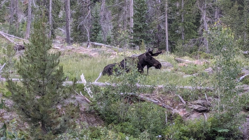
We met at Monarch Lake Trailhead at 5:00 AM and were hiking down the Cascade Creek Trail soon after. As promised, the trail was excellent and between the conversation and scenery the distance passed quickly. Around three miles in, I sent Bill and Kate ahead while I stepped off the side of the trail for a moment. I heard a *SNAP* and looked around, hoping to see blonde hair (Kate) or no hair (Bill) but instead seeing the dark brown fur of a cow moose and her calf, who had just stepped on a stick. I hustled down the trail to catch up with my partners, excitedly telling them of my moose encounter. Their disappointment at not seeing the duo was soon remedied by the sighting of a bull moose lounging in a meadow.
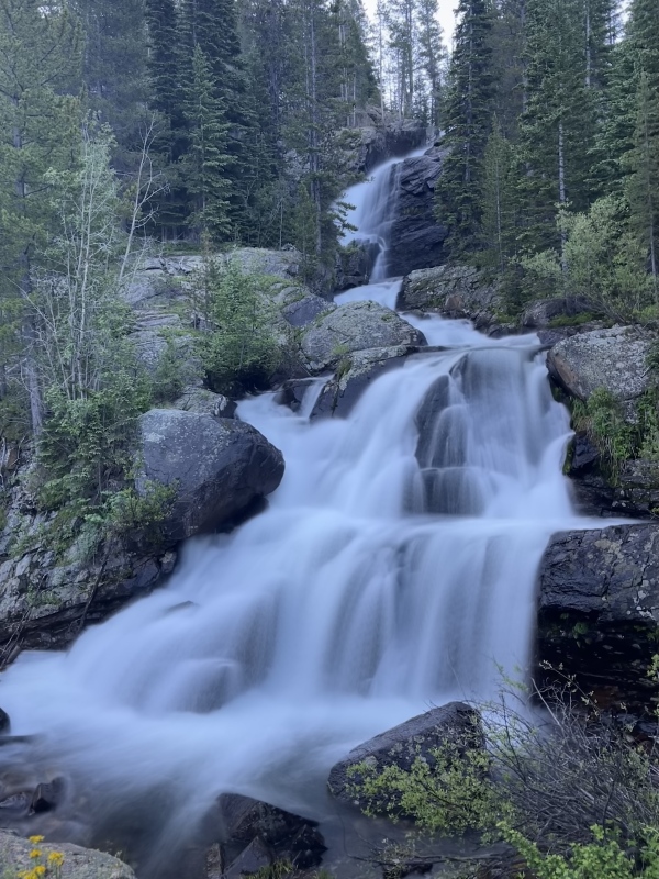
An extremely unbothered bull moose (Photo credit: Kate)Cascade Falls around 4.5 miles in.More beautiful scenery along the trail (Photo credit: Kate)
Finally, Fair Glacier came into view, peeking out over Lone Eagle's shoulder.
Still a long way away, but at least our objective is in sight! (Photo credit: Kate)
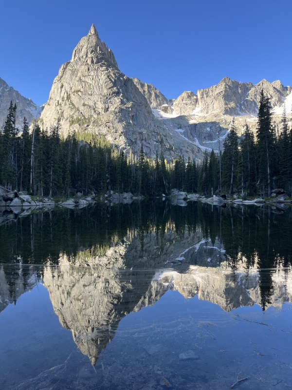
We reached Mirror Lake three hours after starting and paused for a snack and the obligatory reflection shot of Lone Eagle Peak. The lake was devoid of the usual dots of color from various tents, everyone apparently having gone home after the long holiday weekend. A couple and their dog were our only company on this lovely morning.
Lone Eagle Peak reflected in the aptly named Mirror Lake.
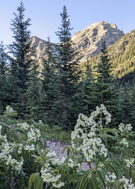
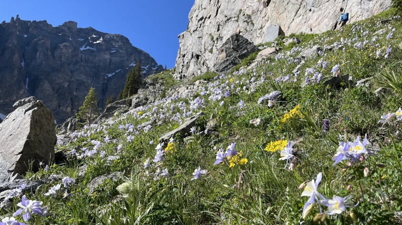
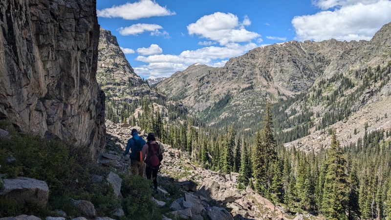
After a fifteen-minute break we continued along the east side of the lake, crossing the log jam at Mirror Lake's outlet into Cascade Creek. The official trail had disappeared now, replaced by several social trails through the woods. We emerged from the woods onto the rocky shore of Crater Lake and turned left to follow the climber's trail southeast up a gully. This proved to be the only steep part of the day aside from the glacier. Above the gully, the trail hugged the cliffs on Lone Eagle's eastern flank. We followed it except for two brief detours: one to drop down and admire a massive columbine field, and the other to avoid a lingering snowfield. Bill, not wanting to lose elevation, swapped his approach shoes for mountaineering boots and crampons and crossed the snow directly.
The largest concentration of columbines I've seen in one place, Bill above on the climber's trail.
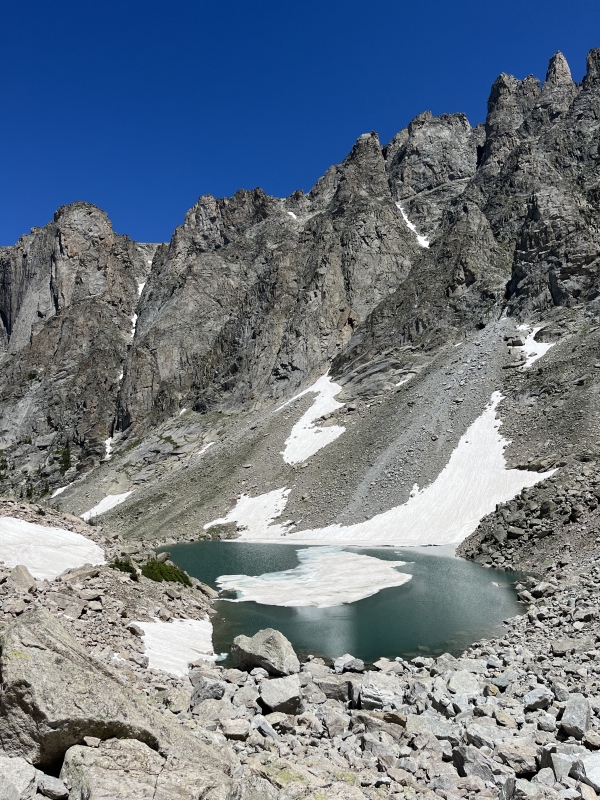
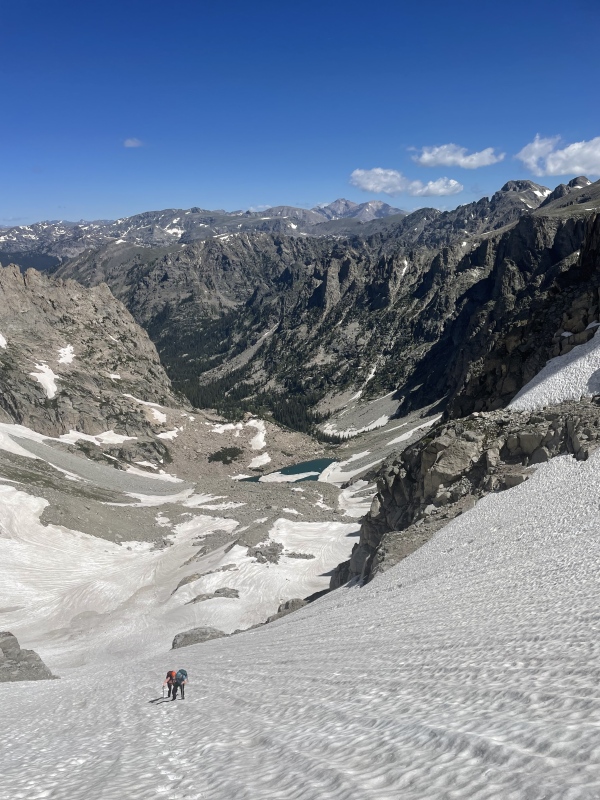
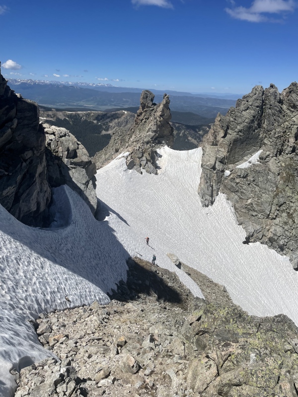
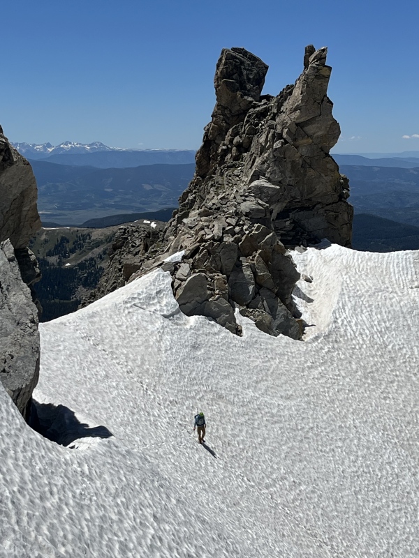
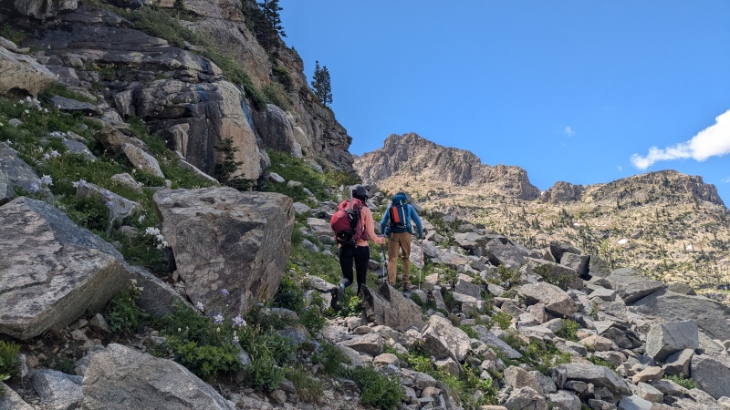
Just past the snowfield, the climber's trail turned right and ascended toward Lone Eagle. We broke off and headed straight for a small saddle overlooking Triangle Lake. An ice floe drifted aimlessly in the lake, resigned to its fate to bounce around like a DVD logo screensaver until the sun reclaimed it. After a bit of talus contouring, we reached the base of the glacier at 10:00 AM. We donned crampons and helmets, swapped out hiking poles for axes, and ate another snack before starting up the snow.
I guess it looks like a triangle if you squint?Fair Glacier still mostly shaded at 9:38 AM with steeper Mt George Couloir nestled between cliffs on the right (Photo credit: Bill)
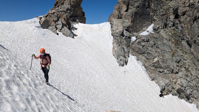
The slope steepened gradually, maxing out around 45 degrees. Conditions were perfect - firm but not icy - and the ascent was aided by shallow suncups and an old bootpack. From bottom to top, we climbed 1,400 feet on snow. Did I mention it was July?!
Kate and me ascending with Lone Eagle Peak to the left (Photo credit: Bill)Bill ascending the glacier with "Iroquois" on the top right (this will come into play shortly).
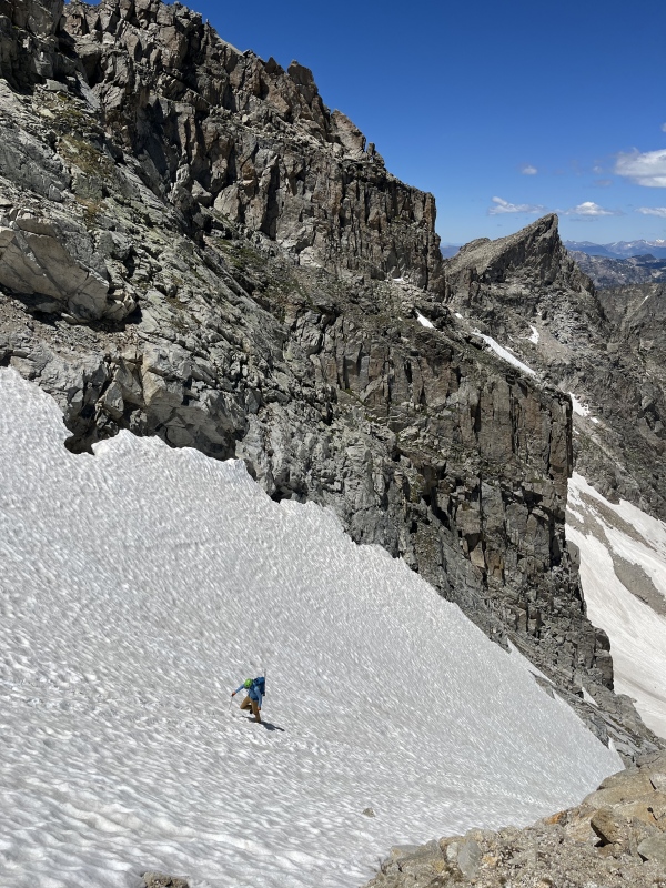
Near the top, we diverged: Bill, equipped with semi-automatic crampons, continued on steeply angled snow to a small saddle. Kate and I had only strap-on crampons and elected to disembark onto dry ground sooner.
Exit the glacier here. Your choice of angled snow or loose scree to the small saddle, photo taken on return trip (Photo credit: Bill)Bill looking back at Kate and me near the top of the glacier from the small saddle (Photo credit: Bill)Steep sidehilling (Photo credit: Kate)
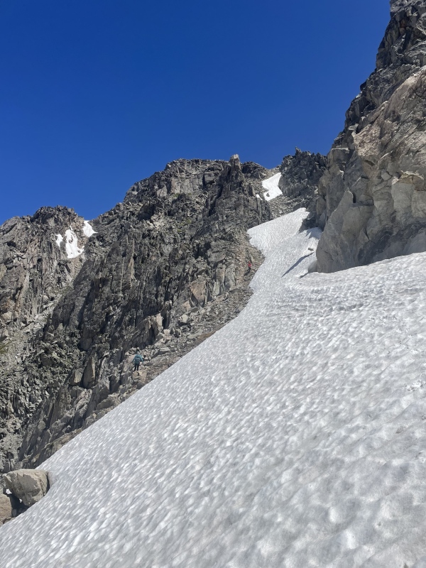
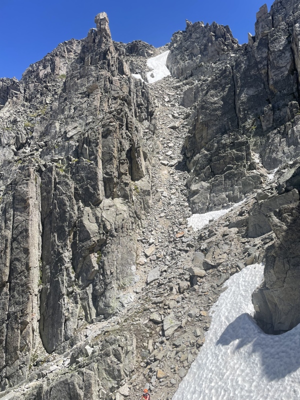
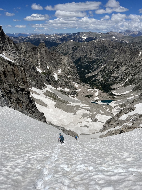
A short class 3 downclimb on the other side of the small saddle dropped us to the bottom of what we disaffectionately dubbed the "garbage gully." Three hundred feet of loose rock loomed between us and the ridge. We stuck to the larger sized talus on the right side of the gully, mindful not to dislodge anything. We all agreed this was the worst part of an otherwise highly enjoyable route. The snowfield at the top was easily skirted to the left. A final stretch of easy class 2 talus led us to the summit.
The garbage gully, me at the bottom for scale (Photo credit: Bill)
We topped out at noon under clear skies and no wind. Longs was easily visible to the north, with its distinctive notch. Navajo looked deceptively close, but we knew difficult terrain lay between us and its summit. Mirror Lake shimmered far below. When I asked Bill and Kate to identify Lone Eagle Peak, they unanimously elected the pointy pinnacle of "Iroquois." Nope! It's funny how Lone Eagle looks so imposing from below, but like nothing more than a nondescript ridge bump from another perspective.
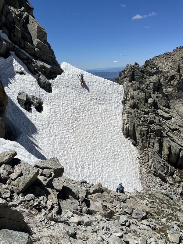
We spent half an hour on the summit before beginning our descent, conscious of the fact that we had a long way to go back to the car. We each chose a different line down the garbage gully, again taking care not to knock any rocks down on each other. Feeling confident in his gear, Bill ascended a nearly vertical wall of snow. Kate and I retraced our route over the rocks to climber's right. The rock here was very loose, and we tested each hold carefully.
Bill getting his steep snow fix.
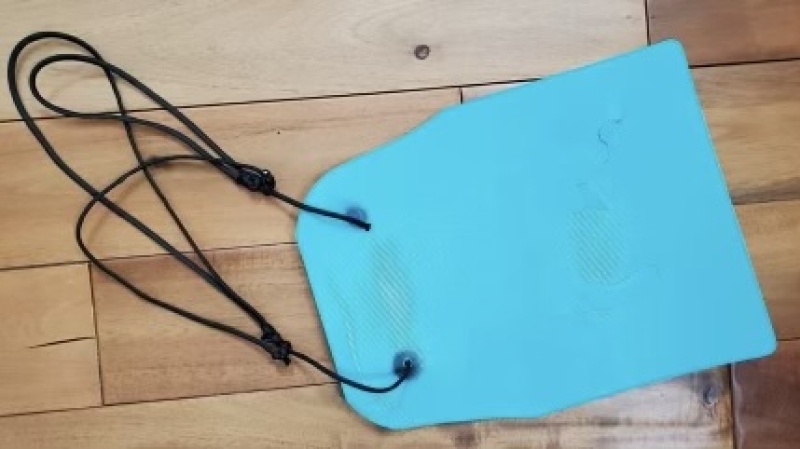
Back on the glacier, the snow had softened into corn that would have been perfect for a snowboard descent, but was still a bit too firm for good plunge stepping. Once the slope angle relented to a reasonable degree, Kate whipped out her secret weapon: a homemade glissading sled. A flexible plastic cutting board with leg loops to keep it securely in place, it let her fly down the slope. My knees creaked in protest as I watched her shrink into the distance.
Bill descending from the col with a cool rock formation overhead.Kate and Bill descending. The small saddle above Triangle Lake is seen above Bill here.Homemade glissading sled (Photo credit: Trotter)
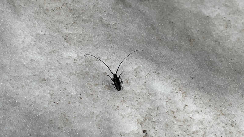
Although I did not get to glissade, I did find a pine sawyer beetle in the snow on the way down. I was impressed by his freakishly long antennae, which are apparently used to sniff out dead coniferous trees for the female beetles to lay their eggs in. This little guy was a bit off track!
We were able to tune into the afternoon showing of Wheel of Fortune using those antennae!
We made good time on the descent back to Monarch Lake, averaging 3 mph, though the final miles dragged in the afternoon heat. Somewhere along that long hike out, I figured it was finally time to come clean about the actual stats. I casually mentioned the real vertical gain, bracing for impact. Fortunately, Kate took the news in stride and, miraculously, still talks to me.
It was a long day - but totally worth it for one last snow climb in July, though I can confidently say I'll be hanging up my crampons until next year after this one.
Following the climber's trail back toward Mirror Lake (Photo credit: Kate)(Photo credit: Kate)
My GPS Tracks on Google Maps (made from a .GPX file upload):
Awesome report of a really cool climb. This one has been on my to-do list for 3 years, I might actually have to give it a go after reading this. Looks like an awesome adventure!
@Eric - thank you! It's funny how even things high on the wish list can take years to get around to sometimes with the wealth of climbing options out there. I definitely recommend this one.
@Bill and Kate - thank you both again for climbing this with me!
@Geo - since this one is on a glacier, I believe it qualifies for a surface lift. It would certainly be less enjoyable to be dragged up this thing on a Poma than to just climb it! I did look around for the (non-existent) helicopter bringing my snowboard and boots before reluctantly descending.
You took some beautiful pictures. Nice write-up. Great job!
Caution: The information contained in this report may not be accurate and should not be the only resource used in preparation for your climb. Failure to have the necessary experience, physical conditioning, supplies or equipment can result in injury or death. 14ers.com and the author(s) of this report provide no warranties, either express or implied, that the information provided is accurate or reliable. By using the information provided, you agree to indemnify and hold harmless 14ers.com and the report author(s) with respect to any claims and demands against them, including any attorney fees and expenses. Please read the 14ers.com Safety and Disclaimer pages for more information.
Please respect private property: 14ers.com supports the rights of private landowners to determine how and by whom their land will be used. In Colorado, it is your responsibility to determine if land is private and to obtain the appropriate permission before entering the property.
")
")
")
")
")
")
")
")
")
")
")
")
")
")
")
")
")
")
")
")
")
")


