| Report Type | Full |
| Peak(s) |
Mt. Katahdin 5267 Feet |
| Date Posted | 07/16/2024 |
| Date Climbed | 06/25/2024 |
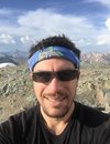
| Author | Ed_Groves |
| Blunders and Happenstance on Mt Katahdin |
|---|
|
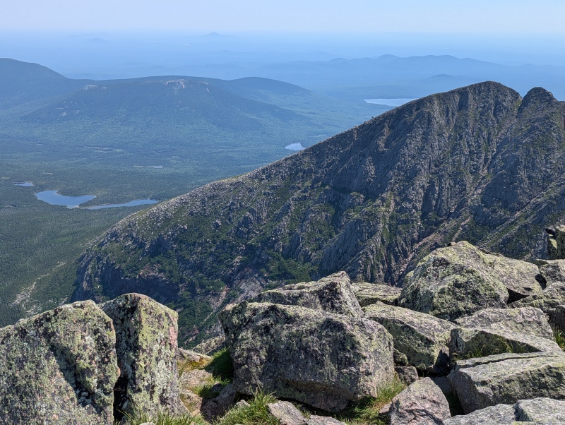
Prologue Mount Katahdin, also known as Baxter Peak, is a magnificent mountain in Maine standing at 5267 feet. The Penobscot Indians gave the mountain its moniker of Katahdin, or "The Greatest Mountain," centuries ago and this area has great spiritual significance for the tribe. Mount Katahdin resides in Baxter State Park, named after Percival P. Baxter who was governor of Maine from 1921 - 1924. Baxter was an outdoorsman and in 1930 he purchased approximately 6000 acres of land including Mount Katahdin. The next year he donated this land to the state of Maine with the purpose of keeping it wild forever. Over the years Baxter purchased more land to add to the park and additional gifts of land were added later after his final purchase in 1962. The entire park size is now 209,644 acres. However, this is not a real state park. It isn't supported by state taxes and the rules for the park are exclusive to Katahdin. It is supported by a trust that Baxter left after his death. The rules of the park favor preservation of its wild and rugged nature over recreation by the public. For this reason, all camping sites are basic, roads are narrow and unpaved, visitor numbers are limited, and the trails receive very little maintenance. As a non-resident of Maine, the easiest way to get in to hike Katahdin is to reserve a campsite for the night before your hike. A day parking pass is included which allows you to park in the lot to hike the next day. Total cost is $50. There is a four month rolling reservation window and reservations can go quickly. I reserved my spot at Roaring Brook Campground on the first day of the rolling window, hoping that when my day arrived the weather would cooperate. If camping is not preferred, one can purchase a day parking pass in advance for $16, but the window for purchase is only 2 weeks before your desired hiking day. Visitors can also show up at the Togue Pond Gate on the morning of their hike and get a pass if there are still openings. The gate opens at 6:00 AM. I do not recommend the last option. From my reading it appears that lines can be long and people arrive quite early to get in line for these remaining spots. It is the wild nature described above that attracted me to this place. The beauty of the rugged ridge and humps leading to the high point has intrigued me ever since I became aware of it, and because of this it has been a bucket list item for me. My wife and I planned a trip this year in June to go up the coast of Maine eating seafood and hiking in Acadia National Park. After about a week of that, we drove to an Airbnb in Millinocket, Maine, on June 24th. While my wife stayed at the lodging in Millinocket, I drove to Roaring Brook Campground in Baxter State Park to camp for the night. This is approximately 25 miles from Millinocket and is about a 50 minute drive. I had planned all of this down to the finest detail before we ever left home; however, before the hike I made a huge blunder. Little did I know that this would make my hike one to remember for reasons other than making the summit. Arrival at the Campsite The roads from Millinocket to the Togue Pond Gate were excellent. Until one reaches the Baxter State Park barrier all driving is on pavement. From there it is dirt but the roads are easy and nothing like the rock-strewn and sometimes precarious thoroughfares we navigate in Colorado. While checking in at the gate I opened my windows and immediately noticed a lot of mosquitoes, but, fortunately, I had brought insect repellent. Leaving the gate, I drove the additional eight miles to the Roaring Brook Campground and I arrived around 7:30 PM. After locating my campsite, I did a walk around to determine where everything was located. My plan for the next day was to ascend via the Helon Taylor Trail crossing Pamola Peak, Chimney Peak, the Knife's Edge, and South Peak on my way to Katahdin. I would descend via the Hamlin Peak Loop resulting in an approximately 11.5 mile hike with 4500 feet of elevation gain. 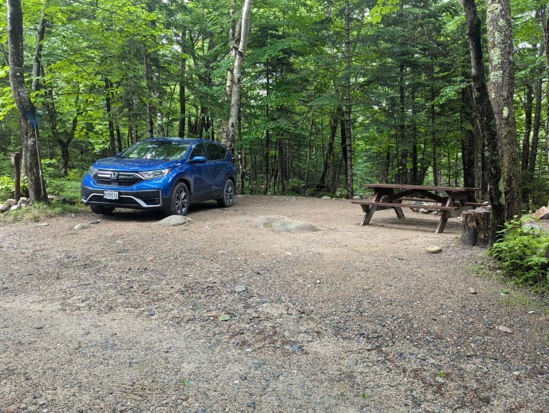
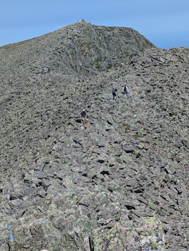
After locating the ranger station and the trailhead for the Helon Taylor Trail, as well as checking out the beautiful brook for which the campsite is named, I proceeded to prepare my sleeping arrangements. I was going to sleep in the back of our Honda CRV because I didn't want to spend time the next morning disassembling my tent and other comforts before I moved to the parking area. I had experienced a digestive tract issue in the previous 24 hours and was feeling a bit tired but it seemed that issue had dissipated. I decided to get a drink of water and it was at this point that I realized, to my dismay, that I had left all of my water bottles in the freezer at our lodging in Millinocket. I had a single half-liter sized insulated cup with a lid and it was about half full. The Togue Pond Gate was already closed but I thought it might be possible to talk to the ranger and see if they could let me through the gate to drive back and get my water. After speaking with the ranger I learned that no one was manning the gate after closure and his responsibility was keeping watch on the campground unless there was a major emergency. He did refer me to areas where I could obtain water along the path, so I decided to attempt the hike without the water. I knew that it was difficult to get reservations and it might be a while before I could come back to do this. Also, since I would only reach 5267 feet above sea level and I had chlorine dioxide additive with me I thought I could pull this off. This faulty logic might have been correct had I not already been dehydrated from my ailment, but I didn't realize at the time how much this was affecting me. If I had been hiking at Colorado elevations I would never have attempted this. The Ascent The next morning I awakened at approximately 4:00 AM, ate a Clif bar, drank the last of my water in my cup, and then got a refill from the brook near the campsite. I treated the water and by 4:45 AM I had signed in at the ranger station and hit the trail. After about a quarter of a mile the Helon Taylor trail cuts left off of the Chimney Pond trail and the grade immediately increases substantially and doesn't subside. Within another quarter of a mile I had developed a bit of a sweat and took a sip of water. There had been quite a bit of rain in previous days and the trail was muddy in places with wet rock. Those of you who have hiked in the Northeastern United States know that many of the forest trails are full of boulders that can be waist high with every single boulder seemingly of a different configuration. It can be very difficult to walk on top of these off-camber, unique rocks and a simple trail can be a chore, in and of itself. I was moving at a good clip when I stepped on a slippery rock and felt my foot slip. I was immediately falling forward, taking steps and maneuvering my trekking poles trying to regain my balance. But it wasn't in the cards. I managed to land between rocks and stuck out my left arm so that my elbow and forearm would be the first parts of my body to hit the ground. As soon as I hit I felt a pop on top of my left shoulder. I gathered myself and began checking everything. Other than a scrape below my left elbow and the pain in my shoulder everything else was fine. (I later discovered I had torn the acromioclavicular ligament where the shoulder attaches to the clavicle, also known as a separated shoulder. Fortunately, mine turned out to be a Type II and was not too severe. However, I obviously did not know this at the time.) I was able to remove my backpack with some pain but it was manageable. Using my right hand and arm to hold most of the weight, I was able to slip back in the backpack with very little problem. I also discovered that, in the fall, all of my water poured out of my cup. I knew there was another location to obtain water within the next mile so I continued on. I reached the second water source, a small creek that crossed the path, and filled my cup. I treated it and had to wait for the pills to cleanse it before I could drink so I continued on. Within about an eighth of a mile, I realized I didn't have my prescription sunglasses. I trudged back to the water source and found them lying on the ground next to a tree, and then I regained the elevation I had just lost. The path continued steeply through the forest with muddy spots interspersed among the boulders now and then. Eventually, as I moved to higher elevations in the forest, I ran into two locations where the rock on the trail was so high I had to actually climb up and over it. There is no mention of class 3 climbing in the descriptions of this trail until one reaches the descent of Pamola Peak, but these two spots all required class 3 moves. They were only seven or eight feet high, but there was no way someone of my height, 5'11," could climb them without using all four appendages. While doing these, I discovered that though I couldn't do any weight bearing with my left arm above my head, I was able to use it for climbing with very little pain. Eventually, the trees became much shorter and I knew I was getting close to tree line. I stopped to take in the beauty and take some photos of this place that has been protected for posterity. I also drank a small amount of water. 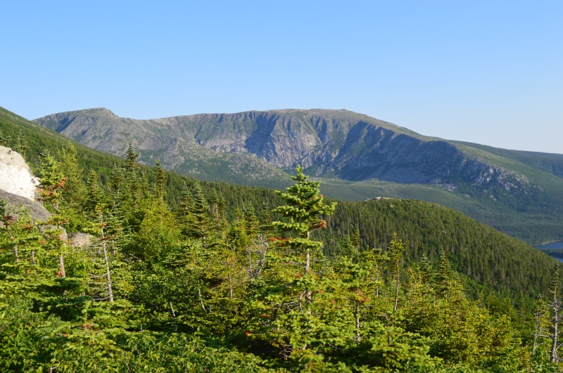
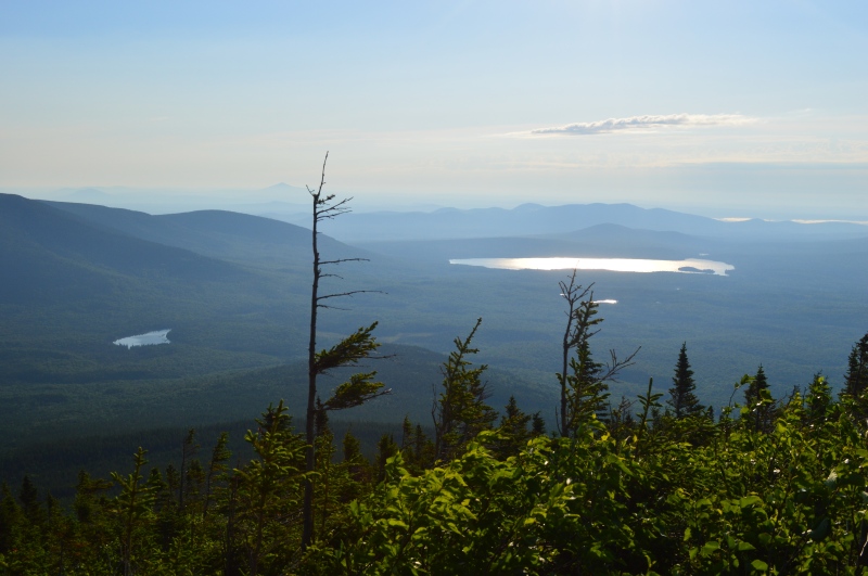
At this point I was feeling ok. I had realized by now that I was somewhat dehydrated but coming out at tree line is always a nice reinforcement for me that I am well on my way. As I hiked through the last of the trees for the next two to three hundred yards, I would soon find out that the difficulties had just begun. Those same crappy boulders down in the forest were also congregated on the rest of the route and the path would become steeper. 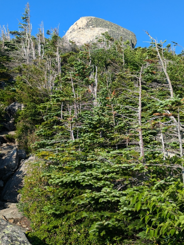
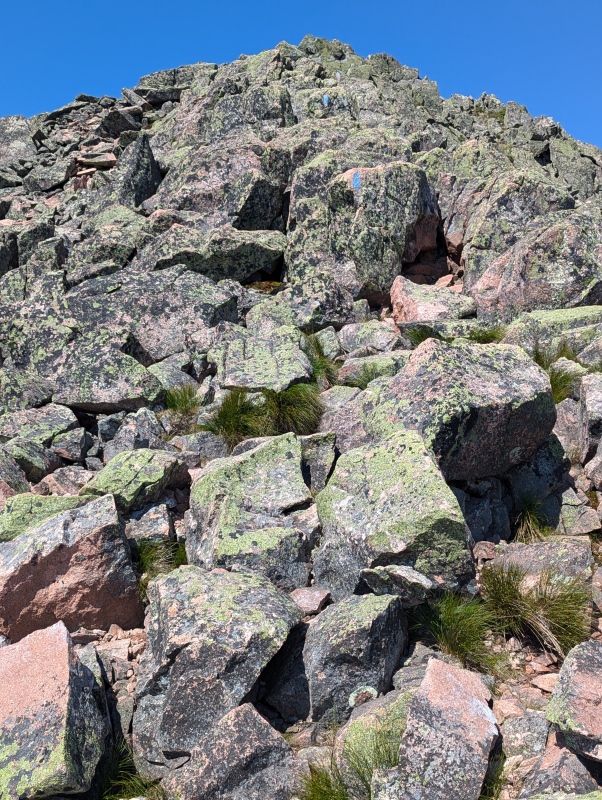
I proceeded to climb and hike over those pesky boulders heading toward my first goal of 4919 foot Pamola Peak. I was surprised at just how far, and how steeply, I had to climb but eventually the peak started to come into view. By now dehydration was having a very noticeable effect, and while photos of the path up Pamola would have been nice, I wanted to keep my mind focused on moving forward so I didn't stop to take a pic. I reached Pamola's summit, took an obligatory selfie, and drank a small amount of my water. 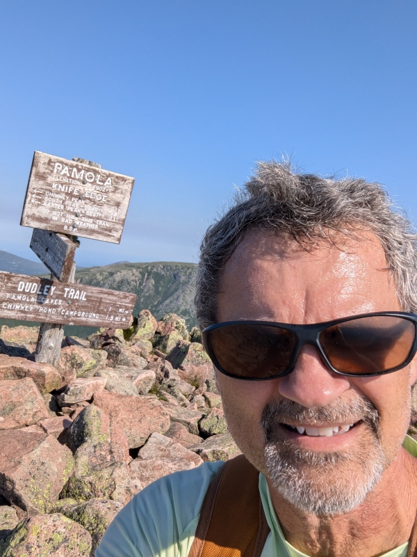
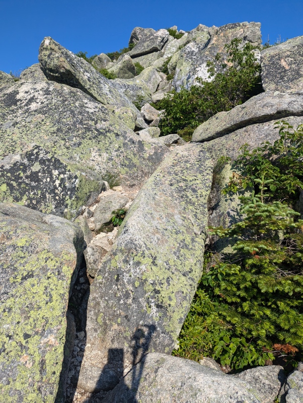
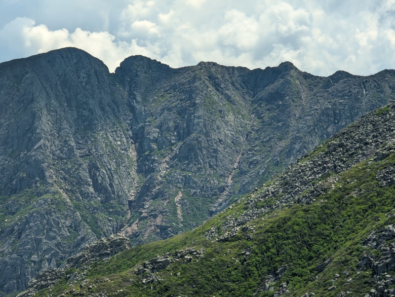
From Pamola, I continued on. Temperatures on this day were in the upper 80s 3000 feet below so it was probably in the 70s on the ridge, but I seemed quite hot. The next section was the most fun of the whole hike. There is a class three down climb off of Pamola, and then a class three ascent of Chimney Peak. While most of it was fairly benign there were a couple of spots climbing Chimney Peak where the exposure was substantial and a fall would have been very injurious, and possibly fatal. 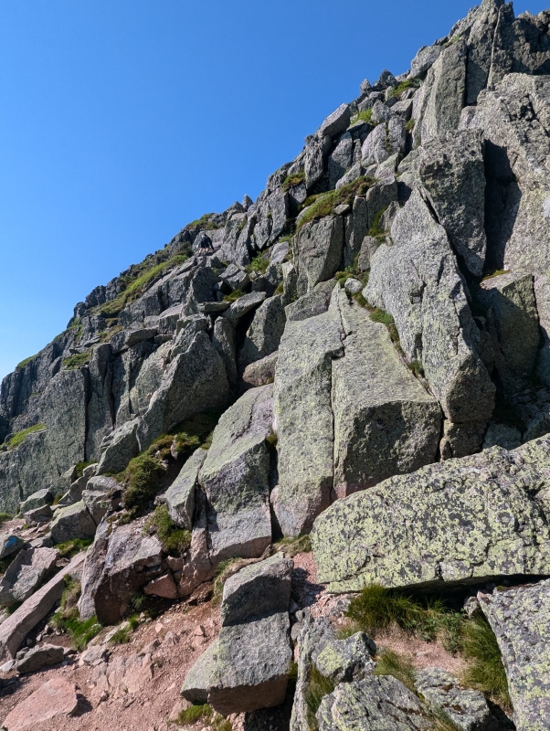
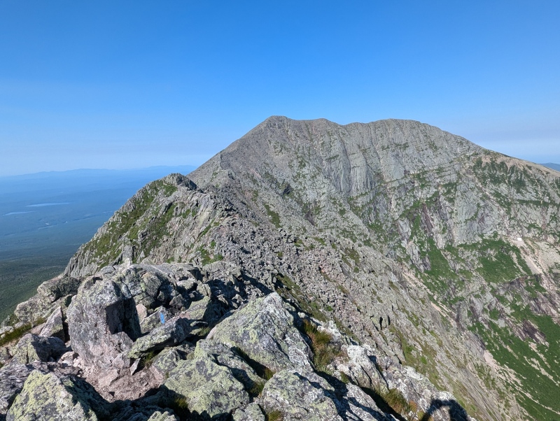

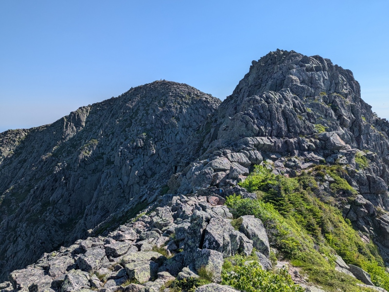
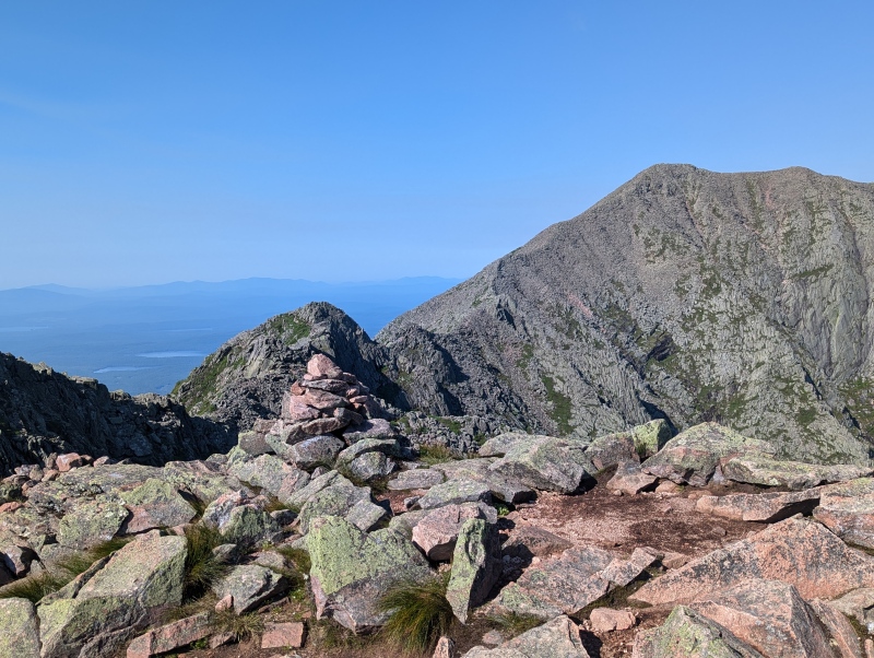
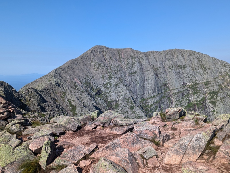
I descended Pamola and climbed Chimney with no problems; however, once I started across the humps the boulders became a tremendous nuisance. I had to concentrate on every step to avoid falling and while this is par for the course on many hikes, dehydration seemed to be affecting my ability to focus. I eventually reached Katahdin's famed Knife's Edge and was underwhelmed. For the most part, it is at least four feet wide and in most places a fall would not be far enough to be fatal. I could see it being a concern in ice, snow, or if wet, but it wasn't too difficult to cross it in the summer. However, those damned off-camber boulders continued to keep me on my guard and my knees and hips were starting to bark at me. I started to feel a cramp in my left hamstring and it was now glaringly obvious to me that the stomach problem I had the day before had dehydrated me far more than I had realized. I had been rationing my water for some time and it ran out at this point, but the next water stop was still miles away. I proceeded forward and the humps were getting harder and harder to scale. I couldn't go very many steps without stopping and I had never experienced that at elevations below 12,000 feet. Truthfully, I didn't know how I was going to make it up South Peak and the idea of turning around did cross my mind, but at this point that would have been about as bad as continuing forward. Just then a couple of hikers came up behind me and asked how I was doing. I told them about my water situation and one of them offered me a half-liter bottle of water. I told him I didn't want to take any of his water if he truly needed it, but he stated he had more than he could use. Then the other hiker also pitched in and filled my insulated cup from his reservoir. These kind souls saved my hike. While the liter of water didn't correct my hydration deficiency, it did help tremendously. The water allowed my body to function and I continued up the ridge. My hike up South Peak proceeded without fanfare, and soon I was at its summit. 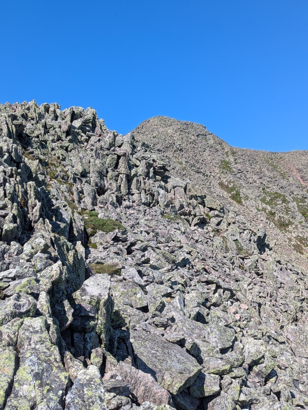
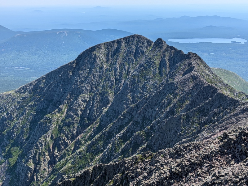
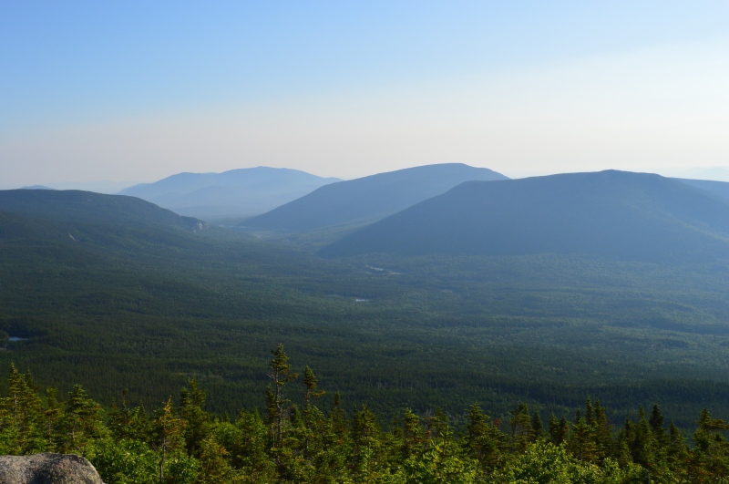
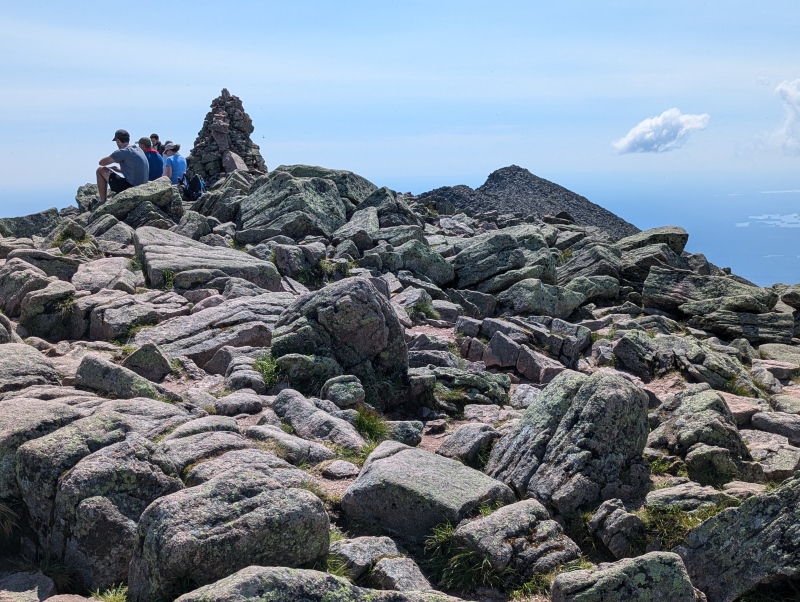
Mount Katahdin was only a couple of hundred yards away now. I crossed the boulder field between South Peak and Katahdin picking my way through the rocks and soon I was at the summit. Since reaching Pamola Peak, I had noticed that the flies were out in force. Deet worked for about an hour but after that, the flies were attempting to fly into every open orifice. They seemed to have a special affinity for my nose. This summit was not as enjoyable as others that I have done. My aching shoulder was surprisingly resilient, but I was still under the weather from dehydration and I didn't want anyone else to short themselves to give me water. So I just sat there exhausted for a few minutes. I ate a little but I was hesitant to eat too much because I didn't want to make myself thirstier than I already was. The ridge of peaks I had just traversed and the surrounding area were so beautiful, and some say there is no place like this in the entirety of the eastern United States. Unfortunately, my hydration woes were interfering with my enjoyment of this beauty and I was a bit perturbed with myself. Eventually, I stood up, took some pics, and a friendly hiker offered to take a shot of me at the summit sign. 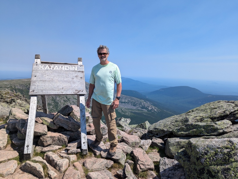
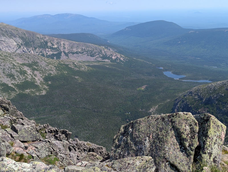
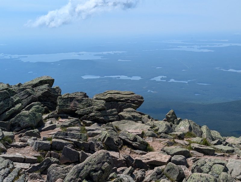
The Descent At this point I was on my way to Hamlin Peak which was my next location to obtain water. However, that was 1.4 miles away. I thought that at least the difficult climbing was over but the loose rock on the descent down to the saddle was making me rethink my route. After thinking it through, I decided to forego Hamlin Peak and cut off at the Saddle Trail. There were lots of hikers who were ascending that path and I thought that some of them could possibly be carrying extra water if I got in trouble again. This turned out to be true as I met a guy hiking with his sons and their friends just beyond the top of the Saddle Trail. We spoke for a while, and one of his sons had picked up a gallon jug of water at Chimney Pond. I couldn't believe he was packing all that weight, but it wasn't bothering him too much as they were taking their leisurely time to the summit. They had left the trailhead at 4:00 AM and at this time it was approximately 11:15. They filled up my half-liter bottle and my half-liter cup and headed off toward the summit. I treated my water and proceeded toward the cutoff for the Saddle Trail, allowing my chlorine dioxide to do its thing while I hiked. Once I reached the cutoff I sat down to rest and contemplate what was before me. The Saddle Trail drops off the ridge at a slope of 45 to 65 degrees in the first quarter of a mile according to the AllTrails app. In that quarter of a mile the rock is loose as hell and there were a number of people ascending and descending. I had not brought my helmet so falling rock was another thing to think about on my descent. 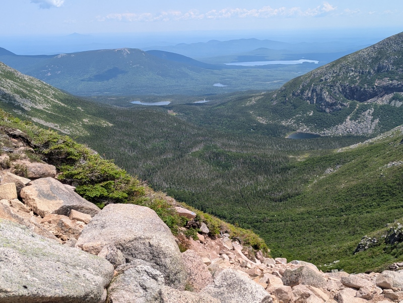
I started down the Saddle Trail and it was extremely slow and arduous. There were a number of people going down at the same time and I could hear rocks tumbling here and there. Rocks at my feet were also moving and tumbling though they didn't move far enough to reach anyone below me. I had to switch between using my hands to hang on as I went down, and using my trekking poles in places where they were appropriate. Because I was standing and moving at precarious angles my insulated liter cup eventually lost most of its water as it opened up slowly on the way down. After what seemed to be an interminable length of time, the trail slowly started to level out and the rock became more manageable. There were still those pesky boulders to maneuver over and around because I didn't want to take another fall. I trudged on and eventually reached the area near Chimney Pond where I took a rest. I was out of water again but I knew I would be able to finish the hike at this point. I was just 3.3 miles away from the trailhead, but those miles seemed like a much longer hike. The boulders were getting smaller, but, as explained earlier, dehydration was affecting my ability to concentrate. At approximately 1.75 miles from the end, I ran into three women hikers who were taking a break. They immediately asked me if I was ok and if I needed anything. I told them about my water situation and that I was good now, but they gave me a liter of water anyway because they were camping at Chimney Pond and were going to refill their water there. I drank the entire liter and after conversing for a bit, I was on my way. There were so many good Samaritans on this hike and I can't thank them enough for helping me out. Eventually, I reached the end of the trail and the ranger station where I signed out. Epilogue After changing the descending portion of this loop from the Hamlin Peak trail to the Saddle Trail, my hike was approximately 10 miles and 4000 feet of gain. Counting about an hour of stops, it took me 10 hours and 20 minutes to complete the hike which is definitely one of my slower hikes. When I reached my lodging in Millinocket, I told my wife about my ordeal with hydration. She had been worried and wondered what kind of rabbit I had pulled out of my hat to complete the hike. I had kept her updated with my progress on my satellite communicator, but I did not tell her about my water deficit at the time. I ate dinner and proceeded to drink over a half gallon of water that evening. The odd thing is I drank about two and a half liters of water on the trail which normally would have been enough, but I did not account for my water deficit from the stomach ailment before starting the hike. Over the next couple of days we moved on to New Hampshire and I climbed Mount Washington without any problems. I only drank approximately 2 liters of water and felt great throughout that hike, which shows how foolish it was for me to attempt the Katahdin hike in the state I was in. This area in Maine is unique and beautiful and I would recommend it to everyone who loves the mountains. I am happy to have summited Katahdin, but I am not exactly proud of the way I did it. With this mountain as a bucket list item and the knowledge that it might be difficult to make it back to Baxter State Park in the future, I allowed summit fever to take control and influence my decisions. This eliminated much of the fun factor from this lower elevation hike. Thumbnails for uploaded photos (click to open slideshow): ")
")
")
")
")
")
")
")
")
")
")
")
")
")
")
")
")
")
")
")
")
")
")
")
")
")
")
")
")
")
")
")
")
")
")
")
|
| Comments or Questions | ||||||
|---|---|---|---|---|---|---|
|
Caution: The information contained in this report may not be accurate and should not be the only resource used in preparation for your climb. Failure to have the necessary experience, physical conditioning, supplies or equipment can result in injury or death. 14ers.com and the author(s) of this report provide no warranties, either express or implied, that the information provided is accurate or reliable. By using the information provided, you agree to indemnify and hold harmless 14ers.com and the report author(s) with respect to any claims and demands against them, including any attorney fees and expenses. Please read the 14ers.com Safety and Disclaimer pages for more information.
Please respect private property: 14ers.com supports the rights of private landowners to determine how and by whom their land will be used. In Colorado, it is your responsibility to determine if land is private and to obtain the appropriate permission before entering the property.