| Report Type | Full |
| Peak(s) |
"Siberia Peak" - 13,425 feet "Fravert Peak" - 13,063 feet |
| Date Posted | 07/08/2024 |
| Date Climbed | 07/07/2024 |
| Author | yaktoleft13 |
| The Hidden Gem by Little Gem |
|---|
|
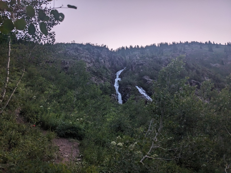
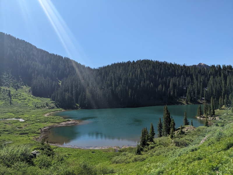
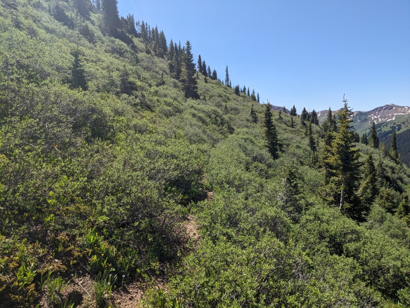
Route: Siberia SE ridge --> Trail Rider Pass trail --> Fravert SW slopes ascent and descent Trailhead: Lead King Basin Distance: 15 miles Gain: 6,350 Difficulty: Class 3 Time: 9 hours Siberia Peak has been high on my hitlist ever since I first went to Lead King Basin in 2019 to climb Snowmass's S-Ridge with my wife. Two hours of staring at it while slipping, falling, and tumbling down the west slopes of Snowmass locked that peak into my brain. After that trip, I scoured the forums to find whatever information I could on the peak, and I found that it was seldom-climbed but highly reviewed. It was like a product on Amazon with 5 stars, but only 2 reviews. Worth the risk, or were they just AI-generated ratings? The only way to know was to go! After my daughter went to bed on Saturday night, I drove to the Roaring Fork Valley and accessed the town of Marble. I recently upgraded to a newer 4Runner, so I was eager to put it to good use. Previously I'd driven the low road through Crystal twice, but stopped at the forest service parking area just out of town, rather than continuing all the way to the upper trailhead. I always felt the road deteriorated after that point to the limits of my vehicle. This time, however, I'd take the high road and see if I could make it all the way. Driving the road at 11pm was the crux of the trip. I constantly felt as though I was on the precipice, as on each of the 4 million berms my headlights would shine into nothingness before staring directly into the ground. However, other than an eroded runoff stream creating an unavoidable thunk-spot, the road didn't have too many obstacles and I arrived at the upper trailhead just before midnight, an hour and a half after leaving Marble. I bumped the alarm back an hour and attempted to fall asleep, but sleep didn't come easy in the back of the car on an off-camber parking spot. The 4:45 alarm confirmed my failures, and I groggily changed, chugged a liquid IV and half a nalgene, and set off on the trail. A headlamp was barely needed with the early morning light and long days of summer. I kept a jacket on as I fought through the willows and bushes crowding the trail, but took it off once above the waterfall. Despite a chillier forecast, it was a warm morning. The climb up to Geneva Lake doesn't mess around -- steep right from the get-go. I made it to the lake in about 45 minutes, trying not to wake the backpackers who were hopefully still asleep in their tents. 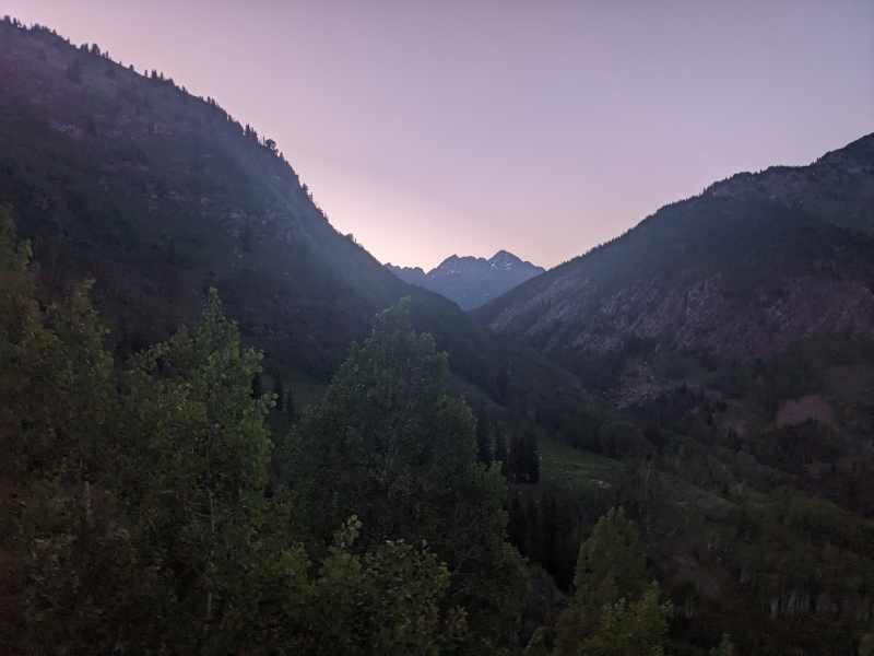
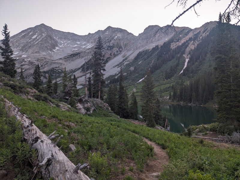
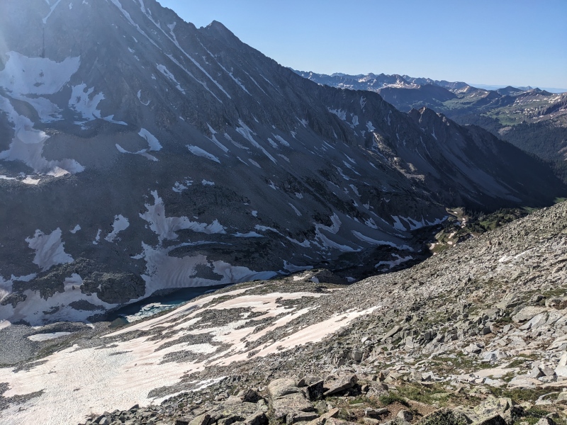
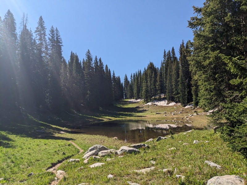
Once at the lake, I followed the sign for campsites 4 and 5, which really undersells where that trail leads. There's a whole world back there! Little Gem Lake was up next, and a rapidly fading trail disappeared completely before reaching Siberia Lake. No matter, I was turning off before then anyway. 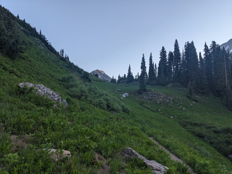
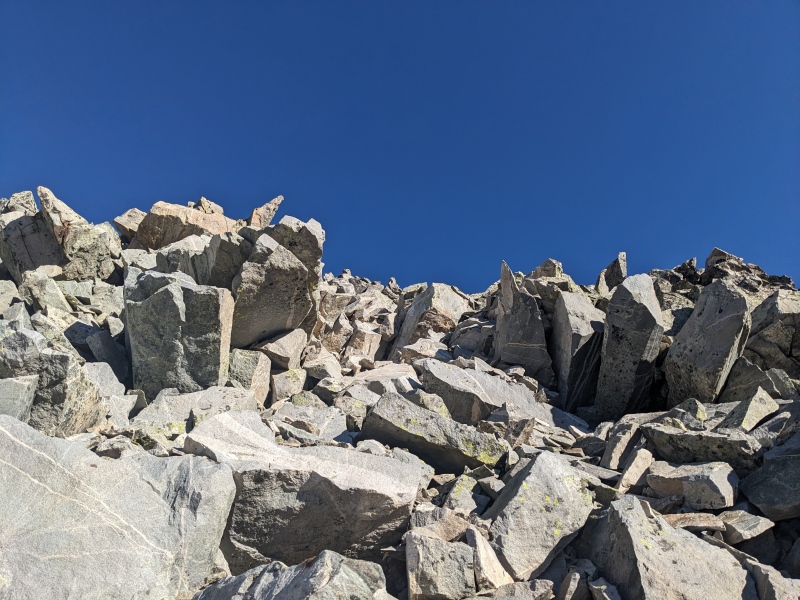
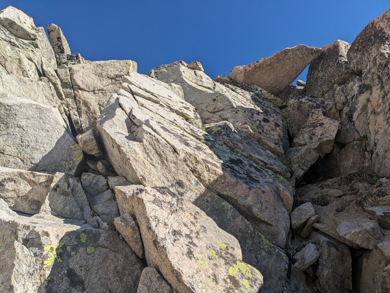
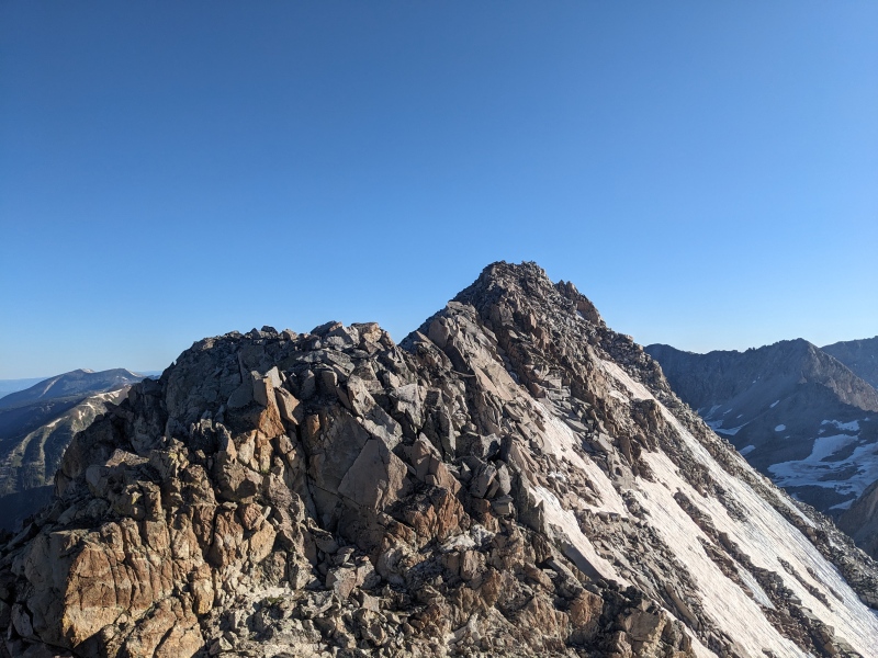
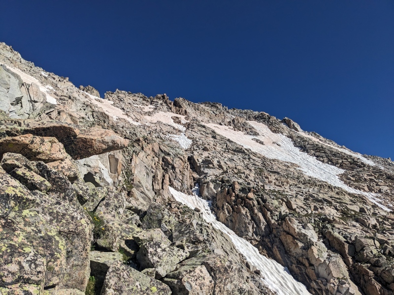
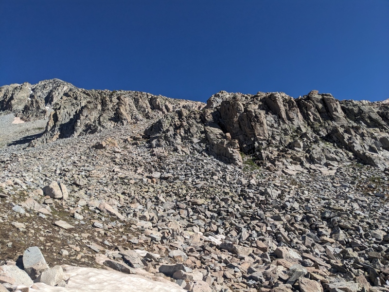
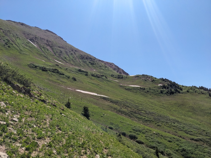
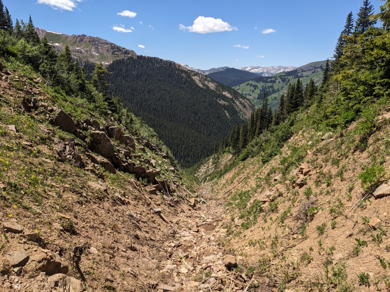
There seemed to be a myriad of options to go up: go to the lake and take a left, scoot up any number of gullies on the south side of the ridge, or hit the ridge right where it rises from the ground. I took a bit of a mix of the latter two options. I went just left of the base of the ridge, took a gully to reach some good looking slabs, and went up. These slabs didn't last long before hiking terrain took over. But then there was another short pitch of scrambling...followed by more rock hopping. Rinse and repeat a third time, and though finally on the ridge, I didn't see continuous scrambling in my future for a long while. In fact, the next section of ridge I encountered was a large, semi-steep talus field that embodied the typical Elk looseness. Sure, some of the lower scrambling was fun, but where was the terrain that made Furthermore call this his "favorite Elk thirteener"? I wasn't seeing it yet. 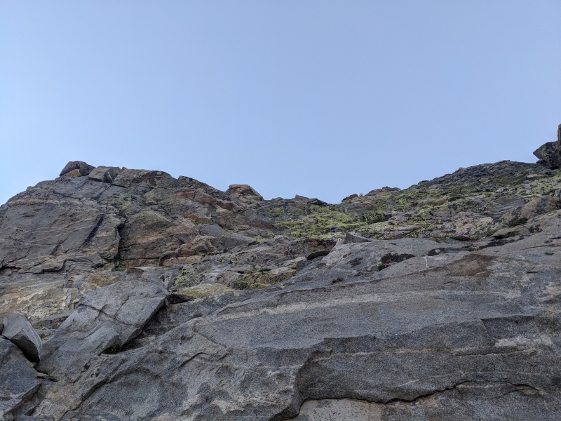

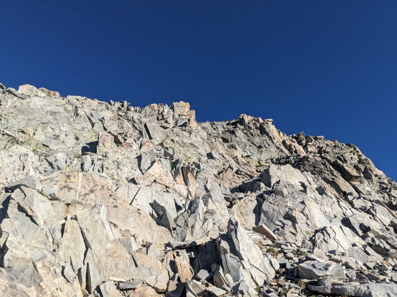
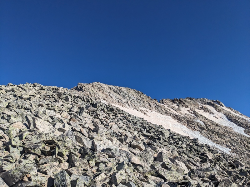
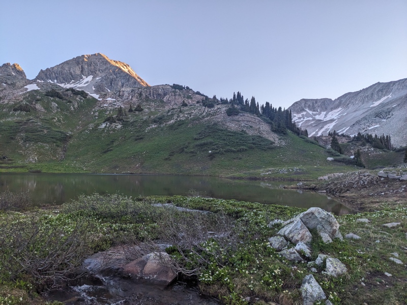
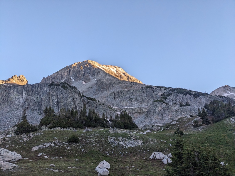
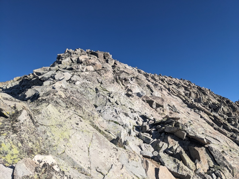
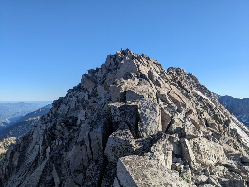
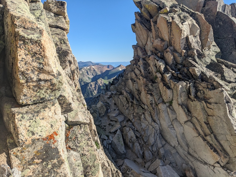
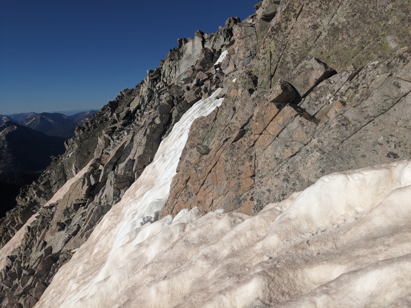
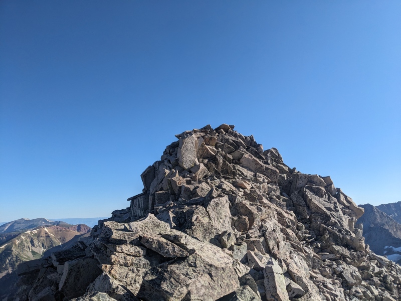
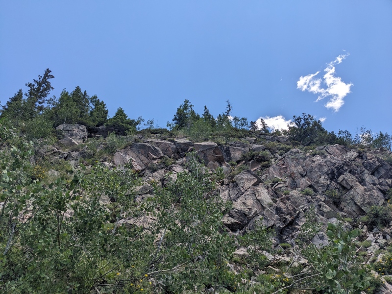
But just past the talus field, it appeared. A beautiful blocky granite ridgeline with a sheer drop to the left and bypasses to the right on largely trustworthy rock. The sharp ridge led to a similarly bomber slabby pitch, which led to the summit ridge. The scrambling ramped up in intensity once on the summit ridge, but the rock stayed solid and the movement manageable. I made quick work of the summit ridge until I hit a 15 foot notch in the ridge that held a vertical downclimb and a semi-overhanging upclimb on the other side. I poked around for a moment to see if there was a good route down, but nothing stuck out to me as something I wanted to tackle head-on. I dropped down to the right and found a firm but steep snowfield blocking the bypass of the notch. To go under the snowfield would require 100+ feet of elevation loss, so I decided to precariously balance my way across the top edge of the snowfield that had revealed itself due to melting around the rock. This was by far the sketchiest part of the day, as a slip would have sent me down the whole snowfield, but it was mercifully short and I was across before the mountain could buck me off. A little more ridge scrambling took me to the summit, 2:50 after leaving the car! It was a fantastic and small perch, offering unorthodox views of Capitol and Snowmass. I could barely see my next objective though, serving as a sobering reminder of how far I had left to go today and how stupid it was to try to link these two peaks. 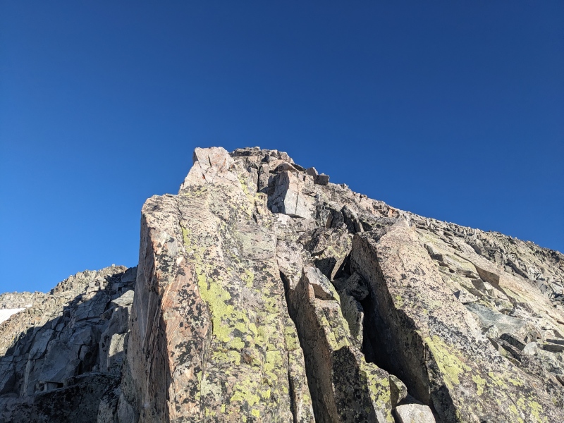
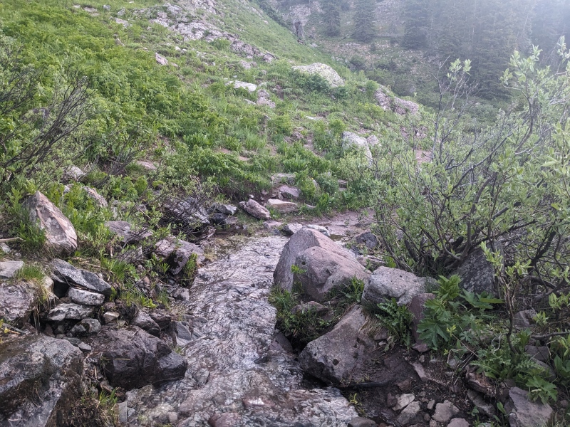
The show must go on, and I must go down. I'd already decided I wasn't going to do the same snow traverse again, instead choosing to drop below the snowfield. But when I neared the notch, I noticed there was a route down the mountain that linked up dry rock all the way to the point where I first reached the ridge out of the basin, save for one inset gully I couldn't see. I figured this might be a more expedient way down the mountain, so off I went. There were a few semi-awkward downclimby-traversy moves, but nothing above 3rd class and nothing that posed any real issue. I kept descending and angling to the right. Eventually I hit the inset gully, and fortunately, a 10-foot scramble down the northern wall led to a dry patch and a walk up and out the other side! Lucky aiming on my part. More sidehilling led me to reach the ridge below the awful talus field, and rather than scrambling the lower walls again, I took a scree and talus filled gully to the right back down to the basin and the trail. 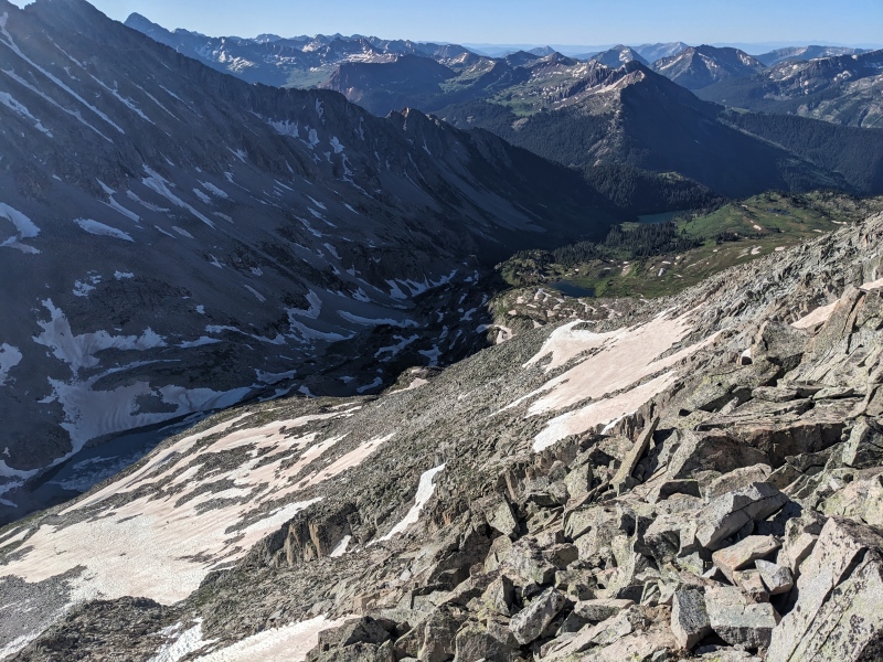
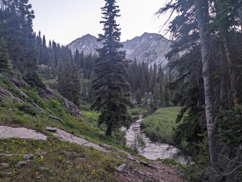
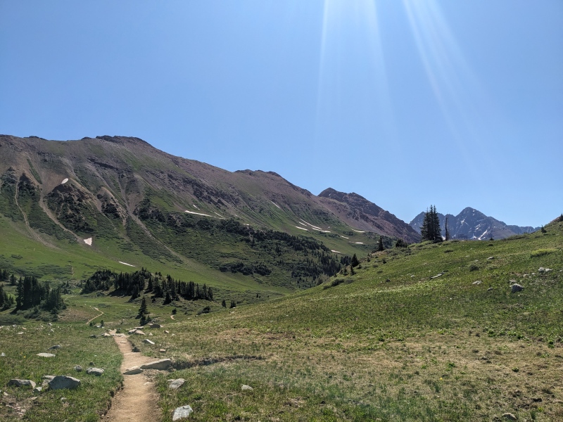
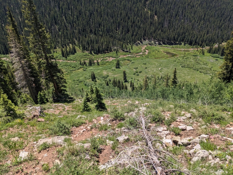
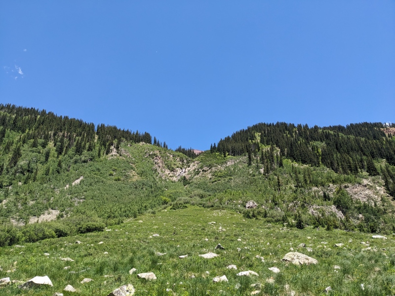
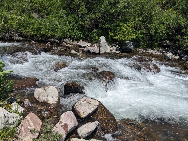
Grateful to be back on trail, I zoomed back toward Geneva Lake, where I took the turnoff for Trail Rider Pass trail. What I didn't expect was a couple of tenths of a mile after the turnoff, I ran into a creek crossing that didn't have any rocks or logs to help me across, and was too long to jump. I said "screw it" and just waded across. At its deepest point, the water was to my knees, but it wasn't flowing too crazily and I made it with no real issues. I figured the shoes would dry at some point. I continued on the trail, circumnavigating Hagerman and Snowmass Peaks, until I ascended to about 11,700. At this point, the trail drops into a broad, grassy meadow before making its final climb up to Trail Rider Pass. At this meadow, I left the trail and began an ascending traverse toward Fravert Peak, which was still far away and out of sight. From the trail, I had spied what looked to be a game trail through the willows that would lead me to the slopes past the next ridge. When I reached the trail, it almost seemed too good to be a game trail, though there were deer and goat tracks all through it. It led me through the willows and to the next area, which was another broad, grassy gully that would eventually become my descent route. I crossed it to a small col on the slope. 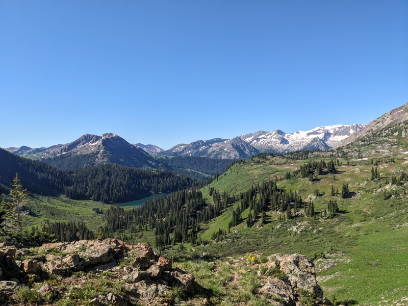
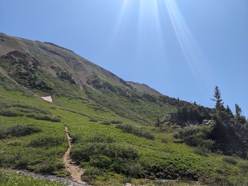
Once at the col, the next section was a loose, rocky slope leading underneath the unimportant 12er to reach the base of Fravert's summit block. To my surprise, the game trail reappeared here! I was able to follow it across the loose slopes to reach the last pitch up to the summit. 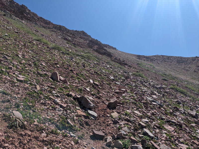
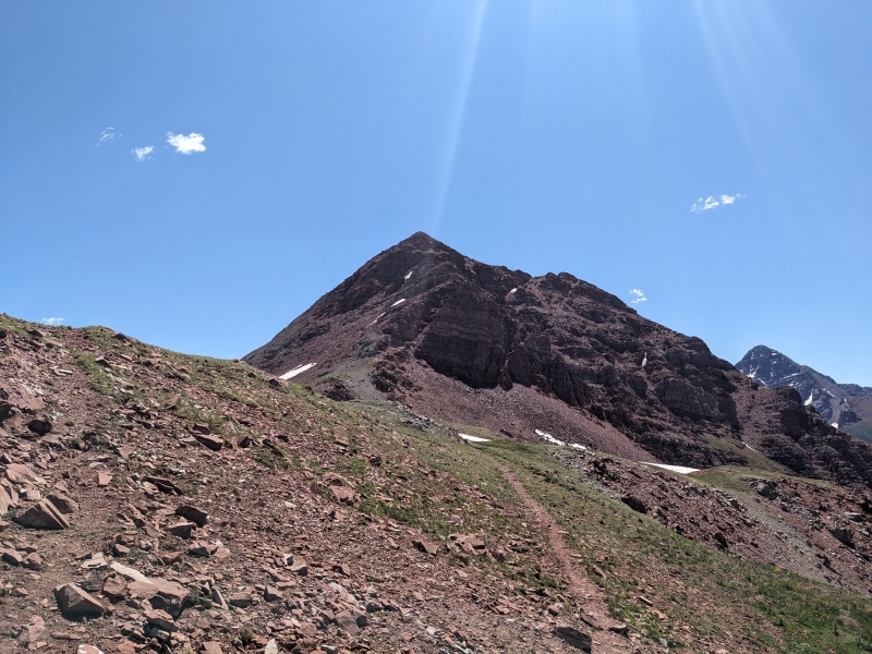
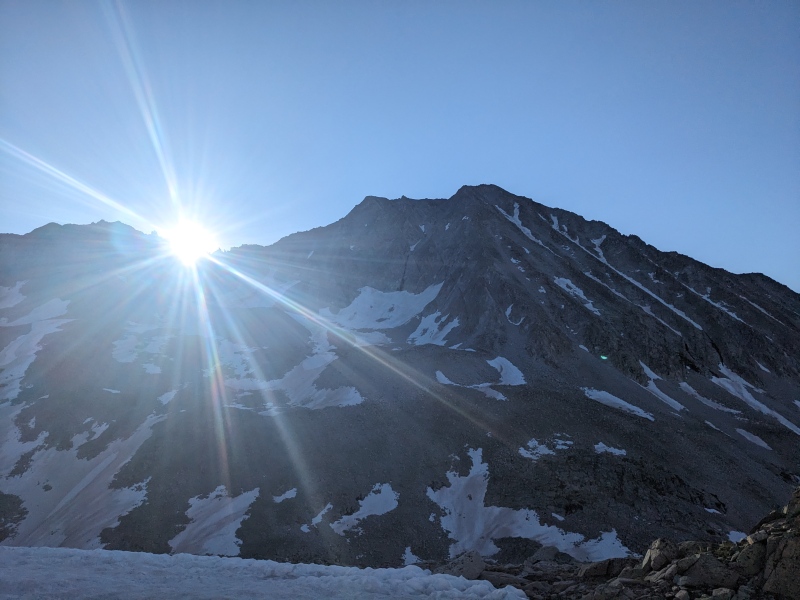
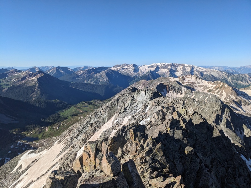
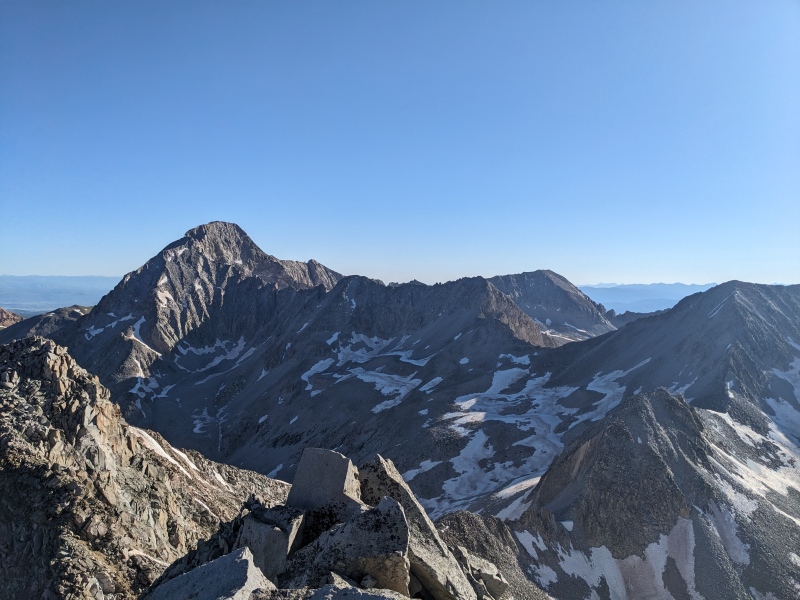
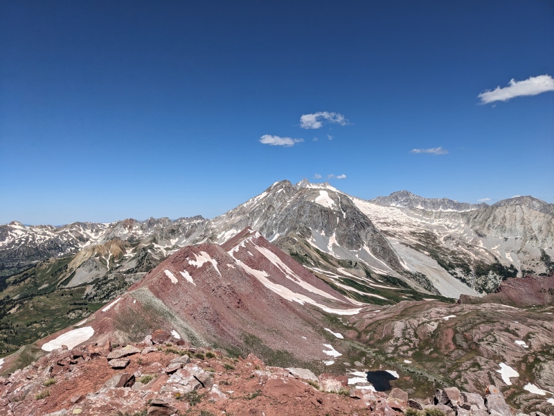
As I approached the imposing summit block of Fravert, I spied a route on the north side that looked like it would take me above the initial difficulties, at which point I'd figure it out. I began upwards, surprised to still see signs of a trail, when I encountered a cairn! Perhaps this wasn't a goat trail after all... I reached the ridge crest, then followed the trail and a couple of cairns over across a scree-covered loose slope. A small snowfield blocked the top of the cairned route, but I turned left and scrambled up some loose ledges to reach the summit ridge. A few steps later put me on the summit, almost 6 miles and 3 1/2 hours after leaving Siberia! This was the second linkup this year where it took longer to go from summit #1 to 2 than from the trailhead to summit #1, but it was well worth it. Fravert may have the best views in the entire range. The view of the Bells and Sleeping Sexton are unreal! 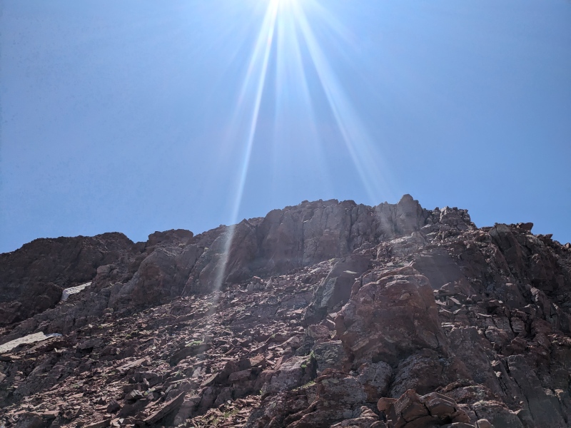


I got service on the summit of Fravert for the first time today, so I sent a few texts and headed down. I retraced my steps down the summit block, to the saddle, and across the rocky slopes with the trail across. Upon reaching the first grassy slopes, I angled down and through some knee-high willows toward a rapidly shrinking gully, until I was hiking down a dry creek bed with steep but grassy slopes on either side. I was assuming that some point the creek bed would have a waterfall and I'd be forced out, but I was able to descend almost to 11k before another less dry creek met up with mine. At that point, I climbed through some small but annoying pine trees to reach the grassy slopes headed down to the basin below. It looked as though the slopes would go all the way there with no obstacles, but I ran into one small cliff band that required some easy scrambling to dispatch, at which point I was good. 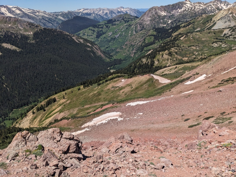
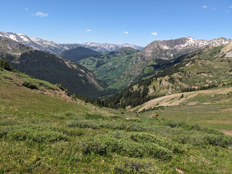
Once on the trail, I powered onward, knowing just a couple of easy trail miles separated me from my car. At least there were no obstacles left! But as I neared the Geneva Lake/Fravert Basin trail split I went left at much earlier in the morning, I heard a slowly increasing roar...must be a stream crossing! Expecting there to be a log bridge or rock hop across, I didn't think too much of it. However, upon reaching the crossing, there was no such avenue, and the water was flowing fast and high. I looked around for a few minutes to find a good place to cross, but there weren't a lot of options. I really didn't know what the alternative route would be to avoid this area. So I tested the water with my poles, committed to a line, and stepped in, aiming for the hidden rocks underneath. The water reached my mid-thigh. I made it across without incident, but unfortunately my route led me directly into a mess of willows rather than the trail. I had to take a few steps down the stream, including down a little rapid, and was able to reach dry ground. 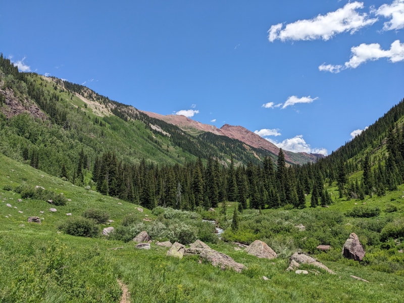
Once across the stream, the difficulties ceased for real. I reached the car minutes later, for a total time of 9 hours almost to the minute. I drove back out the high road, which was much easier in the daylight, and found I70 surprisingly traffic-free for the 4th of July weekend until an accident near Bakerville ruined everything. Siberia had five years to marinate for me, and it certainly lived up to the hype. It's a great climb in a remote area with stunning views. Though it's often overshadowed by its taller neighbors, hopefully it gets a little more love in the future! 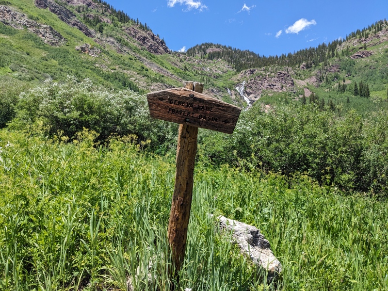
Thumbnails for uploaded photos (click to open slideshow): ")
")
")
")
")
")
")
")
")
")
")
")
")
")
")
")
")
")
")
")
")
")
")
")
")
")
")
")
")
")
")
")
")
")
")
")
")
")
")
")
")
")
")
")
")
")
")
")
")
")
|
| Comments or Questions | ||||||||||||
|---|---|---|---|---|---|---|---|---|---|---|---|---|
|
Caution: The information contained in this report may not be accurate and should not be the only resource used in preparation for your climb. Failure to have the necessary experience, physical conditioning, supplies or equipment can result in injury or death. 14ers.com and the author(s) of this report provide no warranties, either express or implied, that the information provided is accurate or reliable. By using the information provided, you agree to indemnify and hold harmless 14ers.com and the report author(s) with respect to any claims and demands against them, including any attorney fees and expenses. Please read the 14ers.com Safety and Disclaimer pages for more information.
Please respect private property: 14ers.com supports the rights of private landowners to determine how and by whom their land will be used. In Colorado, it is your responsibility to determine if land is private and to obtain the appropriate permission before entering the property.


