| Report Type | Full |
| Peak(s) |
Stewart Peak - 13,988 feet Organ Mountain - 13,808 feet Baldy Alto - 13,703 feet Baldy Chato - 13,417 feet |
| Date Posted | 07/04/2024 |
| Date Climbed | 06/22/2024 |
| Author | BirdMan |
| Bald Organ Stew Can Wear a Guy Out |
|---|
|
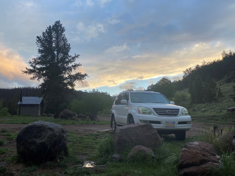
Day One: Baldy Alto, Stewart Peak and Baldy Chato Day Two: Organ Mountain 2024 you've been a year! Not even half over and I found myself more than ready to get outside and start having some adventures. I did a warm-up outing the weekend prior, camping at the Crags trailhead and summitting Pikes Peak from the west side and figured I was ready for something more challenging. Boy did I find it in the remote San Juans. We were lucky enough to see the Rolling Stones in Denver on Thursday night which led me to take Friday off of work. By the time I got back home and packed up I was on the road from Colorado Springs around 1 pm. I'd been there before but I was again amazed at how remote the Stewart Creek trailhead is. When you turn off the lonely intersection of Route 50 and 114 you still have 47 miles to go - and 27 of those miles are on a dirt road! I'd be camping at the Eddiesville trailhead for two nights just a quarter mile past the Stewart Creek trailhead. When I got there around 6 pm I was just in time for the skies to open up and the rain to start falling. Normally I "camp" in the back of my vehicle (Hotel Blanche) but I had decided to return to tent camping for some reason. Having to wait for a break in the rain to set-up my tent certainly gave me time to re-think that decision. Still I was happy when there was enough of a break in the weather and I could get the tent up before the real deluge rolled in. 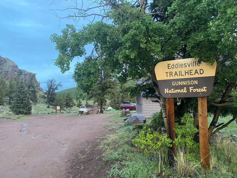
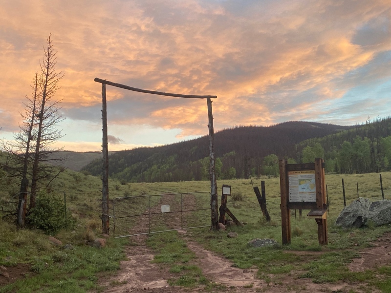
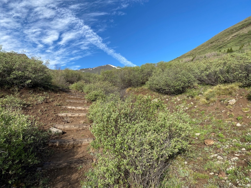
Day One: Baldy Alto, Stewart Peak and Baldy Chato The Stewart Creek TR doesn't have it's own parking area per se. There's some parking areas before you reach the TH, there's the Eddiesville TH just down the road 1/4 mile and people also park along the road where the trail begins. The route up Stewart Creek is the standard route to get to San Luis Peak and as such this is a well established trail. You'll hike along beaver and moose habitats through a lovely forest. It's about 4.25 miles to get to tree line (around 12,000') where things start to open up. The first sign you're getting close to the 12,000' area is you'll start to see some steps put in by trail maintenance folks. My main goal for the first day was Stewart Peak so this was my clue to start looking for my turn-off to the right (north). 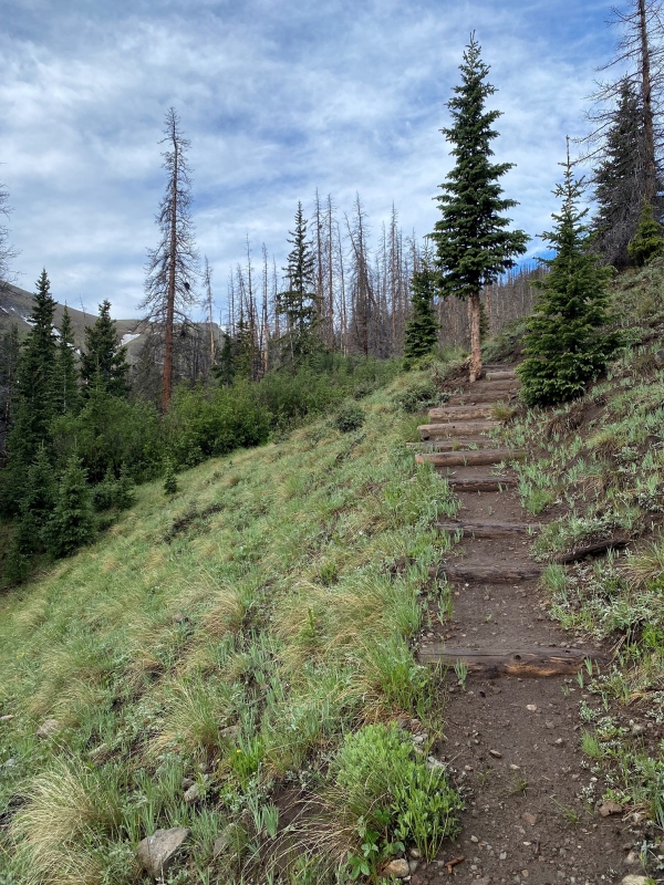
My first look at Baldy Alto revealed what looked to be a fairly large snow field just below and on top of the ridge. The information I was finding indicate you angle to the right as you hike up to the ridge, however, in late June that meant leading me to a larger snow field than to the left. I made a game day decision and went to the left and more directly towards the Baldy Alto summit. Though before getting to the grassy uphill climb I had to first get through the willows. I took care and tried to find the path of least resistance, following animal "trails", hiking along what looked like pseudo-creek beds, anything to make getting through the willows easier. It was not easy going up. I can say that coming down I stayed higher on the mountain and crossing through the willows was easier than on the way up. Any way you go, crossing through the willows will be a part of your journey. 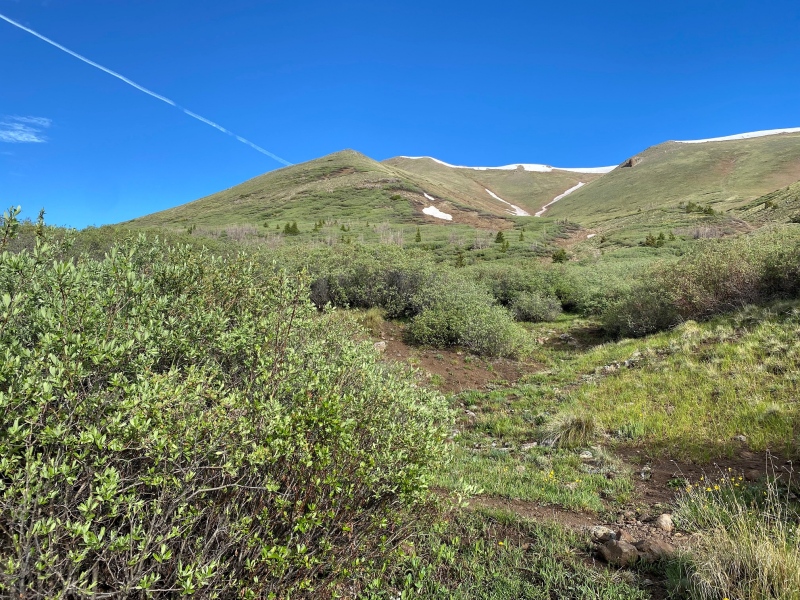
There wasn't a lot to report from around 12,000' up to around 13,700' of the Baldy Alto's summit. For something like this I often grab some candy, nuts or a bar, put on some music, put my head down and just try to take as few breaks as possible. I think I made the right decision regarding the snowfield on the ridge. When I had to cross the snow it was only around 6 - 10' wide? And shortly after that I was on my first summit of the day! 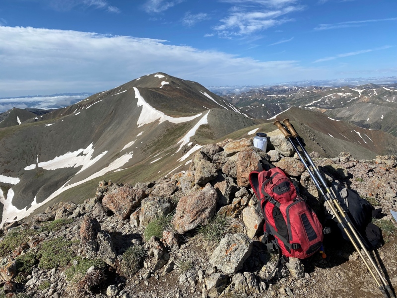
After a brief snack and applying some sunscreen it was time to head on. Today was going to be a big day. Though you never want to feel like you're in a rush in the mountains. You have to remember to stop and smell the flowers, or at least appreciate them. Leaving Baldy Alto I started to notice the prettiest little blue flowers. 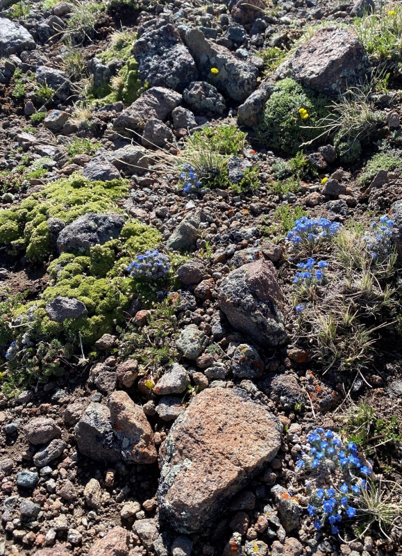
Once you've gained the ridge you can see your whole remaining route at a glance. It's not close but you can definitely see where you need to go. Below is a pretty good shot of the route from Baldy Alto to Stewart Peak - down, to the right and back up again. The only bit of difficulty I found was when I got into a small rock / talus field. Not a big deal at all just a little more time consuming and something I easily avoided on the return trip. 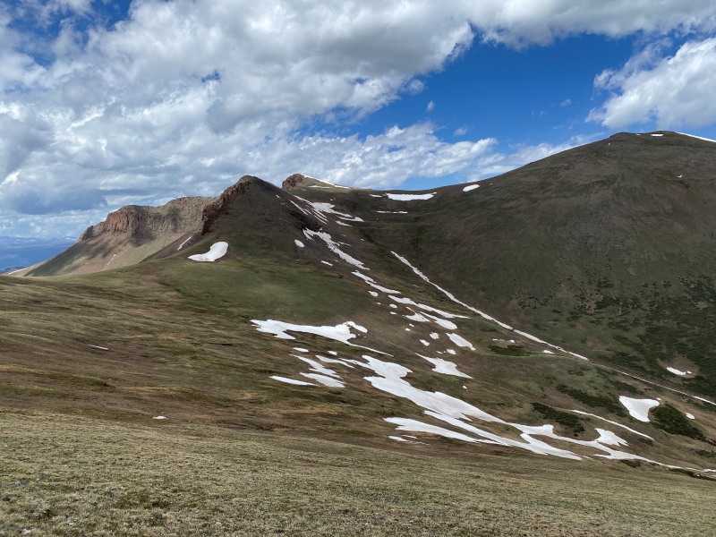
No real trail exists between the peaks but I suppose you don't need one either. Just set yourself a course and go! Before too long I was on top of Stewart Peak, the second tallest 13er in the state! 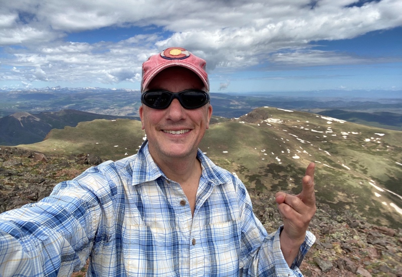
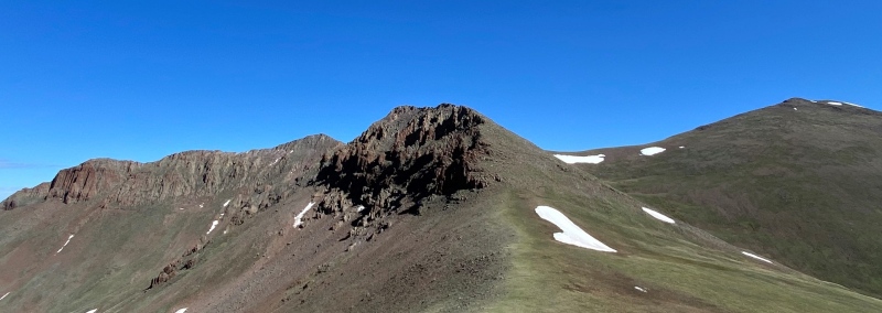
That snowy blip over my shoulder is Baldy Chato, my third and final summit for the day. I made it as quickly as I could over there as the clouds were starting to concern me. Ultimately getting over there and back (I think it's a mile from the Stewart Peak summit?) proved uneventful but slightly exhausting. I made it to Baldy Chato, got back over the ridge, down to 12,000' and through the willows and then started the 4.25 mile hike back to Eddiesville. 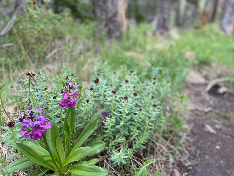
After somewhere in the neighborhood of 13 miles and I don't know how many vertical feet I'm just going to say I was pretty bushed. I set up my portable canopy for a little shelter, made a tasty dinner of salmon and squash and didn't move a whole lot from my comfy little camp chair. Suffice to say I slept well that night. 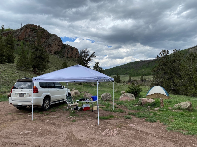
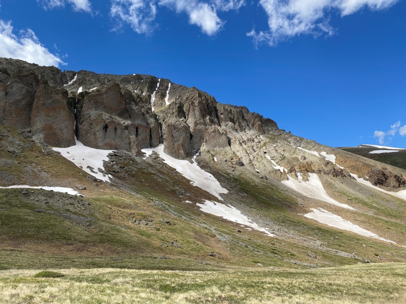
Day Two: Organ Mountain I slept in a bit, and I drove myself the 1/4 mile up to the Stewart Creek trailhead but was back after it on Sunday. For Organ Mountain I repeated the same 4.25 miles up the Stewart Creek trail but this time turned left before trying to avoid the willows. The valley you want to go in is marked by these cliff walls with the erosion to the left. 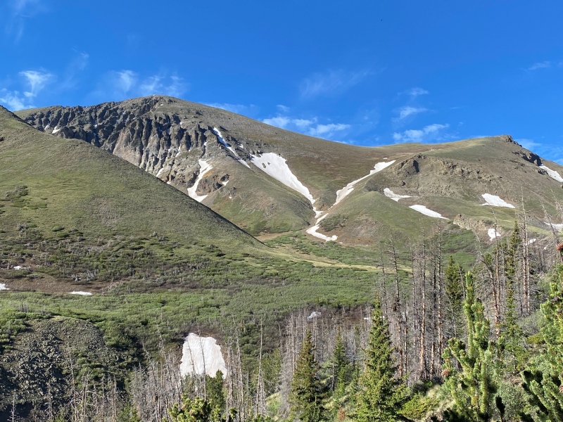
Here's a great look at the Organ Mountain valley and also the route I took to try to minimize my time in the willows. I went down the gulley in the foreground and it really seemed like the best route. 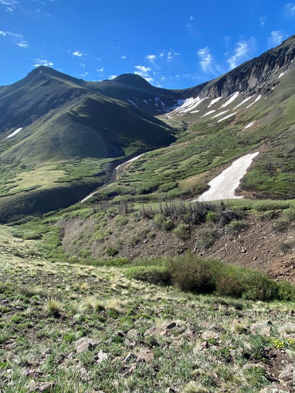
If you keep looking for open terrain you'll be able to keep the willow whacking to a minimum going for Organ. Again, I found the willows were the thinnest on the higher side of the mountain. 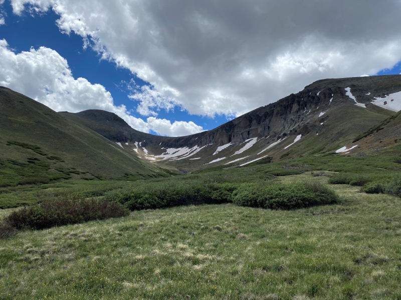
The thing I love about 13ers? This is what passes as a trail on a 13er. 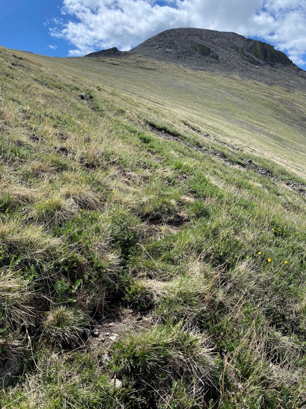
It was roughly 1,800' of up from the 12,000' basin to the summit, and with the previous day fatiguing me it took a lot of breaks and music to keep me moving. A rocky scramble the last couple hundred of feet and at last I was on the summit! 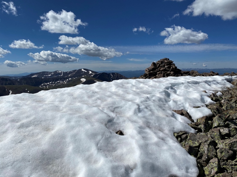
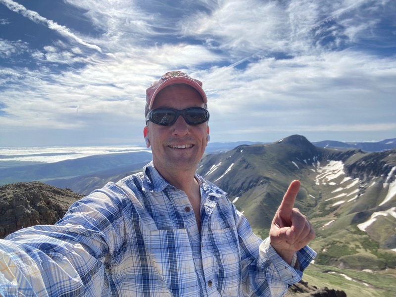
The happy summit-er with #4 for the weekend in the books. 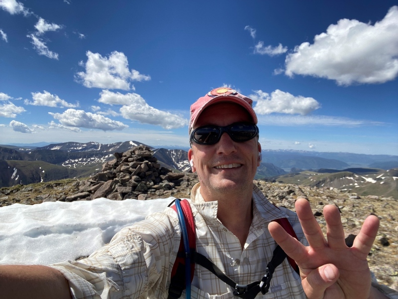
I had to laugh driving the dirt roads before reaching 114 and route 50 - shmeep! 
Thumbnails for uploaded photos (click to open slideshow): ")
")
")
")
")
")
")
")
")
")
")
")
")
")
")
")
")
")
")
")
")
")
|
| Comments or Questions |
|---|
|
|
Caution: The information contained in this report may not be accurate and should not be the only resource used in preparation for your climb. Failure to have the necessary experience, physical conditioning, supplies or equipment can result in injury or death. 14ers.com and the author(s) of this report provide no warranties, either express or implied, that the information provided is accurate or reliable. By using the information provided, you agree to indemnify and hold harmless 14ers.com and the report author(s) with respect to any claims and demands against them, including any attorney fees and expenses. Please read the 14ers.com Safety and Disclaimer pages for more information.
Please respect private property: 14ers.com supports the rights of private landowners to determine how and by whom their land will be used. In Colorado, it is your responsibility to determine if land is private and to obtain the appropriate permission before entering the property.


